2010/11/30: Bears, bears and more bears
Category: General
Posted by: The Agnew Family
Off to the San Diego Zoo today. I was expecting Koalas (who are not bears), Pandas, Polars bears and was happy to find several more types of bears. The zoo is quiet large (we didn't see it all) with lots of birds and animals Ed and I have never seen. The amazing part is that the zoo is located in downtown San Diego. Luck was with us today as most of the animals we wanted to see were active.
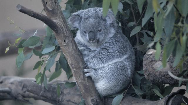
The zoo has the largest colony of Koalas outside of Australia --- think we saw at least fifteen. Most of whom were sleeping. This little guy had just finished breakfast and was settling down for a nap.
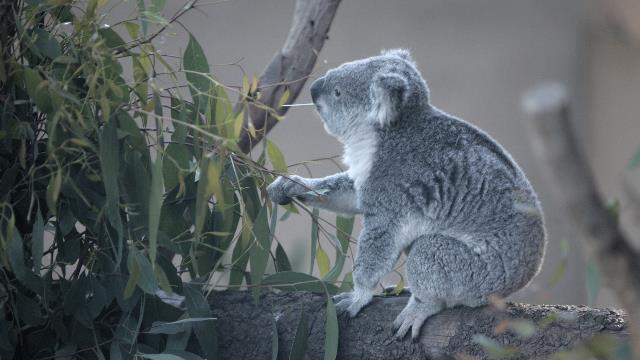
This guy was still munching away.
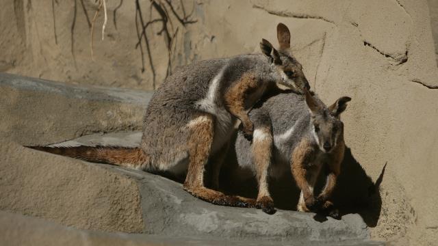
Very friendly Yellow-footed Rock Wallaby.
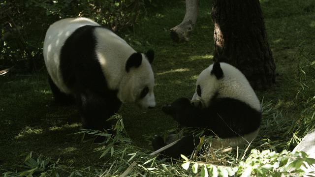
As usual the pandas were amazing. We spent some time speaking with a zoo employee who is known around the zoo as a "pandaopedia" --- she was extremely knowledgeable about the pandas and what is happening with the pandas around the world. Bai Jun and her 16 month old baby Yun Zi
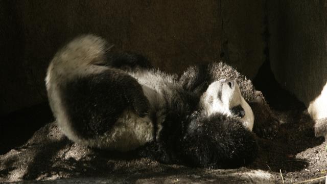
Yun Zi was fun to watch. When we arrived at the exhibit he was sleeping high in a tree. As lunch time approached he woke, climb down from the tree, munch on some bamboo then proceeded to roll in the dirt. He was not in a hurry to let the zoo keepers in to clean the enclosure.

Bai Yun enjoying lunch.
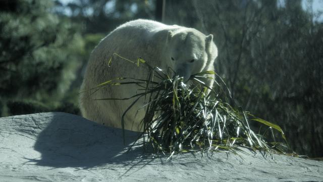
Salad anyone? This big guy was working on a vegetarian lunch --- leaves and carrots.
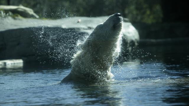
Nothing like a good shake after a swim.
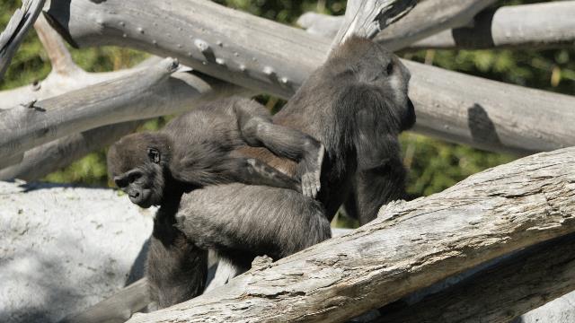
Interesting way to ride. Actually it worked well as the baby did not bump his head when mom went under a tree.
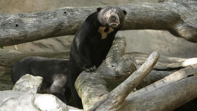
The Bornean Sun Bear, whose name comes from the marking on its chest which many people think looks like the rising or setting sun. The Sun Bear is the smallest of the world's eight bear species, about half the size of the American Black Bear.
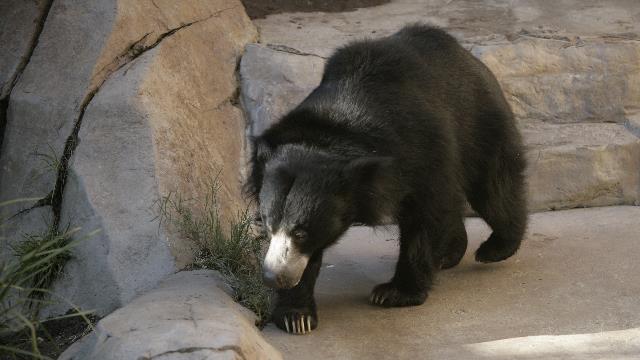
The Sloth Bears can be found in India, Sri Lanka, Bangladesh, Nepal and Bhutan. The bear is not related to sloths though it has many features in common like it's extremely long thick claws and unusual teeth.
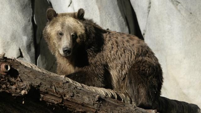
The Grizzly or Brown Bear.
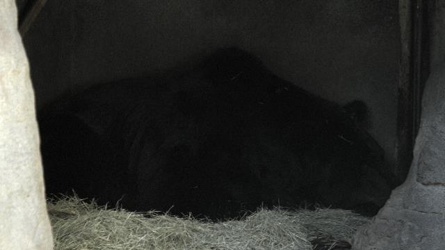
The Manchurian Brown Bear. This guy was the only bear that did not co-operate and stayed sleeping in his cave.
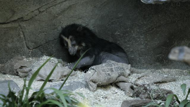
Andean Spectacled Bear is from South America. The name comes from the rings of white or light fur around it's eyes which look like eyeglasses.
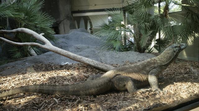
The zoo keeper was in the Komodo Dragons interior enclosure with a couple of eggs, a quick tap on the glass got the dragons attention, a moment later the dragon was inside and chasing one of the thrown eggs. The egg was gone in the blink of an eye.
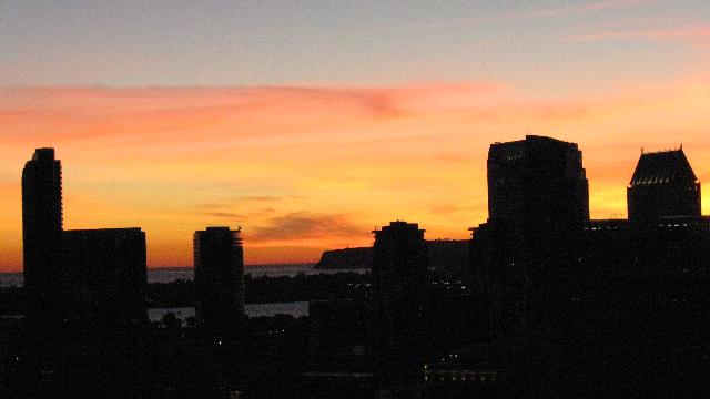
One last San Diego sun set.
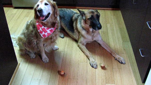
Zaph and Barry waiting patiently for their "pupcakes|. Yup there's a cupcake shop that makes special pupcakes for dogs. Zaph gobbled his down and Barry took his time and enjoyed it.

The zoo has the largest colony of Koalas outside of Australia --- think we saw at least fifteen. Most of whom were sleeping. This little guy had just finished breakfast and was settling down for a nap.

This guy was still munching away.

Very friendly Yellow-footed Rock Wallaby.

As usual the pandas were amazing. We spent some time speaking with a zoo employee who is known around the zoo as a "pandaopedia" --- she was extremely knowledgeable about the pandas and what is happening with the pandas around the world. Bai Jun and her 16 month old baby Yun Zi

Yun Zi was fun to watch. When we arrived at the exhibit he was sleeping high in a tree. As lunch time approached he woke, climb down from the tree, munch on some bamboo then proceeded to roll in the dirt. He was not in a hurry to let the zoo keepers in to clean the enclosure.

Bai Yun enjoying lunch.

Salad anyone? This big guy was working on a vegetarian lunch --- leaves and carrots.

Nothing like a good shake after a swim.

Interesting way to ride. Actually it worked well as the baby did not bump his head when mom went under a tree.

The Bornean Sun Bear, whose name comes from the marking on its chest which many people think looks like the rising or setting sun. The Sun Bear is the smallest of the world's eight bear species, about half the size of the American Black Bear.

The Sloth Bears can be found in India, Sri Lanka, Bangladesh, Nepal and Bhutan. The bear is not related to sloths though it has many features in common like it's extremely long thick claws and unusual teeth.

The Grizzly or Brown Bear.

The Manchurian Brown Bear. This guy was the only bear that did not co-operate and stayed sleeping in his cave.

Andean Spectacled Bear is from South America. The name comes from the rings of white or light fur around it's eyes which look like eyeglasses.

The zoo keeper was in the Komodo Dragons interior enclosure with a couple of eggs, a quick tap on the glass got the dragons attention, a moment later the dragon was inside and chasing one of the thrown eggs. The egg was gone in the blink of an eye.

One last San Diego sun set.

Zaph and Barry waiting patiently for their "pupcakes|. Yup there's a cupcake shop that makes special pupcakes for dogs. Zaph gobbled his down and Barry took his time and enjoyed it.
2010/11/29: Another great day
Category: General
Posted by: The Agnew Family
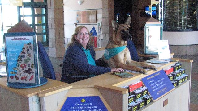
Carol volunteers at the Birch Aquarium at Scripps so we went to see her and Barry at work and the aquarium of course.
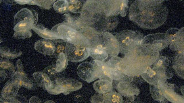
One of the jelly fish tanks. The water for the tanks is pump directly from the ocean.
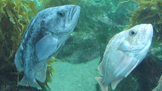
These guys were just hanging about in the kelp tank.
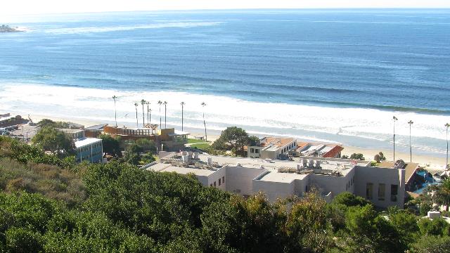
The aquarium has touch tanks set up. The tanks simulate tide pools and allows people to see the creatures that inhabit the pools and to touch the creatures. Kids really love it. From the touch tank area you look down over the research facility connected to the aquarium and the ocean. The waves must have been OK today as there were a lot of surfers out enjoying the waves. This outdoor area is also used for weddings, concerts and other events.
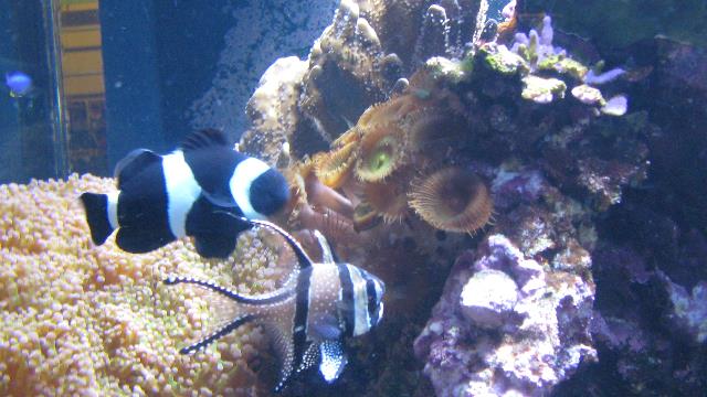
Don't know what he is, but I really like the fish in the foreground.
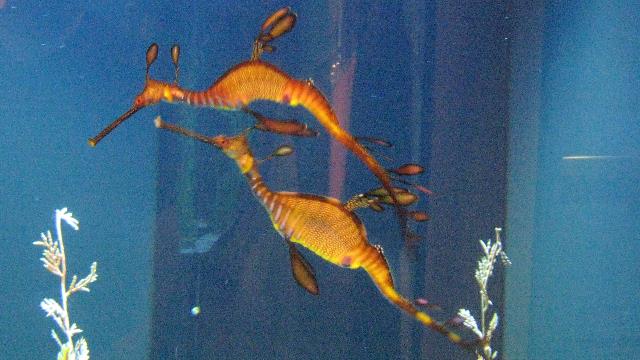
Ed's favourite is the seadragon.
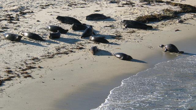
After a wonderful lunch at a Thai restaurant, we went to the children's beach in La Jolla. Well, it use to be the children's beach until the seals moved in. The sheltered beach is now closed to people so the seals can enjoy it in peace.
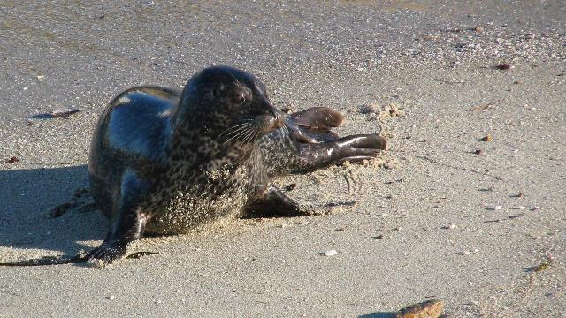
A sea wall protects part of the beach and allows you to get quite close to the seals. One of the smaller seals enjoying the beach.
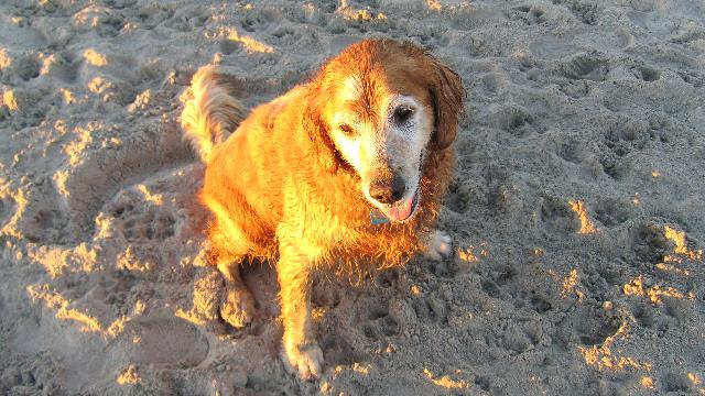
Poor Zaph spent a good portion of the day in the trailer so we took him to the dog beach for a romp.
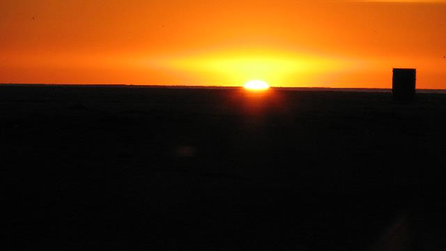
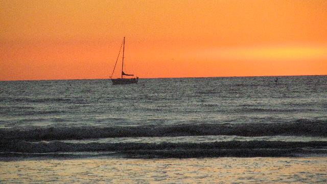
I didn't include a sunset picture yesterday so you get 2 from the dog beach today.


One of the jelly fish tanks. The water for the tanks is pump directly from the ocean.

These guys were just hanging about in the kelp tank.

The aquarium has touch tanks set up. The tanks simulate tide pools and allows people to see the creatures that inhabit the pools and to touch the creatures. Kids really love it. From the touch tank area you look down over the research facility connected to the aquarium and the ocean. The waves must have been OK today as there were a lot of surfers out enjoying the waves. This outdoor area is also used for weddings, concerts and other events.

Don't know what he is, but I really like the fish in the foreground.

Ed's favourite is the seadragon.

After a wonderful lunch at a Thai restaurant, we went to the children's beach in La Jolla. Well, it use to be the children's beach until the seals moved in. The sheltered beach is now closed to people so the seals can enjoy it in peace.

A sea wall protects part of the beach and allows you to get quite close to the seals. One of the smaller seals enjoying the beach.

Poor Zaph spent a good portion of the day in the trailer so we took him to the dog beach for a romp.

I didn't include a sunset picture yesterday so you get 2 from the dog beach today.

2010/11/28: Dog Beaching...... again
Category: General
Posted by: The Agnew Family
Since Zaph had a quiet day yesterday we decided that he could go to a dog beach today. Zaph, Barry, Ed, John and I loaded into the car and drove over the beautiful Coronado Bridge to Coronado. Coronado is on a spit of land that creates the west side of San Diego Bay. "The bridge is known for it's distinctive curve and spectacular all-encompassing view" --- the guide book was correct in its description. The dog beach is beside a Navy base and is smaller than the dog beach we went to the other day though Zaph and Barry still enjoyed it.
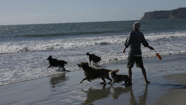
As usual, Zaph joined in the fun.
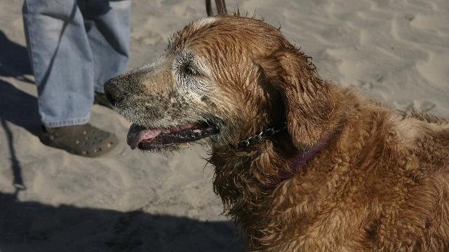
The face says it all ---- think he had a good time.
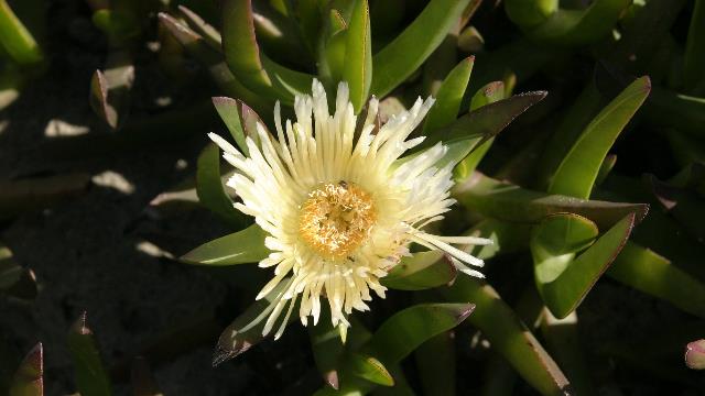
This succulent appears to grow wild. We saw it by the beach and along side roads. It looks like it is a relative of aloe but I really don't know. It has both pink and yellow delicate flowers. Whatever it is, it is very pretty.
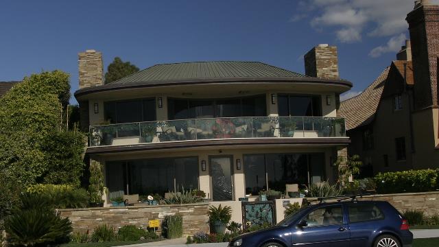
As Zaph needed some drying time, Ed and I walked Zaph and Barry down the road to the Hotel del Coronado (known to the locals as "the Del") while John moved the car closer to the hotel. Barry was very concerned that dad was not with him and kept looking for John and was a very happy when we met up with John again. This stretch of road has some amazing homes on it, any of which I would be happy to live in but probably can't even afford the property taxes. This one really caught my eye with it's copper roof, curved balcony and glass door with the surf etched on it.
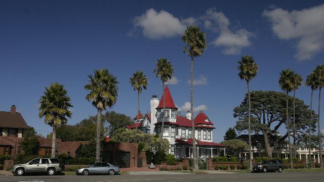
This house really stood out with it's red roofs --- bet the view is amazing from the turret.
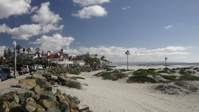
The Hotel del Coronado was built in the early 1900's and received a major face lift in 2001. The hotel was originally built as a hunting and fishing resort but a change of ownership changed the hotels direction into a beach resort. The two most notable items in the hotels history are: this is where the Duke of Windsor first met Coronado socialite Wallis Simpson and was the setting for the film Some Like it Hot starring Marilyn Munroe, Tony Curtis and Jack Lemmon. The hotel offers outdoor ice skating this time of the year ---- yup outdoors. Water was being removed from the ice to prepare for the afternoons skating. I know it's going to be December in a couple of days and I'm not mentally ready for Christmas but the hotel really is. A huge Christmas tree was the focal point of the lobby.
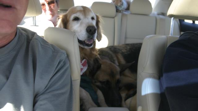
Three in the back seat. Zaph was sitting on my lap giving Barry more than half of the back seat. I could have pushed both dogs over but they were very cute and I'm a suck.

A view from the Coronado bridge.

As usual, Zaph joined in the fun.

The face says it all ---- think he had a good time.

This succulent appears to grow wild. We saw it by the beach and along side roads. It looks like it is a relative of aloe but I really don't know. It has both pink and yellow delicate flowers. Whatever it is, it is very pretty.

As Zaph needed some drying time, Ed and I walked Zaph and Barry down the road to the Hotel del Coronado (known to the locals as "the Del") while John moved the car closer to the hotel. Barry was very concerned that dad was not with him and kept looking for John and was a very happy when we met up with John again. This stretch of road has some amazing homes on it, any of which I would be happy to live in but probably can't even afford the property taxes. This one really caught my eye with it's copper roof, curved balcony and glass door with the surf etched on it.

This house really stood out with it's red roofs --- bet the view is amazing from the turret.

The Hotel del Coronado was built in the early 1900's and received a major face lift in 2001. The hotel was originally built as a hunting and fishing resort but a change of ownership changed the hotels direction into a beach resort. The two most notable items in the hotels history are: this is where the Duke of Windsor first met Coronado socialite Wallis Simpson and was the setting for the film Some Like it Hot starring Marilyn Munroe, Tony Curtis and Jack Lemmon. The hotel offers outdoor ice skating this time of the year ---- yup outdoors. Water was being removed from the ice to prepare for the afternoons skating. I know it's going to be December in a couple of days and I'm not mentally ready for Christmas but the hotel really is. A huge Christmas tree was the focal point of the lobby.

Three in the back seat. Zaph was sitting on my lap giving Barry more than half of the back seat. I could have pushed both dogs over but they were very cute and I'm a suck.

A view from the Coronado bridge.
Category: General
Posted by: The Agnew Family
Zaph was pretty tired after yesterday, so we thought it was a good day to let him rest. John, Carol and Barry picked us up and we headed north up the coast --- unfortunately, none of our vehicles will hold six. Drove past lots of beautiful beaches and cute towns. First stop was a Danish bakery, yum!!!!!, excellent danishes. Second stop was a furniture store where John & Carol have purchased furniture and are in the process of having of some designed and built. The owner of the stores travels to the far east and Bali picking up exotic woods, reclaimed wood from boats, as well as old furniture, statues, etc. He also has a furniture factory in Bali where custom pieces are made. Very interesting store.
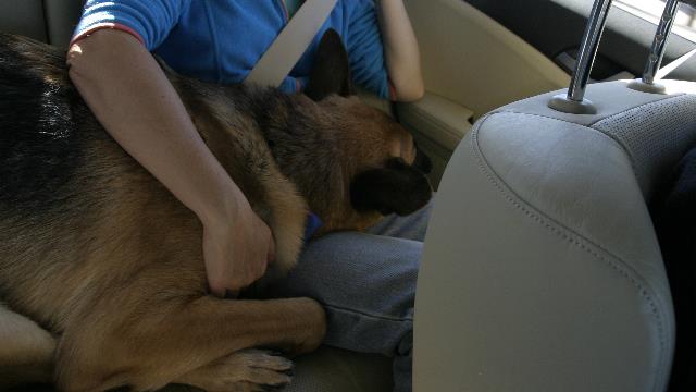
Barry is not use to sharing the back seat but managed to make due.
Back to the trailer to pick up Zaph. After dropping Carol, Barry and Zaph off at the condo, John, Ed and I drove to Cabrillo National Monument (unfortunately dogs are not allowed). This park is on a point across the bay from San Diego and is known for it's great views and tidal pools.
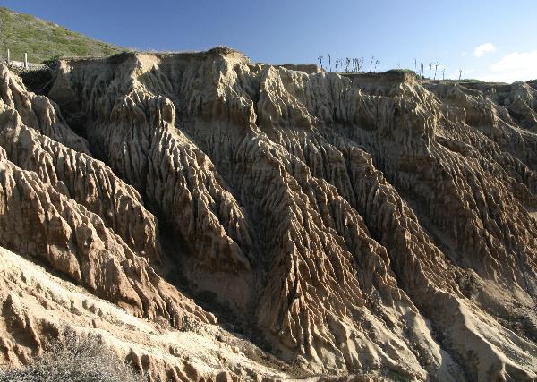
Loved the erosion pattern in the cliffs.
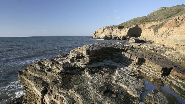
Part of the rocky shoreline.
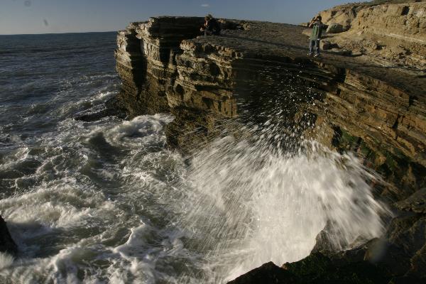
The ocean was quite calm but a few waves did crash against the shore.
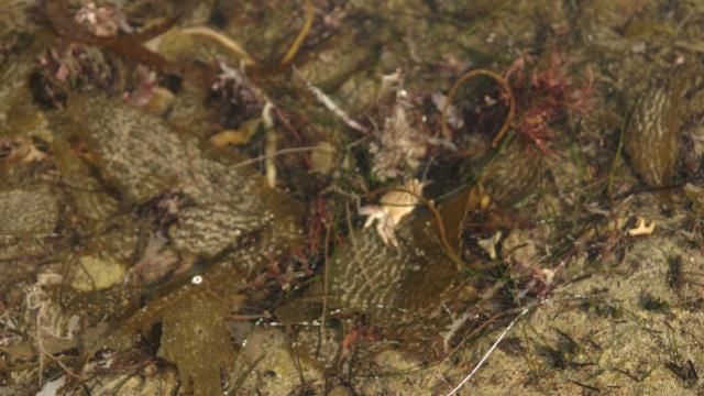
The tide was still quiet high but we did see a couple of tidal pool. If you look close you'll see a crab.
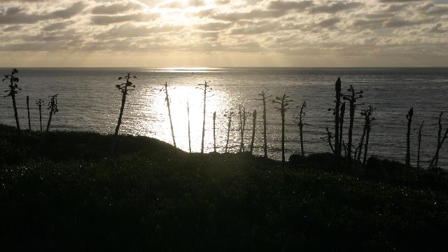
Art shot.
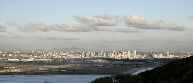
San Diego sky line.
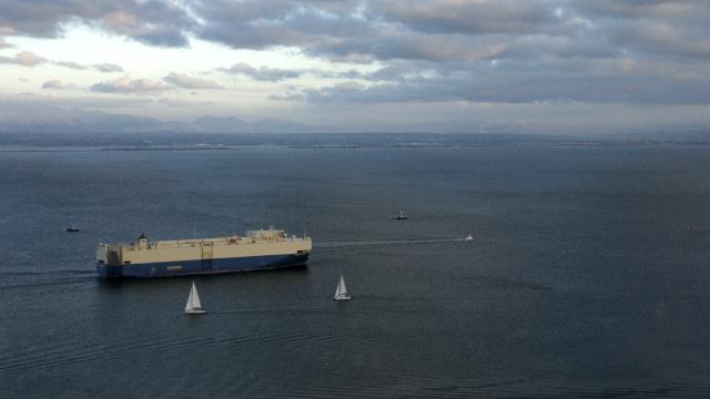
The shoreline in the distance is Tijuana, Mexico.
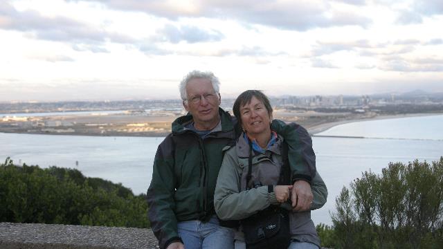
Proof we are actually travelling together.
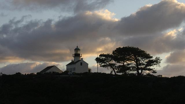
The old lighthouse.
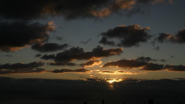
Today's sunset picture.

Barry is not use to sharing the back seat but managed to make due.
Back to the trailer to pick up Zaph. After dropping Carol, Barry and Zaph off at the condo, John, Ed and I drove to Cabrillo National Monument (unfortunately dogs are not allowed). This park is on a point across the bay from San Diego and is known for it's great views and tidal pools.

Loved the erosion pattern in the cliffs.

Part of the rocky shoreline.

The ocean was quite calm but a few waves did crash against the shore.

The tide was still quiet high but we did see a couple of tidal pool. If you look close you'll see a crab.

Art shot.

San Diego sky line.

The shoreline in the distance is Tijuana, Mexico.

Proof we are actually travelling together.

The old lighthouse.

Today's sunset picture.
2010/11/26: A Dog Day
Category: General
Posted by: The Agnew Family
Before I tell you about the day I want to share a little post office story with. When we were in Quartzsite I remembered that I had forgotten my friend Jack's birthday, so I bought him a "belated birthday" post card, addressed it correctly, put the correct postage on it and mailed it. I received a forwarded e-mail from Jack today --- Elizabeth at 111 Chestnut Street (Jack`s street address) in Massachusetts had received his postcard. She looked him up on the web, e-mailed him and put the post card back in the mail (what a nice person). Elizabeth confirmed the post card was addressed correctly. Wonder if Jack will get the card this time. The US postal service is an amazing thing.
Started the day with a trip to the vet John & Carol use. Don't worry nothings wrong with Zaph, Ed and I just wanted to have Zaph's eye checked out. Zaph had an ulcer on his cornea that had not healed when we left home and paranoia mom wanted to make sure it was better and it hooray!!!! it was.
Next stop of the day was a dog beach (there are several in the San Diego area). This was a large sandy beach at the mouth of a river.
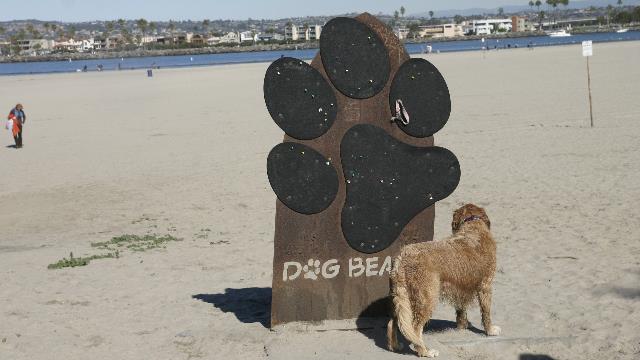
This photo was taken at the end of the beach visit --- no way would Zaph had stood still when we first got to the beach.
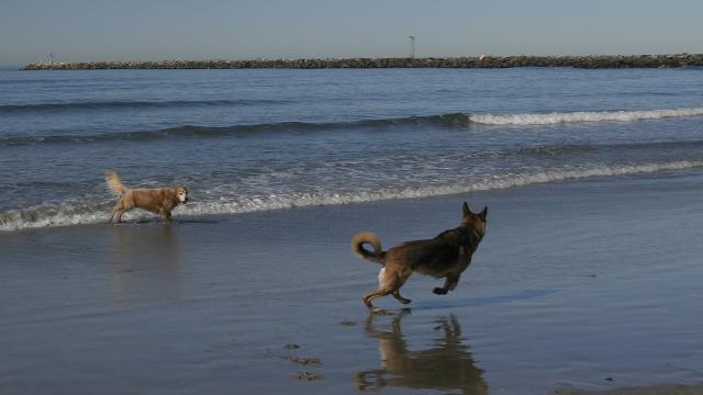
Zaph and Barry romping around.
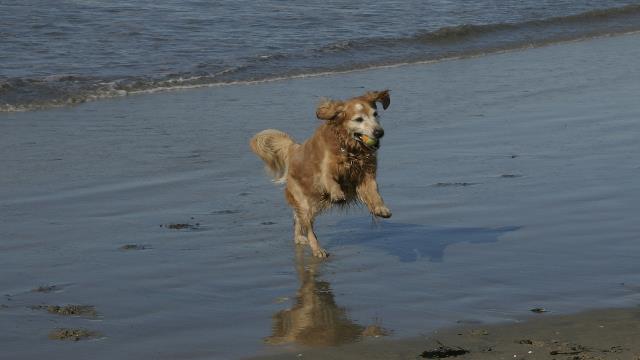
Caught it!!!!
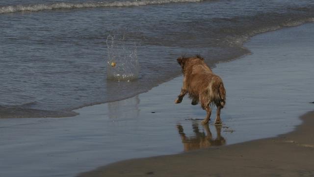
Kersplash!!! I`ll get it.
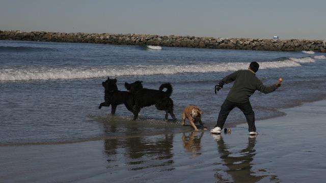
Can anyone join this game? Zaph doesn't care who is throwing a ball, he just joins in the fetching part. He's also very good at training complete strangers to throw the ball for him.

"Hodad's has been recognized as one of the top 5 burger joints in the country by CNN with Hodad's being the only west coast restaurant to get recognized." Loved the "car table" and reading license plates is always fun. Ed was intrigued by one of the items on the menu ---- All you can eat a mere $100 --- must be some pretty big eaters out there. Zaph missed out on this stop but I did save him a piece of my burger. Oh, the burgers were good and so were the onion rings and milk shakes.
About a 1/4 mile from John & Carol's condo is Balboa park. So to complete "Dog Day" we took Zaph and Barry to the Park. This park is a lot like Central Park in New York City ---- it has several museums, theatres, dog park, cactus garden, rose garden, fountains, trails, zoo, etc. Pretty amazing place and plan to visit the zoo in a couple of days .... the have koala bears, pandas and polar bears.
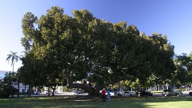
One neat tree.
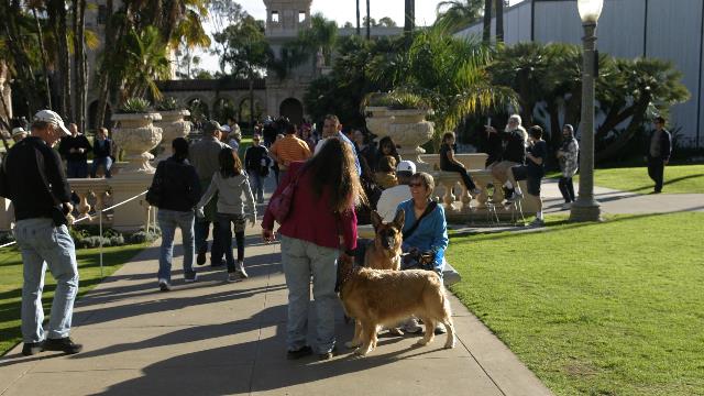
John and Ed had gone into the Botanical building while the dogs and I remained outside. Barry stared at the door the entire time waiting for John to come back while Zaph happily accepted petting.
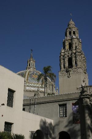
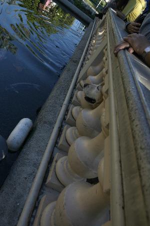
Many of the buildings were very ornate and I particularly liked this one. At first glance the photo on the right looks like one of those pictures taken by accident when your camera is dangling around your neck. Look closely at the rungs in the railing. Ed and I had stopped to look at the coy in the pond and a certain someone decided he needed to see what everyone was looking at. Zaph shocked a couple of women when he slid between them and stuck his head through the railing. Luckily, the women thought it was funny.
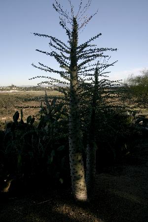
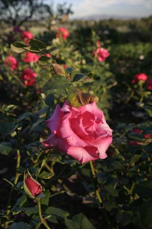
One funky cactus tree that Ed and I had never seen before. Unfortunately no sign so we don't know what it is. Nice to see roses blooming away at the end of November.
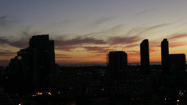
Sipping a glass of wine and watching the sunset after an amazing day.
Started the day with a trip to the vet John & Carol use. Don't worry nothings wrong with Zaph, Ed and I just wanted to have Zaph's eye checked out. Zaph had an ulcer on his cornea that had not healed when we left home and paranoia mom wanted to make sure it was better and it hooray!!!! it was.
Next stop of the day was a dog beach (there are several in the San Diego area). This was a large sandy beach at the mouth of a river.

This photo was taken at the end of the beach visit --- no way would Zaph had stood still when we first got to the beach.

Zaph and Barry romping around.

Caught it!!!!

Kersplash!!! I`ll get it.

Can anyone join this game? Zaph doesn't care who is throwing a ball, he just joins in the fetching part. He's also very good at training complete strangers to throw the ball for him.


"Hodad's has been recognized as one of the top 5 burger joints in the country by CNN with Hodad's being the only west coast restaurant to get recognized." Loved the "car table" and reading license plates is always fun. Ed was intrigued by one of the items on the menu ---- All you can eat a mere $100 --- must be some pretty big eaters out there. Zaph missed out on this stop but I did save him a piece of my burger. Oh, the burgers were good and so were the onion rings and milk shakes.
About a 1/4 mile from John & Carol's condo is Balboa park. So to complete "Dog Day" we took Zaph and Barry to the Park. This park is a lot like Central Park in New York City ---- it has several museums, theatres, dog park, cactus garden, rose garden, fountains, trails, zoo, etc. Pretty amazing place and plan to visit the zoo in a couple of days .... the have koala bears, pandas and polar bears.

One neat tree.

John and Ed had gone into the Botanical building while the dogs and I remained outside. Barry stared at the door the entire time waiting for John to come back while Zaph happily accepted petting.


Many of the buildings were very ornate and I particularly liked this one. At first glance the photo on the right looks like one of those pictures taken by accident when your camera is dangling around your neck. Look closely at the rungs in the railing. Ed and I had stopped to look at the coy in the pond and a certain someone decided he needed to see what everyone was looking at. Zaph shocked a couple of women when he slid between them and stuck his head through the railing. Luckily, the women thought it was funny.


One funky cactus tree that Ed and I had never seen before. Unfortunately no sign so we don't know what it is. Nice to see roses blooming away at the end of November.

Sipping a glass of wine and watching the sunset after an amazing day.
2010/11/25: Walking around San Diego
Category: General
Posted by: The Agnew Family
Happy Thanksgiving to my American friends. As John and Carol are vegetarians we thankfully were spared from the "tofurkey" and enjoyed John's famous cheese fondue for dinner. It's been a long time and it was wonderful.
Carol suffers from post polio syndrome and has stability issues. A couple of years ago Barry, a stability dog, came into her life. He is a large, strong German Shepard who helps her out a lot. When Zaph and Barry met in our trailer it just took a few seconds of sniffing and everything was fine. It was a little different today at John & Carol's condo. Barry kept showing Zaph the door and a one point had Zaph cornered in the hallway. We think the main objective was to keep Zaph away from Carol. After while Barry did get use to Zaph in the condo. Apparently, this routine will happen each time we come to the condo as Barry does this to another dog that visits often. Gracie, the rabbit, and Zaph agreed to give each other space, plus Gracie decided to stay close to her home.
John, Barry, Ed, Zaph and I spent the after walking around the "periphery of downtown". San Diego is a beautiful city and set up for walkers to enjoy.
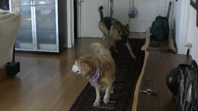
Barry trying to keep Zaph in line. Barry is very cute as he makes "talking" sounds as if he's trying to tell Zaph what to do.
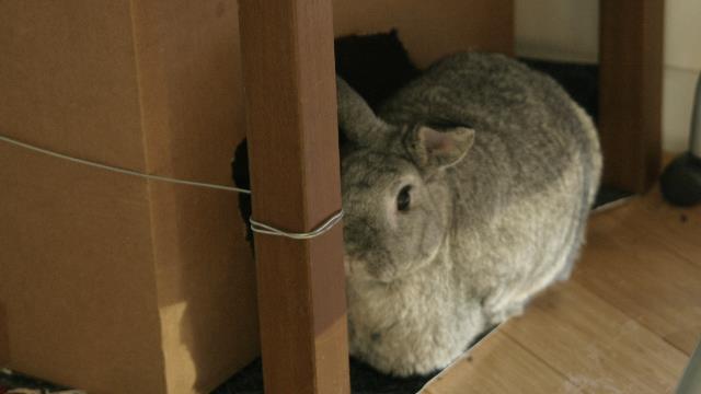
Gracie hanging out beside her house.
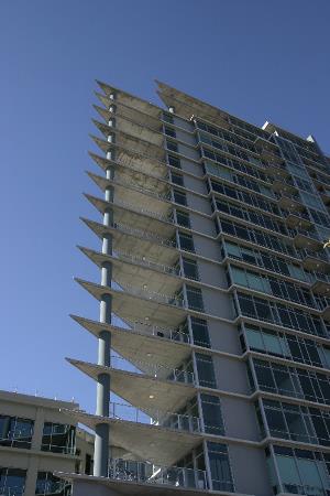
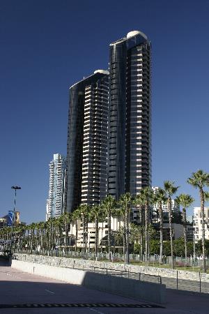
The building on the left is where John, Carol, Barry and Gracie live. Count down four from the top to find their unit. The photo on the right is a view of downtown.
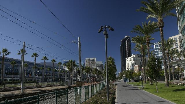
Walking along the trolley line. The convention centre is on the left.
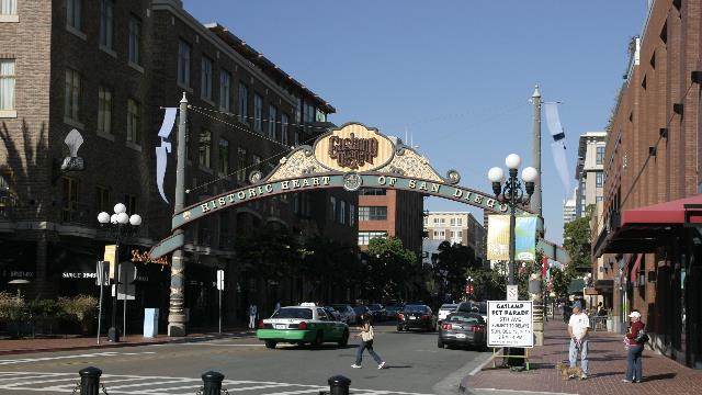
The entrance to the Gas Light district. Lots of shops and restaurants.
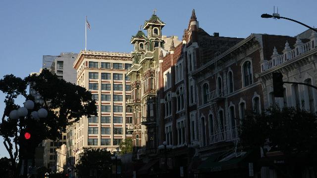
The green building was once owned by Wyatt Earp.
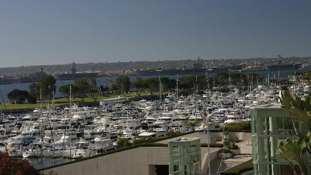
San Diego has a beautiful harbour with lots of boat yards. Across the bay you can see active Air Craft Carriers. One of these was used to help the recently disabled cruise ship. That cruise ship is also in the harbour getting repaired.
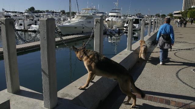
Barry checking out the water.
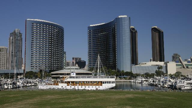
Part of the San Diego skyline.
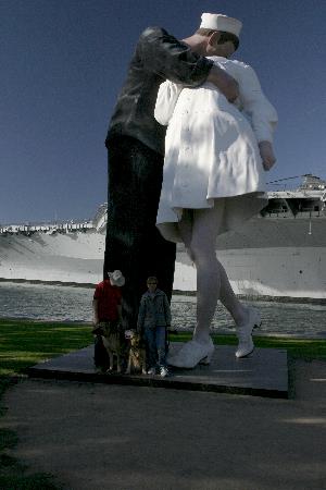
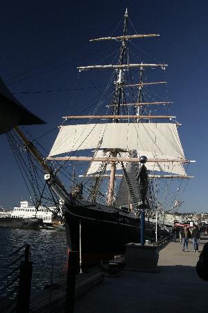
The motley crew getting their photo taken. John, Barry, Zaph and myself. This statue represents the famous photograph taken when the end of WWII was announced. The photo on the right is the Star of India, a steel hulled ship built around 1865. The ship is part of the Maritime Museum and gets taken out for a sail every now and then.
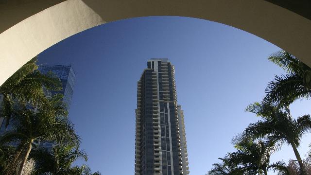
Have to include an art shot every now and then.
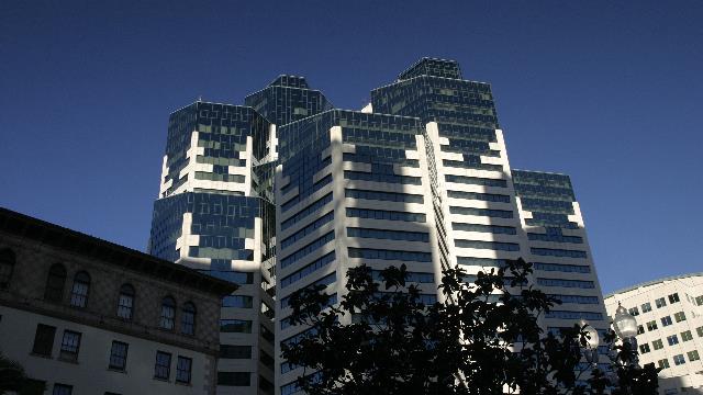
More interesting looking buildings. John told me the name of the building but I don't remember.
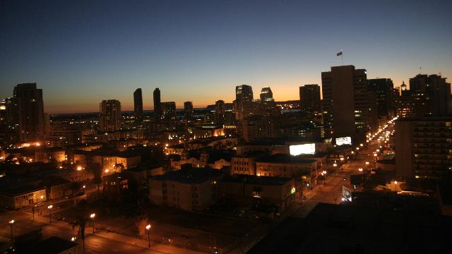
San Diego at night as seen from John & Carol's condo. Amazing view of the city from their home.
Carol suffers from post polio syndrome and has stability issues. A couple of years ago Barry, a stability dog, came into her life. He is a large, strong German Shepard who helps her out a lot. When Zaph and Barry met in our trailer it just took a few seconds of sniffing and everything was fine. It was a little different today at John & Carol's condo. Barry kept showing Zaph the door and a one point had Zaph cornered in the hallway. We think the main objective was to keep Zaph away from Carol. After while Barry did get use to Zaph in the condo. Apparently, this routine will happen each time we come to the condo as Barry does this to another dog that visits often. Gracie, the rabbit, and Zaph agreed to give each other space, plus Gracie decided to stay close to her home.
John, Barry, Ed, Zaph and I spent the after walking around the "periphery of downtown". San Diego is a beautiful city and set up for walkers to enjoy.

Barry trying to keep Zaph in line. Barry is very cute as he makes "talking" sounds as if he's trying to tell Zaph what to do.

Gracie hanging out beside her house.


The building on the left is where John, Carol, Barry and Gracie live. Count down four from the top to find their unit. The photo on the right is a view of downtown.

Walking along the trolley line. The convention centre is on the left.

The entrance to the Gas Light district. Lots of shops and restaurants.

The green building was once owned by Wyatt Earp.

San Diego has a beautiful harbour with lots of boat yards. Across the bay you can see active Air Craft Carriers. One of these was used to help the recently disabled cruise ship. That cruise ship is also in the harbour getting repaired.

Barry checking out the water.

Part of the San Diego skyline.


The motley crew getting their photo taken. John, Barry, Zaph and myself. This statue represents the famous photograph taken when the end of WWII was announced. The photo on the right is the Star of India, a steel hulled ship built around 1865. The ship is part of the Maritime Museum and gets taken out for a sail every now and then.

Have to include an art shot every now and then.

More interesting looking buildings. John told me the name of the building but I don't remember.

San Diego at night as seen from John & Carol's condo. Amazing view of the city from their home.
2010/11/24: Visiting "the rabbits" in San Diego
Category: General
Posted by: The Agnew Family
After saying good-bye to our new friends we hit the road continuing our journey west and south. The drive through the mountains and hills was very pretty but surprisingly built up. Ed was very happy we were driving during a non-rush hour time as there was more than enough traffic --- or maybe rush hour is all the time. Anyway, we made it to the RV resort and marvelled at the difference between the photographs on the resort's web site and reality. The resort is fine and given that it is in a large city, I'm not surprised that the sites are smaller than they appeared on the website. The roadways are wide as the website describes except parking is allowed on both sides .... so not so wide when you're parking your RV.
Our friends, John and Carol met us at the resort. For as long as we've known John and Carol they have been vegetarians and have had house trained bunnies thus the nickname "the rabbits". It was great to see them again and I'm looking forward to spending the next week them exploring San Diego.
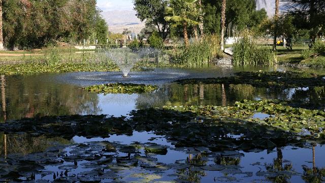
The RV resort in Indio has a beautiful pond.
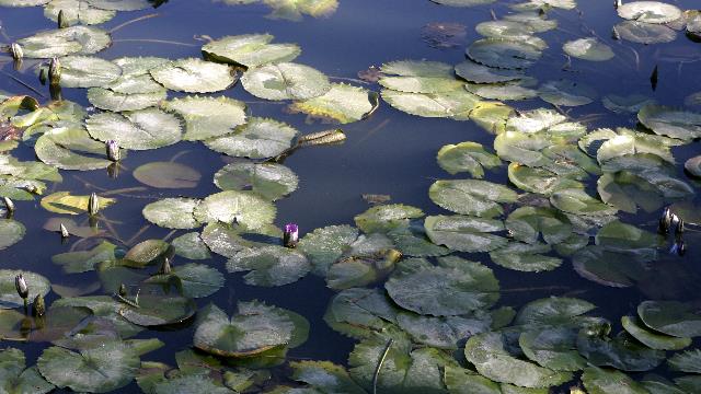
Too bad I didn't think to take photos in the middle of the day to catch the water lilies when the flowers were open.
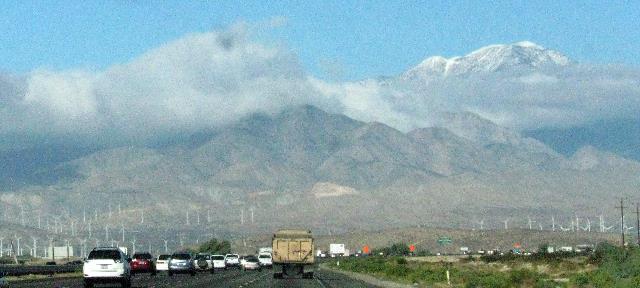
Taking photos from a moving vehicle when traffic is whizzing by is not conducive to great photos but at least it shows how pretty the drive through Palm Springs is.
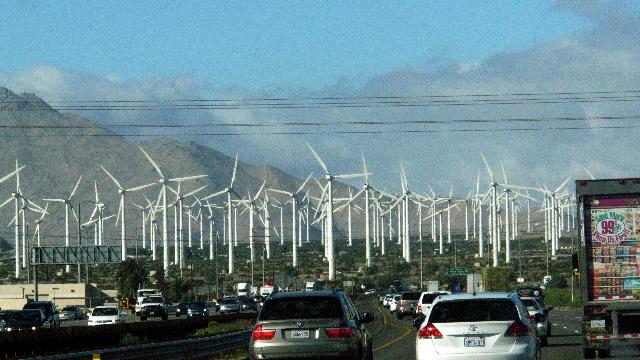
I really am amazed at the size of the wind farm. This is just one little section of it. Wind farms are being installed at home generating lots of controversy --- think someone there should contact someone at the wind farm company in Palm Springs to get answers to the public's questions.
Our friends, John and Carol met us at the resort. For as long as we've known John and Carol they have been vegetarians and have had house trained bunnies thus the nickname "the rabbits". It was great to see them again and I'm looking forward to spending the next week them exploring San Diego.

The RV resort in Indio has a beautiful pond.

Too bad I didn't think to take photos in the middle of the day to catch the water lilies when the flowers were open.

Taking photos from a moving vehicle when traffic is whizzing by is not conducive to great photos but at least it shows how pretty the drive through Palm Springs is.

I really am amazed at the size of the wind farm. This is just one little section of it. Wind farms are being installed at home generating lots of controversy --- think someone there should contact someone at the wind farm company in Palm Springs to get answers to the public's questions.
2010/11/23: Yeah!!! Another hike
Category: General
Posted by: The Agnew Family
The neighbour in the RV we met the other day, George, asked if Ed and I would like to go on a hike with him; Lin offered to watch Zaph and their dog Chip. Go on the Palm Springs Aerial Tramway or go for a hike --- that was easy ---- we went on the hike. Next time we're in Palm Springs we'll go on the Tramway.
Not far from the town of Mecca are some BLM hiking trails --- you hike up the Ladder Canyon trail and back on the Painted Canyon. Both Canyon's are aptly named --- there are several ladders you must climb as you ascended through ladder canyon and the coloured rocks give the illusion of painted walls as you walk through the painted canyon.
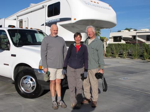
The "hikers" --- Linda: thanks for the mitts and the photo
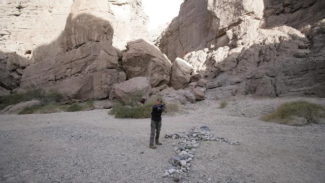
Which way do we go???? Some industrious hiker made an arrow with stones .... who'd of guessed the trail went up through the boulders.
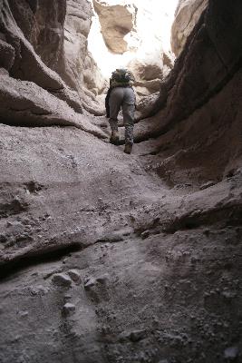
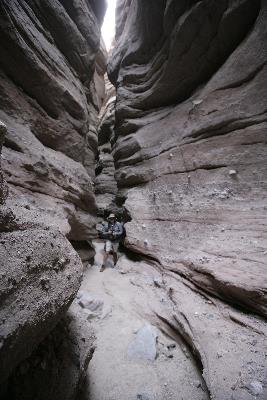
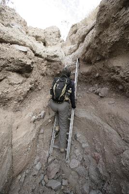 There were ladders, scrambling up rocks and some very skinny the passages. Me scrambling, George in the passage way, Me on the last ladder --- finally out of the canyon.
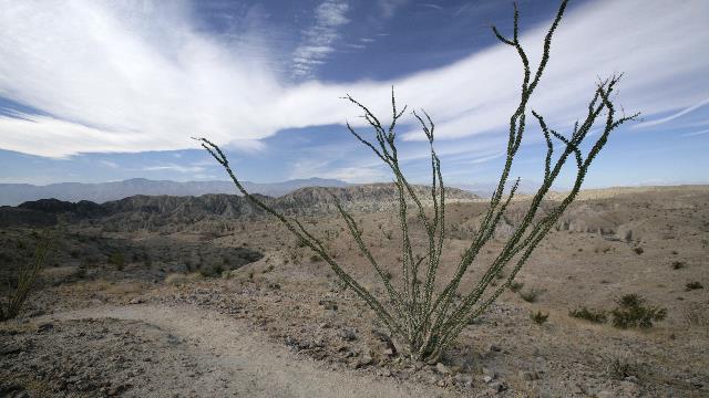
The views were great from the plateau. We could see the Salton Sea but not in this photo.
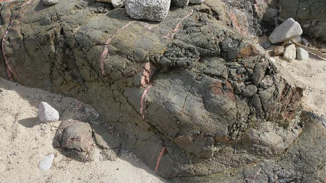
One of the colourful rocks --- I just couldn't lift this rock or I might have been doing a Lucy and The Long Trailer trick.
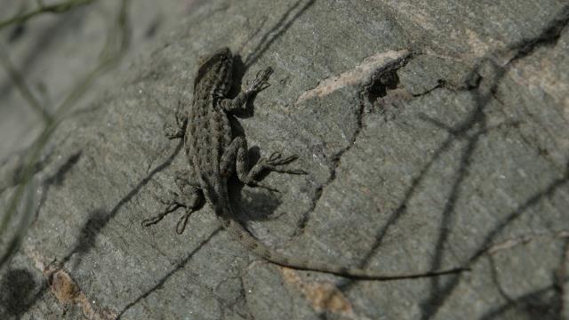
Wildlife --- this guy was pretty tiny.
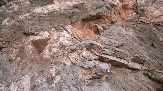
More colourful rock.
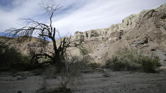
In the bottom of the Painted Canyon looking at the change of rock in the canyon wall.
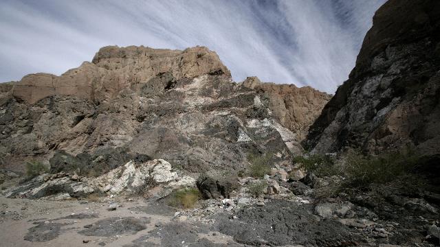
The "black and white" rock. Unfortunately the picture doesn't do it justice.
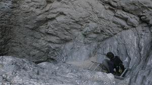
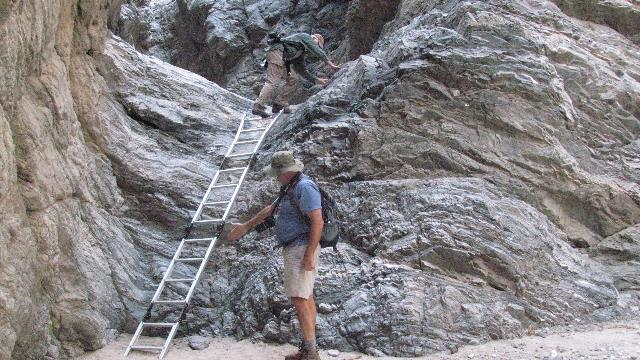
Painted Canyon had a couple of ladders too. They were a little more precarious than the ones in Ladder Canyon --- one looked like it had been crushed by a rock, the 2nd one was on quite the angle so it had to be tied off, and the 3rd one was one of those multi-use ladders with several joints and a little too flexible for my liking. George was explaining that it was safe as several of the rungs were buried in the sand.
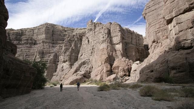
George and I walking through Painted Canyon
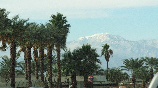
After the hike Ed and I drove to Palm Springs.Yes, that's snow of the mountain.
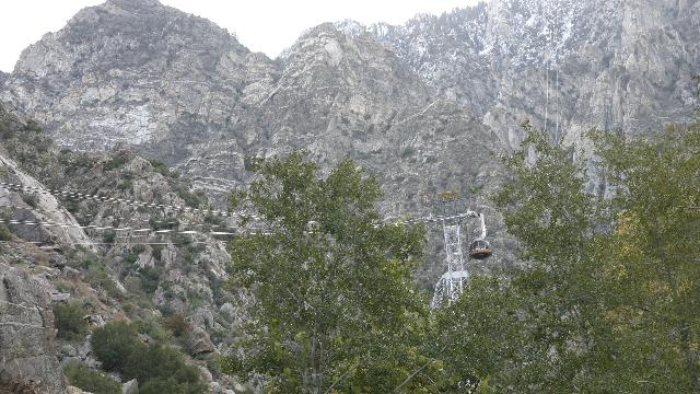
We drove to the Aerial Tramway to have a look. In the winter, kids take toboggans up to the top and play in the snow. Probably just as well we didn't go up as I don't think I would have enjoyed the snow.
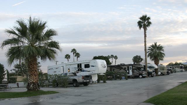
The campground. Where's "doghouse"?
Not far from the town of Mecca are some BLM hiking trails --- you hike up the Ladder Canyon trail and back on the Painted Canyon. Both Canyon's are aptly named --- there are several ladders you must climb as you ascended through ladder canyon and the coloured rocks give the illusion of painted walls as you walk through the painted canyon.

The "hikers" --- Linda: thanks for the mitts and the photo

Which way do we go???? Some industrious hiker made an arrow with stones .... who'd of guessed the trail went up through the boulders.


 There were ladders, scrambling up rocks and some very skinny the passages. Me scrambling, George in the passage way, Me on the last ladder --- finally out of the canyon.
The views were great from the plateau. We could see the Salton Sea but not in this photo.

One of the colourful rocks --- I just couldn't lift this rock or I might have been doing a Lucy and The Long Trailer trick.

Wildlife --- this guy was pretty tiny.

More colourful rock.

In the bottom of the Painted Canyon looking at the change of rock in the canyon wall.

The "black and white" rock. Unfortunately the picture doesn't do it justice.


Painted Canyon had a couple of ladders too. They were a little more precarious than the ones in Ladder Canyon --- one looked like it had been crushed by a rock, the 2nd one was on quite the angle so it had to be tied off, and the 3rd one was one of those multi-use ladders with several joints and a little too flexible for my liking. George was explaining that it was safe as several of the rungs were buried in the sand.

George and I walking through Painted Canyon

After the hike Ed and I drove to Palm Springs.Yes, that's snow of the mountain.

We drove to the Aerial Tramway to have a look. In the winter, kids take toboggans up to the top and play in the snow. Probably just as well we didn't go up as I don't think I would have enjoyed the snow.

The campground. Where's "doghouse"?
Category: General
Posted by: The Agnew Family
Joshua Tree National Park is today’s destination. As Joshua Tree is a large park that you drive through to see the sights with an exit at both ends we did a circular route --- only 227km or 141 miles. The route took us east on hwy 10 to the park road, north (winding through the park) on the park road to hwy 62, west and south to hwy 10 and east again to the park --- Beautiful drive. Joshua Tree is a very diverse park; the southern portion is the Colorado Desert, at a lower elevation with a lot of mesquite; the northern portion is the Mojave Desert, at a higher elevation with lots of Joshua Trees.
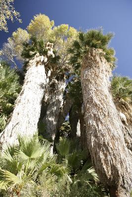
The California Fan Palm at Cottonwood Spring, one of several Oasis in the park. The spring was used for centuries by the Cahuilla Indians and more recently prospectors and minors. There were a couple of gold mines in the area.
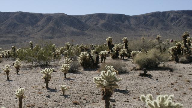
Looking across the desert to the hills.
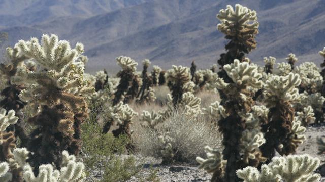
Cholla Cactus Garden. This area in the park has perfect conditions for the Cholla Cactus so they thrive here. This cactus is also known as the "jumping" cactus. Barbs, found on the ends of the spines, attach easily to animals, clothing, etc. and the segments break off easily from the main plant --- thus "jumping". We saw several people with a "segment" on their pant leg or shoe. The plant reproduces not by seed (the plant produces seeds but they tend to be sterile) but by the segments rooting when they land on the ground.
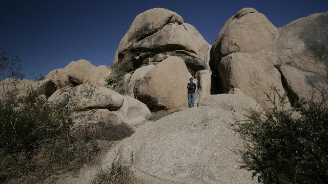
Monzogranite rocks --- I'm in the photo to show just how large these rocks are.
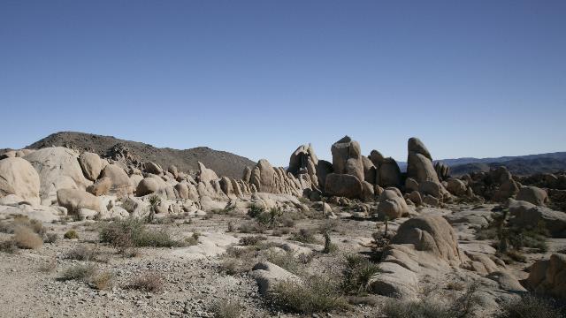
More rocks.
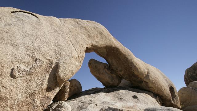
The "arch"
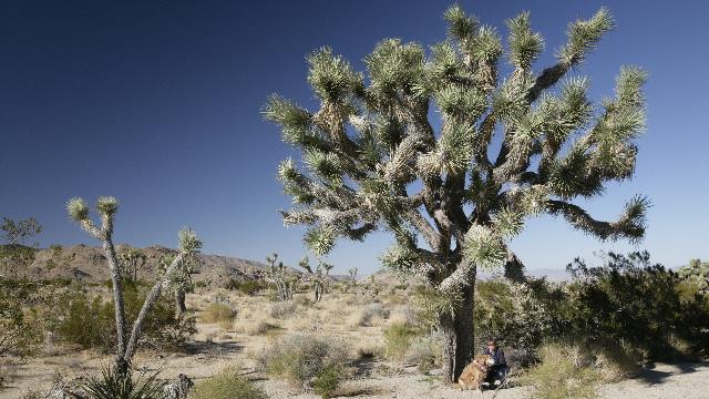
There is a sign along the drive that indicates you are at the joining point of the Colorado Desert and the Mojave desert. It is not long after this that you start to see the Joshua Trees. A Joshua tree is part of the agave family and is related to the Yucca. Young Joshua tree sprouts may grow several inches in the first five years, and then average a half inch of growth per year. This tree has got to be a lot older than me.
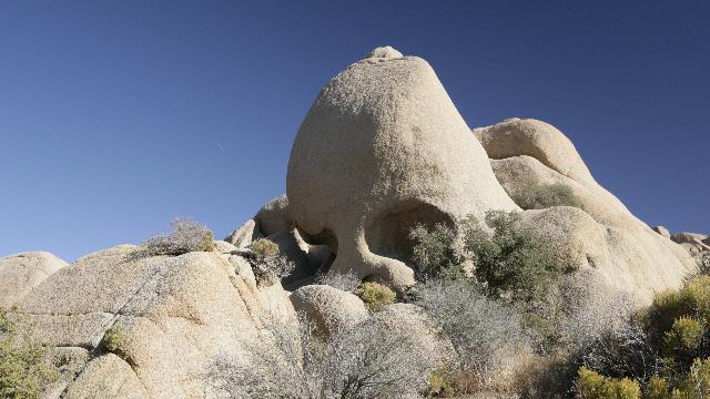
Skull rock.
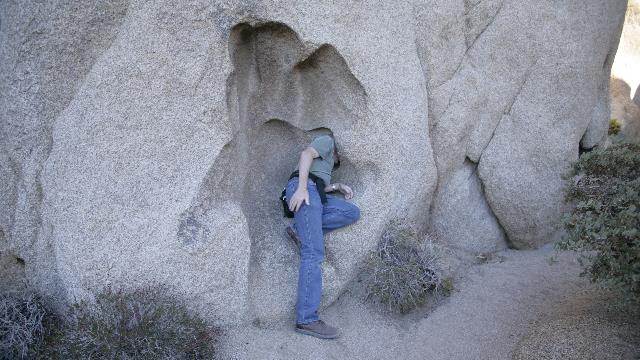
"Help!!!!! the rock is sucking me in"
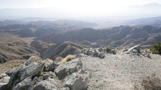
High in the hills looking down on Palm Springs --- too bad the smog is hampering the view.
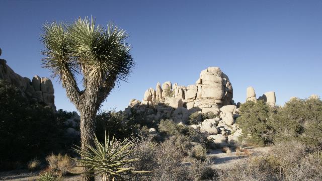
I had commented to Ed that I hadn't seen any rock climbers --- spoke too soon. We saw a lot of climbers in this area.
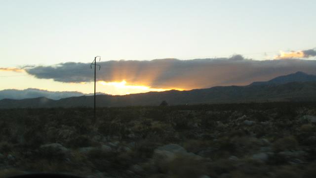
On the drive back to the park, we watched the sun set --- it was 4:37pm. Being at the front of a time zone really affects the daylight hours.
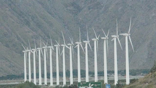
As we drove down into the Palm Springs area we were amazed to see thousands of wind turbines. This spot is apparently the windiest spot in Southern California thus becoming the perfect spot for a wind farm. This is one bank of turbines.

The California Fan Palm at Cottonwood Spring, one of several Oasis in the park. The spring was used for centuries by the Cahuilla Indians and more recently prospectors and minors. There were a couple of gold mines in the area.

Looking across the desert to the hills.

Cholla Cactus Garden. This area in the park has perfect conditions for the Cholla Cactus so they thrive here. This cactus is also known as the "jumping" cactus. Barbs, found on the ends of the spines, attach easily to animals, clothing, etc. and the segments break off easily from the main plant --- thus "jumping". We saw several people with a "segment" on their pant leg or shoe. The plant reproduces not by seed (the plant produces seeds but they tend to be sterile) but by the segments rooting when they land on the ground.

Monzogranite rocks --- I'm in the photo to show just how large these rocks are.

More rocks.

The "arch"

There is a sign along the drive that indicates you are at the joining point of the Colorado Desert and the Mojave desert. It is not long after this that you start to see the Joshua Trees. A Joshua tree is part of the agave family and is related to the Yucca. Young Joshua tree sprouts may grow several inches in the first five years, and then average a half inch of growth per year. This tree has got to be a lot older than me.

Skull rock.

"Help!!!!! the rock is sucking me in"

High in the hills looking down on Palm Springs --- too bad the smog is hampering the view.

I had commented to Ed that I hadn't seen any rock climbers --- spoke too soon. We saw a lot of climbers in this area.

On the drive back to the park, we watched the sun set --- it was 4:37pm. Being at the front of a time zone really affects the daylight hours.
As we drove down into the Palm Springs area we were amazed to see thousands of wind turbines. This spot is apparently the windiest spot in Southern California thus becoming the perfect spot for a wind farm. This is one bank of turbines.

2010/11/21: Indio
Category: General
Posted by: The Agnew Family
There were high wind and blowing sand warnings when we pulled out of Quartzsite this morning. Ed took it easy and was happy that the trucks were blown half a lane over when they were past us not beside us. The terrain was interesting --- we were driving through a flat desert with mountains on three sides of us. The mountains to the south were a fair distance away but you could see them clearly. The altitude did change as well, we were as high as 500 meters and as low as -5 meters. Indio is near Palm Springs and is a very pretty area. The RV park we pulled into is very pretty --- green grass, palm trees, flowering bushes and a pond with water lilies in bloom. A hummingbird was a buzzing around and stopped to check Ed out as he was wearing a red t-shirt. While we were walking around the park we met a nice couple from Vancouver Island who also pull a Titanium fifth wheel. We enjoyed a glass of wine and a visit with them.
2010/11/20: Shopping
Category: General
Posted by: The Agnew Family
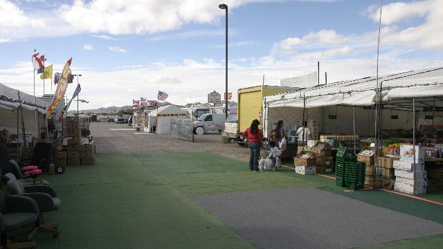
Only a few vendors are here though more have arrived and are in the process of setting up. Still we managed to spend some of our money and could have spent more. Five years ago when we stayed in Yuma, we drove up for a day in January and found out what Quartzsite is really like.
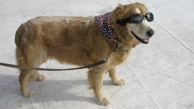
"Gone Hollywood" was the comment Zaph received from several people when they saw him sporting his new doggles and bandanna.
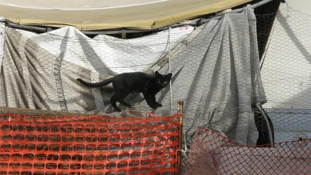
"let me in". This little guy was on the wrong side of the fence, this vendor appeared to have a number of cats.


"Gone Hollywood" was the comment Zaph received from several people when they saw him sporting his new doggles and bandanna.

"let me in". This little guy was on the wrong side of the fence, this vendor appeared to have a number of cats.
2010/11/19: Quartzsite
Category: General
Posted by: The Agnew Family
The hiking portion of our trip has ended, at least for now, as we head to Quartzsite for a couple of nights. Ed, Zaph and I were in Quartzsite five years ago --- I think we're a week to ten days earlier. It hasn't changed much. Quartzsite is still a small town at the crossroads of two highways; the north/south highway from Las Vegas to Yuma and the east/west highway from Phoenix to Las Angeles with lots of RV parks, lots of flea market space, and lots of BLM land. As it was five years ago, the main winter crowd has not arrived. The RV parks are still half empty, the flea markets are open but still have room for lots of vendors and the BLM land has room for a lot more RVs. We stopped at a Rock Mart today and boy did they have a lot of rocks. If only I knew how to cut and polish the rocks and then have the imagination of what to do with them.
2010/11/18: One Last Hike
Category: General
Posted by: The Agnew Family
Huckaby Trail was the destination this morning. We drove to the parking lot ---- it was full; we drove to the parking lot at the other end of the trail ----- it was full; we drove to a picnic area (hoping to hike out of that area)---- no pets allowed; drove to the parking lot for Marg's Draw Trail --- yeah!!!!! there were empty spots. Marg's Draw Trail connects to the Huckaby Trail so we were able to hike our trail of choice, just added a few more kilometres. When we got back to the trailer I took the laundry to the laundry room where I met a woman who had also hiked the Huckaby Trail today .... turned out we passed each other on the trail --- she remembered the dog with the backpack.
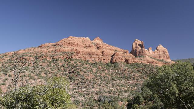
This rock is called Snoopy. If you use your imagination you can see Snoopy sleeping on his doghouse.
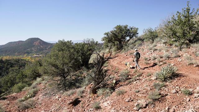
The hikers.
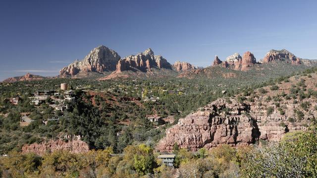
From the Huckaby trail you can overlook Sedona.
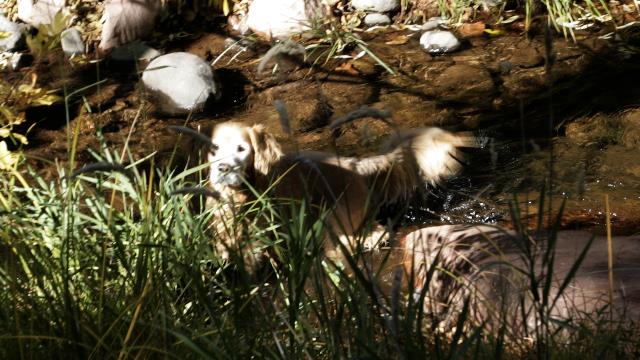
Someone was very happy when we hiked down to Oak Creek, but couldn't understand why we didn't want to spend the afternoon here.
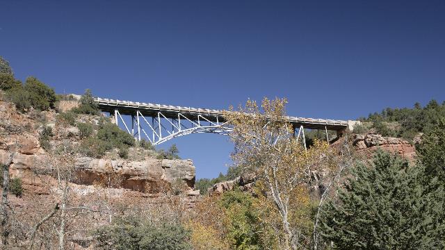
The bridge from below.
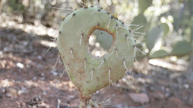
One tough cactus, it seems to have survived having a whole put in it.
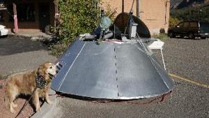
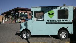
Ed was intrigued by the UFO store. Turned out the store was closed as they were in court fighting for the right to have the flying saucer in the parking lot.
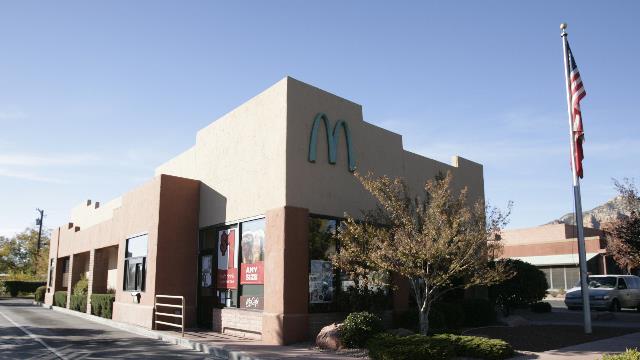
What happened to the golden arches?

This rock is called Snoopy. If you use your imagination you can see Snoopy sleeping on his doghouse.

The hikers.

From the Huckaby trail you can overlook Sedona.

Someone was very happy when we hiked down to Oak Creek, but couldn't understand why we didn't want to spend the afternoon here.

The bridge from below.

One tough cactus, it seems to have survived having a whole put in it.


Ed was intrigued by the UFO store. Turned out the store was closed as they were in court fighting for the right to have the flying saucer in the parking lot.

What happened to the golden arches?
2010/11/17: Boyton Canyon
Category: General
Posted by: The Agnew Family
Today started with the time share presentation. "They" claim they don't use high pressure tactics but it felt high pressure to me. Ed and I must seem too interested or something. Zaph was our excuse but apparently a number of resorts have started allowing pets, so that didn't work so well. After the forth person sat with us offering time shares (not at this resort) for as little as $300, our "NO" finally go us out of the building. Don't think we'll sit through another one of these for a long while.
Boynton Canyon trail was our destination today. The hike takes you along side of a luxury resort called Enchantment then deep into the canyon till you can't go any further. On the Internet, Enchantment is listed as the premium resort in Sedona and as far as location goes it is in an amazing spot.
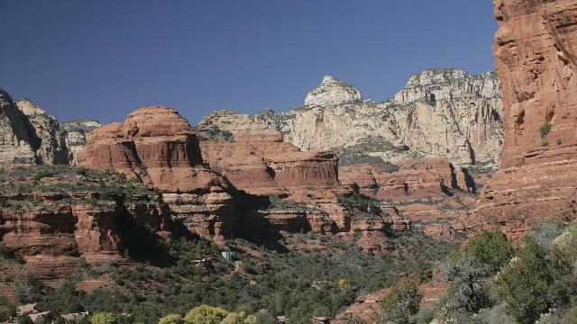
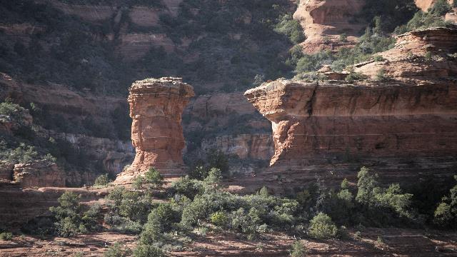
View of the canyon. If you look real close you can see the water tanks and a couple of buildings belonging to the resort.
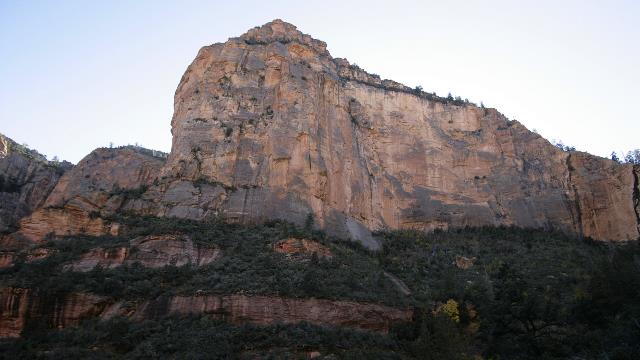
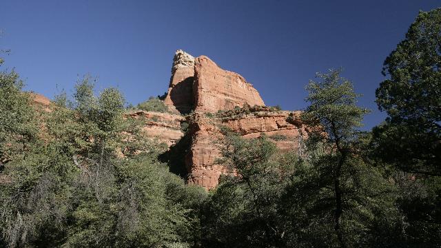
First you hiked along the edge of the resort then down in the bottom of the canyon. Next was a wooded area where you slowly gained altitude and the temperature dropped. Eventually you climbed about half way up the side of the canyon wall where the trail ended and the only way to extend the trail was to go straight up. The view at the end of the trail.
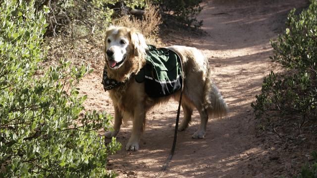
Since Zaph has his own backpack I decided he could carry his water, bowl and treats today. He wasn't a happy camper initially but eventually got use to it. When people stopped to pet him, he would shake the pack as if to say "Pleeeeeease take this off".
Boynton Canyon trail was our destination today. The hike takes you along side of a luxury resort called Enchantment then deep into the canyon till you can't go any further. On the Internet, Enchantment is listed as the premium resort in Sedona and as far as location goes it is in an amazing spot.

View of the canyon. If you look real close you can see the water tanks and a couple of buildings belonging to the resort.


First you hiked along the edge of the resort then down in the bottom of the canyon. Next was a wooded area where you slowly gained altitude and the temperature dropped. Eventually you climbed about half way up the side of the canyon wall where the trail ended and the only way to extend the trail was to go straight up. The view at the end of the trail.


Since Zaph has his own backpack I decided he could carry his water, bowl and treats today. He wasn't a happy camper initially but eventually got use to it. When people stopped to pet him, he would shake the pack as if to say "Pleeeeeease take this off".


2010/11/16: Moving Today
Category: General
Posted by: The Agnew Family
When we were in Sedona on Saturday a nice gentleman started talking to us and offered us three nights free accommodation in the trailer section of a time share, we just had to attend a 90 minute presentation (Zaph too). Some meal coupons were also tossed in. After some hemming and hawing we decided to go for it. The resort is closer to Sedona than we are so that will save a bit of driving. If the promised WiFi is there I'll be able to continue updating the blog otherwise it'll get update when I'm on line again.
Happily there is WiFi at the Time Share Resort. We arrived, parked and went for lunch at the Bistro on site. We were given a two for one lunch coupon and thought we'd use. By the way lunch was very good. The site on the other hand is only OK. The trailer and truck barely fit into the site but as there are no other trailers here it isn't a problem --- we park the truck in the empty site beside us. Can't complain when you think what we're paying for the site ---- nothing.
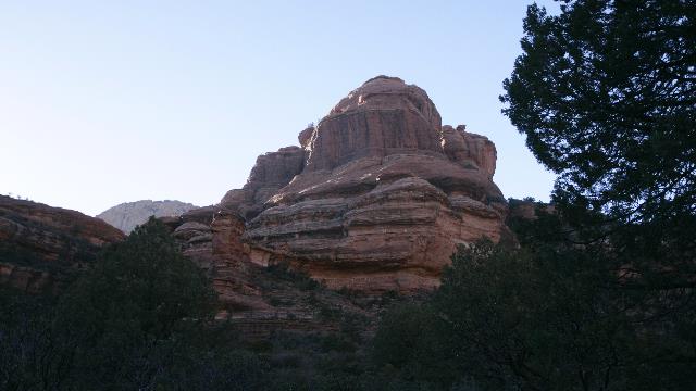
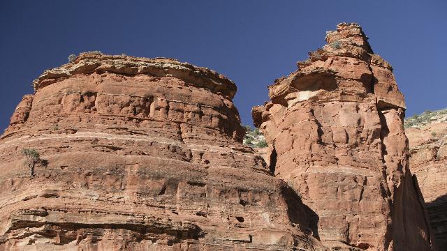
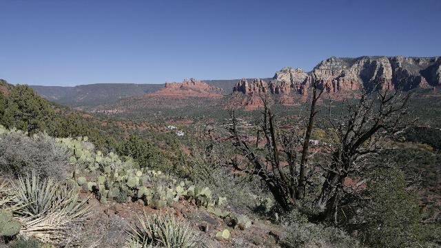
Today's trail was the Airport Trail and yes you guessed it, the trail takes you around Sedona's airport. the airport is on a plateau so the views are wonderful.
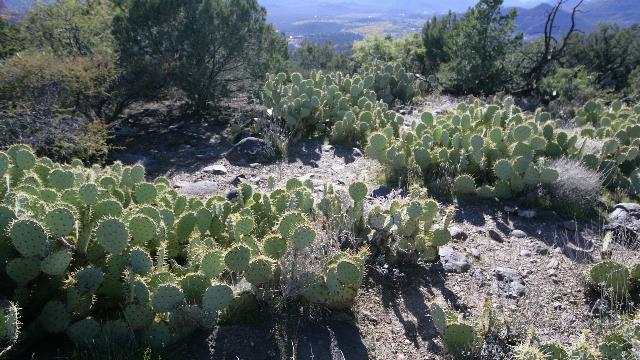
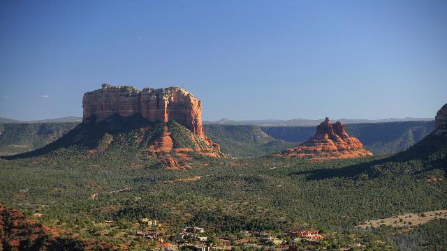
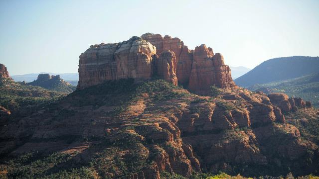
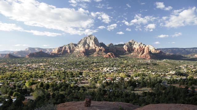
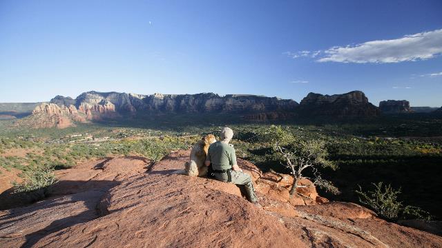
At the trail head there is another trail that takes you to the top of a hill and gives you a beautiful view of the area.
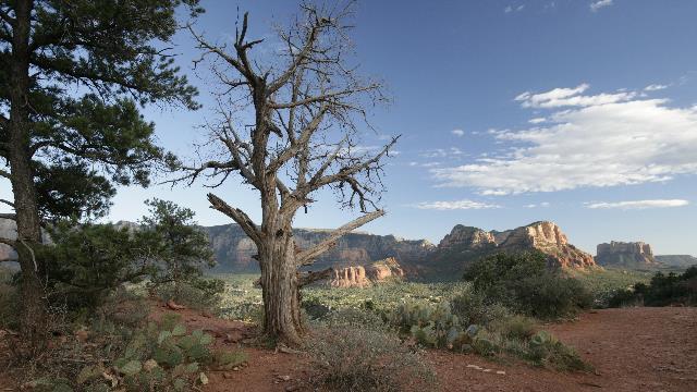
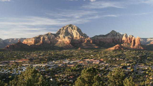
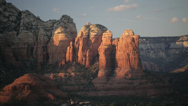
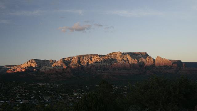
Leaving the trail head we drove up the road to the airport and found another look out spot. Apparently, this spot is pretty popular for sunset photos. It was close to sunset so we decided to stay and see what it was all about. The sunset itself wasn't exciting but the setting sun did do some nice things to the rocks.
Happily there is WiFi at the Time Share Resort. We arrived, parked and went for lunch at the Bistro on site. We were given a two for one lunch coupon and thought we'd use. By the way lunch was very good. The site on the other hand is only OK. The trailer and truck barely fit into the site but as there are no other trailers here it isn't a problem --- we park the truck in the empty site beside us. Can't complain when you think what we're paying for the site ---- nothing.
Today's trail was the Airport Trail and yes you guessed it, the trail takes you around Sedona's airport. the airport is on a plateau so the views are wonderful.


At the trail head there is another trail that takes you to the top of a hill and gives you a beautiful view of the area.


Leaving the trail head we drove up the road to the airport and found another look out spot. Apparently, this spot is pretty popular for sunset photos. It was close to sunset so we decided to stay and see what it was all about. The sunset itself wasn't exciting but the setting sun did do some nice things to the rocks.


2010/11/15: Hiking
Category: General
Posted by: The Agnew Family
The crowds are gone (though there are still lots of people around) from Sedona so we could actually find parking spots at the trail heads and scenic look outs. First stop Cathedral Rock.
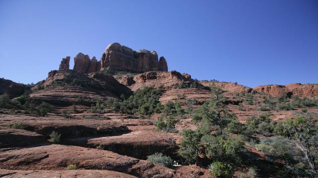
We had done the easy part of the hike at this point. The hike was labelled strenuous but it was short so we thought why not.
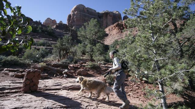
Zaph was a real trooper but just couldn't scramble up the sheer rocks, so Ed continued while Zaph and I sat down to enjoy the view.
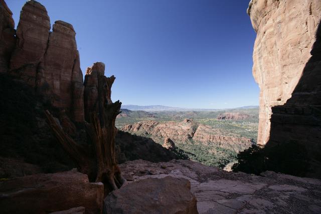
One of the great views Ed saw.
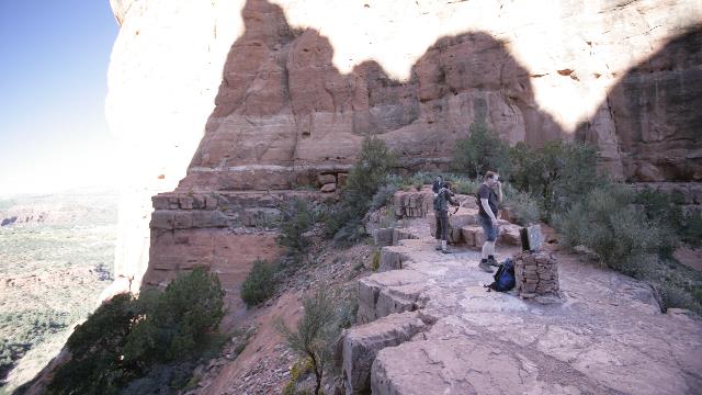
The end of the trail .... you needed climbing gear to continue.
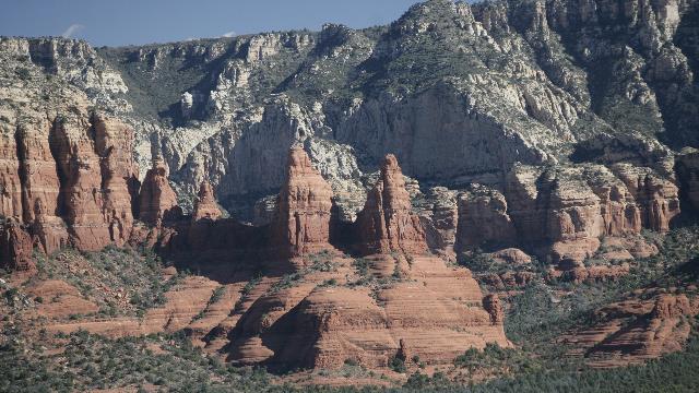
View from the top.
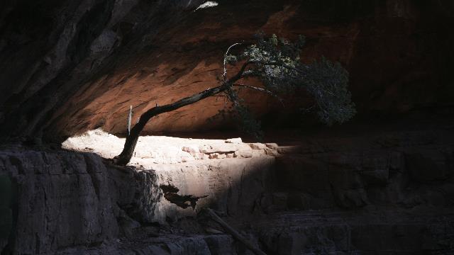
Now that's one determined tree.
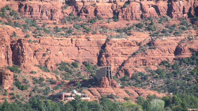
The Chapel of the Holy Cross across the valley.
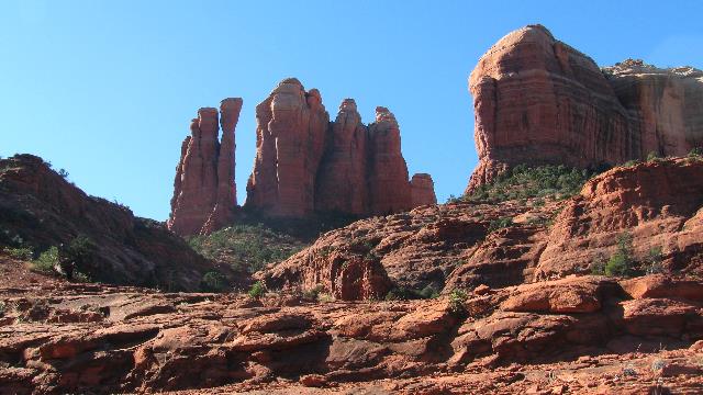
Zaph and I got bored sitting so went for a walk on the plateau trail. Our view of Cathedral Rock.
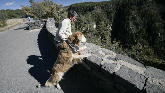
Next hike was going to be a West Fork so we drove a bit past it and up the pass to Oak Creek Vista. Lots of trees down there.
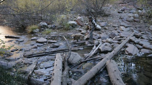
The trail at West Fork crossed Oak Creek a lot of times. Zaph couldn't figure out why I fussed so much during the crossings.
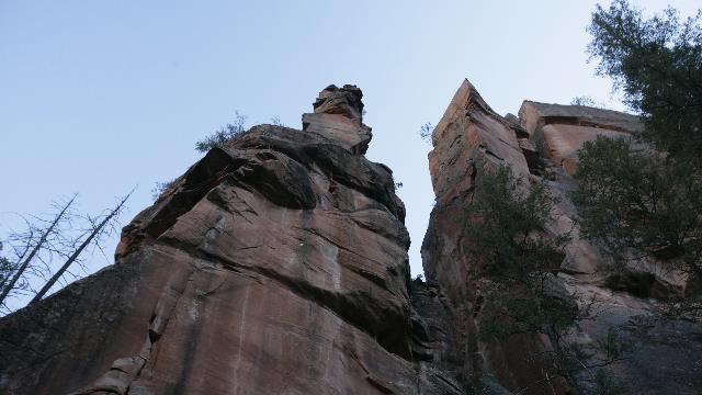
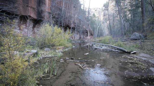
The trail followed the creek through the canyon. There were lots of trees but also great views of the canyon walls.
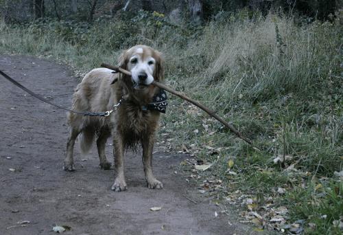
End of the trail --- he carried the stick for over half of the hike, even when he was greeting other dogs. Must have been a really good stick.
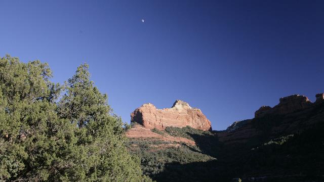
On the drive back we stopped at a view point.

We had done the easy part of the hike at this point. The hike was labelled strenuous but it was short so we thought why not.

Zaph was a real trooper but just couldn't scramble up the sheer rocks, so Ed continued while Zaph and I sat down to enjoy the view.

One of the great views Ed saw.

The end of the trail .... you needed climbing gear to continue.

View from the top.

Now that's one determined tree.

The Chapel of the Holy Cross across the valley.

Zaph and I got bored sitting so went for a walk on the plateau trail. Our view of Cathedral Rock.

Next hike was going to be a West Fork so we drove a bit past it and up the pass to Oak Creek Vista. Lots of trees down there.

The trail at West Fork crossed Oak Creek a lot of times. Zaph couldn't figure out why I fussed so much during the crossings.

The trail followed the creek through the canyon. There were lots of trees but also great views of the canyon walls.


End of the trail --- he carried the stick for over half of the hike, even when he was greeting other dogs. Must have been a really good stick.

On the drive back we stopped at a view point.
2010/11/14: Jerome
Category: General
Posted by: The Agnew Family
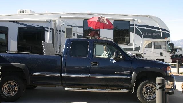
Big Blue got a facial this morning .... the chips in the windshield were fixed and an old one fixed up. Windshield looks great again.
Decided to avoid Sedona today in hopes that it will be a less busy during the week. First stop was Tuzigoot National Monument where there are the remains of an ancient Sinagua pueblo.
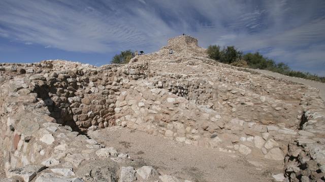
The pueblo was built on the top of a hill and down one side. From the bottom looking at the top room.
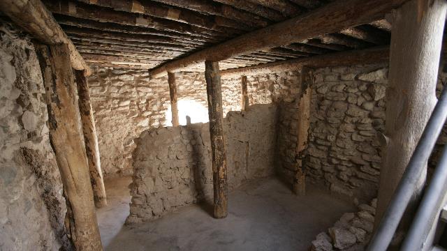
The pueblo at the top has been restored. This is how the "archaeologists" think the inside of the pueblo looked.
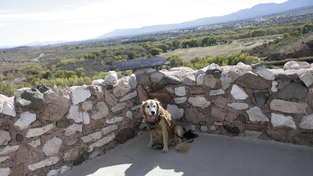
Yup, Zaph came to check out the pueblo.
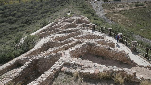
Looking down from the top.
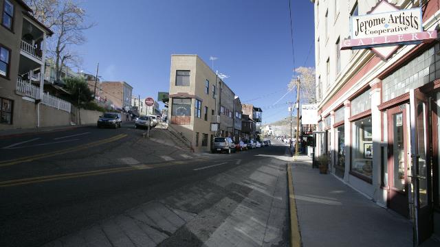
Next stop was Jerome, a town perched high ontop of Cleopatra Hill (5,200 feet). From the Jerome tourism page "Once known as the wickedest town in the west, Jerome was a copper mining camp, growing from a settlement of tents to a roaring mining community. Founded in 1876, Jerome was once the fourth largest city in the Arizona Territory. The population peaked at 15,000 in the 1920's. The Depression of the 1930's slowed the mining operation and the claim went to Phelps Dodge, who holds the claim today. World War II brought increased demand for copper, but after the war, demand slowed. Dependant on the copper market, Phelps Dodge Mine closed in 1953. The remaining 50 to 100 hardy souls promoted the town as a historic ghost town. In 1967 Jerome was designated a National Historic District by the federal government. Today Jerome is a thriving tourist and artist community with a population of about 450."
The town is built along the switch back road as it winds its way up the mountain. The shops are fascinating and the smells wafting from the restaurants enticing --- we almost went into the Haunted Burger even though we had just eaten lunch.
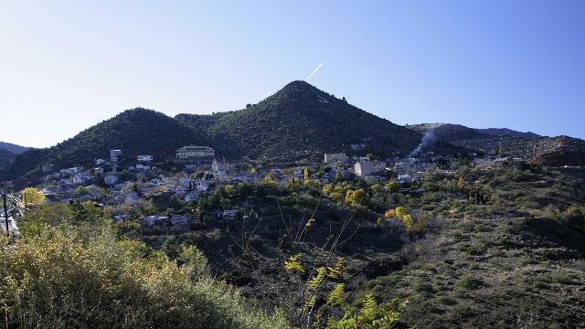
We stopped about half way up the hill to look up at the town. The large building at the top of town is the hotel.
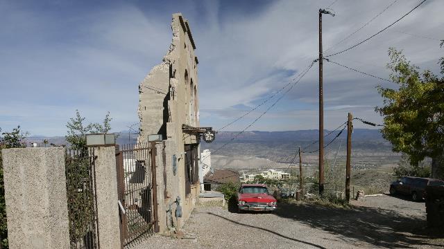
There's a pottery shop behind the wall.
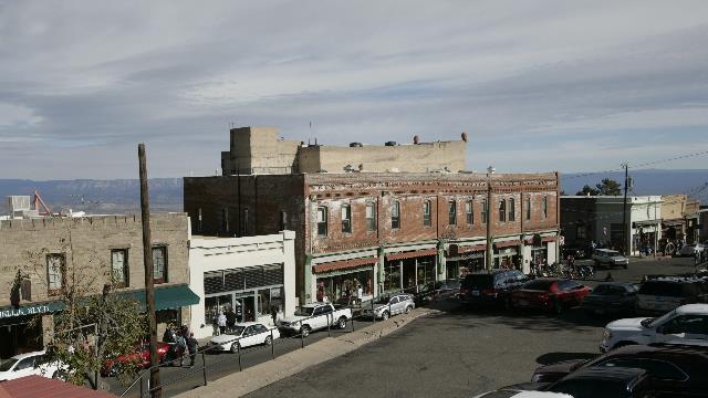
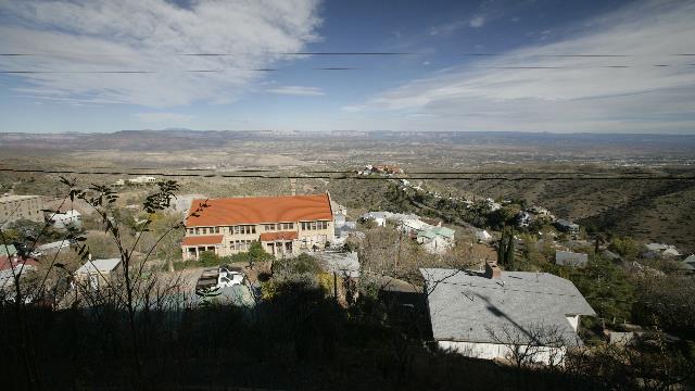
Looking down from the hotel.
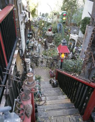
A well decorated side yard.
2010/11/13: Sedona
Category: General
Posted by: The Agnew Family
Drove into Sedona today along with what felt like a zillion people. OK, I'm exaggerating but Ed was got really frustrated with traffic especially when he was trying to park. We stopped at one scenic outlook / trail head where we managed to find parking then went to the Chapel of the Holy Cross where we waited in line to park --- luckily there were a couple of guys managing the parking area. After this we decided to spend the afternoon wandering around town as we thought it might be easier to find parking in town ---- NOT. We did luck into some people pulling out of a parking spot as we were looking for one.
Sedona is a real tourist town. From old photos, you can see that it started to grow as tourism started to take off. The store owners are very friendly, many of them allowing Zaph into the stores. And as always, Zaph considered it a successful day as he received a lot of attention and many pets.
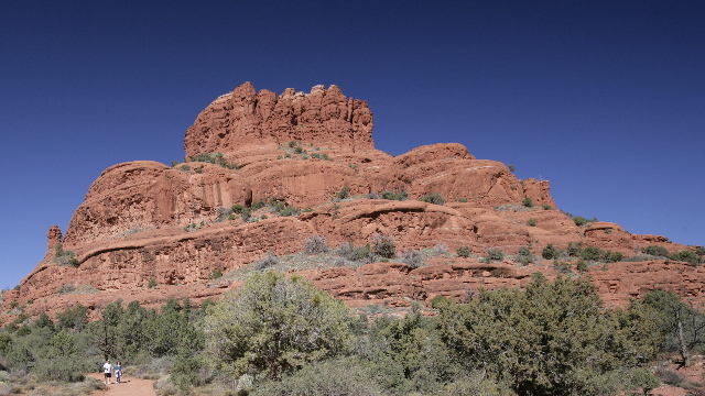
One of the many red stone outcroppings.
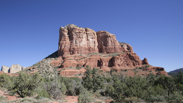
Another beautiful hill.
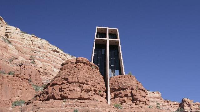
The Chapel of the Holy Cross. The idea for the chapel was conceived in the late 1920's by Marguerite Brunswig Staude, a sculptor and student of Frank Lloyd Wright. Over the next 30 years, a location was chosen and permission granted to build on federal land. In 1956 the chapel was completed.
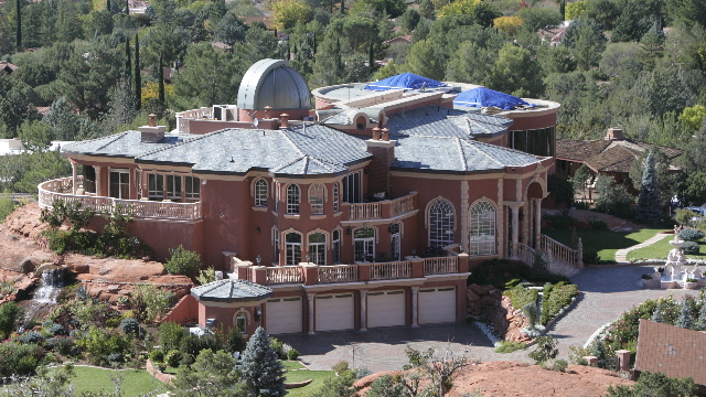
This house was on Chapel Road near the church. Rumour has it that it is worth $25 million, is over 14,000 square feet and the telescope can be worked remotely from the owners other homes. Rumour says the owner holds many medical equipment patents include some for the lasik eye surgery.
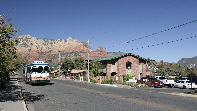
A view while walking in town.
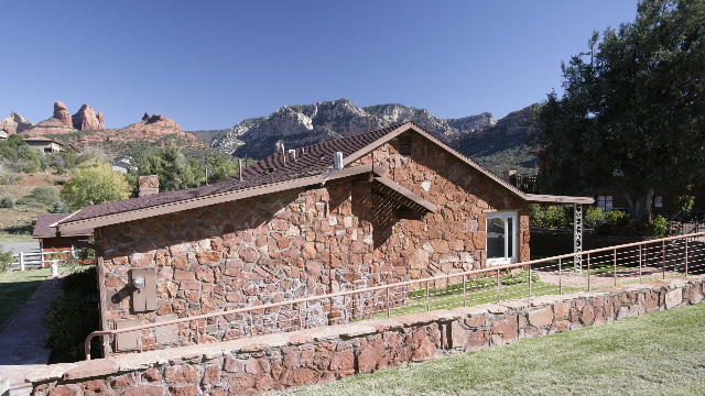
This house is more our style. Just love the view.
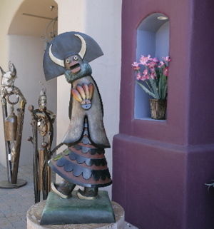
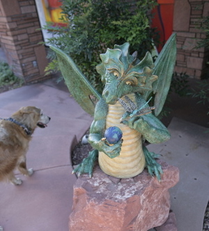
We're on the lookout for a statue type thing for our front steps. Zaph seems to prefer the dragon.
On the drive back to the trailer, the truck's windshield was hit by a stone resulting in a chip --- would you believe it was a newly paved road. If you know Ed you know that it has to be fixed right away. Happily Ed was able to track a fellow down who will fix it at the RV park tomorrow.
As we haven't eaten out in almost two weeks; not breakfast, lunch or dinner, the cook rebelled. When we checked in, the restaurant at the casino lodge was recommended so we decided to give it a try. What a wonderful dinner. Enough people there but not too busy. Reasonable prices, good service, friendly wait staff, a deal on wine and NO TAXES, that's right no taxes because the restaurant is on an Indian Reserve. The restaurant had a "wine tasting" special. Three slightly more than half glasses of wine (either red or white, your choice) selected by the bar tender for $7. A nice way to end the day.
Sedona is a real tourist town. From old photos, you can see that it started to grow as tourism started to take off. The store owners are very friendly, many of them allowing Zaph into the stores. And as always, Zaph considered it a successful day as he received a lot of attention and many pets.

One of the many red stone outcroppings.

Another beautiful hill.

The Chapel of the Holy Cross. The idea for the chapel was conceived in the late 1920's by Marguerite Brunswig Staude, a sculptor and student of Frank Lloyd Wright. Over the next 30 years, a location was chosen and permission granted to build on federal land. In 1956 the chapel was completed.

This house was on Chapel Road near the church. Rumour has it that it is worth $25 million, is over 14,000 square feet and the telescope can be worked remotely from the owners other homes. Rumour says the owner holds many medical equipment patents include some for the lasik eye surgery.

A view while walking in town.

This house is more our style. Just love the view.


We're on the lookout for a statue type thing for our front steps. Zaph seems to prefer the dragon.
On the drive back to the trailer, the truck's windshield was hit by a stone resulting in a chip --- would you believe it was a newly paved road. If you know Ed you know that it has to be fixed right away. Happily Ed was able to track a fellow down who will fix it at the RV park tomorrow.
As we haven't eaten out in almost two weeks; not breakfast, lunch or dinner, the cook rebelled. When we checked in, the restaurant at the casino lodge was recommended so we decided to give it a try. What a wonderful dinner. Enough people there but not too busy. Reasonable prices, good service, friendly wait staff, a deal on wine and NO TAXES, that's right no taxes because the restaurant is on an Indian Reserve. The restaurant had a "wine tasting" special. Three slightly more than half glasses of wine (either red or white, your choice) selected by the bar tender for $7. A nice way to end the day.
2010/11/12: Warmer climate .... ahhhhhhhhhh
Category: General
Posted by: The Agnew Family
The plan was to drive to Sedona and stay there a few days. When Ed phoned ahead to double check that there was room, he was surprised to hear that they only had one space left and we wouldn't fit in it. I guess that's what happens when a popular place has only one RV park, it's a weekend and not far from a city (Phoenix). Plan B came into play. We are in Camp Verde about 22 miles from Sedona in a very nice RV park run by a Native Tribe. As expected there is a casino less than 1/2 a mile away. Camp Verde is only an hour south of Flagstaff but it's elevation is 1000 meters less resulting in warmer temperatures --- only two layers today and I was warm.
Not far from the RV park is Montezuma's Castle National Monument and Montezuma's Well National Monument. The first vagabond groups of miners and soldiers visited the area and misnamed the sites after the Aztec emperor Montezuma, who in fact never came this far north.
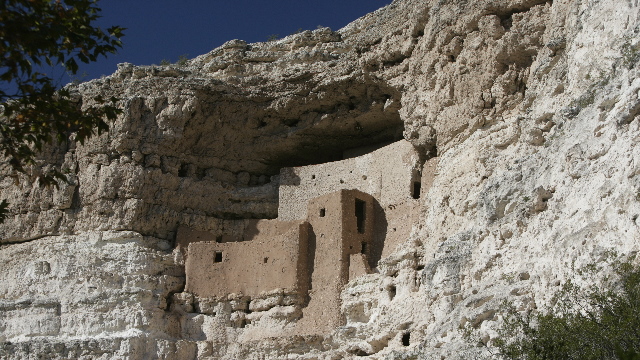
Montezuma Castle, this is one of the best preserved cliff dwellings in North America. The Sinagua culture built this 20 room dwelling high in the limestone cliff.
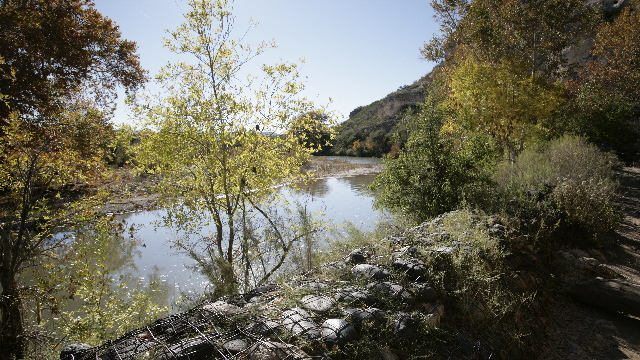
This nearby water source made it a perfect place to live.
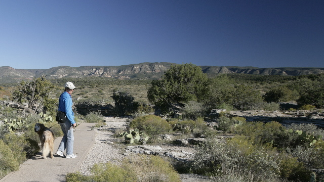
Montezuma's Well is about five miles from the Castle as the crow flies.
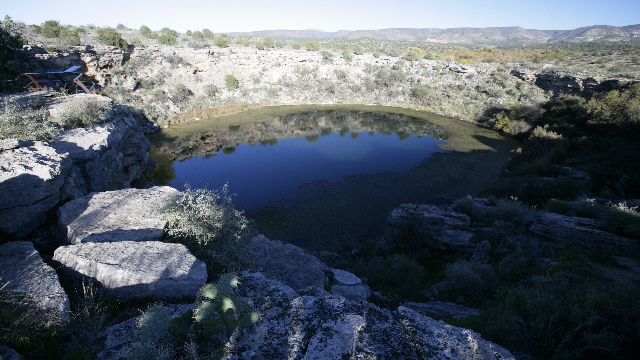
The well was formed by the collapse of a limestone cavern. Over one million gallons of 74F water a day flows continuously into the Well. The water exits the collapsed cavern via a "swallet" and flows through 150 feet of limestone before re-emerging from the outlet into an irrigation ditch. The Sinagua farmed this area using the irrigation ditches to water their crops. Many of the current residents of the area rely on this water for their gardens and livestock.
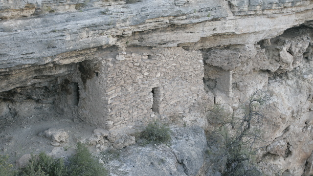
One of the dwellings in the side of the cliff ... one wrong move and you'd be swimming.
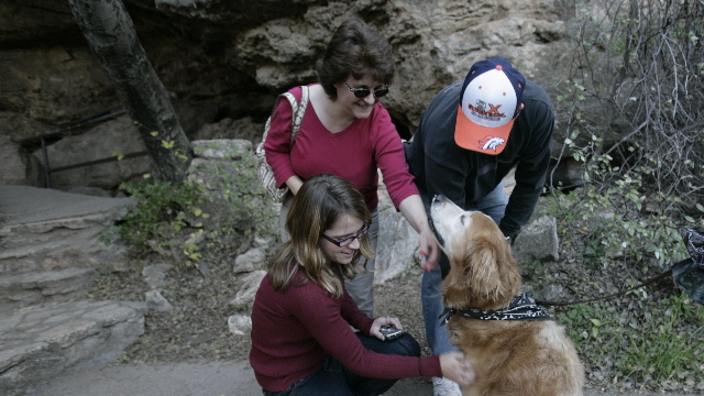
Ahhhh, this makes a walk perfect. Three strangers all petting me at the same time.
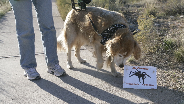
I don't see any tarantulas.... these signs are never right.
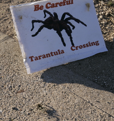
Oh, oh the sign was correct. A young tarantula is walking in front of the sign ... it's shadow is much bigger than the spider itself.
Not far from the RV park is Montezuma's Castle National Monument and Montezuma's Well National Monument. The first vagabond groups of miners and soldiers visited the area and misnamed the sites after the Aztec emperor Montezuma, who in fact never came this far north.

Montezuma Castle, this is one of the best preserved cliff dwellings in North America. The Sinagua culture built this 20 room dwelling high in the limestone cliff.

This nearby water source made it a perfect place to live.

Montezuma's Well is about five miles from the Castle as the crow flies.

The well was formed by the collapse of a limestone cavern. Over one million gallons of 74F water a day flows continuously into the Well. The water exits the collapsed cavern via a "swallet" and flows through 150 feet of limestone before re-emerging from the outlet into an irrigation ditch. The Sinagua farmed this area using the irrigation ditches to water their crops. Many of the current residents of the area rely on this water for their gardens and livestock.

One of the dwellings in the side of the cliff ... one wrong move and you'd be swimming.

Ahhhh, this makes a walk perfect. Three strangers all petting me at the same time.

I don't see any tarantulas.... these signs are never right.

Oh, oh the sign was correct. A young tarantula is walking in front of the sign ... it's shadow is much bigger than the spider itself.
Category: General
Posted by: The Agnew Family
Didn't go far today, just down to Flagstaff. Not any warmer than the Grand Canyon as it's at the same altitude but no snow. Took the afternoon to tour about. Looking at all the tourist information we'll have to come back to four corners area one day (Arizona, New Mexico, Colorado and Utah intersection).
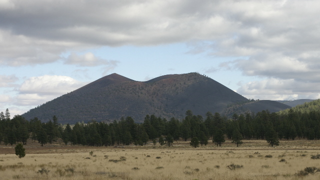
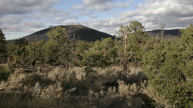
The mountains around Flagstaff are the result of volcanic activity. Sunset Crater Volcano is relatively young as it is thought to have erupted around 1040.
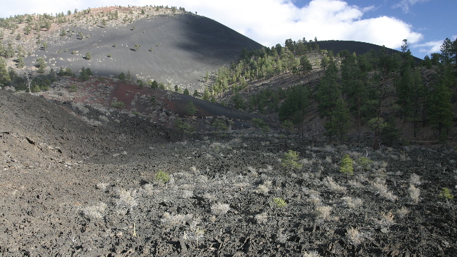
I was amazed at how straight the sides look. That's lava in the foreground of the photo.
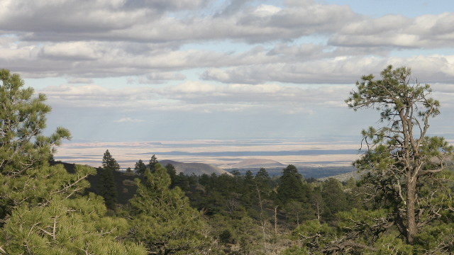
In the distance is the painted desert.
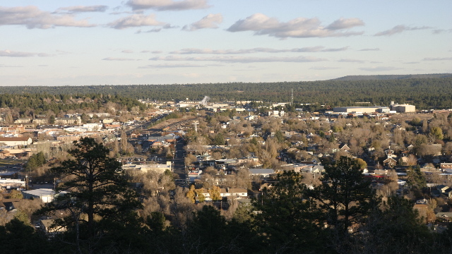
Looking down on Flagstaff.

The mountains around Flagstaff are the result of volcanic activity. Sunset Crater Volcano is relatively young as it is thought to have erupted around 1040.

I was amazed at how straight the sides look. That's lava in the foreground of the photo.

In the distance is the painted desert.


Looking down on Flagstaff.
2010/11/10: Walk along the Rim
Category: General
Posted by: The Agnew Family
It was a sunny cool morning when we put sunglasses on Zaph and set out to walk part of the Rim trail. (Zaph had an eye drop before we left the trailer thus the need for the glasses). As usual he attracted a lot of attention and had his picture taken many times --- making him a very happy camper. The portion of the trail we walked was 8 km long resulting in 16 km (we had to walk back) plus there was the kilometre to and from the truck plus the distance walking around the viewing areas. Nice hike. About an hour into the trip the sky clouded over, a couple hours later the snow flurries started. Hopefully there won’t be much accumulation as the plan is to leave in the morning.
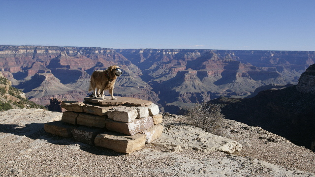
Cool dude.
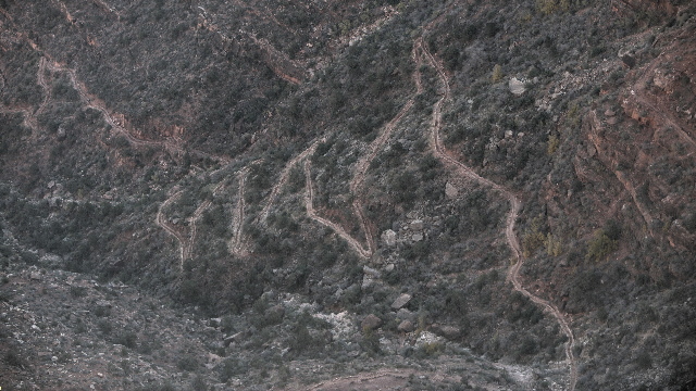
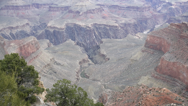
The Bright Angel Trail that we hike the day before.
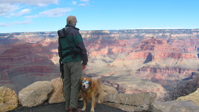
Someone was more interested in getting his photo taken then looking at the view.
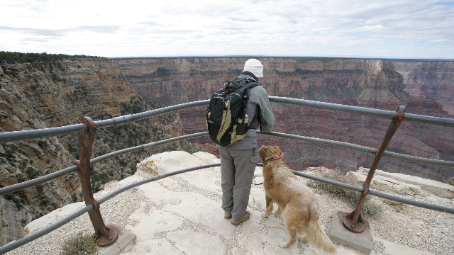
Can you tell it was cold. I had on four layers, a hat and mitts. The pack helped to keep the heat in .... so maybe five layers.
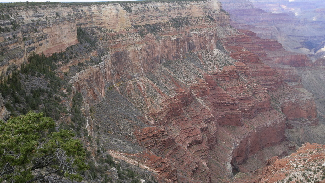
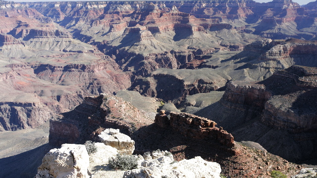
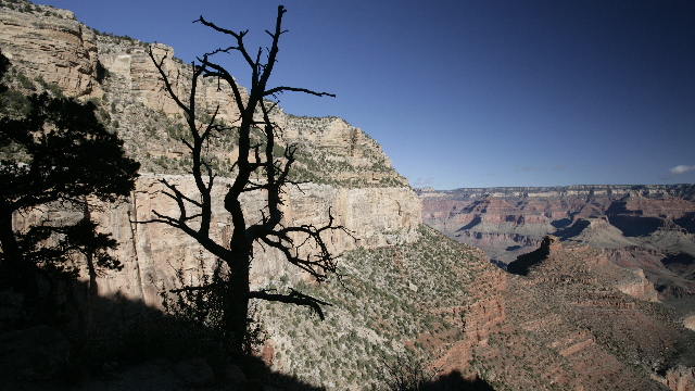
This photo shows the six rock layers starting at the top: Kaibab Limestone - 250 million years ago, Coconino Sandstone - 270 million years ago, Hermit Shale - 280 million years ago, Supai Group - 300 million years ago, Redwall Limestone - 330 million years ago
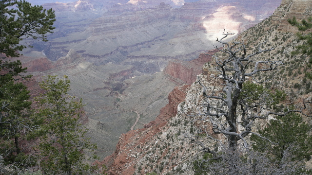
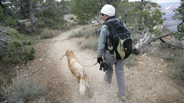
Zaph liked this park as there was always a stick near by.

Cool dude.


The Bright Angel Trail that we hike the day before.


Someone was more interested in getting his photo taken then looking at the view.


Can you tell it was cold. I had on four layers, a hat and mitts. The pack helped to keep the heat in .... so maybe five layers.

This photo shows the six rock layers starting at the top: Kaibab Limestone - 250 million years ago, Coconino Sandstone - 270 million years ago, Hermit Shale - 280 million years ago, Supai Group - 300 million years ago, Redwall Limestone - 330 million years ago


Zaph liked this park as there was always a stick near by.
2010/11/09: The Great Hike
Category: General
Posted by: The Agnew Family
What’s a trip to the Grand Canyon without a hike below the rim? “They” say that you need two days to hike down to the river and back and as dogs are not permitted below the rim we opted for a 4 to 6 hour hike. The Bright Angel trail has a rest spot at the 1½-mile mark and another at the 3-mile mark. Hiking to the 3-mile mark is suppose to take 4 to 6 hours --- perfect. Around 9:30 am, Ed and I started down the trail. Shortly after our departure we ran into some mules headed up the trail. Mules are used for taking tourists into the canyon; transporting supplies down and garbage back up; and helping the work crews maintain the trail. This group of mules were transporting dirt to repair the trail. Later we ran into some more mules that were transporting garbage to the top. As we were hiking down the trail we occasionally heard voices from what sounded like a fair size group. When we arrived at the first rest stop we found a group of at least 50 teenagers and a number of chaperons --- between the teenagers chatter and the leader trying to give direction it was noisy. The 2nd rest stop was much quieter. Here we enjoyed the quiet of the canyon occasionally broken by the tweet of a bird. What a beautiful place to enjoy lunch. The hike up was, of course, more work. I told Ed to walk at his own pace, which of course is faster than mine because of his long legs. He is good and stops every now and then waiting for me to catch up. Imagine my surprise when I got to the top and Ed wasn’t there waiting for me. Turned out there was a cut off near the top of the trail, which took you to a slightly different spot. Probably following a group of people Ed took the alternate trail. He did figure out his error and came looking for me. It was 1:30pm when we reached the top ---- 4 hours including a 40-minute lunch break. Not bad.
There is one section of the park that can only be accessed by shuttle bus, bicycle or foot. As we were by the spot where you catch the shuttle bus, we decided to take it Hermits Rest (the end) and check it out.
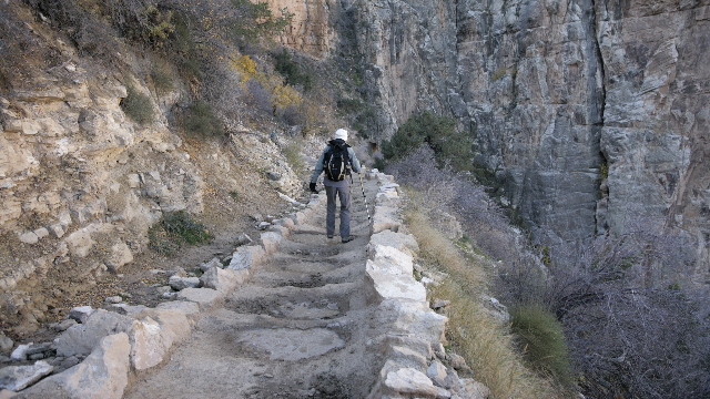
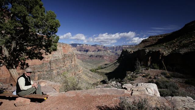
Parts of the trail were mucky --- between the rain/snow and mules --- on the way down I picked my way past the puddles but didn't care quite so much on the way up
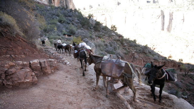
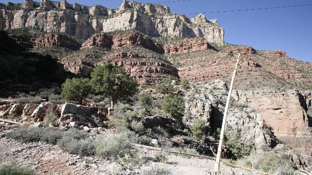
The mules were heading to the top
nice spot for lunch
different perspective when you look up at the walls
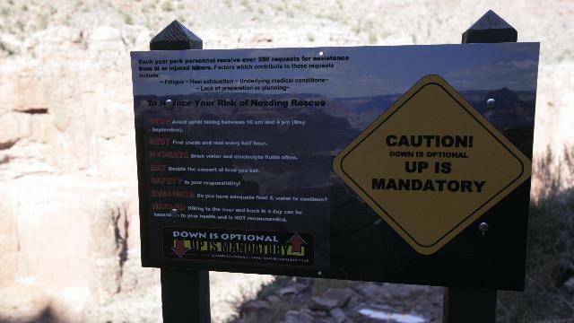
the sign says it all
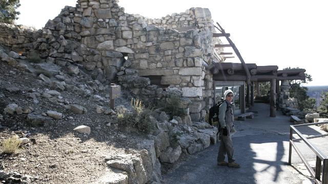
Hermits Rest, another Mary Coulter building.
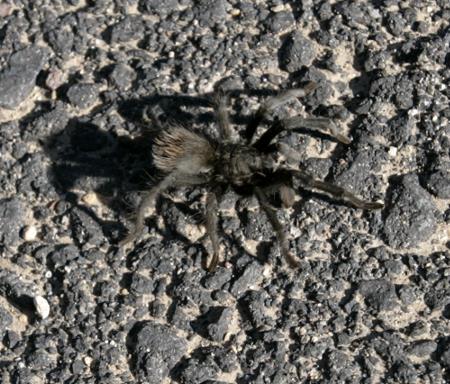
Gave this little guy a wide berth on the trail
There is one section of the park that can only be accessed by shuttle bus, bicycle or foot. As we were by the spot where you catch the shuttle bus, we decided to take it Hermits Rest (the end) and check it out.


Parts of the trail were mucky --- between the rain/snow and mules --- on the way down I picked my way past the puddles but didn't care quite so much on the way up

The mules were heading to the top

nice spot for lunch

different perspective when you look up at the walls

the sign says it all

Hermits Rest, another Mary Coulter building.

Gave this little guy a wide berth on the trail

Category: General
Posted by: The Agnew Family
All the best laid plans and it still snows!!!! The weathernetwork.com gives a ten day forecast and I had been checking for the past ten days. The cold was scheduled to arrive today and the chance of precipitation was 10% and then 0% for the next few days. Figured we were safe. The cold arrived on schedule and this afternoon so did the rain, hail and SNOW --- not on schedule. Oh well, hopefully it will have melted by the time we’re ready to leave.
We decided that Zaph needed some exercise so today’s adventure included hiking part of the rim trail (dogs are allowed on paved trails but not on trails below the rim) and doing the Desert View Drive.
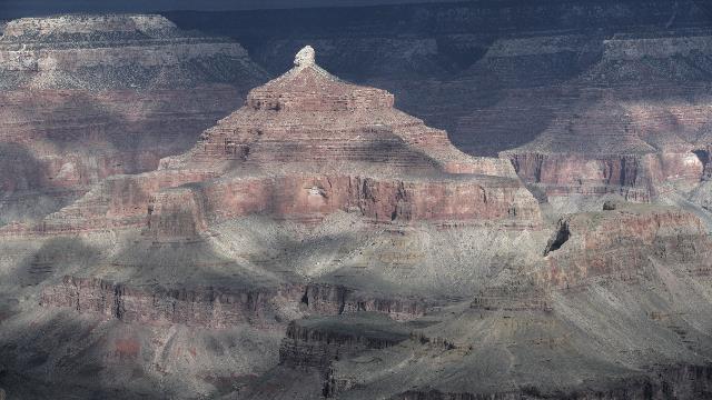
Canyon Views. There were lots of signs so I should know the name of this peak.
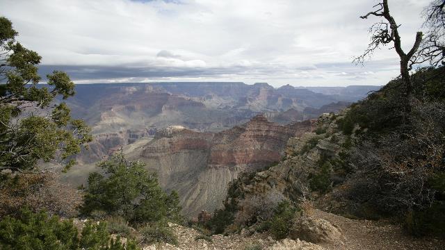
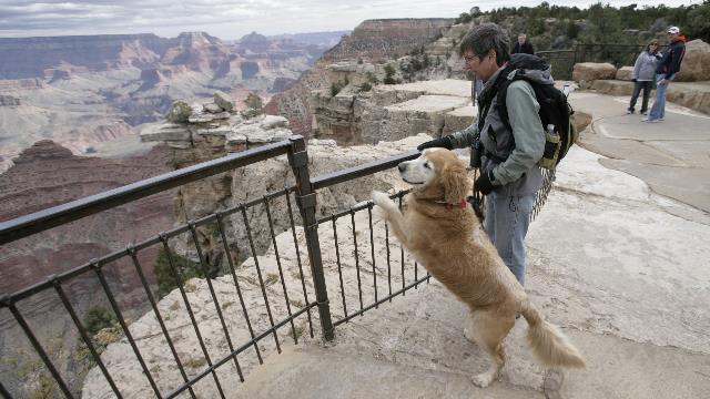
Zaph wanted to get a better view of the canyon.
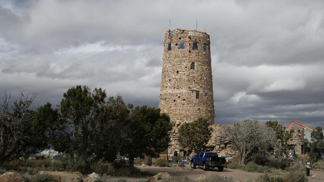
The Watchtower designed by Mary Colter. She worked hard to make the buildings fit the environment and the culture. A spiral staircase led you to the top floor where the views were wonderful.
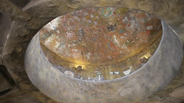
The inside of the watch tower was decorated with Indian paintings and drawings.
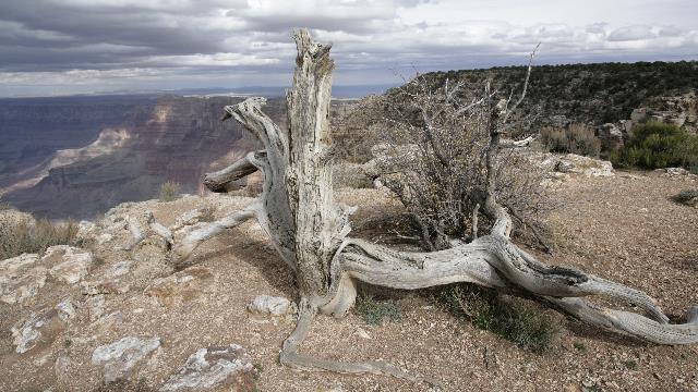
We like gnarly (spell checker doesn't like this --- if it's not a word it should be) trees
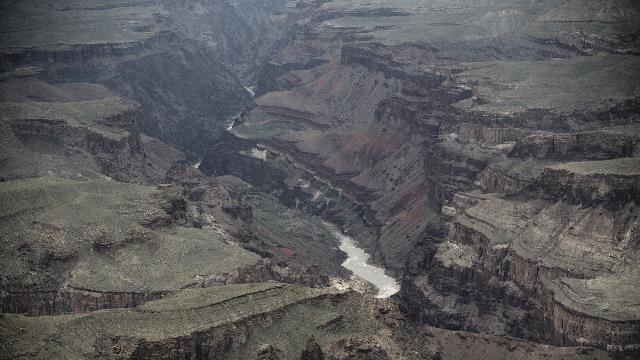
The Colorado River running through the canyon.
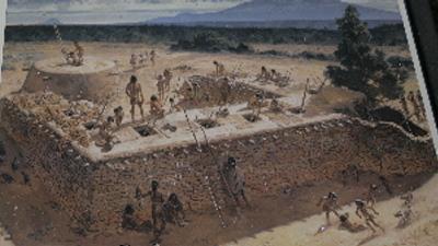
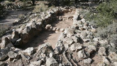
Tusayan Ruins --- an artists rendition of what the native homes may have looked like and what's left now
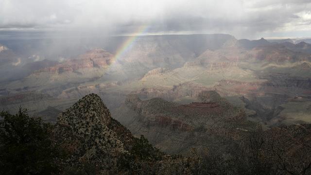
It was raining lightly and we caught a faint rainbow.
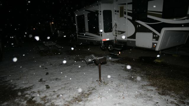
It rained lightly while we were walking, then started hailing --- small stuff but still large enough that we hid under a tree during the worst of it --- then snow when we got back to the trailer
We decided that Zaph needed some exercise so today’s adventure included hiking part of the rim trail (dogs are allowed on paved trails but not on trails below the rim) and doing the Desert View Drive.

Canyon Views. There were lots of signs so I should know the name of this peak.


Zaph wanted to get a better view of the canyon.

The Watchtower designed by Mary Colter. She worked hard to make the buildings fit the environment and the culture. A spiral staircase led you to the top floor where the views were wonderful.

The inside of the watch tower was decorated with Indian paintings and drawings.

We like gnarly (spell checker doesn't like this --- if it's not a word it should be) trees

The Colorado River running through the canyon.


Tusayan Ruins --- an artists rendition of what the native homes may have looked like and what's left now

It was raining lightly and we caught a faint rainbow.

It rained lightly while we were walking, then started hailing --- small stuff but still large enough that we hid under a tree during the worst of it --- then snow when we got back to the trailer
2010/11/07: Grand Canyon Here we Come
Category: General
Posted by: The Agnew Family
What a day! We stood on the corner in Winslow Arizona, walked the rim of a meteor crater and saw the Grand Canyon. OK, nothing earth shattering but we really enjoyed the day.
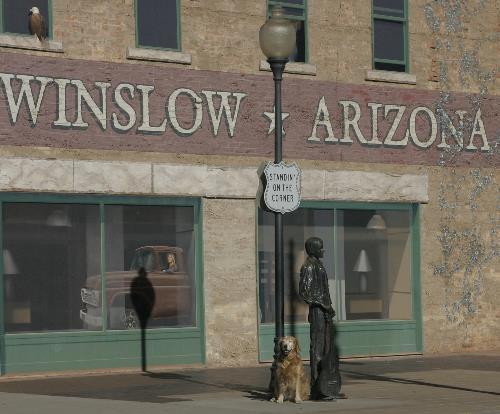
Well, I’m a standing on a corner
In Winslow, Arizona
And such a fine sight to see
It’s a girl, my lord, in a flatbed
Ford slowin’ down to take a look at me
Do these lyrics ring a bell? It’s from the hit song “Take it Easy” by the Eagles. Ed remembered the lyrics and when he saw Winslow, Arizona on the map he decided we needed to go there. Not much to the town but they are definitely making the most of the song.
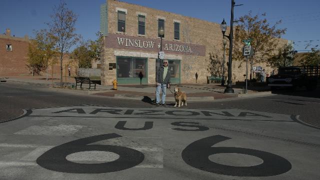
Route 66 is Winslow's main street.
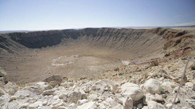
50,000 years ago a meteor hurtling at about 26,000 miles per hour struck the unbroken plane. The meteor is estimated to have been 150 feet across and weighed several hundred thousand tons. The impact was so powerful that the meteor disintegrated on impact resulting in a crater 700 feet deep and over 4000 feet across. Meteor fragments were found miles from the site. In 1902 Daniel Barringer, a mining engineer, became interested in the crater as a potential site for mining iron (meteors are full of iron) and obtained the patents and ownership of the two square miles of the crater. He never did find iron as the meteor had melted on impact but his family retained ownership and along with the Bar T Bar Ranch company (the owner of the land around the crater) opened the crater for public viewing in 1941. The Meteor Crater is not the oldest or the biggest or the deepest but it is the first crater in the world to be verified as a being created by a meteor strike and is one of the best preserved in the world (only 7 inches of precipitation annually).
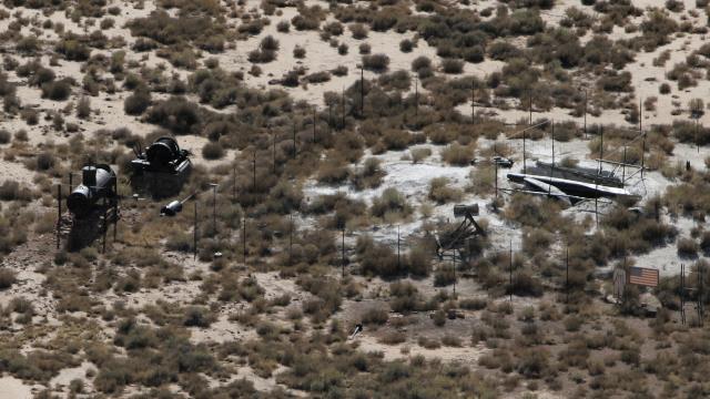
At the bottom of the crater you can see one of the mine shafts, machinery from the old mine, a cut out of an astronaut and an American flag. Before the Apollo missions when the astronauts landed on the moon, the astronauts came to the Meteor Crater to train identifying the age of rocks.
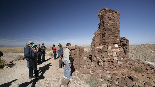
The remains of the house Daniel Barringer lived in. This house was also the original museum.
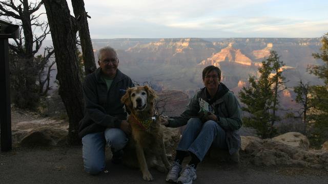
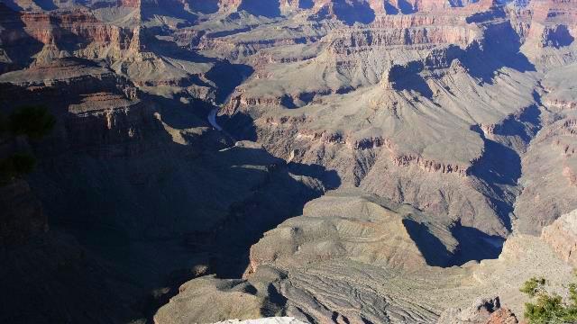
Made it to the Grand Canyon. A fellow from England took our photo --- him and his wife were hiking down the canyon the following day, staying at the Phantom Ranch and hiking back the next day --- sounds like a lot of fun.
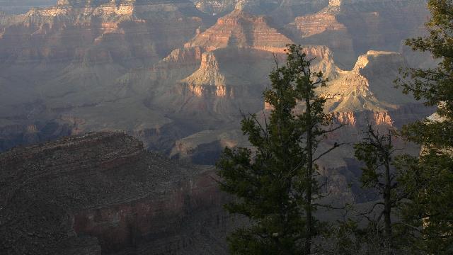
The canyon.
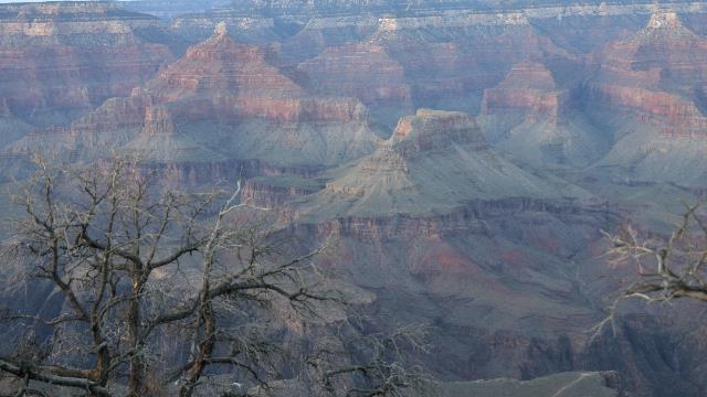
More of the canyon.
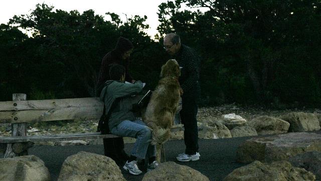
A couple was standing behind the bench I was sitting on and a certain puppy decided he needed to see them. Zaph got on the bench and handed his paw to the fellow.

Well, I’m a standing on a corner
In Winslow, Arizona
And such a fine sight to see
It’s a girl, my lord, in a flatbed
Ford slowin’ down to take a look at me
Do these lyrics ring a bell? It’s from the hit song “Take it Easy” by the Eagles. Ed remembered the lyrics and when he saw Winslow, Arizona on the map he decided we needed to go there. Not much to the town but they are definitely making the most of the song.

Route 66 is Winslow's main street.

50,000 years ago a meteor hurtling at about 26,000 miles per hour struck the unbroken plane. The meteor is estimated to have been 150 feet across and weighed several hundred thousand tons. The impact was so powerful that the meteor disintegrated on impact resulting in a crater 700 feet deep and over 4000 feet across. Meteor fragments were found miles from the site. In 1902 Daniel Barringer, a mining engineer, became interested in the crater as a potential site for mining iron (meteors are full of iron) and obtained the patents and ownership of the two square miles of the crater. He never did find iron as the meteor had melted on impact but his family retained ownership and along with the Bar T Bar Ranch company (the owner of the land around the crater) opened the crater for public viewing in 1941. The Meteor Crater is not the oldest or the biggest or the deepest but it is the first crater in the world to be verified as a being created by a meteor strike and is one of the best preserved in the world (only 7 inches of precipitation annually).

At the bottom of the crater you can see one of the mine shafts, machinery from the old mine, a cut out of an astronaut and an American flag. Before the Apollo missions when the astronauts landed on the moon, the astronauts came to the Meteor Crater to train identifying the age of rocks.

The remains of the house Daniel Barringer lived in. This house was also the original museum.

Made it to the Grand Canyon. A fellow from England took our photo --- him and his wife were hiking down the canyon the following day, staying at the Phantom Ranch and hiking back the next day --- sounds like a lot of fun.

The canyon.

More of the canyon.

A couple was standing behind the bench I was sitting on and a certain puppy decided he needed to see them. Zaph got on the bench and handed his paw to the fellow.
2010/11/06: Petrified Forest National Park
Category: General
Posted by: The Agnew Family
The Petrified Forest National Park has one of the world's largest and most colourful concentrations of petrified wood. It is set in the multi-hued badlands of the Painted Desert. This park is conveniently located with one entrance right on highway 40. A 28 mile road, with lots of places to stop, takes you through the park to the other exit. A lot of people pass through the park on the way to their next destination thus only spending a couple of hours in the park. Ed and I recommend that you give the park a full day as we did --- it was worth it.
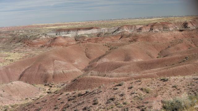
A trail along the rim gives you fabulous views of the Painted Desert.
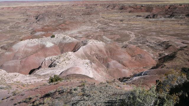
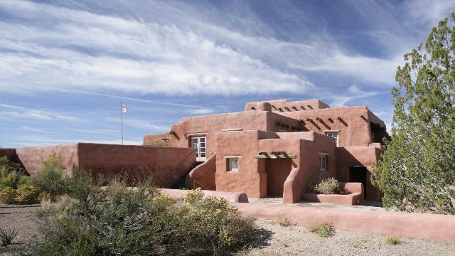
At Kachina point you will find the Painted Desert Inn. It was renovated by the Civilian Conservation Corps in the 1930's. Inside we met a Hopi artist.
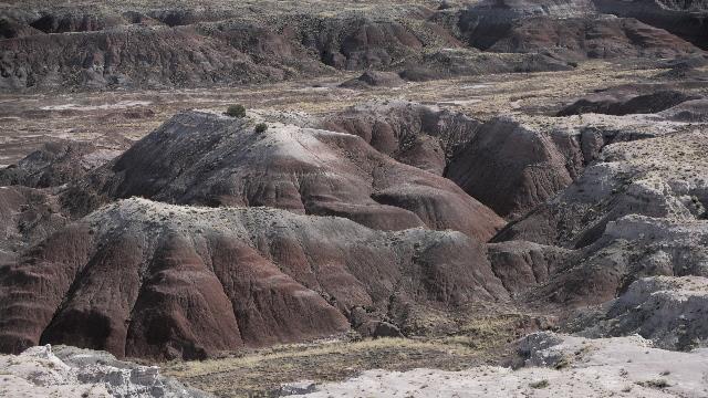
The colours of the Painted Desert change as you drive through the park.
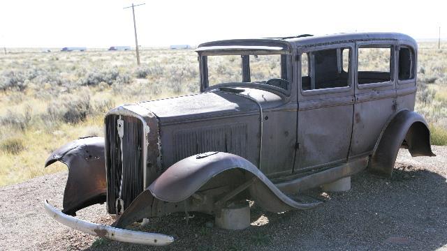
Route 66 ran through the park and was route used by many tourists to get here. This part of Route 66 has now been replaced by highway 40. The old car is a reminder of the past.
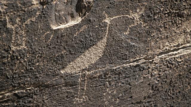
Puerco Pueblo is 100 room pueblo built about 1250 along side the Puerco River. There are some remains of the building along with petroglyphs (pictures scratched into the rock).
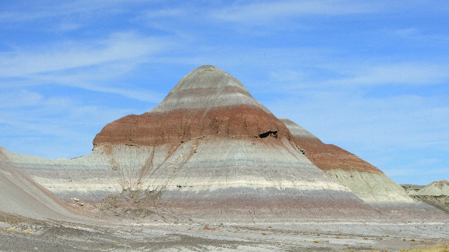
The Tepees are cone shaped formations --- layered blues, purples and greys created by iron, carbon, manganese and other minerals.
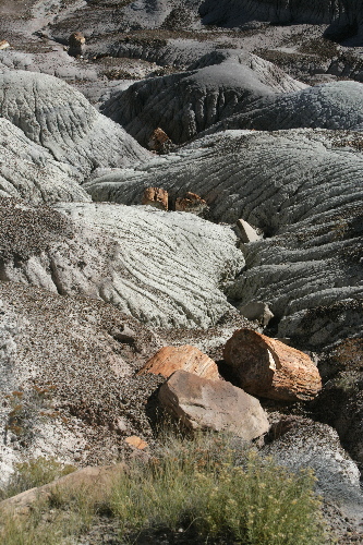
Petrified logs lay among the hills of the Blue Mesa.
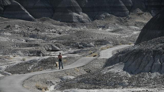
Walking the trail in the Blue Mesa. The trail requires hiking down and later back up a steep incline so we had the place to ourselves --- very quiet and very beautiful.
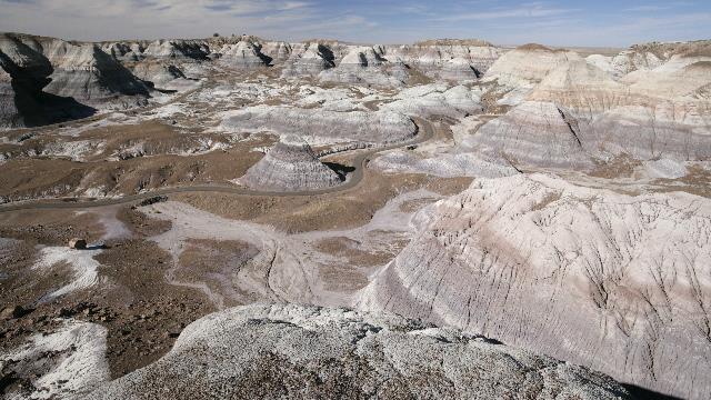
Looking down on the area where we walked.
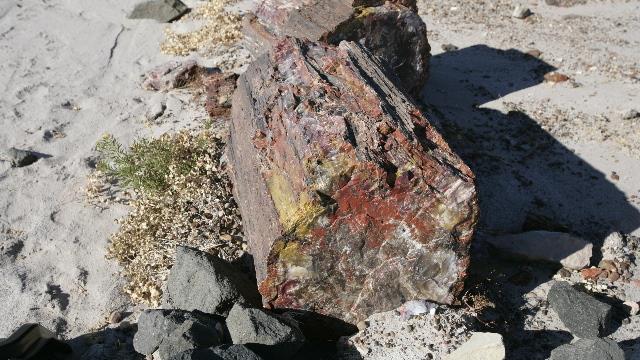
The Crystal Forest trail took you up close and personal to large pieces of petrified logs. Depending on the minerals, some pieces were very colourful while others were the colour of wood.
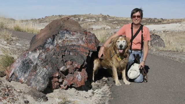
Zaph and I showing how large some of the logs are.
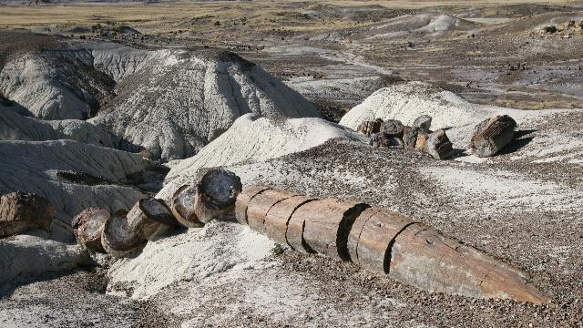
The logs are buried in the ground and appear over time as the soil erodes. The quartz within the petrified wood is hard and brittle, fracturing easily when subjected to stress.
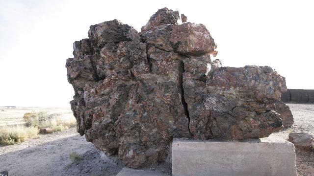
Old Faithful is one of the largest logs in the park and measure 10 feet across at the base.
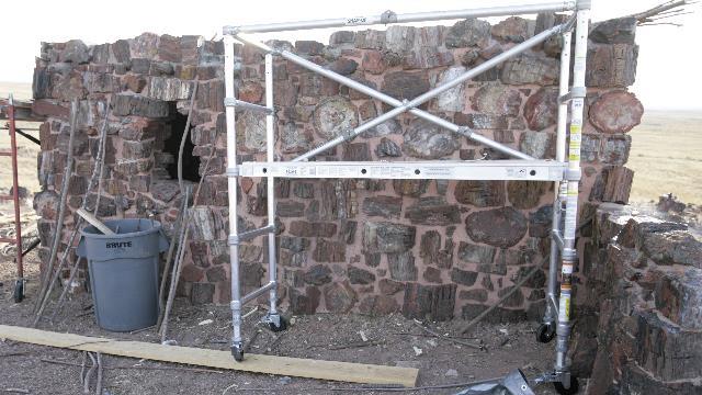
Agate House is a partial restored pueblo of petrified wood.

A trail along the rim gives you fabulous views of the Painted Desert.


At Kachina point you will find the Painted Desert Inn. It was renovated by the Civilian Conservation Corps in the 1930's. Inside we met a Hopi artist.

The colours of the Painted Desert change as you drive through the park.

Route 66 ran through the park and was route used by many tourists to get here. This part of Route 66 has now been replaced by highway 40. The old car is a reminder of the past.

Puerco Pueblo is 100 room pueblo built about 1250 along side the Puerco River. There are some remains of the building along with petroglyphs (pictures scratched into the rock).

The Tepees are cone shaped formations --- layered blues, purples and greys created by iron, carbon, manganese and other minerals.

Petrified logs lay among the hills of the Blue Mesa.

Walking the trail in the Blue Mesa. The trail requires hiking down and later back up a steep incline so we had the place to ourselves --- very quiet and very beautiful.

Looking down on the area where we walked.

The Crystal Forest trail took you up close and personal to large pieces of petrified logs. Depending on the minerals, some pieces were very colourful while others were the colour of wood.

Zaph and I showing how large some of the logs are.

The logs are buried in the ground and appear over time as the soil erodes. The quartz within the petrified wood is hard and brittle, fracturing easily when subjected to stress.

Old Faithful is one of the largest logs in the park and measure 10 feet across at the base.

Agate House is a partial restored pueblo of petrified wood.
2010/11/05: Holbrook, Arizona
Category: General
Posted by: The Agnew Family
Today was a travel day. As we were in Albuquerque a couple of years ago, we decided to bypass it on this trip. The next stop is the Painted Desert and the Petrified forest staying in a campground in nearby Holbrook. Interesting campground ---- it's one huge gravel parking lot with 100 foot long sites that have a sewer connection every 6 feet ... now that's a lot of sewer connections. The idea is that you drive in from one direction for odd number sites and from the other direction for the even number sites. The sites are long enough that the units can be staggered.
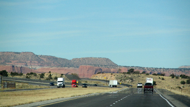

2010/11/04: Long Scenic Drive
Category: General
Posted by: The Agnew Family
As if we haven't spent enough time in the truck, we went for a day long scenic drive. Ed wanted to see Abiquiu and Georgia O'Keefe country and I wanted to see Taos so we opted for a loop that went northwest through Abiqui to Tierra Amarilla then east to Taos and finally south back to Santa Fe. The drive was a success as we saw a lot of scenery, more varied than I expected. Leaving Sanata Fe we drove through rolling hills and past casinos (Indian Land). Heading northwest we came into the mountains and hills that are found in many of Georgia O'Keefe's paintings. Georgia O'Keefe's house in Abiquiu was not what was expected but still it was a cute village. Abiquiu Lake was a beautiful surprise. We drove past Ghost Ranch (not open during the week in the winter) and understood why Georgia picked this as one of her homes. Turning east we were surprised to notice we were gaining altitude and eventually were at an elevation over 10,000 feet. This was not a rugged mountain but hill like in appearance. Once we were over the pass we drove through open plain with the Taos ski hills in the distance. Taos has an interesting plaza with lots of shops and historic buildings. The first half of the drive back to Santa Fe was along the Rio Grande River --- very different in appearance to the Rio Grande River we are use to in Mission, Texas.
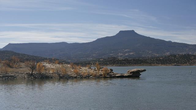
Abiquiu Lake with Pedernal Mountain in the distance
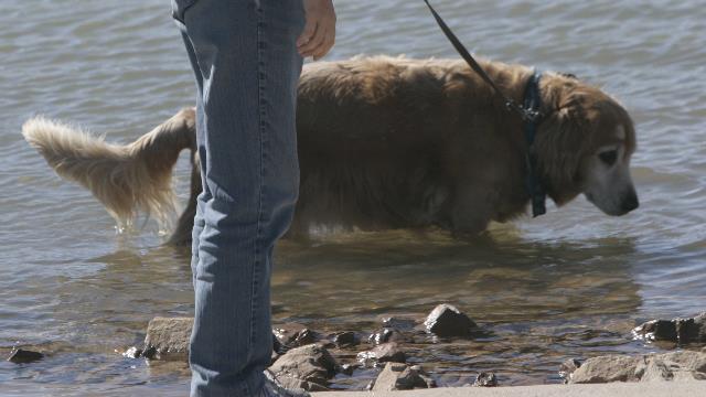
Someone was very excited to dip his toes into the water. He really wanted to lie down in it.
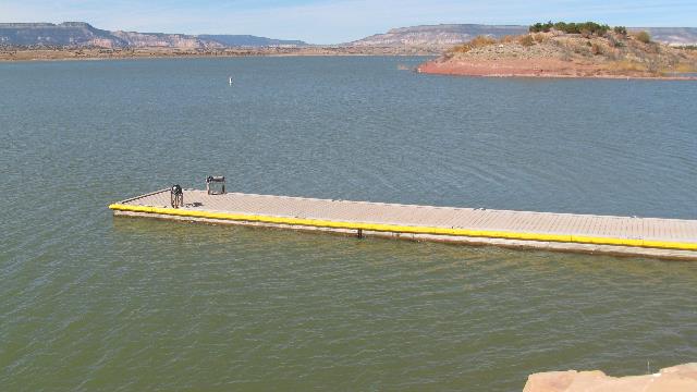
Abiqui Lake.
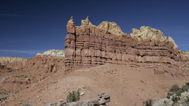
A cliff by the side of the road.
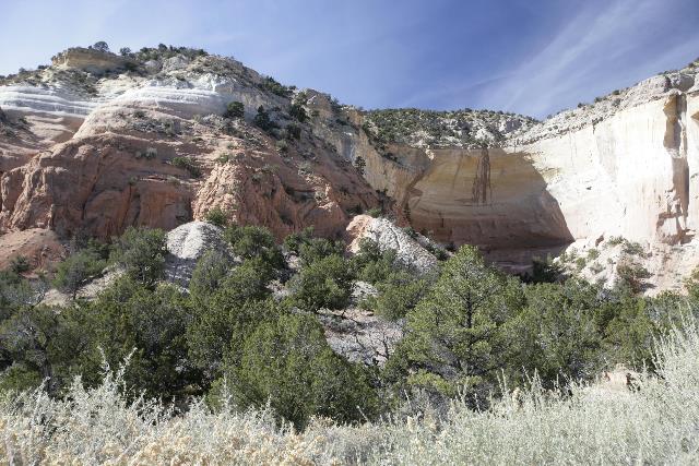
Echo Amphitheater, Carson National Forest
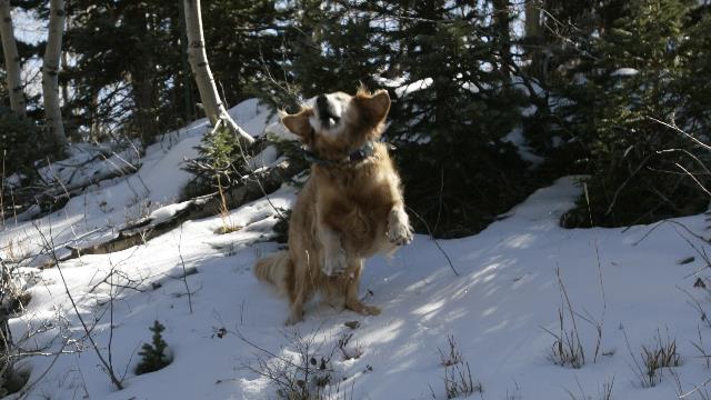
As we neared 10,000 feet we noticed snow on the ground even though the truck's thermometer was reading almost 50F. Decided to stop and let someone play as he'll miss the snow this winter.
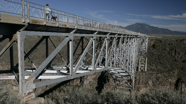
Just north west of Taos is the Rio Grande Gorge Bridge spanning the Rio Grande Gorge. this bridge is a cantilever truss bridge and at 650 feet (200 m) above the Rio Grande, it is the fifth highest bridge in the United States.
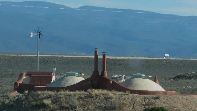
Just outside of Taos, we noticed a series of odd looking buildings. One side of the building was built up with dirt while the south side side was solar panels and glass. A sign had the name Earthship, so when we got back to the trailer I looked it up on the Internet and it turns out to be earthship.com. An "Earthship is a radically sustainable home made of recycled materials" and follows green building design principles. Sounds like a totally self-sufficient home.
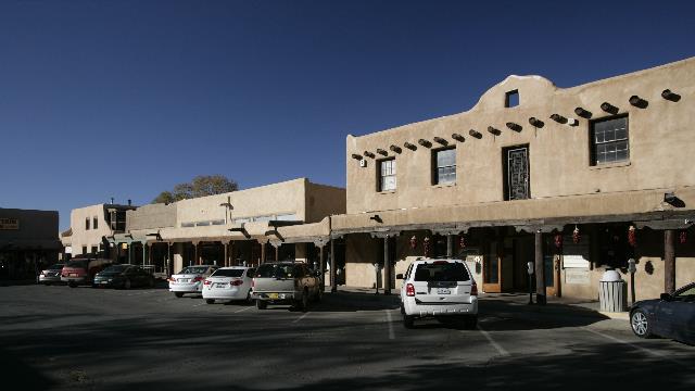
The Plaza in Taos
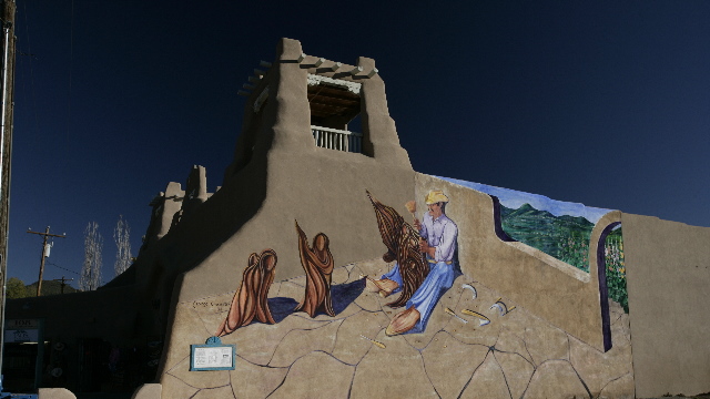
A building across the street from the plaza in Taos.
Kit Carson's house is on the left. The building with the blue trim are just colourful stores.

Abiquiu Lake with Pedernal Mountain in the distance

Someone was very excited to dip his toes into the water. He really wanted to lie down in it.

Abiqui Lake.

A cliff by the side of the road.

Echo Amphitheater, Carson National Forest

As we neared 10,000 feet we noticed snow on the ground even though the truck's thermometer was reading almost 50F. Decided to stop and let someone play as he'll miss the snow this winter.

Just north west of Taos is the Rio Grande Gorge Bridge spanning the Rio Grande Gorge. this bridge is a cantilever truss bridge and at 650 feet (200 m) above the Rio Grande, it is the fifth highest bridge in the United States.

Just outside of Taos, we noticed a series of odd looking buildings. One side of the building was built up with dirt while the south side side was solar panels and glass. A sign had the name Earthship, so when we got back to the trailer I looked it up on the Internet and it turns out to be earthship.com. An "Earthship is a radically sustainable home made of recycled materials" and follows green building design principles. Sounds like a totally self-sufficient home.

The Plaza in Taos

A building across the street from the plaza in Taos.

Kit Carson's house is on the left. The building with the blue trim are just colourful stores.
2010/11/03: Old Santa Fe
Category: General
Posted by: The Agnew Family
It would have been so easy to send a lot of money today as there are amazing shops in old Santa Fe. Sculptures, jewelry, clothes and art were in abundance. Ed and I wandered into a couple of shops but showed restraint by spending most of our time visiting the historical sites. As expected the older buildings are all constructed from adobe and wood. One of the highlights of the day was visiting the Georgia O'Keefe museum. She is a painter that was born in Wisconsin, spent a good deal of time in New York City but found her true home in New Mexico painting desert scenes. On our way to the museum is a store selling photographs. What a wonderful surprise to see photographs by Ansel Adams, Weston, Karsh, and Annie Leibovitz. We also found one more very interesting store --- a doggy bakery; no they don't bake dogs they bake dog biscuits. Guess who got a couple of cookies.
A shot looking down one of the streets in the "plaza" looking at the St. Francis Cathedral
Inside St. Francis Cathedral looking at the main door.
San Miguel Mission, claimed to be the oldest church in the the United States. From Wikipedia "Built between approximately 1610 and 1626. Though the church has been repaired and rebuilt numerous times over the years, its original adobe walls are still largely intact despite having been hidden by later additions." Down the street on the left is the oldest house in Santa Fe.
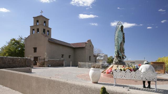
Santuario de Gualaupe which was built in 1781

A shot looking down one of the streets in the "plaza" looking at the St. Francis Cathedral

Inside St. Francis Cathedral looking at the main door.

San Miguel Mission, claimed to be the oldest church in the the United States. From Wikipedia "Built between approximately 1610 and 1626. Though the church has been repaired and rebuilt numerous times over the years, its original adobe walls are still largely intact despite having been hidden by later additions." Down the street on the left is the oldest house in Santa Fe.

Santuario de Gualaupe which was built in 1781
2010/11/02: Santa Fe
Category: General
Posted by: The Agnew Family
What a beautiful day for a drive. The sun was shining and the temperature was in the high 50's low 60's. The scenery was wonderful.
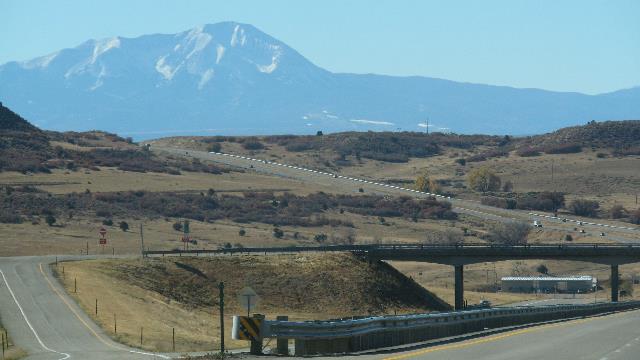
The drive took us over two mountain passes, the above photo is as we started up the first pass.
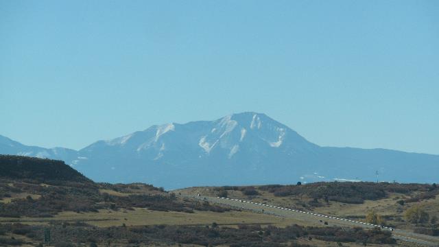
Most of the time we were driving in huge open planes with the mountains to the west of us.
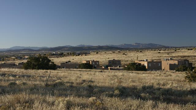
We selected a campground about 15km outside of Santa Fe. It is situated on high open plane with the mountains in the distance. Happily the WiFi works wonderfully in this park unlike the previous park.
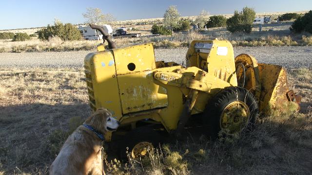
There is a very nice dog walk around the perimeter of the park and in one area there is a display of old equipment.

The drive took us over two mountain passes, the above photo is as we started up the first pass.

Most of the time we were driving in huge open planes with the mountains to the west of us.

We selected a campground about 15km outside of Santa Fe. It is situated on high open plane with the mountains in the distance. Happily the WiFi works wonderfully in this park unlike the previous park.

There is a very nice dog walk around the perimeter of the park and in one area there is a display of old equipment.
2010/11/01: Colorado Springs
Category: General
Posted by: The Agnew Family
Left Hays just after 8 am and pulled into a campground in Colorado Springs around 2pm. Today’s drive through Kansas was the flat farmland I was expecting except the altitude kept increasing. Hays is around 1988 feet (so a web site tells me) and Colorado Springs is around 6000 feet. With a few hours for sightseeing Ed, Zaph and I headed for the mountains and a place called “Garden of the Gods”. It was a good choice after a day and half in the truck. The garden is an huge area of unusual rock formations that was donated to the town of Colorado Springs with the condition that the garden remain open and free to the public and no permanent structures except necessary ones (i.e. maintenance buildings). There are roads through the garden and many parking spaces so you can walk around and enjoy the amazing rocks and walk we did.
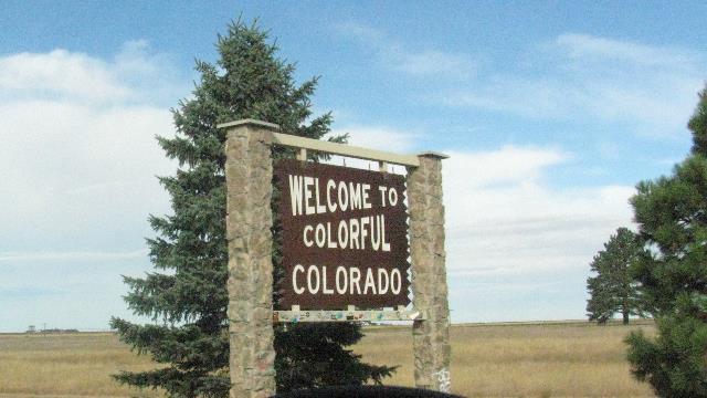
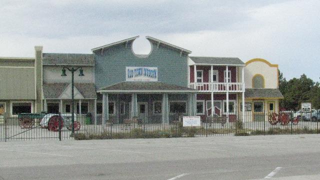
A museum was on the side of the highway beside the information centre.
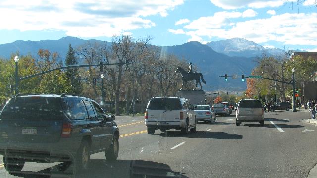
Driving through Colorado Springs.
The rock formations at Garden of the Gods were amazing.
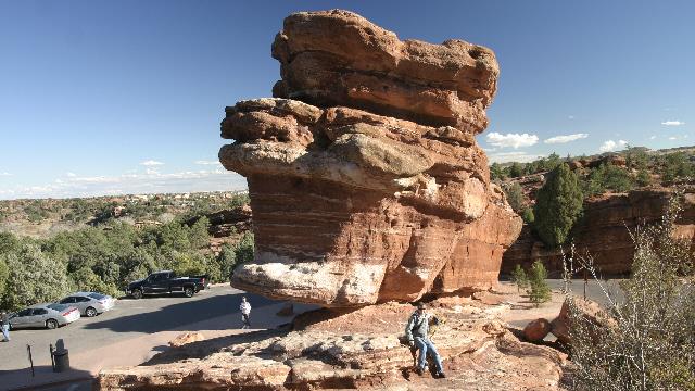
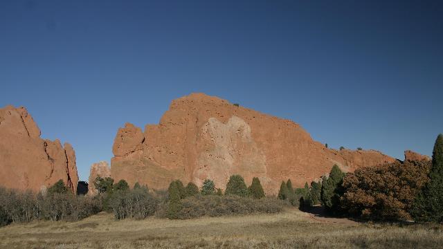
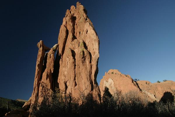
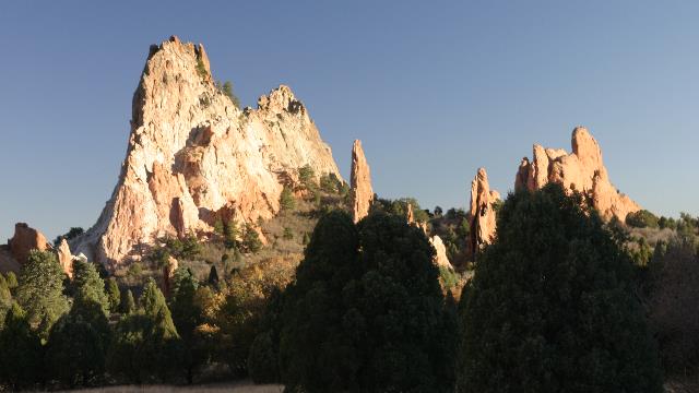


A museum was on the side of the highway beside the information centre.

Driving through Colorado Springs.
The rock formations at Garden of the Gods were amazing.


