2016/04/30: Lots to do around Monterey
Category: General
Posted by: The Agnew Family
The 17-mile drive is a well know tourist attraction for several reasons --- one being the beauty of the drive and the second being that you have to pay $10 to drive on the 17-mile drive. After much persuading Ed agreed to the 17-mile drive (at the end of the drive he agreed it was worth it). The 17-mile drive goes by the famous Pebble Beach Golf Course.
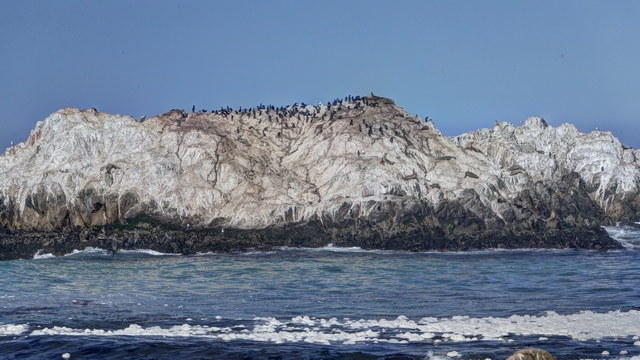
Bird rock.
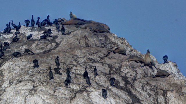
There's more than birds on that rock .... I couldn't believe that seals had climbed to the top of the rock.
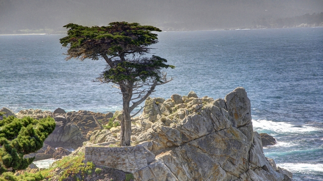
The Lone Cypress --- this tree is the corporate logo and trademark of Pebble Beach Company.
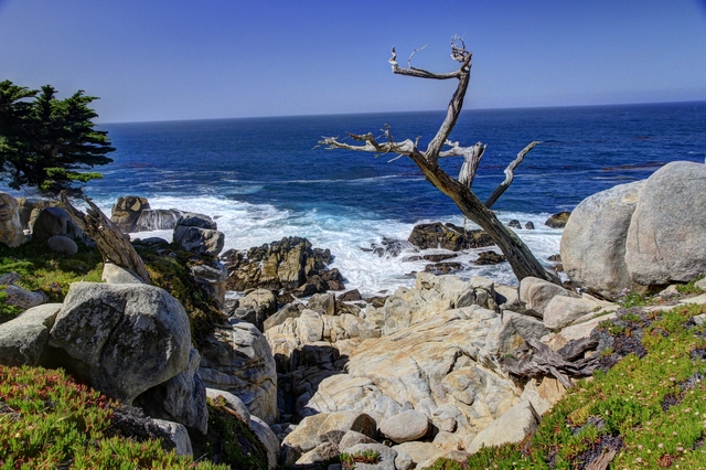
One of the great views along the road.
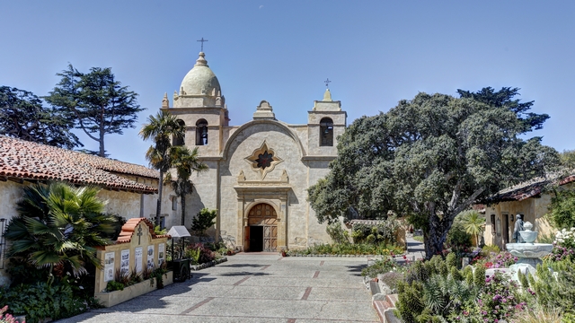
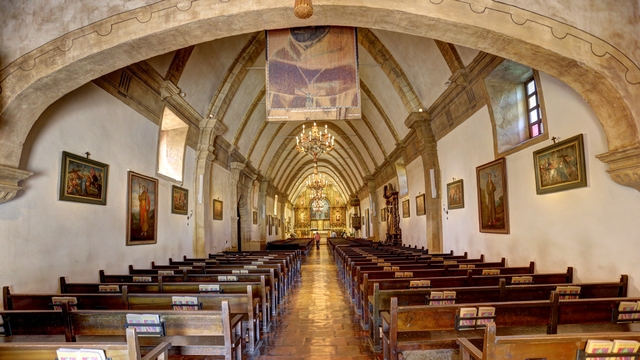
While we were in the Carmel-by-the-Sea area we stopped at the Mission San Carlos Borromeo del rio Carmelo.
We wouldn't normally go to a zoo or aquarium on a weekend but when you are travelling you don't always have a choice. That was the case with our visit to the Monterey Aquarium. It seemed like there was a kazillion kids there but it was still worth the visit, though I think we would have enjoyed it more with less people. Some of the tanks are huge and have a large variety of fish in them and it would have been nice to just stand in front a tank and watch the fish for awhile. Between shooting through curved glass, glass in general and low lighting it was hard to get good photos.
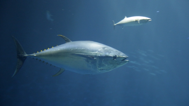
A couple of the fish in one of the large tanks.
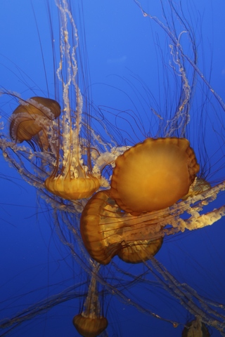
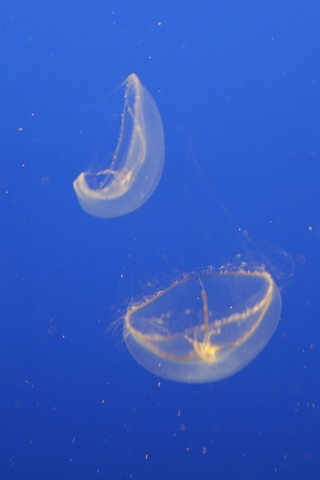
A couple of types of jellyfish. The jellyfish on the right is almost invisible if the light is not turned on in the tank.
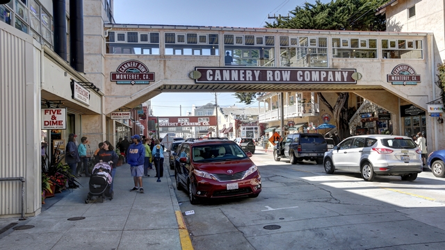
The aquarium is in the Cannery Row and is built around an old cannery. Lots of shops and restaurants here.
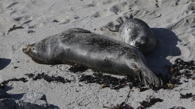
There's a great trail that starts in Cannery Row and heads along the bay. We found more harbour seals and pups.

Bird rock.

There's more than birds on that rock .... I couldn't believe that seals had climbed to the top of the rock.

The Lone Cypress --- this tree is the corporate logo and trademark of Pebble Beach Company.

One of the great views along the road.
While we were in the Carmel-by-the-Sea area we stopped at the Mission San Carlos Borromeo del rio Carmelo.


We wouldn't normally go to a zoo or aquarium on a weekend but when you are travelling you don't always have a choice. That was the case with our visit to the Monterey Aquarium. It seemed like there was a kazillion kids there but it was still worth the visit, though I think we would have enjoyed it more with less people. Some of the tanks are huge and have a large variety of fish in them and it would have been nice to just stand in front a tank and watch the fish for awhile. Between shooting through curved glass, glass in general and low lighting it was hard to get good photos.

A couple of the fish in one of the large tanks.


A couple of types of jellyfish. The jellyfish on the right is almost invisible if the light is not turned on in the tank.

The aquarium is in the Cannery Row and is built around an old cannery. Lots of shops and restaurants here.

There's a great trail that starts in Cannery Row and heads along the bay. We found more harbour seals and pups.
2016/04/29: Seals, Rock and Trees
Category: General
Posted by: The Agnew Family
About 5 miles north of Hearst Castle is the The Piedras Blancas elephant seal rookery. From the Friends of the Elephant Seal website, "The northern elephant seal, Mirounga angustirostris, is an extraordinary marine mammal. It spends eight to ten months a year in the open ocean, diving 1000 to 5800 feet deep for periods of fifteen minutes to two hours, and migrating thousands of miles, twice a year, to its land-based rookery for birthing, breeding, molting, and rest." The current season is the female and juvenile molt (grow new skin and hair). It takes about a month for a Elephant Seal to molt. Ed and I spent an hour watching these facinating creatures and could have easily spent a couple of more hours there.
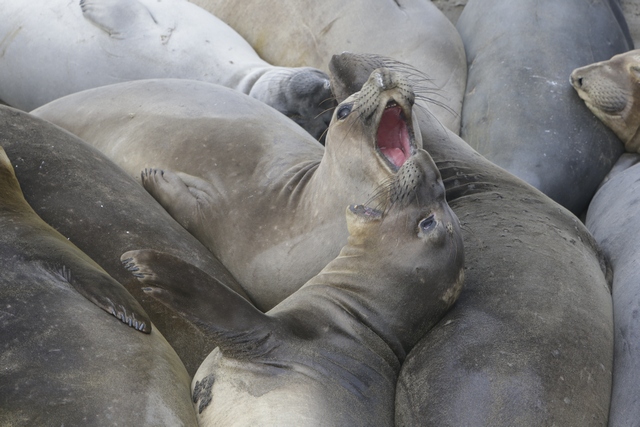
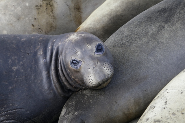
The elephant seals seam to enjoy laying next to or on top of each other.
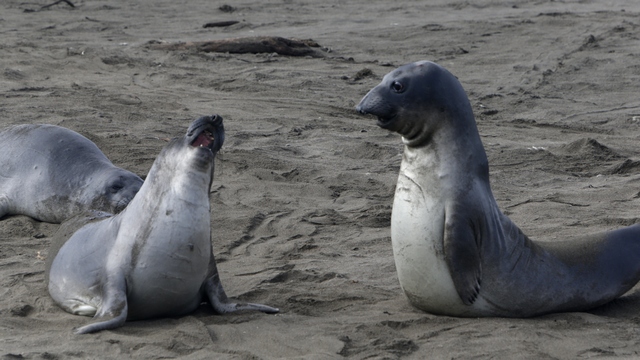
Juveniles practice fighting with each other. The Elephant Seal on the right is starting to get the distinct elephant seal nose.
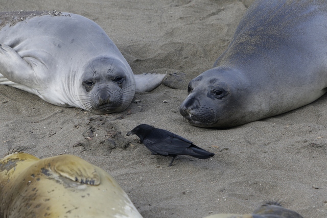
The seals were curious about the bird and moved towards it.
When we left the hotel, it was cool and foggy. Happily, the fog is beginning to disperse.
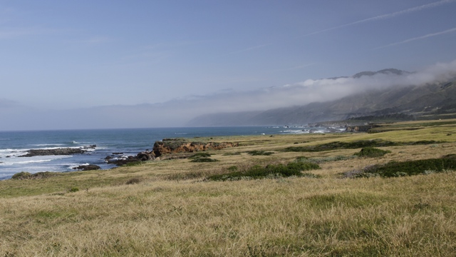
You can see the layer of fog, land below and just a little bit of land above. I think it's going to be hazy today.
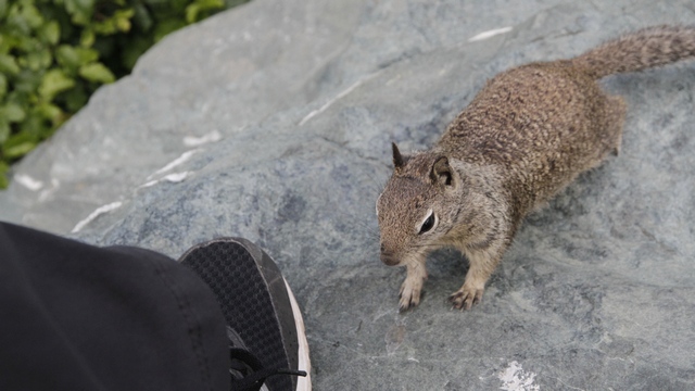
At one of the pull offs the ground squirrels were really cheeky --- this one walked right up to Ed's shoe. I guess people don't pay attention to the signs that say don't feed the wildlife.
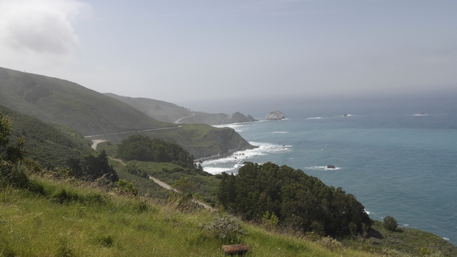
Ed tries to squeeze a bit of geo caching in every day. Today the find took us on a dirt road that climbed part way up a mountain. Ed found the cache and we got a great view.
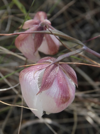
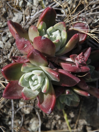
and found these cute flowers and and interesting plant.
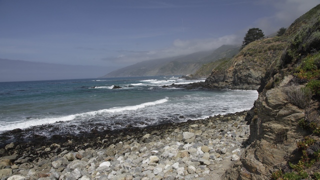
There aren't very many places where you can get to the beach but we found one.
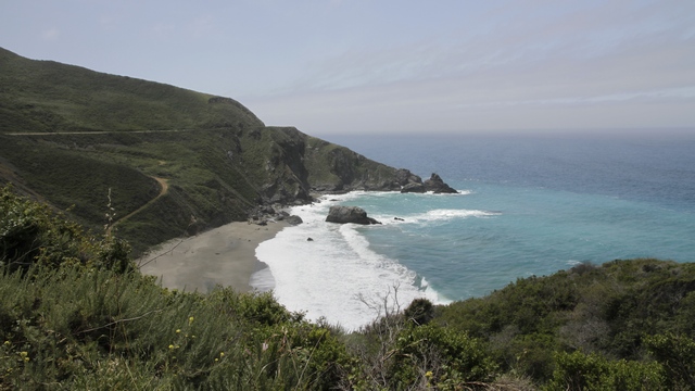
The view from another pull off. If you look closely you can see the highway winding it's way along the coast.
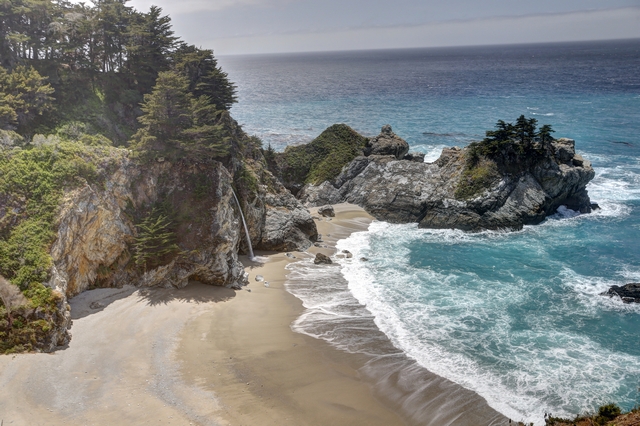
At the Julia Pfeiffer Burns State Park, the McWay Falls drops over a cliff of 80 feet into the Pacific Ocean (depending on the tide).
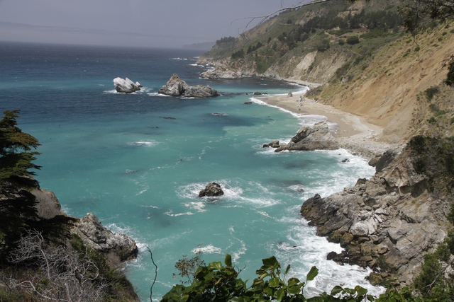
Another view from the Julia Pfeiffer Burns State Park.
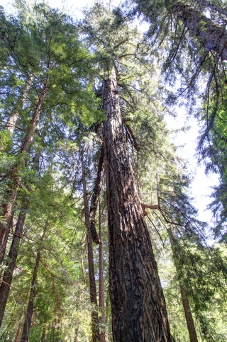
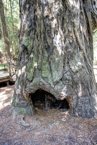
Big Sur Redwood trees at the Pfeiffer Big Sur State Park.
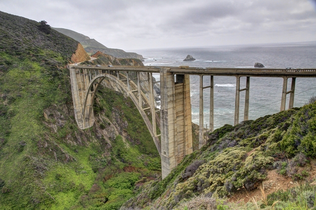
The Bixby Creek Bridge is a reinforced concrete open-spandrel arch bridge that opened in 1932.
Point Lobos State Natural Reserve is just south of Carmel-by-the-Sea. For some reason many guide books and other tourist pamlets overlook this park. Ed and I found it fancinating and would suggest anyone you loves nature to visit it if they find themselves in Carmel or Monterey.
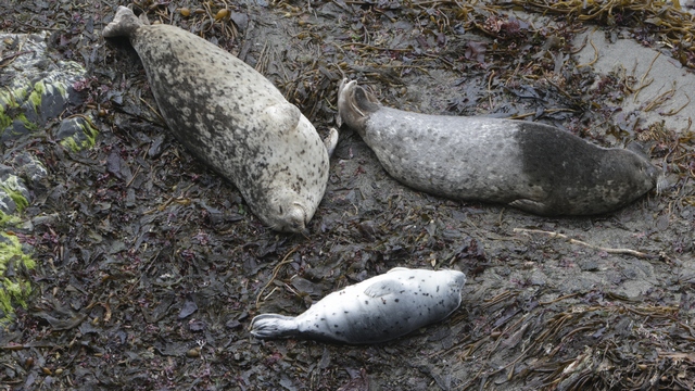
Harbour Seals moms and pups. They spend a lot of time sleeping on the beach.
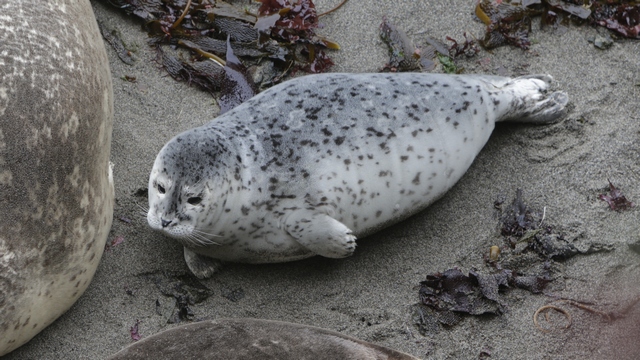
One of the pups.
Point Lobos is one of only two places where the Monterey Cypress can be found in the wild.
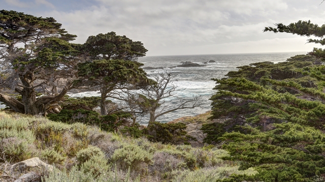
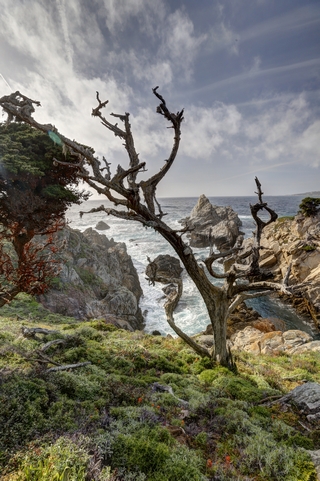
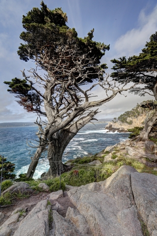
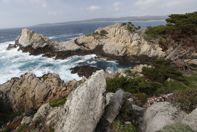
More beautiful rocky coastline.

The elephant seals seam to enjoy laying next to or on top of each other.

Juveniles practice fighting with each other. The Elephant Seal on the right is starting to get the distinct elephant seal nose.

The seals were curious about the bird and moved towards it.

When we left the hotel, it was cool and foggy. Happily, the fog is beginning to disperse.

You can see the layer of fog, land below and just a little bit of land above. I think it's going to be hazy today.

At one of the pull offs the ground squirrels were really cheeky --- this one walked right up to Ed's shoe. I guess people don't pay attention to the signs that say don't feed the wildlife.

Ed tries to squeeze a bit of geo caching in every day. Today the find took us on a dirt road that climbed part way up a mountain. Ed found the cache and we got a great view.


and found these cute flowers and and interesting plant.

There aren't very many places where you can get to the beach but we found one.

The view from another pull off. If you look closely you can see the highway winding it's way along the coast.

At the Julia Pfeiffer Burns State Park, the McWay Falls drops over a cliff of 80 feet into the Pacific Ocean (depending on the tide).

Another view from the Julia Pfeiffer Burns State Park.


Big Sur Redwood trees at the Pfeiffer Big Sur State Park.

The Bixby Creek Bridge is a reinforced concrete open-spandrel arch bridge that opened in 1932.
Point Lobos State Natural Reserve is just south of Carmel-by-the-Sea. For some reason many guide books and other tourist pamlets overlook this park. Ed and I found it fancinating and would suggest anyone you loves nature to visit it if they find themselves in Carmel or Monterey.

Harbour Seals moms and pups. They spend a lot of time sleeping on the beach.

One of the pups.
Point Lobos is one of only two places where the Monterey Cypress can be found in the wild.


More beautiful rocky coastline.
2016/04/28: A Rock and a Castle
Category: General
Posted by: The Agnew Family
Today's drive was only 70km so we decided to spend a few hours visiting Morro Bay.
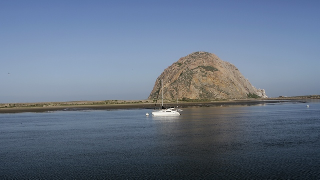
A daytime photo of Morro Rock.
Our timing in visiting Morro Rock was very good ---- we arrived at breakfast time.
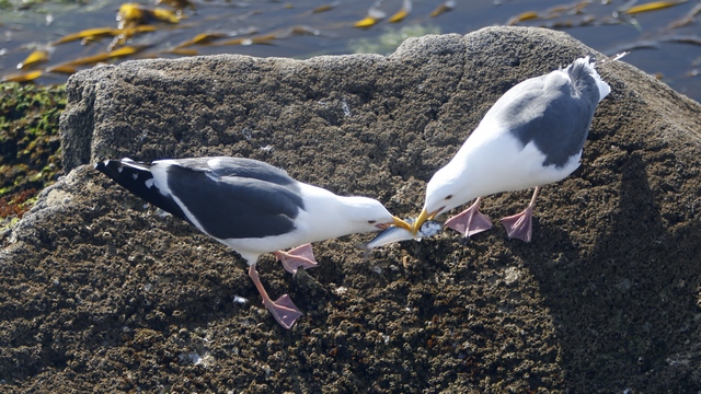
One of these gulls caught himself a fish, almost immeditely a second gull showed up and grabbed the fish --- the fish tug-of-war lasted over a minute. As soon as one of the gulls won the contest he ate the fish.
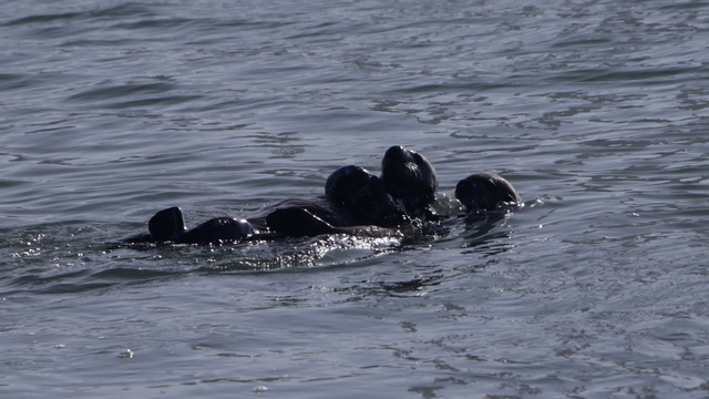
The timing was good but the lighting was bad. There must have been 15-20 sea otters in the kelp bed, either sleeping or eating breakfast. They are fun critters to watch.
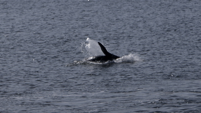
I think that's a seal flipper. I'm pretty sure we saw seals swimming and either dolphins or porpoises. It was exciting t see all these sea creatures.
"In 1919, Newspaper publisher William Randolph Hearst hired San Francisco architect Juia Morgan to build a hilltop house on what he called his "ranch at San Simeon". Their collaboration on the project lasted from 1919 to 1947." Parts of the castle remain unfinished.
I wish I had a photo that shows Hearst Castle sitting on top of the hill but it was hazy so the photos just didn't turn out. It does look amazing sitting on top of a hill with absolutely nothing around it.
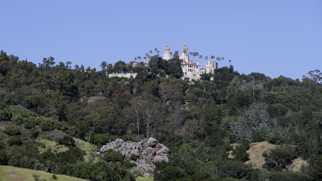
This photo was taken about 1/3 of the way down on the 15 minute bus ride to the visitor center. It only gives you a small idea off what the castle looks from a far.
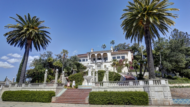
The front of the main house. The house and gardens are filled with amazing antiques and pieces of art.
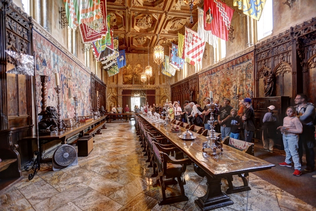
The dining room.
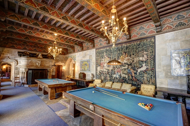
The games room --- early "man cave".
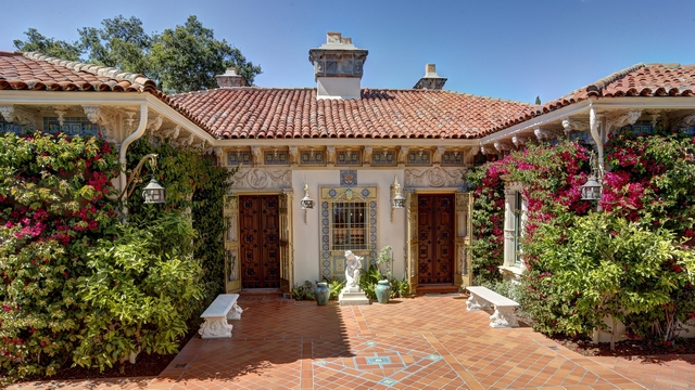
The front of one of the guest cottages.
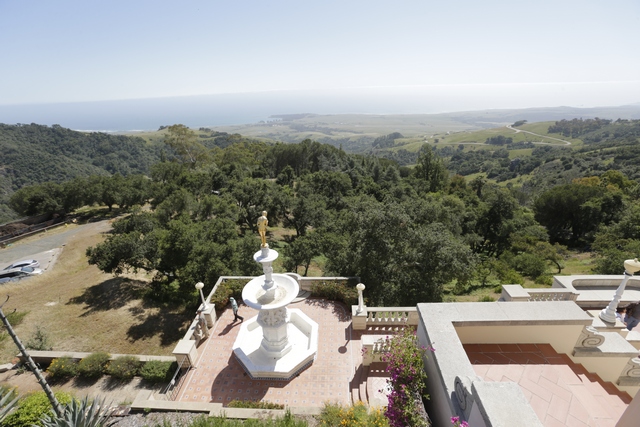
The back garden of another guest cottage. You can see right down to the ocean.
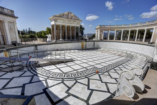
The outdoor pool --- it took the architect three tries to build a pool of an acceptable size. The pool has a leak so it is currently empty and under repair. Luckily the quarry where the marble tiles were originally purchased is still in business and able to make replacement tiles.
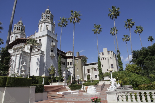
Another view of the main house showing the three stages of completion. The main part of house is finished, the brown section is the concrete with parge coat, the section on the right is the unfinished contrete.
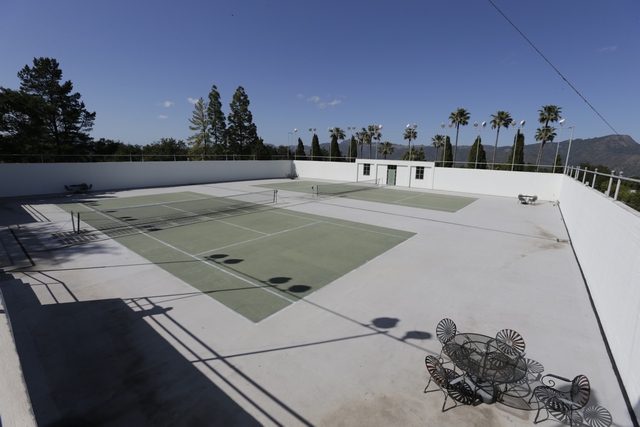
The tennis courts and
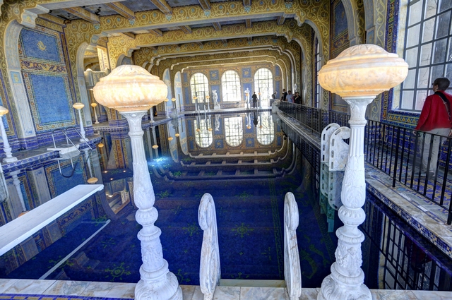
the indoor pool that is under the tennis courts. Ed wasn't excited about paying $25 /person to see an old house but in the end he loved it and thought it was worth the price of admission.
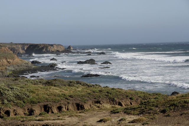
The coastline near San Simeon and a taste off what tomorrow's blog will be like.

A daytime photo of Morro Rock.
Our timing in visiting Morro Rock was very good ---- we arrived at breakfast time.

One of these gulls caught himself a fish, almost immeditely a second gull showed up and grabbed the fish --- the fish tug-of-war lasted over a minute. As soon as one of the gulls won the contest he ate the fish.

The timing was good but the lighting was bad. There must have been 15-20 sea otters in the kelp bed, either sleeping or eating breakfast. They are fun critters to watch.

I think that's a seal flipper. I'm pretty sure we saw seals swimming and either dolphins or porpoises. It was exciting t see all these sea creatures.
"In 1919, Newspaper publisher William Randolph Hearst hired San Francisco architect Juia Morgan to build a hilltop house on what he called his "ranch at San Simeon". Their collaboration on the project lasted from 1919 to 1947." Parts of the castle remain unfinished.
I wish I had a photo that shows Hearst Castle sitting on top of the hill but it was hazy so the photos just didn't turn out. It does look amazing sitting on top of a hill with absolutely nothing around it.

This photo was taken about 1/3 of the way down on the 15 minute bus ride to the visitor center. It only gives you a small idea off what the castle looks from a far.

The front of the main house. The house and gardens are filled with amazing antiques and pieces of art.

The dining room.

The games room --- early "man cave".

The front of one of the guest cottages.

The back garden of another guest cottage. You can see right down to the ocean.

The outdoor pool --- it took the architect three tries to build a pool of an acceptable size. The pool has a leak so it is currently empty and under repair. Luckily the quarry where the marble tiles were originally purchased is still in business and able to make replacement tiles.

Another view of the main house showing the three stages of completion. The main part of house is finished, the brown section is the concrete with parge coat, the section on the right is the unfinished contrete.

The tennis courts and

the indoor pool that is under the tennis courts. Ed wasn't excited about paying $25 /person to see an old house but in the end he loved it and thought it was worth the price of admission.

The coastline near San Simeon and a taste off what tomorrow's blog will be like.
2016/04/27: More Missions and Beaches
Category: General
Posted by: The Agnew Family
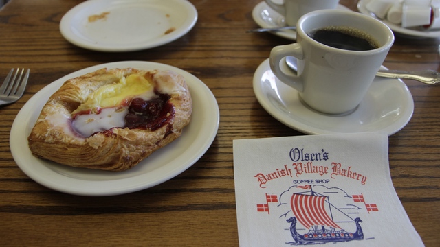
A coffee and danish from the bakery across the road from the motel was included with our room. The danish was so good we bought a few more treats for our lunch.
La Purisima Mission in Lompoc was built in 1787 and destroyed in 1812 by an earthquake and winter rains. The mission moved about four miles from it's original location and was rebuilt in 1813. More than 100 years pass and La Purisima became a pile of melted adobe. Under Roosevelt's New Deal the Civilian Conservation Corps (CCC) came to rebuild the mission on the original foundations. After 7 years of back breaking work, La Parisima was done. Today volunteers and state park staff host thousands of visitors each year. After walking around this mission I have a good idea of what living in a mission was like.
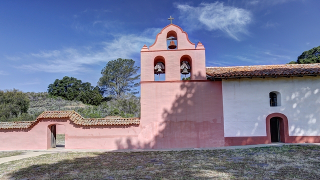
The main chapel.
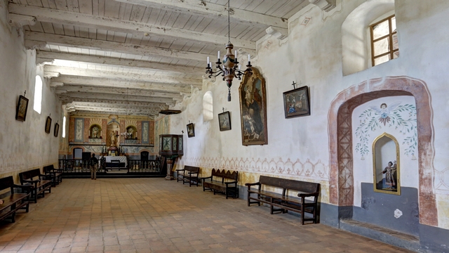
The inside of the main chapel.
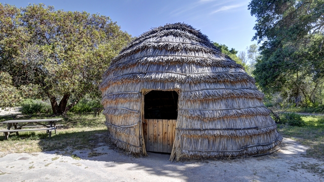
The abode of a native --- I wonder what the natives thought of the huge structures the padres built.
The city of Lompoc is known for fields of flowers (Lompoc is one of the biggest seed producers in the US) and murals. It was too early to see the flowers so we saw the murals instead.
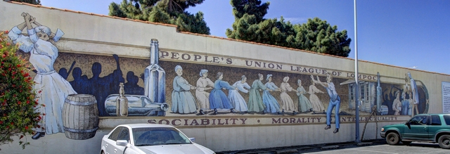
This mural depicts a band of ladies that joined together to fight the evils of alcohol. In 1883 they were a part of a vigilante group that strung a rope around building, yanked it off its foundation and pulled it for a block --- booze spilling out as it went.
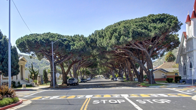
Ever wonder where pine nuts come from? Italian Stone Pines. These threes were planted in 1940 and are worth over 3 million dollars.
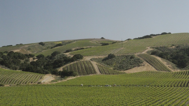
During our drive from Solvang to Lompoc and Lompoc to Pismo Beach we passed rolling hills, fields of grape vines, strawberries and other crops. I think I'm a farm girl at heart.
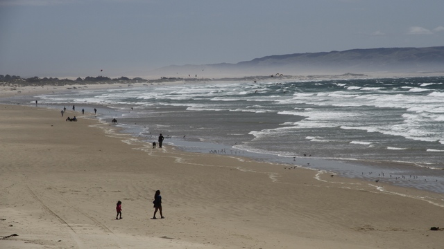
The wind was really blowing again today. The brown in the sky just below the hill is blowing sand.
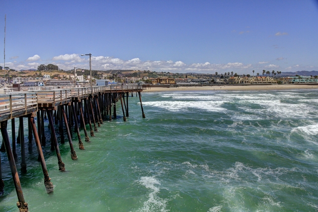
Standing on the pier looking back at Pismo Beach.
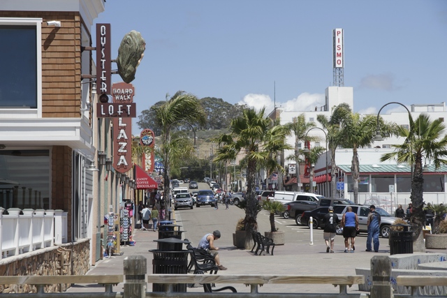
Pismo Beach ... for some reason all beach towns kinda look the same.
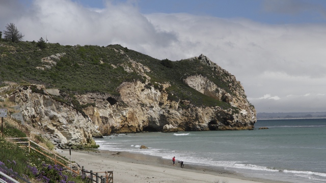
A little off the PCH is the cute town Avila Beach.
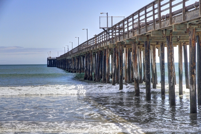
A different view of the pier at Avila Beach.
A quick stop at the San Luis Obispo de Tolosa
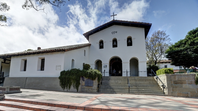
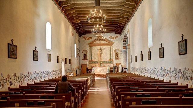
We stopped for the night in Morro Bay. Ed noticed a photograph of the Morro Rock at sunset in the restaurant where we ate dinner, now he wanted a photo of Morro Rock at sunset. As the wind was still howling I suggested going back to the motel for a change of clothes --- I put on my long underwear, socks, running shoes, a light sweater, a hoodie and Ed's down vest. Yes, I did think about the winter coat but I thought that might be a bit much. As long as I was moving I managed to stay warm.
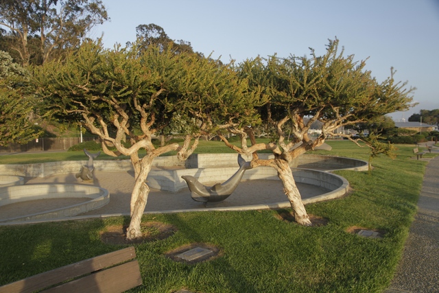
While we were waiting for the sun to set, we walked along the waterfront. These trees remind me a trees from fantasy movies like Lord of the Rings.
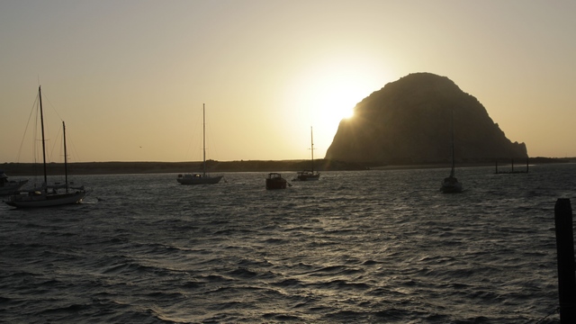
The Rock at Sunset photo. Mission successful. While Ed was taking sunset photos I was watching and listening to (they're pretty noisy) a platform full of seals. The platform is on the right side of the photo near the rock.
2016/04/26: Ventura to Solvang
Category: General
Posted by: The Agnew Family
We continue to head north following the PCH. Santa Barbara has lots to offer tourists and we did our best to enjoy it.
"Mission Santa Barbara, widely referred to as the “Queen of the Missions”, is one of the most beautiful buildings in Coastal California. Dating to 1786, the architecture evolved from adobe-brick buildings with thatched roof to more permanent edifices as the mission's population burgeoned. An earthquake in 1812 destroyed the third church built on the site. It's replacement, the present structure is still a functioning Catholic church."
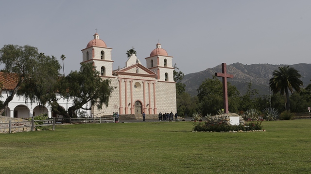
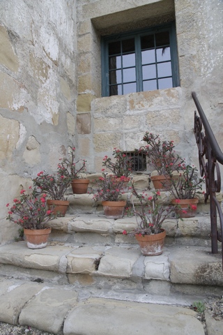
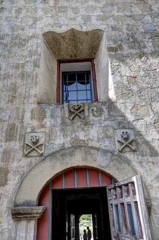
The tour took us through the gardens where we saw the steps to nowhere and the cemetary. The skull and crossbones on the doorway indicate that there is a cemetary attached to the mission.
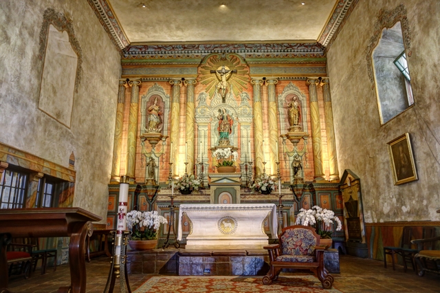
The inside of the mission.
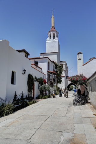
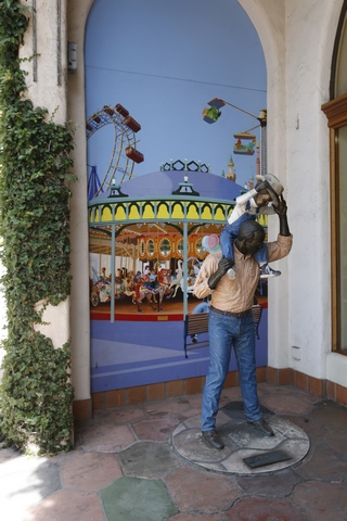
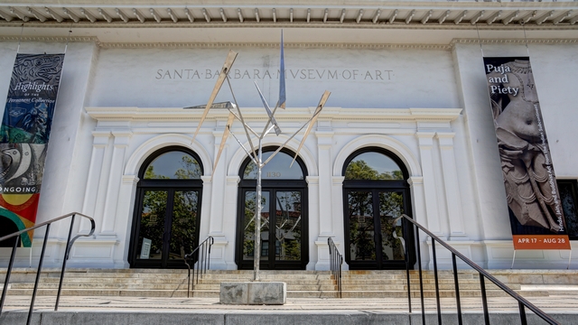
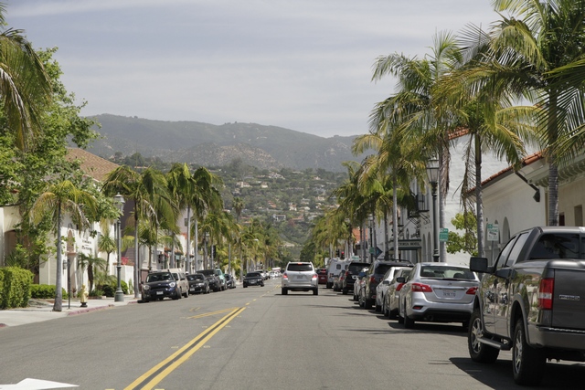
We wandered around downtown Santa Barbara taking in the beautiful architecture, enjoying the view and checking out a few of the stores.
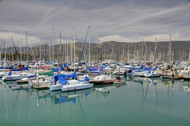
Santa Barbara harbour is huge --- I can't remember the last time I saw this many boats in one place.
We stopped at a couple of state parks to check out the view as we continued our drive north.
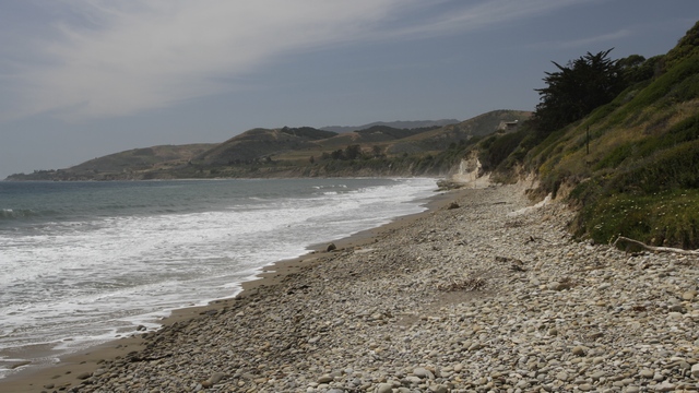
Beautiful beaches and
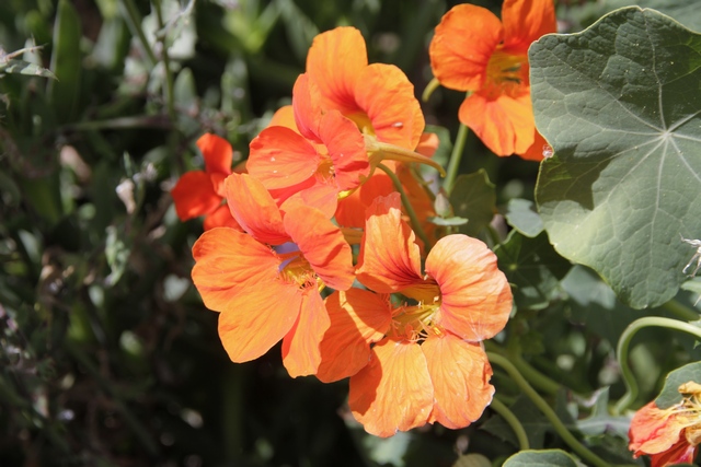
beautiful flowers
And now for somewhere a little different
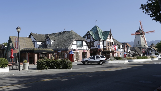
"Solvang was founded in 1911 on almost 9,000 acres (3,600 ha) of the Rancho San Carlos de Jonata Mexican land grant, by a group of Danes who traveled west to establish a Danish colony far from the midwestern winters."
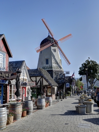
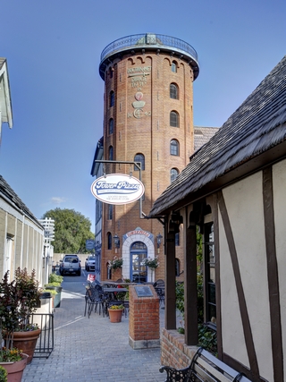
One of serval windmills and a replica of Copenhagen's Round Tower or Rundetårn in the scale 1:3 that was finished in 1991.
Ed and I really enjoyed walking around Solvang ... felt like home. A small town surround by rolling hills filled with cows and farm fields. Solvang is in a grape growing region and thus has many tasting rooms as well as micro breweries. We decided to have dinner at one of the micro breweries where Ed tried 2 different beers and I had a local wine ... oh we ate some wonderrful food as well.
Solvang is also home to an old mission.
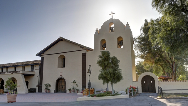
Father Estévan Tapís founded Mission Santa Inés in order to relieve overcrowding at Mission Santa Barbara and Mission La Purísima Concepción since it was located midway between the two.
"Mission Santa Barbara, widely referred to as the “Queen of the Missions”, is one of the most beautiful buildings in Coastal California. Dating to 1786, the architecture evolved from adobe-brick buildings with thatched roof to more permanent edifices as the mission's population burgeoned. An earthquake in 1812 destroyed the third church built on the site. It's replacement, the present structure is still a functioning Catholic church."


The tour took us through the gardens where we saw the steps to nowhere and the cemetary. The skull and crossbones on the doorway indicate that there is a cemetary attached to the mission.

The inside of the mission.
We wandered around downtown Santa Barbara taking in the beautiful architecture, enjoying the view and checking out a few of the stores.


Santa Barbara harbour is huge --- I can't remember the last time I saw this many boats in one place.

We stopped at a couple of state parks to check out the view as we continued our drive north.

Beautiful beaches and

beautiful flowers
And now for somewhere a little different

"Solvang was founded in 1911 on almost 9,000 acres (3,600 ha) of the Rancho San Carlos de Jonata Mexican land grant, by a group of Danes who traveled west to establish a Danish colony far from the midwestern winters."


One of serval windmills and a replica of Copenhagen's Round Tower or Rundetårn in the scale 1:3 that was finished in 1991.
Ed and I really enjoyed walking around Solvang ... felt like home. A small town surround by rolling hills filled with cows and farm fields. Solvang is in a grape growing region and thus has many tasting rooms as well as micro breweries. We decided to have dinner at one of the micro breweries where Ed tried 2 different beers and I had a local wine ... oh we ate some wonderrful food as well.
Solvang is also home to an old mission.

Father Estévan Tapís founded Mission Santa Inés in order to relieve overcrowding at Mission Santa Barbara and Mission La Purísima Concepción since it was located midway between the two.
2016/04/25: Costa Mesa to Ventura
Category: General
Posted by: The Agnew Family
Today's drive is going to take us thru Los Angeles so there was some debate about the highway versus the Pacific Coast Highway (PCH) and when would be the best time to do the drive. Ed decided that we are driving the Pacific Coast Highway then we should stay on the PCH --- route decided. Rush hour would hopefully be over by 11 am so that should be a good time to start across LA.
Huntington Beach is the first town north of Newport Beach (where our drive on the PCH began today). Huntington Beach is well known for it's beaches and great surfing. Instead of exploring the beaches, Ed and I stopped at the Bolsa Chica Ecological Reserve. The reserve has managed to survive with housing developments encroaching from one side and oil wells on the other side.
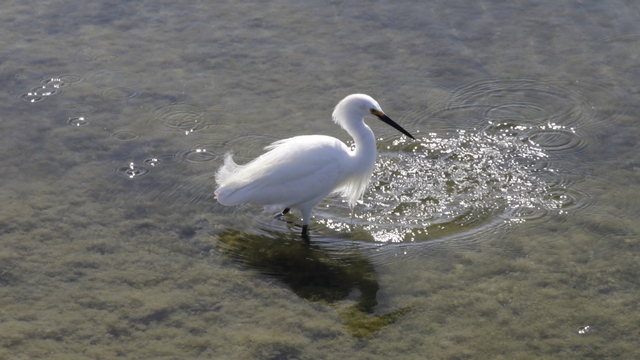
There were lots of birds (mostly gulls, terns, egrets and ducks). This egret co-operated nicely.
As we drove north to Long Beach we spotted this unusual looking RAV.
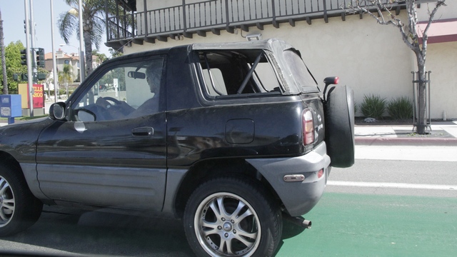
I think it's a 1999 2-door convertible Rav4.
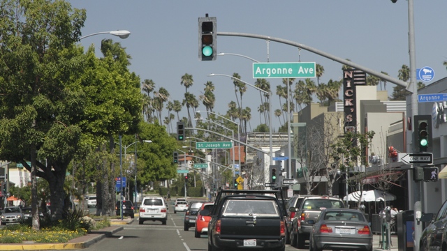
This road in Long Beach had a traffic light at every intersection --- luckily they seemed to be timed so you were able to get through a number of them before hitting a red light.
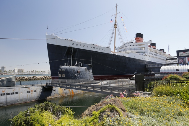
We stopped to take a look at the Russian sub and the Queen Mary while we were in Long Beach. We didn't tour either ship as we neither of us were interested enough to spend $29/person. I guess you can call us cheap but we like to think that we are spending our money wisely.
We drove past the docks, Redonda Beach, Manhattan Beach, Los Angeles Internation Airport (the PCH went under a runway), Marina Del Rey and finally reached Santa Monica. The drive wasn't too bad --- one spot where one lane was closed took awhile to get by and it was really busy (and slow) by the airport. Santa Monica was a bit disappointing --- is wasn't the place but the weather. The wind was blowing the sand so hard that the visibilty was very poor plus it felt like your legs were being sand blasted and Ed complained about the sand hurting his eyes.
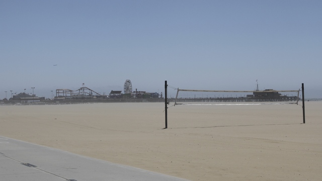
Ed took a few photos then we continued driving north.
The drive through Malibu was interesting. One side of the road are houses built on the side of the cliffs and the other side of the road are houses (that almost touch each other) built on the edge of the ocean. At the edge of this drive is the Malibu Lagoon State Beach.
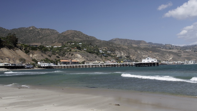
Looking back at the Malibu pier and the PCH.
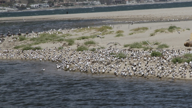
Lots of terns, gulls and pelicans.
The PHC turned inland passing a thru an agricultural area.
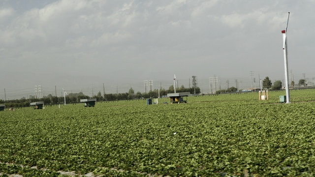
Now I know where a lot of the California strawberries come from.
We wandered the downtown area of Ventura. It's a interesting downtown with a lot of restaurants, a number of antique stores, at least 5 thrift shops, boutiques and of course
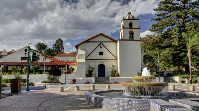
a mission. Mission San Buenaventura is known as the Mission by the Sea
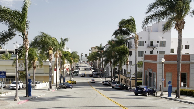
Standing by city hall looking toward the ocean. That's ocean you can see between the two smallest trees in the phto.
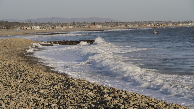
Venture has a long pier, a beautful promenade and a rocky beach.
Huntington Beach is the first town north of Newport Beach (where our drive on the PCH began today). Huntington Beach is well known for it's beaches and great surfing. Instead of exploring the beaches, Ed and I stopped at the Bolsa Chica Ecological Reserve. The reserve has managed to survive with housing developments encroaching from one side and oil wells on the other side.

There were lots of birds (mostly gulls, terns, egrets and ducks). This egret co-operated nicely.
As we drove north to Long Beach we spotted this unusual looking RAV.

I think it's a 1999 2-door convertible Rav4.

This road in Long Beach had a traffic light at every intersection --- luckily they seemed to be timed so you were able to get through a number of them before hitting a red light.

We stopped to take a look at the Russian sub and the Queen Mary while we were in Long Beach. We didn't tour either ship as we neither of us were interested enough to spend $29/person. I guess you can call us cheap but we like to think that we are spending our money wisely.
We drove past the docks, Redonda Beach, Manhattan Beach, Los Angeles Internation Airport (the PCH went under a runway), Marina Del Rey and finally reached Santa Monica. The drive wasn't too bad --- one spot where one lane was closed took awhile to get by and it was really busy (and slow) by the airport. Santa Monica was a bit disappointing --- is wasn't the place but the weather. The wind was blowing the sand so hard that the visibilty was very poor plus it felt like your legs were being sand blasted and Ed complained about the sand hurting his eyes.

Ed took a few photos then we continued driving north.
The drive through Malibu was interesting. One side of the road are houses built on the side of the cliffs and the other side of the road are houses (that almost touch each other) built on the edge of the ocean. At the edge of this drive is the Malibu Lagoon State Beach.

Looking back at the Malibu pier and the PCH.

Lots of terns, gulls and pelicans.
The PHC turned inland passing a thru an agricultural area.

Now I know where a lot of the California strawberries come from.
We wandered the downtown area of Ventura. It's a interesting downtown with a lot of restaurants, a number of antique stores, at least 5 thrift shops, boutiques and of course

a mission. Mission San Buenaventura is known as the Mission by the Sea

Standing by city hall looking toward the ocean. That's ocean you can see between the two smallest trees in the phto.

Venture has a long pier, a beautful promenade and a rocky beach.
2016/04/24: Starting the Drive North
Category: General
Posted by: The Agnew Family
After a wonderful visit, we bid adieu to John, Carol, Hendrix and the bunnies and begin our drive north on the California coast.
We did a quick stop in Carlsbad to check out the Flower Fields at Carlsbad Ranch. Carlsbad Ranch is the largest production farm in Southern California with approximately 50 acres of blooming Giant Tecolote ranunculus.
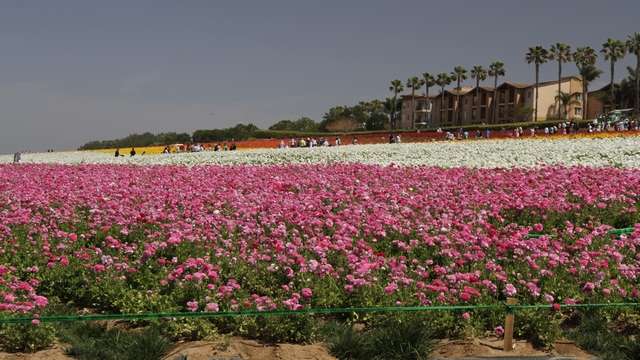
A view of one of the fields from the parking lot. As we had a few other things we wanted to see today we skipped wandering in the fields.
Old Mission San Luis Rey, the 18th, the largest and the most to prosperous of California's missions is known as the King of the Missions. It was build in 1798 by Franciscan friars to help educate and convert local Native Americans.
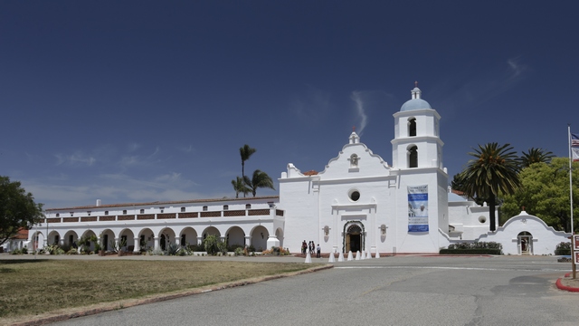
Construction on this church began in 1811. Adobe bricks, fired clay tiles and wooden timbers were used. It is one of only two mission churches built in the shape of a cross.
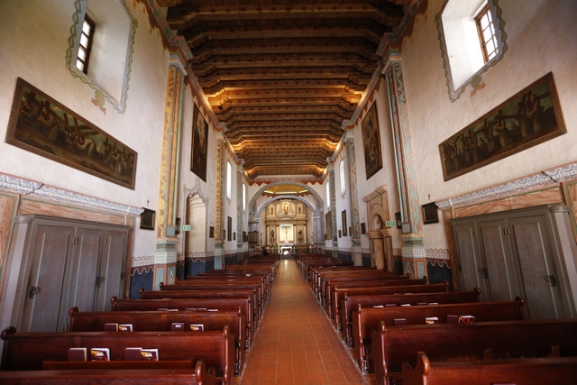
The nave of the church.
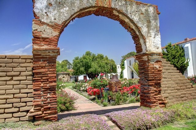
A "secret garden" behind the museum.
Mission San Juan Capistrano was founded in 1776 by Father Junipero Serra. The Great Stone Church begun in 1797, is the largest structure created by the Spanish in California. And yes, this is the place that the swallows return to each. We saw a few nests but no swallows.
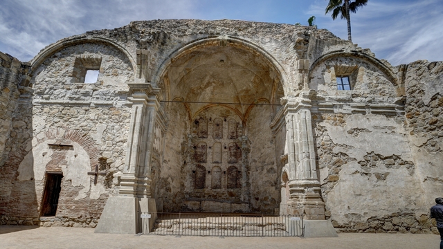
The ruins of the Great Stone Church which was destroyed by the December 8, 1812 earthquake.
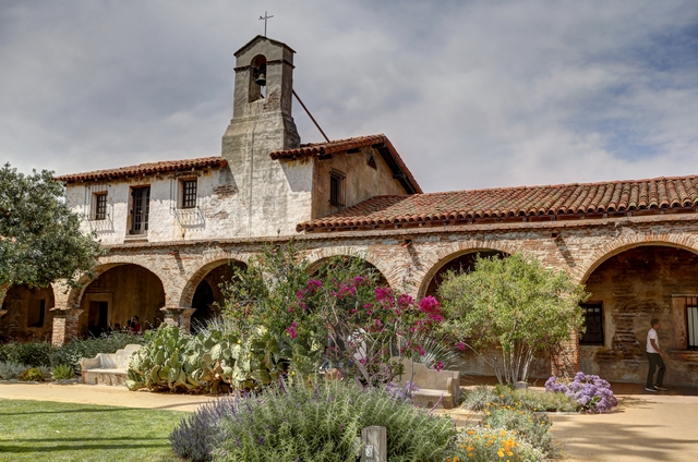
North Corridor Mission School
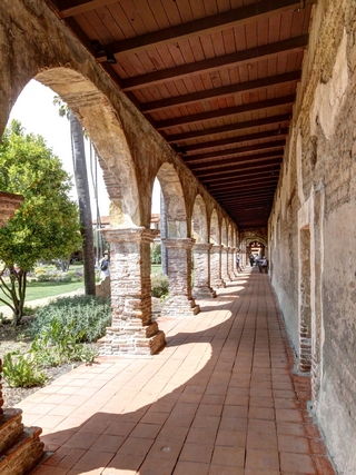
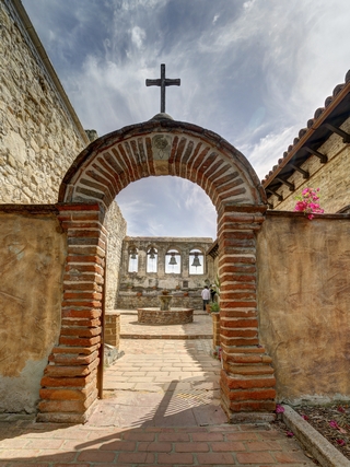
Looking down one of the corridors, sacred garden and the bell wall.
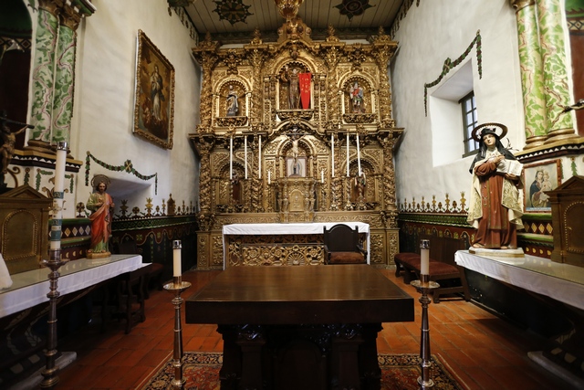
The inside of the Serra Chapel.
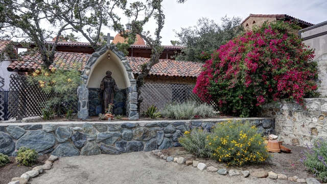
A quiet spot in the picnic area.
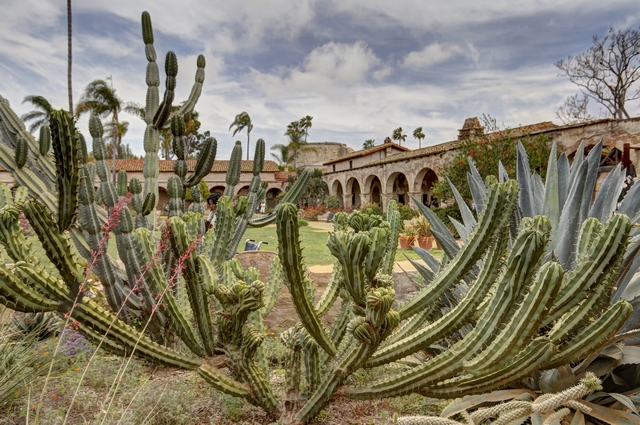
Art shot.
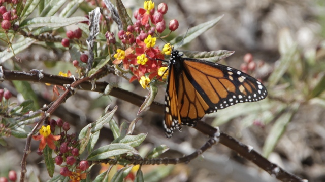
A butterfly enjoying the garden.
We stopped for the night in Costa Mesa just outside of Newport Beach and drove to the Balboa Peninsula, part of Newport Beach for dinner and a walk.
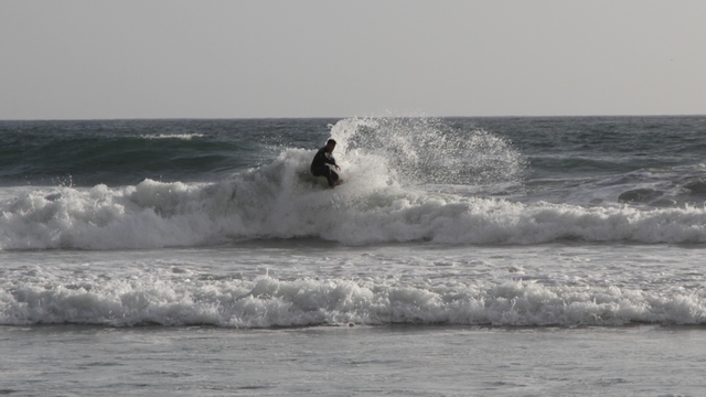
Surfers were enjoying the waves on the ocean side of the peninsula.
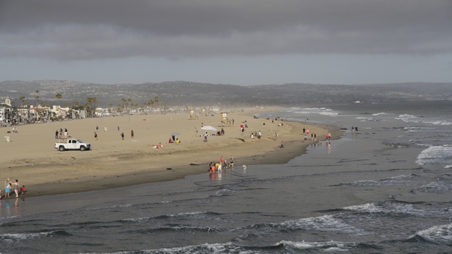
Looking back at the beach from the fishing pier.
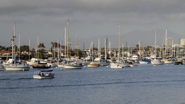
Marinas fill the inland side of the peninsula.
We did a quick stop in Carlsbad to check out the Flower Fields at Carlsbad Ranch. Carlsbad Ranch is the largest production farm in Southern California with approximately 50 acres of blooming Giant Tecolote ranunculus.

A view of one of the fields from the parking lot. As we had a few other things we wanted to see today we skipped wandering in the fields.
Old Mission San Luis Rey, the 18th, the largest and the most to prosperous of California's missions is known as the King of the Missions. It was build in 1798 by Franciscan friars to help educate and convert local Native Americans.

Construction on this church began in 1811. Adobe bricks, fired clay tiles and wooden timbers were used. It is one of only two mission churches built in the shape of a cross.

The nave of the church.

A "secret garden" behind the museum.
Mission San Juan Capistrano was founded in 1776 by Father Junipero Serra. The Great Stone Church begun in 1797, is the largest structure created by the Spanish in California. And yes, this is the place that the swallows return to each. We saw a few nests but no swallows.

The ruins of the Great Stone Church which was destroyed by the December 8, 1812 earthquake.

North Corridor Mission School


Looking down one of the corridors, sacred garden and the bell wall.

The inside of the Serra Chapel.

A quiet spot in the picnic area.

Art shot.

A butterfly enjoying the garden.
We stopped for the night in Costa Mesa just outside of Newport Beach and drove to the Balboa Peninsula, part of Newport Beach for dinner and a walk.

Surfers were enjoying the waves on the ocean side of the peninsula.

Looking back at the beach from the fishing pier.

Marinas fill the inland side of the peninsula.
2016/04/23: San Diego - Day 4, "Chicano Park Day"
Category: General
Posted by: The Agnew Family
John has heard about Chicano Park Day for a number of years and has never managed to go to it. Ed and I thought it sounded interesting so the three of us decided to check it out.
On the way to the park Ed stopped and got the promised photograph of the new library.
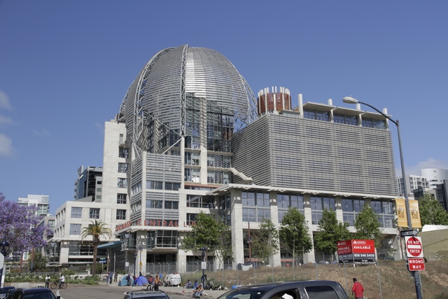
I don't know much about architecture but I do know that I like the look of this building.
Chicano Park Day seems to consist of a car show, music, dancing and vendors. The car show was impressive and is different than the car shows at home. Here most of the people showing cars belong to car clubs (they all had t-shirts on that identified the club they belonged to) and most of the cars were lowriders. A lowrider is an automobile or other vehicle modified so that its ground clearance is less than its design specification. Hydraulics are used to raise the car for driving.
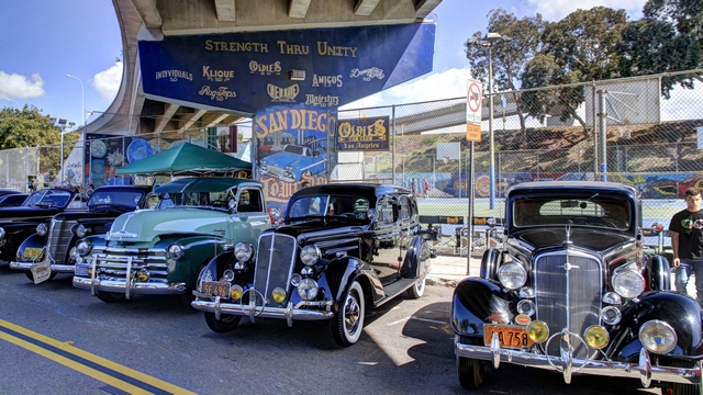
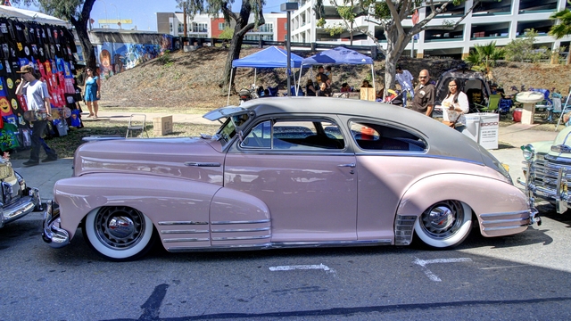
Love the paint colours.
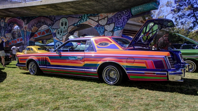
If you can't decide on the colour, you can always try the rainbow effect. The interior, trunk and engine compartment all matched the body.
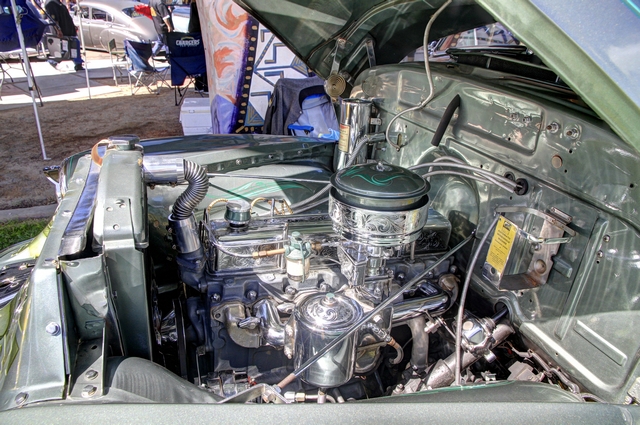
Engine parts are chromed and engraved.
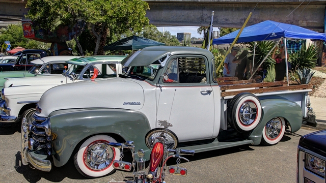
Just liked the look of this truck.
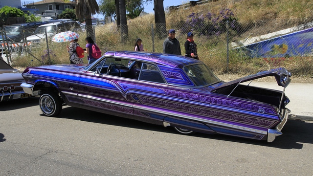
The hydraulics in action, the front is up and the rear is down, also love the paint job.
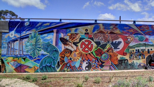
Much of the park in under a couple of bridges. A lot of the concrete associated with bridges have murals painted on them.
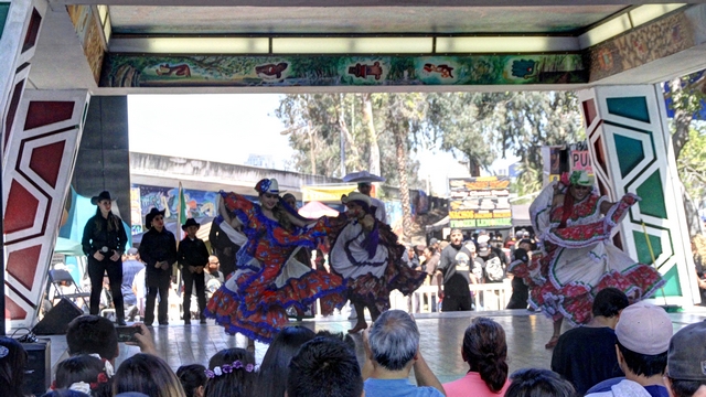
One group of dancers.
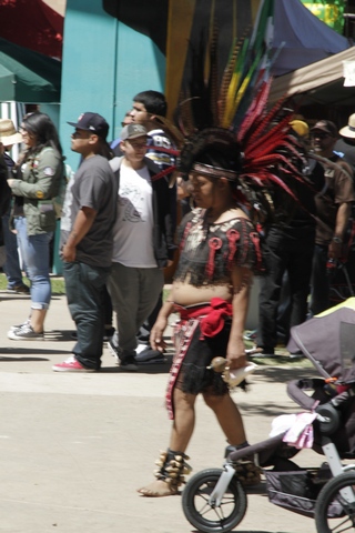
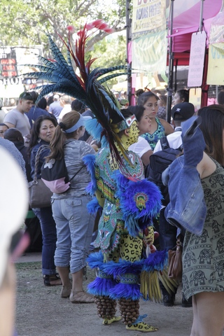
We noticed a few people dressed in costumes that appeared kinda Aztec or Mayan like --- not sure but wondered if they were dancers.
Carol's service dog passed away suddenly in late December. Today we went with her to pick up her new service dog Hendrix. Hendrix is at the stage in his training where he needs to bond with Carol. Hopefully, in a couple of weeks they will be able to pass the "service dog" test.
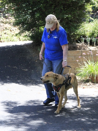
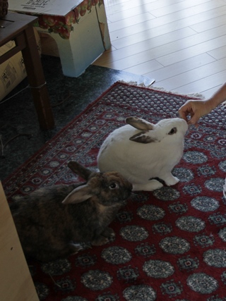
Carol and Hendrix. Abby and Guiness are John and Carol's bunnies.
On the way to the park Ed stopped and got the promised photograph of the new library.

I don't know much about architecture but I do know that I like the look of this building.
Chicano Park Day seems to consist of a car show, music, dancing and vendors. The car show was impressive and is different than the car shows at home. Here most of the people showing cars belong to car clubs (they all had t-shirts on that identified the club they belonged to) and most of the cars were lowriders. A lowrider is an automobile or other vehicle modified so that its ground clearance is less than its design specification. Hydraulics are used to raise the car for driving.


Love the paint colours.

If you can't decide on the colour, you can always try the rainbow effect. The interior, trunk and engine compartment all matched the body.

Engine parts are chromed and engraved.

Just liked the look of this truck.

The hydraulics in action, the front is up and the rear is down, also love the paint job.

Much of the park in under a couple of bridges. A lot of the concrete associated with bridges have murals painted on them.

One group of dancers.


We noticed a few people dressed in costumes that appeared kinda Aztec or Mayan like --- not sure but wondered if they were dancers.
Carol's service dog passed away suddenly in late December. Today we went with her to pick up her new service dog Hendrix. Hendrix is at the stage in his training where he needs to bond with Carol. Hopefully, in a couple of weeks they will be able to pass the "service dog" test.


Carol and Hendrix. Abby and Guiness are John and Carol's bunnies.
2016/04/22: San Diego - Day 3
Category: General
Posted by: The Agnew Family
The San Diego Zoo is one of the top rated zoos in the world. The zoo is in Balboa Park, just minutes from downtown San Diego. It houses over 3,700 animals of more than 650 species and subspecies. On a previous trip to San Diego Ed and I spent a day at the zoo and managed to see most of it. Today we only have a few hours so we will only see part of it.
San Diego Zoo was one of the pioneers of creating natural habitats for the animals. Unfortunately, some of these habitats are older designs and are not "camera" friendly. The polar bear exhibit is a good example as there is no spot to view the bears that does not have "glass/plastic" in front of you, so Toronto Zoo you win on the that exhibit. The new koala habitat is amazing. Keep up the good work San Diego Zoo in you habitat rebuilding.
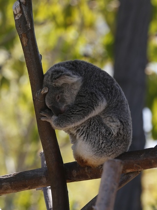
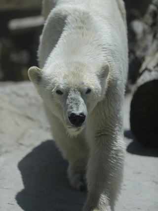
Sleeping Koala (but then they sleep a lot), Polar Bear enjoying the beautiful day.
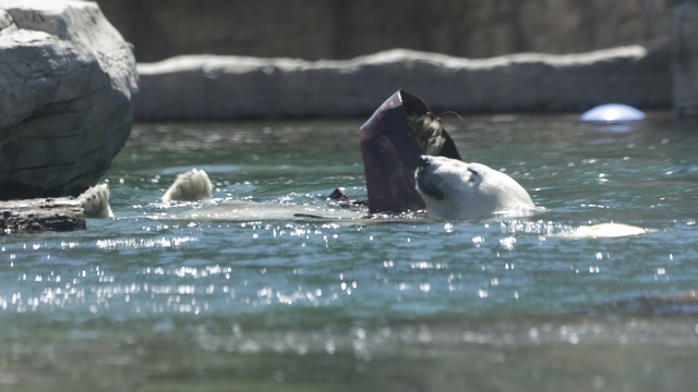
We enjoyed watching this female polar bear playing and swimming.
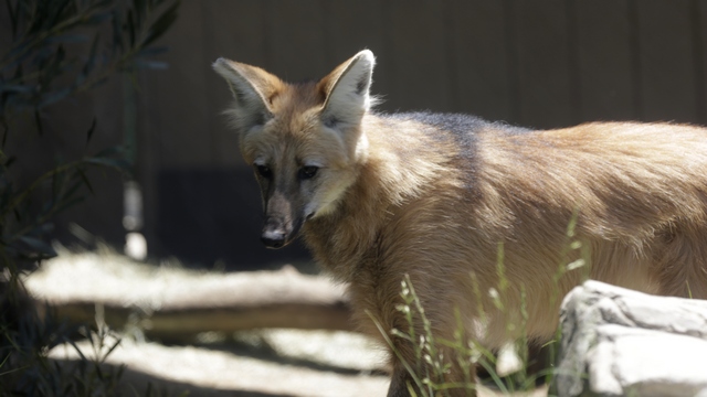
Maned Wolf
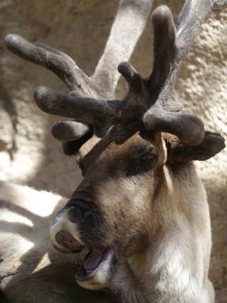
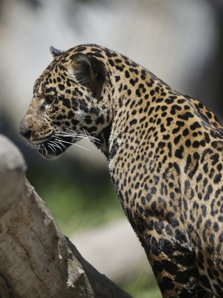
Reindeer and a Jaguar
The Elephant Care Center lets you watch while the zoo keepers are taking care of the elephants.
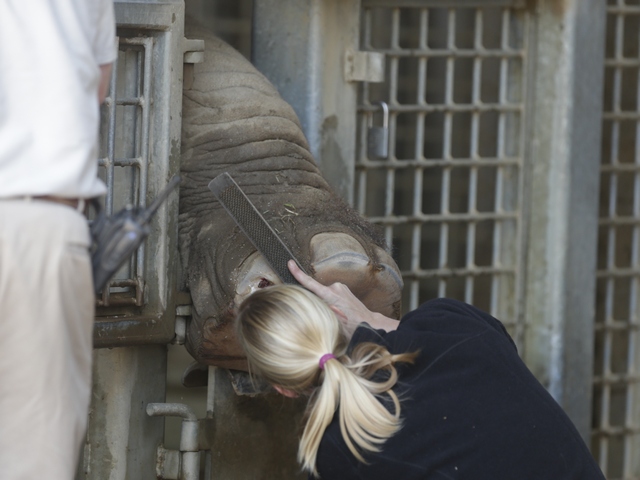
This guy has a sore foot --- one zoo keeper was scratching the elephant on the head to keep him amused while the other zoo keeper worked on the injured foot.
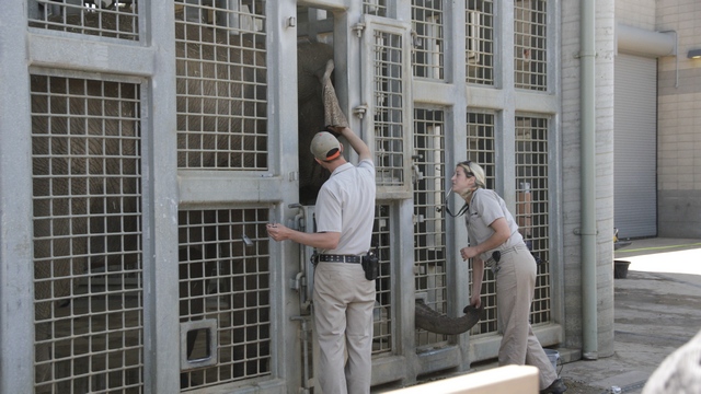
A blood sample was taken from the back of the ear by one zoo keeper while the other zoo keeper kept putting treats in the elephants trunk.
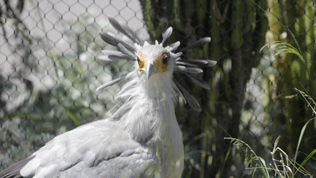
Secretary Bird
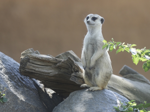
The meercats are fun to watch and we did get a glance at the babies.
Bears are my favorite so I was a little disappointed today --- the line for the pandas was longer than I was willing to stand in (lots of school field trips today), a couple habitats are being worked on so the bears were off exhibit and others were sleeping.
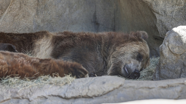
The Grizzly boys were napping.
The polar bears and this Andean bear lessened my disappointment
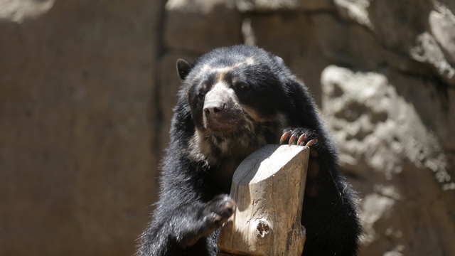
Andean Bear. This guy is fast, he climbed a 12 foot poll in a couple of seconds.
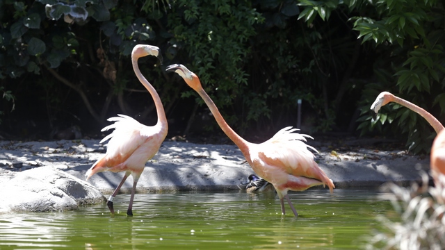
flamingos
The reason we only had a half day at zoo was due to the tour at the local PBS radio and television station. John and Carol are members of the station and were thus eligible to go on a tour. The general manager, who gave the tour, was a interesting and informative guide. I learned a lot about what goes on behind the scenes.

The central hub for the television station. They monitor the feeds coming into the station (i.e. BBC, the PBS network, etc), and the feeds leaving the station (i.e. their shows on local cable stations, etc.)
San Diego Zoo was one of the pioneers of creating natural habitats for the animals. Unfortunately, some of these habitats are older designs and are not "camera" friendly. The polar bear exhibit is a good example as there is no spot to view the bears that does not have "glass/plastic" in front of you, so Toronto Zoo you win on the that exhibit. The new koala habitat is amazing. Keep up the good work San Diego Zoo in you habitat rebuilding.


Sleeping Koala (but then they sleep a lot), Polar Bear enjoying the beautiful day.

We enjoyed watching this female polar bear playing and swimming.


Maned Wolf


Reindeer and a Jaguar
The Elephant Care Center lets you watch while the zoo keepers are taking care of the elephants.

This guy has a sore foot --- one zoo keeper was scratching the elephant on the head to keep him amused while the other zoo keeper worked on the injured foot.

A blood sample was taken from the back of the ear by one zoo keeper while the other zoo keeper kept putting treats in the elephants trunk.

Secretary Bird

The meercats are fun to watch and we did get a glance at the babies.
Bears are my favorite so I was a little disappointed today --- the line for the pandas was longer than I was willing to stand in (lots of school field trips today), a couple habitats are being worked on so the bears were off exhibit and others were sleeping.

The Grizzly boys were napping.
The polar bears and this Andean bear lessened my disappointment

Andean Bear. This guy is fast, he climbed a 12 foot poll in a couple of seconds.

flamingos
The reason we only had a half day at zoo was due to the tour at the local PBS radio and television station. John and Carol are members of the station and were thus eligible to go on a tour. The general manager, who gave the tour, was a interesting and informative guide. I learned a lot about what goes on behind the scenes.

The central hub for the television station. They monitor the feeds coming into the station (i.e. BBC, the PBS network, etc), and the feeds leaving the station (i.e. their shows on local cable stations, etc.)
2016/04/21: San Diego - Day 2
Category: General
Posted by: The Agnew Family
First item of fun on the agenda for today was a harbour cruise. We opted for the 2 hour cruise --- the first hour was the southern half of the harbour and the second hour was the north half of the harbour.
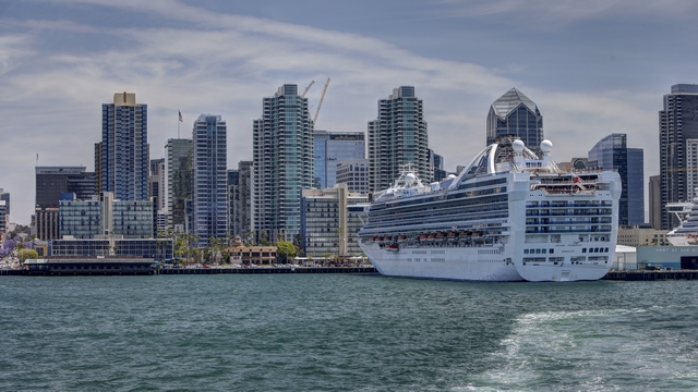
A view of the harbour. Two ships from the Princess Cruise Lines were docked.
In the south half of the harbour are a lot of ship yards, many of them with contracts with the US Navy which meant we saw a lot of ships, some in the water and some in dry dock but all of them being worked on. One of the most interesting for me were the "stealth" ships. These are ships that are designed to fool radar into thinking they are a fishing vessel not a naval ship. I've posted a side view and a front view so you can see how the design may confuse radar.
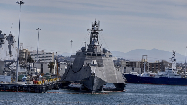
The main part of the hull is small.
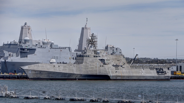
The surfaces are slanted which prevents some of the bounce back to radar.
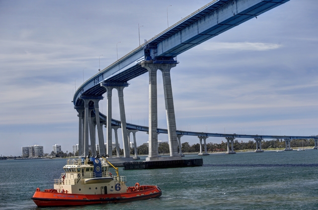
The bridge to Coronado Island.
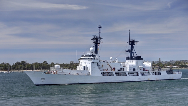
A non-military ship in the harbour.
There is a large military base in the northend of the harbour including a dry dock for submarines and helicopter and airplane training areas. Until you are in the harbour you don't realize how much military is in San Diego.
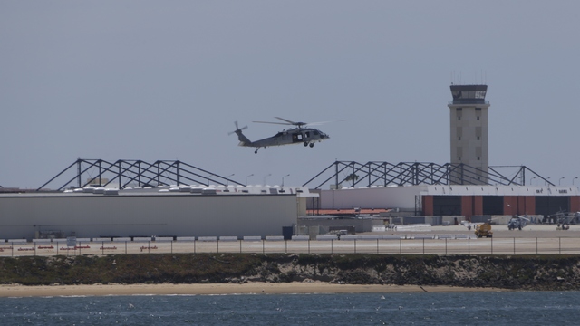
Practicing hovering --- I think this helicopter was hovering for most of our cruise in the north end of the harbour.
There are other things going on in the harbour that are not military related.
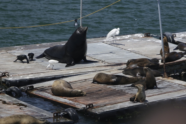
The bait dock is a good place to rest.
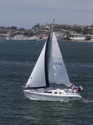
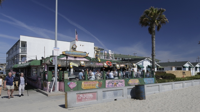
After the tour it was time to relax and enjoy some lunch. John and Carol desided to take us to a beach restaurant called The Green Flash. Guess it's been a while since they had been there as it had changed ownership two years ago. The restaurant has a new name but John and Carol say the ambience is still the same --- fun, loud, surfer hangout --- even at 2:30 on a Thursday afternoon.
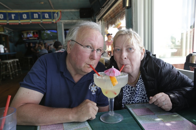
John and Carol enjoying a margarita.
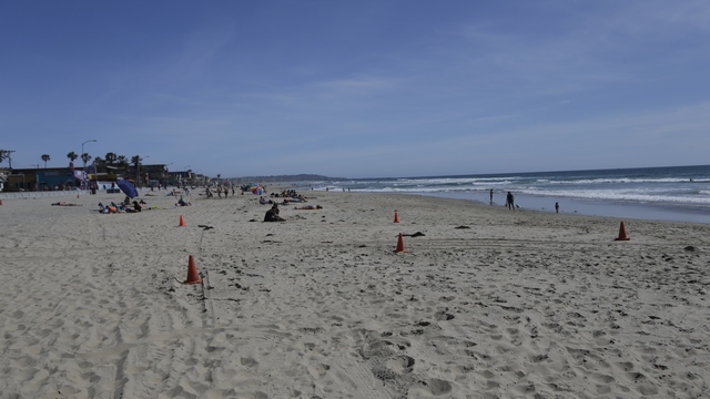
The beach.
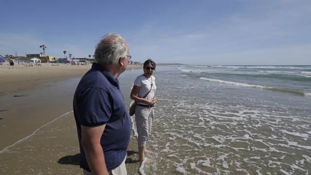
Testing the water ---- it is COOOOOOOLD!!!!
Returning to downtown San Diego, John, Ed and I decided to take our evening constitutional and check out the new library. Somehow, Ed didn't take a photo of the outside of the building so I'll have to get him to do that tomorrow as I think it is unique and beautiful. The building is nine stories high with a sphere on top. Floors six and seven is a high school. The ninth floor houses an outdoor patio, art gallery, geneology area and a rare book room.
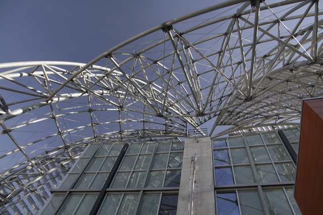
Looking at the sphere from the 9th floor patio.
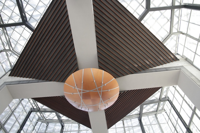
The eighth floor has a reading room that has the sphere as it's ceiling.
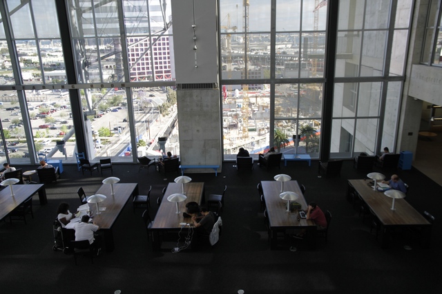
Looking down on the reading room.
The library is an amazing looking building but also appears to be functional with lots of books, magazines and computers. As there were a fair number of people in the library during our visit I think it is also well used.

A view of the harbour. Two ships from the Princess Cruise Lines were docked.
In the south half of the harbour are a lot of ship yards, many of them with contracts with the US Navy which meant we saw a lot of ships, some in the water and some in dry dock but all of them being worked on. One of the most interesting for me were the "stealth" ships. These are ships that are designed to fool radar into thinking they are a fishing vessel not a naval ship. I've posted a side view and a front view so you can see how the design may confuse radar.

The main part of the hull is small.

The surfaces are slanted which prevents some of the bounce back to radar.

The bridge to Coronado Island.

A non-military ship in the harbour.
There is a large military base in the northend of the harbour including a dry dock for submarines and helicopter and airplane training areas. Until you are in the harbour you don't realize how much military is in San Diego.

Practicing hovering --- I think this helicopter was hovering for most of our cruise in the north end of the harbour.
There are other things going on in the harbour that are not military related.

The bait dock is a good place to rest.


After the tour it was time to relax and enjoy some lunch. John and Carol desided to take us to a beach restaurant called The Green Flash. Guess it's been a while since they had been there as it had changed ownership two years ago. The restaurant has a new name but John and Carol say the ambience is still the same --- fun, loud, surfer hangout --- even at 2:30 on a Thursday afternoon.


John and Carol enjoying a margarita.

The beach.

Testing the water ---- it is COOOOOOOLD!!!!
Returning to downtown San Diego, John, Ed and I decided to take our evening constitutional and check out the new library. Somehow, Ed didn't take a photo of the outside of the building so I'll have to get him to do that tomorrow as I think it is unique and beautiful. The building is nine stories high with a sphere on top. Floors six and seven is a high school. The ninth floor houses an outdoor patio, art gallery, geneology area and a rare book room.

Looking at the sphere from the 9th floor patio.

The eighth floor has a reading room that has the sphere as it's ceiling.

Looking down on the reading room.
The library is an amazing looking building but also appears to be functional with lots of books, magazines and computers. As there were a fair number of people in the library during our visit I think it is also well used.
2016/04/20: San Diego - Day 1
Category: General
Posted by: The Agnew Family
This is our third visit to San Diego, so we have seen most of the major attractions. This visit is mostly about visiting with our friends John and Carol. While we're here we'll visit some "attractions" we haven't seen before and a few that we have.
Today we started with the Flying Leatherneck Aviation Museum. The docents here are all ex-military and full of stories. A number of them have flown the planes that are on display here. Here's a few of them:
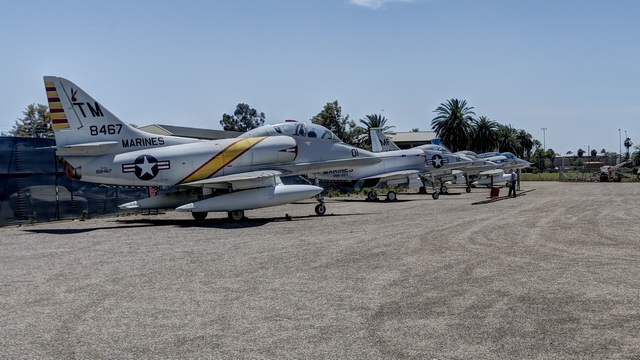
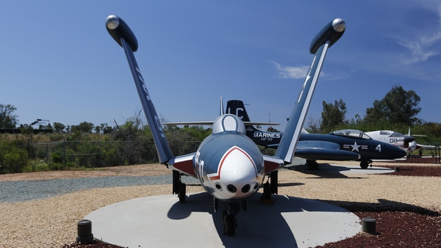
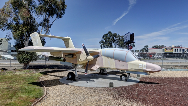
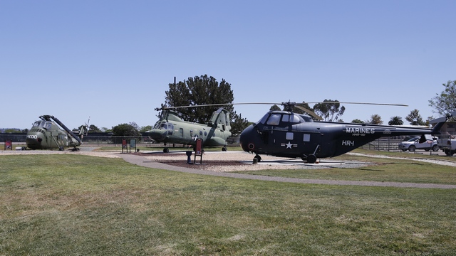
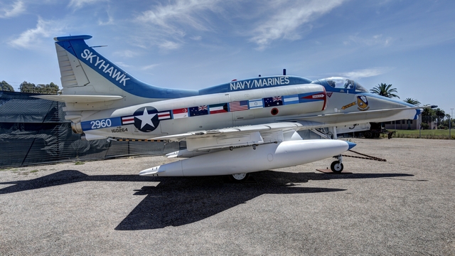
McDonnell Douglas A-4M Skyhawk II
The flags on this plan indicate the countries that the plane was sold to.
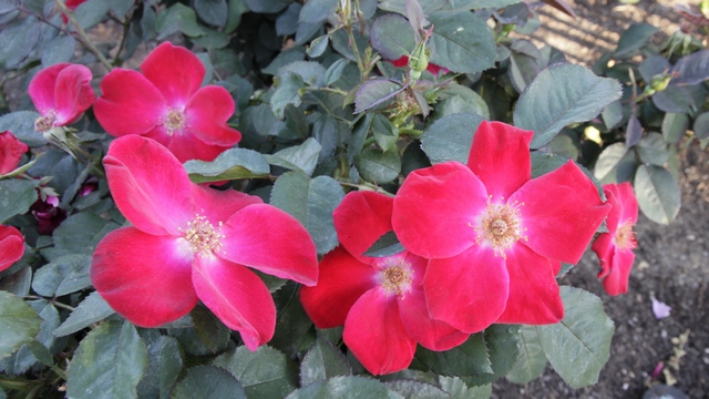
Now more up my alley was our walk to the rose and cactus gardens at Balboa Park. The rose garden was in full bloom.
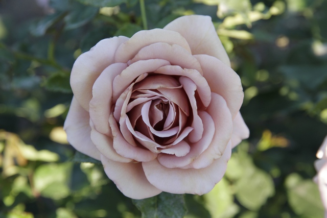
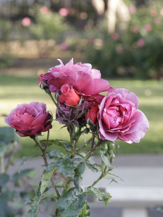
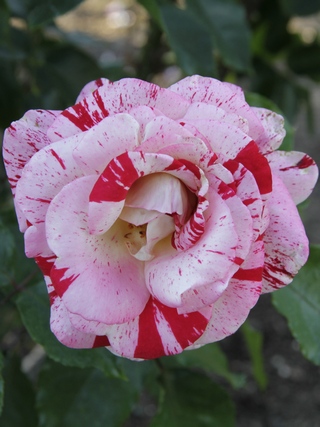
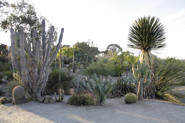
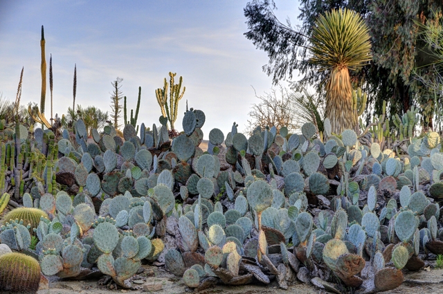
Some of the cacti were thinking about blooming but there is a wide variety of prolific cacti here.
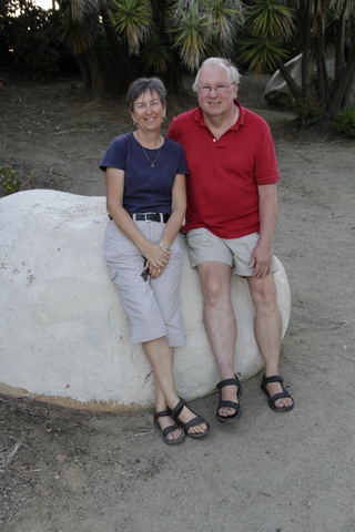
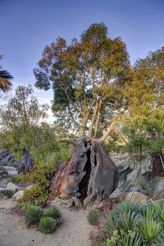
John and I and an interesting looking tree.
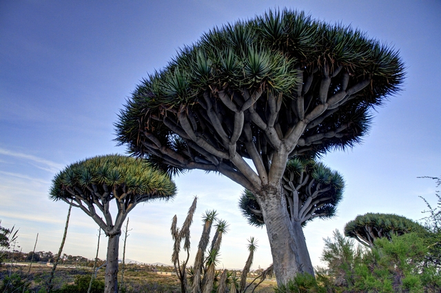
Another interesting tree.
Today we started with the Flying Leatherneck Aviation Museum. The docents here are all ex-military and full of stories. A number of them have flown the planes that are on display here. Here's a few of them:


McDonnell Douglas A-4M Skyhawk II
The flags on this plan indicate the countries that the plane was sold to.
Now more up my alley was our walk to the rose and cactus gardens at Balboa Park. The rose garden was in full bloom.


Some of the cacti were thinking about blooming but there is a wide variety of prolific cacti here.


John and I and an interesting looking tree.

Another interesting tree.
2016/04/19: Riverside
Category: General
Posted by: The Agnew Family
Today we are leaving the desert and moving to the coast. On the way we are stopping in Riverside.
By 1882 Riverside was home to more than half of California's citrus groves, making it the state's wealthiest city per capita in 1895. The prosperity produced a downtown area of opeulent architecture, which is well preserved today.
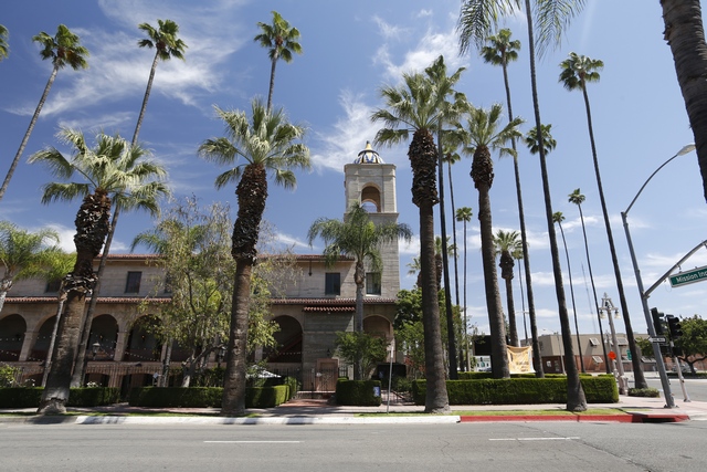
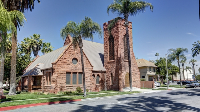
A couple of the beautiful churches in the downtown area.
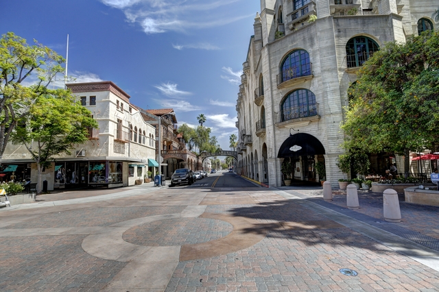
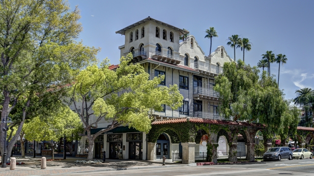
The crown jewel of Riverside is the Mission Inn, a Spanish Revival hotel whose elaborate turrets, clock tower, mission bells, and flying buttresses rise above down.
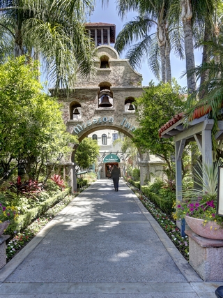
The entrance.
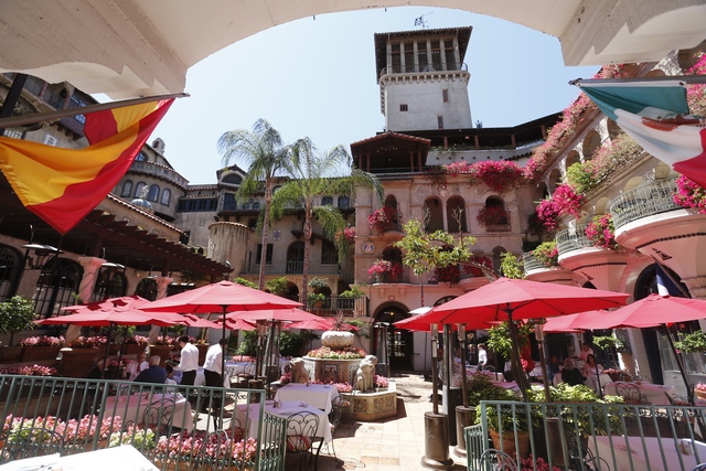
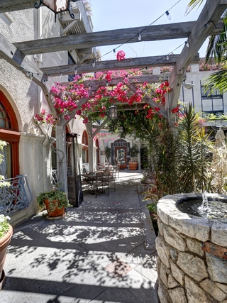
An interior courtyard dining area.
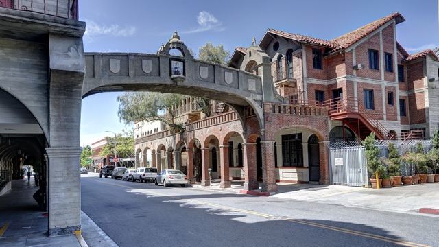
The back "service entrance" of the hotel.
The California University Museum of Photography has received a lot of good reviews so we decided it was worth a visit.
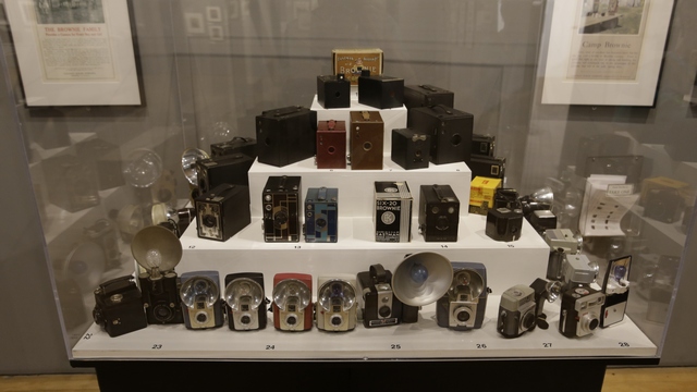
Some of the Brownie camera's on display.
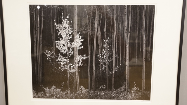
Ansel Adams, Aspens, Northern New Moeico, 1958 (printed 1978). Ansel Adams is one of Ed's and my favourite landscape photographers.
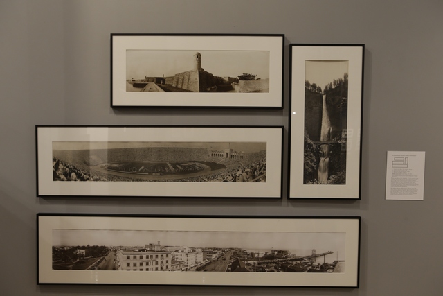
I really like this collection of photographs. William Amos Haines used a Kodak No. 10 Cirkut camera to make panoramic negatives that were ten inches wide and up to twelve feet in length. To make a panorama the entire camera rotated on a fixed tripod, outfitted with springs and gears. The swiveling camera panned its subject simultaneously exposing an entire roll of fill.
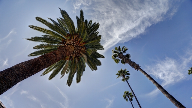
Ed's art shot.
After arriving at our friends (John and Carol) in San Diego, John, Ed and I took a walk to the waterfront.
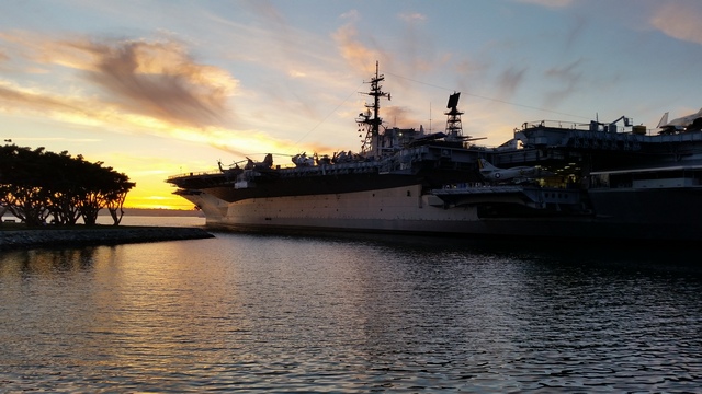
The USS Midway.
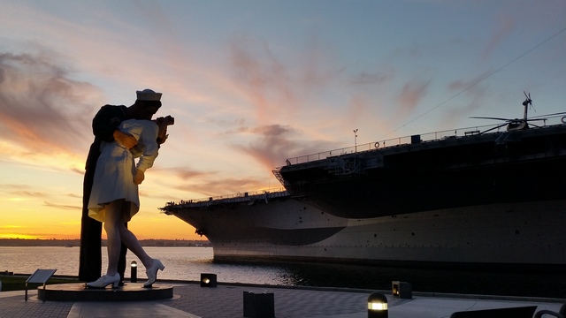
The famous "soldier kissing nurse statue" celebrating the end of world war II.
By 1882 Riverside was home to more than half of California's citrus groves, making it the state's wealthiest city per capita in 1895. The prosperity produced a downtown area of opeulent architecture, which is well preserved today.

A couple of the beautiful churches in the downtown area.


The crown jewel of Riverside is the Mission Inn, a Spanish Revival hotel whose elaborate turrets, clock tower, mission bells, and flying buttresses rise above down.


The entrance.

An interior courtyard dining area.

The back "service entrance" of the hotel.
The California University Museum of Photography has received a lot of good reviews so we decided it was worth a visit.

Some of the Brownie camera's on display.

Ansel Adams, Aspens, Northern New Moeico, 1958 (printed 1978). Ansel Adams is one of Ed's and my favourite landscape photographers.

I really like this collection of photographs. William Amos Haines used a Kodak No. 10 Cirkut camera to make panoramic negatives that were ten inches wide and up to twelve feet in length. To make a panorama the entire camera rotated on a fixed tripod, outfitted with springs and gears. The swiveling camera panned its subject simultaneously exposing an entire roll of fill.

Ed's art shot.
After arriving at our friends (John and Carol) in San Diego, John, Ed and I took a walk to the waterfront.

The USS Midway.

The famous "soldier kissing nurse statue" celebrating the end of world war II.
2016/04/18: Rainbow Basin National Natural Landmark
Category: General
Posted by: The Agnew Family
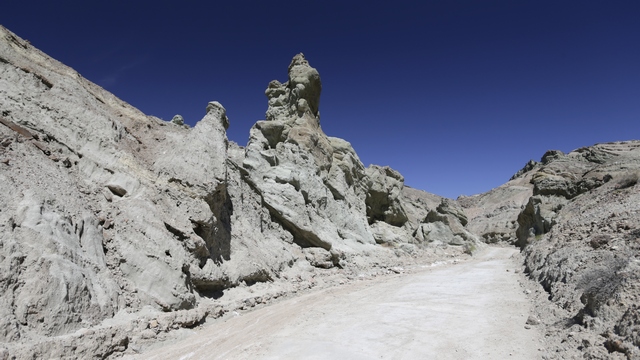
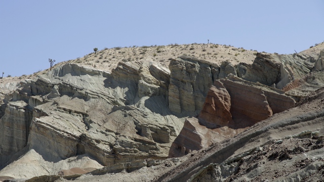
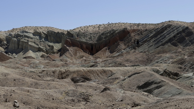
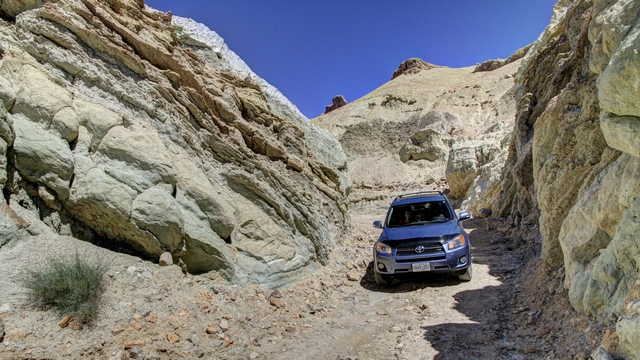
The Rainbow Basin National Natural Landmark is 15 km outside of Bartsow. Many science-fiction movies set on Mars have been filmed at this landmark. Huge slabs of red, orange, white and green stone tilt at crazy angles. There is an approximately 6.5 km loop road for 4 wheel, high clearance vehicles thru part of the landmark. We understood the warnings after we drove our 4 wheel drive RAV around the loop. Unfortunately, the camera doesn't pick up the colours of the rocks as well as our eyes did.
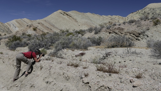
Caught in the act of taking wildflower pictures.
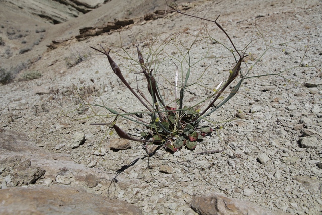
Not sure what this plant is but it looks like it could be from Mars.
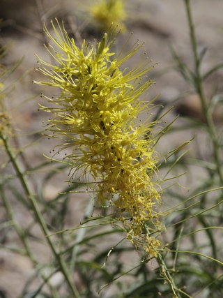
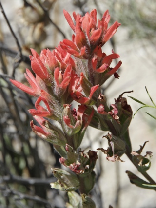
Think the yellow flower is Prince's Plume and the red flower is Paintbrush.
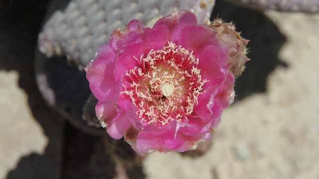
Beavertail
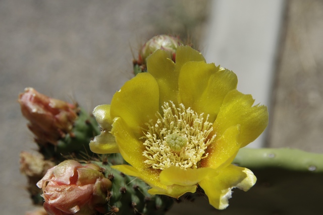
Prickly Pear
After the drive we decided to go for a hike ---- there were a couple of geocaches Ed wanted to get. Once that little job was out of the way he hiked up a small wash and hiked back thru Owl Canyon.
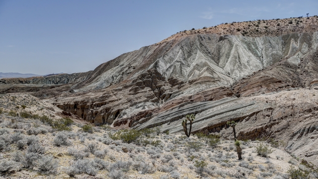
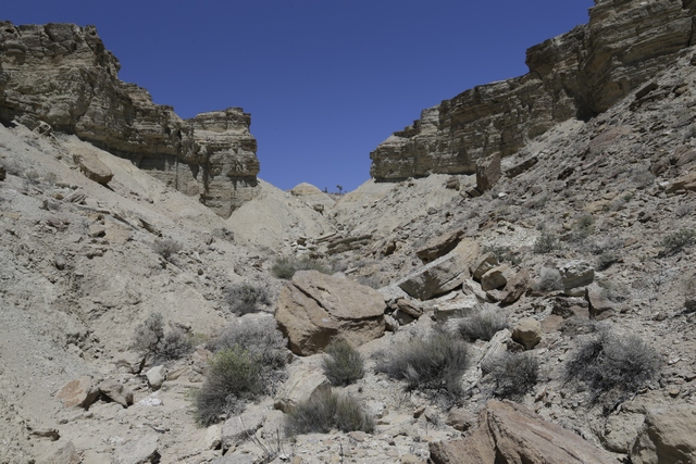
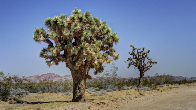
A gorgeous Joshua Tree and a not so gorgeous Joshua Tree.
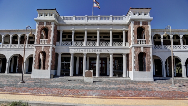
Once we were back in Barstow we stopped at the Casa Del Desierto Harvey House. This distinctive two-storey structure was one of the many hotels and restaurant depots opened by the Fred Harvey Co. in the early 20th century.
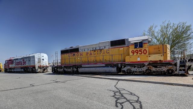
Old railway cars, part of the railway museum are on a side rail near the hotel.
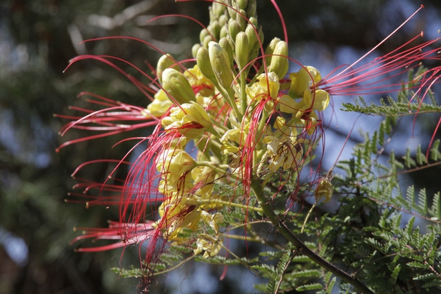
Several gardens around the hotel were planted with shrubs that were in bloom. I have no idea what the shrub is but the flowers are unique.


Caught in the act of taking wildflower pictures.

Not sure what this plant is but it looks like it could be from Mars.


Think the yellow flower is Prince's Plume and the red flower is Paintbrush.

Beavertail

Prickly Pear
After the drive we decided to go for a hike ---- there were a couple of geocaches Ed wanted to get. Once that little job was out of the way he hiked up a small wash and hiked back thru Owl Canyon.


A gorgeous Joshua Tree and a not so gorgeous Joshua Tree.
Once we were back in Barstow we stopped at the Casa Del Desierto Harvey House. This distinctive two-storey structure was one of the many hotels and restaurant depots opened by the Fred Harvey Co. in the early 20th century.


Old railway cars, part of the railway museum are on a side rail near the hotel.
Several gardens around the hotel were planted with shrubs that were in bloom. I have no idea what the shrub is but the flowers are unique.

2016/04/17: Mojave National Preserve
Category: General
Posted by: The Agnew Family
There's a lot of photos today. It was difficult to choose the photos for today's blog as we took a lot of amazing photos. We spent about 10 hours in the Mojave National Preserve which is in southeastern California between I-15 and I-40. The preserve is 1.6 million acres with natural features which include the Kelso Dunes, the Marl Mountains, the Cima Dome, volcanic formations such as Hole-in-the-Wall, Cinder Cone Lava Beds and a Joshua Tree forest. As it is spring and it has rained the desert is green and filled with flowers. We didn't see everything the park has to offer but we tried our best to see a good cross section.
The desert parks always tell you about the wildlife that is in the park and you rarely see any. Today was an exception as we saw a number of birds, including a hummingbird, lizards, jack rabbits, bugs and
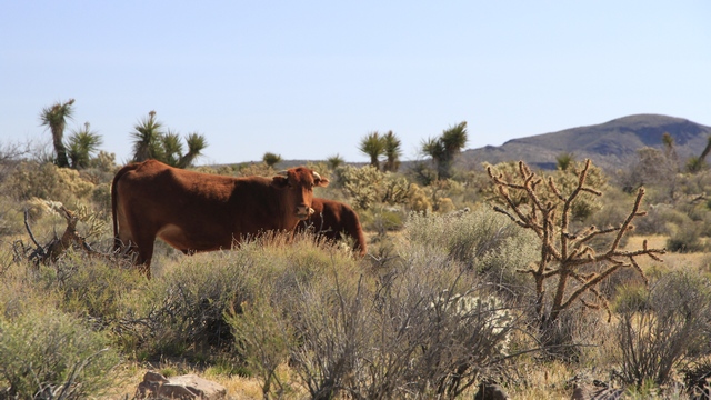
Ok so cows aren't the normally classed as wildlife but these guys were cute. We saw a number of ranches in the park area and drove over a lot of cattle grates.
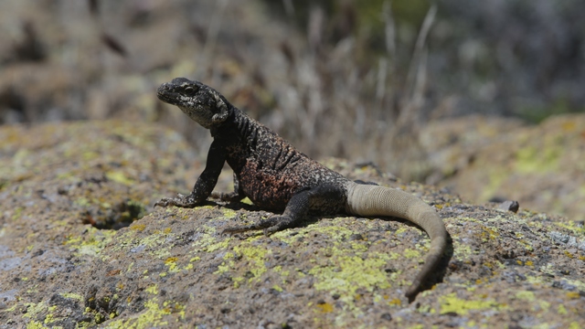
life if good, just sunning on a rock
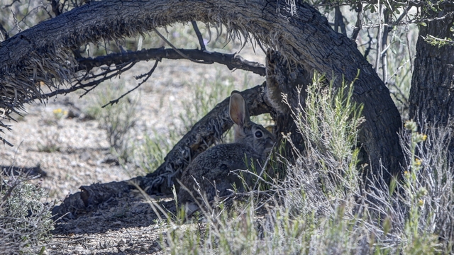
The jackrabbits are really fast. We saw a least 50 of them but it was not easy to get a photo.
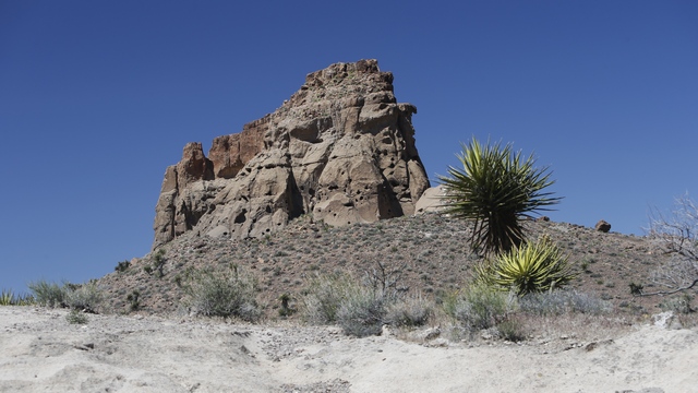
There were some interesting rock formations in the park.
We hiked the Rings Loop Trail along which we saw many flowers. The hike took us thru the Banshee Canyon.
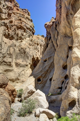
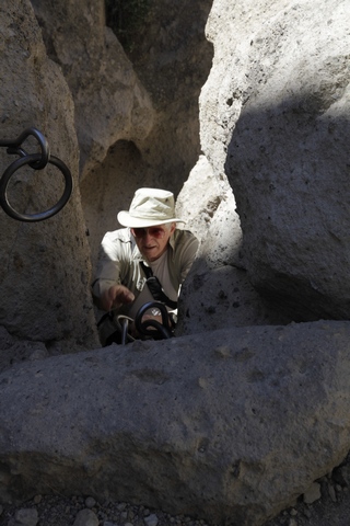
Metal rings mounted in the rocks help you ascend narrow Banshee Canyon. I was wearing my backpack and almost got stuck a couple of times.
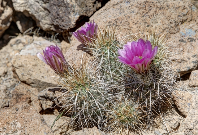
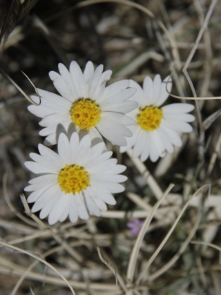
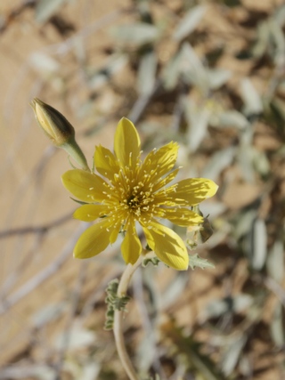
The flowers were beautiful. There were tiny little flowers poking up from the desert floor, bushes bursting with flowers, cacti showing off their brightly coloured blooms. The flowers were a multitude of colours including pink, red, yellow, white, purple, and green. Can you tell I got really excited about the flowers? These are just some of the flowers we saw any that are named are my best guess from comparing them to the brochure we received at the perserve.
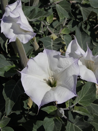
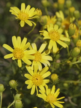
Sacred datura and Threadleaf groundsel.
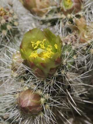
Cholla.
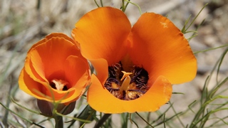
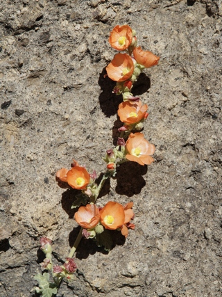
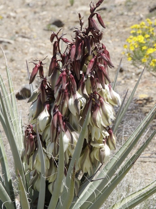
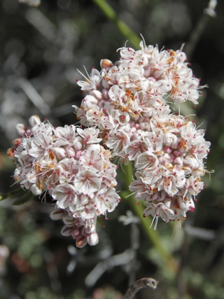
Don't know the first one but the second photo is Mojave Yucca.
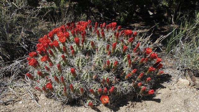
Mojave Mound Cactus.
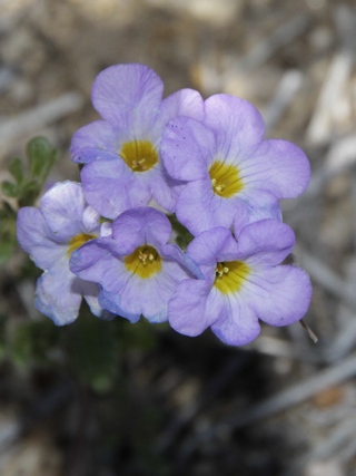
Mohave and Chemehuevi Indians from the Colorado River area created what is now known as the Mojave Road to so they conduct trade with others along the Pacific Coast. There are natural springs about 20 miles or so along the route they chose. When the white man came he also followed this route. Today it is used mostly by four wheelers.
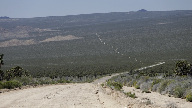
The white line in the photo is the Mojave Road.
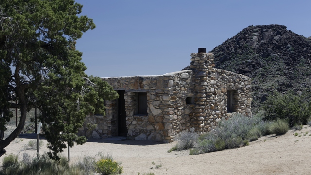
Rock House was built by a soldier when he returned from war after having been gased. The soldier thought we would only live a year or two but lived for 25 years here in the desrt. Rock House is near a well-known watering hole and site of an 1860s military outpost.
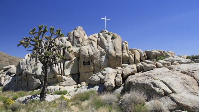
White Cross World War I Memorial.
A sub-species of the Joshua Trees found at Joshua Tree National Park is found in Mojave National Preserve. The trees here are shorter but denser than those found at Joshuar Tree National Park.
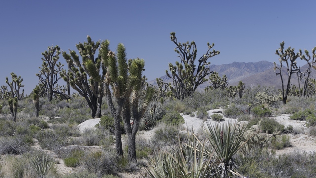
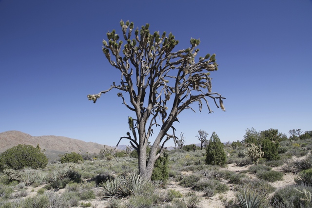
We saw thousands of Joshua Trees as we drove Mojave Road and Cima Road.
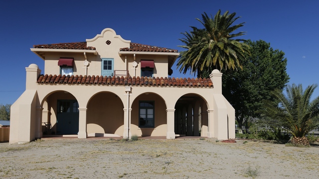
In the early 1900's and around WWII Kelso Depot was a thriving town.
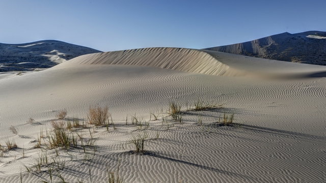
Kelso dunes is the largest field of eolian sand deposits in the Mojave Desert. The dune field covers 45 square miles and includes migrating dunes, vegetation-stabilized dunes, sand sheets and sand ramps. As we were short on time we only hiked to the first dune.
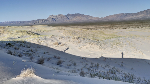
Our shadows.
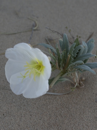
The desert primrose
The desert parks always tell you about the wildlife that is in the park and you rarely see any. Today was an exception as we saw a number of birds, including a hummingbird, lizards, jack rabbits, bugs and

Ok so cows aren't the normally classed as wildlife but these guys were cute. We saw a number of ranches in the park area and drove over a lot of cattle grates.

life if good, just sunning on a rock

The jackrabbits are really fast. We saw a least 50 of them but it was not easy to get a photo.

There were some interesting rock formations in the park.
We hiked the Rings Loop Trail along which we saw many flowers. The hike took us thru the Banshee Canyon.


Metal rings mounted in the rocks help you ascend narrow Banshee Canyon. I was wearing my backpack and almost got stuck a couple of times.
The flowers were beautiful. There were tiny little flowers poking up from the desert floor, bushes bursting with flowers, cacti showing off their brightly coloured blooms. The flowers were a multitude of colours including pink, red, yellow, white, purple, and green. Can you tell I got really excited about the flowers? These are just some of the flowers we saw any that are named are my best guess from comparing them to the brochure we received at the perserve.


Sacred datura and Threadleaf groundsel.


Cholla.


Don't know the first one but the second photo is Mojave Yucca.

Mojave Mound Cactus.


Mohave and Chemehuevi Indians from the Colorado River area created what is now known as the Mojave Road to so they conduct trade with others along the Pacific Coast. There are natural springs about 20 miles or so along the route they chose. When the white man came he also followed this route. Today it is used mostly by four wheelers.

The white line in the photo is the Mojave Road.

Rock House was built by a soldier when he returned from war after having been gased. The soldier thought we would only live a year or two but lived for 25 years here in the desrt. Rock House is near a well-known watering hole and site of an 1860s military outpost.

White Cross World War I Memorial.
A sub-species of the Joshua Trees found at Joshua Tree National Park is found in Mojave National Preserve. The trees here are shorter but denser than those found at Joshuar Tree National Park.


We saw thousands of Joshua Trees as we drove Mojave Road and Cima Road.

In the early 1900's and around WWII Kelso Depot was a thriving town.

Kelso dunes is the largest field of eolian sand deposits in the Mojave Desert. The dune field covers 45 square miles and includes migrating dunes, vegetation-stabilized dunes, sand sheets and sand ramps. As we were short on time we only hiked to the first dune.

Our shadows.


The desert primrose
2016/04/16: Back to driving west again.
Category: General
Posted by: The Agnew Family
After finding several geocaches in Winslow and taking a couple of photos of Ed standing in the corner ---- not in the rain we started our drive west.
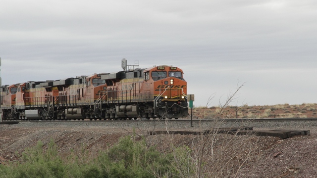
A train coming into Winslow.
We picked up Route 66 just outside of Flagstaff and followed it thru a “downtown” area where we stopped and walked around.
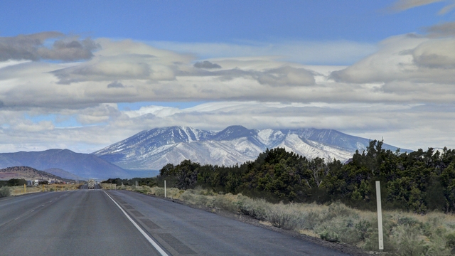
Yup, that's snow you see on the mountain. As we got closer to Flagstaff there was the remains of fresh snow on the ground (it was 7C so the snow was melting).
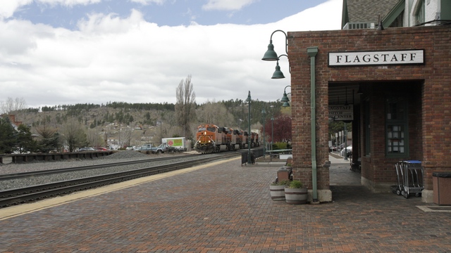
The Flagstaff train station is half AMTRACK train staff and half Visitor Center.
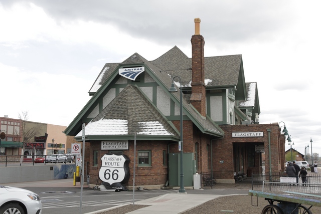
Another view of the train station --- notice the snow on the roof.
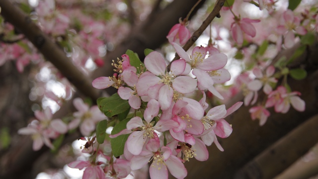
Even though there were signs of winter, there were also signs of spring.
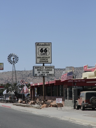
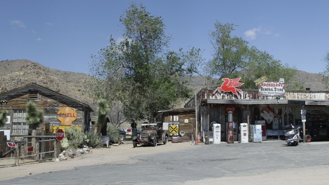
As we drove along Route 66 it turned into I40. After about 50 miles on I40, Route 66 separated from the interstate, so we followed it once again.
Remember the old Burma Shave ads?
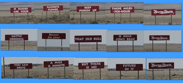
Here's three that we saw.
Do you remember Snoopy from the Peanuts cartoon strip? How about his brother Spike?
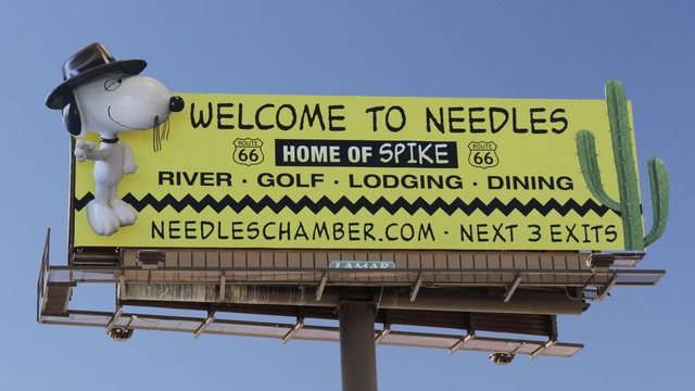
We have arrived, we crossed the Arizona / California border and drove into Needles.
We drove around Needles looking for a grocery store (turns out they don't have one just a 99 cent store that has very basic groceries), finding a few geocaches and finding the resort area.
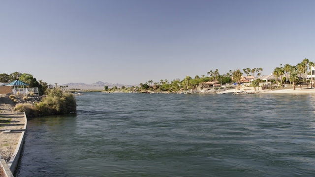
I was a little surprised to see the water but Ed reminded me that even though we are in or at least very near to the Mojave desert, Needles does border the Colorado River.

A train coming into Winslow.
We picked up Route 66 just outside of Flagstaff and followed it thru a “downtown” area where we stopped and walked around.

Yup, that's snow you see on the mountain. As we got closer to Flagstaff there was the remains of fresh snow on the ground (it was 7C so the snow was melting).

The Flagstaff train station is half AMTRACK train staff and half Visitor Center.

Another view of the train station --- notice the snow on the roof.

Even though there were signs of winter, there were also signs of spring.
As we drove along Route 66 it turned into I40. After about 50 miles on I40, Route 66 separated from the interstate, so we followed it once again.


Remember the old Burma Shave ads?

Here's three that we saw.
Do you remember Snoopy from the Peanuts cartoon strip? How about his brother Spike?

We have arrived, we crossed the Arizona / California border and drove into Needles.
We drove around Needles looking for a grocery store (turns out they don't have one just a 99 cent store that has very basic groceries), finding a few geocaches and finding the resort area.

I was a little surprised to see the water but Ed reminded me that even though we are in or at least very near to the Mojave desert, Needles does border the Colorado River.
2016/04/15: Driving East?
Category: General
Posted by: The Agnew Family
This morning we left Monument Valley. The sky was grey and threatened of rain ... and it did rain a little as we drove south to Kayenta and Tuba City.
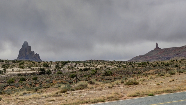
At Tuba City we turned and started to drive east .... yup east. Ed wanted to stop in Holbrook, Arizona and stand on the corner in Winslow, Arizona so we needed to back track (I couldn't figure out a way to see what we wanted to see without backtracking, but at least we found a scenic route and some sun.)
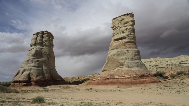
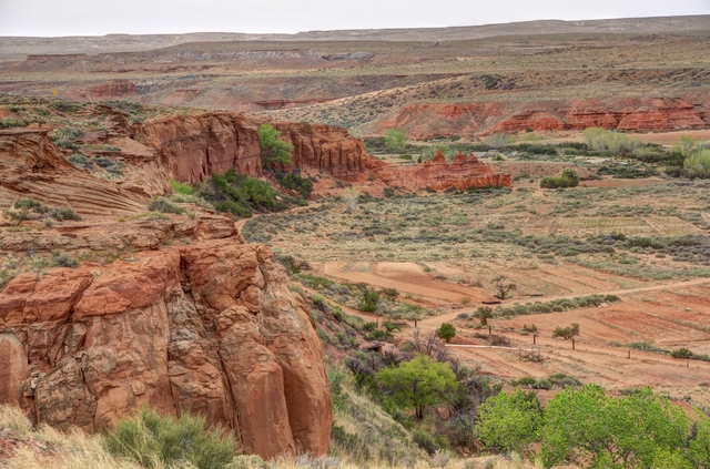
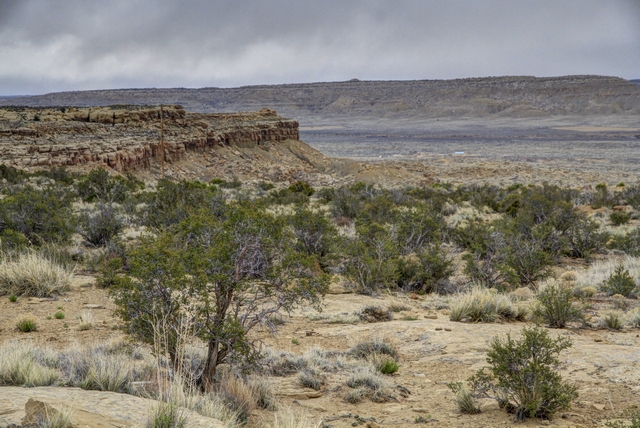
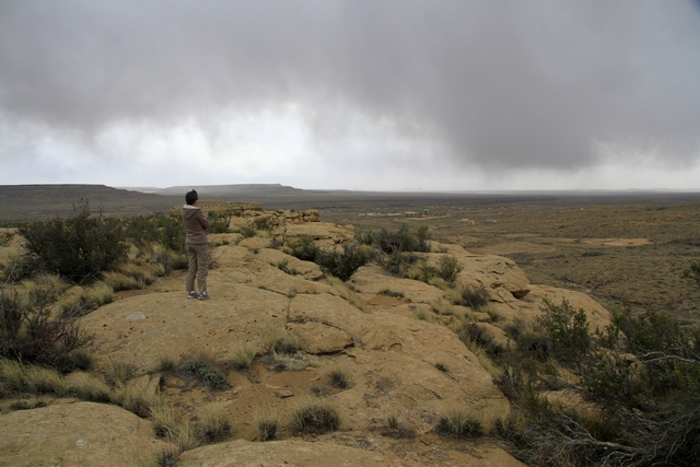
The drive took us thru more of the Navajo reservation and the Hopi reservation, which is surrounded by the Navajo reservation. We drove thru a few small towns in both reservations, a number of schools and what looked like a subdivision --- the buildings were clustered together and identical.
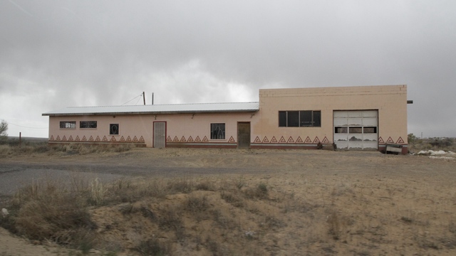
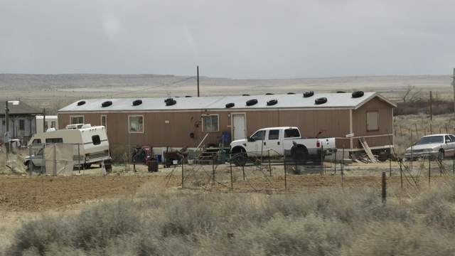
A number of mobile homes had old tires on the roofs --- think the winds can get strong out here.
More scenery photos.
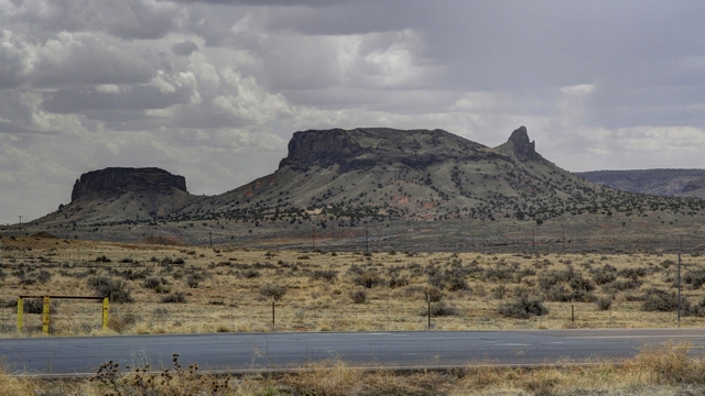
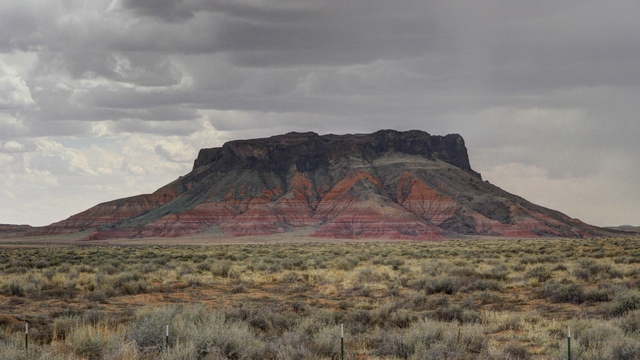
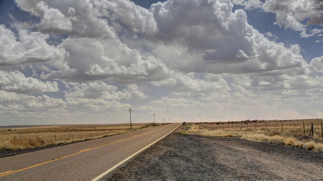
at times the landscape was dead flat.
In 2010 Ed and I visited the Petrified Forest (every time Ed and I drive thru New Mexico we stop and see a few things) and Ed has always regretted not buying a piece of petrified wood.
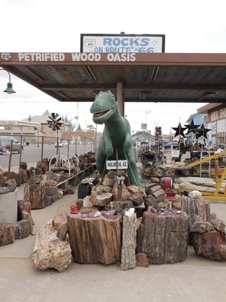
Ed now owns a piece of petrified wood.
La Posada Hotel built in 1930 was the last and most elegant of the great Fred Harvey Hotels built by the Santa Fe Railroad. It was designed by Mary Colter famous for her buildings at the Grand Canyon, but her favourite was La Posada Hotel.
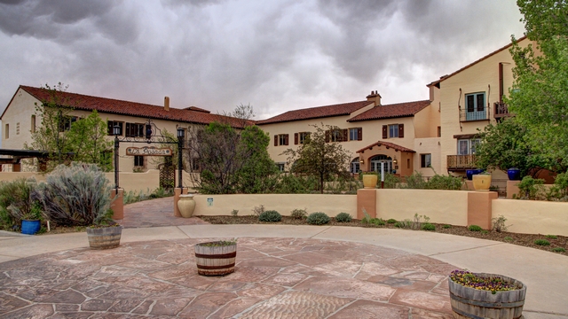
We didn't stay here but did walk around the amazing museum like common rooms.
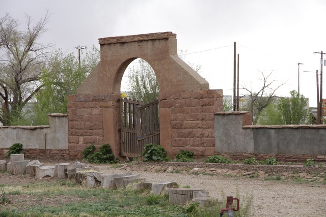
A gate in the gardens.
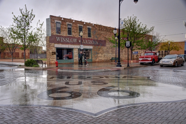
It was raining but Ed did it, he stood on the corner in Winslow, Arizona. Part of the lyrics of the Eagles song Take it Easy

At Tuba City we turned and started to drive east .... yup east. Ed wanted to stop in Holbrook, Arizona and stand on the corner in Winslow, Arizona so we needed to back track (I couldn't figure out a way to see what we wanted to see without backtracking, but at least we found a scenic route and some sun.)


The drive took us thru more of the Navajo reservation and the Hopi reservation, which is surrounded by the Navajo reservation. We drove thru a few small towns in both reservations, a number of schools and what looked like a subdivision --- the buildings were clustered together and identical.


A number of mobile homes had old tires on the roofs --- think the winds can get strong out here.
More scenery photos.


at times the landscape was dead flat.
In 2010 Ed and I visited the Petrified Forest (every time Ed and I drive thru New Mexico we stop and see a few things) and Ed has always regretted not buying a piece of petrified wood.

Ed now owns a piece of petrified wood.
La Posada Hotel built in 1930 was the last and most elegant of the great Fred Harvey Hotels built by the Santa Fe Railroad. It was designed by Mary Colter famous for her buildings at the Grand Canyon, but her favourite was La Posada Hotel.

We didn't stay here but did walk around the amazing museum like common rooms.

A gate in the gardens.

It was raining but Ed did it, he stood on the corner in Winslow, Arizona. Part of the lyrics of the Eagles song Take it Easy
2016/04/15: Monument Valley
Category: General
Posted by: The Agnew Family
Stolen from the Internet "Monument Valley, a red-sand desert region on the Arizona-Utah border, is known for the towering sandstone buttes of Monument Valley Navajo Tribal Park. The park, frequently a filming location for Western movies, is accessed by the looping, 17-mile Valley Drive."
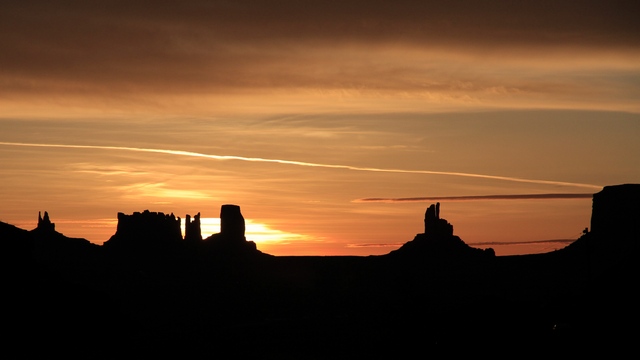
Sunrise from our campsite. Camping in a tent is very different from RVing. I have to admit that I'm enjoying it but knowing it's only for a couple of days at time helps.
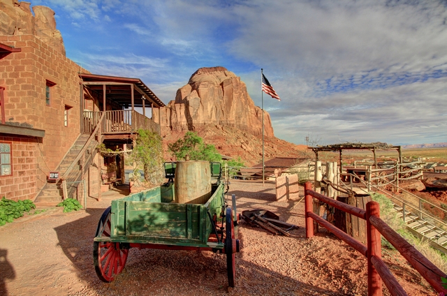
This area likes to promote that it was the filming location for a number of John Wayne movies.
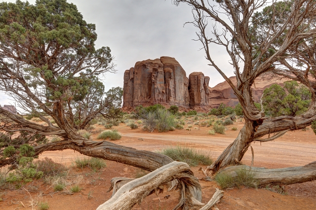
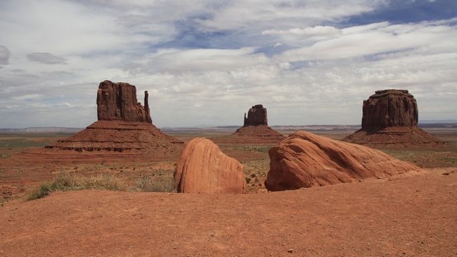
The Mesas, buttes and spires are beautiful. I'm only posting a few of the amazing photos Ed took.
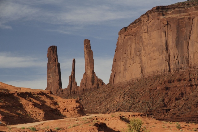
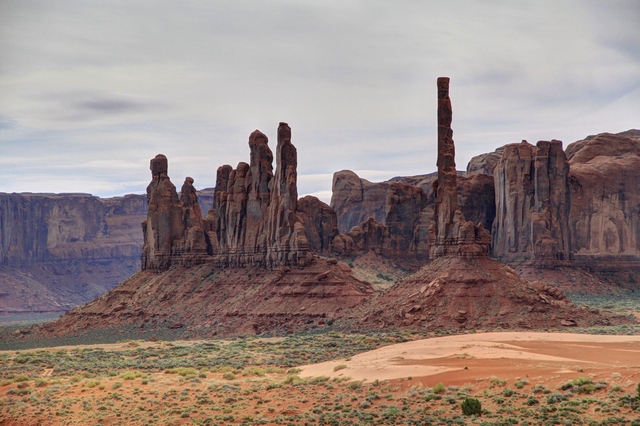
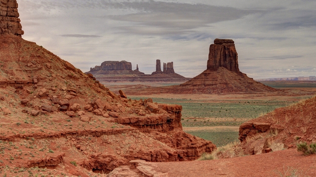
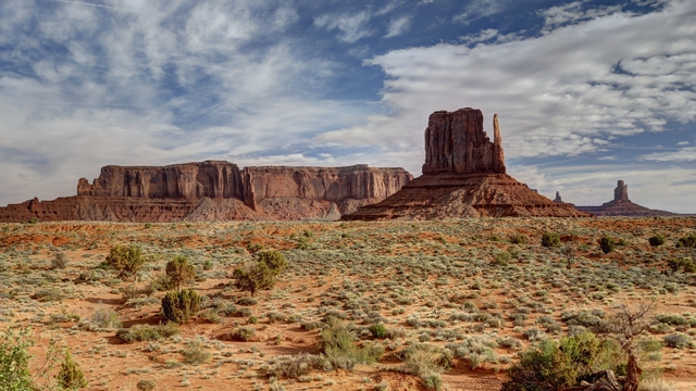
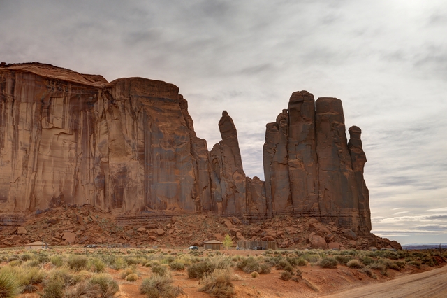
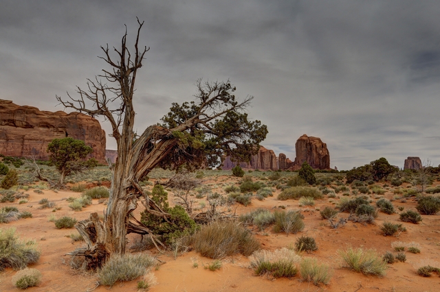
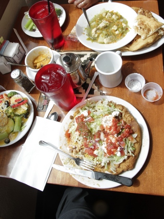
We stopped for lunch at the View Restaurant, part of the Navajo hotel The View. We had a Navajo taco on fry bread, Navajo green chili stew with fry bread and Navajo tea. They were very good.
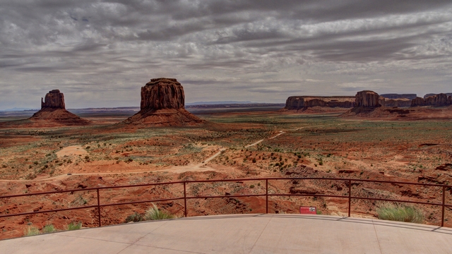
The view from our table at lunch.
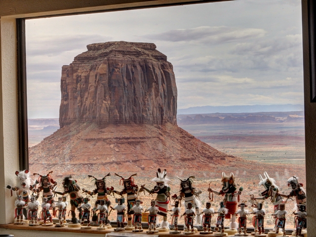
An art shot. The dolls are on a window ledge and the butte of course is outside.
Leaving Monument Valley we drove north east to enjoy the scenery.
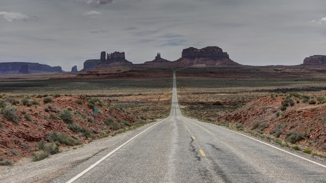
Not sure why, but taking a photo from the middle of road was a popular thing to do.
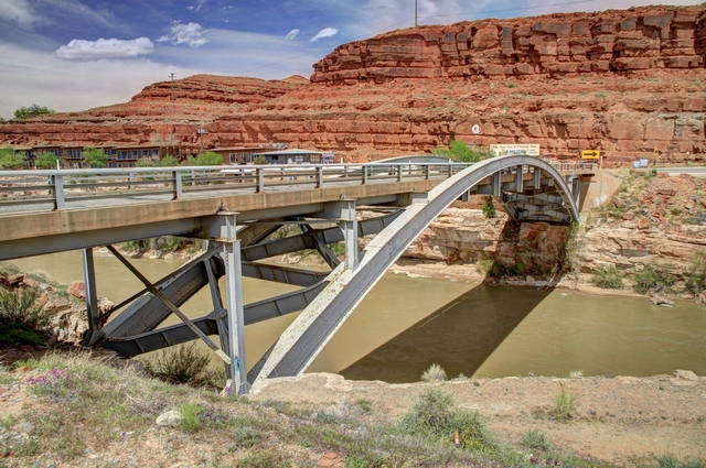
Bridge over the San Juan River.
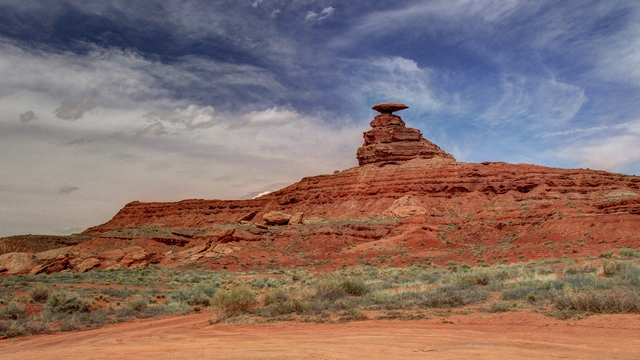
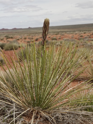
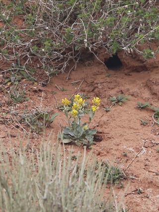
Desert flowers.
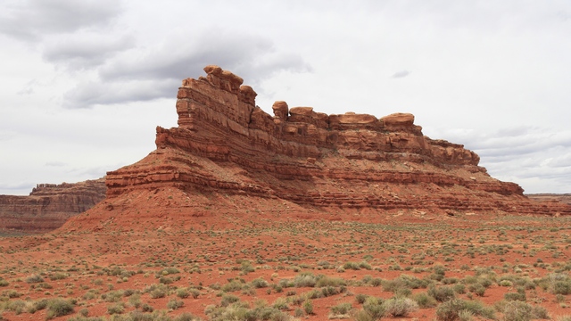
Valley of the Gods is on BLM land. There was a 25 km drive through this area.
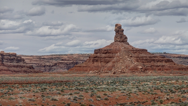
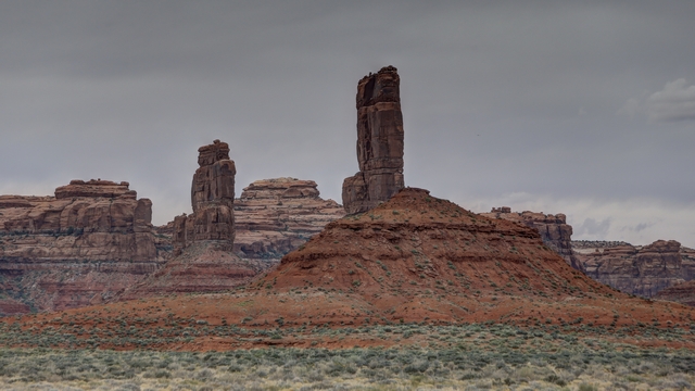

Sunrise from our campsite. Camping in a tent is very different from RVing. I have to admit that I'm enjoying it but knowing it's only for a couple of days at time helps.

This area likes to promote that it was the filming location for a number of John Wayne movies.
The Mesas, buttes and spires are beautiful. I'm only posting a few of the amazing photos Ed took.


We stopped for lunch at the View Restaurant, part of the Navajo hotel The View. We had a Navajo taco on fry bread, Navajo green chili stew with fry bread and Navajo tea. They were very good.

The view from our table at lunch.

An art shot. The dolls are on a window ledge and the butte of course is outside.
Leaving Monument Valley we drove north east to enjoy the scenery.

Not sure why, but taking a photo from the middle of road was a popular thing to do.


Bridge over the San Juan River.


Desert flowers.

Valley of the Gods is on BLM land. There was a 25 km drive through this area.


2016/04/14: Driving Thru New Mexico
Category: General
Posted by: The Agnew Family
We awoke to a clear bright blue sky .... should be a good day weather wise. After picking up fuel we were on our way west. New Mexico is one of Ed and my favourite states. We just love the wide open spaces, the incredible scenery and the wide variety of places to see and things to do.
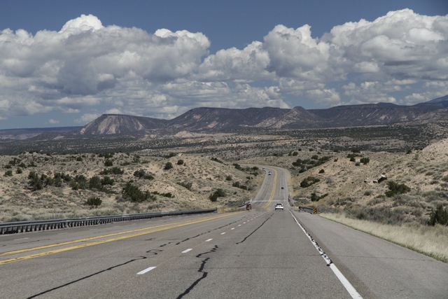
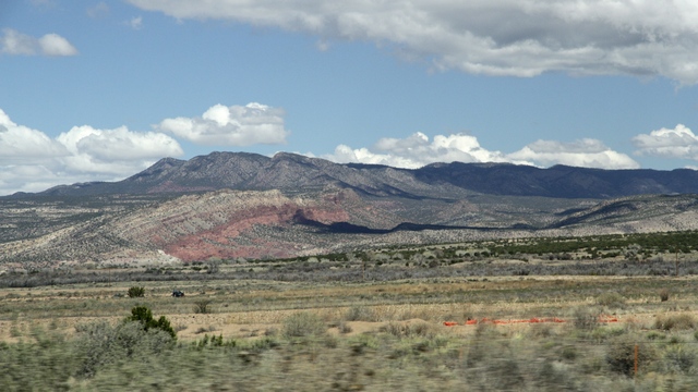
Before we left home we decided to make a slight detour on our way to California and stop at Monument Valley. It's a place that we've wanted to see and just never able to fit it into any of our previous trips thru New Mexico. At Albuquerque we drove north causing our route to go thru Farmington, Ship Rock and Four Corners. In preparation for our visit to Monument Valley Ed and I have been listening to several of Tony Hillerman's books about Joe Leaphorn a Navajo police officer who patrols the Navajo Reservation including the Monument Valley area. It was interesting looking at the country that was so well described by Hillerman.
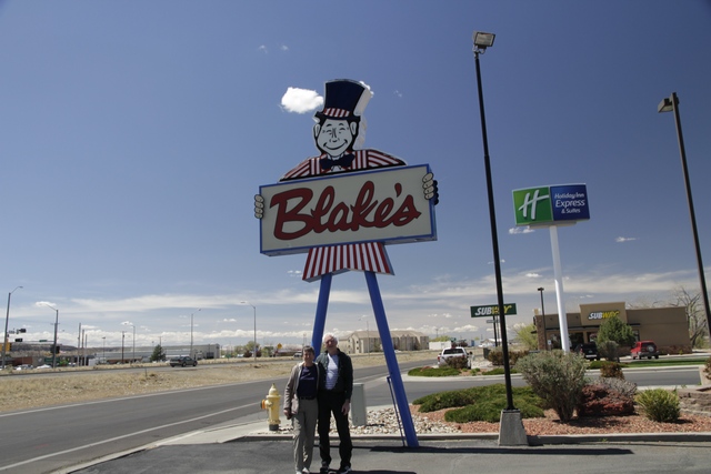
In one of the books, Hillerman mentions one of the characters grabbing a burger at a Lotaburger in Farmington, so we did as well. Pretty good burger.
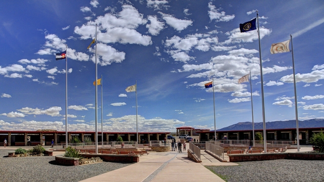
There is only one place in the United States where four states meet. This is called Four Corners. Here Utah, Colorado, New Mexico and Arizona meet.
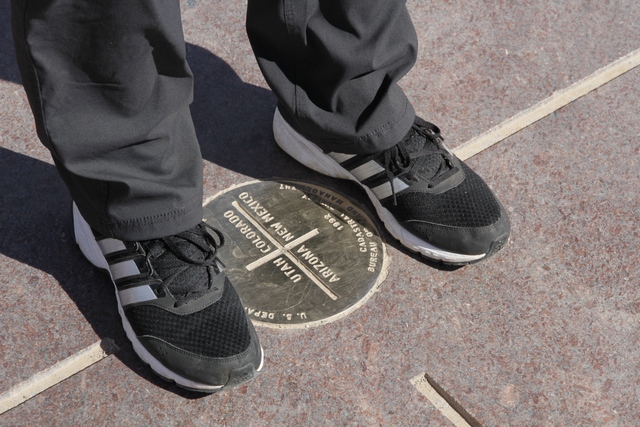
Ed proving he can be in four states at the same time. Now it would be more impressive if he could be a solid, a liquid, a gas and a plasma at the same time.
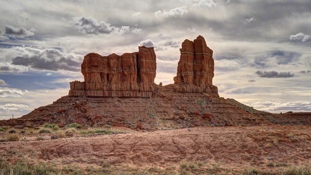
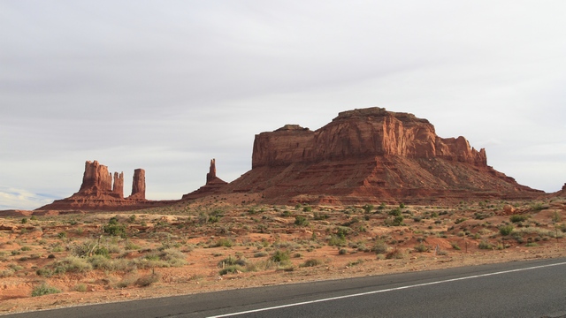
As we continue towards Monument Valley we start to see large rock formations.
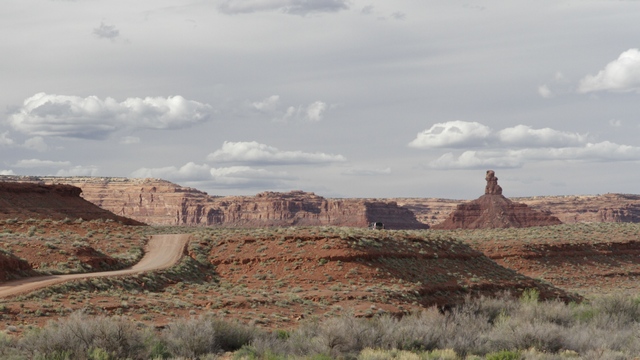
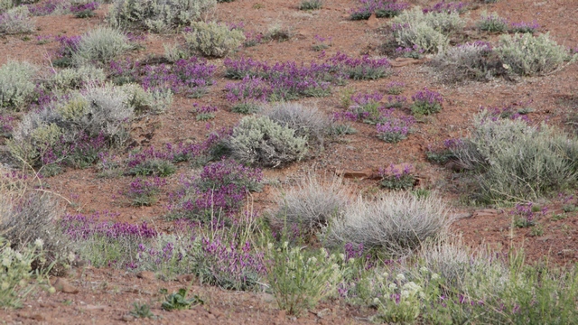
This area must have had some rain as the plants are turning green and there are wild flowers.
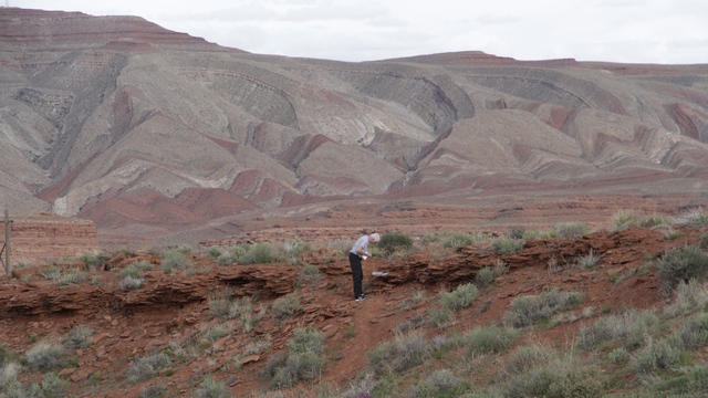
Ed getting his second geocache in Utah, another state he can check off.
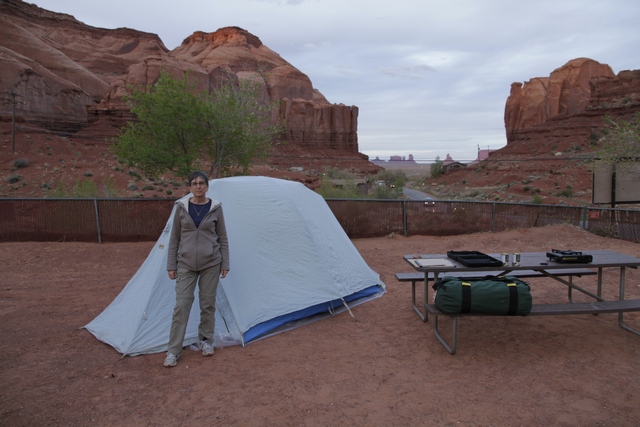
We are camped at Gouldings Resort about 5 miles from Monument Valley.
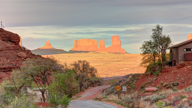
The view from our campsite.


Before we left home we decided to make a slight detour on our way to California and stop at Monument Valley. It's a place that we've wanted to see and just never able to fit it into any of our previous trips thru New Mexico. At Albuquerque we drove north causing our route to go thru Farmington, Ship Rock and Four Corners. In preparation for our visit to Monument Valley Ed and I have been listening to several of Tony Hillerman's books about Joe Leaphorn a Navajo police officer who patrols the Navajo Reservation including the Monument Valley area. It was interesting looking at the country that was so well described by Hillerman.

In one of the books, Hillerman mentions one of the characters grabbing a burger at a Lotaburger in Farmington, so we did as well. Pretty good burger.

There is only one place in the United States where four states meet. This is called Four Corners. Here Utah, Colorado, New Mexico and Arizona meet.

Ed proving he can be in four states at the same time. Now it would be more impressive if he could be a solid, a liquid, a gas and a plasma at the same time.

As we continue towards Monument Valley we start to see large rock formations.


This area must have had some rain as the plants are turning green and there are wild flowers.

Ed getting his second geocache in Utah, another state he can check off.


We are camped at Gouldings Resort about 5 miles from Monument Valley.

The view from our campsite.
2016/04/13: Tucumcari New Mexico
Category: General
Posted by: The Agnew Family
Still no spell checking.
This morning we said good-bye to Bob and Jean and continued westward.
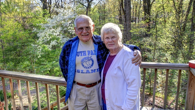
Our route took us a little further south into Arkansas than west to Tulsa, Oklahoma and south to Oklahoma City, Oklahoma. This route took us on several toll roads. The owners of the ETR in Toronto could learn a thing or two from the Oklahoma road department. If you had a “pass” you just drove down the road, if you didn't have a pass you pulled into the right lane and stopped at a toll booth to pay your toll --- no bill in the mail with a huge administration fee.
When we reached Oklahoma City we got on Interstate 40 to continue driving west. As Ed hasn't found any geocaches in Oklahoma we had a mission of finding two geocaches. When we stopped for lunch we found the first cache. We continued west and got onto Route 66 to look for a second cache. It took stops at a couple of caches before he successfully found a second cache.
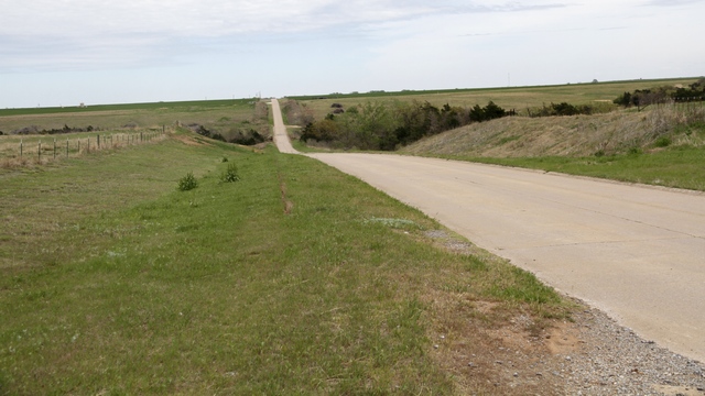
A stretch of Route 66 we drove on.
As we drove west through Oklahoma and Texas these were a common site
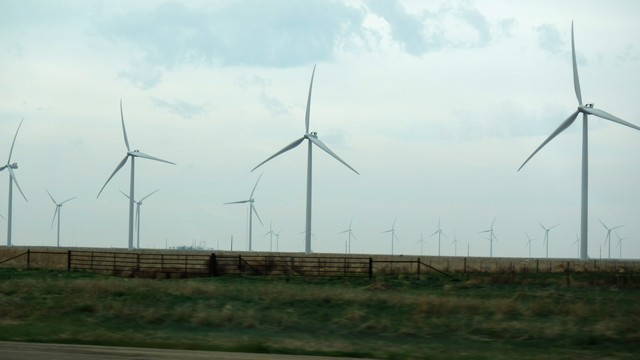
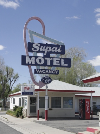
We stopped for the night in a small town in New Mexico called Tucumcari on Route 66. Unfortunately, a number of the businesses have closed but there's still enough of them open for you to get a few of what Route 66 was like in the 50s.
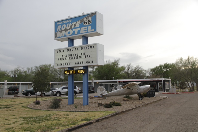
The motel we stayed at.
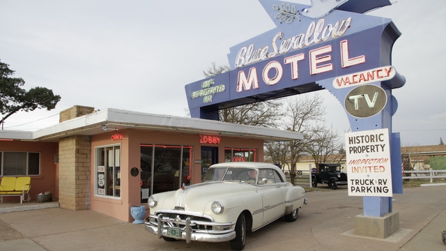
The fancy motel.
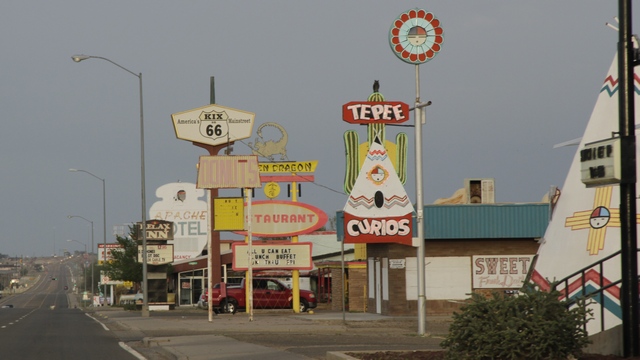
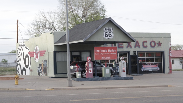
This morning we said good-bye to Bob and Jean and continued westward.

Our route took us a little further south into Arkansas than west to Tulsa, Oklahoma and south to Oklahoma City, Oklahoma. This route took us on several toll roads. The owners of the ETR in Toronto could learn a thing or two from the Oklahoma road department. If you had a “pass” you just drove down the road, if you didn't have a pass you pulled into the right lane and stopped at a toll booth to pay your toll --- no bill in the mail with a huge administration fee.
When we reached Oklahoma City we got on Interstate 40 to continue driving west. As Ed hasn't found any geocaches in Oklahoma we had a mission of finding two geocaches. When we stopped for lunch we found the first cache. We continued west and got onto Route 66 to look for a second cache. It took stops at a couple of caches before he successfully found a second cache.

A stretch of Route 66 we drove on.
As we drove west through Oklahoma and Texas these were a common site

We stopped for the night in a small town in New Mexico called Tucumcari on Route 66. Unfortunately, a number of the businesses have closed but there's still enough of them open for you to get a few of what Route 66 was like in the 50s.

The motel we stayed at.

The fancy motel.


2016/04/11: Bella Vista
Category: General
Posted by: The Agnew Family
I'm not using my regular computer so I don't know why but spell check isn't working, so please excuse my bad typing and terrible spelling.
We spent today with Bob and Jean.
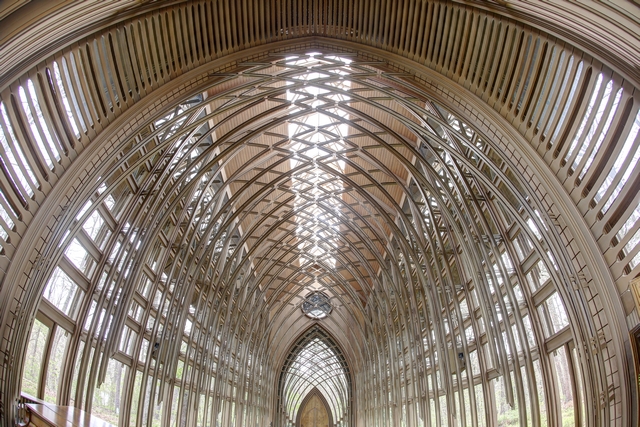
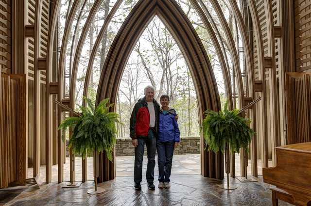
First stop was the Mildred B. Cooper Memorial Chapel. We've been here before but it's always worth a visit.
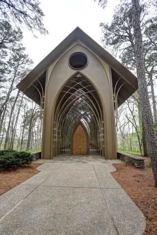
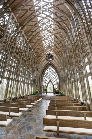
The chapel was designed by E. Fay Jones. The design recalls the prarie school of architecture popularized by Frank Lloyd Wright with whom Jones had apprenticed.
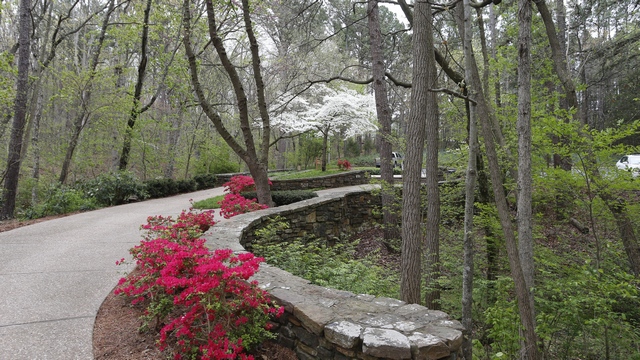
Azeleas and a dogwood.
There are a number of small lakes in Bella Vista. One of them is Lake Ann. This is the waterfall coming out of Lake Ann.
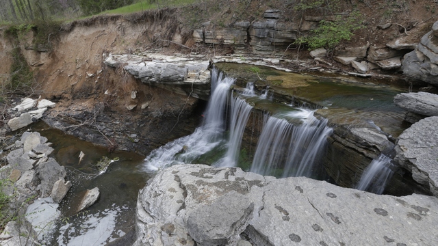
There hasn't been a lot of rain so there isn't a lot of water coming down the falls. Jean showed us photos from last spring where the water covered all the rocks.
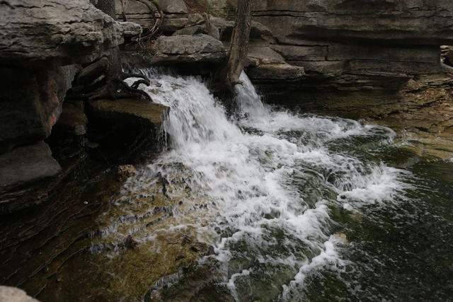
We drove over to Crystal Bridges Museum in Bentonville to walk the Dogwood Trail. Unfortunately, the trail was closed for renovations so we walked the Tulip Trail. We saw some Red Buds, Dogwoods and
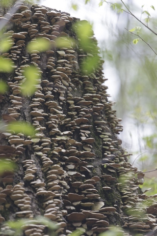
fungus on dead trees
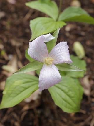
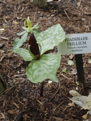
and trilliums. We're going to be away when the trilliums bloom at home so I'm happy we were able to see some here.
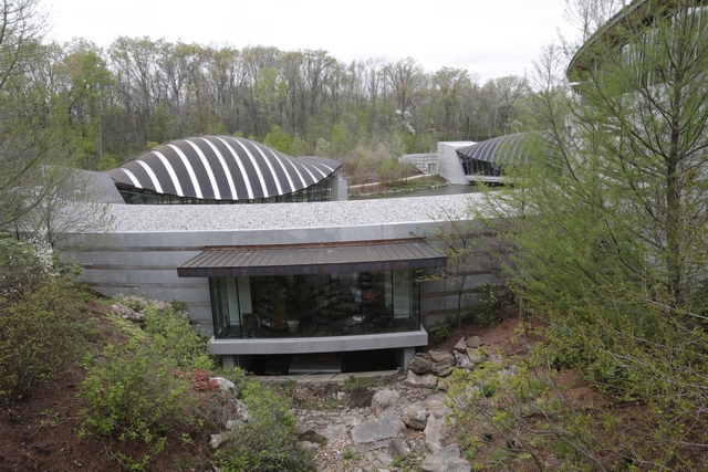
The museum building at Crystal Bridges.
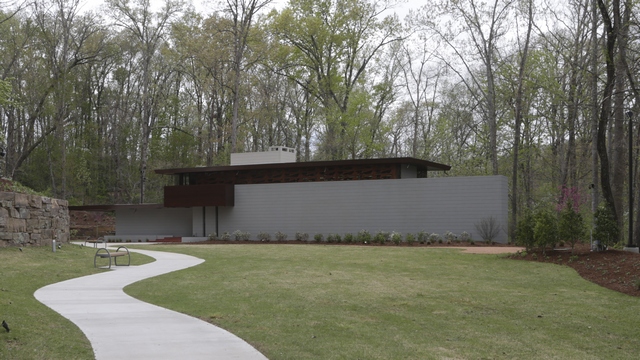
New at Crystal Bridges is this house designed by Frank Lloyd Wright. The house was built along the Millstone River in New Jersey. The structure was threatened by repeated flooding so the owners decided to look for an institution that would buy and move the house. Crystal Bridges acquired the house in 2013. The entire structure was then taken apart and each component was labeled, packed, and loaded into two trucks. At the museum the house was reconstructed. We didn't have time to tour the house today so we'll have to stop on another trip.
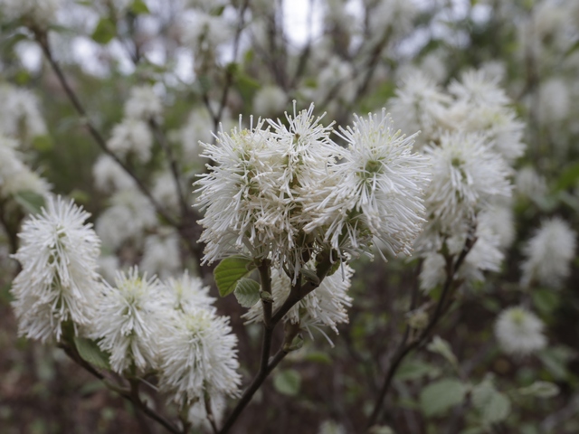
Another pretty flowering shrub (I think it's a bottle brush).
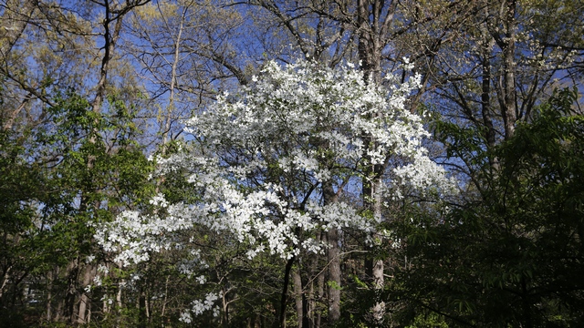
The sun came out when we got back to Bob and Jean's house so Ed got to take a photo of a dogwood tree in the sun.
We spent today with Bob and Jean.
First stop was the Mildred B. Cooper Memorial Chapel. We've been here before but it's always worth a visit.


The chapel was designed by E. Fay Jones. The design recalls the prarie school of architecture popularized by Frank Lloyd Wright with whom Jones had apprenticed.


Azeleas and a dogwood.
There are a number of small lakes in Bella Vista. One of them is Lake Ann. This is the waterfall coming out of Lake Ann.

There hasn't been a lot of rain so there isn't a lot of water coming down the falls. Jean showed us photos from last spring where the water covered all the rocks.

We drove over to Crystal Bridges Museum in Bentonville to walk the Dogwood Trail. Unfortunately, the trail was closed for renovations so we walked the Tulip Trail. We saw some Red Buds, Dogwoods and

fungus on dead trees


and trilliums. We're going to be away when the trilliums bloom at home so I'm happy we were able to see some here.

The museum building at Crystal Bridges.

New at Crystal Bridges is this house designed by Frank Lloyd Wright. The house was built along the Millstone River in New Jersey. The structure was threatened by repeated flooding so the owners decided to look for an institution that would buy and move the house. Crystal Bridges acquired the house in 2013. The entire structure was then taken apart and each component was labeled, packed, and loaded into two trucks. At the museum the house was reconstructed. We didn't have time to tour the house today so we'll have to stop on another trip.

Another pretty flowering shrub (I think it's a bottle brush).

The sun came out when we got back to Bob and Jean's house so Ed got to take a photo of a dogwood tree in the sun.
2016/04/10: No Snow Today
Category: General
Posted by: The Agnew Family
Happily we didn't drive thru any snow today but we did get a few sporadic rain storms and of course they were on my driving shift.
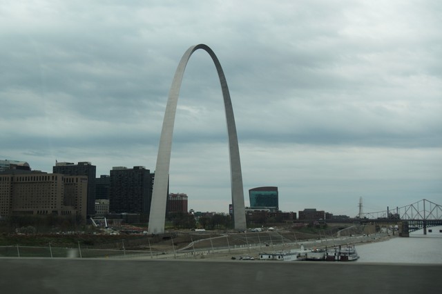
I think Ed is enjoying being a passenger. He managed to get a pretty good picture of the Arch in St. Louis as we drove by on the highway.
Finding 2 geocaches in Missouri was on our list of things to do today. We stopped and found one at a Cracker Barrell Restaurant in Springfield and a second one in a phone booth in Pineville. Now Ed could check another state off his list.
About 4 pm we arrived at our friends house in Bella Vista, Arkansas. I think it's been 4 years since we have seen Bob and Jean. It's really good to see them again.
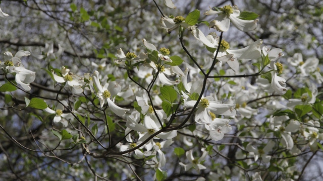
One of the best parts of the drive is finding spring. We've seen Red Buds and Dogwoods in bloom (they're trees) plus leaves on the trees. This Dogwood is in Jean and Bob's backyard.
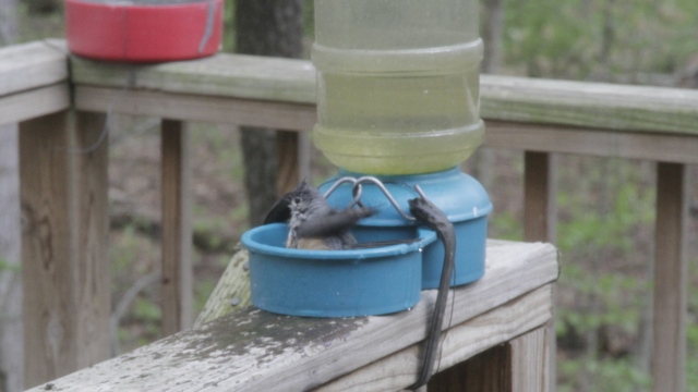
An autofeed dog water bowl makes a good birthbath.

I think Ed is enjoying being a passenger. He managed to get a pretty good picture of the Arch in St. Louis as we drove by on the highway.
Finding 2 geocaches in Missouri was on our list of things to do today. We stopped and found one at a Cracker Barrell Restaurant in Springfield and a second one in a phone booth in Pineville. Now Ed could check another state off his list.
About 4 pm we arrived at our friends house in Bella Vista, Arkansas. I think it's been 4 years since we have seen Bob and Jean. It's really good to see them again.

One of the best parts of the drive is finding spring. We've seen Red Buds and Dogwoods in bloom (they're trees) plus leaves on the trees. This Dogwood is in Jean and Bob's backyard.

An autofeed dog water bowl makes a good birthbath.
2016/04/09: On the Road Again
Category: General
Posted by: The Agnew Family
Ed and I climbed into the Rav this morning and started driving. Our final destination is California, todays destination is Effingham, Illinois. On this trip Ed and I are splitting the driving which meant I was behind the steering wheel for 5 1/2 hours and Ed for about 5 hours.
Happily the border crossing went well --- the lines were only 4 cars deep so it only took about 5 minutes before we were on our way again. The border guard asked us what kind of food we had on board including any lunch. First time we've been asked about our lunch --- but maybe that was because she saw a cooler in the backseat.
The weather was interesting .... it was beautiful when we left home. We encountered snow flurries at the border and off and on till we reached Fort Wayne --- Toledo Ohio looked like they had a few inches of fresh snow. After Fort Wayne the sun came out and the remainder of the drive was in the sun.
After checking into our hotel, Ed insisted on getting a couple of geocaches .... he hadn't found any in Illinois but now he has. Luckily, there were two easy caches within 2 km of the hotel.
2016/04/03: Poor Plants
Category: General
Posted by: The Agnew Family
Snowed again. The good news is the temperature goes above freezing during day so the snow is mostly gone by the end of the day.
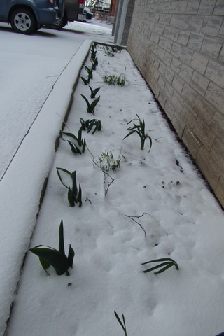
The warm weather in March got the spring bulbs all excited and they started to come up. Now the poor things are fighting the elements.

The warm weather in March got the spring bulbs all excited and they started to come up. Now the poor things are fighting the elements.
2016/04/02: Snow?
Category: General
Posted by: The Agnew Family
We woke up this morning to see snow on the ground. Doesn't mother nature know she spoiled us with a mild March and we don't want any more winter.
We walked down to Lobbies park today to check out the flooding. The water is starting to recede --- we could see the bench seat today.
Maggie stayed overnight with us (yes, Ed was very happy). Here she is enjoying a chewy for desert.
In case your wondering, yes Ed does want another dog. Me, I'm not ready yet.


We walked down to Lobbies park today to check out the flooding. The water is starting to recede --- we could see the bench seat today.

Maggie stayed overnight with us (yes, Ed was very happy). Here she is enjoying a chewy for desert.
In case your wondering, yes Ed does want another dog. Me, I'm not ready yet.
2016/04/01: Maggie Comes to Visit
Category: General
Posted by: The Agnew Family
Zaph had many girl friends over the years and Maggie was one of them. Maggie's parents are in the midst of moving and decided that Maggie would get more attention if she went to "camp" (our house). Guess how Ed felt about this --- if you guessed over the moon happy you'd be correct.

Just like Zaph, Maggie loves to be towelled dry.
Playing with her duck in the backyard.
We took Maggie for a walk around town and found some flooding. This bridge spans a small creek and normall is a few feet above the water.
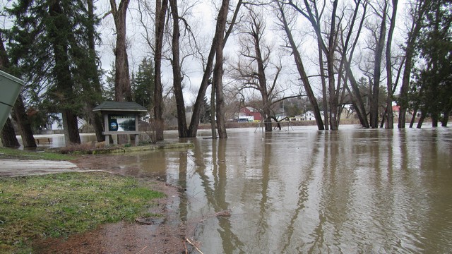
The parking lot (now lake) at Lobbies park.
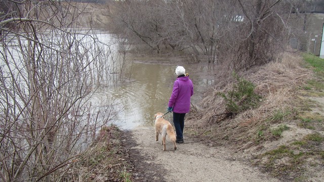
No Maggie you can't go swimming. The river trail disappears into the river.
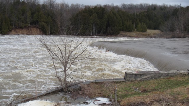
The dam on the river.
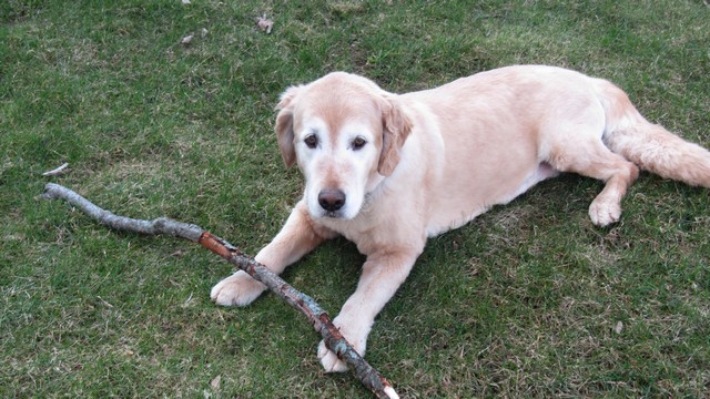


Just like Zaph, Maggie loves to be towelled dry.

Playing with her duck in the backyard.

We took Maggie for a walk around town and found some flooding. This bridge spans a small creek and normall is a few feet above the water.

The parking lot (now lake) at Lobbies park.

No Maggie you can't go swimming. The river trail disappears into the river.

The dam on the river.
