16/09: A Day Without Driving ---- Ed Rejoices
Category: General
Posted by: The Agnew Family
After some careful consideration, Ed and I decided that we were due for a day without driving so we decided to hang out in Kouchibouguac NP today. There are some geocaches hidden in the park and yesterday during our ride we found a number of them. Four were left unfound, so today’s mission was to find the remaining four caches. Since we had decided to not drive today we hopped on our bicycles and headed for the furthest cache. My guesstimate of the distance to the cache was 7.5 km but it was actually 11.3 km. (I guess I’m not a good guesser when it comes to distances or I'm not very good at reading park maps).
The first cache was at the “two bridges” --- a pedestrian bridge goes beneath the road bridge.
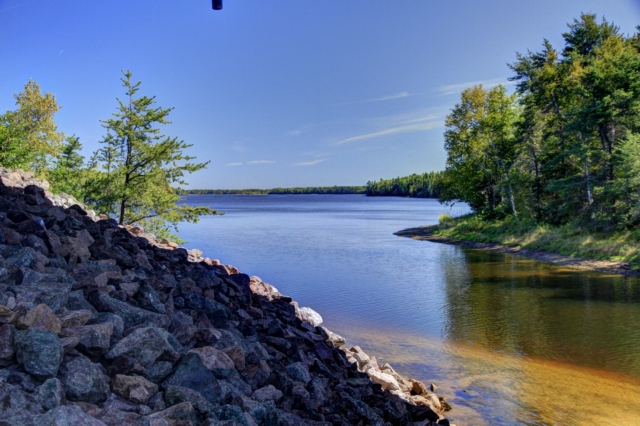
The view from the pedestrian bridge.
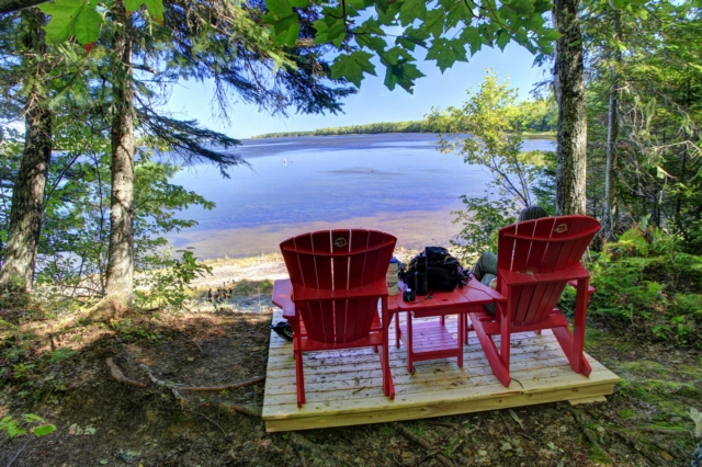
The second cache required some hiking --- a round trip of 3.3 km, but finding the cache (especial since Ed had given up and I found it) and the view made the hike worthwhile. It was a nice spot to enjoy lunch.
While we were riding on the bike trail we noticed a fair bit of bear scat but didn’t think too much about it as moving bike tires on pea gravel is fairly noisy and noise scares animals off. Boy was I surprised and excited when I saw a black bear crossing the path about 50 meters ahead of us --- Ed wasn’t looking ahead during the 2 seconds the bear was on the trail and missed the whole thing.
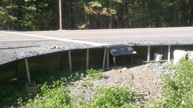
Kouchibouguac NP is making some changes to highway 17 where it passes thru the park in an effort to make conservation gains. One of the changes is to build tunnels under the highway so species such as turtles, salamanders and frogs can cross the highway safely from the water to the woods and back. Fifty centimeter high fences are also being installed to funnel or guide the animals that need to cross the road to the tunnel. The white strip going across the road is the tunnel (it looks like it allows water and light in), the flap is where the tunnel is, on either side of the tunnel are the funnels. It’ll be interesting to check back in a couple of years to see it this project was successful.
The third cache was also a hike to a view, probably a 2 km round trip. The view was nice but nothing special. The fourth and last cache was found down a trail into the bog, another 2 km hike. A viewing tower was built on the edge of the peat bog resulting in a 360 degree view of the forest and the bog.
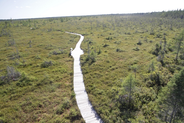
Looking out over the bog from the top of the tower.
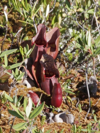
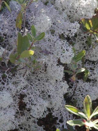
The bog is home to some interesting plants. The pitcher plant eats insects. I think the white plant is a lichen (photos on the internet that look like this plant are referred to as Reindeer Lichen or Reindeer Moss).
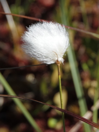
Cotton grass grows in acid bogs around the world. The head feels like fur, at least to me.
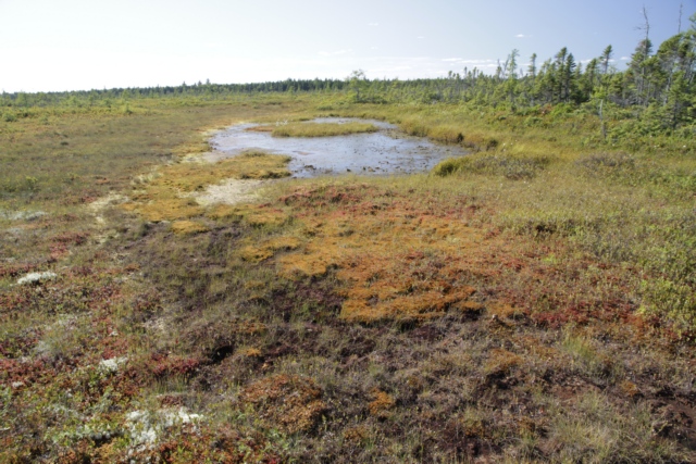
Another view of the bog.
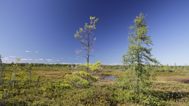
Trees have a difficult time growing in peat bogs. Some of the small trees in this bog are over a 100 years old, older than many of the larger trees in woods at the edge of the bog.
The GPS indicated that we traveled a total distance of 33 km today. We road about 23 km so we hiked the other 10km. Tomorrow we begin our trek home so we’ll get to rest our achy bodies --- don’t know about Ed but my muscles are telling me I hiked and rode wearing a back pack.
The first cache was at the “two bridges” --- a pedestrian bridge goes beneath the road bridge.

The view from the pedestrian bridge.

The second cache required some hiking --- a round trip of 3.3 km, but finding the cache (especial since Ed had given up and I found it) and the view made the hike worthwhile. It was a nice spot to enjoy lunch.
While we were riding on the bike trail we noticed a fair bit of bear scat but didn’t think too much about it as moving bike tires on pea gravel is fairly noisy and noise scares animals off. Boy was I surprised and excited when I saw a black bear crossing the path about 50 meters ahead of us --- Ed wasn’t looking ahead during the 2 seconds the bear was on the trail and missed the whole thing.

Kouchibouguac NP is making some changes to highway 17 where it passes thru the park in an effort to make conservation gains. One of the changes is to build tunnels under the highway so species such as turtles, salamanders and frogs can cross the highway safely from the water to the woods and back. Fifty centimeter high fences are also being installed to funnel or guide the animals that need to cross the road to the tunnel. The white strip going across the road is the tunnel (it looks like it allows water and light in), the flap is where the tunnel is, on either side of the tunnel are the funnels. It’ll be interesting to check back in a couple of years to see it this project was successful.
The third cache was also a hike to a view, probably a 2 km round trip. The view was nice but nothing special. The fourth and last cache was found down a trail into the bog, another 2 km hike. A viewing tower was built on the edge of the peat bog resulting in a 360 degree view of the forest and the bog.

Looking out over the bog from the top of the tower.


The bog is home to some interesting plants. The pitcher plant eats insects. I think the white plant is a lichen (photos on the internet that look like this plant are referred to as Reindeer Lichen or Reindeer Moss).

Cotton grass grows in acid bogs around the world. The head feels like fur, at least to me.

Another view of the bog.

Trees have a difficult time growing in peat bogs. Some of the small trees in this bog are over a 100 years old, older than many of the larger trees in woods at the edge of the bog.
The GPS indicated that we traveled a total distance of 33 km today. We road about 23 km so we hiked the other 10km. Tomorrow we begin our trek home so we’ll get to rest our achy bodies --- don’t know about Ed but my muscles are telling me I hiked and rode wearing a back pack.