06/06: Hovenweep and Canyon of the Ancients National Monument
Category: General
Posted by: The Agnew Family
There aren't a lot of roads in the Canyon of the Ancients NM, but one circular route of roads (about 150km) takes you to 2 sites in the Canyon of the Ancients NM and it also takes you to Hovenweep National Monument. I know this is suppose to be a Colorado trip but Hovenweep is just a few miles into the state of Utah and we have to drive through Utah to complete the loop.
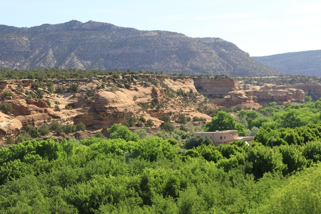
The scenery is a little different on this route compared to what we saw in Mesa Verde. I believe the building in the photo is a B&B, wouldn't that be a beautiful spot to stay.
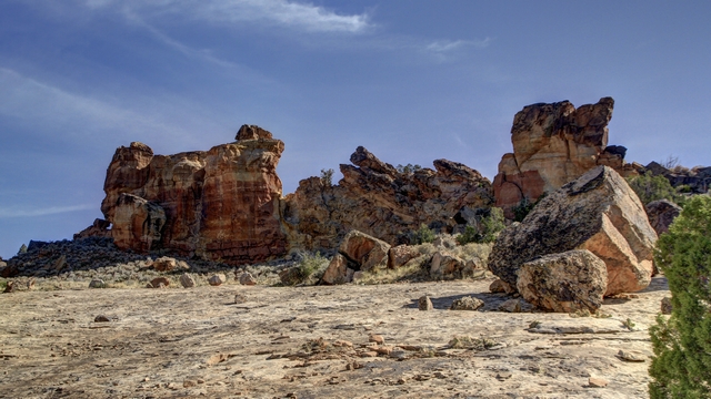
This is the start of the Sand Canyon Trail. It is a 6 mile trail that will take to you the Sand Canyon Pueblo that we visited yesterday.
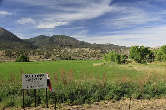
and this is across the road from the rocks. The grape vines were a couple of hundred feet up the road. This area is a lot greener than Mesa Verde because it has water and the fields are irrigated.
Hovenweep became a National Monument in 1923 and is administered by the National Park Service. Human habitation at Hovenweep dates to over 10,000 years ago when nomadic Paleoindians visited the Cajon Mesa to gather food and hunt game. By about 900 CE, people started to settle at Hovenweep year-round, planting and harvesting crops in the rich soil of the mesa top. By the late 1200s, the Hovenweep area was home to over 2,500 people.
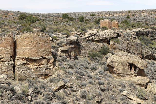
On the left side are the twin towers, on the lower right is the eroded boulder house and above that is rim rock house.
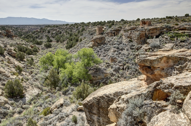
I found the vegetation here to be interesting, especially this bright green tree. I'm guessing the tree is by a spring.
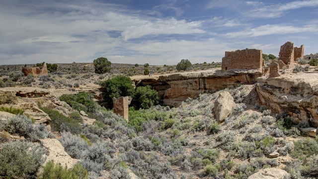
Starting at the left we have Hovenweep house, Square Tower (partway down the gulley) and Hovenweep Castle.
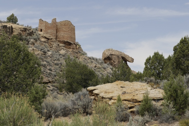
The trail took us down into the gully where we have a different view of the twin towers and eroded boulder house.
Leaving Hovenweep we drive back into Colorado and head for Painted Hand Pueblo. The directions indicated that we needed to turn on road 4531. We thought it was strange that there wasn't a sign but we turned anyway.
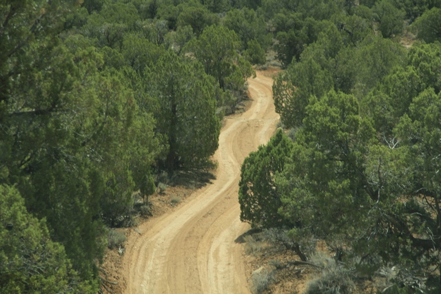
We put the truck into 4 wheel drive and continued down the road. When we came to a 40 foot high rock hill, common sense kicked in and we turned around. Turned out 4531 was a loop road and we should have waited to the 2nd turn off where there was a sign for the Painted Hand Pueblo. This part of the road was much better.
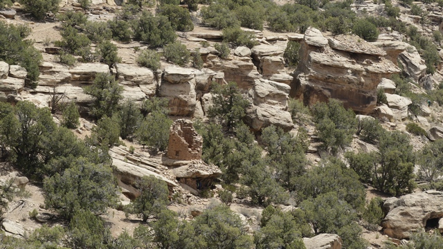
The tower at Painted Hand Pueblo from a distance. It was an interesting hike down to the tower.
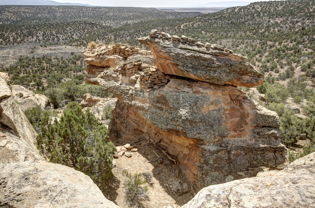
A pretty rock and view.
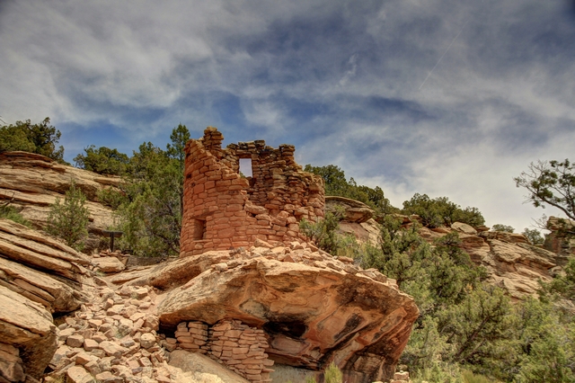
Made it to the tower. In the cliff area under the tower you can see a couple of faint hand prints thus the name Painted Hand Pueblo.
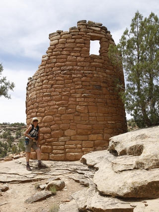
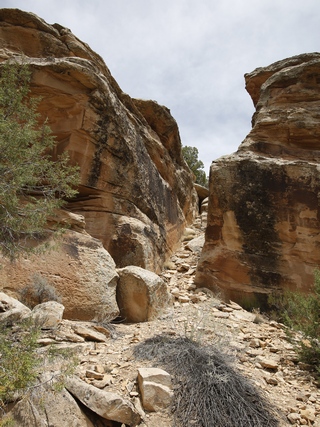
I stood beside the tower for height perspective. Part of the trail.
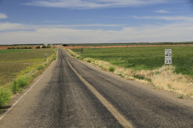
The landscape changed dramatically as we drove north and east to Lowry Pueblo. The road was mostly out of the national monument with active farms.
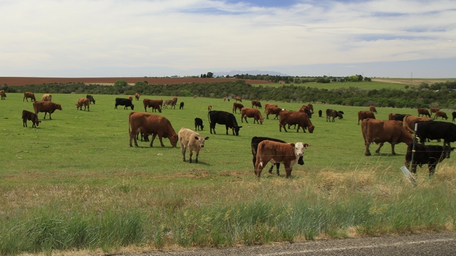
We saw a number of horses and these cattle. This road is also near water so most of the fields were being irrigated.
The last Puebloan ruin we visited was Lowry Pueblo.
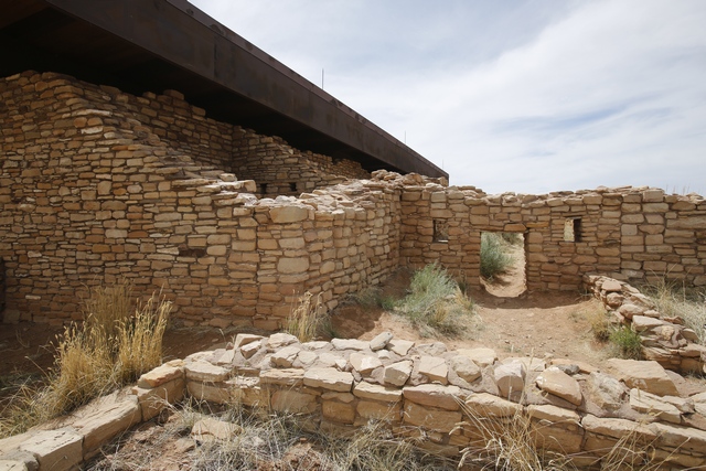
This pueblo had been stabilized allowing the public to walk around it, even into some of the rooms. The doorways are pretty small so some crawling was required.
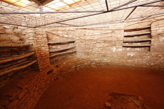
You were allowed inside to look at a small kiva.
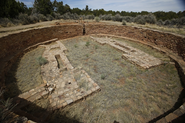
A great kiva, probably used for religious ceremonies.
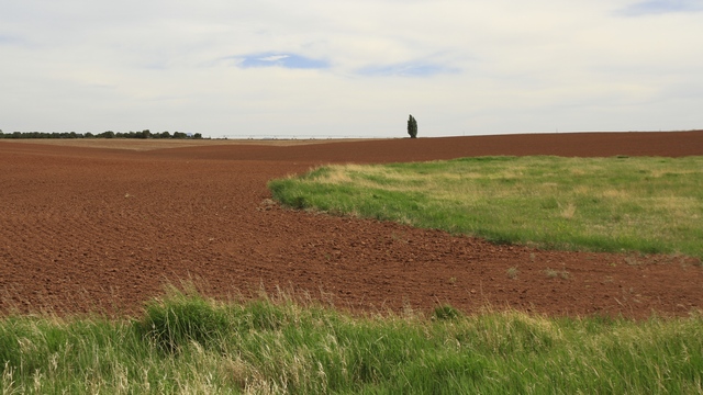
I found the fields very fascinating, especially the red soil.
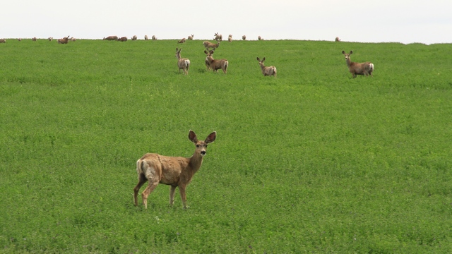
A herd of mule deer. They bounce when they run.
We can scratch an item off the bucket list ---- Mesa Verde and surrounding area is done.

The scenery is a little different on this route compared to what we saw in Mesa Verde. I believe the building in the photo is a B&B, wouldn't that be a beautiful spot to stay.

This is the start of the Sand Canyon Trail. It is a 6 mile trail that will take to you the Sand Canyon Pueblo that we visited yesterday.

and this is across the road from the rocks. The grape vines were a couple of hundred feet up the road. This area is a lot greener than Mesa Verde because it has water and the fields are irrigated.
Hovenweep became a National Monument in 1923 and is administered by the National Park Service. Human habitation at Hovenweep dates to over 10,000 years ago when nomadic Paleoindians visited the Cajon Mesa to gather food and hunt game. By about 900 CE, people started to settle at Hovenweep year-round, planting and harvesting crops in the rich soil of the mesa top. By the late 1200s, the Hovenweep area was home to over 2,500 people.

On the left side are the twin towers, on the lower right is the eroded boulder house and above that is rim rock house.

I found the vegetation here to be interesting, especially this bright green tree. I'm guessing the tree is by a spring.

Starting at the left we have Hovenweep house, Square Tower (partway down the gulley) and Hovenweep Castle.

The trail took us down into the gully where we have a different view of the twin towers and eroded boulder house.
Leaving Hovenweep we drive back into Colorado and head for Painted Hand Pueblo. The directions indicated that we needed to turn on road 4531. We thought it was strange that there wasn't a sign but we turned anyway.

We put the truck into 4 wheel drive and continued down the road. When we came to a 40 foot high rock hill, common sense kicked in and we turned around. Turned out 4531 was a loop road and we should have waited to the 2nd turn off where there was a sign for the Painted Hand Pueblo. This part of the road was much better.

The tower at Painted Hand Pueblo from a distance. It was an interesting hike down to the tower.

A pretty rock and view.

Made it to the tower. In the cliff area under the tower you can see a couple of faint hand prints thus the name Painted Hand Pueblo.


I stood beside the tower for height perspective. Part of the trail.

The landscape changed dramatically as we drove north and east to Lowry Pueblo. The road was mostly out of the national monument with active farms.

We saw a number of horses and these cattle. This road is also near water so most of the fields were being irrigated.
The last Puebloan ruin we visited was Lowry Pueblo.

This pueblo had been stabilized allowing the public to walk around it, even into some of the rooms. The doorways are pretty small so some crawling was required.

You were allowed inside to look at a small kiva.

A great kiva, probably used for religious ceremonies.

I found the fields very fascinating, especially the red soil.

A herd of mule deer. They bounce when they run.
We can scratch an item off the bucket list ---- Mesa Verde and surrounding area is done.