01/11: Cades Cove and Abram Falls
Category: General
Posted by: The Agnew Family
It's a lot busier in Gatlinburg than I expected. My sister had warned me, saying it's always busy in Gatlinburg, so now I'm wondering how busy the Great Smoky Mountain National Park is going to be. Today we are driving to the western side of the park to drive the Cades Cove Loop Road and to hike the Abrams Falls Trail. This is the one of the most visited areas of the park. The loop is an 11 mile, one way road that goes through an area that was settled in the early 1800s. A few of the original buildings still stand in their original locations, others have been moved closer to the road.
It's pretty hazy today, which is apparently pretty normal for the Smoky Mountains. The blue, smoky look is how the mountains got their name.
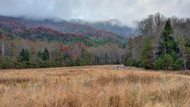
The first stop on the loop is the John Oliver Place. The building is original, built in 1826 and is in its original location so it's a bit walk in from the road.
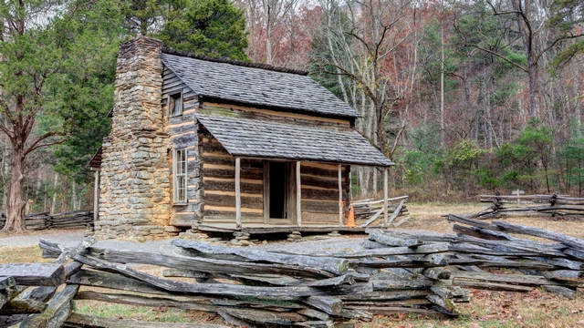
John Oliver Place. We were told that additions were added to the cabin over the years but were removed by the park service to show the original cabin.
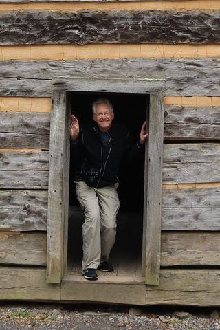
By the height of the door frame, you'd think that people in the early 1800s were short. Apparently, that's not the case. John Oliver was not tall as he came from a city but his son that was raised in the country was over 6 feet tall.
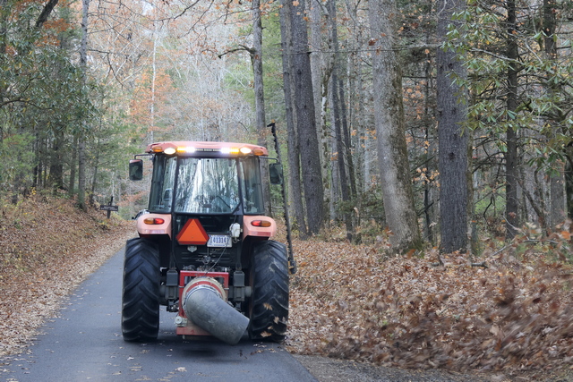
I think that this was Ed's most favourite thing today --- yes, he wants one. This tractor with a blower attachment cleaned the parking areas on the side of the road. If the leaves stayed, no one would find designated parking areas.
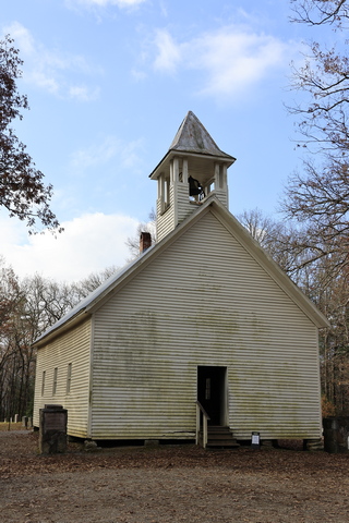
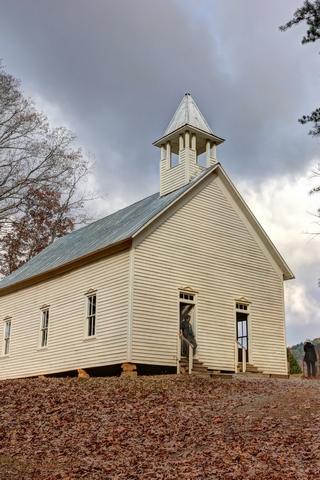
There were several churches along the loop. The one on the left is the Primitive Baptist Church. The one on the right is the Methodist Church. This church did not separate the congregation (women on one side, men on the other) but borrowed the planes from a church that did thus 2 doors.
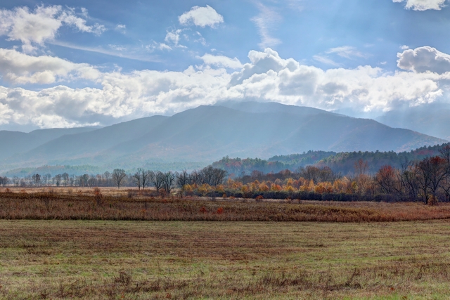
The homes were built in hillier locations but there was lots of flat land for farming.
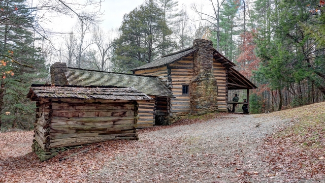
Elijah Oliver Place. Elijah was John's son. This cabin is also original with all the additions left on the cabin. It was a 1/2 mile walk into the cabin. One of the interesting additions was the "stranger room" built onto the front porch. If a traveler needed a place to stay they were given the room on the front porch keeping them separate from the rest of the family.
Halfway along the loop is the trail head for the Abrams Falls Trail. The trail is 5 miles (or 8 km) return trip and has a couple of good hills.
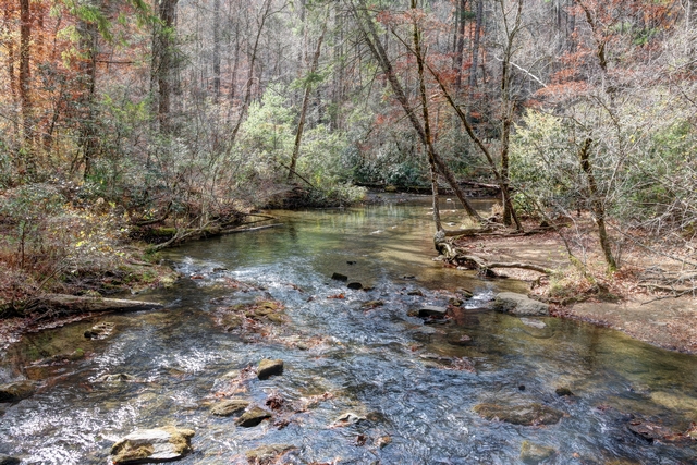
Much of the trail followed Mill Creek.
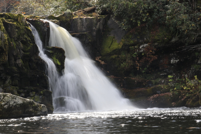
The Abrams Falls.
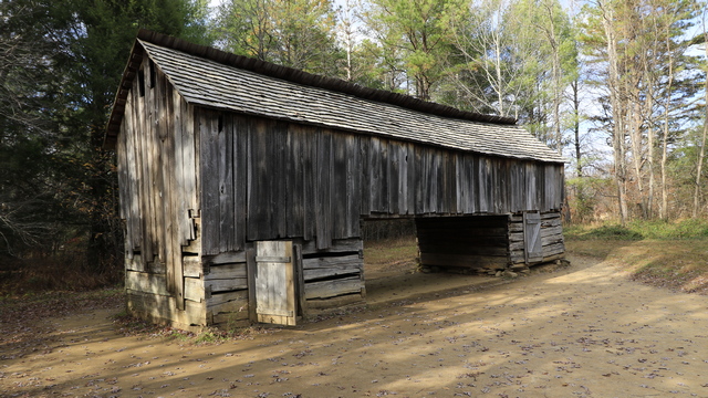
You can tell you are in a weather zone very different from the one in southern Ontario. Some of the barns were built so you could drive the wagon under it and stand in the wagon to offload. The two side areas housed animals when necessary and the hay, etc. were stored in the upper part of the bar.
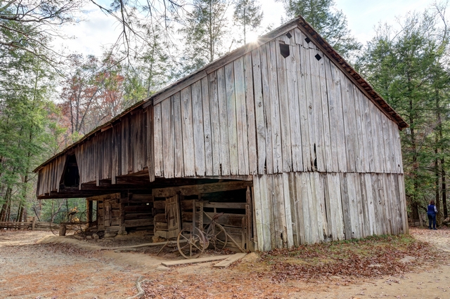
Other barns were cantilevered so wagons, etc. could be stored outside but somewhat protected.
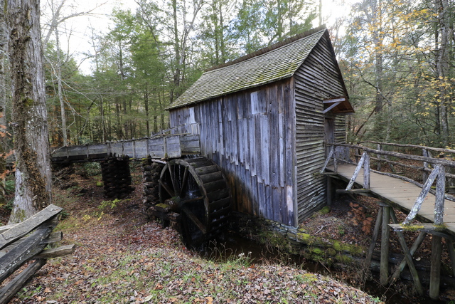
The old mill building.
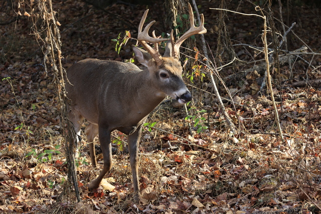
We have lots of deer at home but we couldn't resist taking this guy's photo. He calmly walked about not caring about all the people milling around watching him. He walked into an open field in the middle of the mill site.
We were about 5 miles from the end of the loop road when we ran into stop and go traffic. It didn't make sense as the traffic hadn't been too bad earlier in the day. After travelling about 3 miles in an hour we learned the reason for the slow traffic. Everyone was stopping to look at the bear.
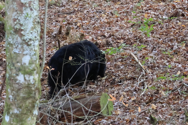
Ed was very growly so we didn't pull over to take pictures. I grabbed this one in the 10 seconds that he was stopped.
It's pretty hazy today, which is apparently pretty normal for the Smoky Mountains. The blue, smoky look is how the mountains got their name.

The first stop on the loop is the John Oliver Place. The building is original, built in 1826 and is in its original location so it's a bit walk in from the road.

John Oliver Place. We were told that additions were added to the cabin over the years but were removed by the park service to show the original cabin.

By the height of the door frame, you'd think that people in the early 1800s were short. Apparently, that's not the case. John Oliver was not tall as he came from a city but his son that was raised in the country was over 6 feet tall.

I think that this was Ed's most favourite thing today --- yes, he wants one. This tractor with a blower attachment cleaned the parking areas on the side of the road. If the leaves stayed, no one would find designated parking areas.


There were several churches along the loop. The one on the left is the Primitive Baptist Church. The one on the right is the Methodist Church. This church did not separate the congregation (women on one side, men on the other) but borrowed the planes from a church that did thus 2 doors.

The homes were built in hillier locations but there was lots of flat land for farming.

Elijah Oliver Place. Elijah was John's son. This cabin is also original with all the additions left on the cabin. It was a 1/2 mile walk into the cabin. One of the interesting additions was the "stranger room" built onto the front porch. If a traveler needed a place to stay they were given the room on the front porch keeping them separate from the rest of the family.
Halfway along the loop is the trail head for the Abrams Falls Trail. The trail is 5 miles (or 8 km) return trip and has a couple of good hills.

Much of the trail followed Mill Creek.

The Abrams Falls.

You can tell you are in a weather zone very different from the one in southern Ontario. Some of the barns were built so you could drive the wagon under it and stand in the wagon to offload. The two side areas housed animals when necessary and the hay, etc. were stored in the upper part of the bar.

Other barns were cantilevered so wagons, etc. could be stored outside but somewhat protected.

The old mill building.

We have lots of deer at home but we couldn't resist taking this guy's photo. He calmly walked about not caring about all the people milling around watching him. He walked into an open field in the middle of the mill site.
We were about 5 miles from the end of the loop road when we ran into stop and go traffic. It didn't make sense as the traffic hadn't been too bad earlier in the day. After travelling about 3 miles in an hour we learned the reason for the slow traffic. Everyone was stopping to look at the bear.

Ed was very growly so we didn't pull over to take pictures. I grabbed this one in the 10 seconds that he was stopped.