03/01: Proving Grounds and Beyond
Category: General
Posted by: The Agnew Family
From Wikipedia "The U.S. Army's Yuma Proving Ground is one of the largest military installations in the world. Situated in southwestern La Paz County and western Yuma County in southwestern Arizona, U.S., approximately 30 miles (48 km) north-east of the city of Yuma, the proving ground is used for testing military equipment and encompasses 1,307.8 square miles (3,387.2 kmē) in the northwestern Sonoran Desert."
Today we drove to the proving grounds then through the grounds to the Imperial Dam.
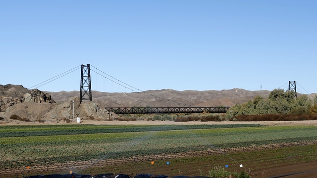
On the way to the proving grounds we stopped at the bridge to nowhere. In 1929 The McPhaul bridge was opened to traffic and for 40 years provided the only way over the Gila River for Yuma residents. The bridge was designed by Ralph Modjewski, well-known builder and mentor to Joseph B. Strauss, who would later design the Golden Gate Bridge in 1933.
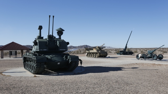
Soon after driving into the Proving Grounds you see this tank and missile display.
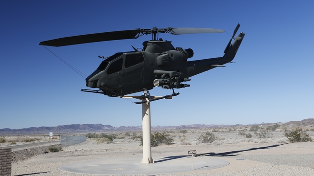
At the main gates of military base is one of Ed's favourite gate markers, a helicopter on a stick.
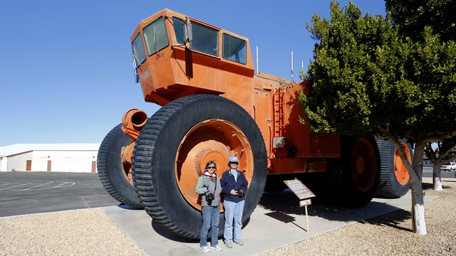
The Heritage Center is on the base. Outside of the building is the Overland Train Mk II, a multi-car, rubber-tired, logistical cargo carrier for transporting military cargoes over adverse terrain when operating in the climactic extremes encountered in global re-supply operations. Inside are interesting displays giving the history of the Proving Grounds.
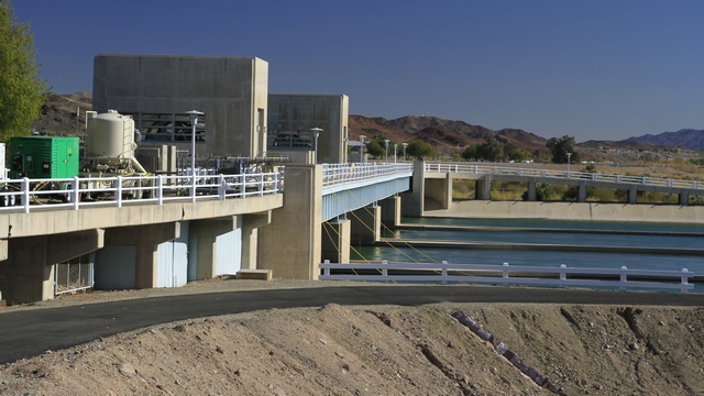
"The Imperial Dam is a concrete slab and buttress ogee weir structure across the California/Arizona border. Completed in the 1938, the dam retains the waters of the Colorado River into the Imperial Reservoir before desilting and diversion into the All-American Canal, the Gila River, and the Yuma Project aqueduct." again from Wikipedia.
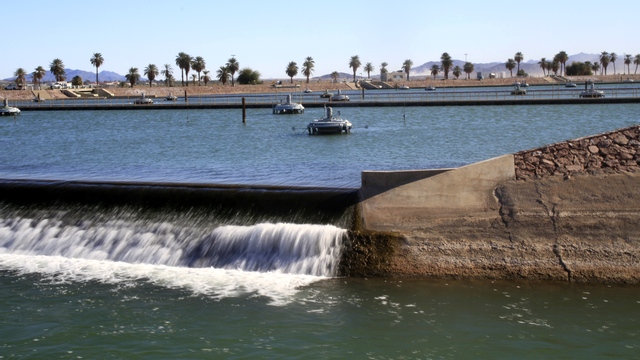
One of the desilting ponds. We think the water flowing off the edge is going into the All-American Canal.
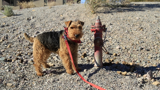
Caity found a hydrant just her size by one of the boat ramps.
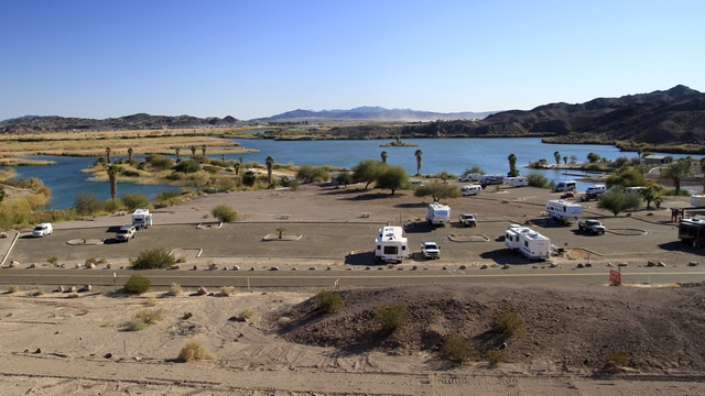
Outside of the Proving Grounds is BLM land. For a small fee you can park your trailer for up to a year. You need to provide your own water, power and sewage. A lot (thousands) of people set up their rigs and spend the winter. Solar panels and wind turbines are a common site. Very few are in pretty lots like this one, but out in open areas of the desert.
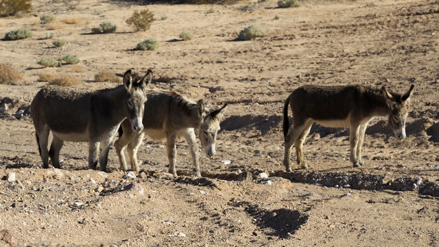
We saw signs of the burros and finally saw the actual wild burros.
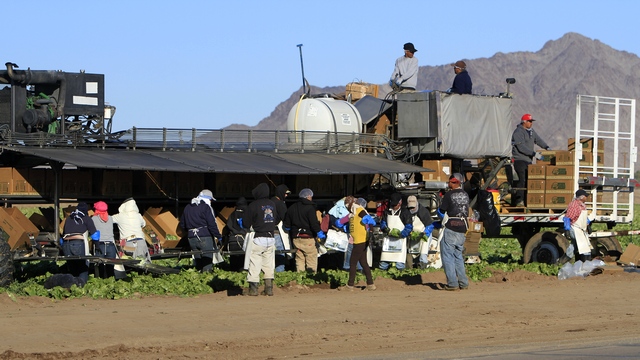
The vegetable picker machines has really caught our attention. This one was close to road so we stopped to have a good look and take a few photos. The machine was moving toward the road and reached the end of the rows. The wheels turn 90 degrees so they are parallel to the machine, the machine drives forward to next set of rows, the wheels turn 90 degrees so they are perpendicular to the machine and the machine drives slowly into the field. The machine continues to move slowly as the workers pick the crop. The first row of workers picked the lettuce, cut off extraneous leaves, put the lettuce in a plastic bag and placed it in a trough on the machine. The second row of workers closed the bag and packed the lettuce into the boxes. A conveyor belt moved the boxes to the back where a worker passed to the worker on the wagon.
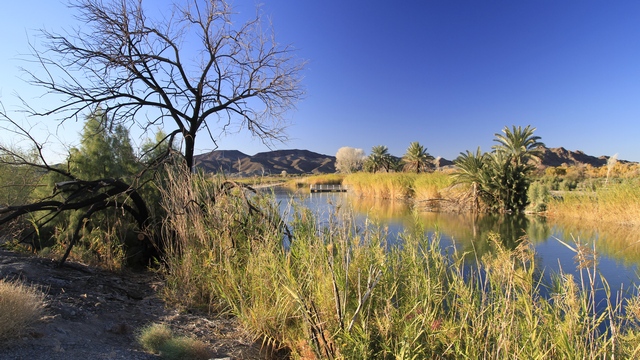
A pretty view by the Laguna Dam.
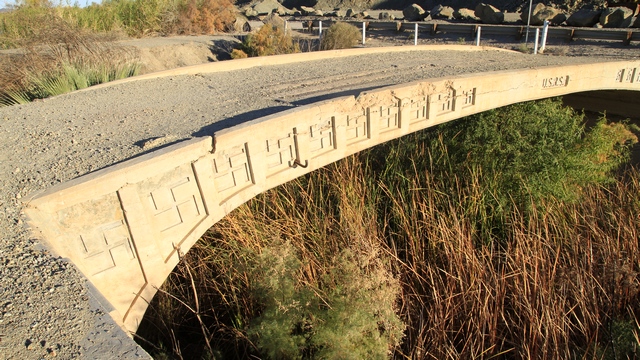
Near the Laguna Dam is Swastika Bridge. This bridge was built in 1905 by the USRS (United States Reclamation Service). At this time the swastika symbol was a symbol of sun, fire and lightening.
Today we drove to the proving grounds then through the grounds to the Imperial Dam.

On the way to the proving grounds we stopped at the bridge to nowhere. In 1929 The McPhaul bridge was opened to traffic and for 40 years provided the only way over the Gila River for Yuma residents. The bridge was designed by Ralph Modjewski, well-known builder and mentor to Joseph B. Strauss, who would later design the Golden Gate Bridge in 1933.

Soon after driving into the Proving Grounds you see this tank and missile display.

At the main gates of military base is one of Ed's favourite gate markers, a helicopter on a stick.

The Heritage Center is on the base. Outside of the building is the Overland Train Mk II, a multi-car, rubber-tired, logistical cargo carrier for transporting military cargoes over adverse terrain when operating in the climactic extremes encountered in global re-supply operations. Inside are interesting displays giving the history of the Proving Grounds.

"The Imperial Dam is a concrete slab and buttress ogee weir structure across the California/Arizona border. Completed in the 1938, the dam retains the waters of the Colorado River into the Imperial Reservoir before desilting and diversion into the All-American Canal, the Gila River, and the Yuma Project aqueduct." again from Wikipedia.

One of the desilting ponds. We think the water flowing off the edge is going into the All-American Canal.

Caity found a hydrant just her size by one of the boat ramps.

Outside of the Proving Grounds is BLM land. For a small fee you can park your trailer for up to a year. You need to provide your own water, power and sewage. A lot (thousands) of people set up their rigs and spend the winter. Solar panels and wind turbines are a common site. Very few are in pretty lots like this one, but out in open areas of the desert.

We saw signs of the burros and finally saw the actual wild burros.

The vegetable picker machines has really caught our attention. This one was close to road so we stopped to have a good look and take a few photos. The machine was moving toward the road and reached the end of the rows. The wheels turn 90 degrees so they are parallel to the machine, the machine drives forward to next set of rows, the wheels turn 90 degrees so they are perpendicular to the machine and the machine drives slowly into the field. The machine continues to move slowly as the workers pick the crop. The first row of workers picked the lettuce, cut off extraneous leaves, put the lettuce in a plastic bag and placed it in a trough on the machine. The second row of workers closed the bag and packed the lettuce into the boxes. A conveyor belt moved the boxes to the back where a worker passed to the worker on the wagon.

A pretty view by the Laguna Dam.

Near the Laguna Dam is Swastika Bridge. This bridge was built in 1905 by the USRS (United States Reclamation Service). At this time the swastika symbol was a symbol of sun, fire and lightening.