2023/06/16: Some HDR photos of the trip
Category: General
Posted by: The Agnew Family
It's taken awhile but I've finally got a few of the HDR photos ready to post. There were a lot of great photos but I showed restraint and I only have 31 photos to post. I didn't check but some of the photos may already be in the blog but not their HDR version. HDR means 3 photos with slightly different aperture and focal lengths are merge together to create what is generally a more vibrant photo. We tend to use the HDR technique when it is either very flat light or difficult light (like taking a photo into the sun). There a couple of photos that still aren't the best but at least you can see what you are taking a photo of.
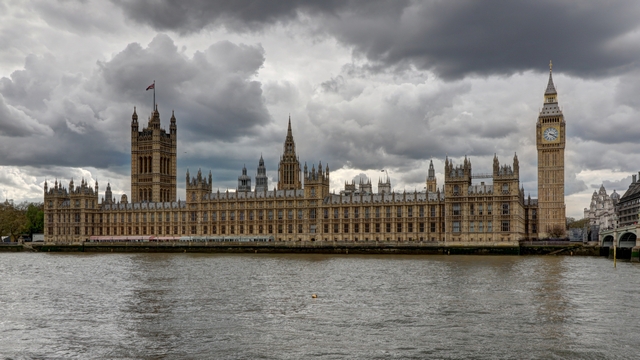
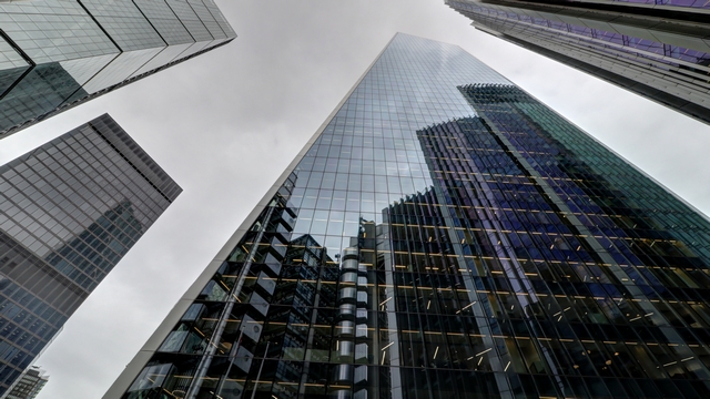
London
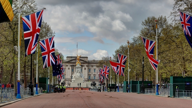
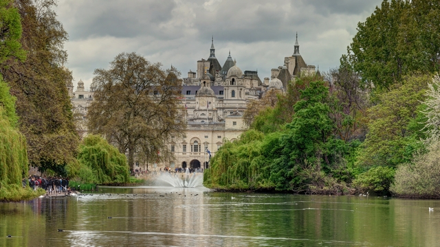
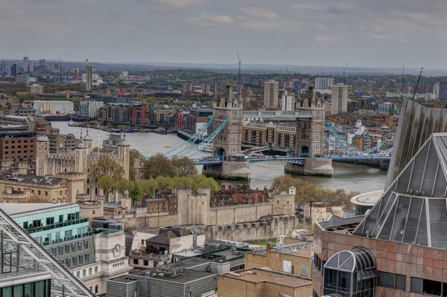
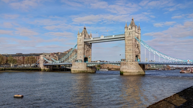
Tower Bridge
Falkirk
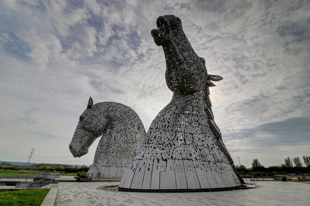
The Kelpies
Glen Coe
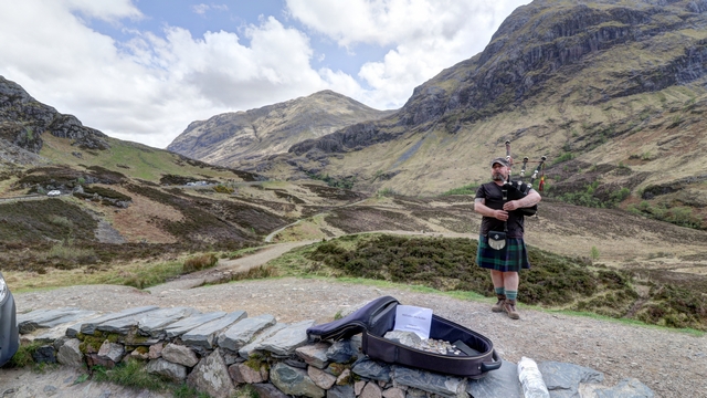
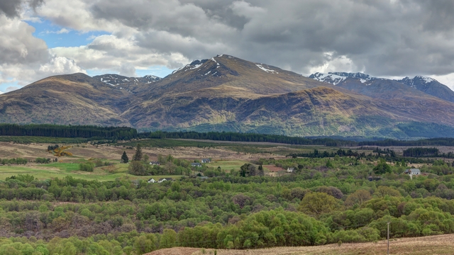
Oban
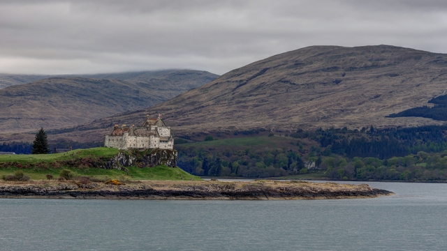
From the ferry
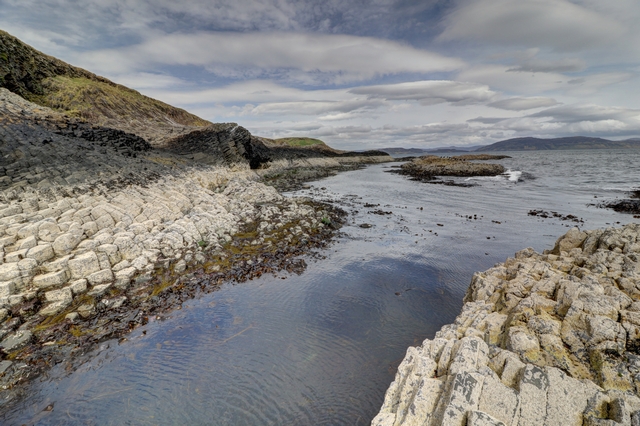
On the boat tour
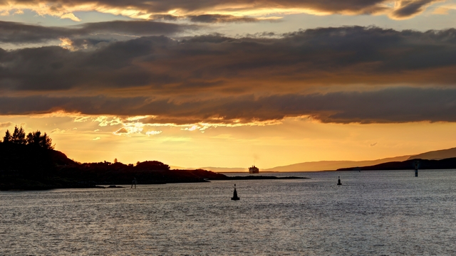
Sunset in Oban
Driving toward Skye
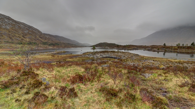
Skye
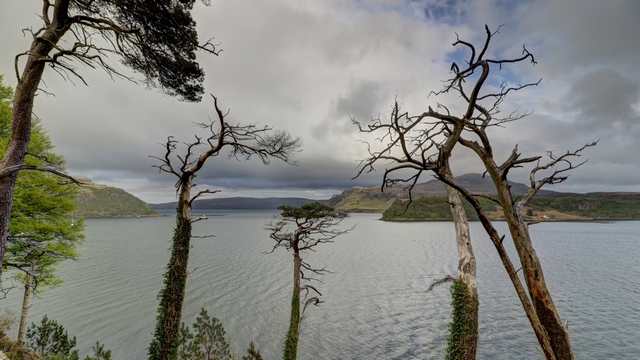
Portree Harbour
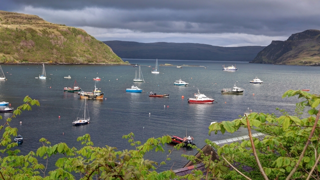
Portree Harbour
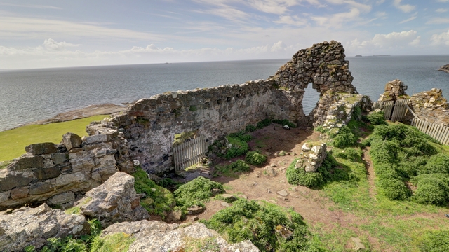
An old castle
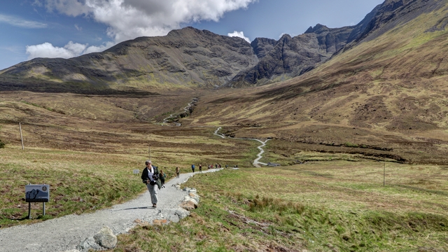
Fairy Pools
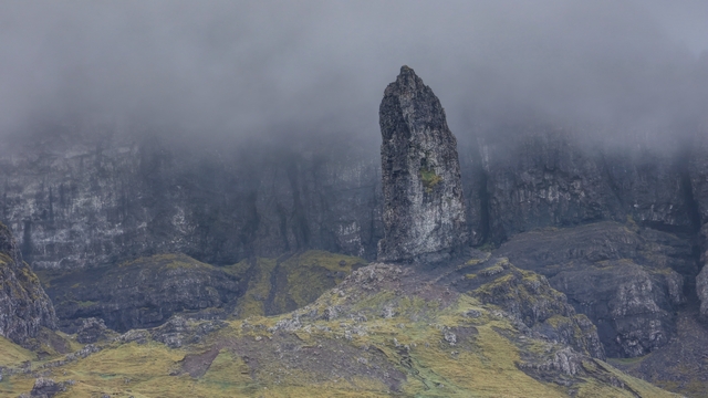
Old Man of Storr
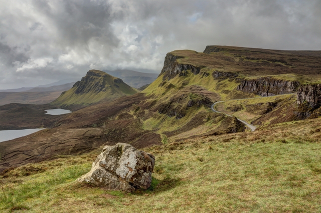
Quiraing
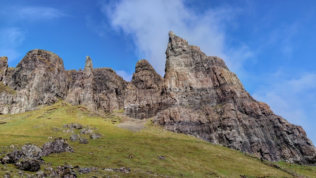
Quiraing
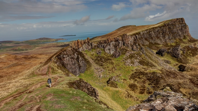
Quiraing
Lewis
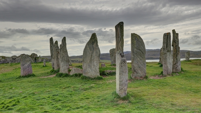
Callanish Standing Stones
Harris
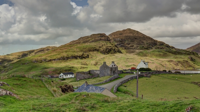
Northern Scotland
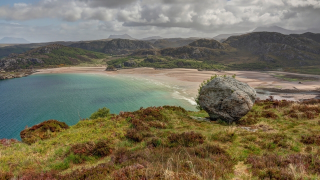
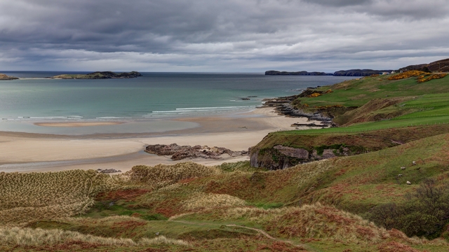
Orkney
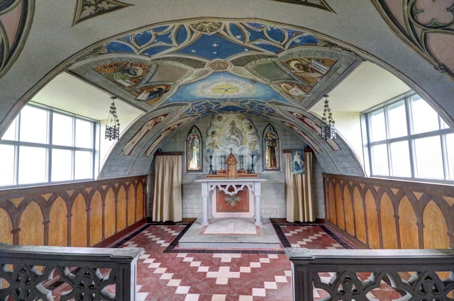
Inside the Italian Church
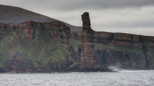
Old Man of Hoy from the Ferry
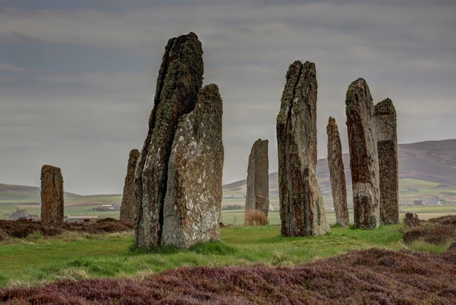
Ring of Brodgar
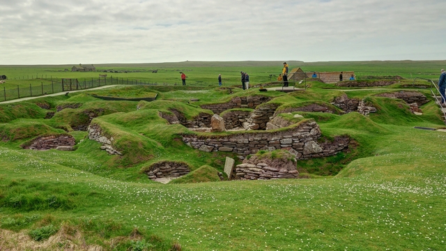
Skara Brae
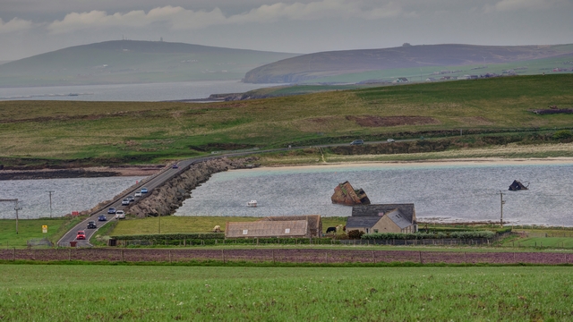
Churchill Barrier
Near John o'Groats
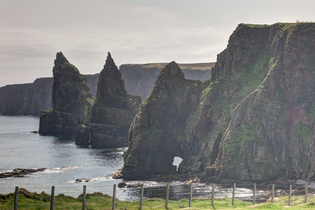
Duncansby Stacks
London


Tower Bridge


Falkirk

The Kelpies
Glen Coe


Oban

From the ferry

On the boat tour

Sunset in Oban
Driving toward Skye

Skye

Portree Harbour

Portree Harbour

An old castle

Fairy Pools

Old Man of Storr

Quiraing

Quiraing

Quiraing
Lewis

Callanish Standing Stones
Harris

Northern Scotland


Orkney

Inside the Italian Church

Old Man of Hoy from the Ferry

Ring of Brodgar

Skara Brae

Churchill Barrier
Near John o'Groats

Duncansby Stacks
2023/05/23: Flying Home
Category: General
Posted by: The Agnew Family
We had a great time in London and in Scotland but we are ready to go home. We picked a hotel quite close to the airport which worked out really well. Last night, once the car was unloaded we drove the 5 minutes to the car rental to return the car and walked the 2 minutes back to the hotel --- one way roads made the driving longer than the walking.
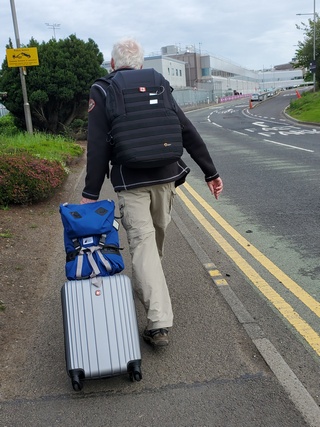
This morning we walked to the airport terminal which took about 5 minutes.
The flight leaving Edinburgh left about 15 minutes late but we landed on time in London. We had about an hour and half between flights. After walking down a long hallway then taking an elevator down 2 flights (the escalator was broken) then riding the rapid transit one stop then up a couple of escalators and walking down another hallway we arrived at the gate for the flight to Toronto where boarding had started. Everyone was on board and we were ready to leave at the scheduled departure time. Except we didn't. Apparently, there was an issue in the cabin and by time that was fixed the tug that was going to push the plane off had left to move another plane. So we waited some more till the tug came back and finally took off about 2 hours late. Somehow the captain managed to speed up the flight and we arrived in Toronto only 1 hour late. Later in the evening I noticed an email from British Airways apologizing for the delay.
Luckily Ed and I were not bothered by the delay as Toronto was our final destination and our ride checked the estimated arrival time of the flight before he left home.
It's good to be home.
2023/05/22: Inverness to Edinburgh
Category: General
Posted by: The Agnew Family
Today is the last touring day of our trip with our destination being a hotel within walking distance to the Edinburgh airport.
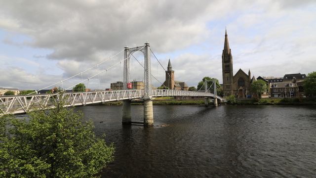
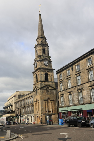
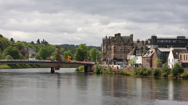
Downtown Inverness like most city and towns in Scotland is full of old buildings. One big difference is Inverness has the River Ness flowing through it.
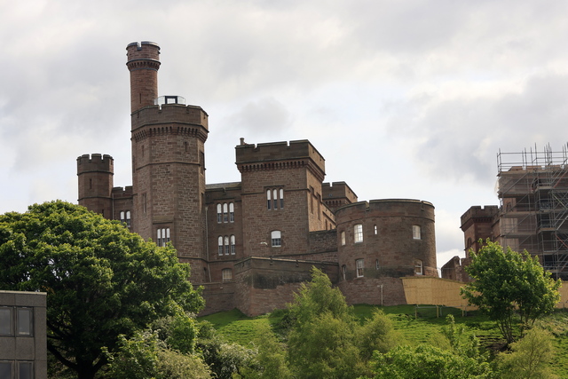
A huge restoration project is under way at Inverness Castle. You can see some of the scaffolding on the right side of the photo. A succession of castles have stood on this site since 1057, although the present structure dates from 1836.
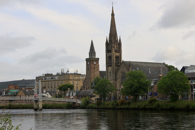
One of the many beautiful churches in Inverness.
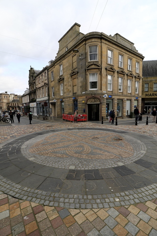
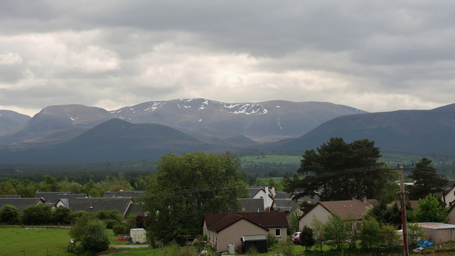
On our drive we could see snow on the mountain tops.
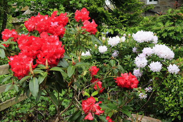
The Rhododendrons are in bloom. This was in Pitlochry a very cute small town.
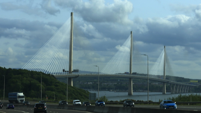
A beautiful bridge as we drove into Edinburgh area.

Downtown Inverness like most city and towns in Scotland is full of old buildings. One big difference is Inverness has the River Ness flowing through it.

A huge restoration project is under way at Inverness Castle. You can see some of the scaffolding on the right side of the photo. A succession of castles have stood on this site since 1057, although the present structure dates from 1836.

One of the many beautiful churches in Inverness.


On our drive we could see snow on the mountain tops.

The Rhododendrons are in bloom. This was in Pitlochry a very cute small town.

A beautiful bridge as we drove into Edinburgh area.
2023/05/21: Orkney to Inverness
Category: General
Posted by: The Agnew Family
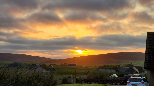
Good morning ... it's 5:15 am. Ed and I are up and driving to the ferry. When I originally planned the trip I booked a 9 am ferry. Due to unforeseen circumstances, the ferry schedule changed and we were booked onto a 6:30 am ferry. BTW sunrise was at 4:28 am.
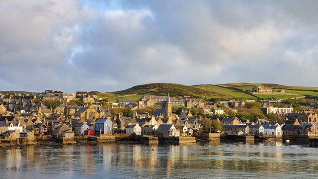
Stromness habour.
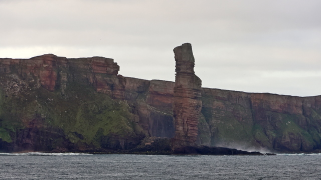
The Old Man of Hoy. Not enough sun to get a good photo but the haze was even worse on the way to Orkney. As the clouds are disappearing, the ferry riders later today should get good photos.
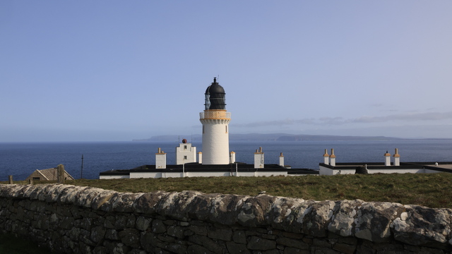
Dunnet Head lighthouse at the most northerly point in mainland Scotland.
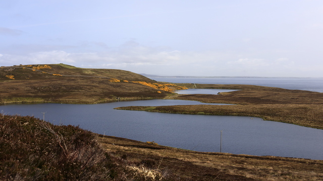
A view at Dunnet Head.
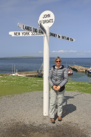
John o'Groats
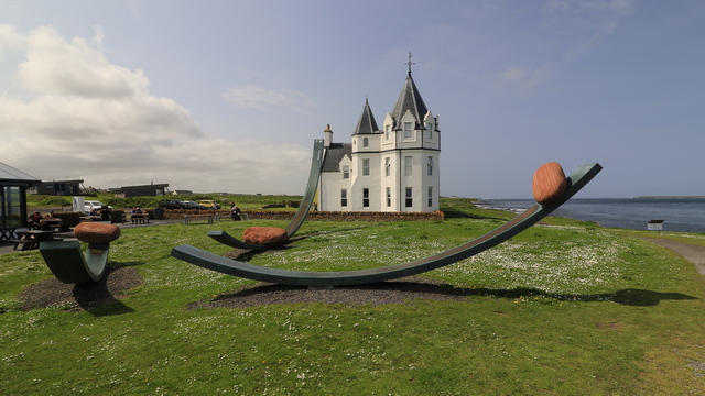
The Nomadic Bolders at John o'Groats
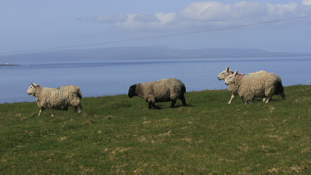
Sheep at Duncansby Head.
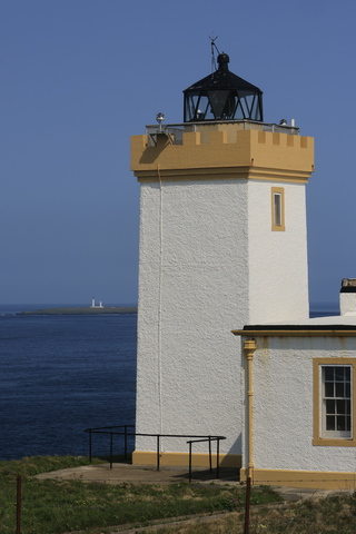
Finally a spot with really good visibility. We could see a lighthouse on a island several miles away. It's the two white lines on the horizon.
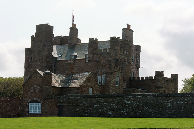
The Castle of Mey was built as a Z-plan castle between 1566 and 1572 by the fourth Earl of Caithness, it was bought from Captain Imbert-Terry by the Queen Mother in 1952. In 1996, when Her Majesty generously gifted it with an endowment to the Trust.
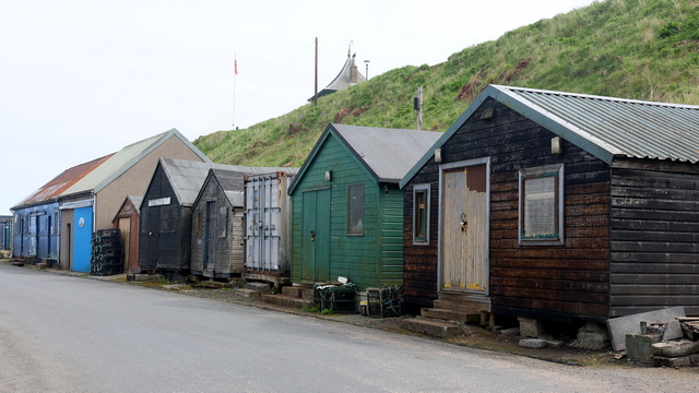
Sheds by the harbour in Wick.
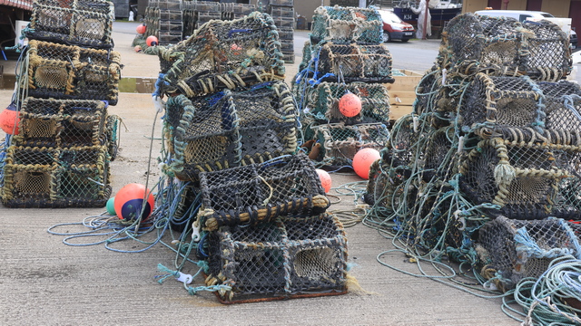
Langoustine trap. Langoustines, a relative of lobster, are smaller than lobster, however, growing in size to a maximum of only around 10 inches.
2023/05/20: Day 2 Exploring the Orkney Islands
Category: General
Posted by: The Agnew Family
I don't know if you noticed in the photos from yesterday, but there are essentially no trees on Orkney. When I say Orkney I mean Mainland and the islands that are joined to it by the Churchill causeways (more about them later). A few trees have been planted but in general the landscape is treeless. By 3500 BC, Orkney had seen a decline in forest cover. This was due to human activity and a deterioration in the climate. Orkney isn't flat but rather low gentle hills which are mainly grass but there are some moors. Beef cattle, dairy herds and sheep graze in the many green fields across the island.
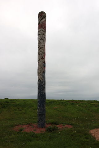
Yes, there really is a totem pole on Orkney. It was a joint project between local carvers and 4 Squamish Nation carvers in 2007.
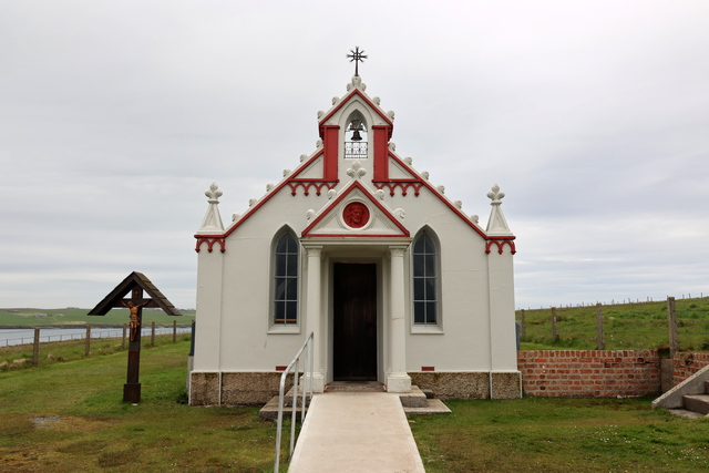
I find the story of the Italian Chapel to be fascinating. During WWI and WWII the British navy were based out of Scapa Flow (an area between several of the Orkney Islands). In October 1939 a German submarine sank the battleship HMS Royal Oak. Churchill decided that barriers needed to be built between several of the islands. Manpower was short but coincidentally at that time thousands of Italian soldiers fighting in North Africa were captured. Over 1,000 soldiers were brought to Orkney and under guise of bettering communications between the Orkney Islands, built the barriers. Following the request from the camp priest it was agreed that 2 Nissen huts would be joined together to provide a chapel. Among the Italians in Camp 60 was an artist, Domenico Chiocchetti, and he was given the task of transforming the two Nissen huts into a chapel. He was assisted by other tradesmen - in particular Giuseppe Palumbi, a blacksmith, and Domenico Buttapasta, a cement worker. This photo and the 3 following photos are the end result.
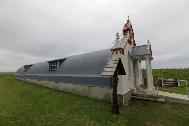
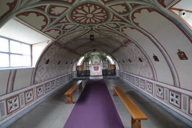
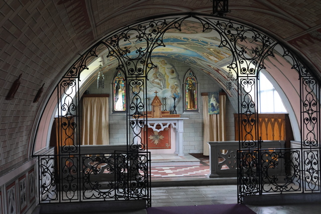
BTW the interior walls of the chapel are painted.
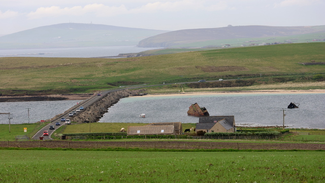
One of the 4 Churchill Barriers, a series of causeways linking South Ronaldsay to Orkney Mainland. Overhead cableways were set up, and 250,000 tons of rock dumped to form a base. The base of rocks was then topped by 66,000 concrete blocks, cut to 5 and 10-ton sizes. The 5-ton blocks were laid directly on the base, and the 10-ton blocks arranged randomly along the sloping sides, to break up wave patterns. Rock was quarried locally and the concrete was cast on Orkney and transported by railways to the site.
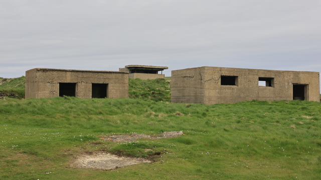
The remains of bunkers, gun mounts, etc. can be found on the islands linked by the Churchill barriers.
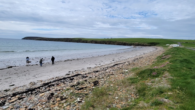
Sands of Wright ---- my maiden name is Wright so are these my sands?
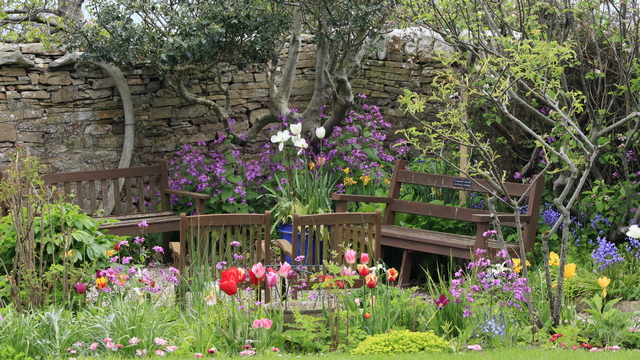
A beautiful community garden in St Margaret's Hope
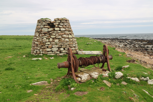
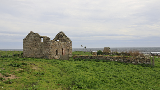
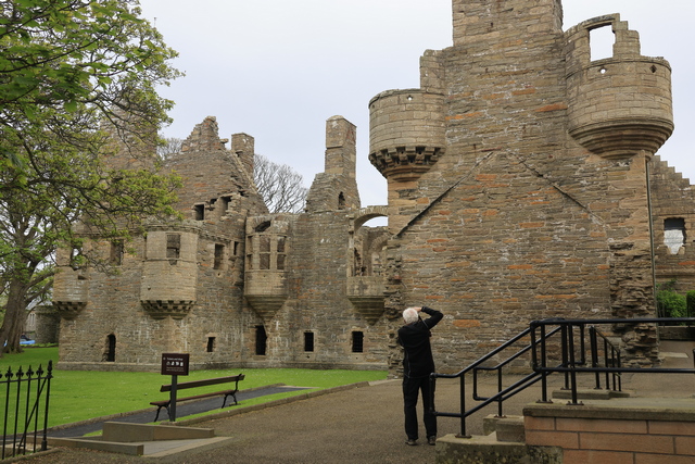
The Bishop's Palace, Kirkwall is a 12th-century palace built at the same time as the adjacent St Magnus Cathedral in the centre of Kirkwall. It housed the cathedral's first bishop, William the Old of the Norwegian Catholic church.
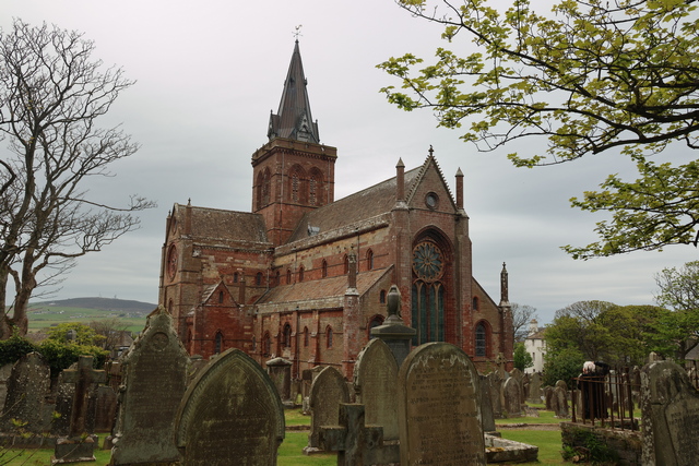
The back of St. Magnus Cathedral. The front of the church was crowded with people from a wedding.
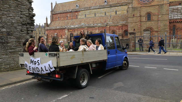
Ed and I are easily identifiable as tourists. These young ladies asked where we were from and we asked what they were doing? They told us the young woman sitting hirer than the rest was getting married in 6 weeks. I guess one of the things to do is get covered in goop, ride around in the back of a pickup truck making lots of noise. We saw a 2nd truck with a group of guys in it doing a similar thing.

Yes, there really is a totem pole on Orkney. It was a joint project between local carvers and 4 Squamish Nation carvers in 2007.

I find the story of the Italian Chapel to be fascinating. During WWI and WWII the British navy were based out of Scapa Flow (an area between several of the Orkney Islands). In October 1939 a German submarine sank the battleship HMS Royal Oak. Churchill decided that barriers needed to be built between several of the islands. Manpower was short but coincidentally at that time thousands of Italian soldiers fighting in North Africa were captured. Over 1,000 soldiers were brought to Orkney and under guise of bettering communications between the Orkney Islands, built the barriers. Following the request from the camp priest it was agreed that 2 Nissen huts would be joined together to provide a chapel. Among the Italians in Camp 60 was an artist, Domenico Chiocchetti, and he was given the task of transforming the two Nissen huts into a chapel. He was assisted by other tradesmen - in particular Giuseppe Palumbi, a blacksmith, and Domenico Buttapasta, a cement worker. This photo and the 3 following photos are the end result.


BTW the interior walls of the chapel are painted.

One of the 4 Churchill Barriers, a series of causeways linking South Ronaldsay to Orkney Mainland. Overhead cableways were set up, and 250,000 tons of rock dumped to form a base. The base of rocks was then topped by 66,000 concrete blocks, cut to 5 and 10-ton sizes. The 5-ton blocks were laid directly on the base, and the 10-ton blocks arranged randomly along the sloping sides, to break up wave patterns. Rock was quarried locally and the concrete was cast on Orkney and transported by railways to the site.

The remains of bunkers, gun mounts, etc. can be found on the islands linked by the Churchill barriers.

Sands of Wright ---- my maiden name is Wright so are these my sands?

A beautiful community garden in St Margaret's Hope


The Bishop's Palace, Kirkwall is a 12th-century palace built at the same time as the adjacent St Magnus Cathedral in the centre of Kirkwall. It housed the cathedral's first bishop, William the Old of the Norwegian Catholic church.

The back of St. Magnus Cathedral. The front of the church was crowded with people from a wedding.

Ed and I are easily identifiable as tourists. These young ladies asked where we were from and we asked what they were doing? They told us the young woman sitting hirer than the rest was getting married in 6 weeks. I guess one of the things to do is get covered in goop, ride around in the back of a pickup truck making lots of noise. We saw a 2nd truck with a group of guys in it doing a similar thing.
2023/05/19: Day 1 Exploring the Orkney Islands
Category: General
Posted by: The Agnew Family
We took the ferry from Scrabster to Stronmess on Mainland, the largest of the Orkney Islands. We spent the day visiting several ancient sites as well as the tidal island of Brough of Birsay.
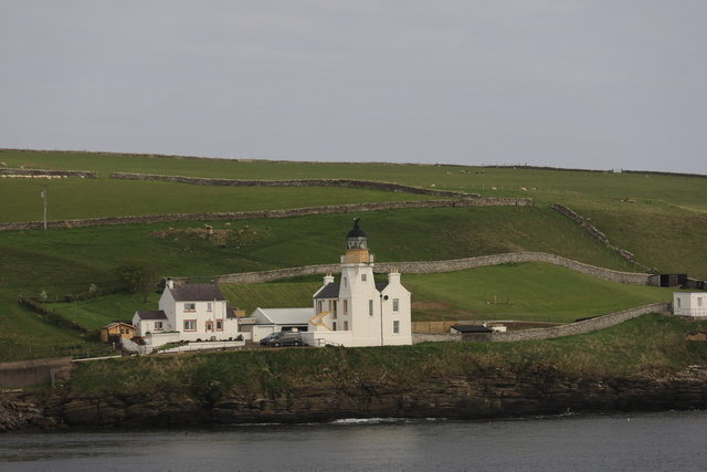
The lighthouse in Scrabster. Goodbye mainland.
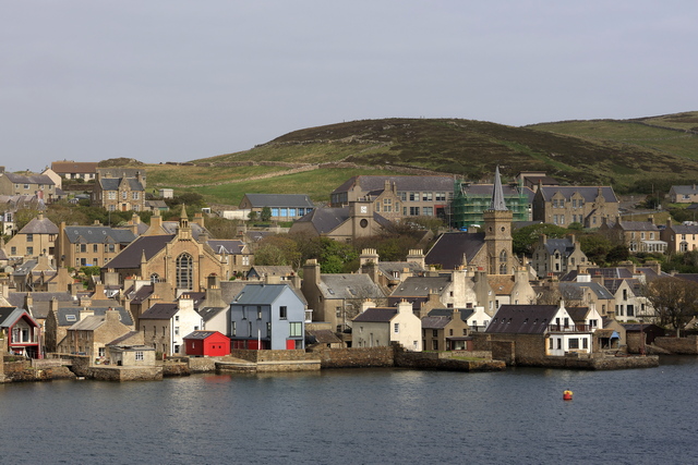
The village of Stromness Orkney. Hello Mainland --- that's the name of this island in Orkney.
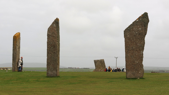
The Standing Stones of Sterness are over 5000 years old and may be the earliest henge monument in the British Isles. The enormous Stones of Stenness are all that remains of a great stone circle on an ancient ceremonial site.
The Stones of Stenness today consist of four upright stones up to 6m in height in a circle that originally held 12 stones. The focus of the interior was a large hearth. The stones were encircled by a large ditch and bank, the form of which has been lost over time by ploughing. Thanks Historic Environment Scotland. I'll be using you a lot today.
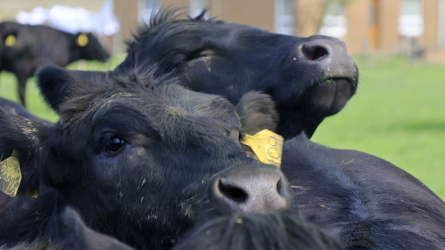
Cows greeting us at the Maeshowe visitors centre.
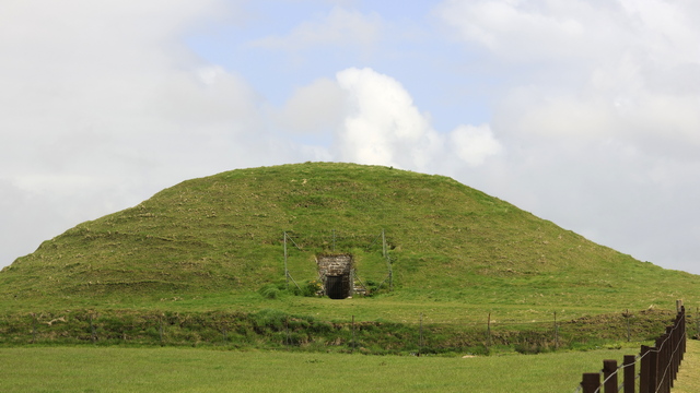
Maeshowe Chambered Cairn. Maeshowe, a monumental chambered tomb, is the finest Neolithic building to survive in north-west Europe. Built around 5,000 years ago, it is a masterpiece of Neolithic design and construction – not least because of its use of massive stones.
Creating such a huge building must have been a major challenge for our remote ancestors, working without metal tools or powered machinery. It also clearly shows a tremendous social commitment.
From the outside, Maeshowe looks just like a large grassy mound. (The word ‘howe’ comes from the Old Norse for ‘hill’.) To appreciate its size and significance, visitors must enter Maeshowe, stooping to walk its long passageway to reach the central, stone-built chamber.
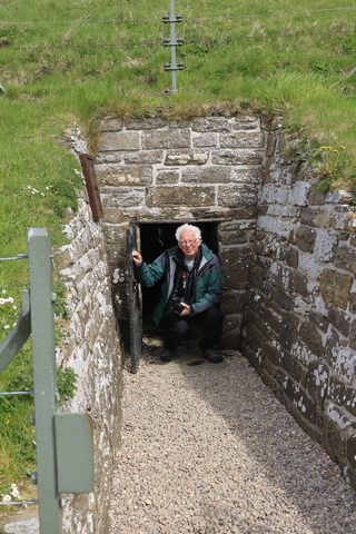
Ed exitting Maeshowe.
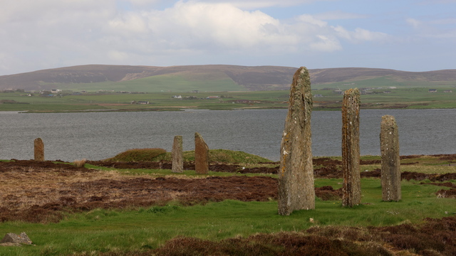
The Ring of Brodgar Stone Circle and Henge is an enormous ceremonial site dating back to the 3rd millennium BC. The Ring of Brodgar comprises:
A massive stone circle, originally consisting of 60 stones – 36 survive today
At least 13 prehistoric burial mounds
A large rock-cut ditch surrounding the stone circle
The age of this site is unknow as it hasn't been excavated. The three sites I've mention so far very close. A 4th site, the Ness of Brodgar is only open for a short time in the summer. The Ness of Brodgar site has been under excavation since 2004, revealing a massive complex of monumental Neolithic buildings dating from the centuries around 3000BC.
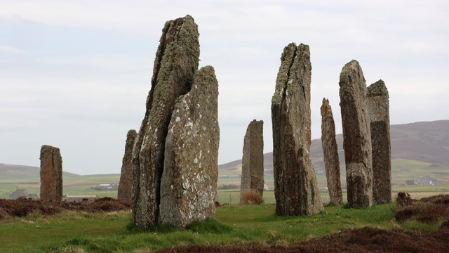
Ring of Brodgar
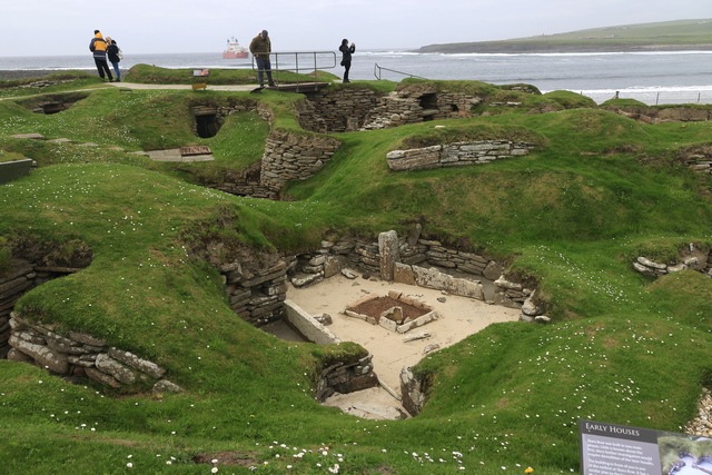
Skara Brea was discovered in the winter of 1850 when a storm ripped the grass and dirt of a large mound revealing buildings. Skara Brea is over 5000 years old.
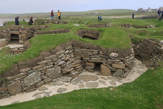
Skara Brae is remarkable because of its age, and even more so for the quality of its preservation. Its structures survive in impressive condition – as does, incredibly, the furniture in the village houses. Skara Brae was originally an inland village beside a freshwater loch. All of the houses were:
well built of flat stone slabs
set into large mounds of midden
linked by covered passageways
Each house has a single room, its floor space roughly 40sq m.
‘Fitted’ stone furniture in each room includes:
a ‘dresser’ – perhaps to store and display special objects
two box-beds
a central hearth
small tanks set into the floor – possibly for preparing fish bait
A larger structure at one end of the village has a special hearth and no box-beds, so may have been a workshop.
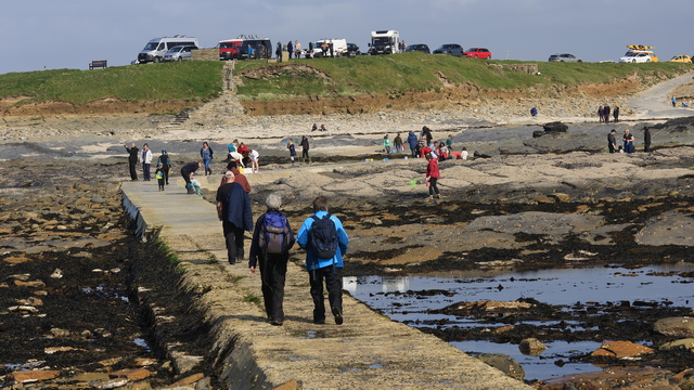
The Brough of Birsay is a tidal island, which means you can walk out to it during low tide. It's a popular place. I think a lot of the people were locals as there were lots of kids in wellies with nets looking for crabs and other interesting things.
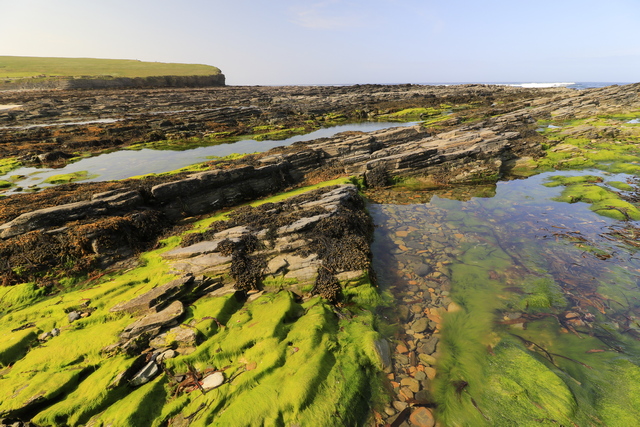
The rocks after the tide went out.
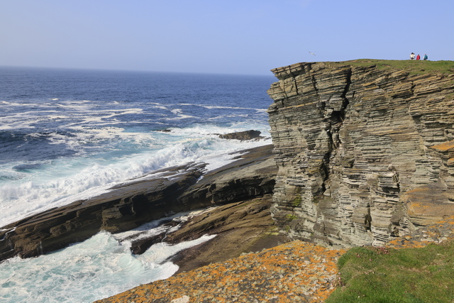
The rocky coast at the far end of the Brough of Birsay ear the lighthouse.
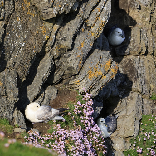
Nesting birds.
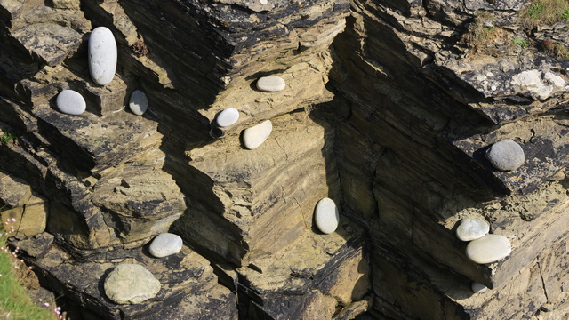
Looking down, these stones are sitting on rock ledges. The waves move these large stones around.
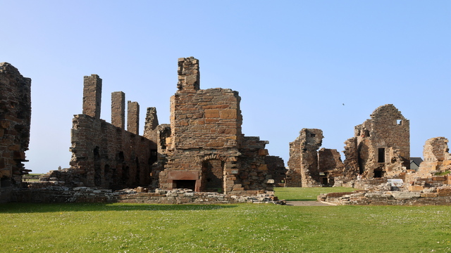
Earl's Palace, Birsay. Robert Stewart was the illegitimate son of James V by his mistress Euphemia Elphinstone and half-brother to Mary Queen of Scots. He was granted the royal and earldom estates of Orkney and Shetland in 1564, but not the title itself.
Robert Stewart moved north and between 1569 and 1574 he built the Earl’s Palace at Birsay at the north of the Orkney mainland. His nephew, James VI, created him Earl of Orkney, Lord of Shetland and Knight of Birsay in 1581.

The lighthouse in Scrabster. Goodbye mainland.

The village of Stromness Orkney. Hello Mainland --- that's the name of this island in Orkney.

The Standing Stones of Sterness are over 5000 years old and may be the earliest henge monument in the British Isles. The enormous Stones of Stenness are all that remains of a great stone circle on an ancient ceremonial site.
The Stones of Stenness today consist of four upright stones up to 6m in height in a circle that originally held 12 stones. The focus of the interior was a large hearth. The stones were encircled by a large ditch and bank, the form of which has been lost over time by ploughing. Thanks Historic Environment Scotland. I'll be using you a lot today.

Cows greeting us at the Maeshowe visitors centre.

Maeshowe Chambered Cairn. Maeshowe, a monumental chambered tomb, is the finest Neolithic building to survive in north-west Europe. Built around 5,000 years ago, it is a masterpiece of Neolithic design and construction – not least because of its use of massive stones.
Creating such a huge building must have been a major challenge for our remote ancestors, working without metal tools or powered machinery. It also clearly shows a tremendous social commitment.
From the outside, Maeshowe looks just like a large grassy mound. (The word ‘howe’ comes from the Old Norse for ‘hill’.) To appreciate its size and significance, visitors must enter Maeshowe, stooping to walk its long passageway to reach the central, stone-built chamber.

Ed exitting Maeshowe.

The Ring of Brodgar Stone Circle and Henge is an enormous ceremonial site dating back to the 3rd millennium BC. The Ring of Brodgar comprises:
A massive stone circle, originally consisting of 60 stones – 36 survive today
At least 13 prehistoric burial mounds
A large rock-cut ditch surrounding the stone circle
The age of this site is unknow as it hasn't been excavated. The three sites I've mention so far very close. A 4th site, the Ness of Brodgar is only open for a short time in the summer. The Ness of Brodgar site has been under excavation since 2004, revealing a massive complex of monumental Neolithic buildings dating from the centuries around 3000BC.

Ring of Brodgar

Skara Brea was discovered in the winter of 1850 when a storm ripped the grass and dirt of a large mound revealing buildings. Skara Brea is over 5000 years old.

Skara Brae is remarkable because of its age, and even more so for the quality of its preservation. Its structures survive in impressive condition – as does, incredibly, the furniture in the village houses. Skara Brae was originally an inland village beside a freshwater loch. All of the houses were:
well built of flat stone slabs
set into large mounds of midden
linked by covered passageways
Each house has a single room, its floor space roughly 40sq m.
‘Fitted’ stone furniture in each room includes:
a ‘dresser’ – perhaps to store and display special objects
two box-beds
a central hearth
small tanks set into the floor – possibly for preparing fish bait
A larger structure at one end of the village has a special hearth and no box-beds, so may have been a workshop.

The Brough of Birsay is a tidal island, which means you can walk out to it during low tide. It's a popular place. I think a lot of the people were locals as there were lots of kids in wellies with nets looking for crabs and other interesting things.

The rocks after the tide went out.

The rocky coast at the far end of the Brough of Birsay ear the lighthouse.

Nesting birds.

Looking down, these stones are sitting on rock ledges. The waves move these large stones around.

Earl's Palace, Birsay. Robert Stewart was the illegitimate son of James V by his mistress Euphemia Elphinstone and half-brother to Mary Queen of Scots. He was granted the royal and earldom estates of Orkney and Shetland in 1564, but not the title itself.
Robert Stewart moved north and between 1569 and 1574 he built the Earl’s Palace at Birsay at the north of the Orkney mainland. His nephew, James VI, created him Earl of Orkney, Lord of Shetland and Knight of Birsay in 1581.
2023/05/18: Kinlochbervie to Scrabster
Category: General
Posted by: The Agnew Family
Today we're driving a bit north then across the top of Scotland.
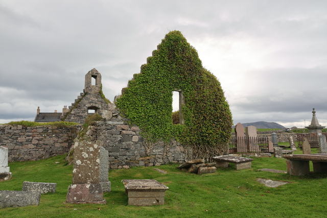
The ruins of the Balnakeil Church. It was established in the 1600s and abandoned in the 19th century when the current church was built.
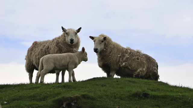
Today's sheep picture.
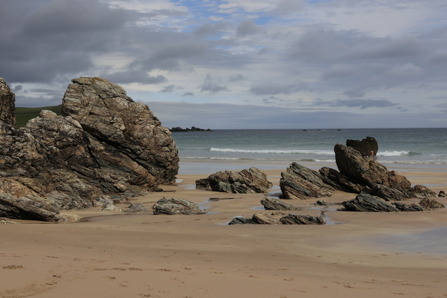
Rock on yet another beach. Durness beach.
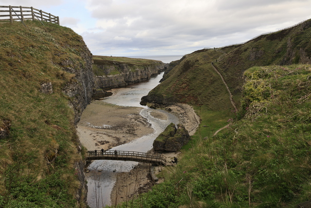
Looking down to the entrance of Smoo cave.
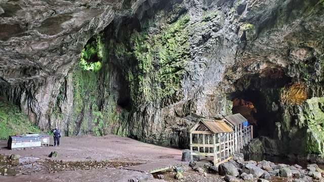
Smoo Cave is a large combined sea cave and freshwater cave.
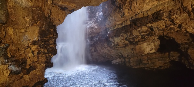
A waterfall is in the 2nd chamber.
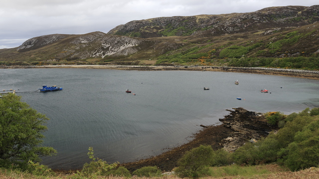
Along the road.
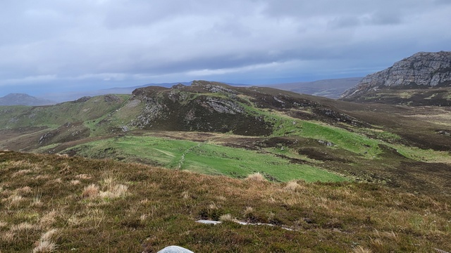
We climbed another hill to find another cache.
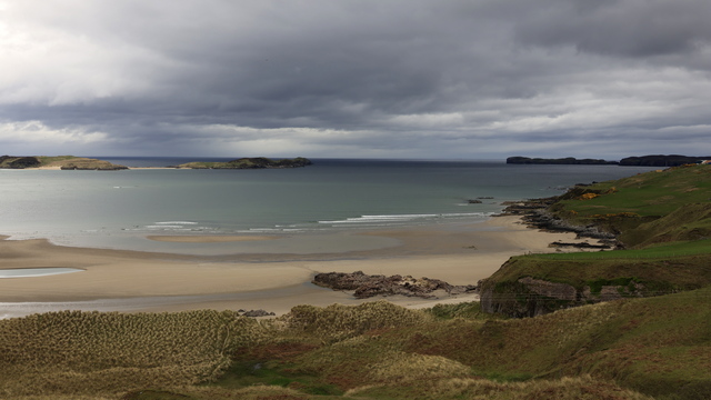
Coldbackie beach.
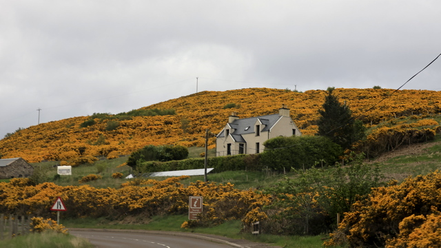
Needed some colour again today.
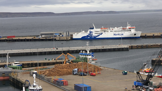
In Scrabster our airbnb was high on the cliff and we got a great view of the harbour from the sitting area attached to our room. We're taking that ferry to Orkney tomorrow morning.
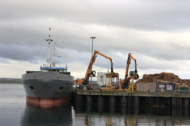
We walked into town for dinner. We watched a boat being load with wood while we ate.

The ruins of the Balnakeil Church. It was established in the 1600s and abandoned in the 19th century when the current church was built.

Today's sheep picture.

Rock on yet another beach. Durness beach.

Looking down to the entrance of Smoo cave.

Smoo Cave is a large combined sea cave and freshwater cave.

A waterfall is in the 2nd chamber.

Along the road.

We climbed another hill to find another cache.

Coldbackie beach.

Needed some colour again today.

In Scrabster our airbnb was high on the cliff and we got a great view of the harbour from the sitting area attached to our room. We're taking that ferry to Orkney tomorrow morning.

We walked into town for dinner. We watched a boat being load with wood while we ate.
2023/05/17: Achmore back to Ullapool and onto Kinlochbervie
Category: General
Posted by: The Agnew Family
It took us about 1.5 hours to drive back to Ullapool. The first part of the drive was 1 lane roads which are slower as you either slow way down or stop when you meet a car going the opposite direction. When we hit the two lane roads we made good time. The scenery was nice but nothing like what we saw yesterday. In Ullapool we got back on the NC500 and started driving north.
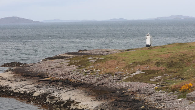
First stop was the Rhue lighthouse. It's not a big lighthouse and looks even smaller from a distance. We saw this lighthouse as the ferry entered Ullapool harbour yesterday.
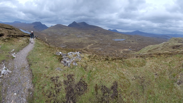
We stopped at the Knockan Crag National Nature Reserve in the North West Highlands Geopark. The low cliff of Knockan exposes rocks that set the scientific world ablaze in the 19th century, with the discovery that a slice of old rock sits on top of much younger ones. Rocks here are 500 million years old. The crag was formed by the Moine Thrust, the force of two continents crashing together. That's me walking on the trail --- the high wind make it a little chilly.
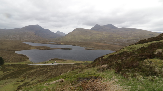
Looking down at one of the lakes you could see from the trail.
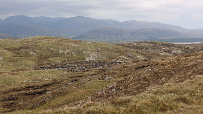
A view from near the top.
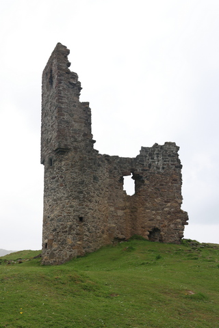
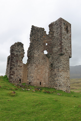
Two views of ruins of Ardvreck Castle, standing on a rocky promontory in Loch Assynt. The structure dates from about 1490 and is associated with the then landowners, the Macleods of Assynt. Thanks Wikipedia.
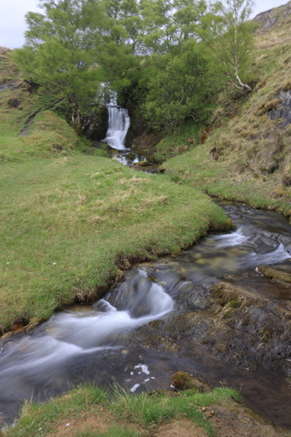
A little water falls across the road from the castle parking.
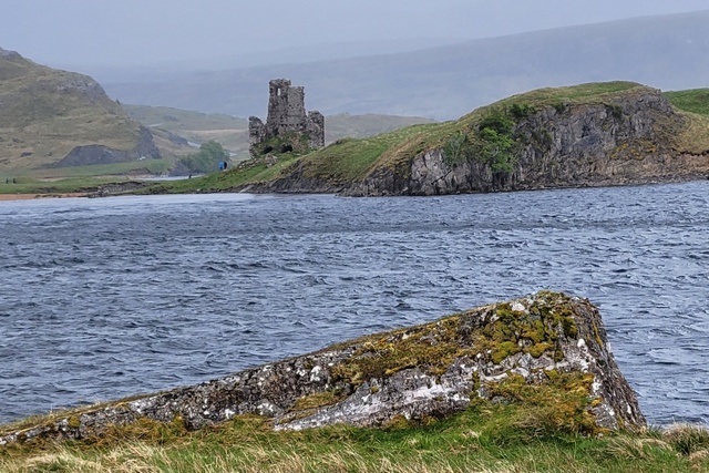
Ed got tired of wiping rain drops off the camera lens before you could take a picture so he switched to the cell phone. The cell phone does a great job in adverse weather conditions.
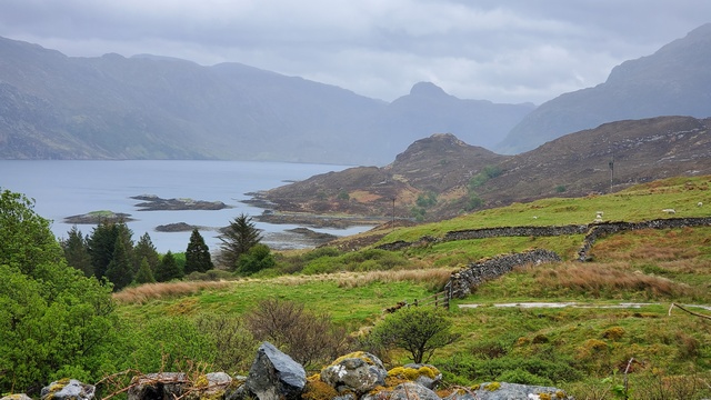
If the view looked pretty and there was parking we'd stop and take a photo.
Near Kylesku Bridge.
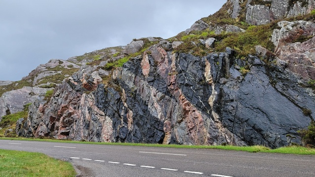
I think this rock is beautiful. The grey rock, Lewisian Gneiss formed deep inside the earth's crust. The rocks got so hot down there that they almost melted. Later on, other molten rock forced it's way through the gneiss and eventually hardened. The black rock (dolerite) and the pink (granite) have penetrated the grey gneiss.

First stop was the Rhue lighthouse. It's not a big lighthouse and looks even smaller from a distance. We saw this lighthouse as the ferry entered Ullapool harbour yesterday.

We stopped at the Knockan Crag National Nature Reserve in the North West Highlands Geopark. The low cliff of Knockan exposes rocks that set the scientific world ablaze in the 19th century, with the discovery that a slice of old rock sits on top of much younger ones. Rocks here are 500 million years old. The crag was formed by the Moine Thrust, the force of two continents crashing together. That's me walking on the trail --- the high wind make it a little chilly.

Looking down at one of the lakes you could see from the trail.

A view from near the top.


Two views of ruins of Ardvreck Castle, standing on a rocky promontory in Loch Assynt. The structure dates from about 1490 and is associated with the then landowners, the Macleods of Assynt. Thanks Wikipedia.

A little water falls across the road from the castle parking.

Ed got tired of wiping rain drops off the camera lens before you could take a picture so he switched to the cell phone. The cell phone does a great job in adverse weather conditions.

If the view looked pretty and there was parking we'd stop and take a photo.

Near Kylesku Bridge.

I think this rock is beautiful. The grey rock, Lewisian Gneiss formed deep inside the earth's crust. The rocks got so hot down there that they almost melted. Later on, other molten rock forced it's way through the gneiss and eventually hardened. The black rock (dolerite) and the pink (granite) have penetrated the grey gneiss.
2023/05/16: Ullapool to Achmore (almost back to Skye)
Category: General
Posted by: The Agnew Family
We're starting what is called the NC500 (Northern Coast 500) today. The route actually starts in Inverness but we're skipping the part from Inverness to Skye. I read that the section between Ullapool and Skye is amazing so we decided it was worth backtracking. Tomorrow we'll take a shorter, easier route back to Ullapool and continue North. In case you're wondering, yes the article was correct. The scenery was amazing, the roads very interesting but few parking spots so a lot of photos through the windshield photos.
Early this morning it was pouring rain, luckily it started to let up as we were heading out and got progressively better as the date went on. In retrospect we should have taken 2 days to do this drive as there were several cute towns that could have been explored and lots to trails to walk.
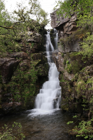
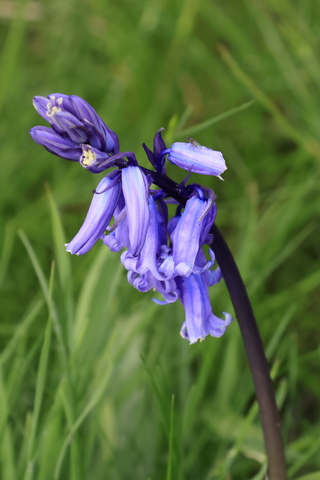
Ardessie Falls, right by the side of the road and one of the few wild flowers we've seen.
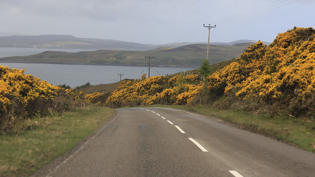
I think I've taken a hundred photos with the common grose.
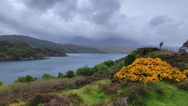
It brightens up a dull day. Today there were a lot of bushes along the roads.
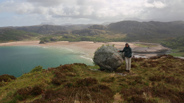
To find a geocache we climbed a hill. Not only did Ed find the geocache we got a wonderful view of Wester Ross. Sometimes the geocaches take you somewhere amazing.
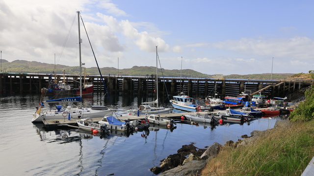
Gairloch has a cute harbour.
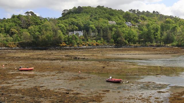
I hope no one needs the dinghies soon. They won't be going anywhere till the tide comes back in.
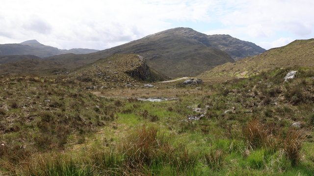
There's a number of hiking trails in the Torridon Hills, so there's a parking lot. We stopped, walked round, looked at a deer resting just off of the parking lot and took some photos.
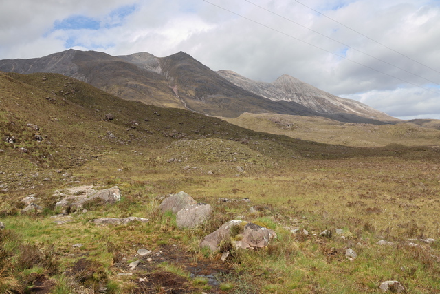
The Torridon Hills.
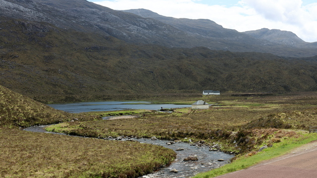
Across the road from the parking lot.
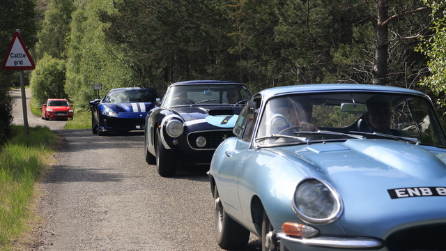
I saw more Ferraris today then I think I've seen in my lifetime (excluding TV of course). A group of at least 20 maybe even 30, mostly expensive, sports cars were going the opposite way on the road so they all passed us. I got a photo of 3 of them when we were in a passing spot and they were passing.
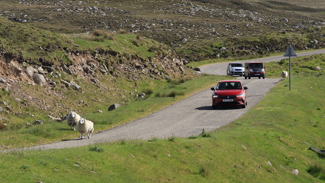
Some traffic moves slows even when they're going as fast as they can.
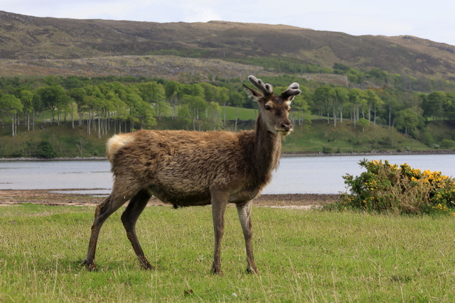
Just outside of Applecross we came across a number of wild deer grazing. This one posed nicely for us.
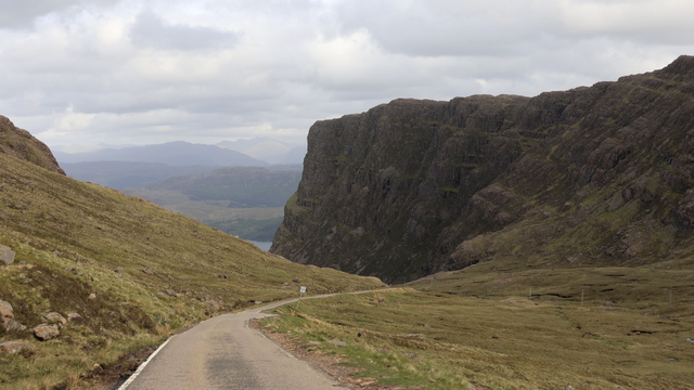
This is at the highest point on the Bealach Na Ba Pass or the road to Applecross. The road is 9.1 km long and the highest point is at 626m. The highest grade is 20% (which is steep) and the average grade is 7%. 626m really isn't that high but when you drive up it on a single lane road that is very twisty with the only armco barriers being near the top it's a little scary (well for me especially when I'm on the edge side). It get's even a bit scarier when a car is coming the other way and you have to pass. I asked Ed what he considered the worse road we've driven on the trip so far. He found all the blind hills that had unknown turns after them on the rocky side of Harris tiring to drive he said the pass was worse.
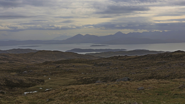
Early this morning it was pouring rain, luckily it started to let up as we were heading out and got progressively better as the date went on. In retrospect we should have taken 2 days to do this drive as there were several cute towns that could have been explored and lots to trails to walk.


Ardessie Falls, right by the side of the road and one of the few wild flowers we've seen.

I think I've taken a hundred photos with the common grose.
It brightens up a dull day. Today there were a lot of bushes along the roads.

To find a geocache we climbed a hill. Not only did Ed find the geocache we got a wonderful view of Wester Ross. Sometimes the geocaches take you somewhere amazing.

Gairloch has a cute harbour.

I hope no one needs the dinghies soon. They won't be going anywhere till the tide comes back in.

There's a number of hiking trails in the Torridon Hills, so there's a parking lot. We stopped, walked round, looked at a deer resting just off of the parking lot and took some photos.

The Torridon Hills.

Across the road from the parking lot.

I saw more Ferraris today then I think I've seen in my lifetime (excluding TV of course). A group of at least 20 maybe even 30, mostly expensive, sports cars were going the opposite way on the road so they all passed us. I got a photo of 3 of them when we were in a passing spot and they were passing.

Some traffic moves slows even when they're going as fast as they can.

Just outside of Applecross we came across a number of wild deer grazing. This one posed nicely for us.

This is at the highest point on the Bealach Na Ba Pass or the road to Applecross. The road is 9.1 km long and the highest point is at 626m. The highest grade is 20% (which is steep) and the average grade is 7%. 626m really isn't that high but when you drive up it on a single lane road that is very twisty with the only armco barriers being near the top it's a little scary (well for me especially when I'm on the edge side). It get's even a bit scarier when a car is coming the other way and you have to pass. I asked Ed what he considered the worse road we've driven on the trip so far. He found all the blind hills that had unknown turns after them on the rocky side of Harris tiring to drive he said the pass was worse.

Category: General
Posted by: The Agnew Family
Today we head back to the mainland. The ferry doesn't leave till 2 pm so we have time to do a little geocaching. This time we drive north from Stornoway on the east side of Lewis. It's much flatter here and the sheep are mostly in neat fenced in fields. Very different from our drive on the each side of Harris yesterday.
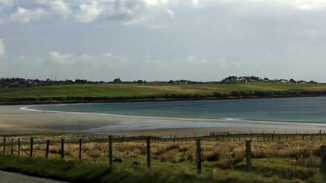
There also some beautiful sandy beaches along this coast.
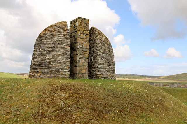
This is one of 3 memorials commemorating the land raiders. This memorial stands on a low hill surrounded by earthworks in the form of trenches and waves, a reminder of the First World War and the promises made to those who survived the conflict. After having fought and faced the horrors of the First World War, crofters returned to Lewis to make good the promise of land and homes made to them by the government. Unfortunately the new landowner Lord Leverhulme had other plans for the land and denied crofting land to the ex-servicemen. The ex-servicemen raided the farms over the next couple of years and eventually in 1922 the Board of Agriculture took over the farms and divided them into 100 new crofts.
Lord Leverhulme had established the very successful soap manufacturing company, Lever Brothers and bought the Isle of Lewis in 1918. He lived in the Lews Castle and later bought Harris. His intention was to revolutionise the lives of the population of these islands. His plans included industrialisation of the island resources including fish, seaweed, peat, and unproductive land. Lewis would grow to become an island of up to 200,000 people and major infrastructure was to be built to support the industry which included a railway. (borrowed from Visit Outer Hebrides website). Sorry for information overload I just thought it was a really interesting story)
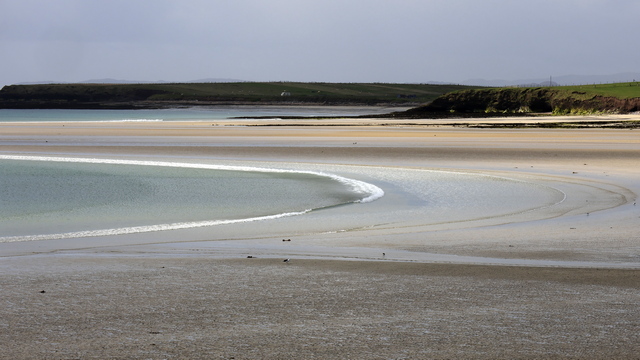
Another beautiful beach.
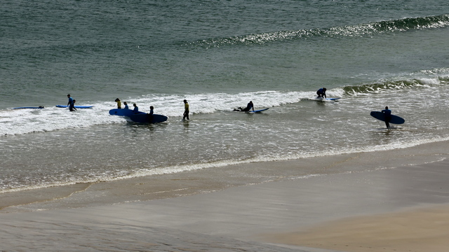
and another beautiful beach. At least this time there's actually people using the beach, very brave people I think. It was a little warmer today --- I think most of the time I was only wearing my down sweater. :)
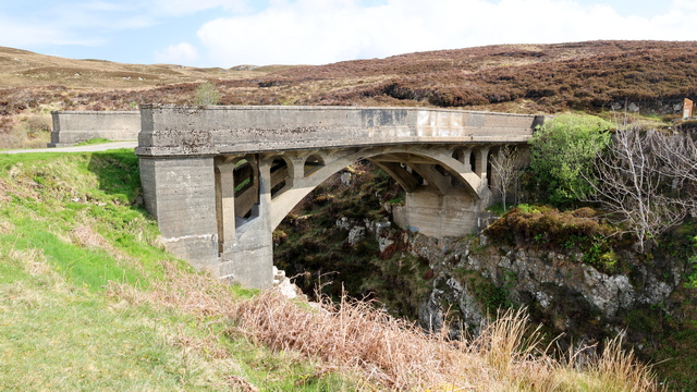
The Bridge to Nowhere or Garry Bridge was build by Lord Leverhulme in the process of continuing the road north along the coast. The building of road was abandoned when the raiders won their fight for crofts. Lewis and Harris would very different if the raiders hadn't won.
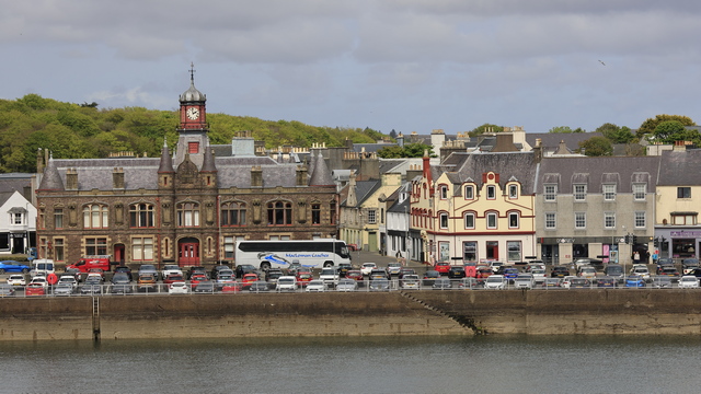
A view of Stornoway.
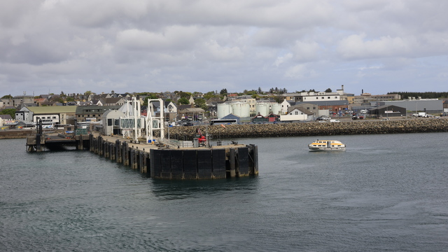
Leaving Stornoway. Yes, that's a tender in the water. There was a cruise ship anchored just outside of the harbour.
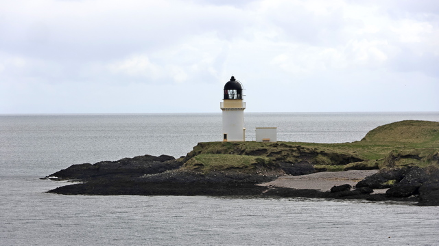
A lighthouse in the harbour.
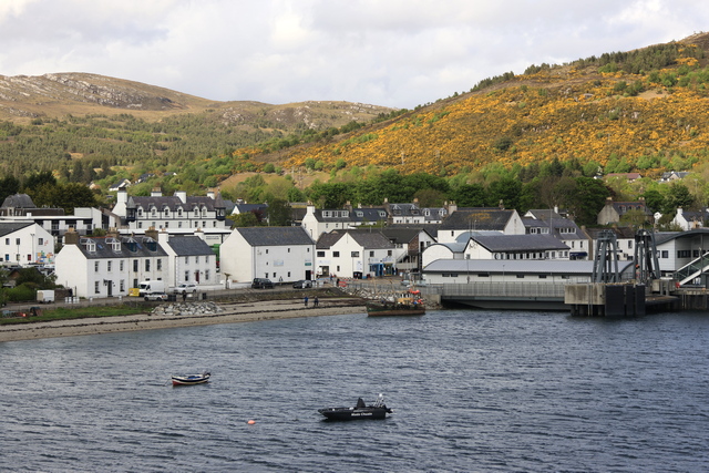
Arriving at Ullapool.
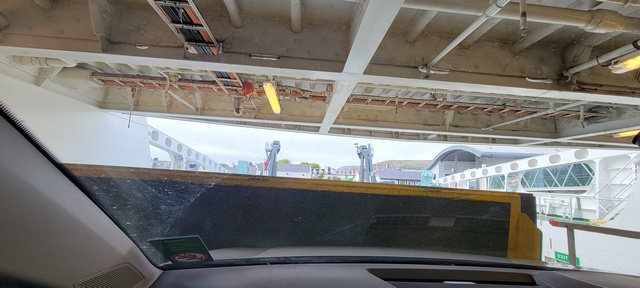
I know you're asking yourself "what is this a picture of?". It's what you see when you are the front care on the mezzanine on a ferry. I was not thrilled when I realized that we were actually parked on the ramp. This section of the mezzanine was lowered and became the ramp. Ed had me recording us being lowered so it wasn't as scary as I thought it would be.
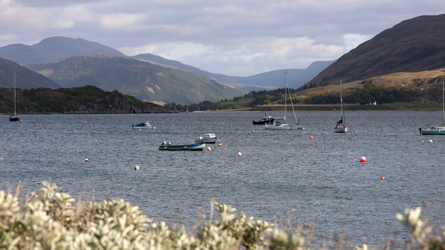
Ullapool harbour.

There also some beautiful sandy beaches along this coast.

This is one of 3 memorials commemorating the land raiders. This memorial stands on a low hill surrounded by earthworks in the form of trenches and waves, a reminder of the First World War and the promises made to those who survived the conflict. After having fought and faced the horrors of the First World War, crofters returned to Lewis to make good the promise of land and homes made to them by the government. Unfortunately the new landowner Lord Leverhulme had other plans for the land and denied crofting land to the ex-servicemen. The ex-servicemen raided the farms over the next couple of years and eventually in 1922 the Board of Agriculture took over the farms and divided them into 100 new crofts.
Lord Leverhulme had established the very successful soap manufacturing company, Lever Brothers and bought the Isle of Lewis in 1918. He lived in the Lews Castle and later bought Harris. His intention was to revolutionise the lives of the population of these islands. His plans included industrialisation of the island resources including fish, seaweed, peat, and unproductive land. Lewis would grow to become an island of up to 200,000 people and major infrastructure was to be built to support the industry which included a railway. (borrowed from Visit Outer Hebrides website). Sorry for information overload I just thought it was a really interesting story)

Another beautiful beach.

and another beautiful beach. At least this time there's actually people using the beach, very brave people I think. It was a little warmer today --- I think most of the time I was only wearing my down sweater. :)

The Bridge to Nowhere or Garry Bridge was build by Lord Leverhulme in the process of continuing the road north along the coast. The building of road was abandoned when the raiders won their fight for crofts. Lewis and Harris would very different if the raiders hadn't won.

A view of Stornoway.

Leaving Stornoway. Yes, that's a tender in the water. There was a cruise ship anchored just outside of the harbour.

A lighthouse in the harbour.

Arriving at Ullapool.

I know you're asking yourself "what is this a picture of?". It's what you see when you are the front care on the mezzanine on a ferry. I was not thrilled when I realized that we were actually parked on the ramp. This section of the mezzanine was lowered and became the ramp. Ed had me recording us being lowered so it wasn't as scary as I thought it would be.

Ullapool harbour.