10/09: Oh, What a Beautiful Morning, Oh What a Beautiful Day….
Category: General
Posted by: The Agnew Family
The sun was shining when we woke this morning and it shined all day. Not one bit of fog. The weather really co-operated today --- we could look out over the water and see Nova Scotia and we could look down the coast and see the peninsula that is the Fundy Trail about 50 kilometers south west.
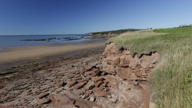
A beach just outside of Alma
Cape Enrage is about 20 kilometers east of Alma along the coast. There is a lighthouse, beach, rappelling, zip line and a restaurant. Sharon, one of the women who is employed at Cape Enrage is a fountain of knowledge about Cape Enrage and the surrounding area. With a name like Cape Enrage one would expect violent water but the water is actually quite calm. I guess there were enough stormy conditions for the French description of the coast to be 'cape of rage'.
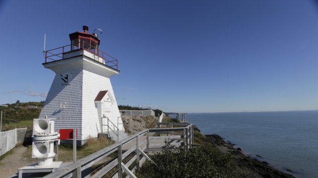
The lighthouse marks Cape Enrage. When the lighthouse was converted to modern equipment (i.e. the lighthouse keeper was no longer required) it quickly fell into disrepair. A number of years later, a teacher, the son of a lighthouse keeper, received permission to repair the lighthouse. He recruited students to help do the repairs enticing them with outdoor activities like repelling from the cliff. This was the start of the Not-for Profit Organization that currently maintains the property
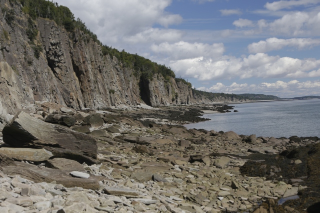
Cape Enrage is on an island called Barn Marsh Island. It's beach is rocky and only accessible for a couple of hours before and after low tide. Fossils that have been strewn from the cliffs can be found on the beach.
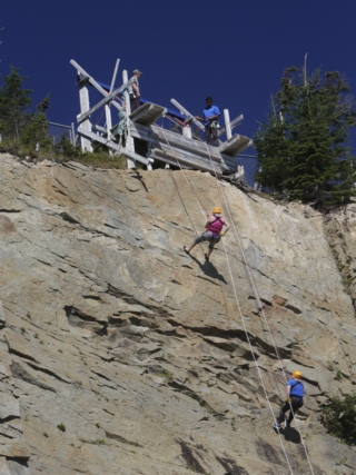
Ed and I watch a couple of women repelling from the cliff. I was tempted to try it but not tempted enough to actually do it.
Using Sharon’s directions Ed and I set off to explore the area.
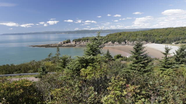
From atop a hill at Cape Enrage we saw beautiful Barn March Beach. We stopped to explore the beach and found one of the geocaches placed Province of New Brunswick here.
Mary’s Point is known as a good birding area. Between mid July and mid August over 300,000 thousand Semipalmated Sandpipers as well as large numbers of other Artic-breeding shorebirds stop here during their migration to South America. There were only a few gulls on the beach but it’s a pretty beach at low tide.
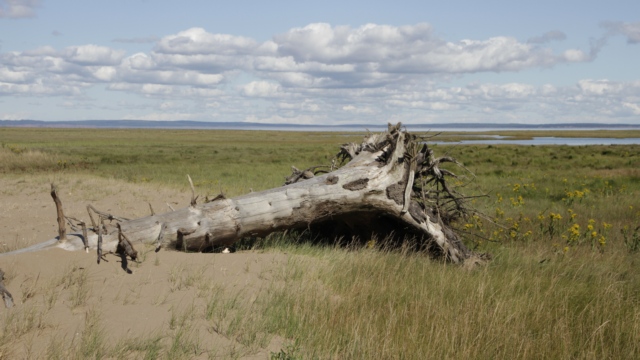
The beach at Mary’s Point.
Just down the road from the beach is Shipyard Park. Sharon told us that one woman was the driving force behind the park.
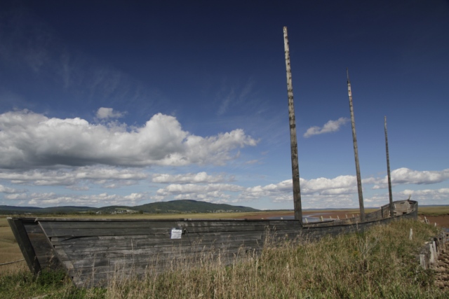
It looks like an old boat but it’s actually just a mock up of a boat. The masts are telephone poles and the sides are built on the ground.
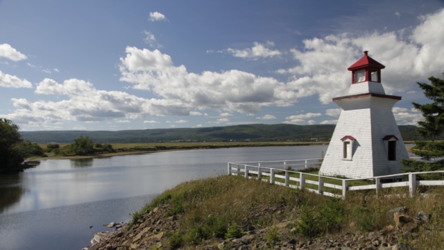
This is the Anderson Hollow Lighthouse from Waterside NB and it has been relocated 4 times and is currently in Shipyard Park at Harvey Bank
.
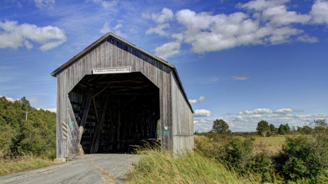
Yes, another covered bridge. This one is the Sawmill Creek Bridge built in 1905. In 1975 a concrete bridge was built on the new road and this bridge was closed to traffic.

A beach just outside of Alma
Cape Enrage is about 20 kilometers east of Alma along the coast. There is a lighthouse, beach, rappelling, zip line and a restaurant. Sharon, one of the women who is employed at Cape Enrage is a fountain of knowledge about Cape Enrage and the surrounding area. With a name like Cape Enrage one would expect violent water but the water is actually quite calm. I guess there were enough stormy conditions for the French description of the coast to be 'cape of rage'.

The lighthouse marks Cape Enrage. When the lighthouse was converted to modern equipment (i.e. the lighthouse keeper was no longer required) it quickly fell into disrepair. A number of years later, a teacher, the son of a lighthouse keeper, received permission to repair the lighthouse. He recruited students to help do the repairs enticing them with outdoor activities like repelling from the cliff. This was the start of the Not-for Profit Organization that currently maintains the property

Cape Enrage is on an island called Barn Marsh Island. It's beach is rocky and only accessible for a couple of hours before and after low tide. Fossils that have been strewn from the cliffs can be found on the beach.

Ed and I watch a couple of women repelling from the cliff. I was tempted to try it but not tempted enough to actually do it.
Using Sharon’s directions Ed and I set off to explore the area.

From atop a hill at Cape Enrage we saw beautiful Barn March Beach. We stopped to explore the beach and found one of the geocaches placed Province of New Brunswick here.
Mary’s Point is known as a good birding area. Between mid July and mid August over 300,000 thousand Semipalmated Sandpipers as well as large numbers of other Artic-breeding shorebirds stop here during their migration to South America. There were only a few gulls on the beach but it’s a pretty beach at low tide.

The beach at Mary’s Point.
Just down the road from the beach is Shipyard Park. Sharon told us that one woman was the driving force behind the park.

It looks like an old boat but it’s actually just a mock up of a boat. The masts are telephone poles and the sides are built on the ground.

This is the Anderson Hollow Lighthouse from Waterside NB and it has been relocated 4 times and is currently in Shipyard Park at Harvey Bank
.

Yes, another covered bridge. This one is the Sawmill Creek Bridge built in 1905. In 1975 a concrete bridge was built on the new road and this bridge was closed to traffic.