16/05: The Burren
Category: General
Posted by: The Agnew Family
And this evening's beer is Harp lager and another wonderful Irish cider.
I can't think of a better way to describe the Burren than to borrow text for the web. This is from the Galway on-line vistor guide.
"The Burren, in North County Clare and parts of South County Galway covering an area of 160 square km, is unique - it is like no other place in Ireland. There are no bogs and very few pastures. Instead there are huge pavements of limestone called 'clints' with vertical fissures in the called 'grikes'. The Burren was under a tropical ocean over 360 million years ago, the result being the area covered with limestone, it was tectonic movement that raised an area of this ancient seabed into a magnificent plateau that we now know as 'The Burren'. The Ice Age ploughed through the area widening the river valleys and leaving behind boulder clay. It was after the Ice Age that the landscape went through periods of tundra and may have even been wooded, evidence suggests that early settlers cut down the forest, and allowed the soil to be eroded away, this has happened in many of the worlds karst regions. Centuries of weathering has produced a terrain of fissured limestone pavements, disappearing lakes, terraced mountains, and underground cave systems."
This morning started with rain and ended up sunny. Dressed for rain, Ed and I drove out to the Burren for a hike.
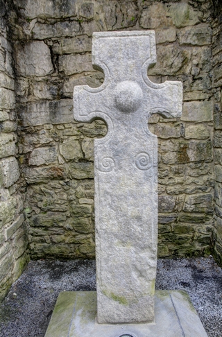
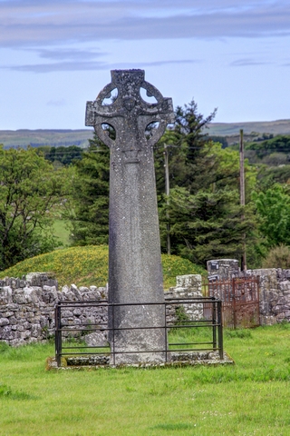
First stop was the small town of Kilfenora where we found these crosses.
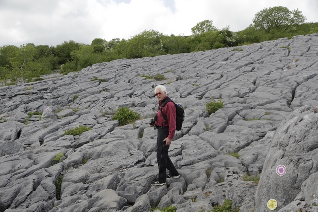
As I forgot Ed's hiking boots at the B&B, we did at short hike at the National Park. Then we started walking up a road and ended up on a farm loop trail. One we got started we just kept on going. This is some the rock in the Burrent.
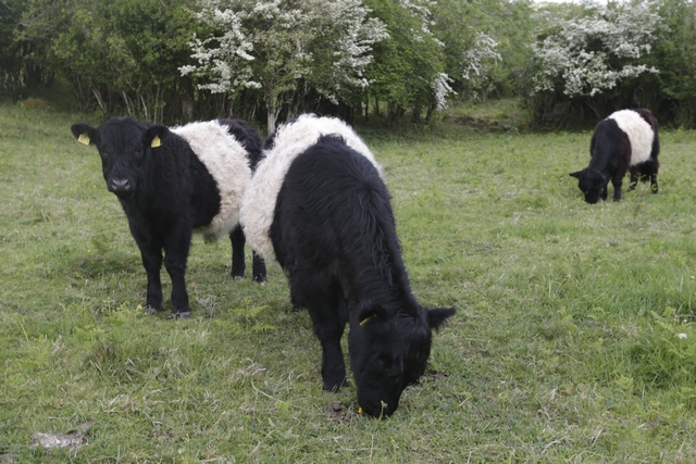
Part of a trail was on a working farm. In one field we met the farmer and some of his Scottish Belted Galloway cows.
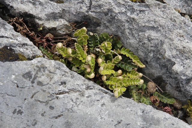
If there was any soil in a hole a plant took root.
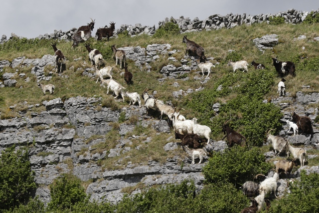
On the ridge above the hiking trail was a herd of goats.
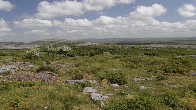
The trail took us up into the hills yeilding some amazing views.
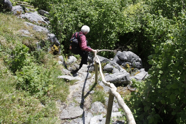
What goes up must come down. The trail going up didn't seem steep, but coming down we hit some steep sections. A few were steep enough that hand rails were fashioned out of tree branches.
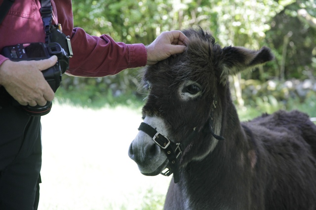
Not sure if guy was a donkey, mule or something else, but he sure was freindly. The trail took us through the field he was hanging out in.
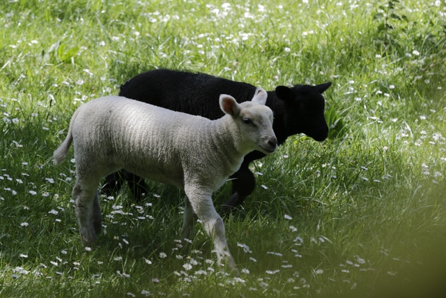
Another field had sheep including these babies. At the end of the hike I found a sign board that indicated the hike was 6 km, would take 2 1/2 to 3 hours and was classified as "hard". Good thing I didn't read the sign board before we started.
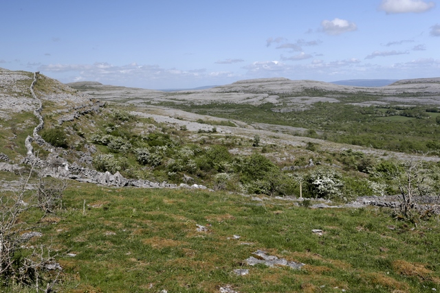
After the hike we started driving back to the coast on some back roads that took us through more of the burren.
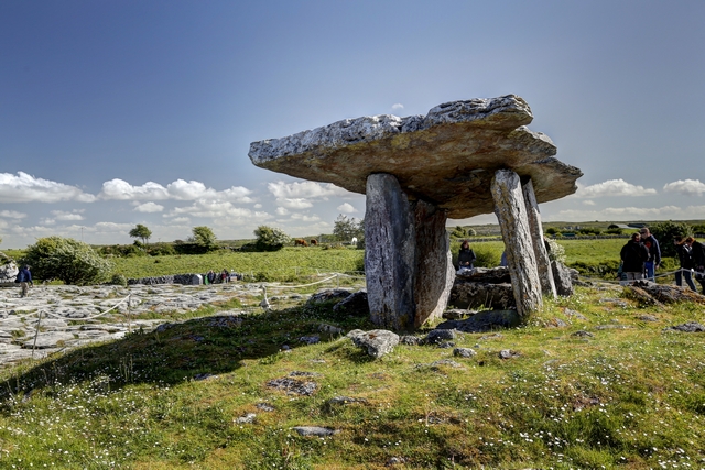
This is the Poulnabrone Dolmen aka the portal tomb
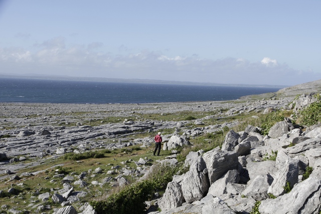
Where the burren meets the sea. Inland, the mountain rose quickly, but here there was a flat expanse of rocks down to the water.
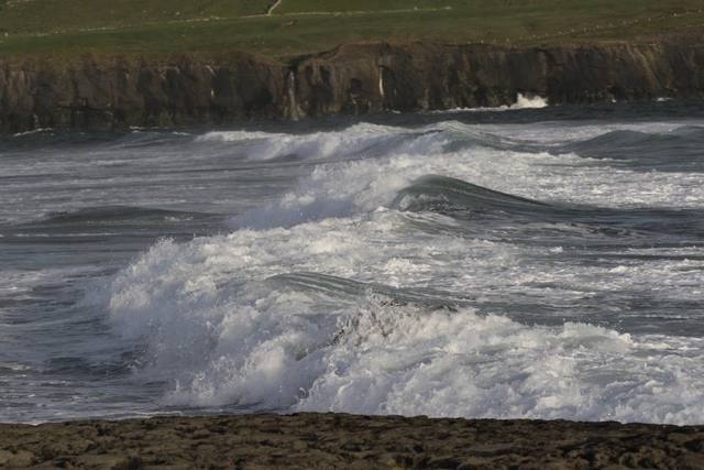
Good waves out by Doolin pier.
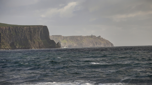
The backside of the Cliffs of Moher seen from Doolin.
I can't think of a better way to describe the Burren than to borrow text for the web. This is from the Galway on-line vistor guide.
"The Burren, in North County Clare and parts of South County Galway covering an area of 160 square km, is unique - it is like no other place in Ireland. There are no bogs and very few pastures. Instead there are huge pavements of limestone called 'clints' with vertical fissures in the called 'grikes'. The Burren was under a tropical ocean over 360 million years ago, the result being the area covered with limestone, it was tectonic movement that raised an area of this ancient seabed into a magnificent plateau that we now know as 'The Burren'. The Ice Age ploughed through the area widening the river valleys and leaving behind boulder clay. It was after the Ice Age that the landscape went through periods of tundra and may have even been wooded, evidence suggests that early settlers cut down the forest, and allowed the soil to be eroded away, this has happened in many of the worlds karst regions. Centuries of weathering has produced a terrain of fissured limestone pavements, disappearing lakes, terraced mountains, and underground cave systems."
This morning started with rain and ended up sunny. Dressed for rain, Ed and I drove out to the Burren for a hike.


First stop was the small town of Kilfenora where we found these crosses.

As I forgot Ed's hiking boots at the B&B, we did at short hike at the National Park. Then we started walking up a road and ended up on a farm loop trail. One we got started we just kept on going. This is some the rock in the Burrent.

Part of a trail was on a working farm. In one field we met the farmer and some of his Scottish Belted Galloway cows.

If there was any soil in a hole a plant took root.

On the ridge above the hiking trail was a herd of goats.

The trail took us up into the hills yeilding some amazing views.

What goes up must come down. The trail going up didn't seem steep, but coming down we hit some steep sections. A few were steep enough that hand rails were fashioned out of tree branches.

Not sure if guy was a donkey, mule or something else, but he sure was freindly. The trail took us through the field he was hanging out in.

Another field had sheep including these babies. At the end of the hike I found a sign board that indicated the hike was 6 km, would take 2 1/2 to 3 hours and was classified as "hard". Good thing I didn't read the sign board before we started.

After the hike we started driving back to the coast on some back roads that took us through more of the burren.

This is the Poulnabrone Dolmen aka the portal tomb

Where the burren meets the sea. Inland, the mountain rose quickly, but here there was a flat expanse of rocks down to the water.

Good waves out by Doolin pier.

The backside of the Cliffs of Moher seen from Doolin.