2007/03/28
Hike the Lower Trails
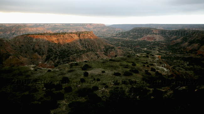
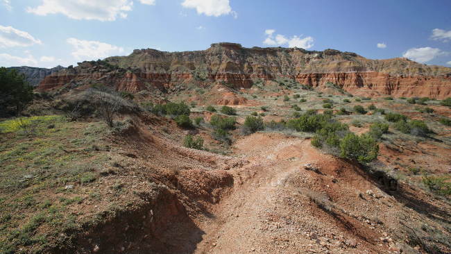
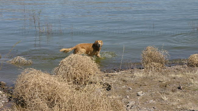
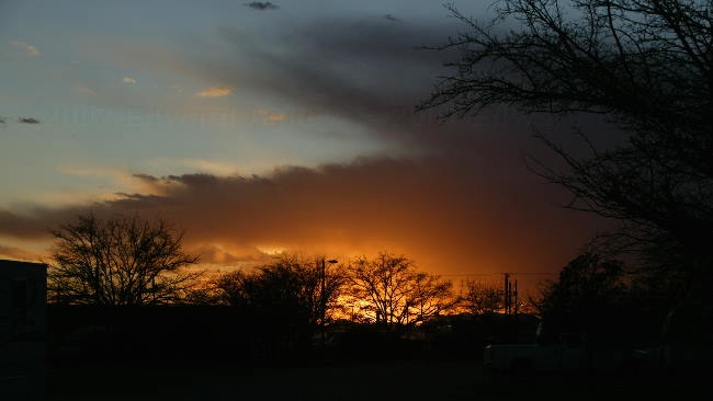
We decided to take it easier today and hiked several of the interior trails that linked together to make a 5 mile trek and I wasn’t silly today so we drove to the trail head. Part of the hike was along the river where we saw remnants of the recent flooding resulting from the severe thunder storms of March 23. The main park road crosses the river six times and the last one was still closed (the water is still a foot above the road), the road in one of the picnic areas was a pond, and there were some huge puddles on the trail. We talked to a local and he said they never complain about the storms as they are happy with any rain especially after last years drought and subsequent grass fires. So far they have had over 4 inches of rain in March where the average rainfall for March is 1.13 inches — I guess the people in the panhandle are happy this year.
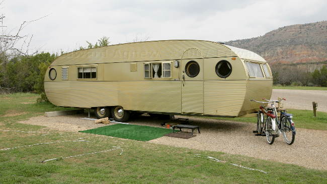
A vintage trailer and vintage bikes --- there was a modern SUV pulling it. It was very cool looking but I think I'll stick to our modern trailer.
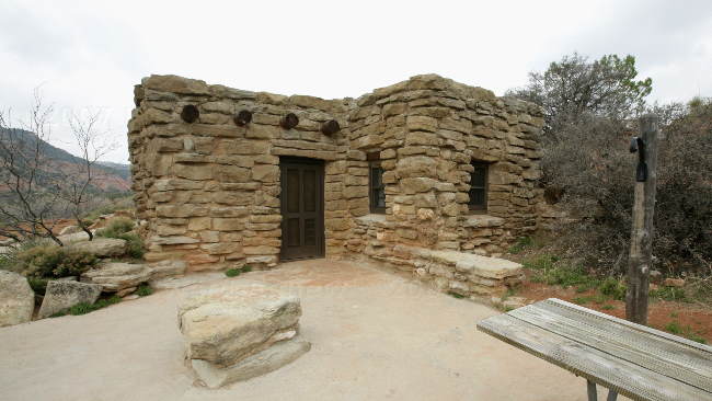
This is the largest cabin in the "Cow Camp" built by the CCC. You can rent it for $55 a night.
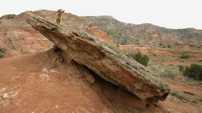
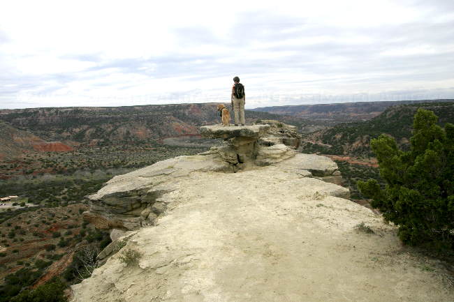
Zaph checking out the view in one of the other campgrounds.
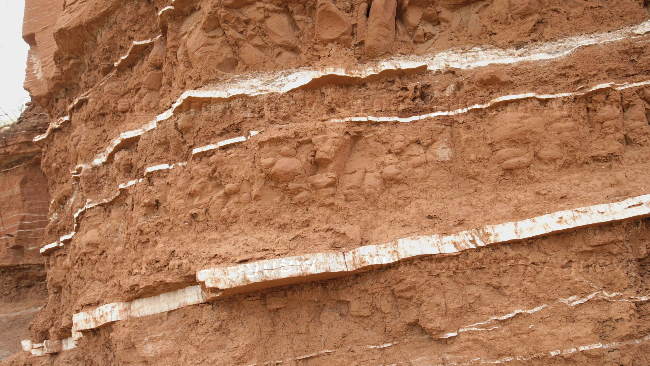
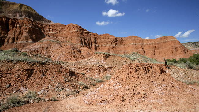
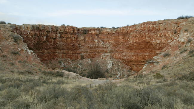
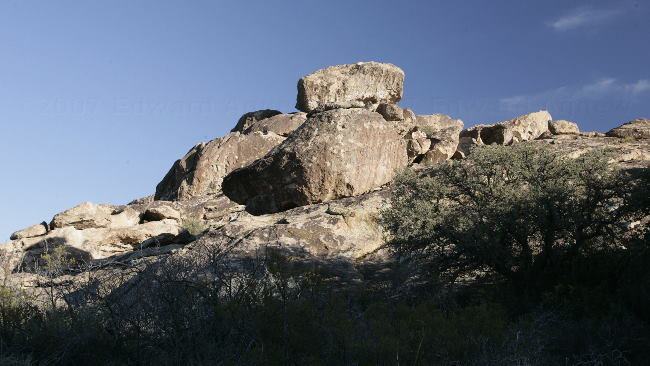
This rock is part of the Quartermaster Formations --- red claystone and white gypsum.
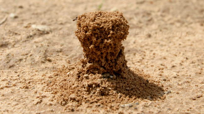
Interesting ant hill.
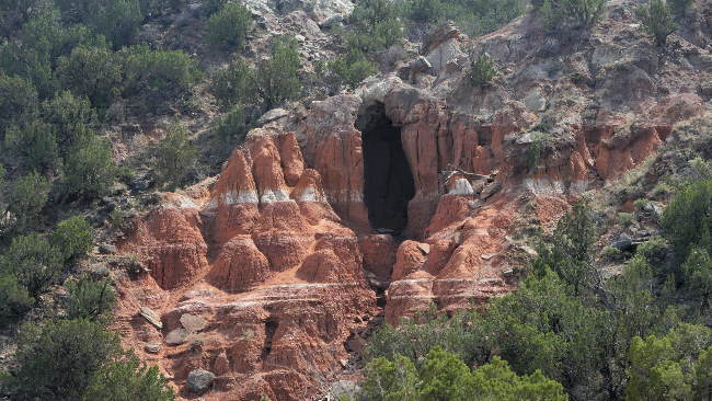
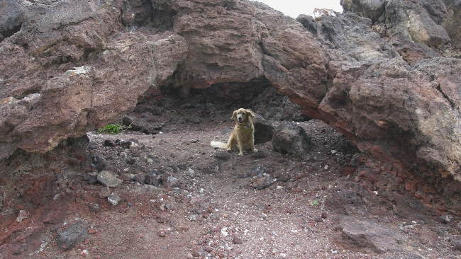
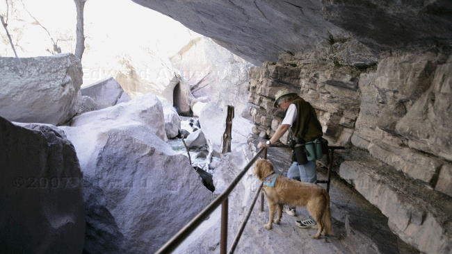
One of many caves in the cliffs.
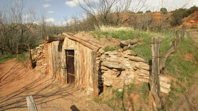
This type of "dugout" house was used by the first rancher in the area.
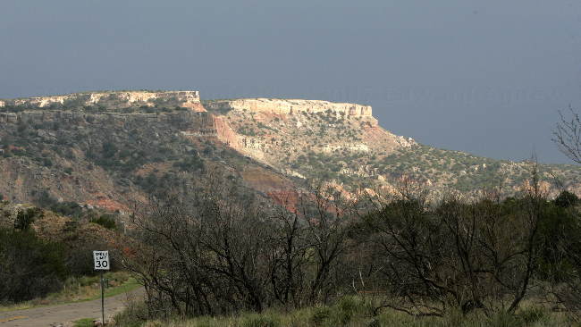
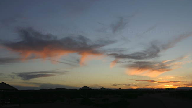
Ed drove to the top of the canyon hoping for sunset photos --- unfortunately a nasty thunderstorm was on its way.
A vintage trailer and vintage bikes --- there was a modern SUV pulling it. It was very cool looking but I think I'll stick to our modern trailer.
This is the largest cabin in the "Cow Camp" built by the CCC. You can rent it for $55 a night.
Zaph checking out the view in one of the other campgrounds.
This rock is part of the Quartermaster Formations --- red claystone and white gypsum.
Interesting ant hill.
One of many caves in the cliffs.
This type of "dugout" house was used by the first rancher in the area.
Ed drove to the top of the canyon hoping for sunset photos --- unfortunately a nasty thunderstorm was on its way.
2007/03/27
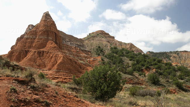
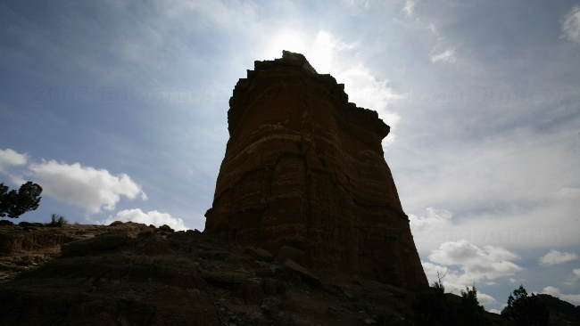
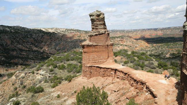
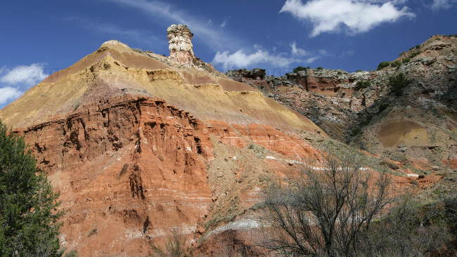
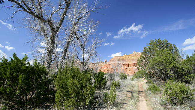
Hike to the Lighthouse
The most famous landmark at Palo Duro is the erosion feature called “The Lighthouse”. We couldn’t be here and not see it so today we hike the 10 mile round trip to see it. It’s actually a 6 mile round trip hike but we added an extra 4 miles by hiking from the campsite — sometimes I really wish the truck would come to a whistle like Trigger use to do for Roy Rogers. The hike was definitely worth it as you hopefully can tell from the photos. We managed to tire Zaph out — probably a combination of having to carry a pack, the length of the hike and the heat.
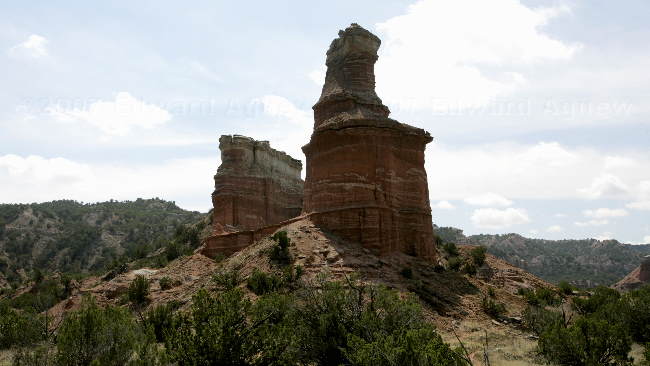
The "lighthouse"
Another view of the "lighthouse"
One last view of the "lighthouse"
One of the many interesting rock formations.
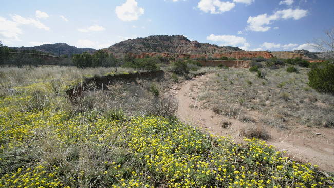
The spring flowers are out --- most are yellow but there are some purple and white ones too.
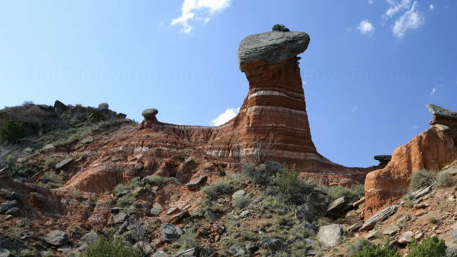
The "lighthouse"
Another view of the "lighthouse"
One last view of the "lighthouse"
One of the many interesting rock formations.
The spring flowers are out --- most are yellow but there are some purple and white ones too.
2007/03/26
Hike to the Top
During our visit to the information center we found out that there is a hike from the amphitheater (a five minute walk from our campsite) at the bottom of the canyon to the view point by the information center at the top of the canyon and it is suppose to yield the best views. This is a newly opened “old” trail that does not appear on the current park map. The trail was made by the CCC in the 1930s and at some point was closed. It has been cleaned up in the last couple of years and opened less than a year ago. Zaph was ready for a good hike so the three of us headed up. The views were spectacular.
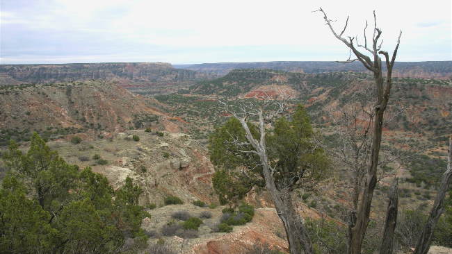
A view of the canyon
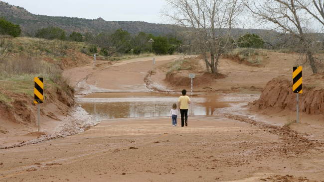
During a drive around the park we came across this flooded river crossing --- there's about a foot of water on the road. The flooding resulted from severe thunderstorms on March 23.
Zaph and Frances looking down on the canyon.
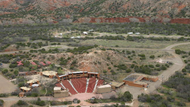
Looking down on the amphitheater and campground --- our trailer is the 2nd one from the left.
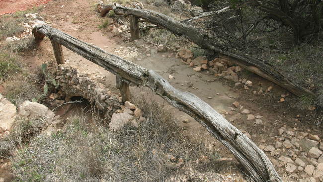
One of the bridges on the trail built by the CCC.
A view of the canyon
During a drive around the park we came across this flooded river crossing --- there's about a foot of water on the road. The flooding resulted from severe thunderstorms on March 23.
Zaph and Frances looking down on the canyon.
Looking down on the amphitheater and campground --- our trailer is the 2nd one from the left.
One of the bridges on the trail built by the CCC.
2007/03/25
Howdy Texas
Back in truck and heading east. As we leave New Mexico the landscape becomes very, very flat. Good thing there are cattle grazing as they break the monotony of the flat countryside. We are headed to the Palo Duro Canyon State Park and we are wondering about a canyon in a totally flat landscape. As we near the entrance to park, we see a gap and the canyon appears before us. The canyon is a gouge (800 feet deep and 120 miles long) cut into the landscape by the Prairie Dog Town Fork a spur of the Red River. The campground is situated in the bottom of the canyon placing us in a beautiful setting. As we are setting up the official greeters come by — a flock of wild turkeys.
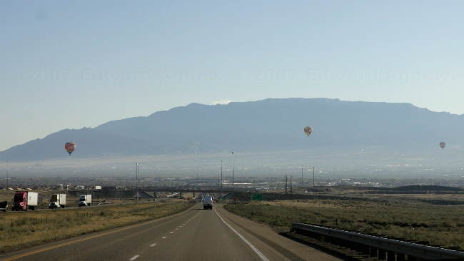
A view of Albuquerque as we head east --- Albuquerque is one of the top hot air balloon destinations in the world.
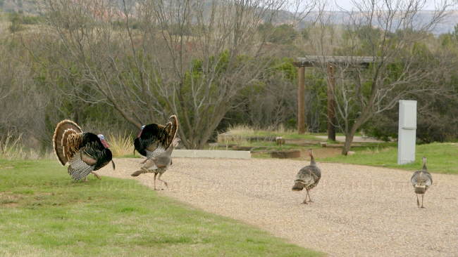
The welcoming committee
A view of Albuquerque as we head east --- Albuquerque is one of the top hot air balloon destinations in the world.
The welcoming committee
2007/03/24
Pueblo Indians
One of the attractions of the Albuquerque area are the Pueblos of New Mexico. The 19 pueblos are distinct in every way but they did join together to create the Indian Pueblo Cultural Center in Albuquerque. The center houses two exhibit rooms, a museum, a restaurant and several meeting rooms. On weekends the different pueblos take turns demonstrating their native dances.
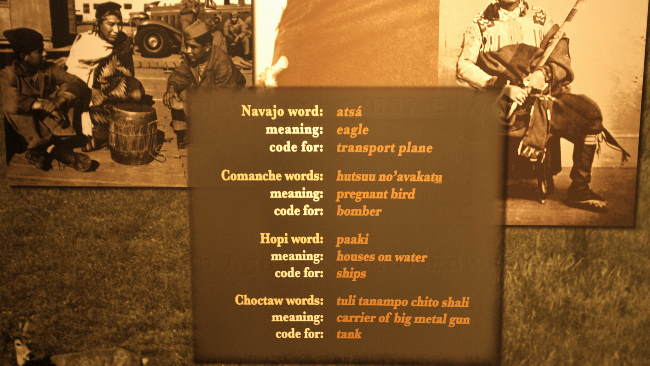
"Code Talkers" were unsung heroes of WWI and WWII. The languages of the pueblo people were used as a code which was unbreakable as these languages do not have a root in any other language.
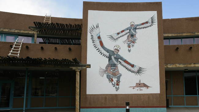
One of several murals displayed in the courtyard.
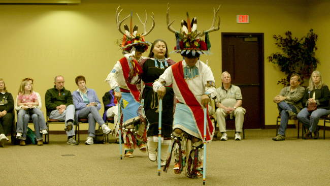
Zuni dancers
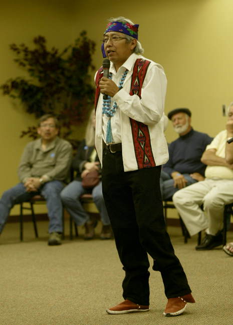
The emcee, singer and drummer.
"Code Talkers" were unsung heroes of WWI and WWII. The languages of the pueblo people were used as a code which was unbreakable as these languages do not have a root in any other language.
One of several murals displayed in the courtyard.
Zuni dancers
The emcee, singer and drummer.
2007/03/23
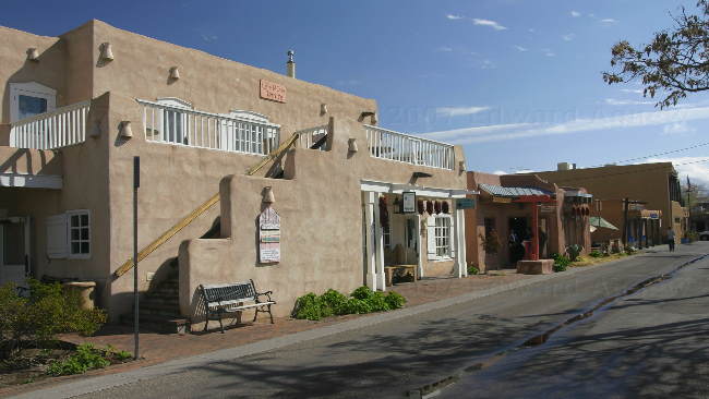
Old Town
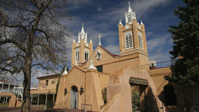
"Old Town" is the original core of the city which currently spans a 4 block area and is, of course, full of shops and restaurants. The center of this area is a plaza and a church. The church was built in 1706 and is still used today.
The Petroglyph National Monument is also home to the "Three Sisters", remnants of three volcanoes that produced the rock the petroglyphs are found on. As Zaph thought he deserved a walk after being left in the trailer for the morning we headed to the volcanoes. The wind picked up and it looked we were going to get rained on but the storm missed us.
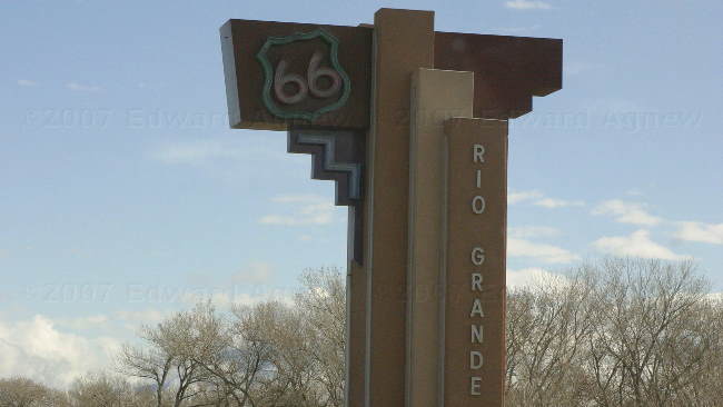
The first route from Chicago to Los Angles went through Albuquerque.
The church.
The downtown area.
Ed, that's quite the hat but I don't think it's you.
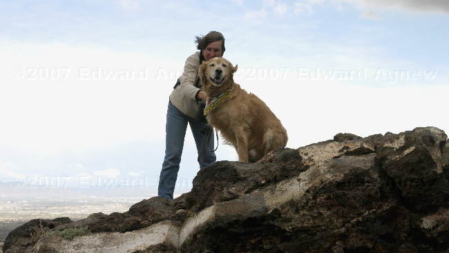
Zaph and Frances on top of one of the "volcanoes" trying to avoid being blown away.
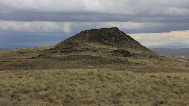
One of the volcanoes.
Zaph trying to stay out of the weather in a cave.
We're not sure the significance of a volcano in the center of a rainbow.
The Petroglyph National Monument is also home to the "Three Sisters", remnants of three volcanoes that produced the rock the petroglyphs are found on. As Zaph thought he deserved a walk after being left in the trailer for the morning we headed to the volcanoes. The wind picked up and it looked we were going to get rained on but the storm missed us.
The first route from Chicago to Los Angles went through Albuquerque.
The church.
The downtown area.
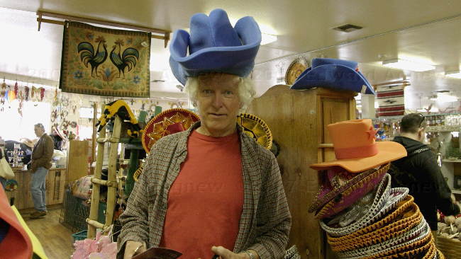
Ed, that's quite the hat but I don't think it's you.
Zaph and Frances on top of one of the "volcanoes" trying to avoid being blown away.
One of the volcanoes.
Zaph trying to stay out of the weather in a cave.
We're not sure the significance of a volcano in the center of a rainbow.
2007/03/22
Albuquerque
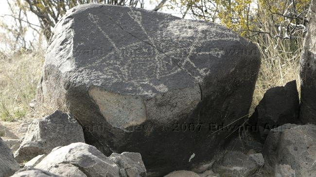
Our last stop in New Mexico is Albuquerque. We would have liked to gone to the northern part of New Mexico but we are wimpy and don't want to go anywhere there is snow in the forecast. I guess we just do it another year during a spring or fall trip. On the northern edge of Albuquerque is the Petroglyph National Monument --- yup more rocks with pictures. Most of the petroglyphs were created by Indian cultures though some (crosses) were done by the Spanish.
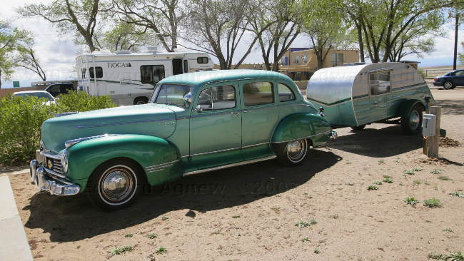
A "modern" car and trailer. I think it's the RV Park's owner's toy.
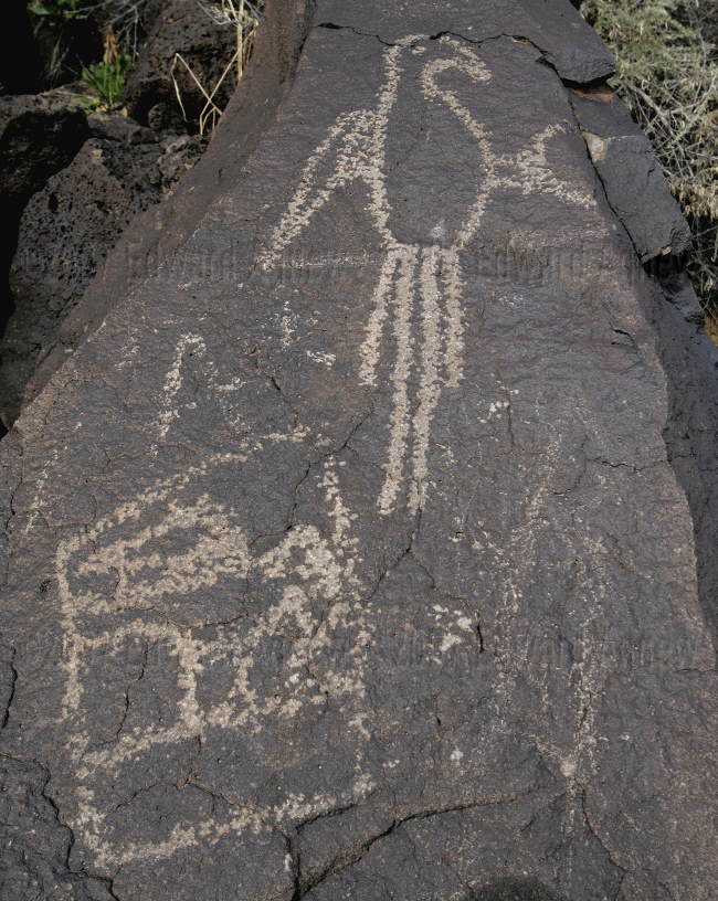
The "bird" is used as the symbol for the park.
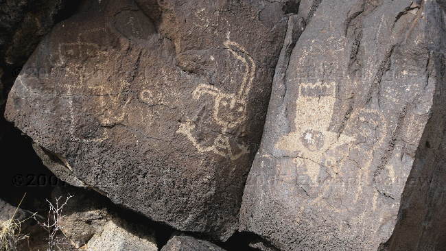
Ed likes to think the more interesting "people" are actually aliens.
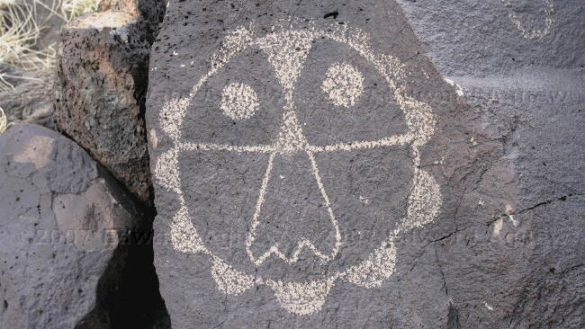
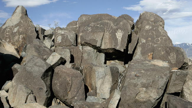
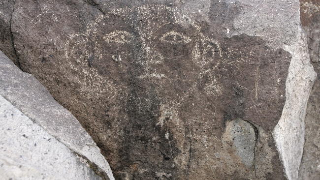
Many of the petroglyphs are faces or masks.
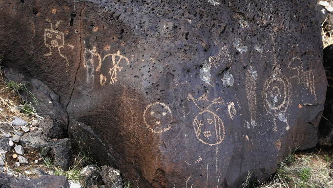
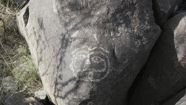
Spirals are another common theme.
A "modern" car and trailer. I think it's the RV Park's owner's toy.
The "bird" is used as the symbol for the park.
Ed likes to think the more interesting "people" are actually aliens.
Many of the petroglyphs are faces or masks.
Spirals are another common theme.
2007/03/21
Now that's a Lot of Antennas
We left the campground near Bosque del Apache and headed north west to the VLA or Very Large Array. From their web site “The Very Large Array, one of the world's premier astronomical radio observatories, consists of 27 radio antennas in a Y-shaped configuration on the Plains of San Agustin fifty miles west of Socorro, New Mexico. Each antenna is 25 meters (82 feet) in diameter. The data from the antennas is combined electronically to give the resolution of an antenna 36km (22 miles) across, with the sensitivity of a dish 130 meters (422 feet) in diameter.” The antennas can be arranged in different shapes and were in the "D" configuration during our visit. That means the antennas were close together so we could see all of them. This arrangement allows them to get more detail on a particular area. The antennas can be spread out across 13 miles on each arm of the "Y" allowing them to see larger areas in space. The antennas are mounted on railway tracks and are moved using a special railway car.
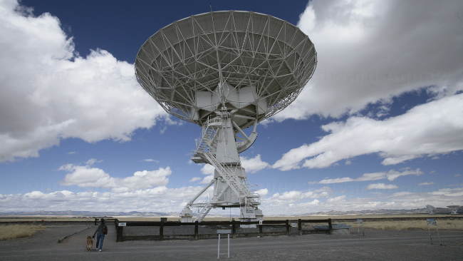
One of the antennas

The array --- the antennas were pointed in two directions.

While we were there they rotated the antennas to all face the same direction.
One of the antennas
The array --- the antennas were pointed in two directions.
While we were there they rotated the antennas to all face the same direction.
2007/03/20
Bosque del Apache
March 19 and March 20
Bosque del Apache National Wildlife Refuge is one of New Mexico's premier birding centers for winter birds and as it was on our route we decided to stop and visit it. Our timing wasn't the best as the cranes and the large of flocks of snow geese and many of the other winter birds had already left and were heading north for the summer.
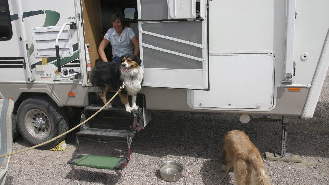
Nicki, another campers dog decided to check out the trailer.
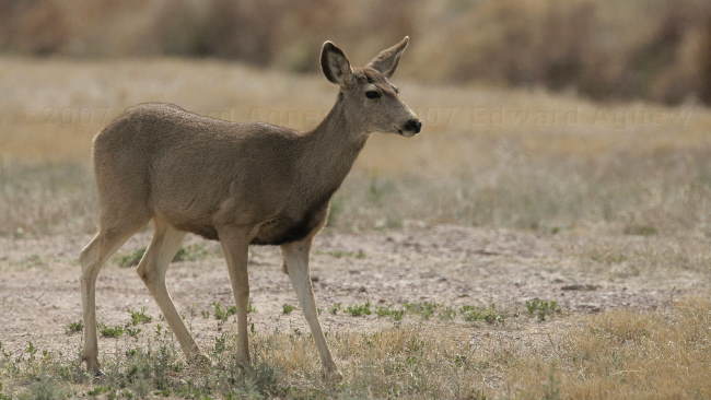
We saw a number of mule deer in the refuge.
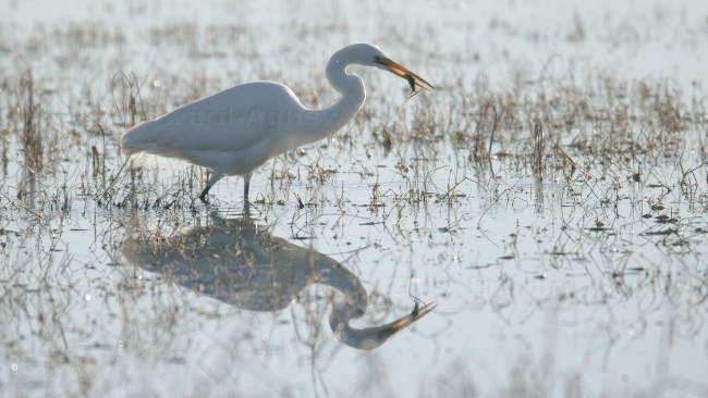
Yum..... what a tasty treat. (Great Egret)
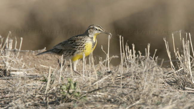
A Meadowlark --- don't know if it is an Eastern or a Western.
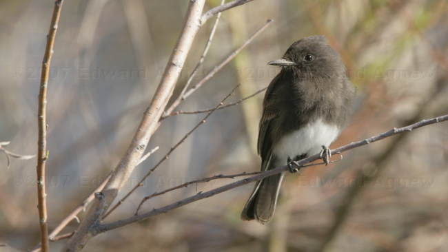
Black Pheobe --- they're fun to watch as the hover in the air to catch insects.
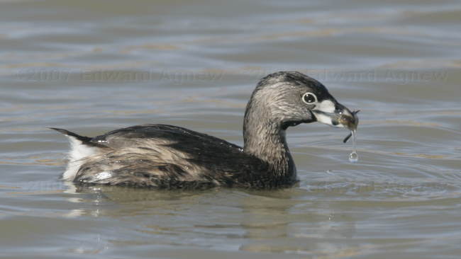
This Pied-billed Grebe found a tasty treat.
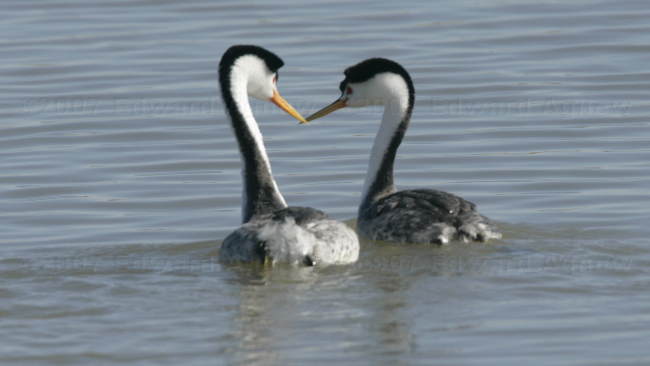
These 2 Clark's Grebes were hanging out.

Snow Geese. A lot of the geese had headed north already but there were still a few flocks around.
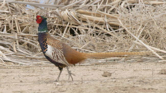
A Ring-necked Pheasant strutting his stuff.
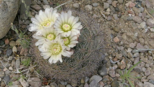
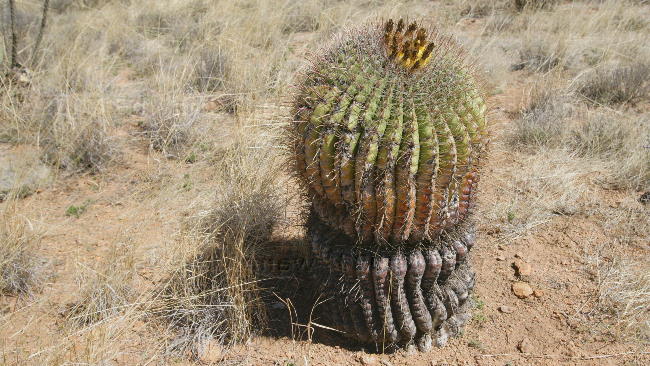
This barrel cactus was in bloom --- the only cactus we've seen blooming so far.
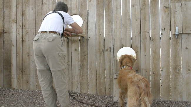
They cut the wholes into the blind at different heights so everyone can get a good view.
Bosque del Apache National Wildlife Refuge is one of New Mexico's premier birding centers for winter birds and as it was on our route we decided to stop and visit it. Our timing wasn't the best as the cranes and the large of flocks of snow geese and many of the other winter birds had already left and were heading north for the summer.
Nicki, another campers dog decided to check out the trailer.
We saw a number of mule deer in the refuge.
Yum..... what a tasty treat. (Great Egret)
A Meadowlark --- don't know if it is an Eastern or a Western.
Black Pheobe --- they're fun to watch as the hover in the air to catch insects.
This Pied-billed Grebe found a tasty treat.
These 2 Clark's Grebes were hanging out.
Snow Geese. A lot of the geese had headed north already but there were still a few flocks around.
A Ring-necked Pheasant strutting his stuff.
This barrel cactus was in bloom --- the only cactus we've seen blooming so far.
They cut the wholes into the blind at different heights so everyone can get a good view.
2007/03/18
Back to the Rio Grande
The Rio Grande starts in Colorado and travels south through New Mexico till it reaches El Paso, Texas where it starts heading south east and eventually east finally ending at the Gulf of Mexico. Elephant Butte Lake was created by damming the Rio Grande in 1916. This afternoon we drove down to the main campground and we were very happy that we camped at Monticello as the camp sites were much nicer and had better views. The water access was much better at the main campground — there was the main boat launch but people were also launching their boats off the beach. Driving a couple of more miles down the road we found several day use areas, more boat ramps, another RV campground, cabins and the dam. We stopped at one of the day use areas and went for a walk along the Rio Grande and we let our little furry buddy get his feet wet ---- no swimming as he had to get back in the truck. Elephant Butte is quite the park.
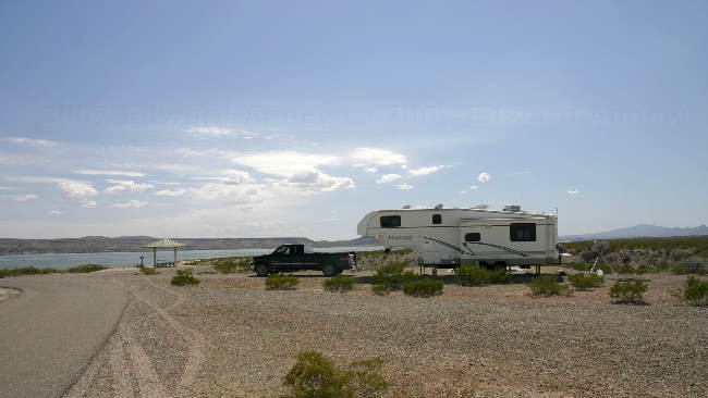
Our campsite
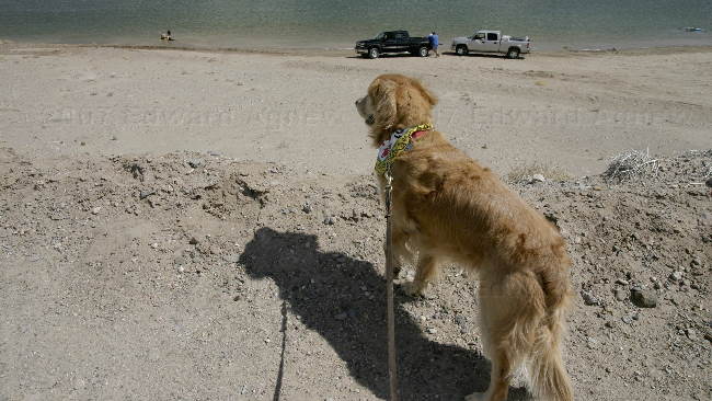
Please unhook the leash --- I promise I'll be good. At the main park.
One of several marinas on the lake.
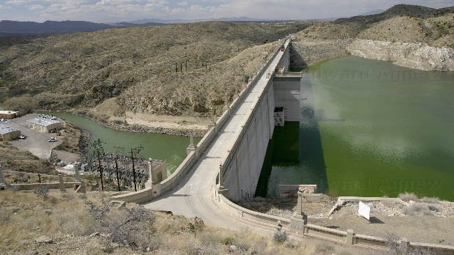
The dam
Elephant Butte Island
Zaph checking out a picnic shelter
Sunset
Our campsite
Please unhook the leash --- I promise I'll be good. At the main park.
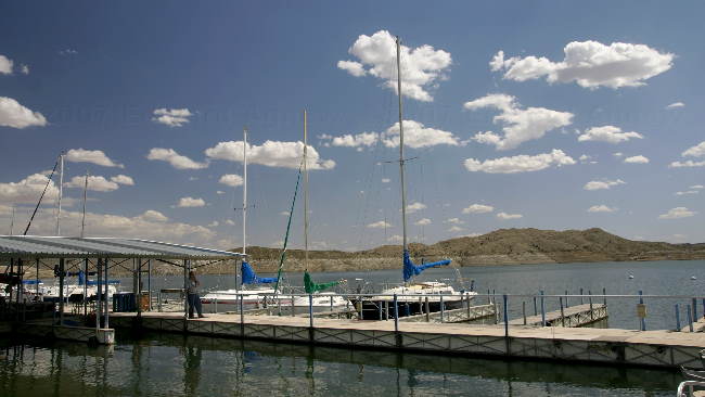
One of several marinas on the lake.
The dam
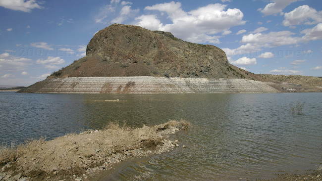
Elephant Butte Island
Zaph checking out a picnic shelter
Sunset
2007/03/17
Truth or Consequences
It’s time to start heading north .... oh so very slowly. Our destination for today is Elephant Butte State Park just outside of Truth or Consequences (yup the town legally changed it’s name to that of the show). We landed at the Monticello campground about 9 miles north of the main campground (the state park is huge) and have a great view of the lake and the mountains in the background. Somebody insisted that he needed to go swimming so we headed down to the boat launch and in he went even though the water temperature was probably around 50F. As we are enjoying 80+ temperatures and sun, Zaph was dried in no time at all.
I'm ready --- throw the ball!
I'm ready --- throw the ball!
2007/03/16
More Basking
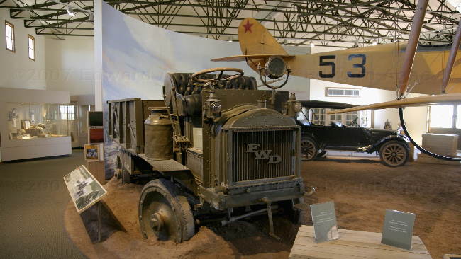
We enjoyed yesterday so much we decided to stay another day and repeat it. The thought of burgers got out us off the lounge chair and into the village of Columbus for some fantastic burgers. After touring the town (5 minutes at the most) we came back to the state park and headed to the museum. The state park is call Poncho Villa after the Mexican general who attacked the village on March 9, 1916 (we missed the re-enactment) and the exhibits in the museum explain how the attack occurred and the subsequent chase into Mexico. Pancho Villa was not captured but the Americans did learn a lot about staging campaigns using new technology — cars, trucks and aeroplanes. Oh, and we did manage another walk to look at birds — Gambel quails were my highlight.
The main exhibit in the museum.
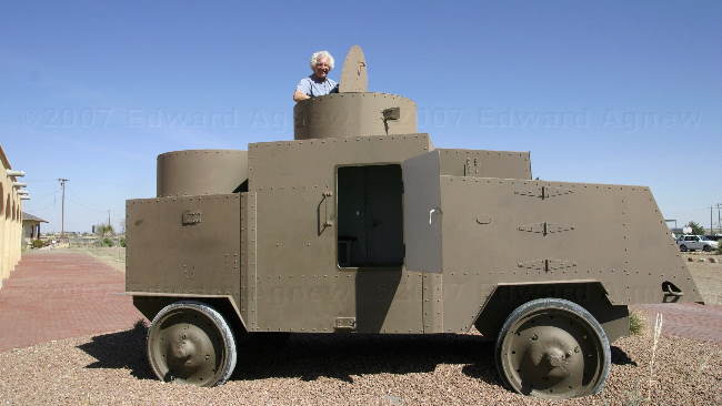
Boys and their toys!
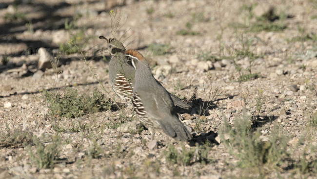
A couple of Gambel's Quail
The main exhibit in the museum.
Boys and their toys!
A couple of Gambel's Quail
2007/03/15
Basking in the Sun
Shining sun, gentle breeze, 27C..... perfect day for lying in the sun and reading a book. We did take a break from sunning to go for a walk with Zaph while we check out the local bird population. The afternoon was ended by spending cocktail hour with our neighbours and their golden retriever Annie.
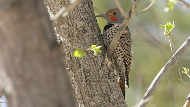
Red-shafted Northern Flicker
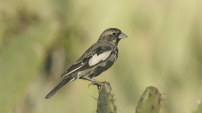
Lark Bunting changing from winter plumage to summer plumage.
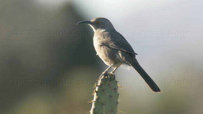
Curved-billed Thrahser
Red-shafted Northern Flicker
Lark Bunting changing from winter plumage to summer plumage.
Curved-billed Thrahser
2007/03/14
Another Mexican Town
In conversation with someone during our travels we were told that the Pancho Villa State Park was very nice so we decided that we should check it out and headed the approximately 90 miles south to Columbus and the Pancho Villa State Park. The park is situated approximately 3 miles from the Mexican border and is the site where (from their website) “on March 9, 1916, soldiers led by Mexican Gen. Francisco “Pancho” Villa attacked the military camp at the sleepy border town of Columbus, New Mexico, killing 18 Americans. This was the only ground invasion of the continental U.S. since 1812.” The state park has historical exhibits depicting the raid and the subsequent expedition into Mexico.
This afternoon we decided to check out the Mexican border town of Las Palomas. The town is small but does have a number of dental clinics, pharmacies and optical stores. There a few tourist shops with the largest one being “The Pink Store”. Ed and I did manage to find some very good Margaritas and nachos.
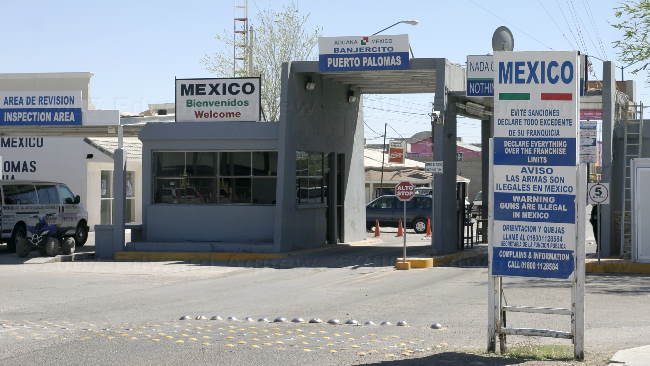
Entering Mexico
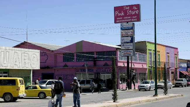
The big tourist store in town.
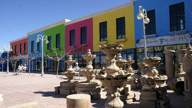
Some stores in the plaza behind the Pink Store.
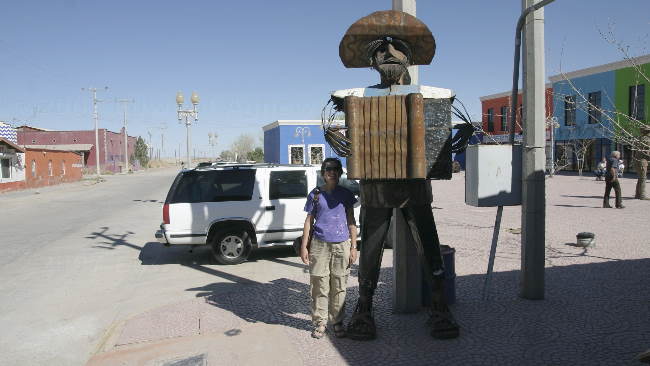
My new friend.
Zaph walked into our neighbours trailer and helped himself to Annie's tennis ball.
Treat time for Zaph and Annie
This afternoon we decided to check out the Mexican border town of Las Palomas. The town is small but does have a number of dental clinics, pharmacies and optical stores. There a few tourist shops with the largest one being “The Pink Store”. Ed and I did manage to find some very good Margaritas and nachos.
Entering Mexico
The big tourist store in town.
Some stores in the plaza behind the Pink Store.
My new friend.
Zaph walked into our neighbours trailer and helped himself to Annie's tennis ball.
Treat time for Zaph and Annie
2007/03/13
More Rocks
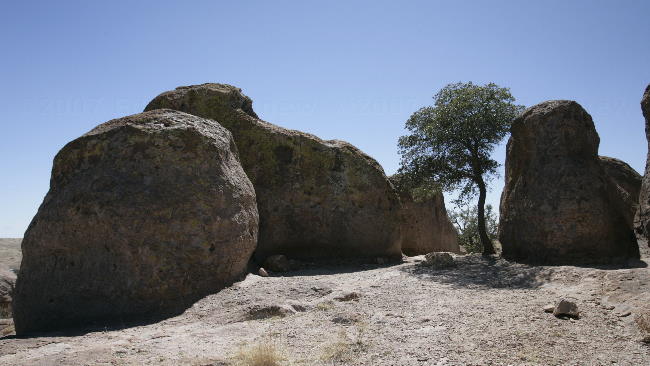
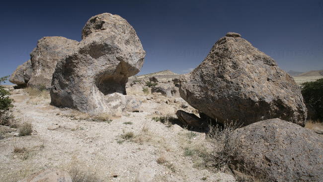
Not far from Silver City is the "City of Rocks State Park". “Formed of volcanic ash welded together 30 million years ago, then sculpted by wind and water into rows of monolithic blocks, these incredible rock formations give City of Rocks its name. Theory is that these formations were thrown 180 miles from a volcano near Albuquerque.” Regardless of where they came from and how they were created, the rocks are fun. Each one is a unique shape and you can see giants chairs, dogs, monsters, just about anything in them.
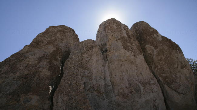
This place reminded us a bit of Stonehenge.
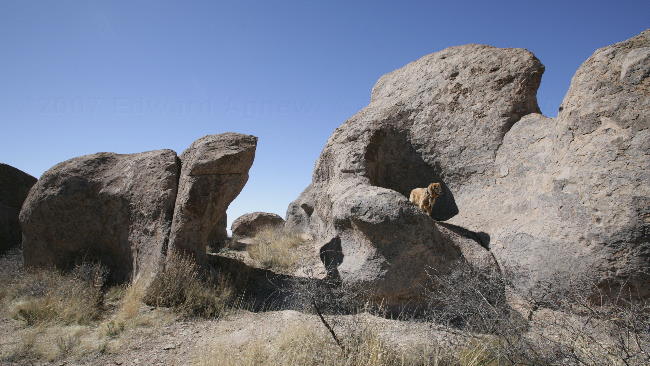
Zaph checking out the rocks.
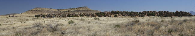
Rock City with Table Mesa in the background
Rocks
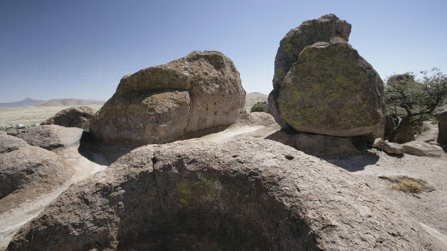
Rocks
and more Rocks
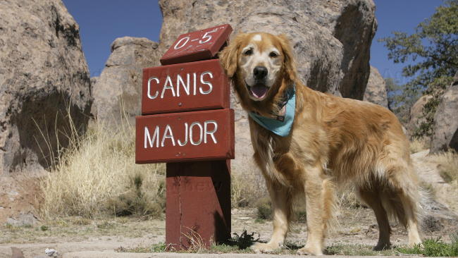
As the park has an observatory all of the sites were given astronomical names --- Zaph found his favorite.
This place reminded us a bit of Stonehenge.
Zaph checking out the rocks.
Rock City with Table Mesa in the background
Rocks
Rocks
and more Rocks
As the park has an observatory all of the sites were given astronomical names --- Zaph found his favorite.
2007/03/12
Trail of the Mountain Spirits
Today’s adventure followed the Trail of the Mountain Spirits north into the Gila National Forest. Ed really enjoyed driving today as the roads were narrow and twisty as they climbed into the mountains — he did wish the truck could morph itself into sport car. The highlight was the Gila Cliff Dwellings National Monument which offers a glimpse of the homes and lives of the people of the Mogollon culture who lived there from the 1280s through the early 1300s. One of the volunteers did mention that some of the theories are being disputed and they are starting to think that the dwellings may have been used for religious ceremonies and not permanent homes. Not far from the cliff dwellings are some petroglyphs and another dwelling, this one built on the ground near a stream.
As there was a trail nearby Zaph got to have another leash free walk — happiness is a dog running down the trail with a stick in his mouth.
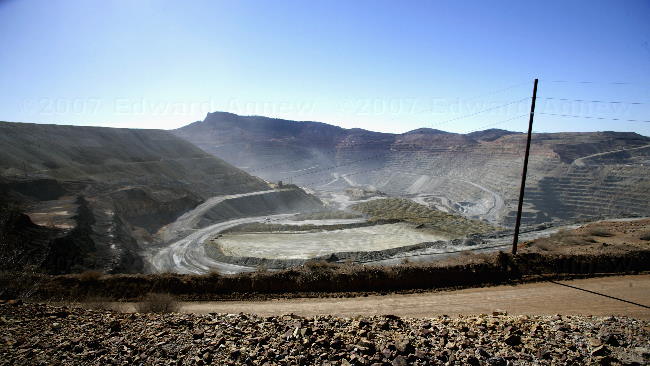
The Santa Rita / Chino Mines open pit copper mine
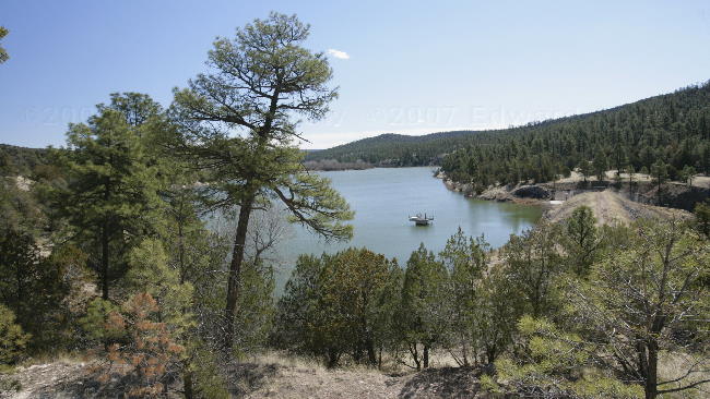
Roberts Lake
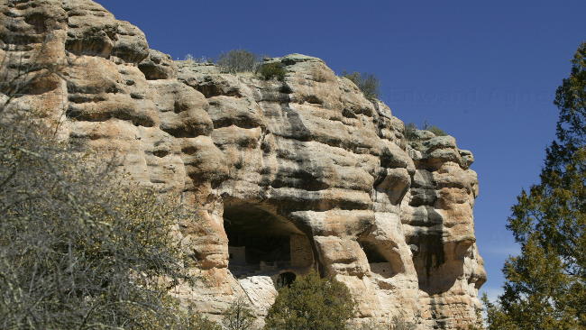
The cave dwellings from a distance.
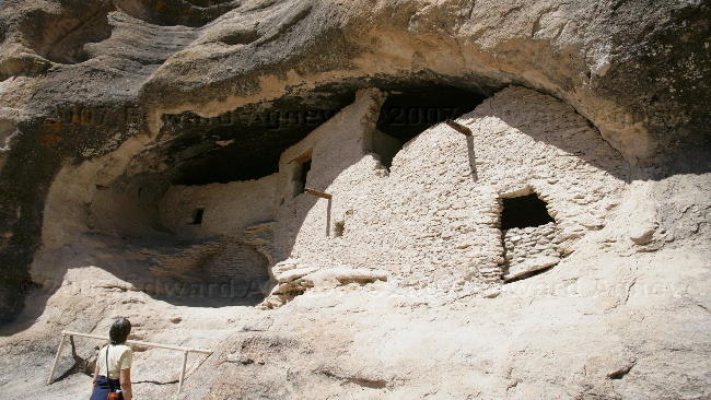
We're not sure how they entered this dwelling
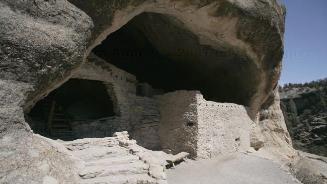
Another cliff dwelling.
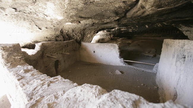
Inside one of the cliff dwellings
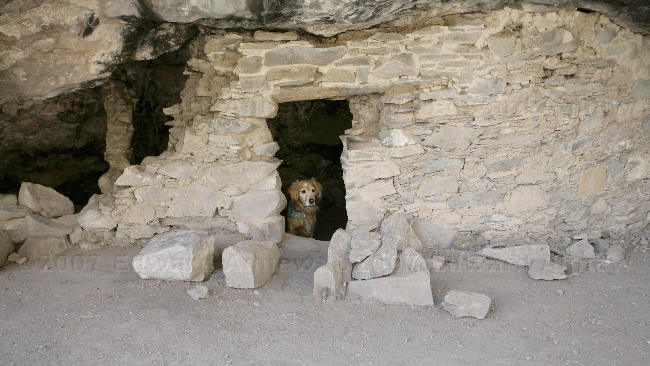
Zaph checking out the dwelling not on the cliff.
Some of the petroglyphs
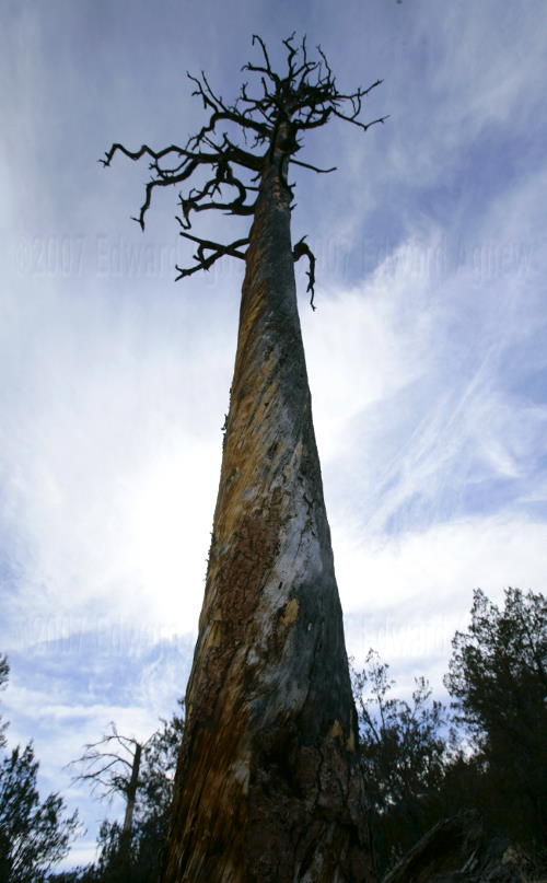
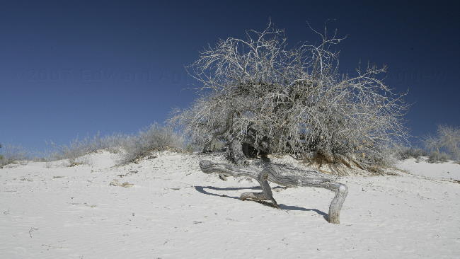
One gnarly tree
A barrel cactus --- with either the remnants from last years flowers or the start of this years flowers.
Happiness is.......
As there was a trail nearby Zaph got to have another leash free walk — happiness is a dog running down the trail with a stick in his mouth.
The Santa Rita / Chino Mines open pit copper mine
Roberts Lake
The cave dwellings from a distance.
We're not sure how they entered this dwelling
Another cliff dwelling.
Inside one of the cliff dwellings
Zaph checking out the dwelling not on the cliff.
Some of the petroglyphs
One gnarly tree
A barrel cactus --- with either the remnants from last years flowers or the start of this years flowers.
Happiness is.......
2007/03/11
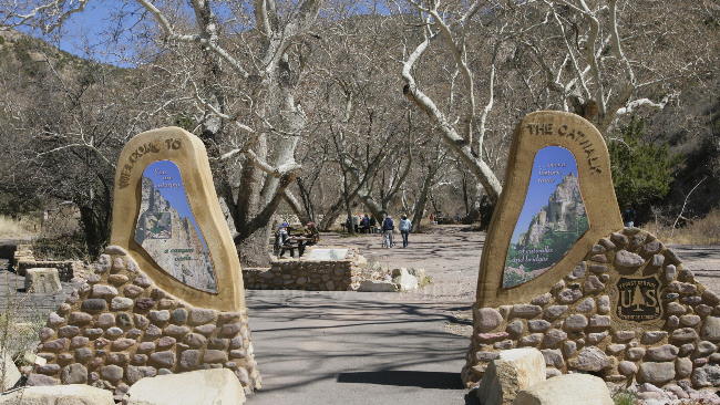
The Catwalk
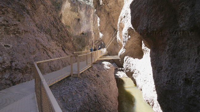
We headed northwest into the Gila National Forest with Whitewater Canyon as our destination. In 1889 the Whitewater Canyon and the town of Whitewater was the home to many mine claims and a processing mill. As the canyon was rough and narrow the mill was built 4 miles downstream from the mines. A 3 mile, 4" metal pipeline provided a continuous water supply to the town and its electric generator which was later upgraded to an 18" pipe. In the 1934 the CCC (Civilian Conservation Corps) built a “catwalk” using the pipeline's supports as a recreation attraction for the Gila National Forest. In 1961 the original catwalk was replace with the current metal catwalk.
Zaph managed the catwalk with out any problems, it was the swinging bridge he didn’t like especially when Ed made it sway. We followed another trail further into the canyon and let Zaph off his leash so he could run around and splash in the river. Yup, Zaph’s favourite type of park is the National Forest as dogs only need to be on leashes where there are a lot of people.
The entrance to the Catwalk.
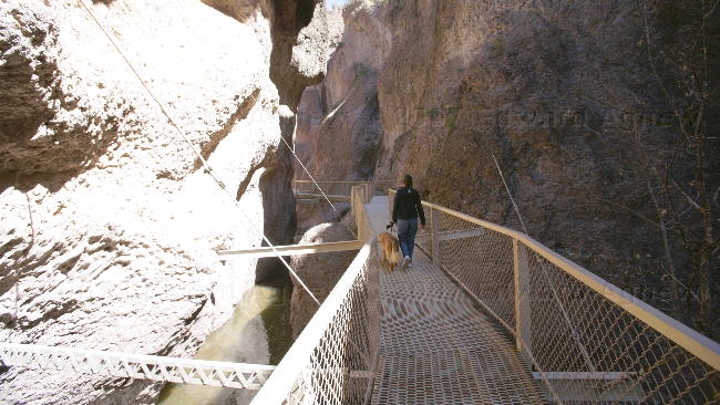
One part of the catwalk.
Another view of the catwalk.
Ed and Zaph check out the end of the catwalk.
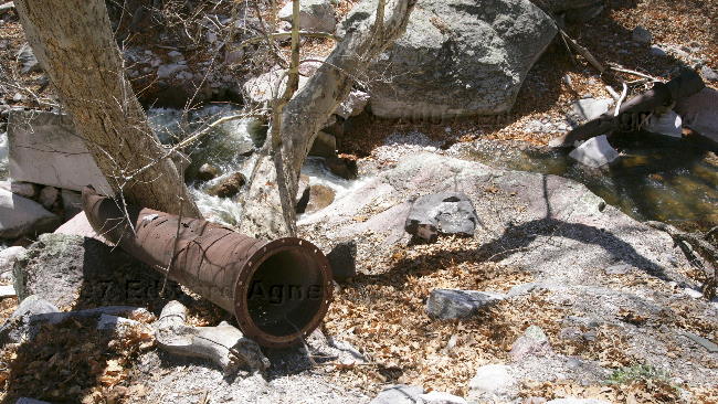
Some of the old 18" pipe.
Zaph checking out the canyon trail.

We found the perfect store for Ed.
Zaph managed the catwalk with out any problems, it was the swinging bridge he didn’t like especially when Ed made it sway. We followed another trail further into the canyon and let Zaph off his leash so he could run around and splash in the river. Yup, Zaph’s favourite type of park is the National Forest as dogs only need to be on leashes where there are a lot of people.
The entrance to the Catwalk.
One part of the catwalk.
Another view of the catwalk.
Ed and Zaph check out the end of the catwalk.
Some of the old 18" pipe.
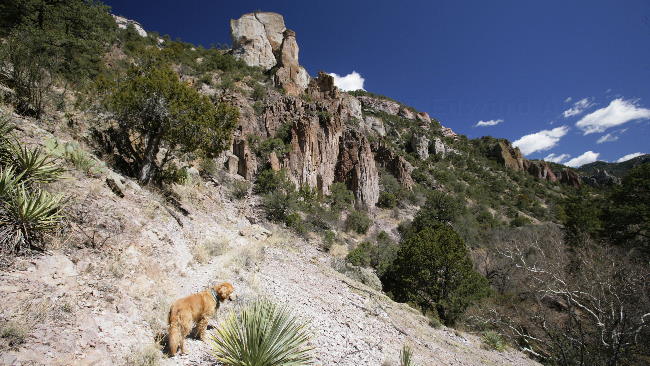
Zaph checking out the canyon trail.
We found the perfect store for Ed.
2007/03/10
Silver City
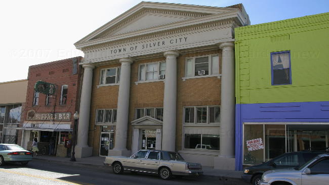
Leaving Alamogordo we headed west to the town of Silver City, known for it’s proximity to the Gila National Forest (the first national forest) and the large copper mines in the area. Silver City was named when silver was discovered and in the town grew from a single cabin to over eighty buildings in 10 months. Unfortunately in 1893 the bottom dropped out of the silver market but the town survived because of a strong cattle industry, and eventually the new mineral discoveries.
We spent the afternoon checking out the downtown area and found a card store that is dog friendly — they invited Zaph into the store so Ed and I could shop together.

Interesting ---- the courthouse is in the middle and the bar is on the left.
Colourful restaurant
Parts of old cars are used to make some cute art.
Colourful murals.
We spent the afternoon checking out the downtown area and found a card store that is dog friendly — they invited Zaph into the store so Ed and I could shop together.
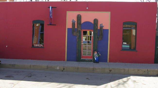
Interesting ---- the courthouse is in the middle and the bar is on the left.
Colourful restaurant
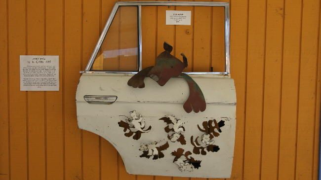
Parts of old cars are used to make some cute art.
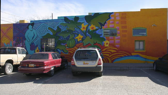
Colourful murals.
2007/03/09
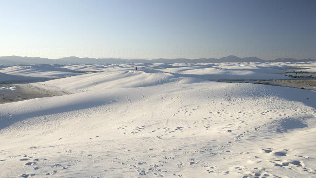
White Sands National Monument
It took me a while to figure it out but National Parks, National Monuments, National Forests, National Wildlife Refuges are all US national parks but the words after “national” change the rules under which the park operates (and probably who operates it). Only National Parks do not allow dogs on the trail so Zaph got to go with us to the White Sands National Monument and play in the sand. From White Sands web site: “Rising from the heart of the Tularosa Basin is one of the world's great natural wonders - the glistening white sands of New Mexico. Here, great wave-like dunes of gypsum sand have engulfed 275 square miles of desert and created the world's largest gypsum dune field.” Currently, part of the park is closed due to flooding ---- yup that’s right flooding in a desert area filled with sand dunes. “Record-breaking rainfall in August of 2006 flooded much of the white sands dune field and subsequent rain and snow continue to keep much of the dune field under water.” Zaph, of course, had a great time as he got to splash in the water and run up and down the dunes.
Interdune area --- the tree continued to keep leaves and branches above the sand.
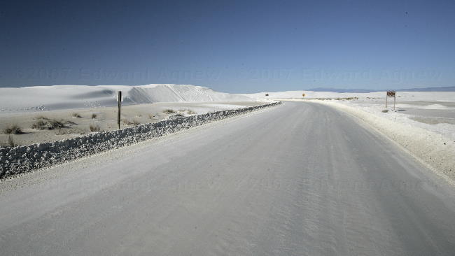
Looks like a fresh plowed road after a snow storm but it's not .... it's a plowed road in a dune field.
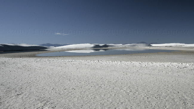
This is part of the flooded area --- small lakes formed at the base of the dunes.
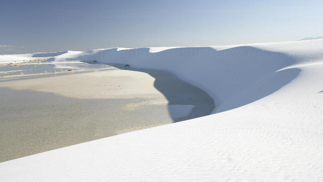
It really is sand and again that's waters on the left.
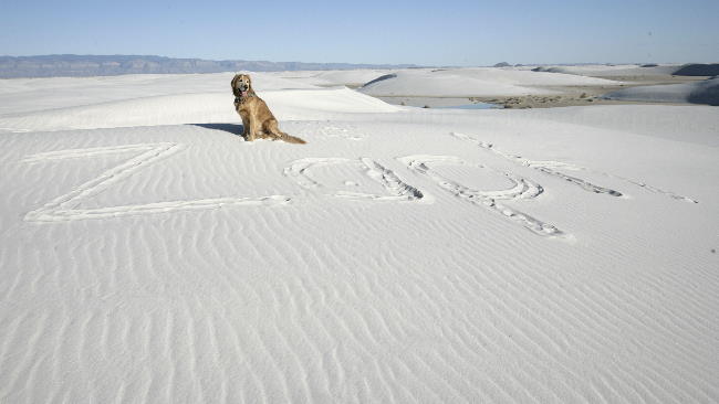
Having some fun.
The dunes
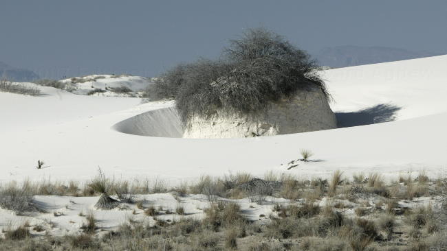
The skunk-bush sumac's root holds the sand even after the dune moves on.
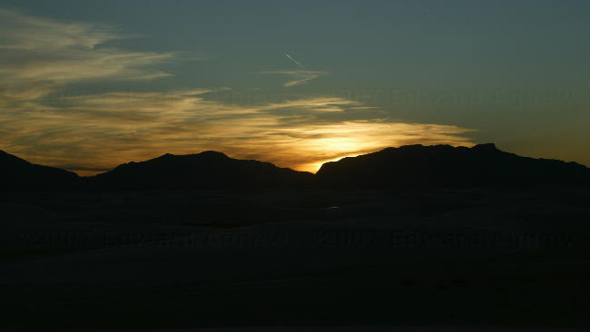
Sunset over the dunes
Interdune area --- the tree continued to keep leaves and branches above the sand.
Looks like a fresh plowed road after a snow storm but it's not .... it's a plowed road in a dune field.
This is part of the flooded area --- small lakes formed at the base of the dunes.
It really is sand and again that's waters on the left.
Having some fun.
The dunes
The skunk-bush sumac's root holds the sand even after the dune moves on.
Sunset over the dunes
2007/03/08
Now That`s a Lot of Petroglyphs
Leaving Roswell, we head west towards the snow covered mountain — yup that`s right snow. The drive through a National Forest and Mescalero Apache Indian Reserve is beautiful and takes us through a range of mountains with a pass at over 7,500 feet. We drive past tall pine trees, huge ranches, Casinos, Ruidoso Downs (horse racing) and snow. Luckily, we are headed to Alamogordo a town in the basin between mountain ranges where there is no snow and the temperatures are warmer.
About 30 miles north of Alamogordo is the Three Rivers Petroglyph Site, one of the few locations in the Southwest set aside solely because of its rock art. From the Bureau of Land Management website “The number and concentration of petroglyphs here make it one of the largest and most interesting petroglyphs sites in the Southwest. More than 21,000 glyphs of birds, humans, animals, fish, insects and plants, as well as numerous geometric and abstract designs are scattered over 50 acres of New Mexico's northern Chihuahuan Desert. The petroglyphs at Three Rivers, dating back to between about 900 and 1400 AD, were created by Jornada Mogollon people who used stone tools to remove the dark patina on the exterior of the rock.” The site was pretty amazing as we hiked up a trail and the glyphs were on rocks right beside us. The skeptic in me really wonders who actually did the glyphs and when.
The trees and snow from the truck window.
There were a lot of petroglyphs at this park.
This petroglyph was done on a rock edge giving the face a 3-D quality
This face even includes earings.
This bighorn sheep has arrows sticking in him.
Someone of them really make you wonder about the story they are telling.
This is a "photograph" of a UFO from the museum in Roswell........
This is a petroglyph...... hmmmm I wonder if........
Down the road from the Petroglyphs was this chapel that was built in 1911. You can't see it in the picture but there are mountains behind the church with crosses on them.
Sunset at the RV park.
About 30 miles north of Alamogordo is the Three Rivers Petroglyph Site, one of the few locations in the Southwest set aside solely because of its rock art. From the Bureau of Land Management website “The number and concentration of petroglyphs here make it one of the largest and most interesting petroglyphs sites in the Southwest. More than 21,000 glyphs of birds, humans, animals, fish, insects and plants, as well as numerous geometric and abstract designs are scattered over 50 acres of New Mexico's northern Chihuahuan Desert. The petroglyphs at Three Rivers, dating back to between about 900 and 1400 AD, were created by Jornada Mogollon people who used stone tools to remove the dark patina on the exterior of the rock.” The site was pretty amazing as we hiked up a trail and the glyphs were on rocks right beside us. The skeptic in me really wonders who actually did the glyphs and when.
The trees and snow from the truck window.
There were a lot of petroglyphs at this park.
This petroglyph was done on a rock edge giving the face a 3-D quality
This face even includes earings.
This bighorn sheep has arrows sticking in him.
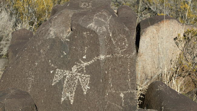
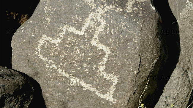
Someone of them really make you wonder about the story they are telling.
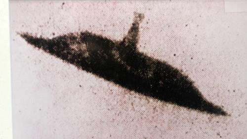
This is a "photograph" of a UFO from the museum in Roswell........
This is a petroglyph...... hmmmm I wonder if........
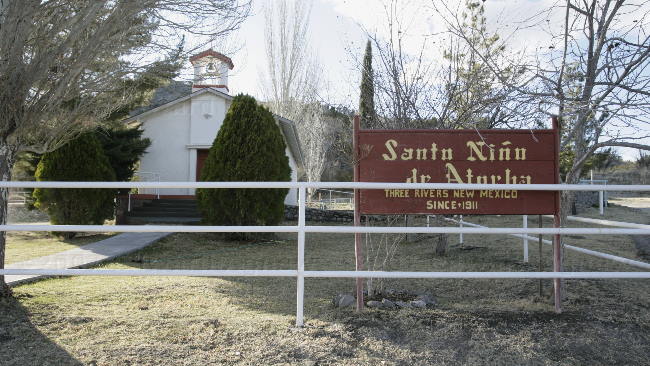
Down the road from the Petroglyphs was this chapel that was built in 1911. You can't see it in the picture but there are mountains behind the church with crosses on them.
Sunset at the RV park.
2007/03/07
Where’s the Mothership?
Roswell, New Mexico was a must visit on Ed’s list — anyone surprised? We headed to the UFO Museum and Research Center to get the scoop. The museum presents the story of the 1947 Roswell Incident with eye witness accounts, released government documents, newspaper clippings and even a radio broadcast. It’s up to you to decide what you believe. Anything and everything you want to know about UFO sightings and contacts is here.

I thought we were looking for little green men.

Alien fashions.
McDonald's play zone is shaped like a flying saucer.

I guess all the aliens shop here.

The town kept the theme going as well.
I thought we were looking for little green men.
Alien fashions.
McDonald's play zone is shaped like a flying saucer.
I guess all the aliens shop here.
The town kept the theme going as well.
2007/03/06
Bottomless Lakes?
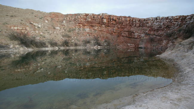
Just outside of Roswell, New Mexico is the Bottomless Lakes State Park where we are staying for a couple of nights. From the campsite brochure “The Bottomless Lakes are a chain of eight lakes that are actually sinkholes that range for 17 to 90 feet deep. They were formed when circulating water dissolved salt & gypsum deposits to form subterranean caverns. Eventually, the roofs of the caverns collapsed from their own weight. Sinkholes resulted & soon filled with water and formed the existing lakes.” A lot of the things at the state park are white (wooden posts, the ground, etc. ) .... no not snow but salt and gypsum deposits. Some of the lakes will support fish but some won’t because the concentration of salt is too high. We were hoping to find birds here but the winter residents (cranes, geese, etc.) have left and the spring birds haven’t arrived.

A view as we drove towards Roswell.
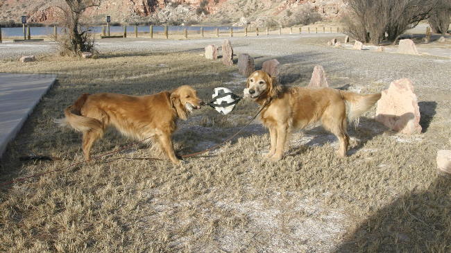
Zaph made a new friend --- Sassy, a 3 year old golden retriever. Zaph paused during a game of tug to smile for the camera.
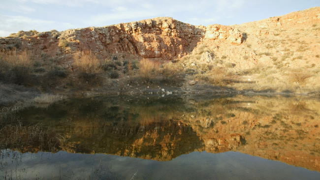
One of the bottomless lakes.
A sink hole.
Another bottomless lake.
A view as we drove towards Roswell.
Zaph made a new friend --- Sassy, a 3 year old golden retriever. Zaph paused during a game of tug to smile for the camera.
One of the bottomless lakes.
A sink hole.
Another bottomless lake.
2007/03/05
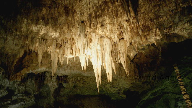
Now that’s a Cave
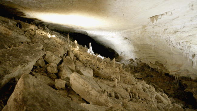
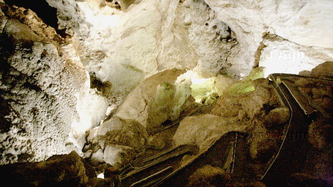
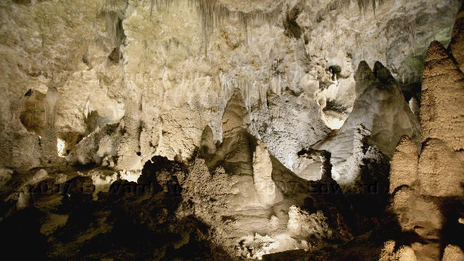
Good-bye Texas, Hello New Mexico. First stop is the Carlsbad Caverns. We decided to enter the cave through the one mile Natural Entrance Route which descends more than 750 feet into the Earth following a steep and narrow trail. In the summer, a cave off the Natural Entrance is home to thousands of bats and visitors can watch the bats leave the cave in the early evening. The Natural Entrance trail ends at the start of the Big Room. The Big Room is the largest room in the cave and is filled with lots of “cave art” — stalactites, stalagmites, soda straws, draperies (my
favorite), columns, popcorn.
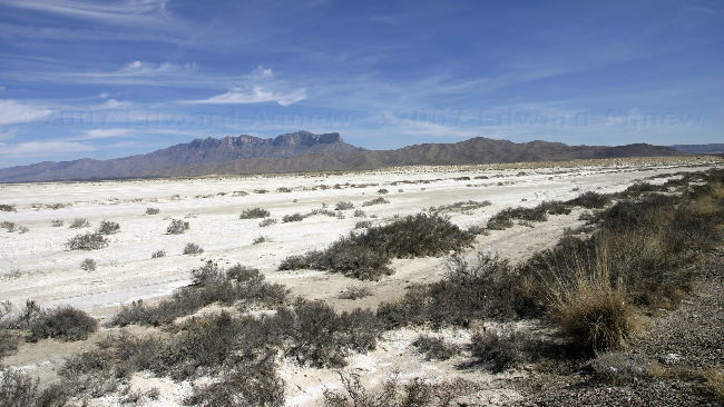
The map showed a lake --- when we stopped we found a sea of salt.
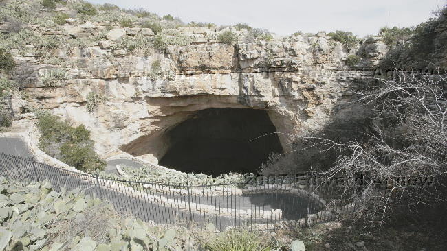
That Natural Entrance
The trail going down the natural entrance
Draperies
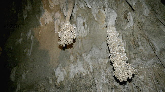
The Lion's Tail --- a "popcorn" formation
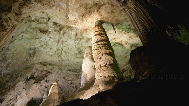
A rightmost formation is a Column, the ones to the left are Stalagmite.
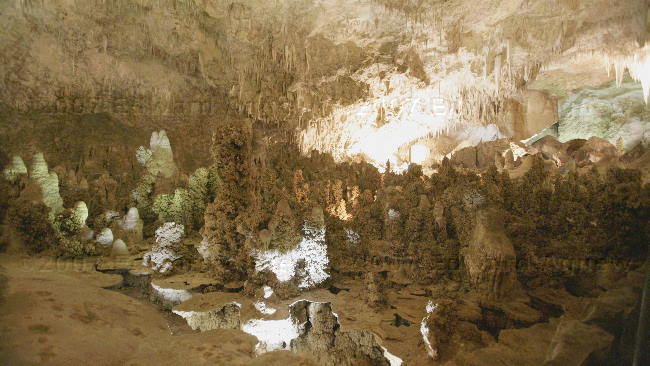
Fairyland --- popcorn formations.
Soda straws
favorite), columns, popcorn.
The map showed a lake --- when we stopped we found a sea of salt.
That Natural Entrance
The trail going down the natural entrance
Draperies
The Lion's Tail --- a "popcorn" formation
A rightmost formation is a Column, the ones to the left are Stalagmite.
Fairyland --- popcorn formations.
Soda straws
2007/03/04
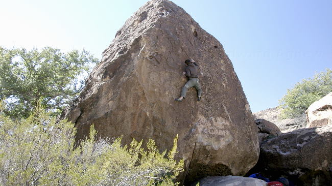
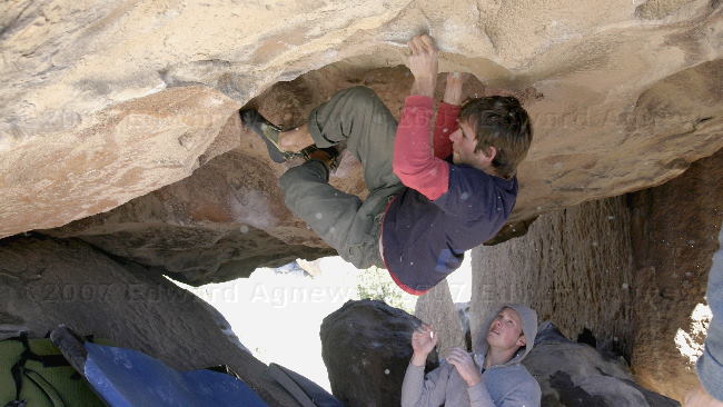
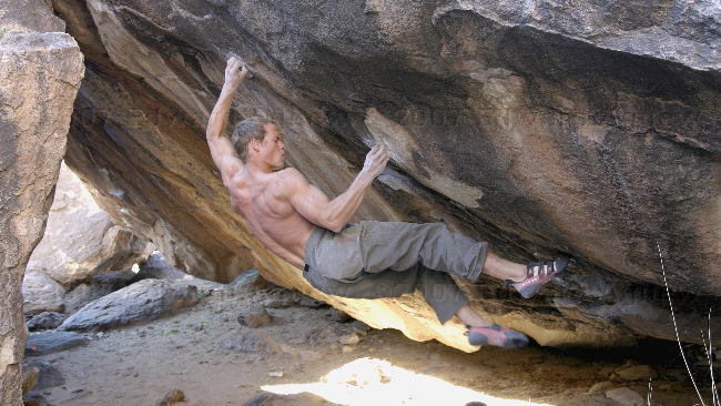
Bouldering
When I made the reservation for Hueco Tanks State Park, I had made the assumption that “Bouldering” was scrambling on boulders so I signed us up for a “Bouldering” Tour. Lesson learned today ---- “Don’t make assumptions”. Ed and I decided that if the people “bouldering” didn’t mind we would go out with them as observers as we were now curious about this sport. We hiked into the closed area and headed to a set of rocks where some of the climbs were easy and used for warming up. Over the course of the day we moved to several different locations. We learned that there are two types of climbs — some are rated for difficultly and others are rated as problems (you have to figure out how to climb them). Some of these climbs were as I expected — scampering up the boulder to the top. Some others were not — crawling across the underside of a rock and working across the edge of the rock then up and over. This is a sport where you need to be in excellent shape, have extremely strong hands and fingers and be fairly flexible as twisting your body into a pretzel shapes seemed to be required in most climbs. A climb would only last a few minutes but it took at lot of energy.
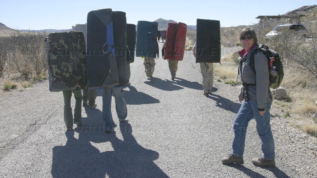
Heading out --- I still thing they look like Sponge Bob.
This fellows just warming up --- one of the easier climbs.
The white specks aren't dust in the camera it's chalk. The climbers chalk their hands and the buildup on the hand holds sometimes breaks off and floats in the are. I think this climb was rated a V9 on a scale from 0 to 15.
This climb is rated as a hard problem --- neither of the two fellows attempting it succeeded in completing the climb.
2007/03/03
Rock Art
Brrrr...... it went below freezing last night -1.5 C. What’s going on? That’s about the same temperature that Campbellville is experiencing.
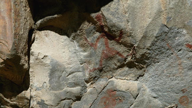
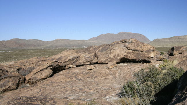
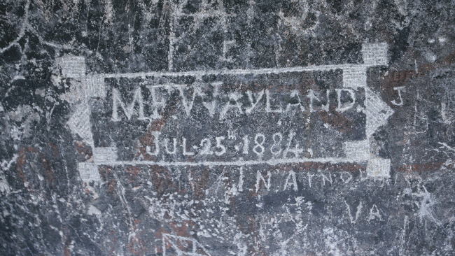
Hueco Tanks is divided into 2 sections — the area where you need a guide (2/3 of the park) and the area where you need a permit (the other 1/3). This morning we headed out to the restricted area with a guide to see Rock Art. The Rock Art can be more than 1,000 years old (a long time ago natives) or it can be 150 years old (stage coach era) or it can be more recent (one of the local Indian tribes consider it sacred ground and still hold ceremonies here.
In the afternoon we managed to get a permit to visit the north mountain — only 70 people are allowed on the north mountain at one time and we were lucky some people left in the early afternoon so we could go. Ed and I had a great time looking for a cave with pictographs ---- the instructions included “keep the rocks that look like 2 ducks on your right and look for a rock that resembles an alligator, it’s nose points to the cave”. We did find the cave and the art made it worthwhile.
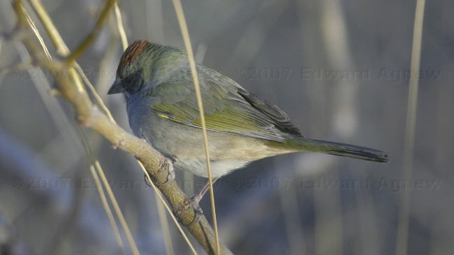
Green-tailed Towhee --- Ed was able to take his picture from the comfort of the trailer.
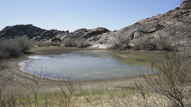
Huecos are pockets in the rock which can hold water, Tanks are large areas where water is stored --- this is one of the tanks. Thus the name Hueco Tanks.

The ranger who took us on the tour is pointing out a symbol from one of the native tribes. This cave is still used by the tribe today.
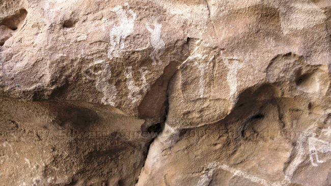
These dancers are painted on the cave used by the Indian Tribe.

This is one of the oldest pictographs in the park --- carbon dating is used to determine the age.
Charcoal barbeques are not permitted in the park as they could affect the carbon dating process.
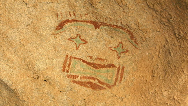
The only rock art using the colour turquoise. There is no substance in the area that will give this colour so it is thought that it was transported in by someone.
The "alligator" rock --- it took us a while to find him.
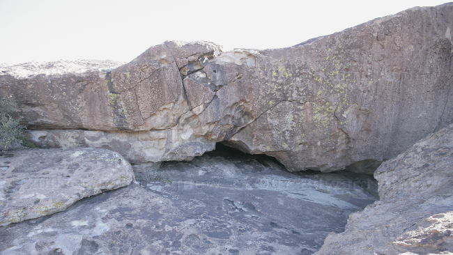
And the cave he was looking at (Kiva Cave). The open is less than 2 feet high --- we had to crawl in.
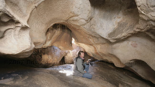
Frances looking at the art in the cave.
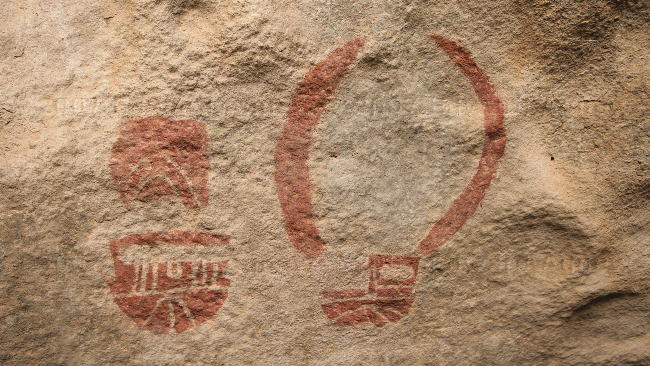
Two the masks found on the wall of the cave we searched for.
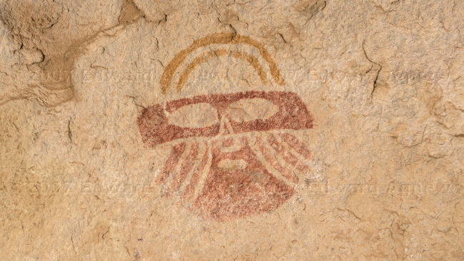
Another mask.
Another "tank"
Some of the stagecoach era rock art.
The holes in the rock were made by Indians who used them to grind corn. The Indians teeth were in pretty bad shape because of the bits of stone found in the cornmeal.
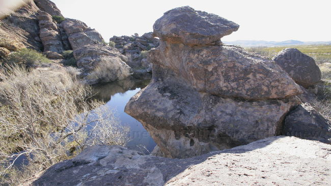
We called this Turtle Rock.
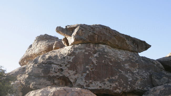
Some of the boulders.
Hueco Tanks is divided into 2 sections — the area where you need a guide (2/3 of the park) and the area where you need a permit (the other 1/3). This morning we headed out to the restricted area with a guide to see Rock Art. The Rock Art can be more than 1,000 years old (a long time ago natives) or it can be 150 years old (stage coach era) or it can be more recent (one of the local Indian tribes consider it sacred ground and still hold ceremonies here.
In the afternoon we managed to get a permit to visit the north mountain — only 70 people are allowed on the north mountain at one time and we were lucky some people left in the early afternoon so we could go. Ed and I had a great time looking for a cave with pictographs ---- the instructions included “keep the rocks that look like 2 ducks on your right and look for a rock that resembles an alligator, it’s nose points to the cave”. We did find the cave and the art made it worthwhile.
Green-tailed Towhee --- Ed was able to take his picture from the comfort of the trailer.
Huecos are pockets in the rock which can hold water, Tanks are large areas where water is stored --- this is one of the tanks. Thus the name Hueco Tanks.
The ranger who took us on the tour is pointing out a symbol from one of the native tribes. This cave is still used by the tribe today.
These dancers are painted on the cave used by the Indian Tribe.
This is one of the oldest pictographs in the park --- carbon dating is used to determine the age.
Charcoal barbeques are not permitted in the park as they could affect the carbon dating process.
The only rock art using the colour turquoise. There is no substance in the area that will give this colour so it is thought that it was transported in by someone.
The "alligator" rock --- it took us a while to find him.
And the cave he was looking at (Kiva Cave). The open is less than 2 feet high --- we had to crawl in.
Frances looking at the art in the cave.
Two the masks found on the wall of the cave we searched for.
Another mask.
Another "tank"
Some of the stagecoach era rock art.
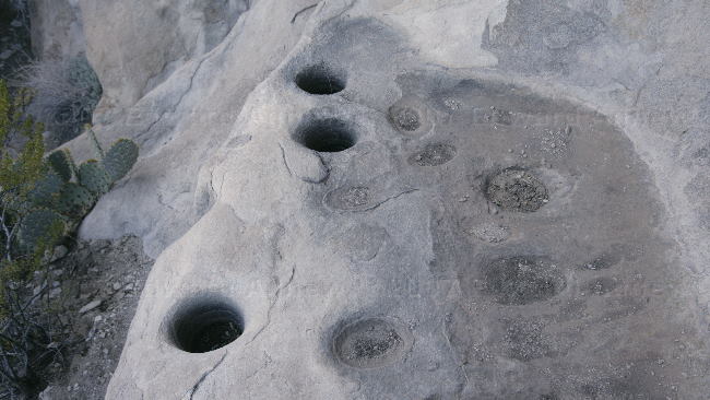
The holes in the rock were made by Indians who used them to grind corn. The Indians teeth were in pretty bad shape because of the bits of stone found in the cornmeal.
We called this Turtle Rock.
Some of the boulders.
2007/03/01
Old El Paso
Today was a driving day and El Paso was our goal. Picked up some groceries and got our Walmart fix as we hadn’t seen one since we left Mission.
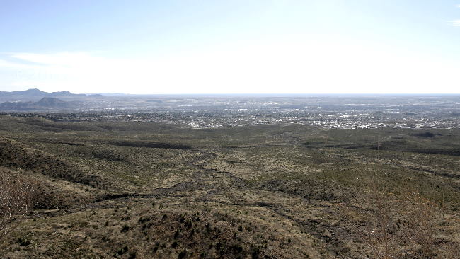
A view looking down at El Paso
A view looking down at El Paso
![]()