2007/06/30
More Waterfalls
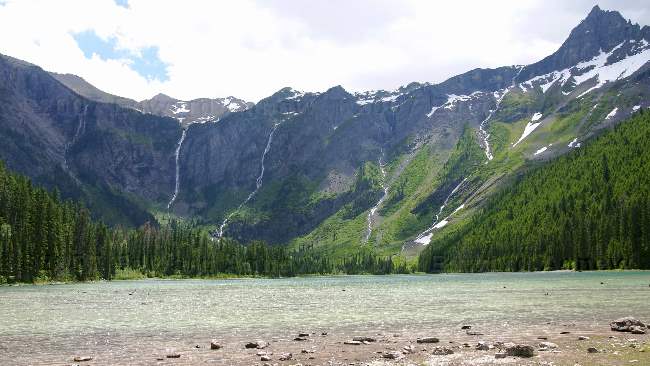
This view was our reward when we reached the lake. The lake was surrounded on three sides by mountains with at least six waterfalls. We thought it was worth the hike.
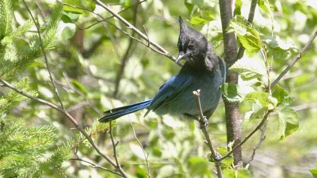
The Stellar Jay was flitting about at the end of the lake.
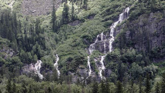
A close up of one or is it more waterfalls?
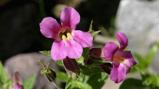
One of the many wildflowers we saw on the hike.
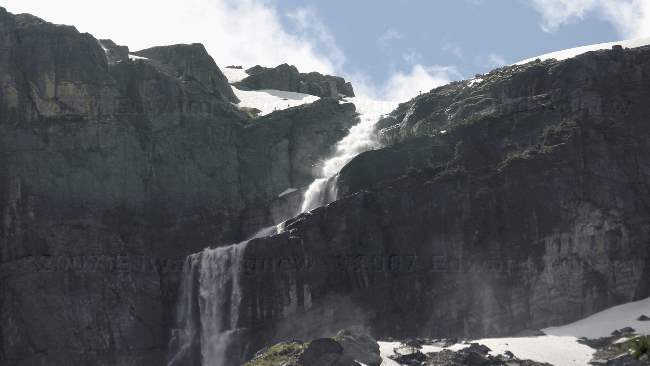
This waterfall looks like it's coming straight from a glacier.
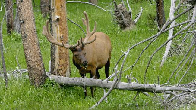
2007/06/29
Waterfalls
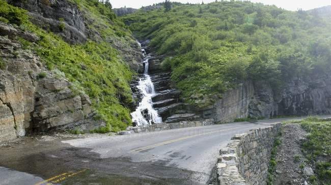
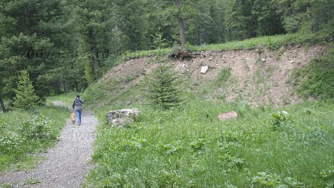
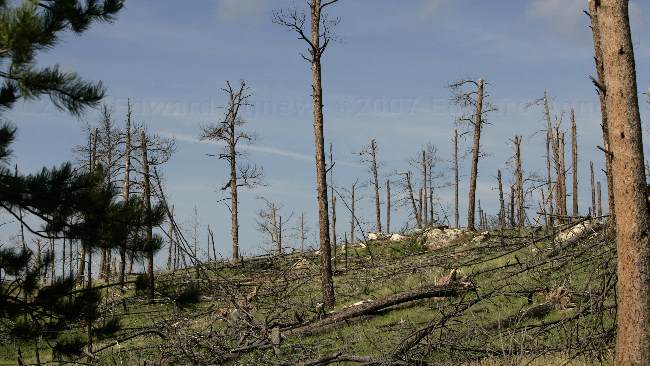
One of the many waterfalls we passed as we drove the Going-To-The-Sun-Road
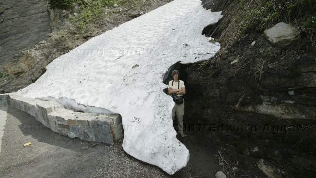
As the name of the park implies there are many glaciers in the park and there is still a reasonable amount of snow. This pile of snow was beside the road and as you can see it is still over 5 feet in depth
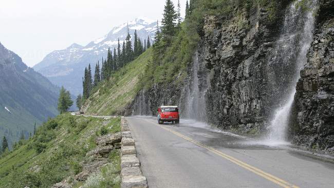
A 1930's style tour bus drives past the "Weeping Wall".
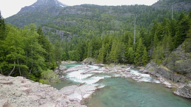
The colours in the park are incredible --- purple rocks, blue-green water frothing white over the rapids and deep green trees
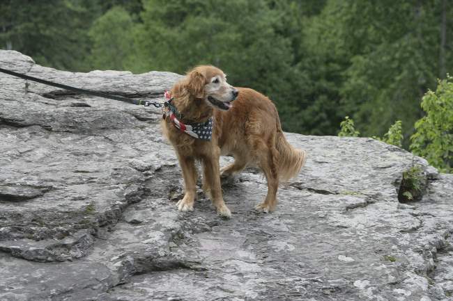
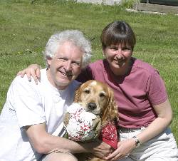
No, this isn't Zaph but a 12 year old female that looks a lot like him -- good thing Zaph has his spot on the forehead to make him unique
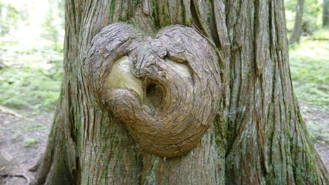
An interesting "burl" on an western red cedar --- I think it looks like a heart and Ed thinks it looks like a face.
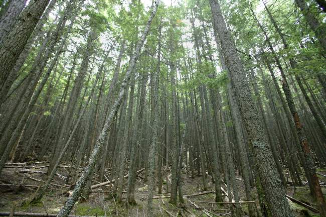
A cedar forest.
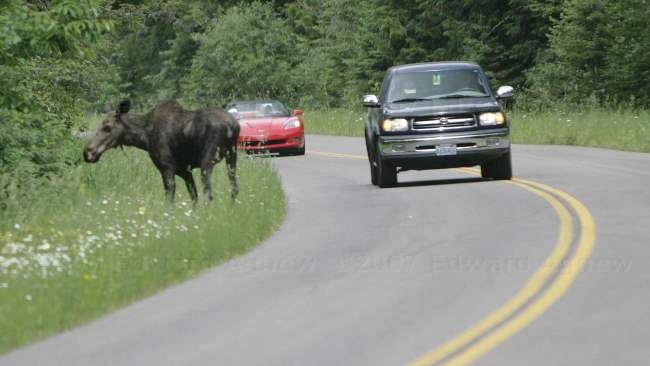
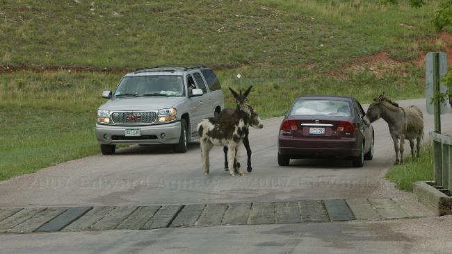
Why did the moose cross the road? ..... to see how big of a traffic jam she could cause
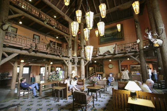
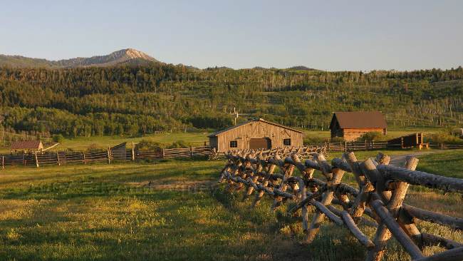
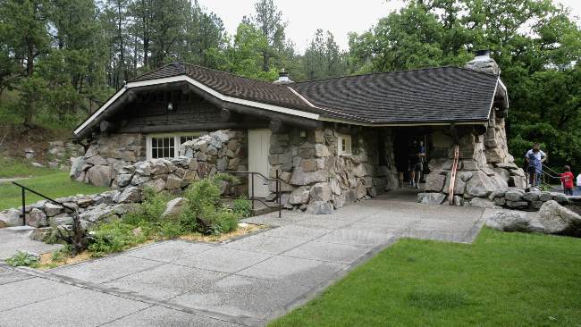
The lobby of the Lake McDonald Lodge, one of the historical lodges in the park.
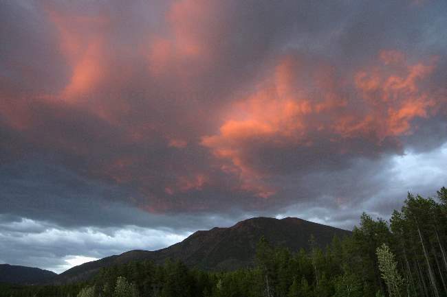
Sunset from the campground
2007/06/28
Travel Days
As we had booked campgrounds ahead at the major parks, we had a left a window of 2 nights between Craters of the Moon National Monument and Glacier National Park. If you didn't mind a really long day of driving you could do it in a day, we decided to give ourselves a break and take 3 days (2 nights).
The first day of driving was interesting as at one point we ended up in the middle of what appeared to be a "cattle drive". There were about 100 cattle on either side of the road and a few in the middle of the it, 4 cowboys on horses, several dogs and at least one guy in a pickup truck. We slowly picked our way through and unfortunately the person in charge of the camera (me - Frances) didn't managed to get any decent shots. When we stopped at a Bureau of Land Management park for lunch we liked it so much we found a campsite and spent the night.
On Day 2 we drove through some more of the beautiful Idaho countryside crossing into Montana at a mountain pass made famous by Lewis and Clark. After picking up groceries we stopped at a campground just outside of Missoula.
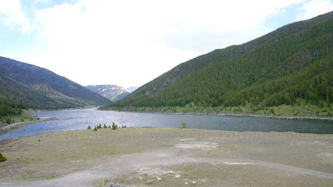
Day 3 saw us driving along Flathead Lake looking at tree after tree loaded with cherries --- this area produces all of Montana's cherries. Shortly after leaving the Flathead Lake area we started to the mountains of Glacier National Park. After landing at the RV park we headed to Hungry Horse Dam. This dam was the forth largest and fourth tallest in the world when it was built in 1953.
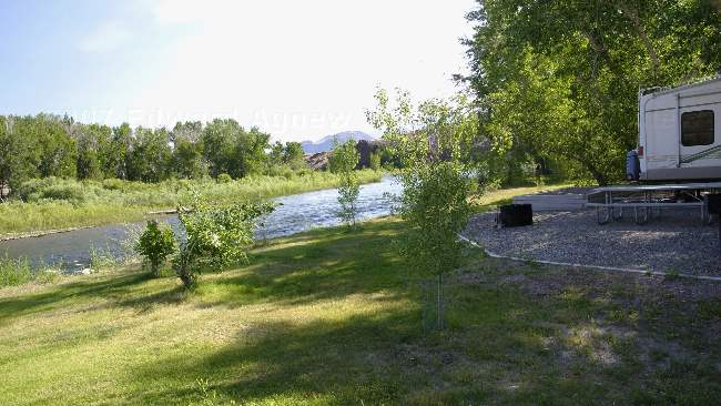
Our campsite at the Bureau of Land Management campground backed onto the Salmon River. As the current was strong, Zaph remained on a leash when he went in for a quick dip.
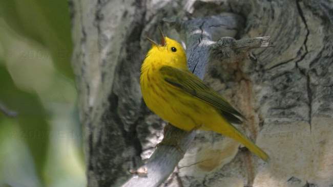
This Yellow Warbler was singing his heart out in the campsite next to ours.
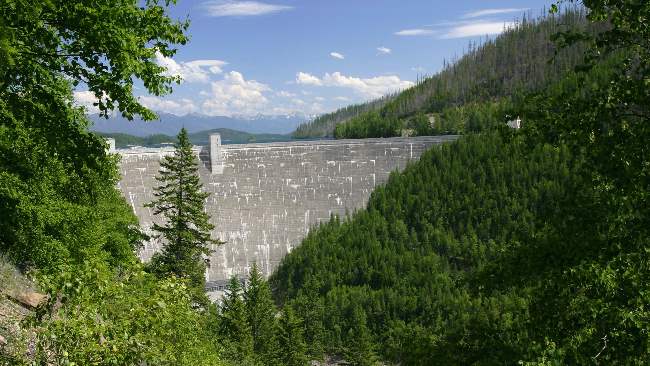
The Hungry Horse Dam. If you look closely you can see the water on the top side of the dam.
2007/06/25
Tubing
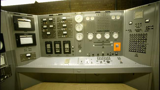
The main console in the control room --- the walls of the room were lined with monitors.
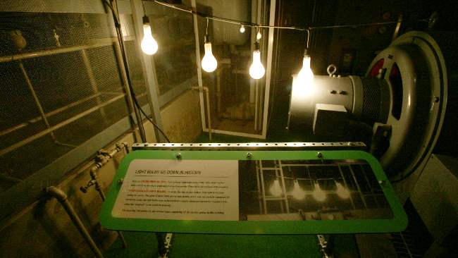
The first test of the plant created enough electricity to run four light bulbs, the next day they were producing enough electricity to run the plant.
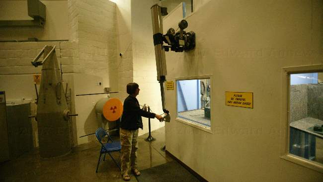
I'm trying one of the mechanical arms. The first arms were heavy and I found them hard to use. Later models were lighter and much easier to use.
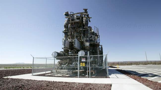
A working X-39 atomic jet plan engine --- can you image how large the plane would be
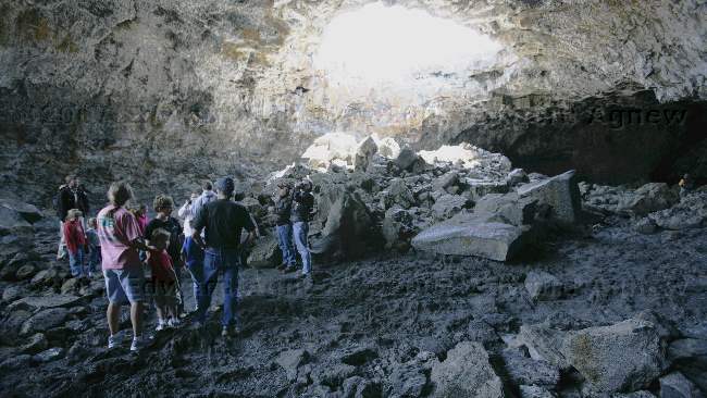
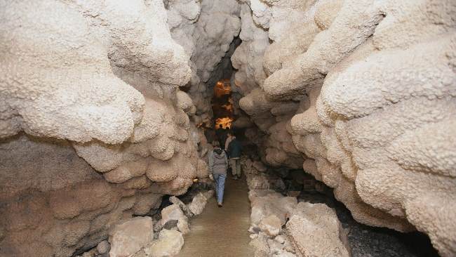
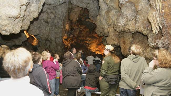
Indian Cave - a large lava tube.
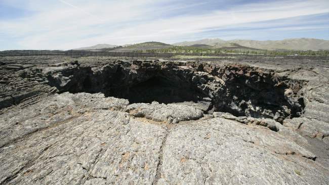
Looking down at Indian Cave.
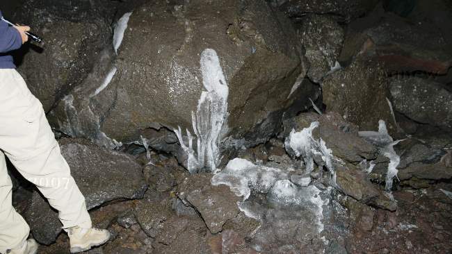
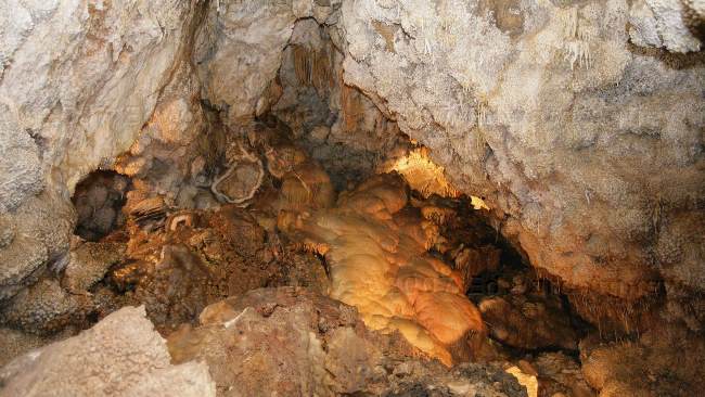
There was ice in Boyscout Cave. It was in the 70sF outside and close to freezing in the cave.
A view of the landscape.
A view of a lava flow.
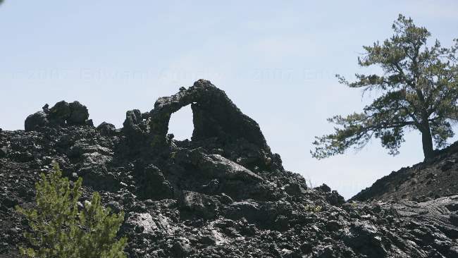
An arch in the lava.
2007/06/24
Craters of the Moon
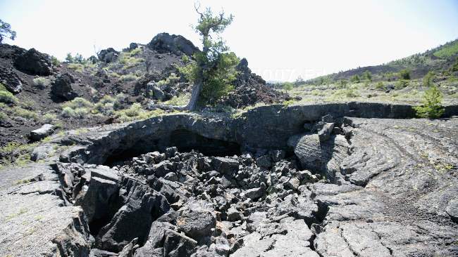
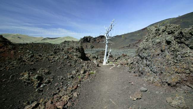
This is a collapsed lava tube. An amazing number and variety of plants thrive in this environment.
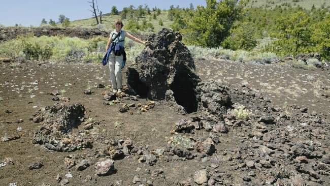
I'm standing beside a "lava tree".
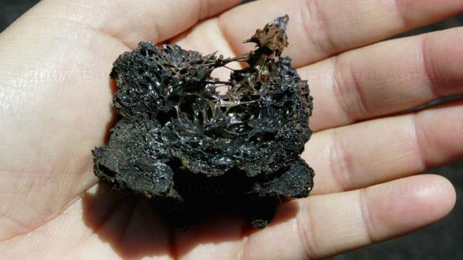
A close up look at a volcanic cinder.
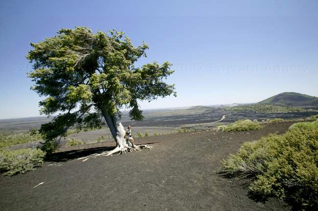
High atop a cinder cone is this lone Limber Pine and a number of bushes. The Limber Pine has very flexible branches which helps it survive in this windy environment.
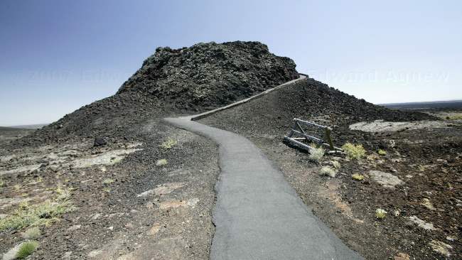
One of the splatter cones. As the volcanic activity in this area was along the rift there are few volcanic cones.
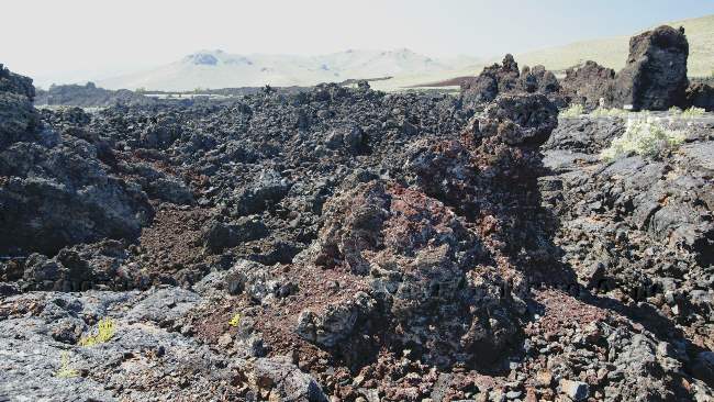
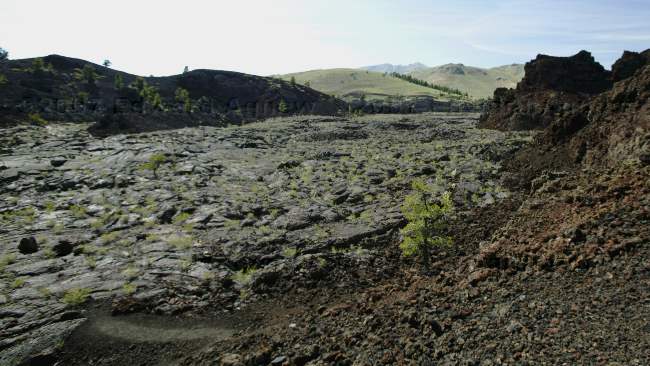
A view of the A'A lava.
2007/06/23
Land of Potatoes
A view from a mountain pass.
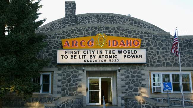
Arco's claim to fame is that on July 17, 1955 it became the first city to be powered by nuclear energy. The interesting thing is Arco was only powered by nuclear energy for a few hours and there are no commercial nuclear power plants in Idaho though the area still has several test reactors.
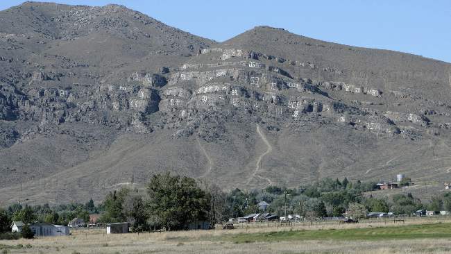
The hill overlooking the town is covered in numbers --- we haven't asked anyone but are assuming graduating high school classes are responsible.
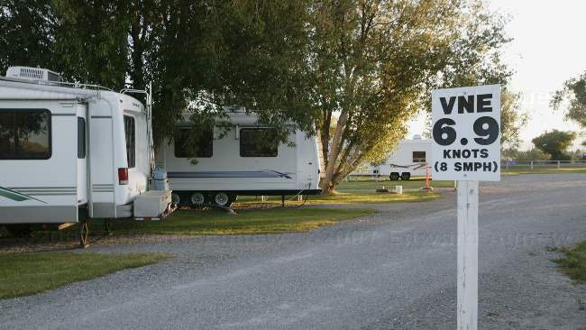
The fellow who owns the RV park is retired army helicopter pilot, so the park has an "aviation" feel to it. Ed thinks it's great. VNE mean velocity not to exceed.
2007/06/22
A Hiking we will go...
One of the many flowers we encountered on the hike.
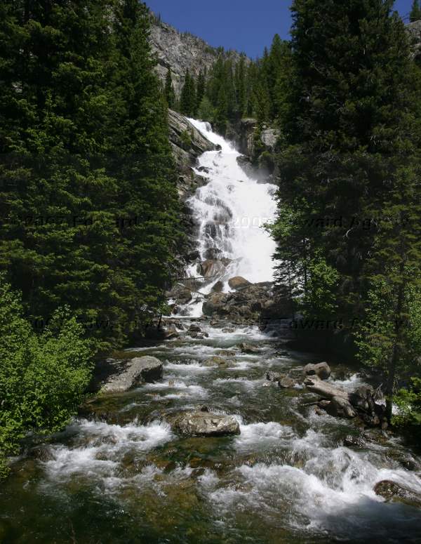
Hidden Falls
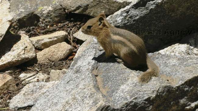
A golden-mantled squirrel
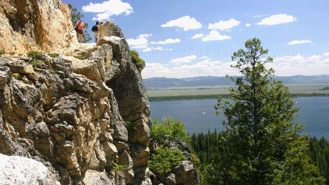
Inspiration Point and it's view.
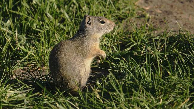
A ground squirrel
A sunset view from the RV park.
2007/06/21
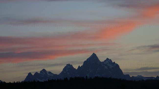
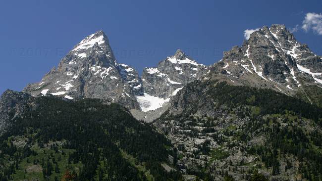
Touring the Tetons
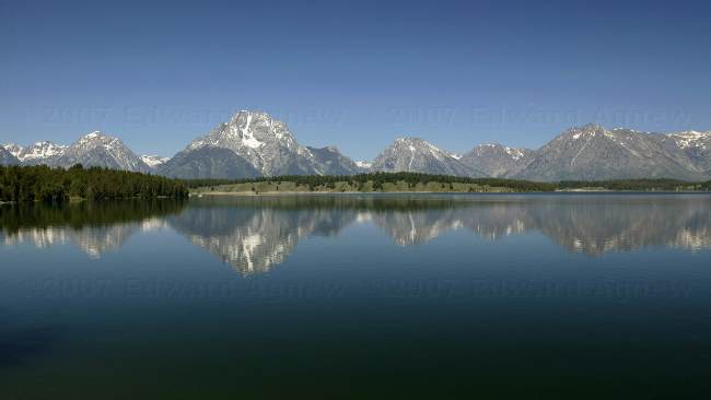
The Grand Tetons reflecting into Jackson Lake.
One of several glaciers nestled high in the mountains.
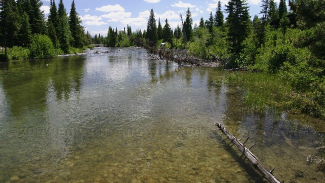
The area is filled with incredible views.
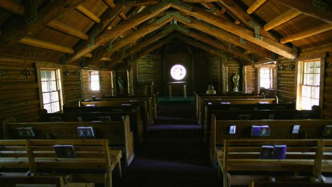
Chapel of the Sacred Heart, one a couple such of wooden log structures in the park
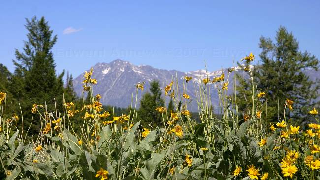
Another gorgeous view of the mountains.
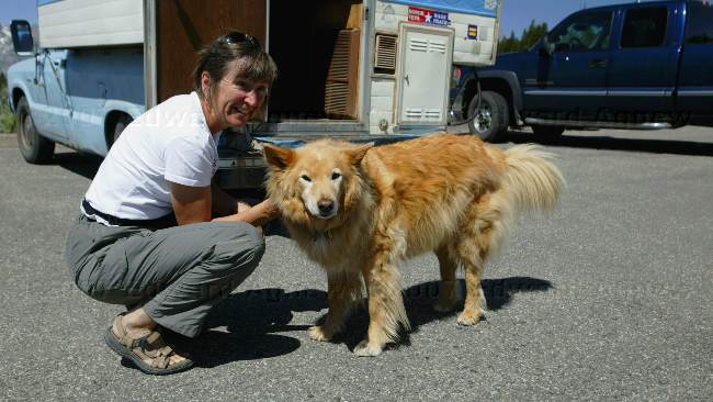
We met this 16 year old Coydog, named Marty at one of the pull offs along the road --- he's half golden retriever, the other half is coyote.
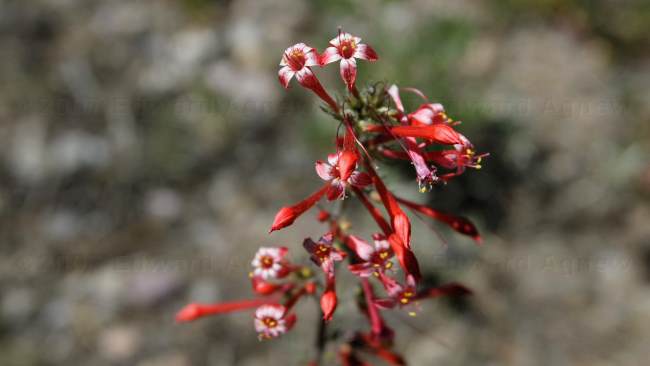
A pretty pick wild flower, these skyrockets (aka scarlet gilia, or skunk flower) are seen often in the park.
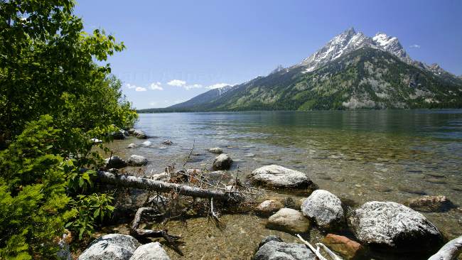
A view of the mountains at Jenny Lake.
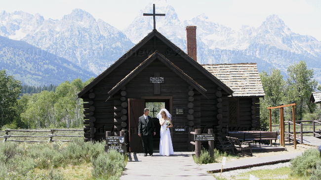
Chapel of the Transfiguration --- a wedding was ending as we arrived.
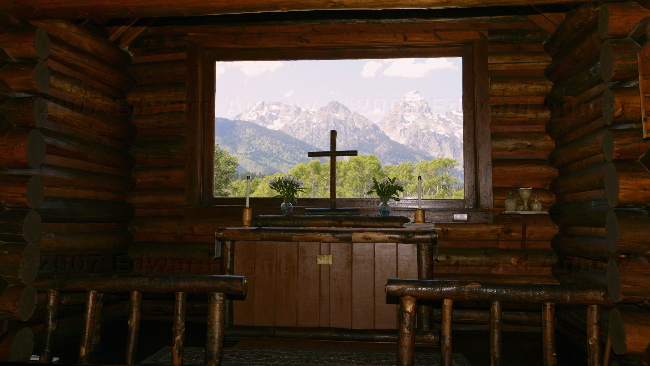
From the inside of the chapel the Tetons are framed in the window behind the alter--- an inspiring place to be.
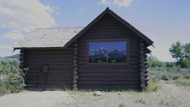
Outside of the chapel, the window reflects the mountains --- an easier photo to take. We think the most important job for the chapel's caretaker is to clean this window every day.
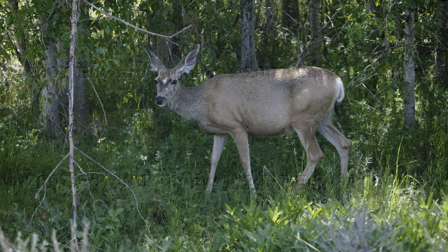
A mule deer walked about 5 feet from us.
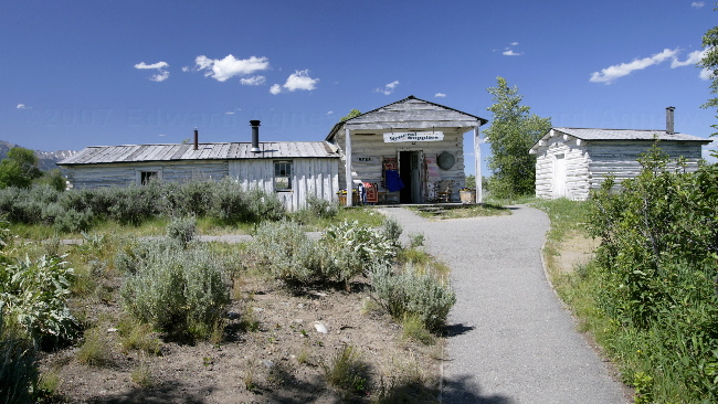
The old general store has been reopened to visitors --- you can buy huckleberry soda .... mmmm good.
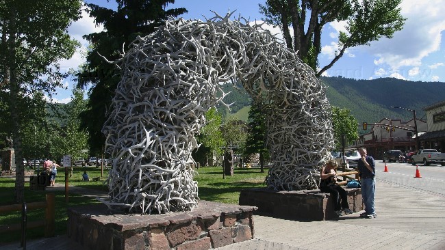
Can you tell what the arches are made of? ..... yes it's antlers. This is one of four such entrances to the park in Jackson.
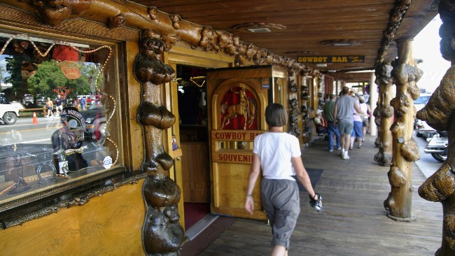
Jackson is filled with shops .... lots and lots of expensive shops and note the boardwalk. There is a ski area at the end of the main street and it's about 30 minutes from the world famous ski area of Jackson Hole. I think the rich and famous play here.
2007/06/20
Veg'ng in the Tetons
A view from the campground.
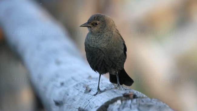
This little brown headed cow bird and his friend below both were hanging around Ed until they got their photos taken.
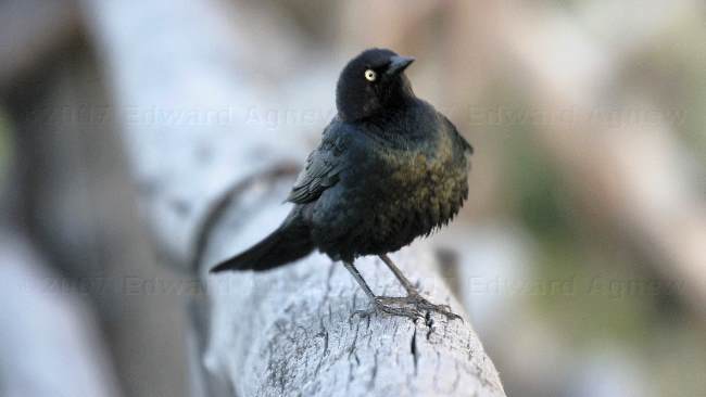
Common grackle, with a bronzed tine typical of this area
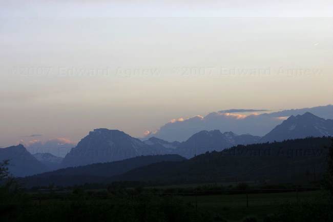
Sunset in the Tetons.
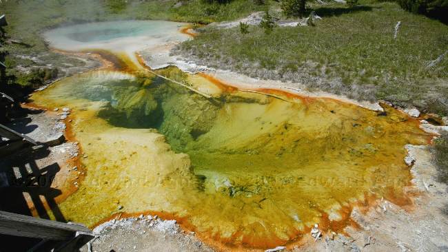
2007/06/19
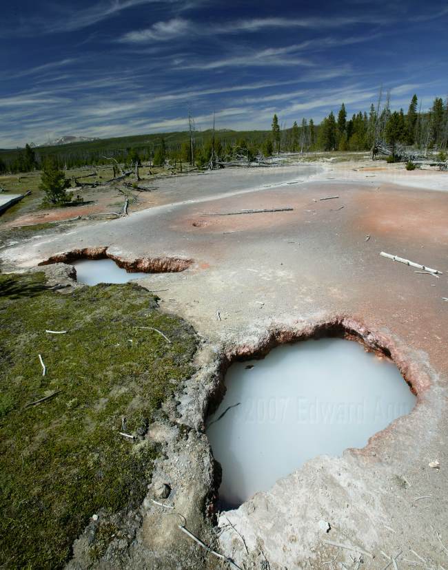
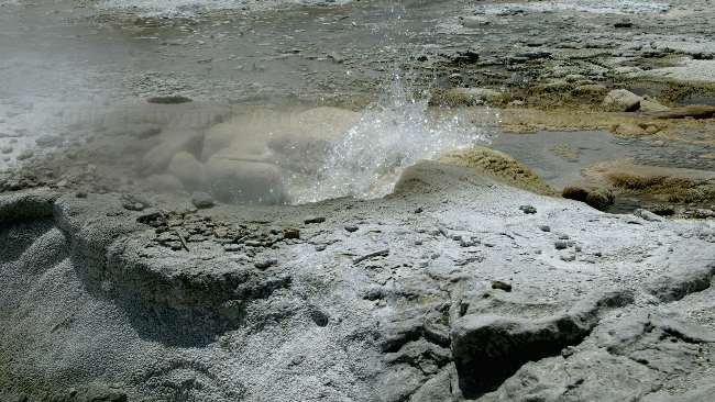
Spurting Mud
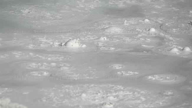
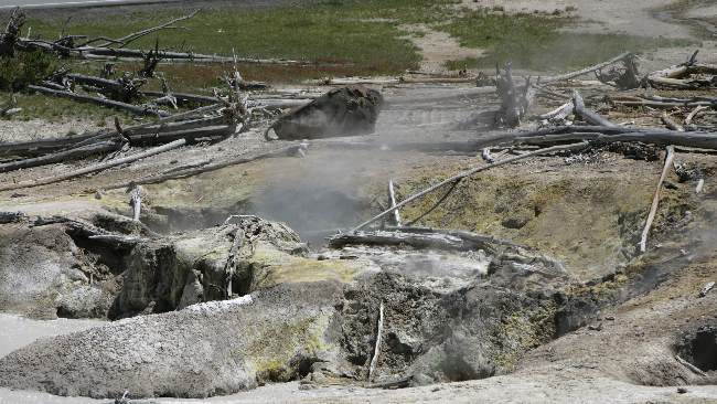
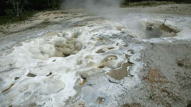
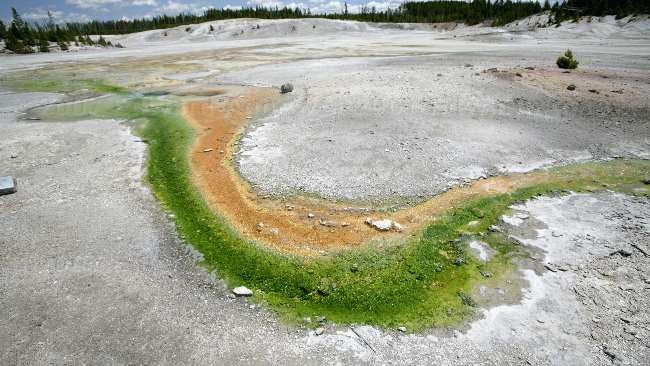
The Lower Geyser Basin has your typical geysers but it also has "paint pots" --- bubbling pools of clay.
We couldn't see into the pool but this "geyser" was shooting mud into the area. It's called Red Spouter.
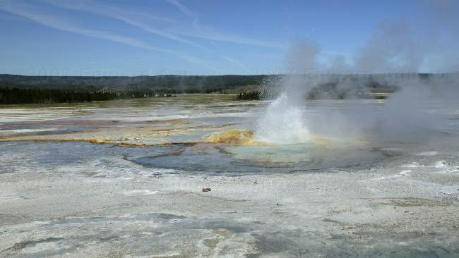
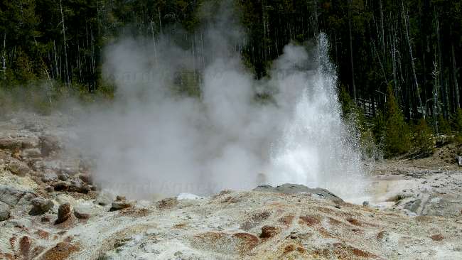
When Fountain Geyser (the geyser not erupting in the front of the photo) is thinking about erupting, the thermal activity increases in the area --- Morning Thief, the geyser erupting in the photo, erupts as well as a couple of other smaller geysers near by.
Clepsydra Geyser has been erupting constantly since the 1959 earthquake.
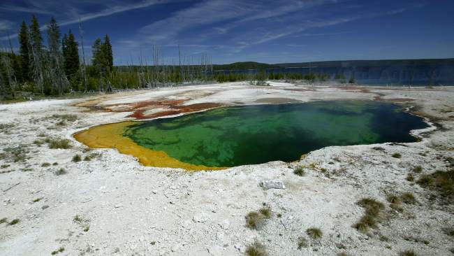
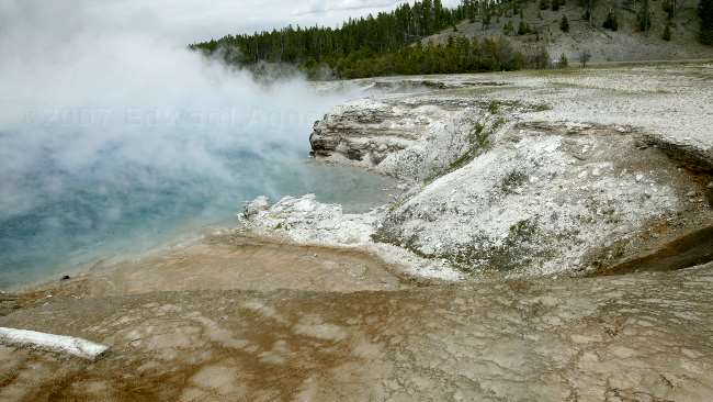
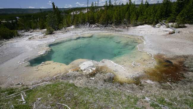
In the West Thumb Basin we saw this beautiful pool call Abyss Pool ---- the water was so clear you could see a long way down into the pool but couldn't see a bottom.
Seismograph Spring
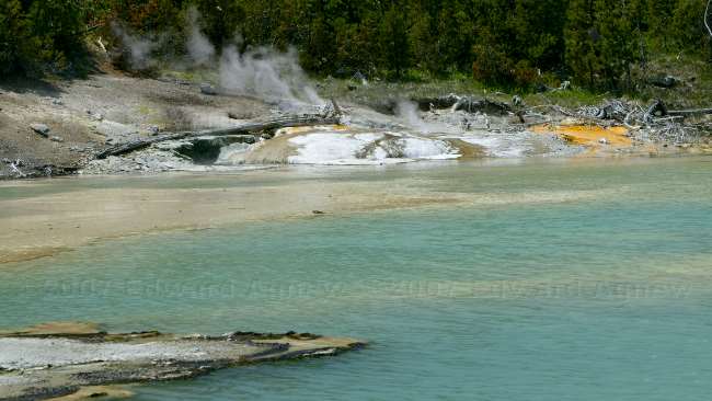
Yellowstone Lake is a large (136 square miles) beautiful lake on the eastern side of the park. From the national parks web site: "The west Thumb of Yellowstone Lake was formed by a large volcanic explosion that occurred approximately 150,000 years ago (125,000-200,000). The resulting collapsed volcano, called a caldera ("boiling pot" or caldron), later filled with water forming an extension of Yellowstone Lake." The cone in the photo is called Fishing Cone and is one of the many thermal features in this area.
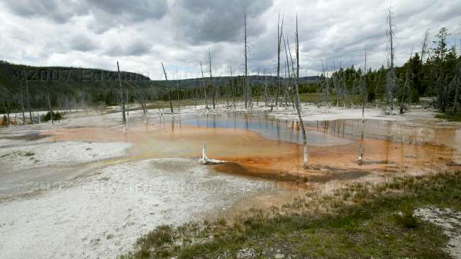
A fire did not kill these trees ---- they were cooked. After a series of small earthquakes the temperature of the ground rose to 200F subsequently "cooking" the trees. This is called Cooking Hillside in the Mud Volcano area.
Across from Cooking Hill is this large thermal area --- can you see the Buffalo getting a spa treatment?
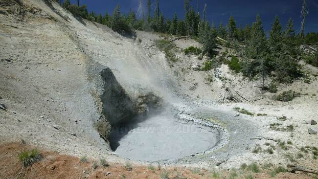
Mud Volcano
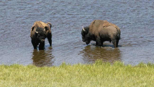
Nothing like a quick dip to cool off.

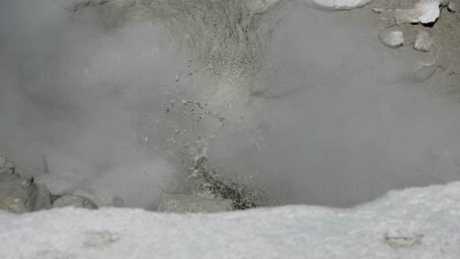
It's easy to understand why this area is called Artists Paint Pots.
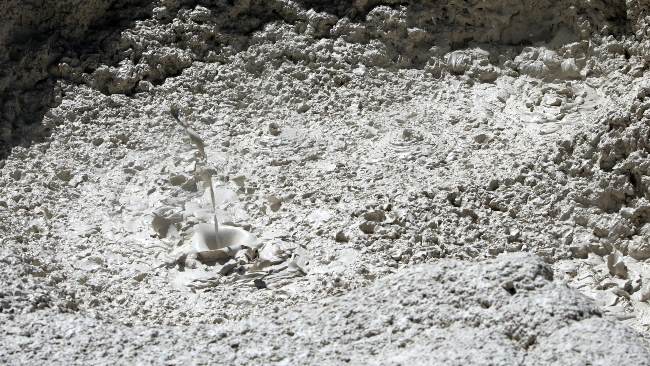
A mud geyser near Artists Paint Pots --- this geyser was spurting mud about 10 feet into the air.
Another view of the Artists Paint Pots
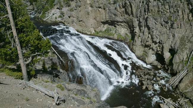
Gibbon Falls
2007/06/18
Here a Geyser, There a Geyser, Everywhere a Geyser
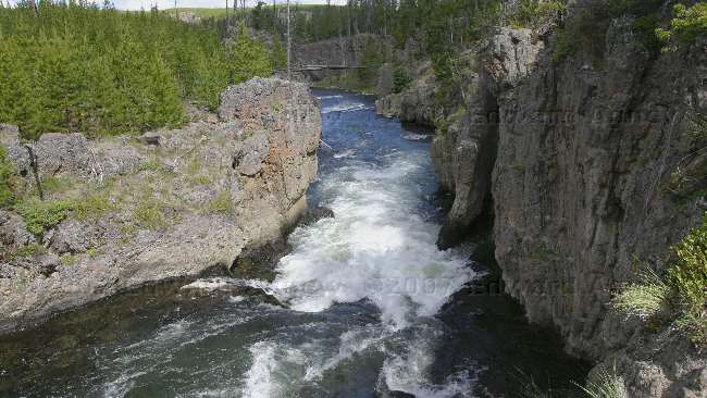
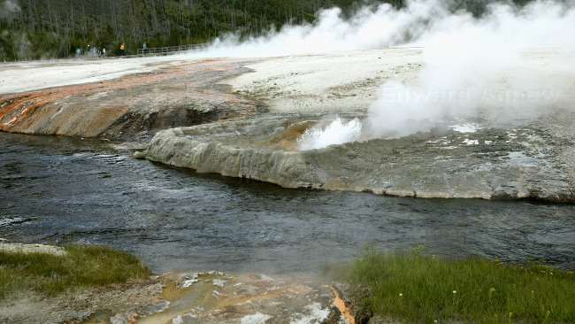
Rapids just below Firehole Falls
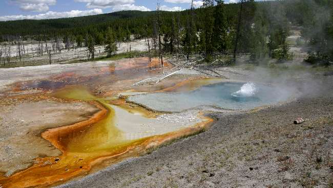
Some of the thermo area near Firehole Lake
The Heart Geyser not far from Old Faithful
The Spasmodic Geyser, near Old Faithful
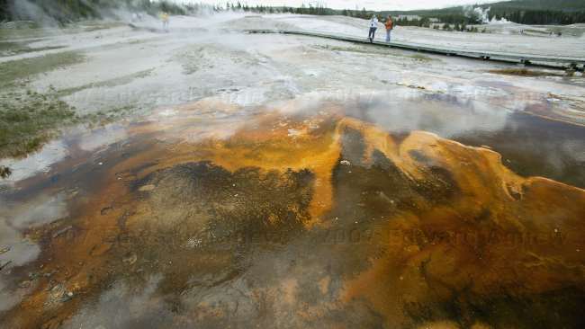
More of the geyser area near Old Faithful, the orange colour is from thermophilic bacteria
The Lion Geyser
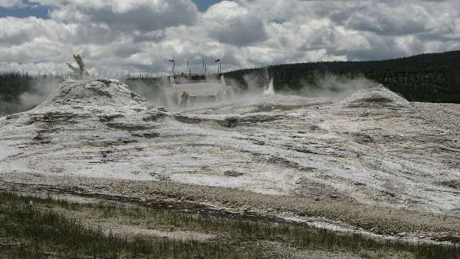
Another view of the Lion Geyser with some of the Old Faithful's Lodge buildings in the rear
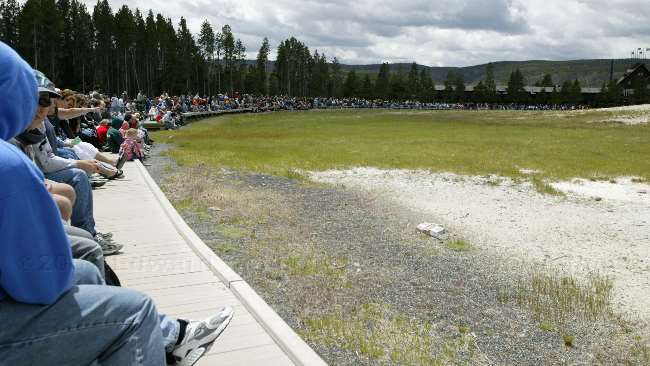
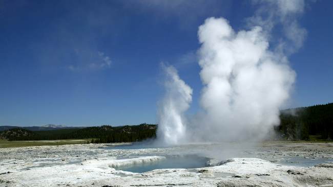
Everyone was waiting for Old Faithfull --- I can't image how busy it will be when the "busy season" begins on July 4.
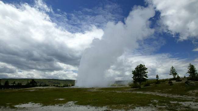
There she blows.....Old Faithful erupted right on schedule.
Cliff Geyser in the Black Sand Basin
More colourful thermo ponds in the Black Sand Basin
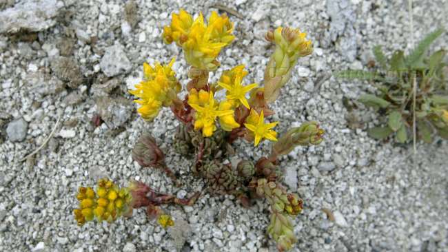
One of the flowers that like being near the hot springs.
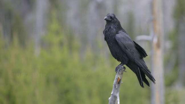
A Raven happily posed for us.
These trees died with the water levels covered their roots. Accumulated silicate gives the white sock look to their bases. This is near the Opalescence Pool, in the Black Sand Basin
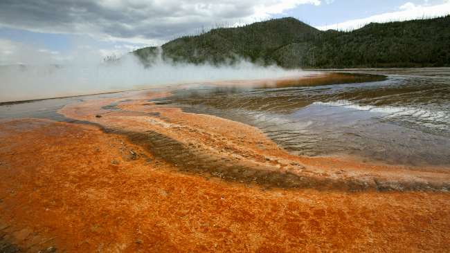
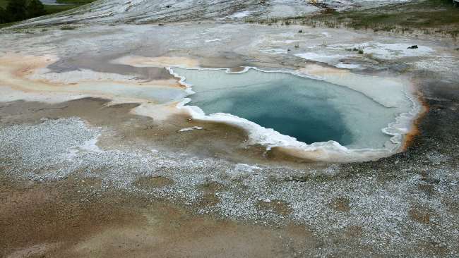
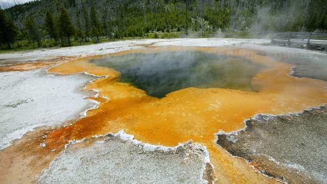
The Grand Prismatic Spring in the background is the largest hot spring in the world
Closer view of the Grand Prismatic Spring
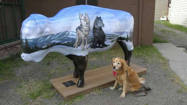
Zaph decided to join the wolf pack.
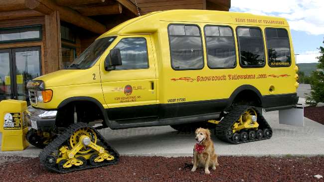
Even though all but one road closes to cars in the winter, the park is still open for business. Snowcoaches and snowmobiles are used to ferry people into the park. If you like to snowmobile this is the place to be as they usually get 4 to 5 feet of snow.
2007/06/17
1959 Earthquake
This elk was getting a lot of attention while he was eating breakfast.
Don't need a post hole digger to put up this fence.
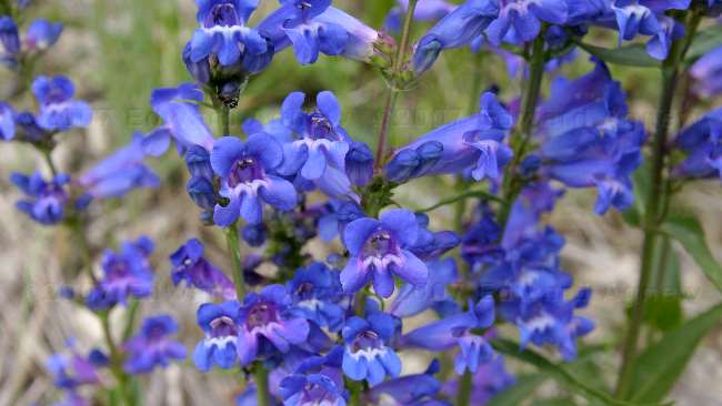
Some pretty blue flowers.
Hebgen Lake tilted upward during the earthquake lowering the south shore by 19 feet. The occupant of this cabin jumped out just before it slipped into the lake.
The ridge on the right of the picture was formed during the earthquake.
A view of Earthquake Lake. In a hundred years or so it may be drained as the river slowly widens the channel allowing more water to flow out of it.
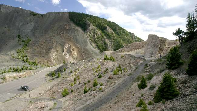
To give you a size prospective that's our truck in the parking lot. The rock on the right was originally attached to the circle like outcropping on the left and was moved during the slide. The rock is sitting about 300 feet above the original valley floor.
2007/06/16
Wildlife and Flowers
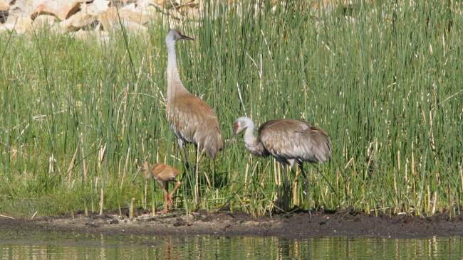
A Sandhill Crane family.
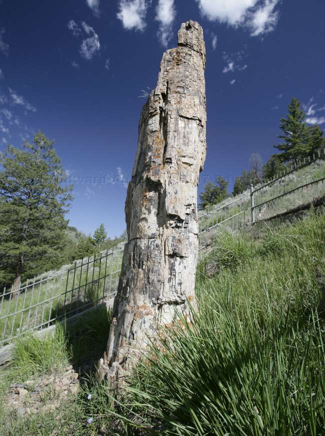
A petrified tree.
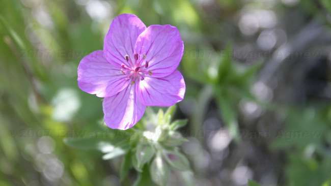
A pretty purple flower --- I need to spend some time reading our wildflower book.
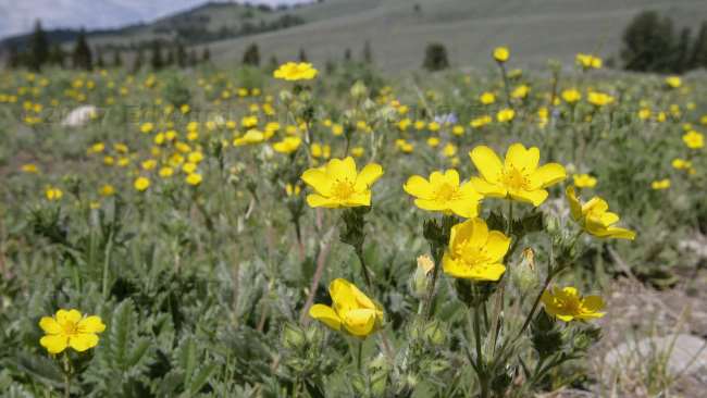
A field of pretty yellow flowers.
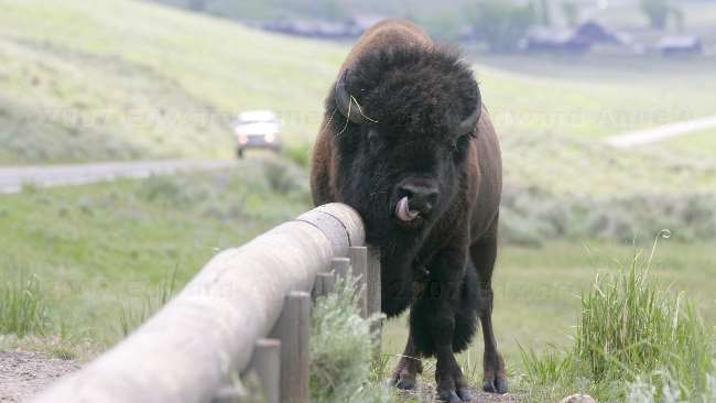
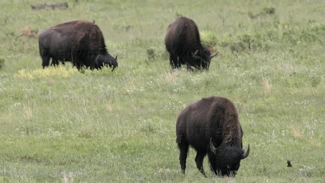
We stopped at a pull off to watch a herd of Bison down in a valley. There was a lone Bison across the road and up a hill. He slowly made his way down the hill, crossed the road and headed straight for the wooden guard rail. He happily scratched his back and chin while 20 people backed up and watched. When he finished scratching he headed about 40 feet down the hill then stopped and rolled around in the dirt. That's a piece of grass on his face not a hair on the photo.
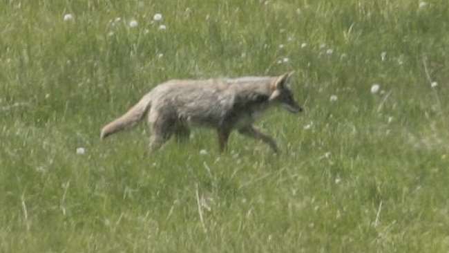
There was a herd of Bison, several Pronghorns (antelope) and this coyote in the valley.
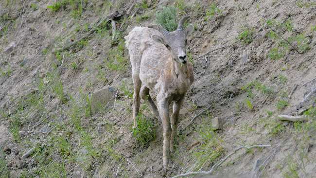
This guy was ripping vegetation of the side of a hill by a road. (I think he's a young bighorn sheep).

A Black Bear. We had stopped to look at a black bear high on a hill sleeping by a tree. When we walked back to the truck we saw this guy down the hill.
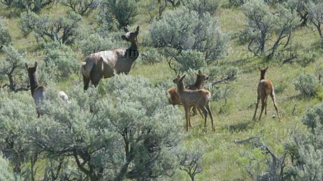
A herd of Elk.
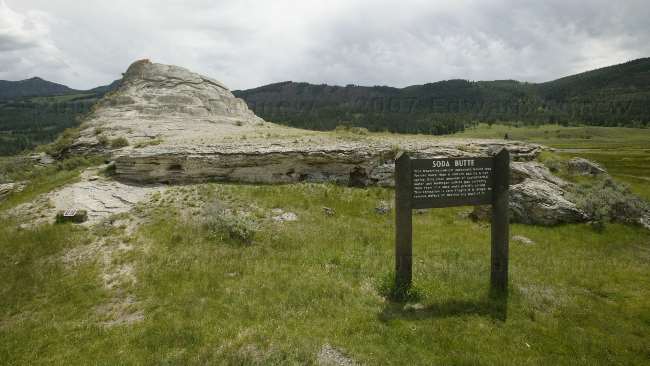
Soda Butte.
2007/06/15
So Much to See
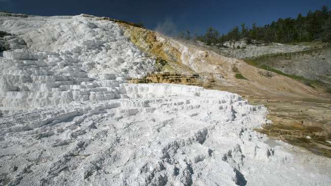
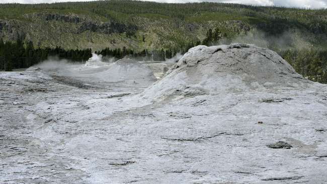
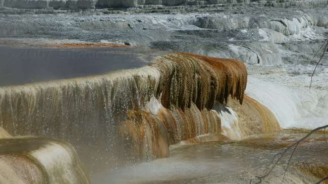
Mammoth Hot Spring Terraces - Palette Springs: Several key ingredients combine to make the Mammoth Hot Springs Terraces: heat, water, limestone, and a rock fracture system through which hot water can reach the earth's surface. Palette Springs were created by water flowing from a flat area and then down a steep ridge, creating a colorful hillside palette of brown, green, and orange (the colors are due to the presence of different heat-tolerant bacteria). This effect is much the same as an artist would achieve by allowing wet paint to run down a vertical surface.
Mammoth Hot Springs Terrace - Cleopatra Terrace
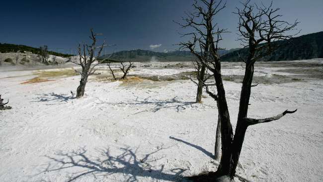
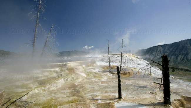
Mammoth Hot Springs Terraces - Main Terrace: On the main terrace the travertine (calcium carbonate) surrounded trees creating an eerie image.
Mammoth Hot Springs Terrace - Canary Springs: Canary Springs was named for its bright yellow color (sulfur dependent filamentous bacteria). This is the upper portion.
Mammoth Hot Springs Terrace - Canary Springs: water falls on the lower portion
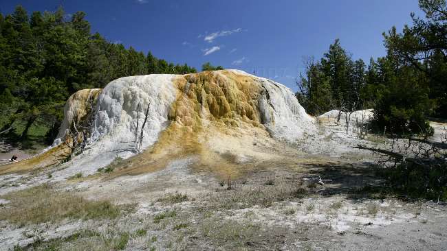
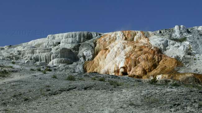
Mammoth Hot Springs Terrace - Orange Spring Mound: Its large mounded shape is the result of very slow water flow and mineral deposition.
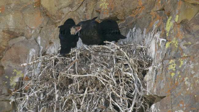
At one of the lookouts along the road we say this Raven next complete with young.
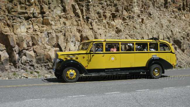
One of the Yellowstone tour buses --- this one is unique because it is a convertable. You don't have to get off the bus to get a very view --- just stand up.

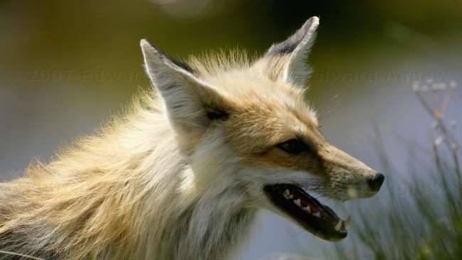
At another pull off we noticed a lot of people, so we stopped to see what had been spotted. Turned out it was a fox. I think it got tired of being watched so it stood up and walked past the crowd before heading away.
Many of the animals in the park are not afraid of people as people are not considered predators by the animals at Yellowstone (no hunting). Now we understand why we heard people in Cody referring to Yellowstone as the "petting zoo down the road".
Norris Geyser Basin -Norris Geyser Basin the hottest and most changeable thermal area in Yellowstone. Ed liked the green and orange colours in the Porcelain Basin area.
Norris Geyser Basin - One of the many colourful springs in the basin.
Norris Geyser Basin - A small lake with thermal activity at the far end of it.
Norris Geyser Basin - The Veteran Geyser bubbles away.
Norris Geyser Basin - A small eruption of the Steamboat Geyser. The Steamboat Geyser eruptions can reach more than 300 feet and last 3 to 40 minutes. The major eruptions are rare with the last one being in May of 2005. Small eruptions occur on a regular basis.
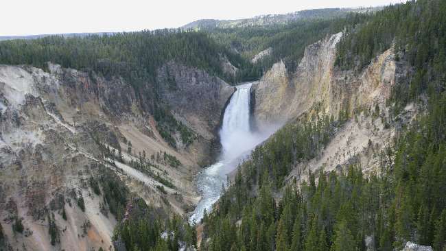
Yellowstone's Grand Canyon - Our first view of the Lower Falls. It is 308 feet high making it twice as tall as Niagara Falls.
Yellowstone's Grand Canyon - We walked down till we were at the brink of the Lower Falls. A view looking down the canyon.
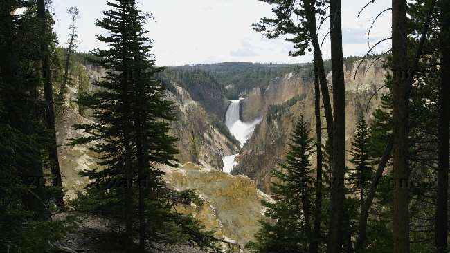
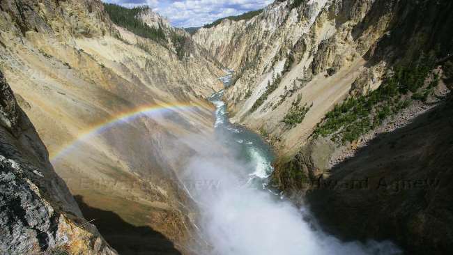
Yellowstone's Grand Canyon - A view of the falls from Artist Point. I thought that this was the best view of the falls and understood why they called this area Artist Point.
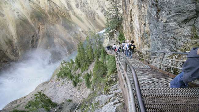
Yellowstone's Grand Canyon - 328 steps take you down to view the Lower Falls from the South Rim. It was too bad that you have to climb back up them.
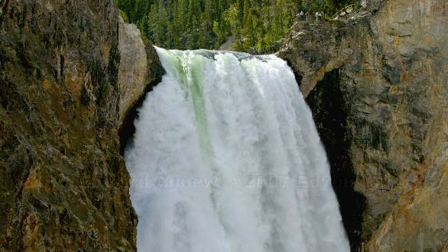
Yellowstone's Grand Canyon - The view from the bottom of the steps. Notice how some of the water appears green --- it reminded Ed of his toothpaste - white with green stripes.
2007/06/14
That Other Season - Road Construction
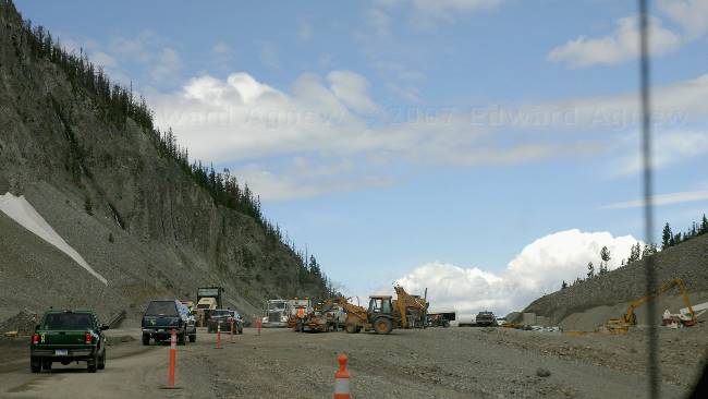
Road Construction inside Yellowstone National Park.
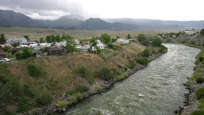
The Yellowstone River goes through the middle of Gardiner.
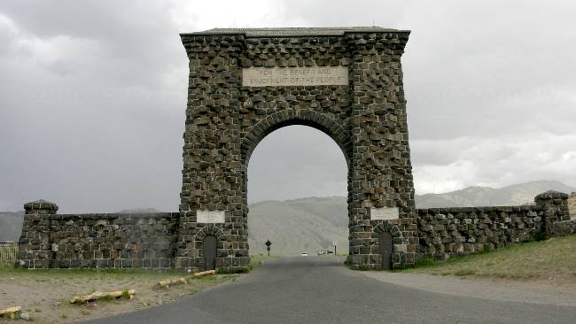
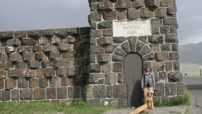
The Roosevelt Arch at the north entrance to Yellowstone National Park. This arch was dedicated by Theodore Roosevelt on April 24, 1903.
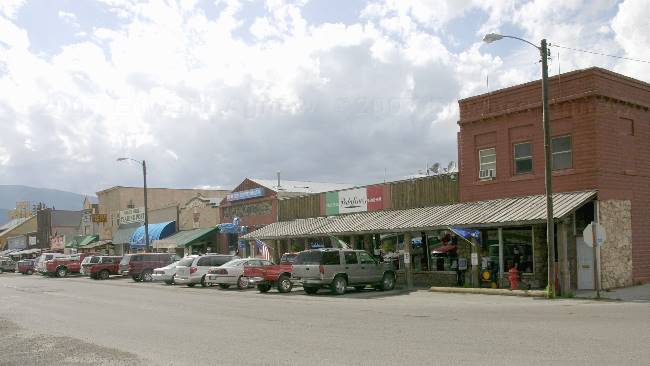
The main tourist shopping area in Gardiner.
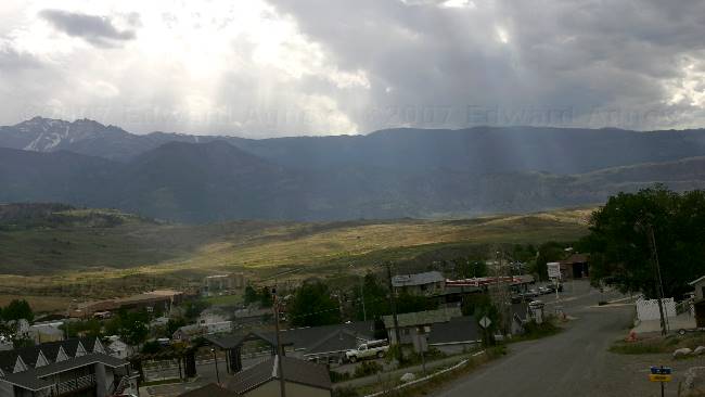
Mother Nature couldn't make up her mind --- it was raining and the sun was shining causing the "sun ray affect".
2007/06/13
Another Gunfight
Next stop of the day was the Buffalo Bill Dam ---- yeah, a lot of the places in town are named for Buffalo Bill. The dam completed in 1910 and was the highest dam in the world at 325 feet. It was 108 feet wide at the base and 10 feet wide at the top. Its crest was 200 feet across. Buffalo Bill Dam was Reclamation's first high concrete arch dam. In 1993 an additional 25 feet was added to the dam.
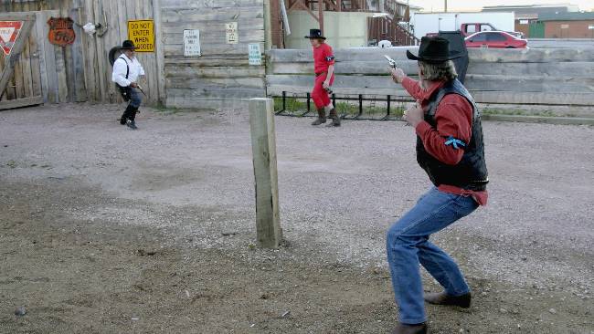
In 1902 Buffalo Bill built the Irma Hotel (named after his daughter) which he called -"just the sweetest hotel that ever was.". This hotel is one of the other big attractions in town and each evening there is a gun fight. The performance is free but you can rent a chair for $1. The gun fight was our last stop for the day.
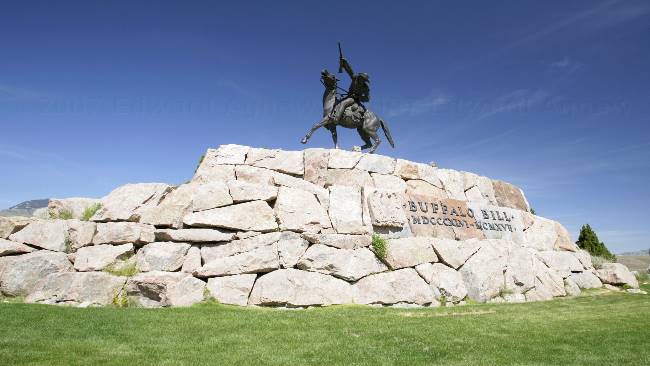
Yet one more bronze statue of Buffalo Bill Cody.
Zaph says this is definitely "dog abuse" --- can't image that any dog would submit willingly.
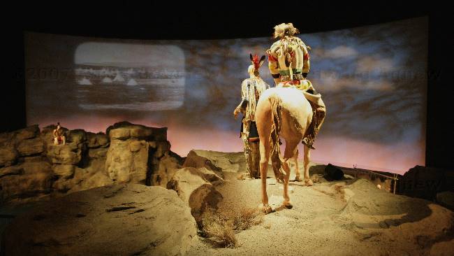
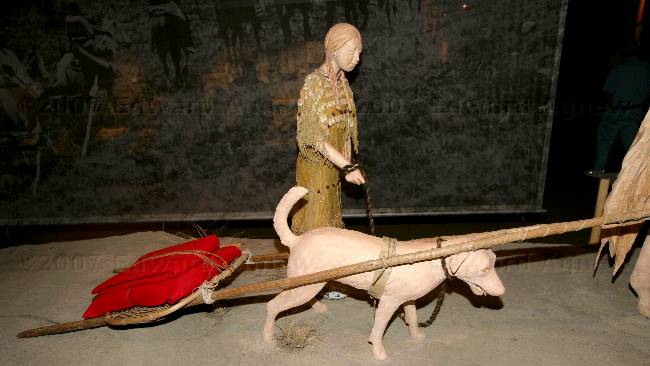
The exhibits in the Plains Indian Museum were very well done.
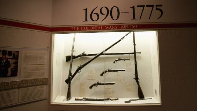
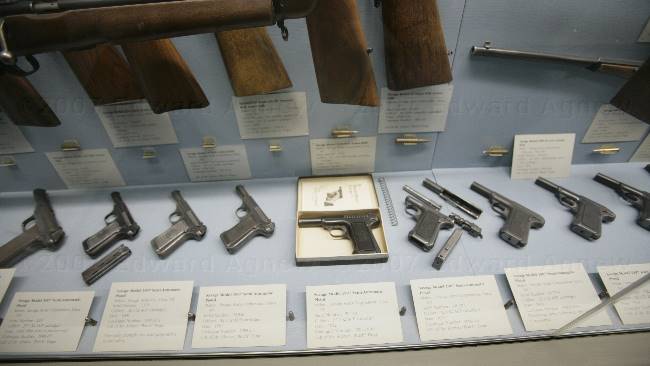
One of the gun exhibits.
"It Banishes Fear" --- that's the title in the display box.
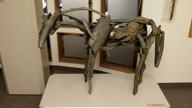
A very interesting horse.
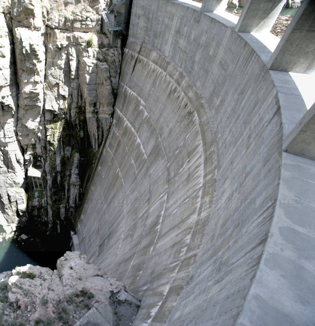
Looking down the Buffalo Bill Dam
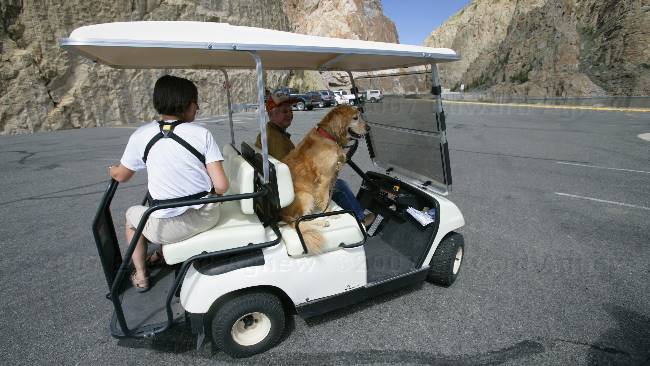
A golf cart is used to transport visitors from the parking lot to the visitor center and even Zaph was offered a ride. I was surprised when he climb on board.
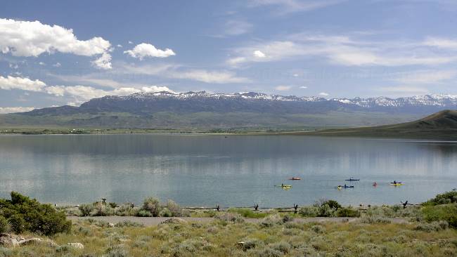
Kayaking on the Buffalo Bill Reservoir
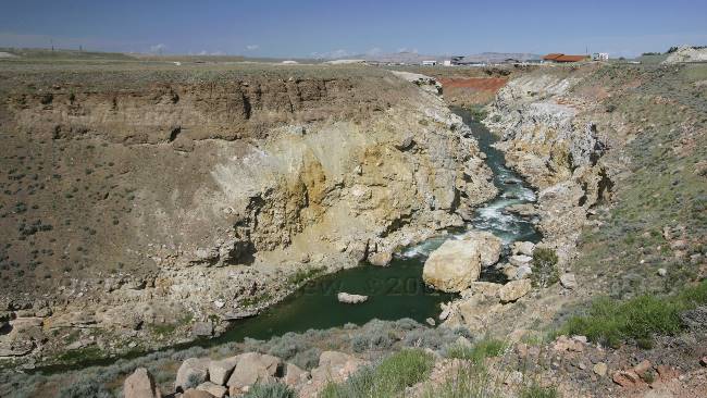
The Shoshone River runs along the highway.
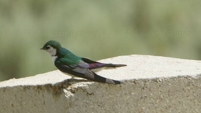
Violet-Green Swallows were flying over the Shoshone River.

Queen Victoria was so impressed with the "Buffalo Bill's Wild West Show" that she gave Buffalo Bill this cherry wood bar for the Irma Hotel.
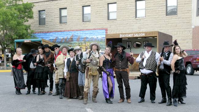
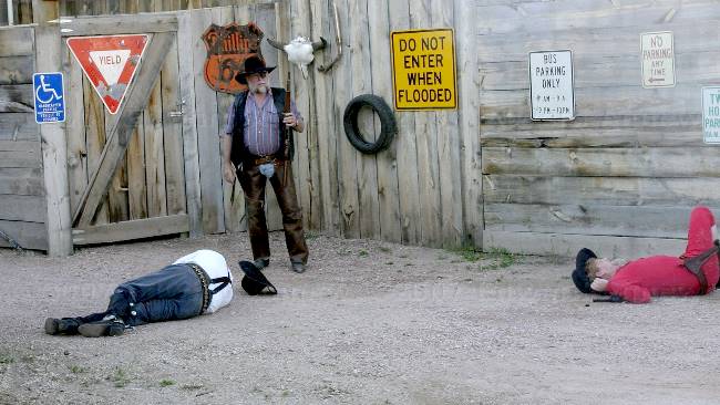
The cast of the "Gun Fight"
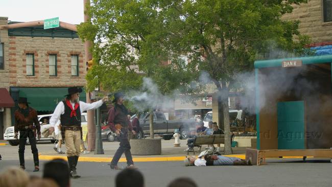
The gun fight is on.
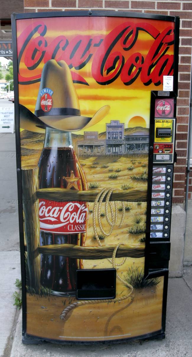
Even the coke machines is "western".
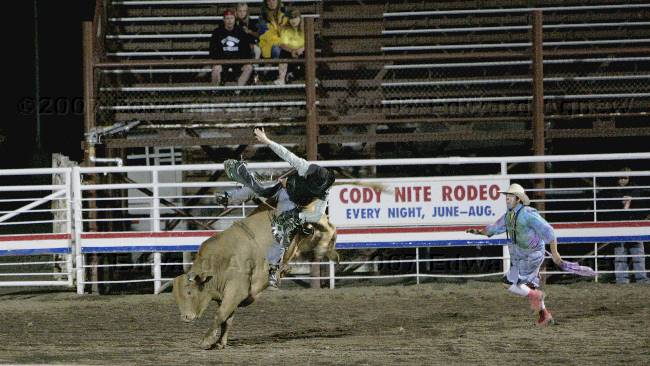
2007/06/12
Rodeo Nite
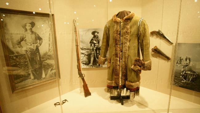
Day One we visited The Buffalo Bill Museum which of course is all about Buffalo Bill, the Draper Museum of Natural History which is all about the Yellowstone area and the Whitney Gallery of Western Art which of course is art work about the west.
The day ended with a trip to the Cody Nite Rodeo. The rodeo is on every evening all summer except when the stampede is on. The rodeo was a lot of fun .... maybe we'll have to plan a trip to the Calgary Stampede.
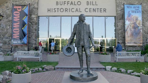
A bronze of Buffalo Bill is at the front entrance.
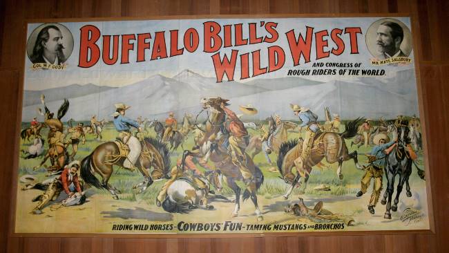
A big part of the Buffalo Bill Museum revolved around "Buffalo Bill's Wild West Show". There was even a video of one of the performances.
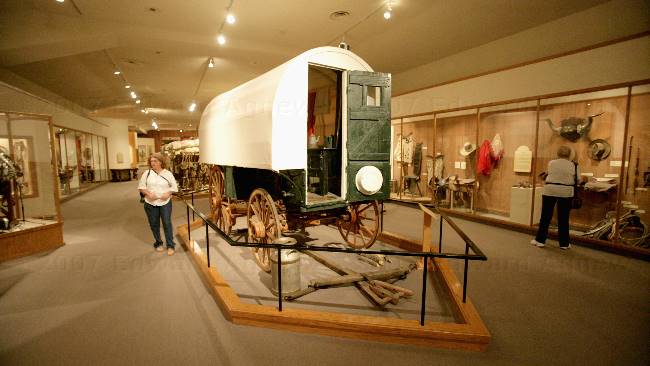
Ed wasn't interested in trading our 5th wheel for one of the original trailers. This is a sheep ranch wagon complete with bed and kitchen.
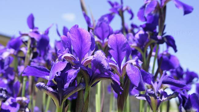
Iris's in one of the gardens.
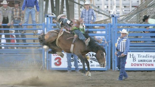
Ride em cowboy! --- bareback riding.
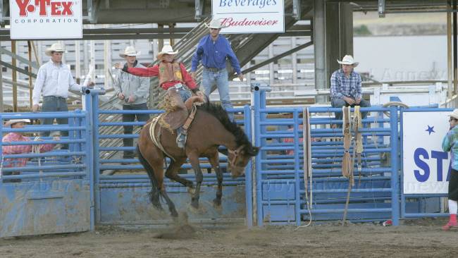
It doesn't look any easier with a sadlle --- Sadlle bronc riding
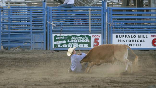
I think the steer won --- this cowboy just wasn't big enough to bring him down. Steer Wrestling.
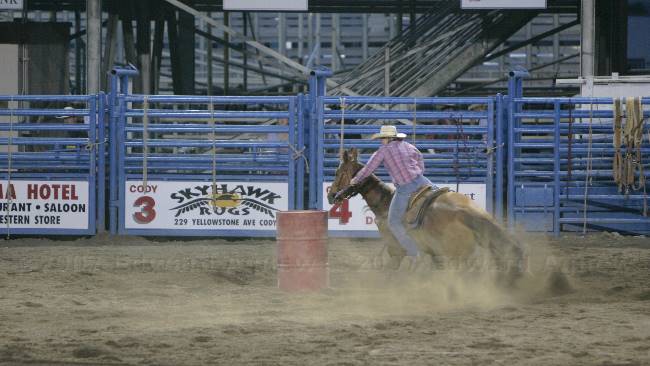
That horse has really good brakes --- Girl's barrel racing.
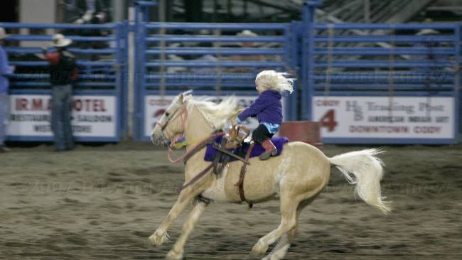
Even the little ones got in on the show --- Novice Barrel Racing. Unfortunately this little one lost control and fell off her horse but dad was there to rescue her.
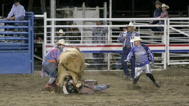
Yup, that's a cowboy under a bull --- the clowns got in the fast and moved the bull off.
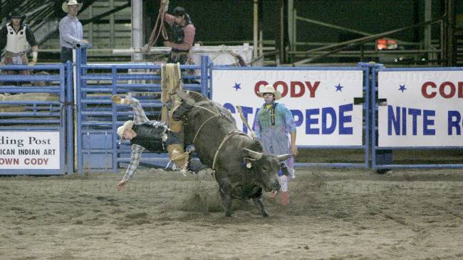
Oops.... he did hang on --- Bull Riding.
This is more like it --- but I don't know why anyone would want to do it.
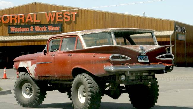
Some people's driveways must be a bit rough around this part of the country, interesting solution.
2007/06/11
The Home of Buffalo Bill
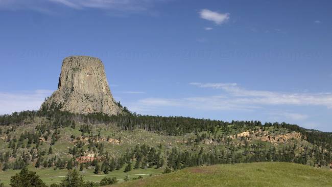
One last look at Devil's Tower as we head down the road.
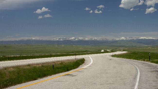
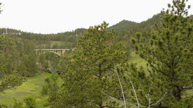
In the distance we can see snow covered peaks. The highway led us through these mountains.
2007/06/10
Bear Lodge
| |
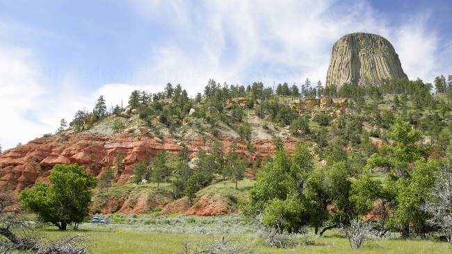
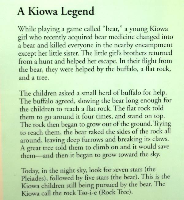
A view of Devils Tower from the main road showing some of the red "spearfish" formation, a dominate feature of the black hill .
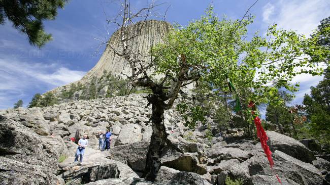
This site is a sacred spot for many Indian tribes and you'll see prayer cloths and bundles hanging in the trees.
June is the most sacred month at Devils Tower for many Indian Tribes. In deference to the Indian beliefs the park has put a voluntary ban on climbing during the month of June. This voluntary ban has reduced the number of climbers in June by 85%. We did see two climbers near the top.

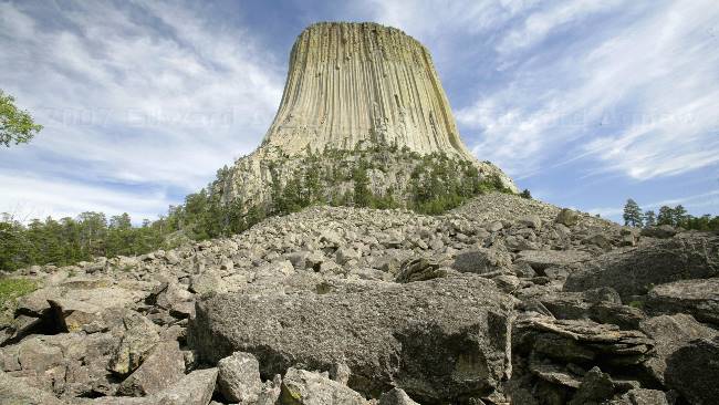
The tower glows in the setting sun.
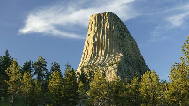
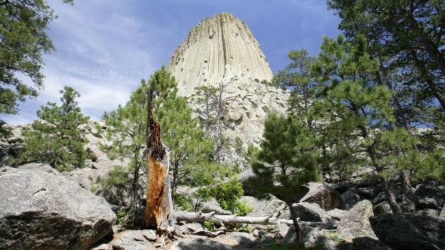
OK, this is the last tower picture ---- there really wasn't a lot of things to take photos of.
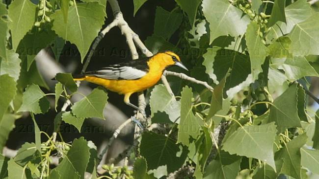
Bullock's Oriole --- we did see a number of birds and white tailed deer.
2007/06/09
Crazy Horse and the Shootout
About five miles north of Custer is the Crazy Horse Memorial. This not for profit organization has been working on the memorial since 1948 and very far from complete. It’s unfortunate that the original sculptor who died in 1982 had such grandiose plans for the sculpture that it is destroying a large portion of a mountain and may never be completed --- at least not in my lifetime. I’m not sure that this is the memorial that the founding Indian chiefs had envisioned.
This evening we attended a "shoot out" at the Gold Pan Saloon. A bunch of locals including the owner of the RV park where we are staying and his wife are the cast of this grass roots show.
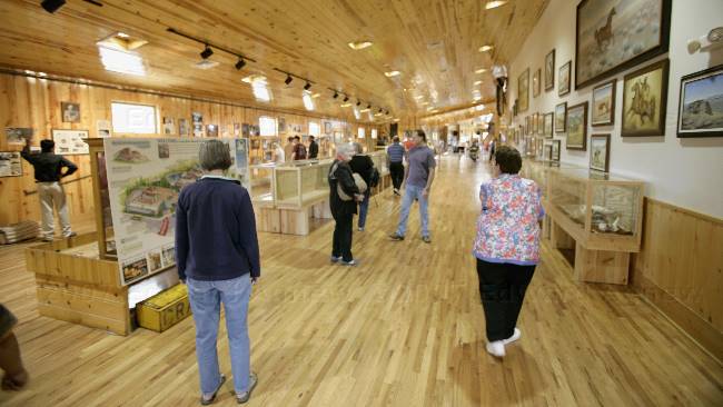
Inside the Museum at the Crazy Horse Memorial
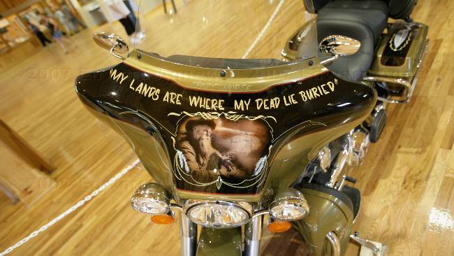
A motorcycle with Crazy Horse's famous saying.
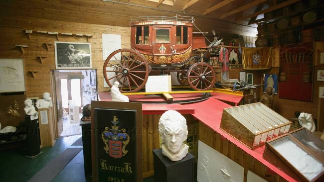
The sculptor's studio.
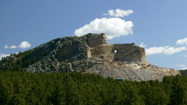
The Crazy Horse Memorial in its current state
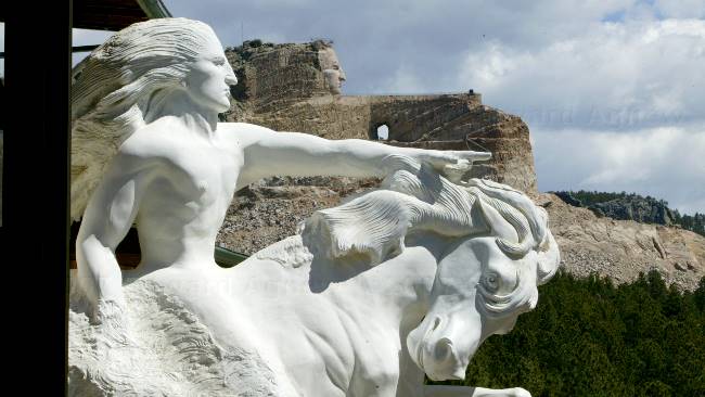
The white sculpture is the model that reflects what the mountain will look like when done. In the background one can see there is a lot of work still to be done.
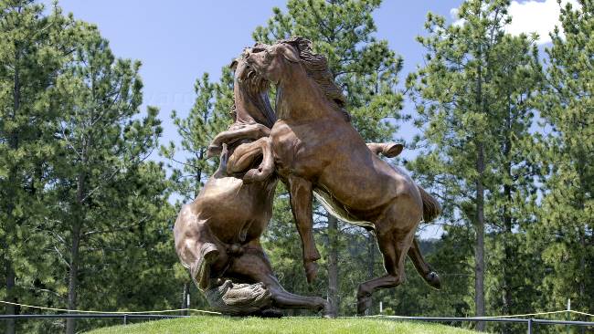
A bronze sculpture that was donated to the memorial.
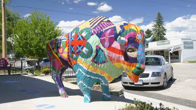
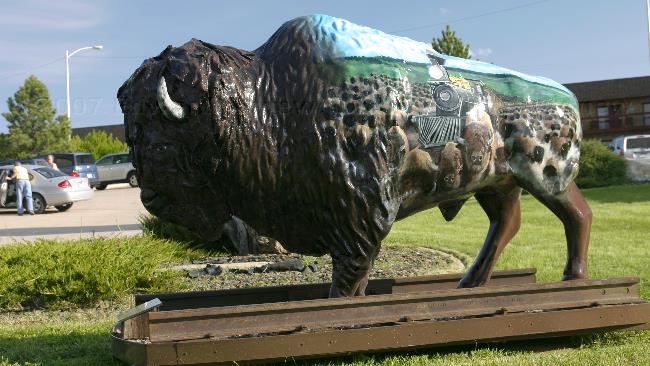
A colourful bison on one of the downtown streets of Custer.
"The shootout" the good guys are on the left and the bad guy is at the right front.
Looks like everyone has been shot except for Rock (RV park owner) --- he was shot just after this photo was taken.
2007/06/08
Friendly Ghost Town and What Every Happened to Wild Bill Hichok
The fellow at the Custer information centre had drawn a scenic route from Custer to Spearfish at the north end of the Black Hills. As the sun was shining we decided that it was a good day to do the drive. The route took us deep into the National Forest, past pristine lakes, up winding roads to lookout points, past quaint small towns and some not so quaint. One of the highlights was Rochford, a small "ghost" town with a church, fire station, the mall or “small” as they called it and a restaurant / bar / store / meeting place. Another highlight or should I saw “downlight” was finding snow on the ground at Terry Peak --- there wasn’t a lot of snow but there was snow. While it was cold, drizzling and windy in Custer yesterday, Terry Peak was having a blizzard. Another interesting stop was the town of Deadwood --- South Dakota’s "Las Vegas" western style.
A small corner of Deerfield Lake.
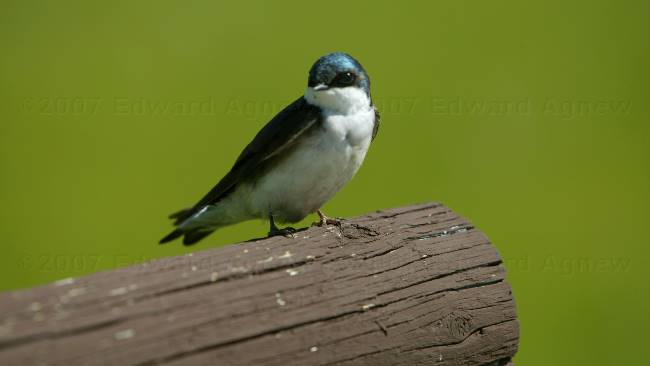 This tree swallow kept hanging around till Ed took his picture --- Ed was about 3 feet away from him.
Ditch Creek on the edge of Deerfield Lake.
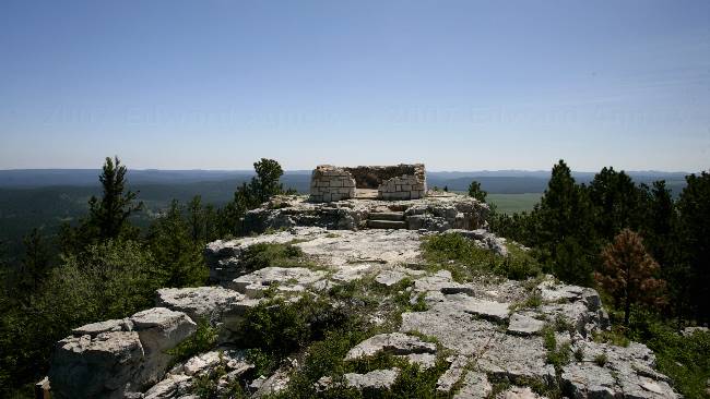
Flag Mountain --- in the 1940's there was a fire lookout here.
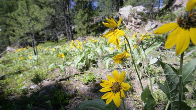
As we drove up the road to flag mountain we saw hundreds of these yellow flowers.
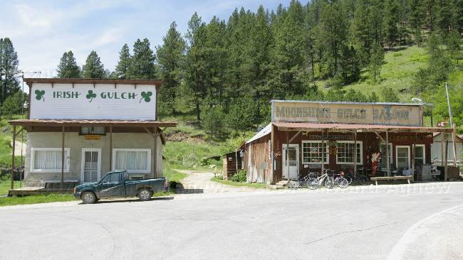
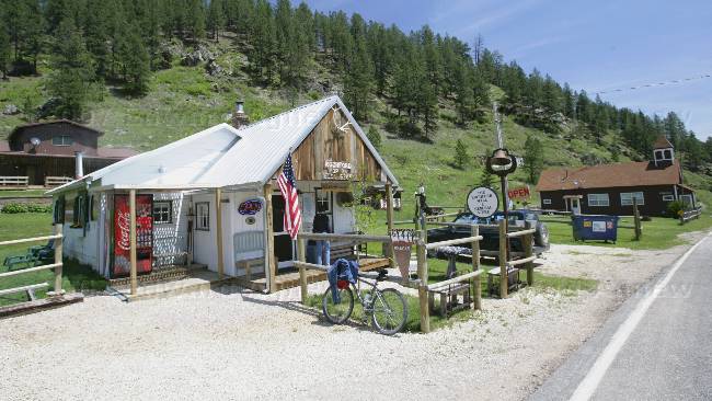
Rochford --- Moonshine Gulch Saloon is the restaurant / bar /meeting place etc.
The mall... better known as the "small". In a past life this building was a garage and fuel depot for the old mining operation. The owner showed us a photo album of the renovations.
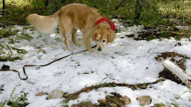
Yup mom, it's snow.
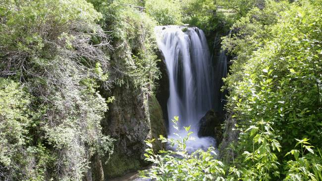
Roughlock Falls
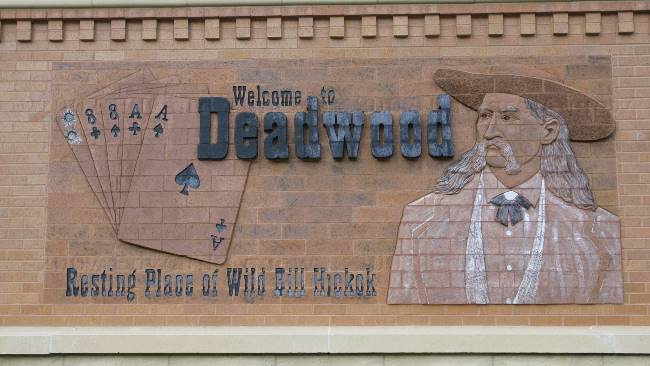
Wild Bill Hichok was gunned down in a saloon in Deadwood --- the only time he every sat with his back to the door.
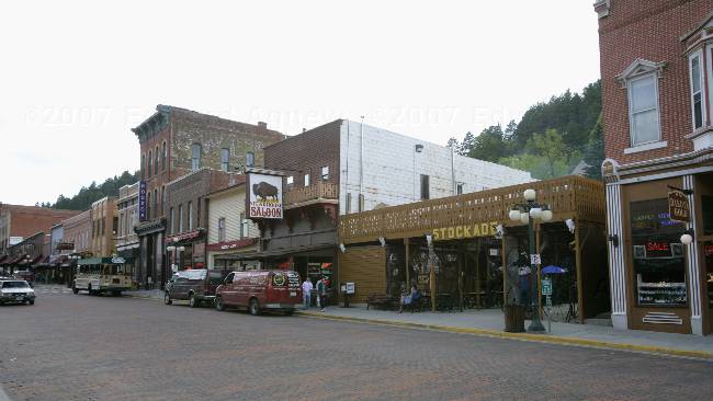
A view of downtown Deadwood. About 80 percent of the establishments along this street are casinos.
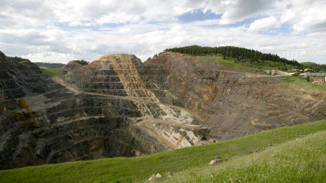
Homestake Open Gold Mine in Lead. I think all the gold is gone as the mine no longer operates.
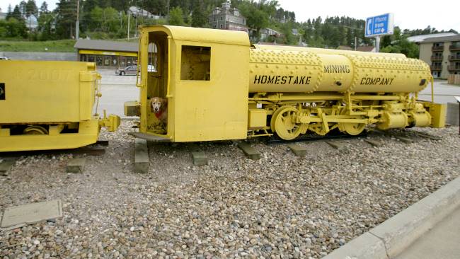
Mom... Which lever was it to make it move?
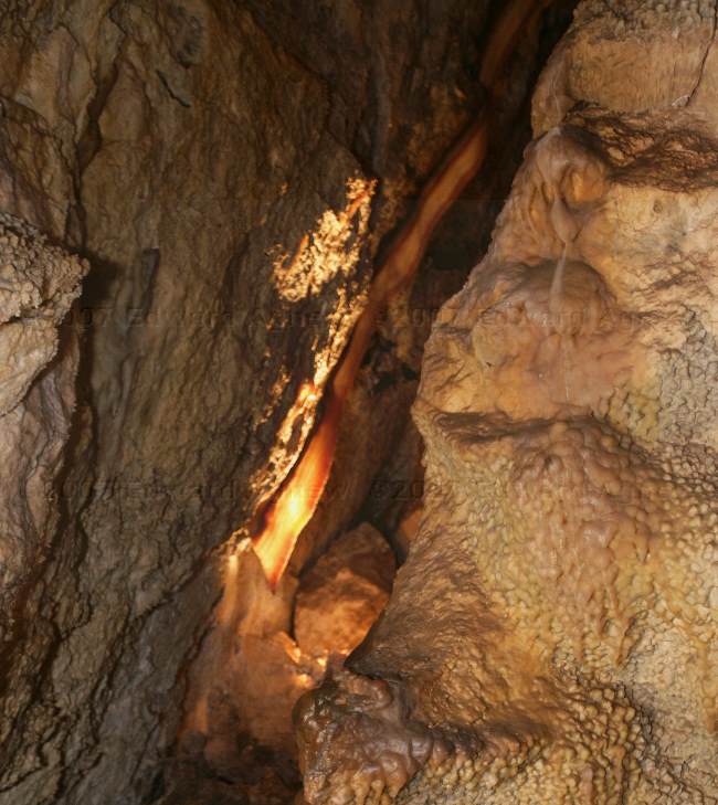
2007/06/07
Wind and Box works
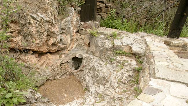
The natural entrance to Wind Cave --- I don't think I would have crawled into that 8"x10"hole.
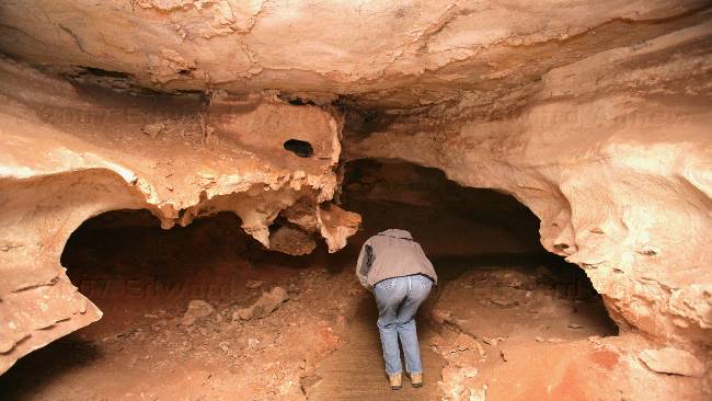
Some of the passage ways were low --- OK I was probably bending more than I needed to.
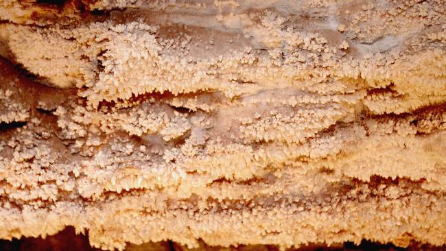
This structure is called popcorn. It is formed by water seeping through the cave wall and forming a water droplet. The water evaporates leaving the popcorn formation.
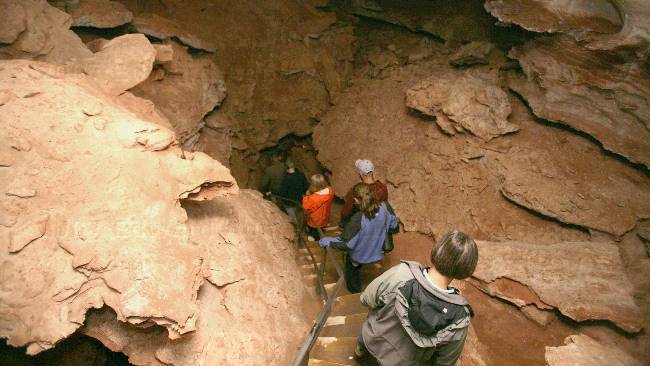
Descending deep into the cave. The tour included some rooms on the upper level and middle level.
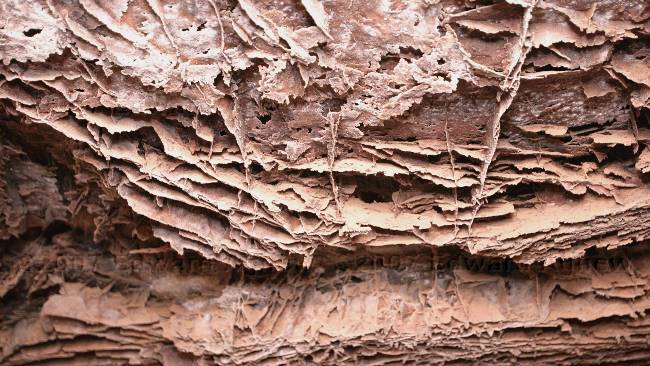
This is the formation called "box works". Before the cave was formed, the limestone rock cracked under pressure from above rocks. Water carrying calcite fills the cracks as time passed, left the calcite behind forming a hard plug. As the acidic ground water carved the cave passages, in the weak limestone, it exposed the more acid resistant calcite, which resulted in the box work structures which the cave if famous for.
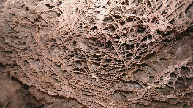
Wind Cave has about 95% of the exposed "box works features" in the world.
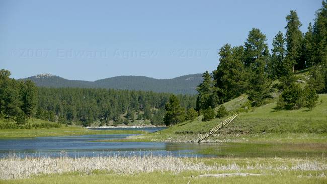
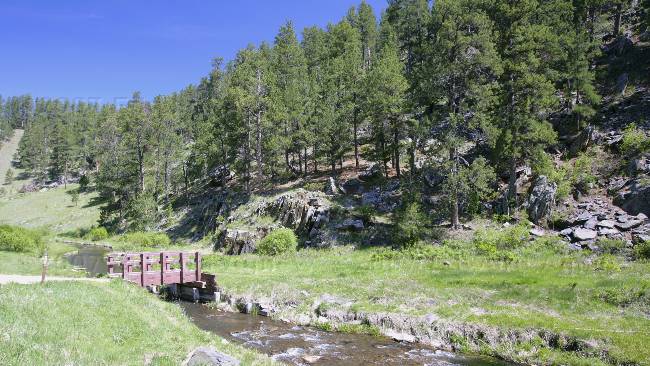
A view in the Black Hills.
2007/06/06
Mammoths
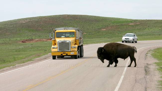
Bison are pretty big .... that's a dump truck coming towards us.
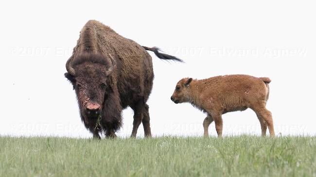
Babies are always so cute.
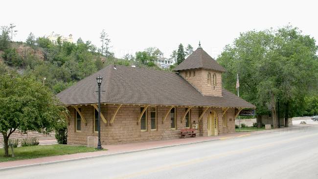
The old train station has been converted to an information center.
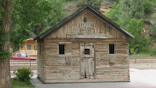
The former town jail.
This spring was very hot --- I think it was only around 75F
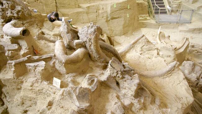
To date 55 mammoths have been found. By examining the bones the paleontologists have determined that all of the mammoths in the dig are males and the majority are Columbian Mammoths and the remainder are Woolly Mammoths.
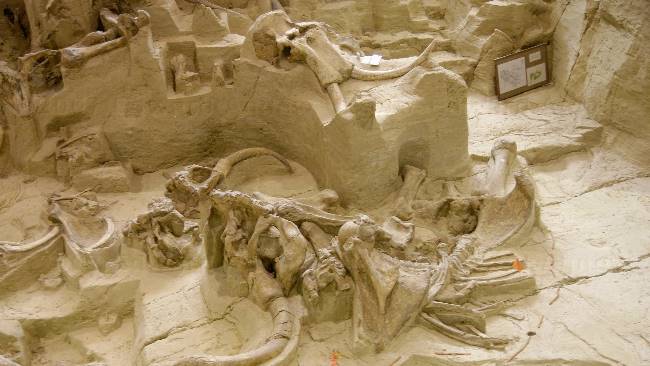
One of the complete skeletons found in the dig. A large sink hole form and filled with water. When the mammoths tried to eat the grass at the edge of the hole or get a drink of water some of them fell in a were unable to get out due to the steepness of the sink hole.
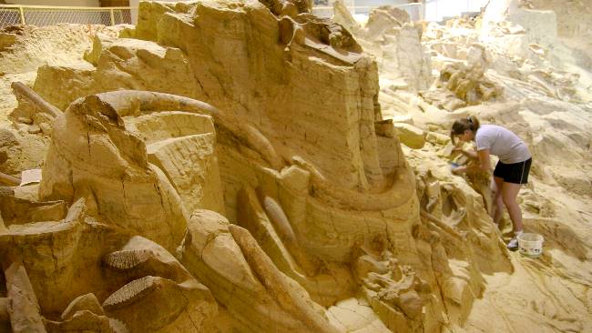
A volunteer is using dentals tools to clean around a bone.
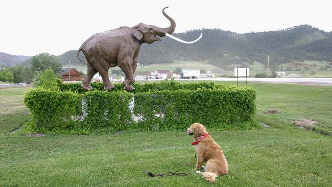
Zaph checking out the Mammoth statue --- he doesn't really like the looks of it.
2007/06/05
Jewel Cave
The afternoon included a hike up one of the hills bordering Custer and a trip into the state park for some hiking and a quick dip in a lake--- Zaph's pick!
In 2000 a forest fire burned in the area including that over the cave. The park was happy to know that the smoke from the fire did not penetrate or effect the cave in any way.
One of the many passages we walked down.
Some of the "jewels" in the cave, the mud like material in the centre is "flow stone".
The tour group admiring the cave, while the ranger points out features.
Look for the strip of bacon --- it is a ribbon formation and this one is the largest know ribbon in Jewel cave. Start at the brightest spot in the photo and follow it towards the top right corner.
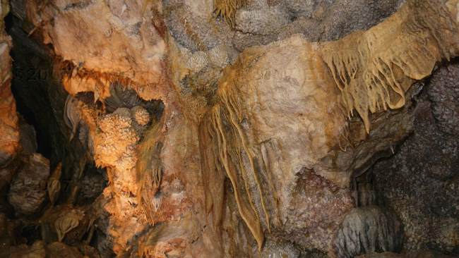
Some of the beautiful draperies.
A view of Custer from the top of an overlook.
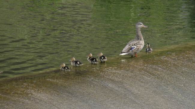
A mom and her babies on one of the lakes in Custer State Park.
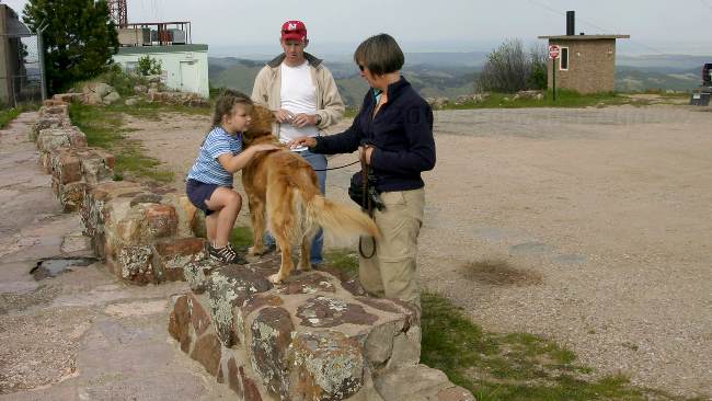
Zaph seems to attract little girls and they all love to pet him.
2007/06/04
Tunnels and faces
After a visit to the information center, Ed was armed with a long list of things to do and places to see in the area. We decided that we would start with the Peter Norbeck Scenic Byway, but inserted a detour to drive the Wildlife Drive in Custer Sate Park, then continue on the scenic drive stopping at Mount Rushmore before heading back to Custer. What an interesting drive, we passed through several tunnels (one of which was just over 8 feet wide), saw white-tailed deer, bison, prairie dogs and burros, some fantastic views and of course Mount Rushmore.
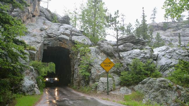
One of the tunnels we drove through in Custer State Park.
Custer State Park is home to about 1500 bison --- I think we seen about 10 of them.
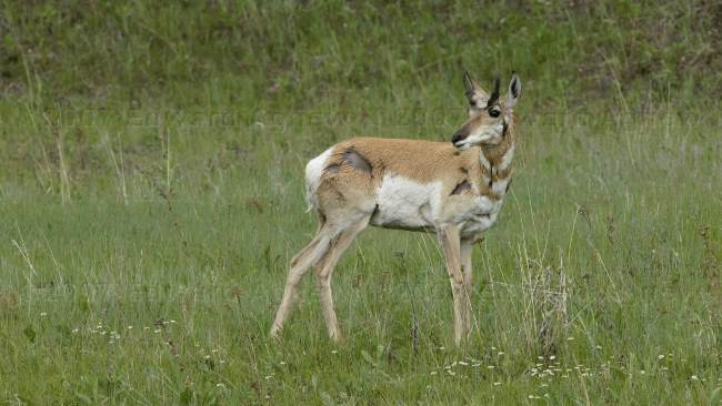
A Pronghorn
Very friendly burros. A number of years ago the burros were brought into the park to pull carts to transport people and goods to the more rugged area of the park. When the burros were no longer needed they were released into the park and have thrived.
The visitor center another Civilian Conservation Corps project
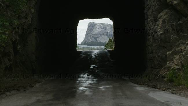
The man who designed the road and thus tunnels leading to Mount Rushmore planned the tunnels to frame the presidents on Mount Rushmore.
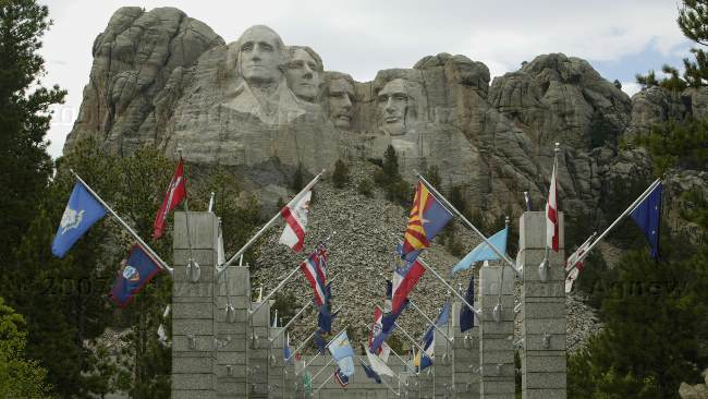
A walkway leading to the viewing platform is lined with flags from all of the states.
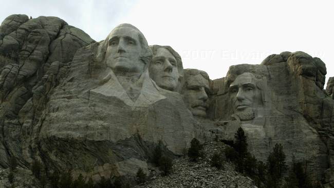
The presidents are from left to right: George Washington, Thomas Jefferson, Theodore Roosevelt and Abraham Lincoln.
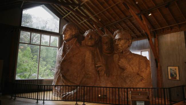
Gutzon Borglum, the sculptor, created this model of the sculpture. Mount Rushmore and the presidents can be seen out of the upper window.
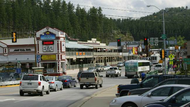
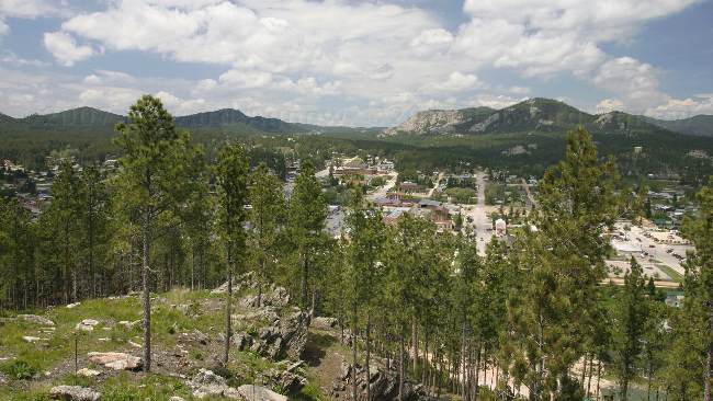
Keystone, has become a real tourist town. Prior to 1900, Keystone was the centre a mining community, with local mines extracting mica, tin oxide, gold and other rare mineral. Keystone is the nearest town to Mount Rushmore and at one time supplied the electrical power required to create the faces on the mountain.
2007/06/03
Off to the Black Hills and Custer
The town of Custer is about 125 miles from the Badlands National Park and it was our destination for today. We decided to drive the south highway and enjoyed some beautiful scenery as we skirted the south side of the badlands. As we neared the Black Hills, the scenery changed dramatically --- no more flat land with badlands thrown it but real hills with lots of granite, quartz and mica and lots of trees. Custer is a quaint town with lots of hotels and campgrounds in the area. A gentleman who is originally from northern Ontario owns the campground we’re staying at. Zaph needed to stretch his legs so we went for a walk around town and checked out the local sites.
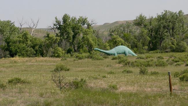
We saw this critter just outside of the "badlands" --- interesting lawn ornament.
One of the old buildings in Custer.
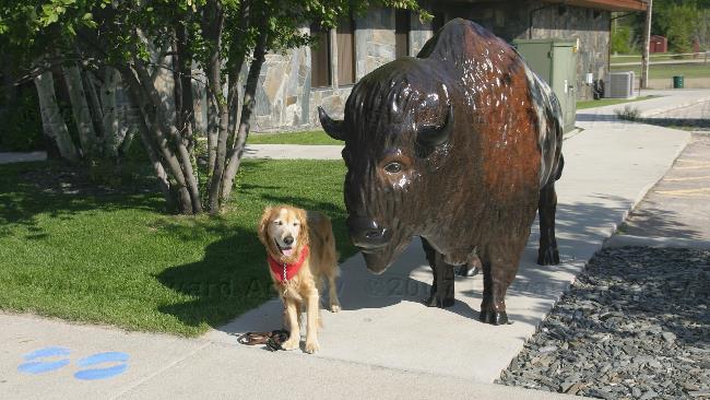
It took a lot of cautious sniffing before Zaph would stand beside the Bison for his photo.
A park in downtown Custer, protected by the spirits of General Custer and Chief Sitting Bull.
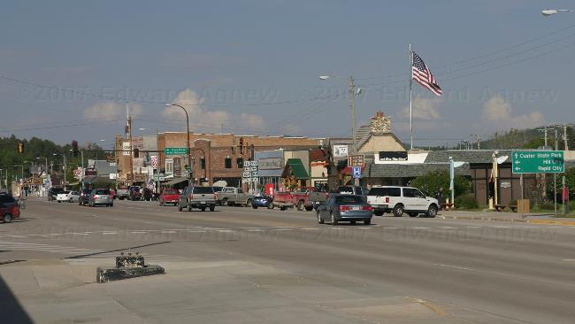
A view of downtown Custer.
The Bison around town are painted --- this one tells the story of the effect of the train on the Bison herds.
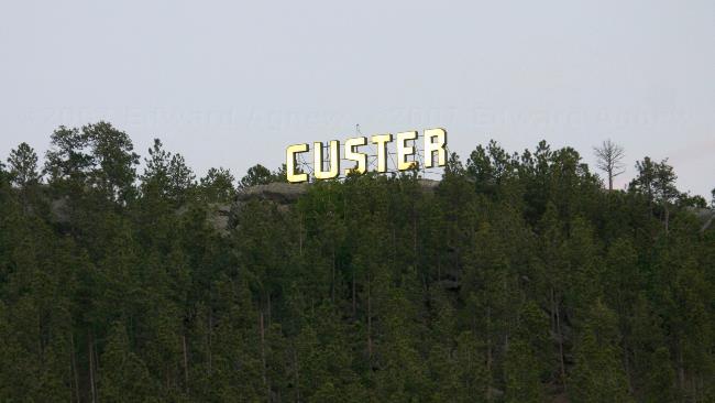
Just in case you forget where you are there is a lighted sign on the hill behind town.
2007/06/02
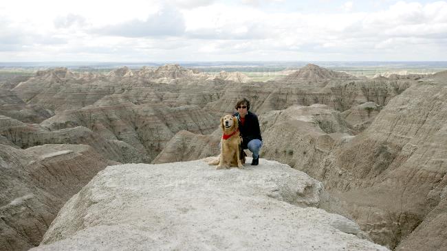
Exploring the Badlands
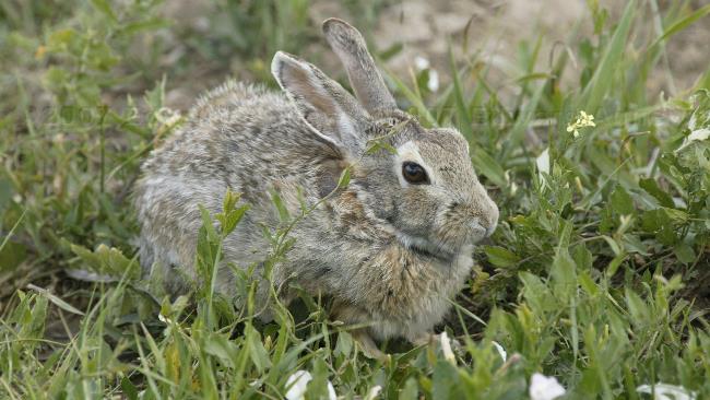
First stop today was the visitor’s center where we learned about the geology and history of the area. With our new knowledge in hand we started the 29-mile drive through the park. Along the drive we saw some great scenery, beautiful wildflowers including flowering cactus (I was surprised to see cactus as the winters can be pretty harsh here), mule deer, lots of rabbits, a couple of prairie dog towns complete with prairie dogs and Mountain Bluebirds.
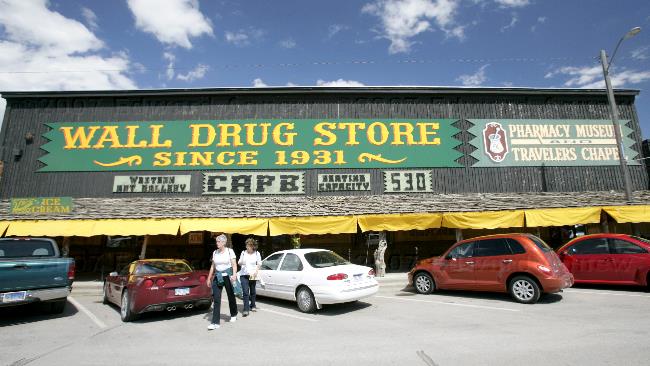
The end of the drive is near the town of Wall, so having seen a million or so billboards (Ok probably only 50) for Wall Drug we decided to go and check it out. Wall Drug has been around since the early 30’s. The owner of the store was disappointed that a lot of the traffic passing by town didn’t stop, so they decided to advertise “free ice water”. Well, that changed things --- people started stopping and the store grew. The store is the size of a city block and continues to expand. They sell the normal drug store items and much more …. toys, gift items, souvenirs, art work, jewelry, western wear. It also has a restaurant where you can get your free ice water and a 5 cent coffee and they make their own cake donuts, delicious.
Returning to the park, we decided to do four short hikes. Two of the hikes took us to vantage points overlooking the badlands where the view reminded us of Bryce Canyon but on a much small scale. The third hike gave us a great view of the low lands. The last hike was longest and the most interesting. You walked among the hills then climbed a ladder to get to a higher level. Here you were able to see the different layers of rocks and veins of different types of rock. The trail ended with a view of the third trail and the low lands.
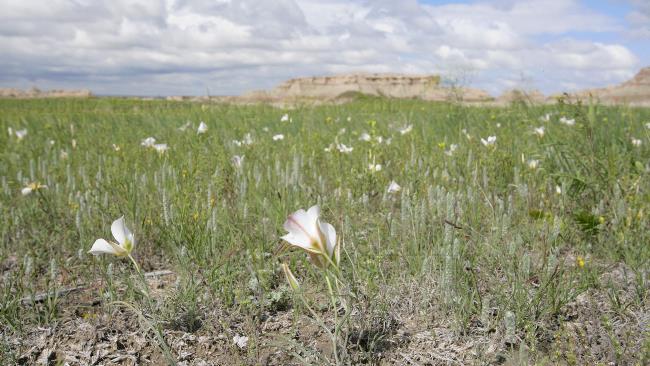
A field of flowers looking towards the badlands

White tailed deer grazing.
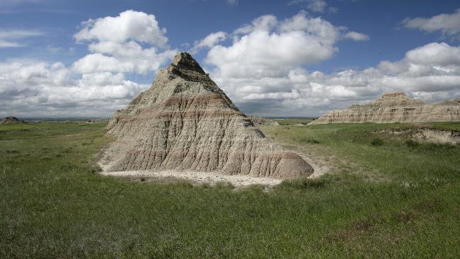
A unique hill --- note the strata lines.
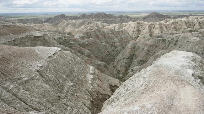
A view of the badlands
Another view of the badlands with a couple of good lookers in the foreground.
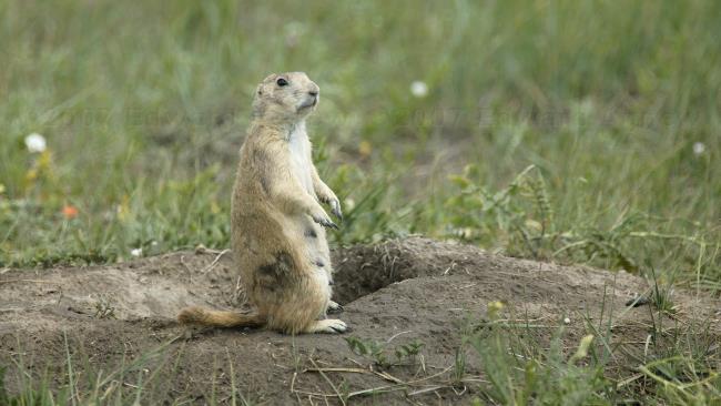
One of the many prairie dogs in the prairie dog town.
This cute little guy sat near the truck for the 10 minutes we watched the prairie dogs.
The picture says it all.
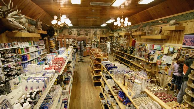
One of the many rooms inside Wall Drug
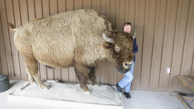
Zaph wasn't available for posing so I stepped in.
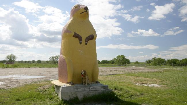
Now that's a mighty big prairie dog!
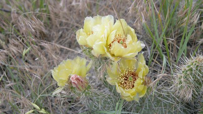
Prickly Pear in bloom.
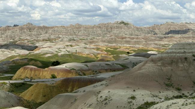
Another view of the badlands
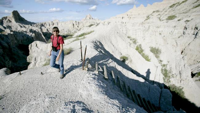
Made it up the ladder --- going down is going to be harder!
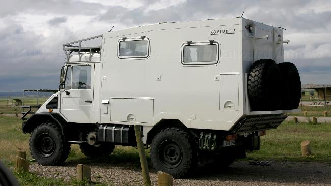
An unusual camper --- we're pretty sure that it's from Germany.
2007/06/01
On The Road …. Again
After two and a half days of driving (and Ed says the first two were LONG!!!) we arrived at Badlands National Park in South Dakota. The park is made up of a North Unit (where we were) and a South Unit (on an Indian Reservation). The north unit’s main feature is “the wall” --- the area between the high ground and low ground where the wind, rain and snow has eroded much of the soil away leaving sculptured mounds. The pictures will show this much more clearly. The campground is on low ground with a great view of the “badlands”.
Along the main highway was a rest stop that had a great view of the Missouri River and an exhibit on Lewis and Clark who explored this river.
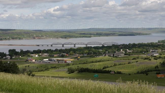
A view of the Missouri River.
![]()