Thursday, June 30, 2005
Back to Fairbanks
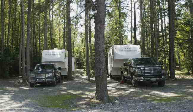
Colin and Margaret needed to be back in Fairbanks today to pick up some papers that needed to signed, so it was goodbye hot springs hello city. We did squeeze one last visit to the rock pool in and it was wonderful. The drive into Fairbanks was uneventful but we did see a porcupine on the side of the road (no moose this time). We arrived at the campground in Fairbanks, checked in and walked over to look at the sites we were assigned. Hotdog pull through sites, this was going to be an easy set up. Margaret and I stayed at the sites and sat down at the picnic table while the guys went and got the trailers. The trailers were parked and Ed decided to move the picnic table. A moment later we heard a scream ..... Wet Paint!!!! followed by a lot of cursing. Margaret and I took a quick look at our bums and noticed that we had red paint streaks on the back of our jeans. Margaret and I hurried after Ed to the office. When we got there the women who worked at the campground were already sympathizing with him. Margaret and I simultaneous turned and showed them our butts. Everyone decided that I had gotten the worst of it .... what a contest to win! The paint of course was oil paint. I have to say that the manager was great, she made a phone call immediately and got permission to give us money to replace Ed’s shorts and Margaret and my jeans. As we returned to the site, the girl who had painted the picnic table was coming by to put a Wet Paint sign on it. Sorry no butt picture! The remainder of the day was spent doing fun things like laundry, trailer cleaning (finally time to rid the trailer of the Top of the World dust, taking the trucks for service and groceries. A fun day all round.
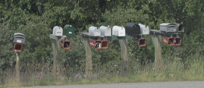
Mail boxes along the Chena Hot Springs Road.
Mail boxes along the Chena Hot Springs Road.
Wednesday, June 29, 2005
Beaver Tales
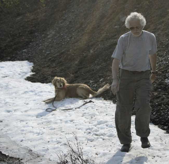
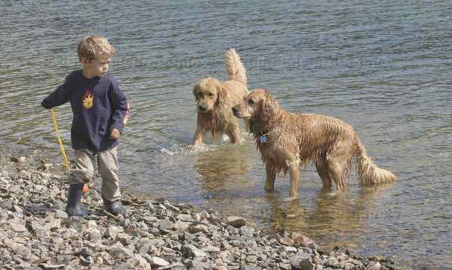
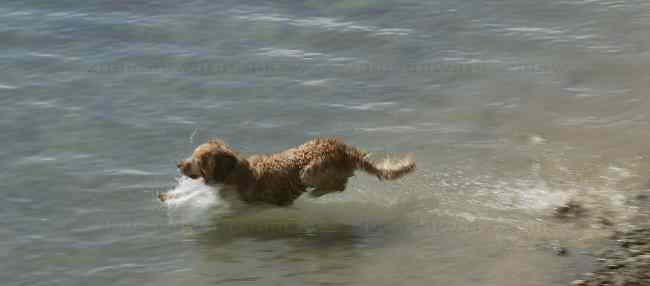
We decided to stay a second day at the Hot Springs — are you the least bit surprised? Zaph decided he needed to go for a walk/swim, so after our “dip” in the hot spring off we went Colin, Splash, Ed, Zaph and myself down the nature trail to the pond. We threw Zaph’s ball and Splash’s stick and a swimming they went. Then we heard a large splash. The dogs continued swimming while Ed watched the water to see what was creating the loud splashes. After a couple of minutes Ed spotted it — a beaver. I couldn’t believe it, there was actually a beaver in the beaver pond (this was a first for me). And it wasn’t a happy beaver. He kept slapping his tale on the water and circling closer to us. We called the dogs out of the water but the beaver kept slapping his tale and getting closer. At one point Zaph thought that something had been thrown for him to fetch and was about to fetch the beaver. I think the beaver finally declared victory and swam off. The dogs finish their swim without any more trouble from the beaver. Later that day we saw a weather forecast. There were the regular items sun, clouds, chance of rain and there was a new item for us smoke. In southern Ontario smoke in the air isn’t something you think about but it really does have an effect out here where there are huge forest fires. In fact it has a large enough impact that it is included in weather reports.
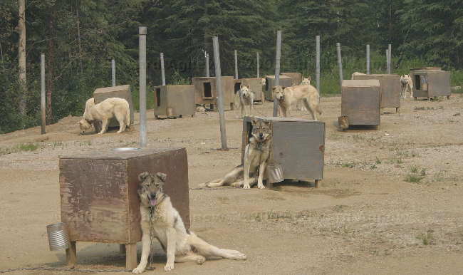
Sled dogs hanging out.
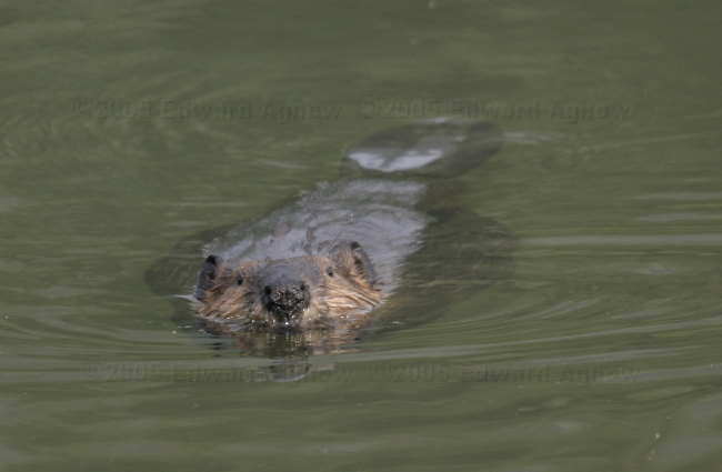
Mr. Beaver. Here he comes.
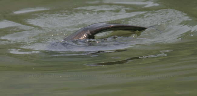
See my tail.
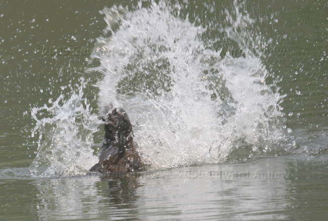
See the splash.... get out of my pond!
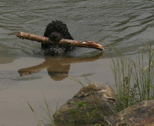
Splash and her stick.
Sled dogs hanging out.
Mr. Beaver. Here he comes.
See my tail.
See the splash.... get out of my pond!
Splash and her stick.
Tuesday, June 28, 2005
Ahhhh .... Hot Springs
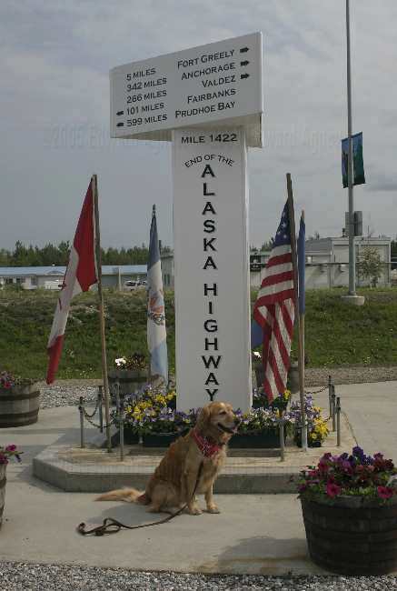
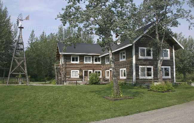
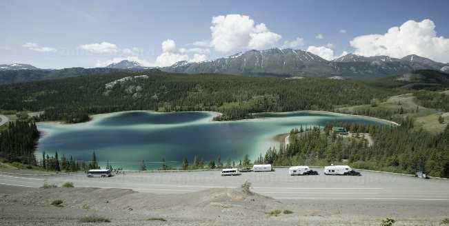
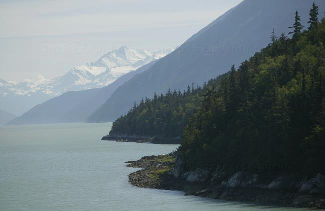
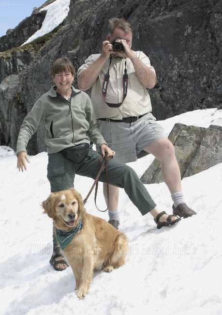
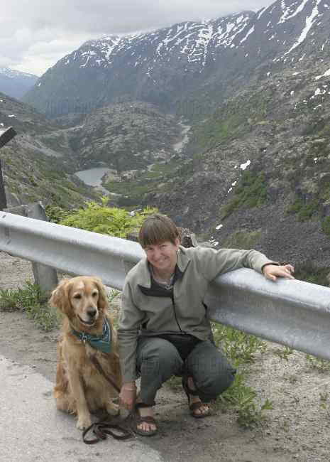
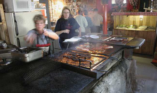
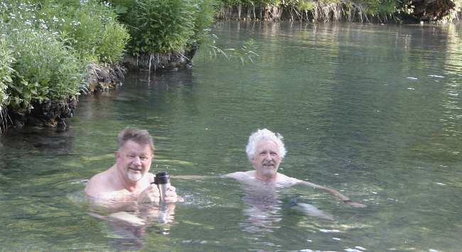
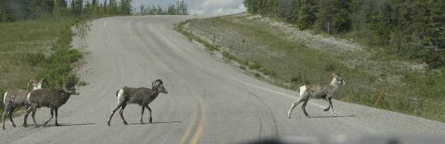
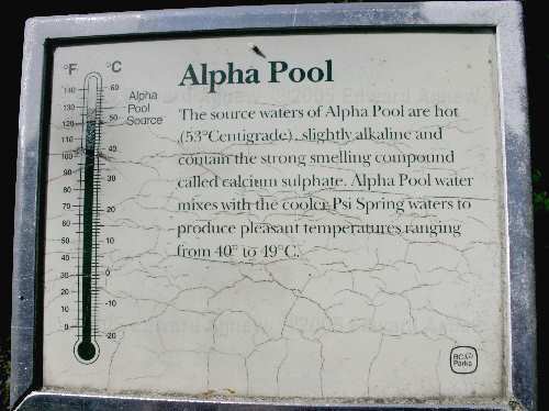
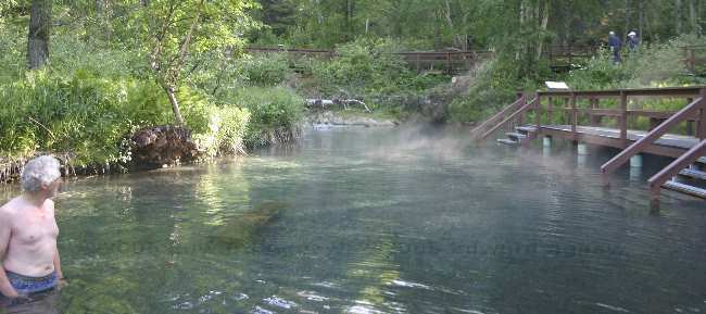
We were leaving the North Pole today and started the regular routine of putting everything away, closing the slide, hitching the truck, etc. Everything was going smoothly till we ran the slide in — the big bang as the slide closed just wasn’t right. After an anxious hour of fiddling Ed got the slide to go in and out without any “bangs” but it wasn’t positioned correctly. We drove out of the campground bumping along the gravel road and stopped at the dump station (you get rid of the gray and black water at a dump station). Ed looked at the slide and it was positioned correctly now .... he thinks a stone got stuck in the rail and jammed the slide and going down the bumpy road knocked it out. That stone caused a lot of worrying! About 1 hour north east of Fairbanks are the Chena Hot Springs.... how could we resist a visit. It was a nice paved road (no gravel!) that went through some nice scenery. A lot of people live out off of this road .... or at least there are a lot of mail boxes. We saw a couple of moose in ponds along the roadside. The hot springs resort provides dry RV camping in a wooded area — quite nice. While Colin was parking the trailer he misunderstood something Margaret said, and stomped off. Margaret waited a few minutes and then decided “the hell with him” she would finish parking the trailer. And she did a great job — Woman Power! Or was this a plot by Colin to get Margaret to learn how to park the trailer? The hot springs are offered in several flavors: a swimming pool at 80ish degrees F, 2 in door hot tubs, 1 large out door hot tub and a rock pool. The hot tubs and pool are chlorinated and children are allowed to use them. The rock pool is more natural and no one under 18 is allowed. They dug a rather large whole, placed very large rocks around it and put gravel on the bottom. Filtered (but not chlorinated) water from the hot spring (I think they said it is at 115F) is flowed into the pool and a water spray adds cold water. Very nice. We spent several hours floating in the rock pool. Zaph and Splash did manage to talk us into taking them for a walk. We found a nature trail that led to a beaver pond. The perfect place for Zaph and Splash to swim. Colin didn’t have a Splash’s ball with him so he threw a stick.... turns out Splash likes big sticks. Zaph wasn’t into sticks today and wanted the ball he had carried to be thrown. Worked out great.
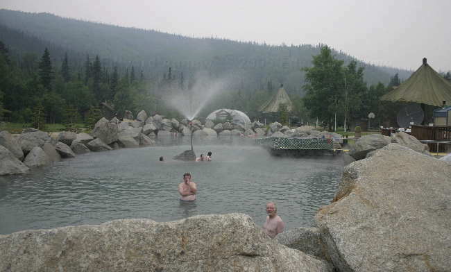
The Chena Hot Springs
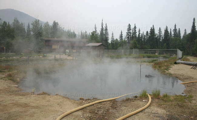
The pool that feeds the rock pool --- this one looks really hot!
The Chena Hot Springs
The pool that feeds the rock pool --- this one looks really hot!
Monday, June 27, 2005
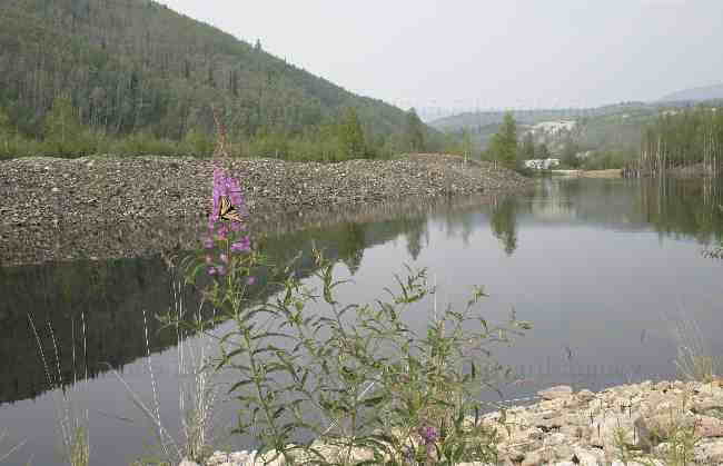
They Know How to Control Flooding in Alaska
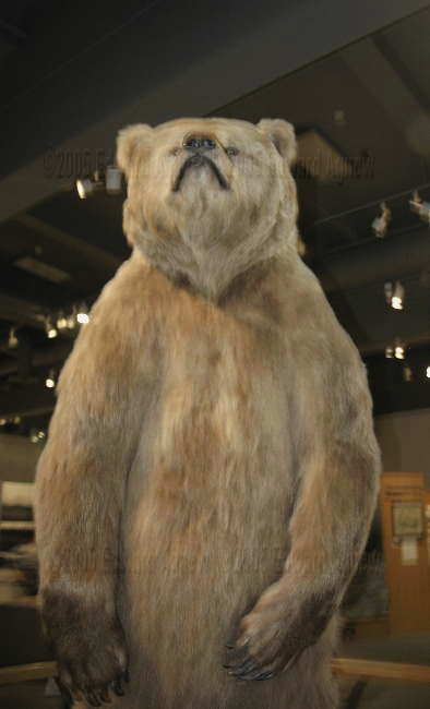
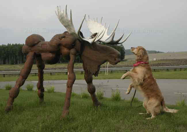
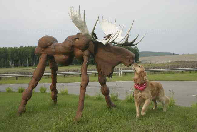
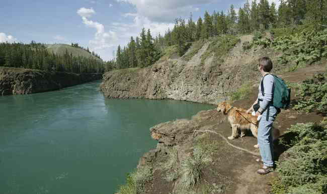
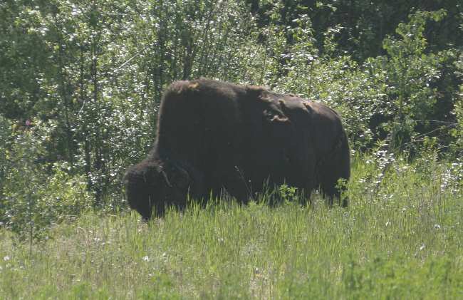
The Chena Lakes Recreation Area was developed when they put a flood control system into place. In 1967 Fairbanks was hit by severe flooding of the Chena River. The pictures of the flooding helped to make you realize just how bad it was. If you look at a map you’ll see that the Chena River meanders through Fairbanks. A lot of the rivers we’ve seen have huge river beds with a few streams of water currently flowing, which makes you realize what spring run off is like. Anyway, the flood control area consists a dam and 20 foot high burms that run for at least 3 miles creating what could be a large lake but is used in summer and winter as a recreation area for horse back riding, 4 wheeling, snowmobiling, skiing, etc. Then along the road way which runs beside the burms are spill ways to take more water. It was incredible and apparently put to use in 1992 (I think). The people in Fairbanks don’t seem to worry about the Chena flooding as they continue to build near the banks of the river. Today we went to the museum at the University of Alaska. The building is under construction so the display areas are a bit crowded. It was worth the trip though. There were displays regarding the Japanese and native populations being interned during WWII, the history of the native population, sea life and birds in the area, mining, the Hubble Telescope, Northern Lights and Blue Babe (restored Ice Age steppe bison mummy).
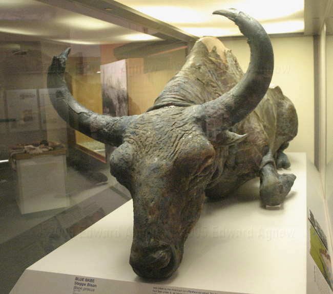
Blue Babe therestored Ice Age steppe bison mummy
They wouldn't let me take him home.
Blue Babe therestored Ice Age steppe bison mummy
They wouldn't let me take him home.
Sunday, June 26, 2005
We’re at the North Pole ---- really we are.
It was drizzling and overcast as we left Moon Lake. Too bad as we were driving along the Alaska Range of mountains. Mind you I always like it when complete clouds are below the mountain tops. Anyway we made it to the official end of the Alaska Highway — Delta Junction and took some pictures of the monument and Zaph met a nice spaniel and the sun started shining. We continued on the Richardson Highway till Rika’s Roadhouse & Landing (Big Delta State Historical Park). This park was a homestead with a house, a couple of out buildings, a garden, a pen for fowl (ducks, turkeys), a couple of goats (Zaph was afraid of them but Splash wasn’t!) and an outhouse. Just past the park was our first view of the Alaska Pipeline — it is one big pipe. Next stop was the Knotty Shop — if you showed them their ad in the Milepost book you got a free ice-cream cone (it was enough to make us stop). Here Zaph met two goofy goldens, a 13 year old and a 14 month old and some very knotty creatures. I think he preferred the goofy goldens. Last stop of the day was North Pole, Alaska (I kid you not... it’s 14 miles southeast of Fairbanks). This town has street names like Santa Claus Lane, St. Nicholas Drive and Mistletoe Street. Giant candy canes are still attached to the light poles on some of the roads — tacky but cute in it’s own way. We camped at the Chena Lakes Recreation Area (a very nice campground) where Zaph met another knotty friend.
The end of the "road"
interesting "butts" The Werner's unit (centre) it would appear did not come properly dressed
Rika's road house
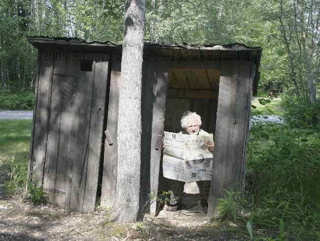
Can't a man get any privacy???
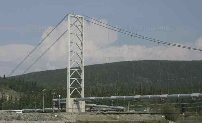
The Alaskan pipeline
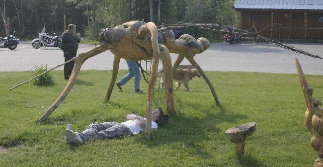
Headline!!! Alaskan bugs takes another tourist!
Zaph picks a fight with local "wildlife"
Then kisses and makes up
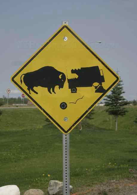
So what do make of the local roadside warning signs?
The end of the "road"
interesting "butts" The Werner's unit (centre) it would appear did not come properly dressed
Rika's road house
Can't a man get any privacy???
The Alaskan pipeline
Headline!!! Alaskan bugs takes another tourist!
Zaph picks a fight with local "wildlife"
Then kisses and makes up
So what do make of the local roadside warning signs?
Saturday, June 25, 2005
Back to the Alaska Highway
Leaving the Walker Forks BLM campground we were about 50 miles from the Alaska highway and the most note worthy part of trip was the evidence of a forest fire. We noticed that there had been a forest fire just after Chicken and this evidence continued all the way to the Alaska highway. When we at the information center in Tok (the first town once we were back on the Alaska highway) about this she explained that there was a forest fire last year that burned about 1 million acres. Let me tell you it is a very weird feeling looking across a valley from a hill top look out and seeing the remains of a forest fire as far as you can see. Another strange site was the pockets of trees that hadn’t burned. The result of the fire is an flurry of Morel Mushroom buying. Morel mushrooms grow after a forest fire and there were signs everywhere about picking, buying and selling Morel mushrooms. Our stop tonight was at a state park called Moon Lake State Recreation site. It’s a small campground (15 sites) on a gorgeous little lake. Zaph especially enjoyed this stop as he convinced us he needed to swim and swim and swim (for over an hour). Splash even joined him for a romp in the lake. Unfortunately, it pour rain for a couple of hours in the evening but we were still able to watch the ducks in the lake fishing for supper from the comfort of our warm dry trailer. The sky was overcast except for a small strip in the west just above a mountain. This create a very pretty sun set. It started with a pink glow and ended with a gorgeous orange. Lori you would have loved it.
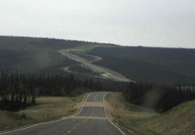
View of the Taylor Highway ... old and new. This area was in the forest fire.
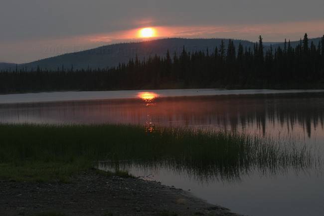
Sunset on Moon Lake.
Rika's Roadhouse.
View of the Taylor Highway ... old and new. This area was in the forest fire.
Sunset on Moon Lake.
Rika's Roadhouse.
Friday, June 24, 2005
On Top of the World
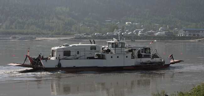
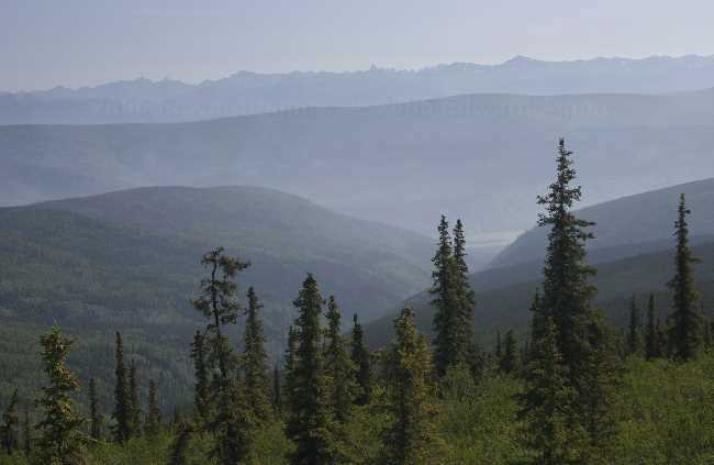
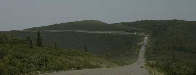
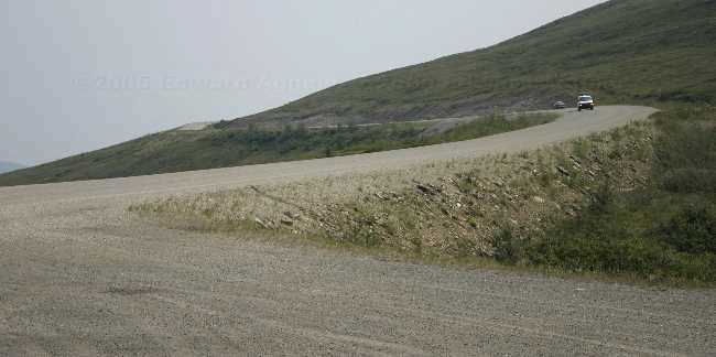
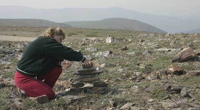
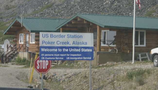
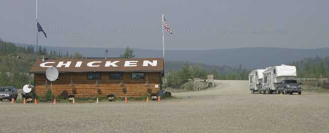
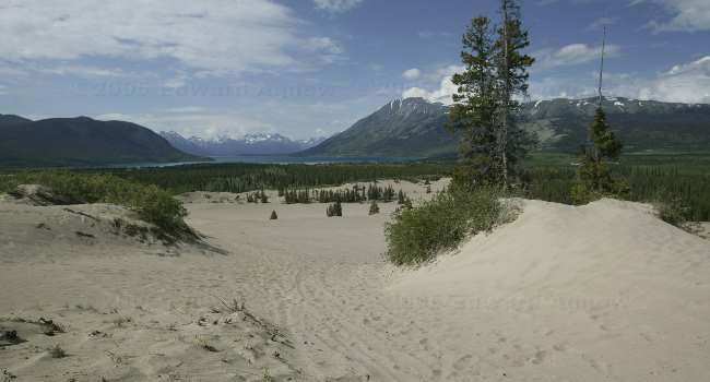
This was the big day. We were driving the Top of the World Highway to Chicken, Alaska. We had heard a lot of stories from friends and family who have been to Alaska and people we met on the road and it was our turn to find out what the road was really like. On the 23rd I had taken Zaph on his morning walk to main street to look at the ferry and found an incredible line up. A caravan of 23 RV’s had created a 3 hour line up. This morning we were a lot luckier. When Ed and I pulled up to the ferry we were 4th in line, Colin and Margaret were a few minutes behind us and 7th in line. Not too bad, 3 ferry crossings later and we were on the other side (the ferry can take about 3 Rvs and a car or two at a time). The Top of the World Highway goes from Dawson City, Yukon to Jack Wade Junction, Alaska then continues on as the Taylor Highway till it ends at the Alaska Highway. The portion between Dawson City and Chicken tends to stay high in the mountains and follows at lot of ridges. This leads to beautiful views and some scarey roads. A fire burning in the north of the Yukon created a smokey haze over the mountains obscuring the views for photographs but the was still very nice. The road was not as bad as we had been led to believe but I’m sure it has been widened and repaired over the past 15 years. Also, as Ed and I have traveled through mountainous regions in other parts of the world (Peru, Turkey, Morocco) we may be a bit more accustomed to them. Now there was a spot near Chicken where the road was winding through the mountain and trailer coming the other met us at the bend ... at least we were on the inside of the turn! Chicken, now that’s an interesting place. Oh, by the way it got it’s name because the town people want to call it Ptarmigan after the bird but no one new how to spell Ptarmigan and the bird was also known as a chicken thus the name. Ed read some literature that said that Chicken no longer exists but it seems some very enterprising people have recreated the town in a new location (a few miles from the original one). There are 2 campgrounds, 1 mining operation complete with historic dredge and a section called “Beautiful Downtown Chicken”. “Beautiful Downtown Chicken” consists of a store, bar, and a café. 15 people live there all year and 25 or 30 in the summer. The Taylor Highway and Top of the World Highway are closed in the winter so the 15 people are pretty isolated. Mail and supplies come in by plan in the winter. We decided to forgo the opportunity of staying in Chicken (the campgrounds were parking lots) and continued down the highway to Walker Forks BLM. Very pretty but they grow the mosquitos really big there — had to hide in the trailer! We crossed the Canada / US border about 106 km into the drive high in the mountains. This was the easiest border crossing we’ve ever had. We handed over our passports and Zaph’s health certificated, had a nice chat about the posting and continued on our way. No questions, no fuss — boy was that ever nice.
Colin and Margaret are on the ferry crossing the Yukon River.
A view from the Top of the World Highway
Another view of the highway
Ed and Zaph found some more snow to play in.
Nice road, eh?
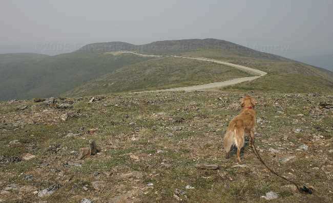
Zaph enjoying the view at the highest point of the Top of the World Highway.
Sometimes you just have to build a man to get a good one.
The nicest border guard works here.
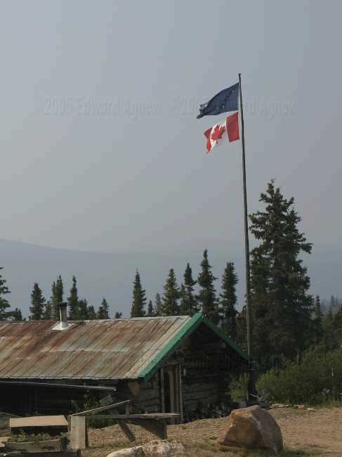
Interesting ... they fly the Alaskan flag and the Canadian flag here.
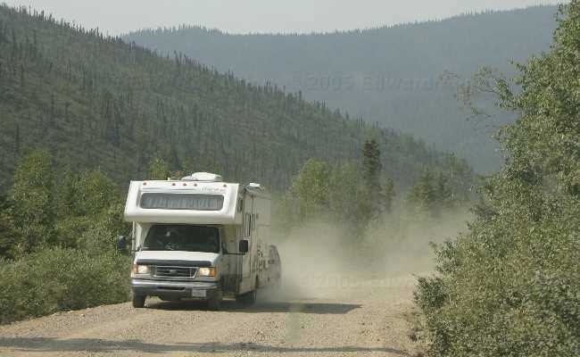
Look at that dust. The inside and outside of our trailer is covered with it.
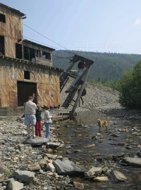
A dredge along side of the highway ... Zaph thinks it's a great place to play.
Here we are in Chicken.
Colin and Margaret are on the ferry crossing the Yukon River.
A view from the Top of the World Highway
Another view of the highway
Ed and Zaph found some more snow to play in.
Nice road, eh?
Zaph enjoying the view at the highest point of the Top of the World Highway.
Sometimes you just have to build a man to get a good one.
The nicest border guard works here.
Interesting ... they fly the Alaskan flag and the Canadian flag here.
Look at that dust. The inside and outside of our trailer is covered with it.
A dredge along side of the highway ... Zaph thinks it's a great place to play.
Here we are in Chicken.
Thursday, June 23, 2005
Dawson City Repeated
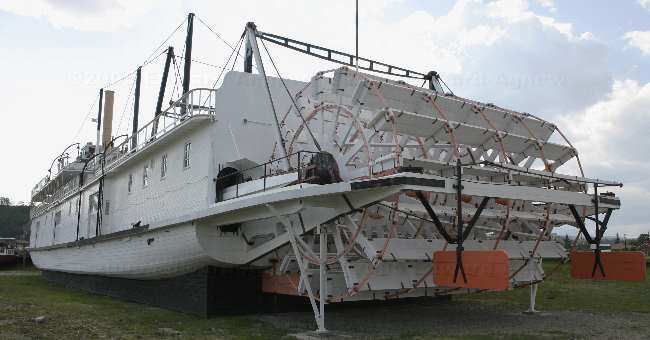
Today was the day for doing things inside Dawson City. We decided to go on a tour of the SS Keno, the last steamer to run on the Yukon River so we headed down to main street. As we were a few minutes early we went into a small jewelry shop and the woman who worked in the store came up to us and started chatting. Would you believe that she worked for Birks in Toronto for years then moved to Burlington and worked in women’s wear at Robinson’s in the Burlington Mall? The world is a small place! Riverboats were used on some of the rivers in Alaska and Yukon for moving supplies and people around. The SS Keno was used mostly to transport silver, lead and zinc ore from the Mayo District to Stewart. Next item on the agenda was the Dawson City Museum. This museum covered the geology of the area, first nations, gold mining, a photo story on dogs of the north and a collection of narrow-gauge locomotives. The museum had a demonstration on panning for gold and pouring gold. The young man put 6 flakes of gold into a pail of gravel. Next he put the gravel through a sluice box, then finally put it in a pan. It was neat watching him panning and sure enough he ended up with 6 flakes of gold. In the pouring gold demonstration, he melted gold in a furnace and poured the melted gold into a sand mold. When the gold hit the sand, the sand burst into flames — I didn’t think sand could burn but it did. Next he put the “coin” into a glass of water which steamed for a minute. When he removed the “coin” from the water it was safe to touch. Later that evening (around 10:30 pm) as it was fairly clear we decided to go up Midnight Dome Mountain. It was much clearer this time. The pictures from the dome were taken around 11:00pm — I still can’t believe how light it is. I am finally getting used to it though and don’t feel like I can’t go to bed before it’s dark.
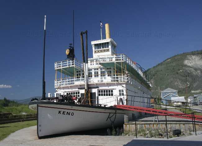
“You may romance all you choose about steam boating but it would be very difficult to convince a deck hand, pilot, mate or engineer of a boat stuck on a sand bar with the water level dropping because the tributaries were freezing, that there was anything good to be said about that damn way to make a living.” 2nd mate Arthur E. Knutson
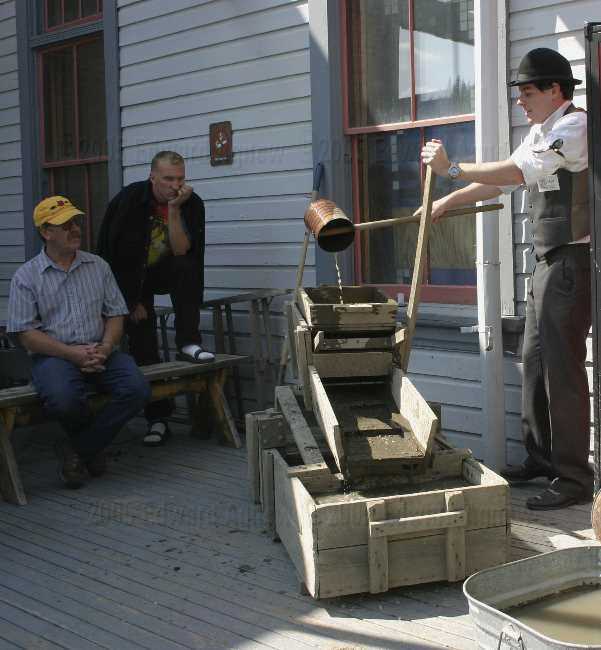
Demonstration of the Sluice Box at the Dawson City Museum
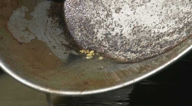
The gold!
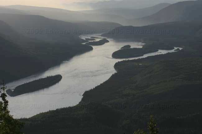
View from Midnight Mountain Dome --- look at the formation the dredge trailings made.
View of the Yukon River from the Midnight Dome taken at 11:00pm (notice the glare from the sun)
“You may romance all you choose about steam boating but it would be very difficult to convince a deck hand, pilot, mate or engineer of a boat stuck on a sand bar with the water level dropping because the tributaries were freezing, that there was anything good to be said about that damn way to make a living.” 2nd mate Arthur E. Knutson
Demonstration of the Sluice Box at the Dawson City Museum
The gold!
View from Midnight Mountain Dome --- look at the formation the dredge trailings made.
View of the Yukon River from the Midnight Dome taken at 11:00pm (notice the glare from the sun)
Wednesday, June 22, 2005
We arrived in Dawson City today. Now this town is pretty close to how I pictured it. Looks at bit like a town out of an old western .... wood sidewalk
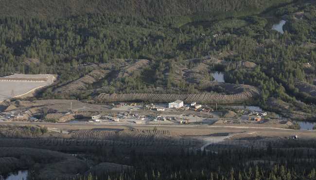
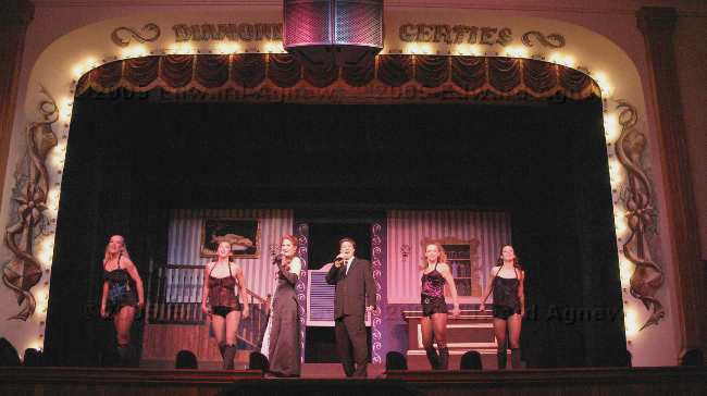
We drove up Midnight Dome mountain this morning. There was a haze over the town but the view was still very nice. A lot of broken beer bottles, several large bags of garbage and a couple of cars on the side of the road were the only evidence of the solstice celebration. Next we headed to Dredge Number 4 for a tour. It’s about 10km outside of Dawson City. The dredge ceased operations in 1959. A dam failed, the creek flooded and the dredge sunk into the mud. As the company who owned the dredge felt that the gold had been removed from the valley they decided to cease operations. At some point the dredge was given to Parks Canada and in the 1990's they decided to restore the dredge and make a park out of it. The dredge required little work to repair the interior, the big job was removing it from the mud. If your are ever in Dawson City it’s worth going out there for a tour. Down the road from the dredge is a claim where tourists are allowed to pan for gold for free. The active claims are on the side of the hills. Their back to the original ways of extracting the gold except they have much better machinery to do it with. A backhoe instead of a pick and shovel and a large sluice box operated by a generator instead of a pan. We watched some neighbours from the RV park panning and I think it’s too much work. The highlight of the day was going to Diamond Tooth Gerties Gambling Hall. It’s a charity casino that has a floor show. What a lot of fun! We sat at a table right up front (only one we could get) and at one point one of the Cancan dancers came up to Ed and said “Take a picture of this” and tossed her skirt over his head.
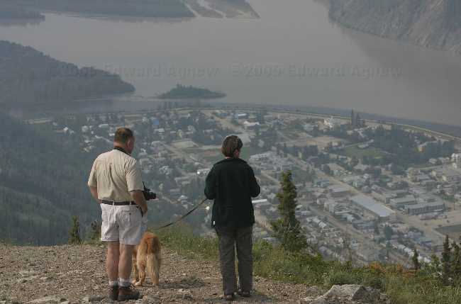
Looking down on Dawson from the top of the "Dome"
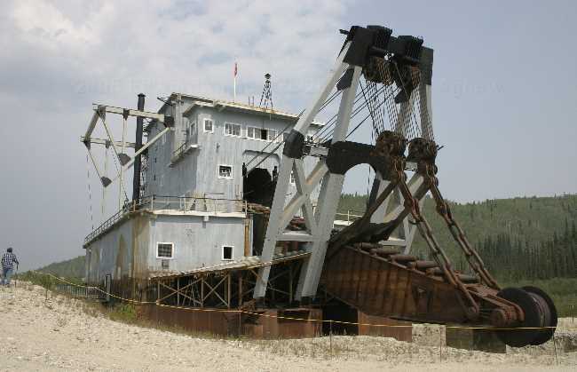
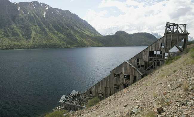
The "dredge number 4", a national historic site, this machine, built in the early 1900's changed the way gold mining was done, is simply processed everthing in the valley, extracting 98% of the gold down to the bedrock. It was in operation until 1959, the left in the mud. The Canadian Army's engineering group raised it in 1992, and place it on safe ground.
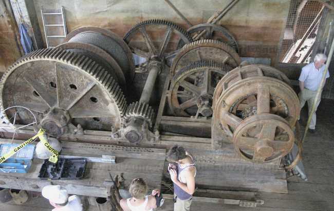
Some of huge drive trains and electric motors of the dredge.
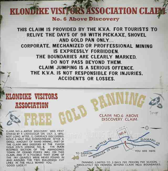
Want to try gold panning? The town has a claim you can work for a few days.
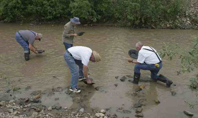
And that how you do it.
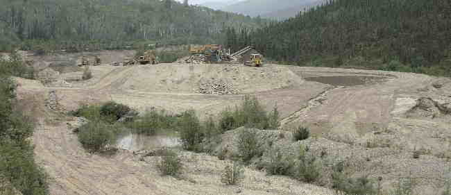
A modern mining operation, material is dug from the banks and sent into the seperator.
The landscape in the valley is filled with these rock piles, a result of the dedge in operation.
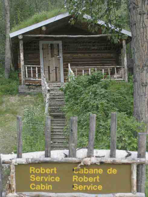
Having seen Sam McGee's house in Whitehorse, here is Robert Service's house.
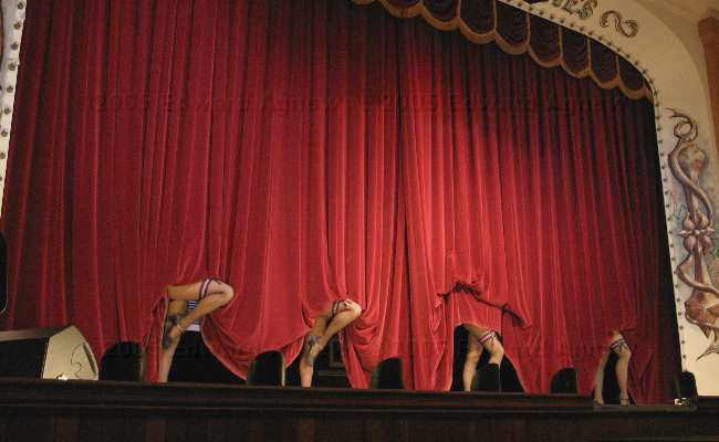
In the evening we when to Diamond Toothed Gerties
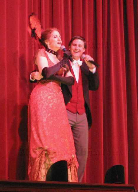
Margaret gets personal attention from the host.
Looking down on Dawson from the top of the "Dome"
The "dredge number 4", a national historic site, this machine, built in the early 1900's changed the way gold mining was done, is simply processed everthing in the valley, extracting 98% of the gold down to the bedrock. It was in operation until 1959, the left in the mud. The Canadian Army's engineering group raised it in 1992, and place it on safe ground.
Some of huge drive trains and electric motors of the dredge.
Want to try gold panning? The town has a claim you can work for a few days.
And that how you do it.
A modern mining operation, material is dug from the banks and sent into the seperator.
The landscape in the valley is filled with these rock piles, a result of the dedge in operation.
Having seen Sam McGee's house in Whitehorse, here is Robert Service's house.
In the evening we when to Diamond Toothed Gerties
Margaret gets personal attention from the host.
Tuesday, June 21, 2005
The Longest Day of the Year
We arrived in Dawson City today. Now this town is pretty close to how I pictured it. Looks at bit like a town out of an old western .... wood sidewalks, wood buildings with the square false fronts, lots of log cabins. You can definitely picture the “Gold Rush”. The RV park is a large parking lot but is right downtown so you can walk to anything you want to see in town. As it is summer solstice today it is extremely busy, we got 2 of the last 4 spots available. An Indian festival was happening today as they celebrate summer solstice. Also, there is a mountain just outside of Dawson City called Midnight Dome Mountain and people go up there to “drink too much beer and the sun not set” (this is how the owner of the RV park put it). As there is limited parking and probably too many people we opted to stay in town. We watch some para sailors come down from the mountain at midnight and saw the sun still in the sky at 12:15 when I decided to darken the bedroom and go to bed.
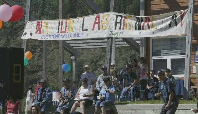
June 21 is also national aboriginal day
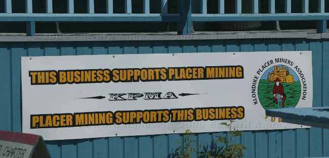
in late 2002 the National fisheries dept. decided it would enforce a rule regarding any mining operation near streams (that would be all mining in this area), a major problem as it would have destroyed the economy of the entire Yukon. Most if not all business, as well as the aboriginal peoples, supported an action of shutting down operations in both Dawson City and Whitehorse in protest. In 2003 the Federal Government reworked the fisheries act.
One of the many building in downtown Dawson

The rules are different when you live on PermaFrost!!. All heated building in Dawson sit 2 to 3 three off the ground, with ventilated skirts to insure no heat from the building gets to the ground. These building, built about 1902, are reminders of what happens when you let heat melt the frost layer. The permafrost is about 5 to 10 feet down here, left over from the last ice age.
Old structure waiting for new owner. Note the air space below
Typical home in Dawson, again note the building is raised.
Life at the campground
June 21 is also national aboriginal day
in late 2002 the National fisheries dept. decided it would enforce a rule regarding any mining operation near streams (that would be all mining in this area), a major problem as it would have destroyed the economy of the entire Yukon. Most if not all business, as well as the aboriginal peoples, supported an action of shutting down operations in both Dawson City and Whitehorse in protest. In 2003 the Federal Government reworked the fisheries act.
One of the many building in downtown Dawson
The rules are different when you live on PermaFrost!!. All heated building in Dawson sit 2 to 3 three off the ground, with ventilated skirts to insure no heat from the building gets to the ground. These building, built about 1902, are reminders of what happens when you let heat melt the frost layer. The permafrost is about 5 to 10 feet down here, left over from the last ice age.
Old structure waiting for new owner. Note the air space below
Typical home in Dawson, again note the building is raised.
Life at the campground
Monday, June 20, 2005
Dawson City Here We Come
Time to start heading for Dawson City. We planned on stopping half way or a bit further — the location of the campgrounds control where we get to stop. And there aren’t a lot of campgrounds on the road to Dawson City. It was a uneventful drive. The scenery was OK but not spectacular like some of the other drives (OK we’re getting spoiled!). We did stop to see the Five Fingers Rapids. That involved going down then back up 219 steps, but we all made it even Colin! Splash out did us all as she ran up the steps as fast as she could to get to her mommy (Margaret). We stopped for the night at Moose Creek Yukon Campground. When we go there we had the place to ourselves so we picked what we though were the best two sites. Once we were settled Ed, Colin, Zaph, Splash and I decided to go for a walk. The guys laughed at me in my mosquito jacket. Half way through our walk Ed was scrambling into his mosquito jacket and Colin was spraying himself with deet ... it was my turn to laugh at them. I have never seen as many mosquitos and as big of mosquitos as I did on that walk. The fishing is suppose to be good at the creek as Grayling love to eat mosquitos. They should be well fed fish!
a view from the window of the ruins of the Montague House, once a typical early day road house on the stagecoach route between Whitehorse and Dawson City
one of the many small narrow bridges alone the route
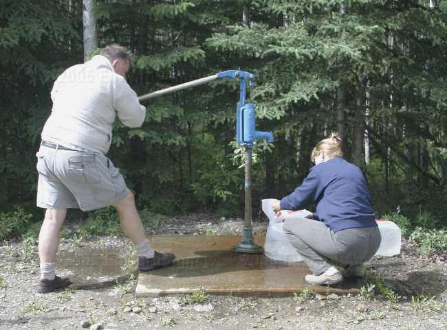
Colin and Margaret fight with the water pump at Moose creek park
a view from the window of the ruins of the Montague House, once a typical early day road house on the stagecoach route between Whitehorse and Dawson City
one of the many small narrow bridges alone the route
Colin and Margaret fight with the water pump at Moose creek park
Look! real wildlife!
Man, are these mosquitos big!
Sunday, June 19, 2005
Rainy Day
Fox Lake was so nice that we thought we’d stay an extra day and take the boats out on the lake. That plan didn’t happen as is rained most of the day. That was OK, I think the four of us were happy to veg out — no driving, no laundry (no facilities), no cleaning (no electricity). Zaph did manage to talk me into taking him out so he could swim. I guess if you’re swimming in a cold lake you don’t notice the cold. Margaret and I had a rematch and this time I lost. Anyone know any good scrabble words?
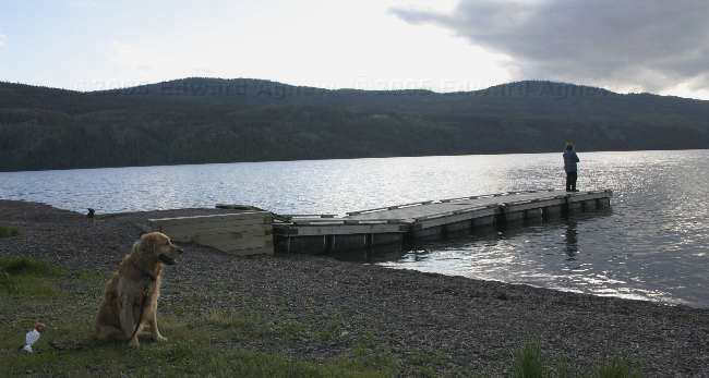
Can we just forget the fishing and get on with the swimming?
Our campsite at Fox Lake
Can we just forget the fishing and get on with the swimming?
Saturday, June 18, 2005
Hot Springs Not So Hot
There is a hot spring about ½ hours drive north of Whitehorse, so we thought that we head there for a night and enjoy the hot springs. Unfortunately, the hot springs and campground are privately owned so that means money making operation. We had wrongfully assumed that entrance to the hot springs pool would be free or at least discounted for campers. Wrong, it cost an additional $7 per person to use the hot springs. Given that information we decided that we wouldn’t stay. We continued North about 50km to Fox Lake Yukon Campground. What a beautiful lake and campground. Now there weren’t any hot springs but Zaph and Splash went swimming in the lake — at least one member of each family got wet! As you can guess, Zaph loved it. Margaret and I also managed to squeeze in a game of Scrabble and I tromped her!
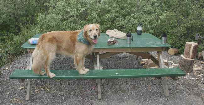
Double your fun!! Zaph and his new friend Milky wait for the water toy to be thrown
Zaph is ready for lunch to be served
Double your fun!! Zaph and his new friend Milky wait for the water toy to be thrown
Friday, June 17, 2005
“The Northern Lights has seen queer sites. But the queerest they ever did see, was that night on the marge of Lake Lebarge I created Sam McGee”
We’ve added a new feature to our journal.... it’s a map showing our route to date.
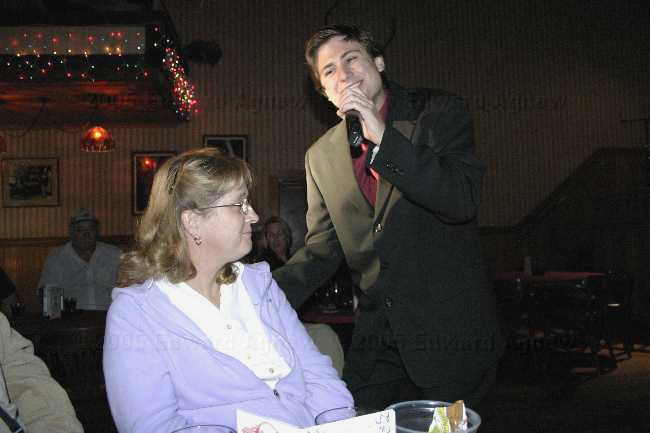
Today I heard "The Cremation of Sam McGee" twice. Once was at the McBride Museum and the second time was at the Frantic Follies. I’ll tell you about the Frantic Follies later in this journal. The McBride Museum was well done. It has a large area on gold mining, including an area where they show you how to pan for gold. Panning for gold seems like a lot of work to me. In the gold mining area they also include a National Film Board film that we think was done in 1957 by Pierre Burton. I remembered that he was from Dawson City but I didn’t know that his father was one of the thousands of people who came north to strike it rich. Pierre’s father didn’t strike it rich but he stayed in Dawson City for 40 years. I’m so impressed with the film that I think I may find myself a book by Pierre Burton. I hope he wrote one about the Yukon! The Museum also had a section of taxidermied (is that a word) animals. It gives me the shivers to look at them but it is a good way for people to see what the animals actually looked like. The last area of the museum was outside and consisted of old building include Sam McGee’s cabin and implements like trams, tractors and snowmobiles. One of the young women who worked at the museum came out and did a skit on the poem The Creation of Sam McGee. It turns out that Sam McGee was from Peterborough, Ontario not Tennessee and he was not cremated on the marge of Lake Lebarge. Robert W. Service met Sam in Whitehorse and because he like the sound of Sam’s name he asked if he could use it in a poem he was working. Sam left Whitehorse and returned when he was 71. While he was walking down the street he was approached and asked if he would like be buy some of the remains of Sam McGee. How could he resist. After she told us about the real Sam McGee, she did a good job of reciting the poem.
The boys decided that they didn’t want to go and see the Frantic Follies but Margaret and I decided we would go anyway. Was it ever good. It is a vaudeville type show and is hilarious. One of the jokes in the show was:
What is the difference between roast beef and pea soup? Everyone knows how to roast beef
They also recited a couple of Robert W. Service poems, one of them of course is The Cremation of Sam McGee. While one person was reciting it and couple of the guys were acting it out. I thought Margaret was going to pee her pants she was laughing so hard.
Ed and I also managed to take Zaph for swim in the Yukon river and a walk along the river to downtown Whitehorse. I really like Whitehorse... too bad they have winter up here.
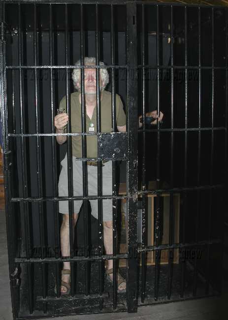
testing out the cell in a NWMP office (at the Whitehorse museum)
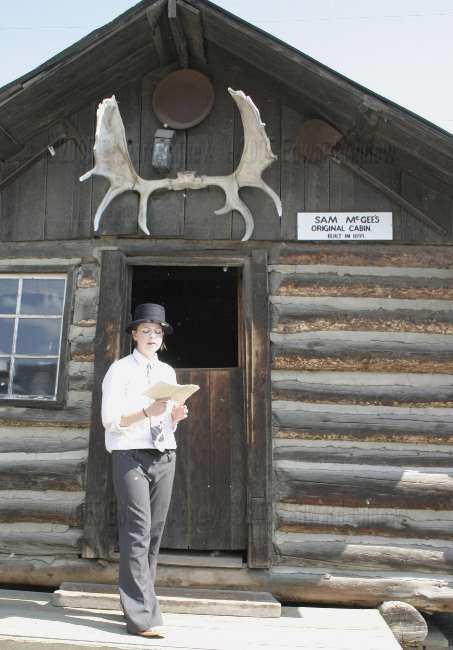
The real Sam McGee's cabin, moved to the Whitehorse museum
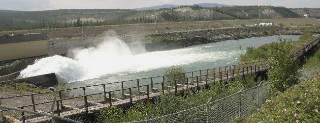
The world's longest wooden fish ladder at Whitehorse
restored paddle wheeler, at Whitehorse
Today I heard "The Cremation of Sam McGee" twice. Once was at the McBride Museum and the second time was at the Frantic Follies. I’ll tell you about the Frantic Follies later in this journal. The McBride Museum was well done. It has a large area on gold mining, including an area where they show you how to pan for gold. Panning for gold seems like a lot of work to me. In the gold mining area they also include a National Film Board film that we think was done in 1957 by Pierre Burton. I remembered that he was from Dawson City but I didn’t know that his father was one of the thousands of people who came north to strike it rich. Pierre’s father didn’t strike it rich but he stayed in Dawson City for 40 years. I’m so impressed with the film that I think I may find myself a book by Pierre Burton. I hope he wrote one about the Yukon! The Museum also had a section of taxidermied (is that a word) animals. It gives me the shivers to look at them but it is a good way for people to see what the animals actually looked like. The last area of the museum was outside and consisted of old building include Sam McGee’s cabin and implements like trams, tractors and snowmobiles. One of the young women who worked at the museum came out and did a skit on the poem The Creation of Sam McGee. It turns out that Sam McGee was from Peterborough, Ontario not Tennessee and he was not cremated on the marge of Lake Lebarge. Robert W. Service met Sam in Whitehorse and because he like the sound of Sam’s name he asked if he could use it in a poem he was working. Sam left Whitehorse and returned when he was 71. While he was walking down the street he was approached and asked if he would like be buy some of the remains of Sam McGee. How could he resist. After she told us about the real Sam McGee, she did a good job of reciting the poem.
The boys decided that they didn’t want to go and see the Frantic Follies but Margaret and I decided we would go anyway. Was it ever good. It is a vaudeville type show and is hilarious. One of the jokes in the show was:
What is the difference between roast beef and pea soup? Everyone knows how to roast beef
They also recited a couple of Robert W. Service poems, one of them of course is The Cremation of Sam McGee. While one person was reciting it and couple of the guys were acting it out. I thought Margaret was going to pee her pants she was laughing so hard.
Ed and I also managed to take Zaph for swim in the Yukon river and a walk along the river to downtown Whitehorse. I really like Whitehorse... too bad they have winter up here.
testing out the cell in a NWMP office (at the Whitehorse museum)
The real Sam McGee's cabin, moved to the Whitehorse museum
The world's longest wooden fish ladder at Whitehorse
restored paddle wheeler, at Whitehorse
Thursday, June 16, 2005
It's a great day to be a Dog!!
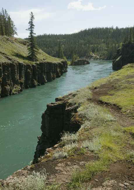
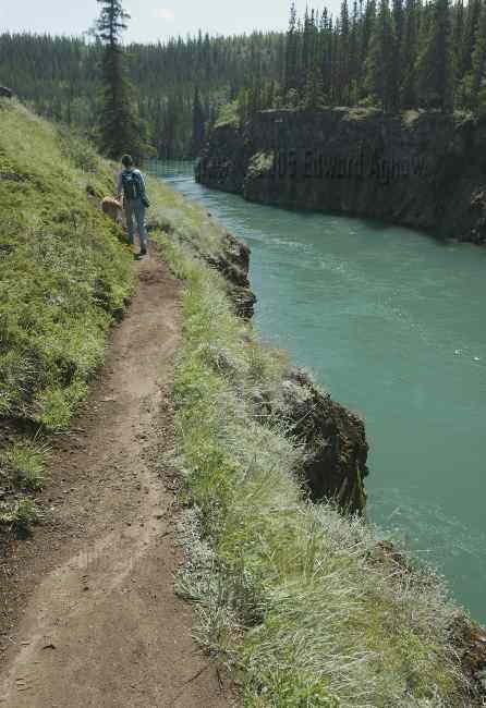
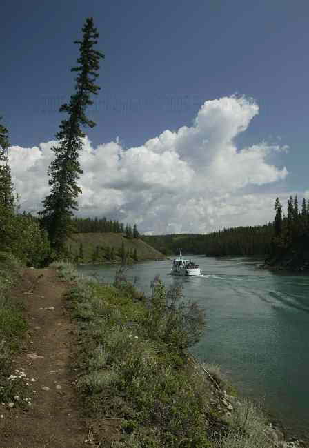
After a walk around Whitehorse, we headed out to the campground and set up. Now it was time for touring. After a review of Milepost we set off for Miles Canyon and Canyon City. Miles Canyon is a section of the Yukon River. The interesting thing about Miles Canyon is that sides are made of lava that has cracked into columns. Canyon City is about 1 mile upstream from Miles Canyon. This city existed during the gold rush as the starting point of the tram lines that moved miners supplies past the rapids. The city now is just some impressions in the dirt and rusted tin cans. Zaph decided that this was a great spot to swim. As we were enjoying the hike we continued on along the canyon. Zaph had another swim when we returned to Canyon City. Luckily we still had the hike back to Miles Canyon for Zaph to dry off.
Miles Canyon
walking along the edge of the canyon
just upstream of the canyon
last one in is rotten whatever
Heading back to the canyon
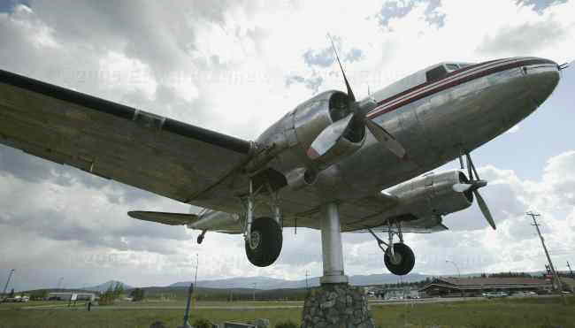
World's largest windvane, DC-3 plane (registration C-FCPY) was converted to a windvane at the Whitehorse airport
Miles Canyon
walking along the edge of the canyon
just upstream of the canyon
last one in is rotten whatever
Heading back to the canyon
World's largest windvane, DC-3 plane (registration C-FCPY) was converted to a windvane at the Whitehorse airport
Wednesday, June 15, 2005
Whitehorse here we come
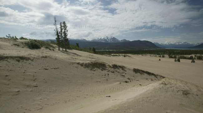
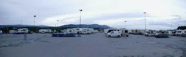
We left Skagway this morning in rain and very low visibility. The climb up through White Pass was very interesting. We couldn’t believe it but some guy in a mini bus wanted to pass us and then suddenly turned off into a pull off - very weird. We had planned to stop at the summit but didn’t as the visibility was about 40 feet. Luckily, it started to clear and by time we crossed the Canadian check point the sun had begun to shine. The scenery was a beautiful driving away from Skagway as it was driving there. Just past the town of Carcross we stopped at the Carcross Desert. This is the world’s smallest desert and an International Biophysical Programmed site for ecological studies. All that said, it was neat. The desert was a flat area and half of a hill. We walked up the hill and when you looked down there was lots of vegetation. When you turned and looked back towards the road you saw the desert, the road, lush green vegetation (trees etc), a lake and then mountains in the background. The view was worth the climb. Zaph of course had a riot running in the sand. The next stop was Emerald (or Rainbow) Lake. The lake was a rainbow of green / blue colors. The Milepost book indicated that the view improved if you climbed the steep hill across the road from the lake — we did and it did. The last stop of the day was Whitehorse. It was time for groceries and other errands. While we were in the grocery store a thunderstorm hit. The drainage in the parking lot wasn’t very good — when we came out we had to wade through ankle deep water to get to the trucks! We decided to spend the night at the Walmart parking lot and then head to a campground in the morning. We expected to find some trailers in the parking lot and were astounded to find over 50 rigs! I think the RV’s filled about 1/3 of the parking lot. It’s a good thing Rvers also like to shop at Walmart.
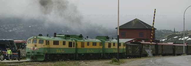
The White Pass and Yukon Route train going through Canada Customs at Fraiser BC
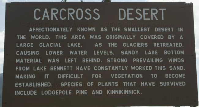
sign at Carcross Desert
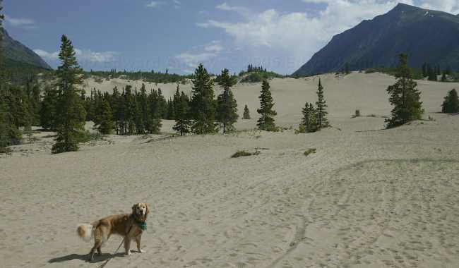
The brave dog sets out on his trek into the desert
sand sand everywhere
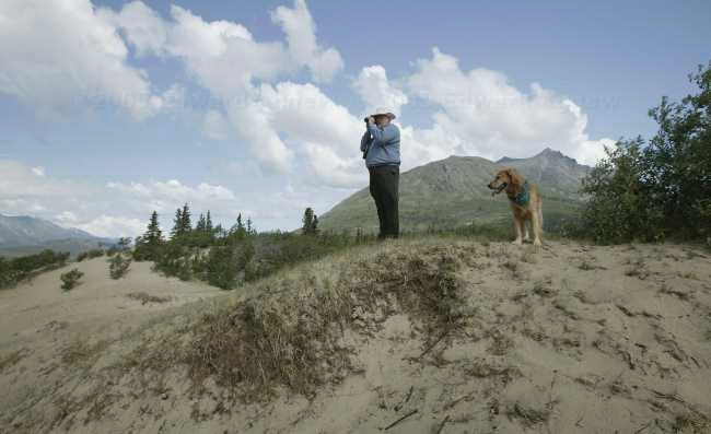
Colin and Zaphod looking at (see next photo)
The view of Emeral lake from the top of the bank, looking down on our rigs
By day this is a normal Walmart, by night it become Wally Land RV park, there are more than 50 rigs here tonight, shot taken about 11PM, and it is still daylight!
The White Pass and Yukon Route train going through Canada Customs at Fraiser BC
sign at Carcross Desert
The brave dog sets out on his trek into the desert
sand sand everywhere
Colin and Zaphod looking at (see next photo)
The view of Emeral lake from the top of the bank, looking down on our rigs
By day this is a normal Walmart, by night it become Wally Land RV park, there are more than 50 rigs here tonight, shot taken about 11PM, and it is still daylight!
Tuesday, June 14, 2005
Another day in Skagway
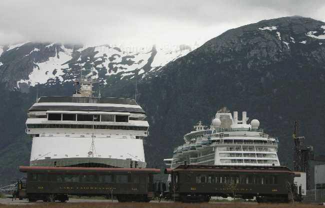
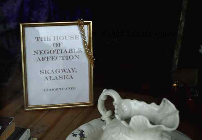
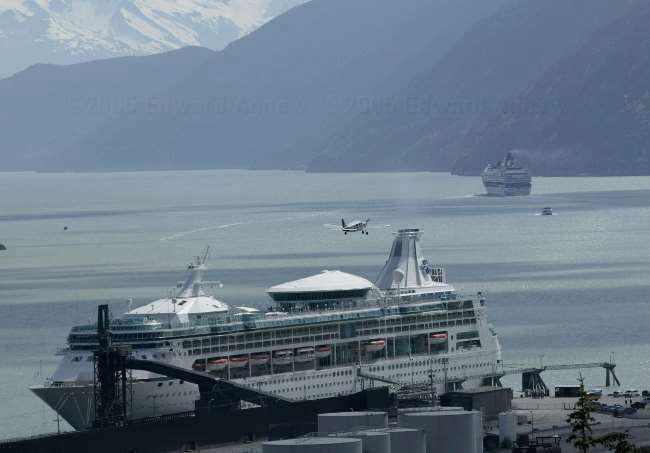
By 8:00am you can hear the cruise ship horns and trains click clacking, Skagway is open for business again. I spoke with some of the “locals” today and asked about the town. The population of Skagway is around 800 then in the summer with transient workers it jumps to 2500. Of the 800, probably only about 200 stay for the entire winter (those 200 are probably families with children in school). The transient workers live just about anywhere, in trailer parks, rooming houses, tents half way up the mountain. One woman I spoke with lives in Haines a 20 minute ferry away. She told me that she has lived here for 29 years and doesn’t plan on any more winters up here as her children have finished school. She thinks her daughter will end up in a city and her son will stay in the Yukon — she called him a cave man! It was overcast and rainy today, so it was off to the museum and then shopping. The museum was well done and worth the $2 admission. The weather cleared a bit so we wandered up to the Gold Rush Cemetery and the Reid waterfalls. The “villain” Soapy Smith and “hero” Frank Reid are buried in the cemetery.
rush hour in Skagway harbour
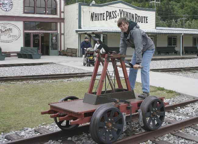
With the high fuel prices, this may be the way to go
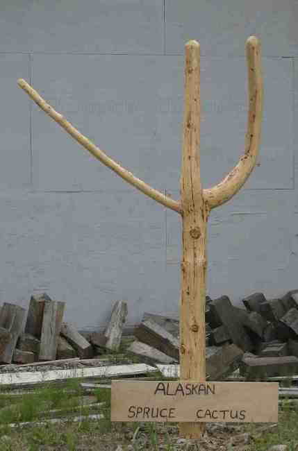
The very rare Alaskan spruce cactus
The rail line here is very narrow gauge,(36") I though they might be prone to rolling over on turns!
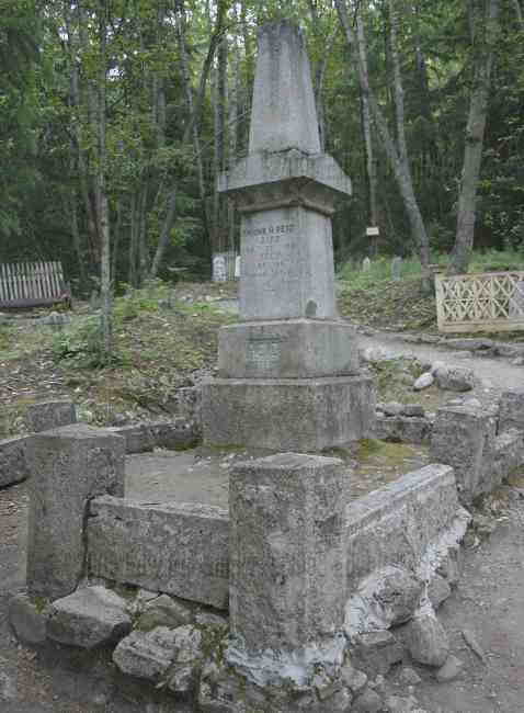
The tomb of Frank Reid
rush hour in Skagway harbour
With the high fuel prices, this may be the way to go
The very rare Alaskan spruce cactus
The rail line here is very narrow gauge,(36") I though they might be prone to rolling over on turns!
The tomb of Frank Reid
Monday, June 13, 2005
Mountains, Mountains Everywhere!
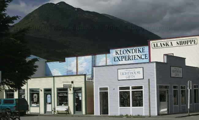
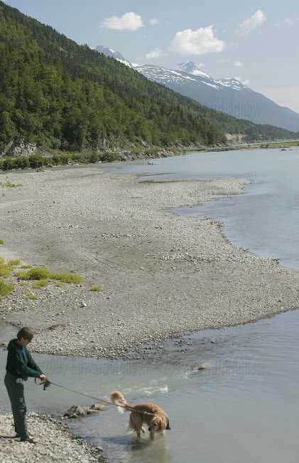
Everywhere you look there is a mountain. The town is nestled in a small valley. The town has number avenues from 1 to 22 (the blocks are very small) and is four streets wide. The west most part of town is taken up by the airstrip and the east side is the train tracks You can walk around the entire town in about 1 hour! Skagway (the oldest incorporated town in Alaska) owes its birth to the Klondike Gold Rush. Skagway sprung up as thousands of thousands of gold seekers arrived to follow the White Pass and Chilkoot trails to the Yukon. By the summer of 1899 the stampede was all but over and by 1903 Skagway’s population dwindled to 500. The arrival of the cruise ships has revived Skagway at least in the summer. The main street is full of shops catering to tourists and lots of excursions are available (a train ride to the summit, horseback riding, river rafter, bus tours, 4x4 jeep tours and more). Margaret and I did a tour of the shops this morning (we both showed great restraint!) and then went to see a show about the notorious Soapy Smith (the villain of Skagway). A drive out the Dyea Road to the remains of the town of Dyea (just some boards on the ground are left) was the next adventure. The road was a lot of fun — I was glad we weren’t pulling trailers — up, down, right bend, left bend, one lane and single lane wooden bridges. I’m still not use to these extra long days – I took Zaph for a walk at 11:00 and it felt like 7:00. Skagway was very quite as the cruise ships had left, a couple of guys were playing horseshoes, a few people beside myself were out walking and a few people were in the bars.

Broadway Street, Skagway Alaska
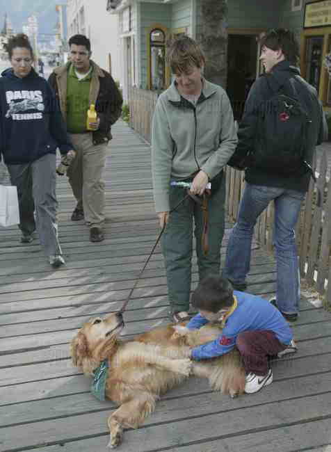
This town's OK - there's kids willing to give you belly rubs!
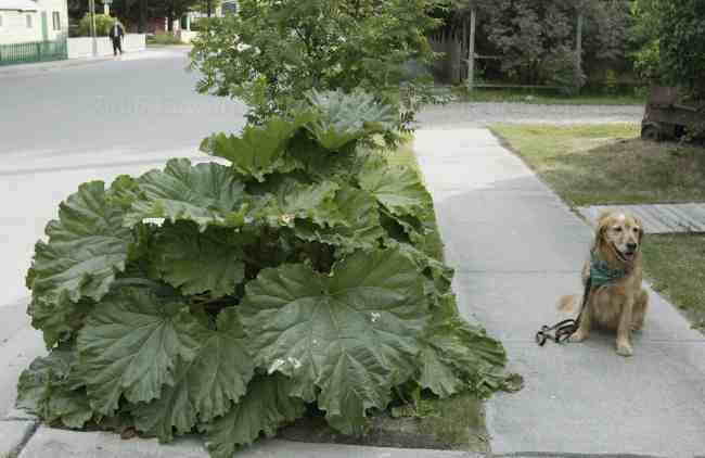
Man, they grow big rhubarb here!
Pretty nice parking jobs, eh!
Harbour traffic.
But mom... I want to go swimming!
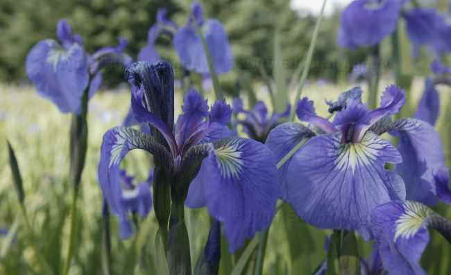
Rare wild Iris's.
All that remains of the realestate office is the false front. Dyea townsite.
Skagway River from Dyea Road.
Broadway Street, Skagway Alaska
This town's OK - there's kids willing to give you belly rubs!
Man, they grow big rhubarb here!
Pretty nice parking jobs, eh!
Harbour traffic.
But mom... I want to go swimming!
Rare wild Iris's.
All that remains of the realestate office is the false front. Dyea townsite.
Skagway River from Dyea Road.
Sunday, June 12, 2005
Snowball Fight!!!
After a great all you can eat breakfast featuring blueberry pancakes at Mukluk Annie’s we head west. I highly recommend Mukluk Annie’s to any one traveling the Alaska Highway. Today’s drive was very exciting as we drove on three different highways (Alaska Highway, Tagish Road (Hwy 8) and South Klondike Highway) on the way to Skagway — we’ve been driving on the Alaska Highway since Dawson Creek. It was a day of incredible scenery, the further along we went the better the scenery got – Margaret and I both managed to stay away for the entire drive! The road climbed as we headed for White Pass and the amount of snow on the mountains kept increasing. Finally, there was snow right by the highway. We stopped and took the dogs for a snowball fight. Colin and I realized we weren’t exactly dressed for it — I was wearing sandals and Colin was wearing shorts! The Canadian / US border (there is a huge pull off) is a ½ mile or so from the summit so the view is incredible with waterfalls, a lake and mountains in the background — you literally feel like you are on top of the world. The border stations are miles from the actual border. Once we reached the summit we started going downhill to Skagway. The 1,000 plus meter descent was done in less than 10 miles — it was a steep decent! Skagway was the reward at the end of the road — more about it tomorrow.
Aren't we cute!!!! So where's the cookies?
Bove Island in Tagish Lake
Abondoned mining tramline
White & Yukon Railway line at Log Cabin
Zaphod admiring the pretty flowers.

Tormented Valley - a rocky desolate "moonscape" of stunted trees and small lakes - about 6 miles after Canadian customs and 7 miles before US customs..... definitely a no man's land!
I know there is gold in these them mountains - just gotta dig deep enough!
Love the knees Colin!
Canada - US border
Zaph and I at the summit.
Aren't we cute!!!! So where's the cookies?
Bove Island in Tagish Lake
Abondoned mining tramline
White & Yukon Railway line at Log Cabin
Zaphod admiring the pretty flowers.
Tormented Valley - a rocky desolate "moonscape" of stunted trees and small lakes - about 6 miles after Canadian customs and 7 miles before US customs..... definitely a no man's land!
I know there is gold in these them mountains - just gotta dig deep enough!
Love the knees Colin!
Canada - US border
Zaph and I at the summit.
Saturday, June 11, 2005
Just as Good the Second Time
We decided to stay a second night at Mukluk Annie’s ... the price of camping was right and the food was good. Are Margaret and I going to complain about going out for dinner instead of having to cook? We went into Teslin to an internet café / video rental to read e-mail, do banking and update the journal. After that we toured around taking some photo. Following a very good dinner we went on the “free” boat ride offered by Mukluk Chuck (Annie’s other half) on Teslin Lake (they ask for tips for maintaining the boat). As it was a beautiful evening the ride was very pleasant. The sea gulls know the routine. They start fallowing the boat after about 15 minutes and about 15 minutes later, the captain stops the boat and throws bread to the birds. When the boat is moving again the birds don’t follow it — they know where they get fed! The RV parking was almost full — sunny weather seemed to bring more people out.
mmm.... salmon and ribs over a hot wood fire!
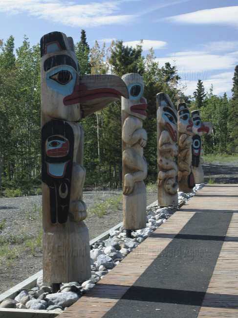
Totem poles outside of the Tlingit Heritage Center.
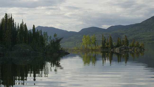
Teslin Lake
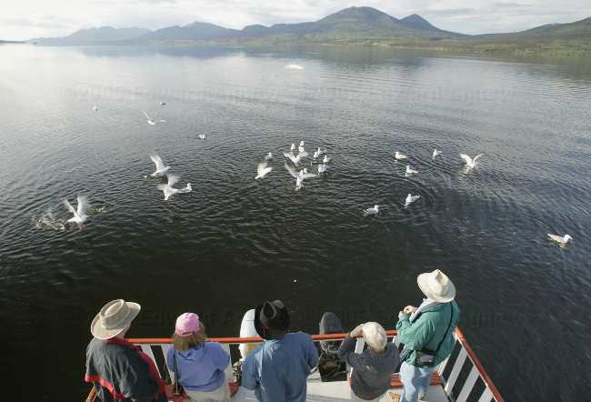
Seagull dinner time
mmm.... salmon and ribs over a hot wood fire!
Totem poles outside of the Tlingit Heritage Center.
Teslin Lake
Seagull dinner time
Friday, June 10, 2005
Salmon bake....mmmmm good.
Zaph and I had a leisurely walk this morning. We headed out from the campground and went down a side road just past the campground. Now the campground is 3 km outside of Watson Lake (population 1,794), so Zaph and I were surprised to see street lights on this road. It turned out to be a subdivision (probably at least 1 acre lots). There were some amazing log homes and one huge A-frame house. Some of the homes backed onto a lake — very nice. As we headed west we entered the Cassiar Mountains, so many beautiful views. Unfortunately, the rain came so not a lot of great opportunities for photos. Our destination today is Mukluk Annie’s Salmon Bake. I read about the restaurant in The Milepost and was intrigued — they offer free RV parking and a free boat ride on the lake. Colin was very excited about the “free parts”. We arrived and sure enough overnight parking is free. We found a couple of spots with views of the lake and as it is still early in the season not too crowded. Then we headed in to try the restaurant. We were not disappointed — the salmon / ribs / pork chops / steak / burgers are grilled over a wood fire. All of us had the rib / salmon combo....mmmmm good! You even get a chocolate brownie for desert (it would pass Jack’s chocolate brownie test).
While Zaph and I were enjoying our walk, the RCMP paid a visit to Colin and then to Ed (Colin ratted him out!). Apparently, while Zaph and I were having pleasant dreams at midnight Colin and Ed decided to look for unsecured WiFi in town as Colin needed to send a file to his daughter and Ed wanted to add pictures to our journal. They found WiFi outside of one of the local hotels but before they could access the internet the owner of the hotel came out and asked them to leave. They left as instructed but he followed them back to the campground. In the morning he called a complaint into the RCMP (I guess there’s not a lot of crime in Watson Lake so they went out right away). Apparently, the people of the north take their internet seriously!
It's even pretty in middle of a rain storm.
Thursday, June 09, 2005
Where Are We?
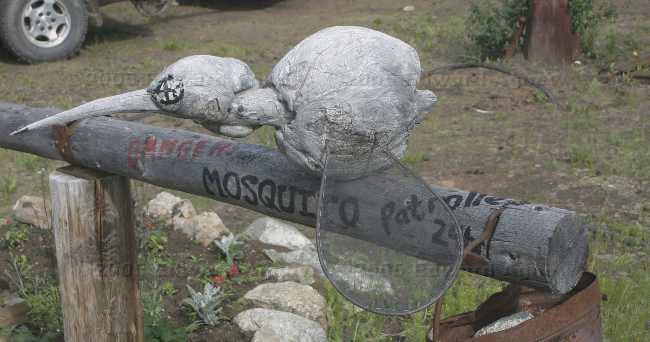
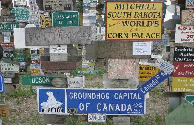
After one last dip into the hot springs we head north. Watson Lake is our destination today as we need to do laundry, buy groceries and send e-mail. Wildlife today was a couple of Bison grazing along side of the highway. Watson Lake’s claim to fame is the signpost forest. It was started in 1942 when a homesick US soldier put up a sign pointing to his home town of Danville, IL. Now there are more 51,800 signs. It was quite a sight seeing all of the signs especially the ones from close to home. Some of the signs are homemade and I’m sure a few of the signs were “borrowed” from towns and cities!
I hope this guy keeps grazing ... I'd hate to run into him!
Sign, sign everywhere there's a sign. (thanks Crosby Stills and Nash)
I hope this guy keeps grazing ... I'd hate to run into him!
Sign, sign everywhere there's a sign. (thanks Crosby Stills and Nash)
Wednesday, June 08, 2005
It's Still Light at Midnight!
We enjoyed the Liard Hot Springs Provincial Park so much that we decided to stay another day. Colin said he needed some time to finish his GST and taxes, Margaret wanted to sew a bed for Splash and Zaphod wanted to go hiking and swimming. We found a couple of walking trails and took Zaph for his promised walk and swim. The trails both led to waterfalls so that gave us goals. We also tested our bug jackets (Kathleen: we bought some before we left Burlington!) -- and with the aid of a few thousand mosquitos (at least it seemed liked it) we decided that the jackets worked and are now classified as a necessity for travelling up here. We went to the hot springs 3 times today and enjoyed each outing. The last one was at 10:30pm --- still bright enough to walk the kilometer to the hot spring --- still bright enough at midnight when we returned. I thing we are in the land of the midnight sun and it's not even summer soltice yet! These light evenings really mess with your mind .... I keep thinking that I have hours before I need to go to bed.
Zaphod having a wonderful time
those mean old bugs won't get me now!
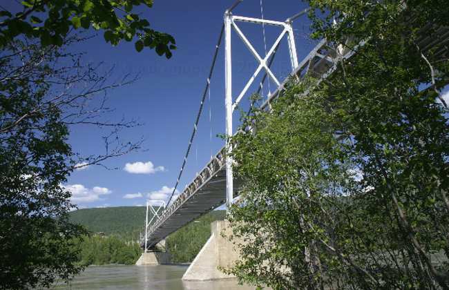
The only suspension bridge left on the Alaska Highway
Another hour and a few carrots and we'll have Colin-Ed Stew!
Zaphod having a wonderful time
those mean old bugs won't get me now!
The only suspension bridge left on the Alaska Highway
Another hour and a few carrots and we'll have Colin-Ed Stew!
Tuesday, June 07, 2005
Wildlife Everywhere
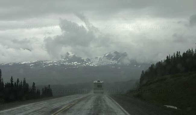
Today we drove from Fort Nelson, BC to the Liard Hot Springs Provincial Park near Liard, BC. Shortly after we left Fort Nelson we drove into the mountains. The views were incredible! As we drove we saw deer, caribou, moose, Stone sheep, wild horses and my favorite a black bear cub. All of these animals were hanging out by the road. I'm not sure why the road attracts them except maybe there are less bugs on the road. The Liard Hot Springs Provincial Park was everything and more than we expected. Big private campsites and a couple of fantastic Hot Spring pools. The pools were natural (not the cement ones you find at Jasper), one of the pools was about 3 feet deep with a gravel bottom and very clear. The temperature was around 106 degrees F. The other pool was 9 feet deep and around 106 degrees F as well.
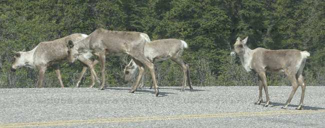
caribou on road
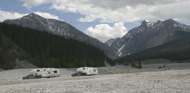
our rigs
caribou on road
our rigs
more wildlife; sheep on road
The hot springs, hot enough?
Steam rising from surface of hot springs
Monday, June 06, 2005
Where is my bug jacket?
This morning we pulled out of Dawson Creek destination not quite known. We thought we would find a place that we liked and magically there would be a campground and we would pull in. Mother Nature did not co-operate. The day started sunny but turned cloudy quickly followed by sprinkling — this did not encourage us to stop. We drove a bit further than we planned and are currently in Fort Nelson. We did manage to experience a bit of the “old Alaska” highway. About 20 km outside of Dawson Creek you can take a 10 km loop road and go over the only original timber bridge built along the Alaska Highway that is still in use today. It was the Alaska Highway I imagined ... hilly, lots of bends, full of pot holes and a gravel section. During the course of the drive we saw 3 deer by the side of the highway and several great views. Now, Fort Nelson. It seems like a nice little town except for the welcoming committee. When we got out of the truck we were attacked.... there must of been hundreds of them.... yes mosquitos. The gold bracelet is wonderful and I love it but I could have really used that bug jacket Kathleen!!!! They also have a museum in Fort Nelson and yes it has all of the “old stuff” that unfortunately we can remember from our early childhood but they also had cars and trucks and tractors and engines and other neat pieces of machinery. Well worth the a visit. But there is a cost; diesel is $99.9/L and gas is $104.9/L ouch!!!
Wildlife
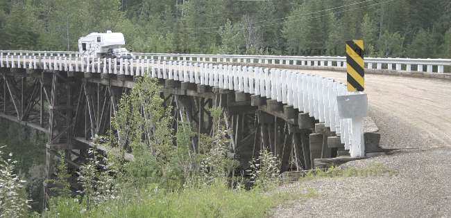
crossing the only wooden bridge left on the Alaska highway
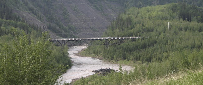
another view of the same bridge
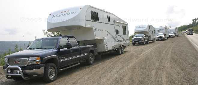
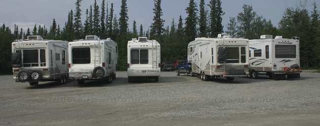
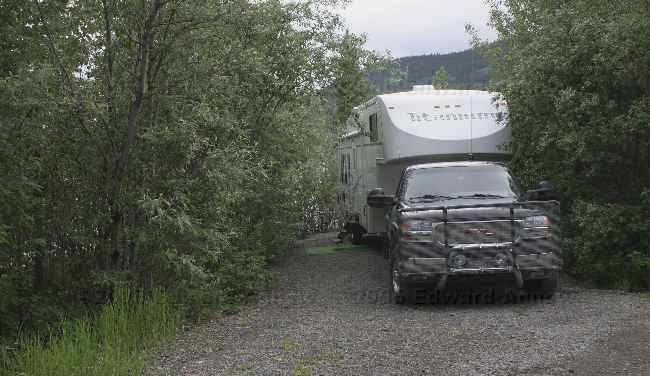
a lot of RV's around here
Wildlife
crossing the only wooden bridge left on the Alaska highway
another view of the same bridge
a lot of RV's around here
Sunday, June 05, 2005
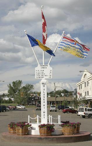
I didn't think we were old
For me today is the beginning of the trip. We are at Dawson Creek, BC mile 0 of the Alaska Highway. A brochure we picked up indicated that there was a spring rodeo this weekend, so we thought great we’d go as we’ve never been to a rodeo. Lunch bag let down – the rodeo was cancelled. Apparently, a lot of the small rodeos have been cancelled due to lack of interest by participants. They prefer to go to the larger rodeos where the prizes are larger. In place of the rodeo we visited the local art gallery, museum that included a film on the making of the Alaska highway, the Walter Wright Pioneer Village (weird co-incidence one of my uncles is Walter Wright) and went bird watching. In both the museum and the pioneer village, I heard Margaret and Ed commenting that they had “one of those things” at home when they were growing up. Those things included irons, sleds, radios, dishes and much more. I thought museums and pioneer villages had “old” stuff in them.
Saturday, June 04, 2005
driving to Dawson Creek BC
Left Edmonton early and had an un-eventful drive to Dawson Creek, in northern BC, which is mile zero of the Alaskan highway. booked into a campground for two nights and went out for supper.
Friday, June 03, 2005
Another day in Edmonton
A quiet day in the park, Zaphod however found a couple of new toys to play.
Thursday, June 02, 2005
A day in Edmonton AB
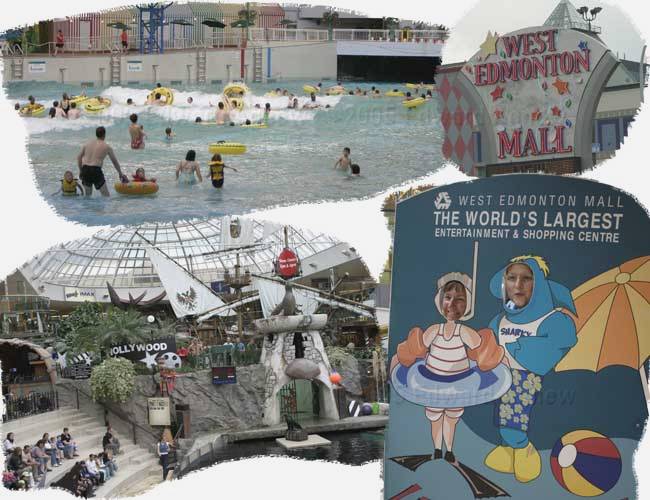
First order of business was to move our trailer into the "Glowing Embers" trailer park for a couple of days. Having done that, it was off to the West Edmonton Mall, the largest mall in the world, complete with wave pool, hockey rink, amusment park, sea lion show, 100's of restaurants, many hundreds of stores. Colin and Ed kept Margaret and Frances' shopping in check, limiting them to the dollar stores. Finally we had a chance to get caught up with the latest Star Wars movie.
Wednesday, June 01, 2005
Yorkton SK to Edmonton AB
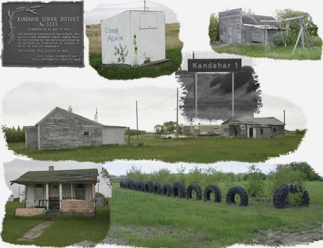
So... this is where Ed's mom is from, Kandahar SK
history of town at (http://www.quill-lakes.com/kandahar/Kanhistory.htm).
Now we understand why she left.
Moving further down the road
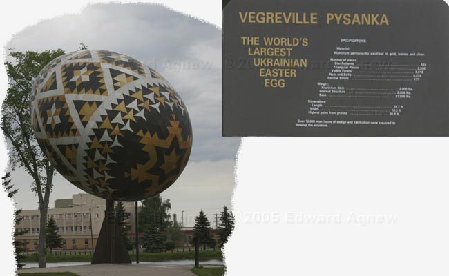
We got to Vegreville, home of the world's largest Easter Egg. at 25.7' long, 18.3' wide and about 5,000 lbs excluding base.
![]()
