Wednesday, August 31, 2005
Another Picturesque Village
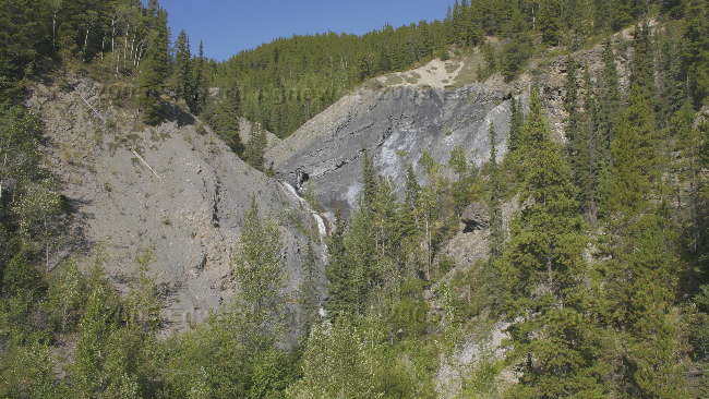
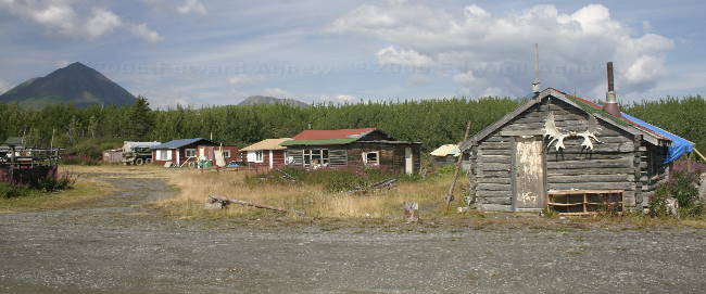
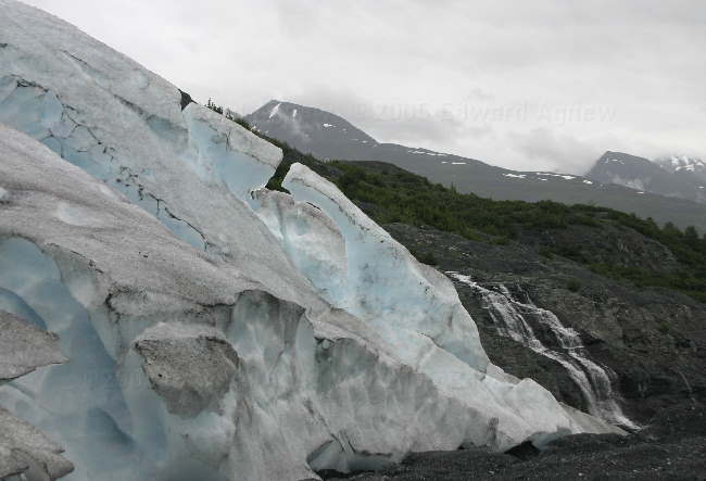
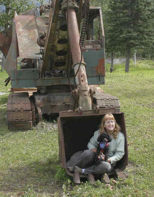
Leaving Telegraph Cove we drove through the village of Beaver Cove where there is a large lumber operation. We stopped to watched a huge machine that could pick up full size trees, then cut them in half with its attached chain saw.
As we weren’t very far from Port McNeil we decided to drive through. I had expected a very small town and was surprised to see how large it was. I guess I’m not used to being in a populated area yet.
We drove south towards Campbell River and stopped at Ripple Rock RV Resort at Browns Bay. This campground was recommended to us by the fellow from Nanaimo and it is one of the few places that advertises a hot tub. We were all ready for a nice long hot tub and Ed remembered about the “Ripple Rock Explosion” from his childhood. The harbour was very picturesque and the campground or should I call it a resort was very clean. Due to the terrain the campground was on two levels and just about everyone had a great view. We chose the lower level (even though it was more expensive) because it was nearer to the hot tub. Even though the jets weren’t working the hot tub was oooooooh soooooo goooooood!
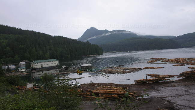
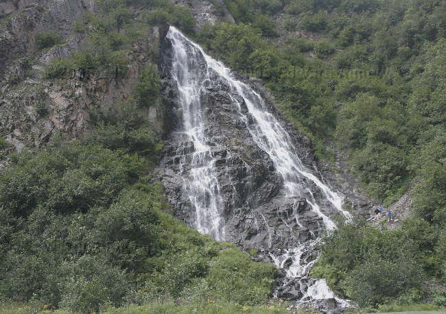
Logging operation at Beaver Cove.
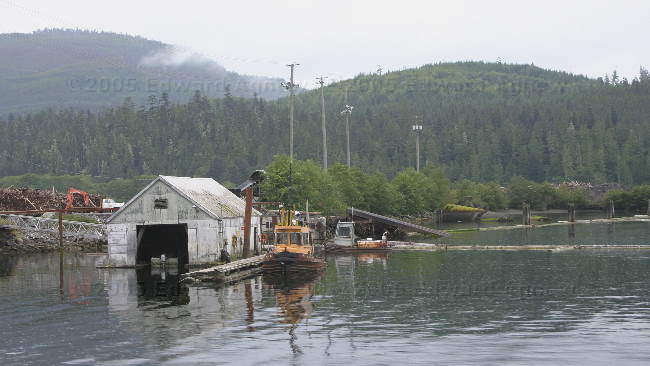
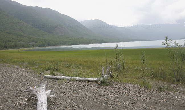
Beaver Cove
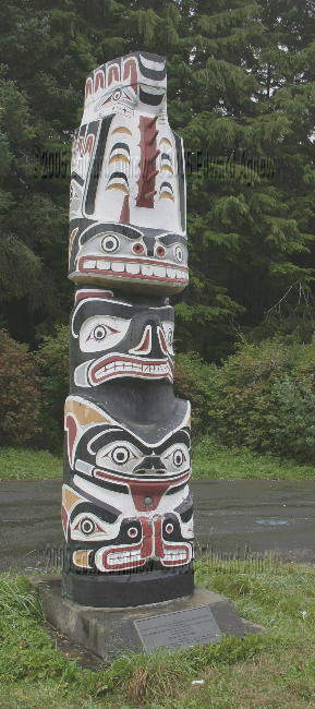
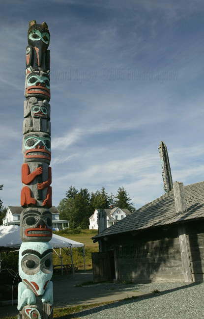
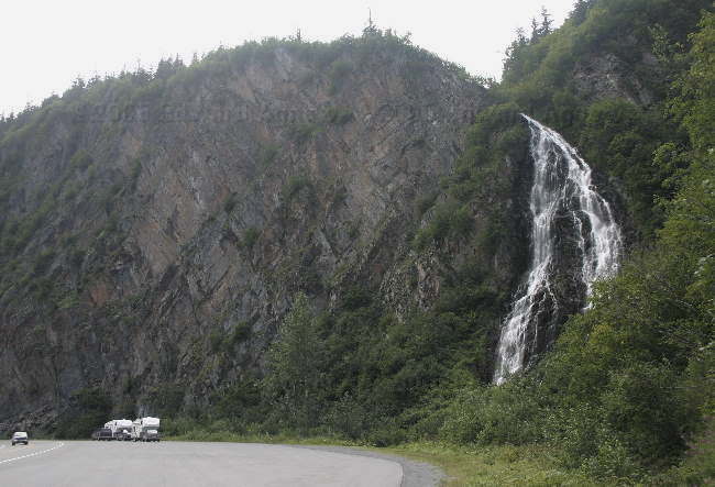
Totem pole on the side of the highway
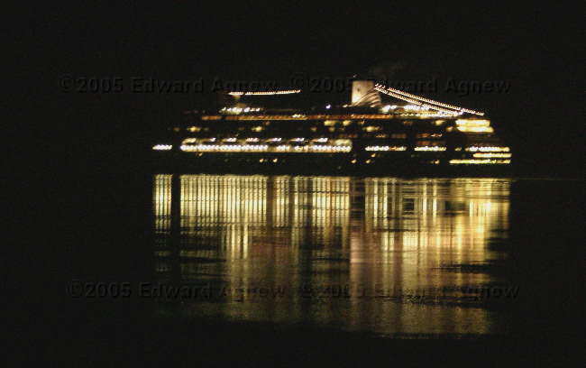
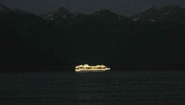
Cruise ship going past our campground (Ripple Rock)
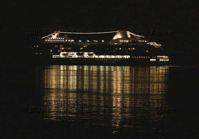
A second cruise ship. We had nice neighbours from New Mexico who alerted us to the ships.
As we weren’t very far from Port McNeil we decided to drive through. I had expected a very small town and was surprised to see how large it was. I guess I’m not used to being in a populated area yet.
We drove south towards Campbell River and stopped at Ripple Rock RV Resort at Browns Bay. This campground was recommended to us by the fellow from Nanaimo and it is one of the few places that advertises a hot tub. We were all ready for a nice long hot tub and Ed remembered about the “Ripple Rock Explosion” from his childhood. The harbour was very picturesque and the campground or should I call it a resort was very clean. Due to the terrain the campground was on two levels and just about everyone had a great view. We chose the lower level (even though it was more expensive) because it was nearer to the hot tub. Even though the jets weren’t working the hot tub was oooooooh soooooo goooooood!
Logging operation at Beaver Cove.
Beaver Cove
Totem pole on the side of the highway
Cruise ship going past our campground (Ripple Rock)
A second cruise ship. We had nice neighbours from New Mexico who alerted us to the ships.
Tuesday, August 30, 2005
Well, It Sounded Great in the Book
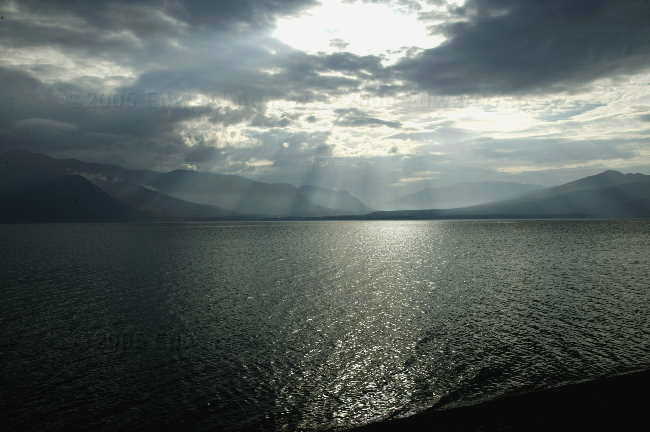
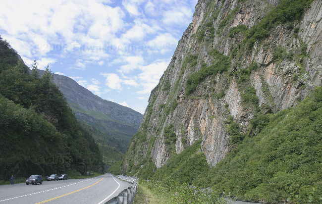
We decided that our plan of attack for Vancouver Island would be to drive to the north end of the island and work our way down to Victoria and take the ferry from Sydney. After reading the descriptions of the towns on the north island, Telegraph Cove became our destination. Telegraph Cove was described BC government’s tourism guide as “This outdoor adventure mecca is also one of the most picturesque places on Vancouver Island.” It is located about a ½ hour south of Port McNeil and 2 ½ hours north of Campbell River. The original village is quite picturesque — but I’m not sure it ranks as “one of the most picturesque places”. Several of the old buildings are raised above the water on pilings and joined by boardwalks (that would be the picturesque part). But... New docks have been added as well as a new hotel has been built. They are also working on a approximately 300 acre development of condos and what might be timeshares. When that’s done most of the picturesque qualities will be gone... very sad..
The campground we stayed at had a communal fire pit. As Colin wanted to cook his dinner over the fire, he started one in the communal pit. After supper we joined Colin, Margaret and a couple from Nanaimo at the campfire. The evening passed quickly as the fellow from Namaino related his many escapades. Another wonderful “character” to add to our list.
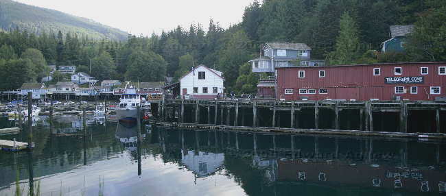
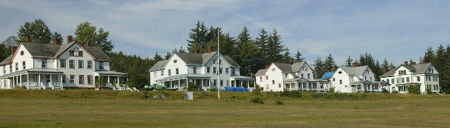
Telegraph Cove
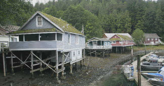
Houses on stilts.
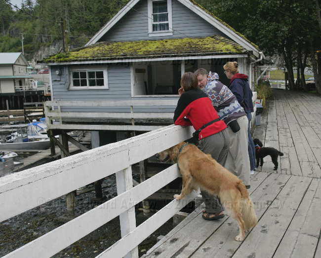
Someone wanted a really good view.
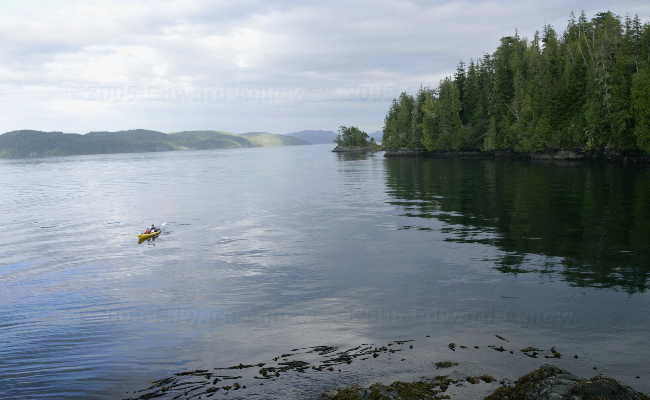
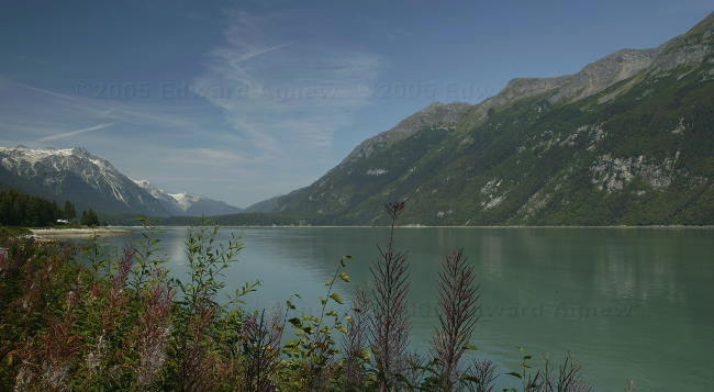
Another bay near Telegraph Cove.
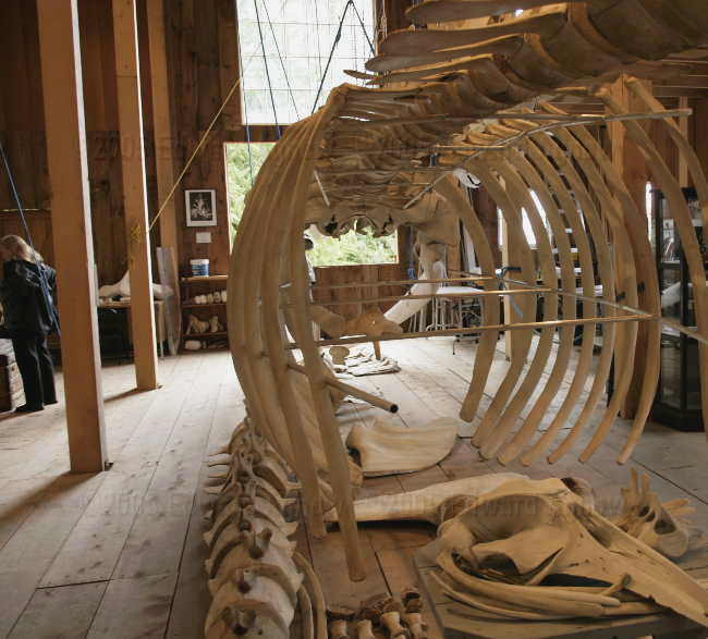
Whale bones in the museum.
The campground we stayed at had a communal fire pit. As Colin wanted to cook his dinner over the fire, he started one in the communal pit. After supper we joined Colin, Margaret and a couple from Nanaimo at the campfire. The evening passed quickly as the fellow from Namaino related his many escapades. Another wonderful “character” to add to our list.
Telegraph Cove
Houses on stilts.
Someone wanted a really good view.
Another bay near Telegraph Cove.
Whale bones in the museum.
Monday, August 29, 2005
Bad Mom
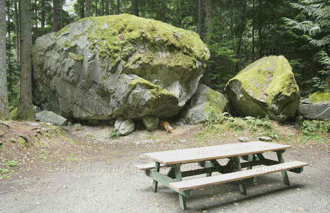
Ed and I had skipped Shannon Fall’s provincial park and were told by Margaret that we really needed to go see it. The beeping of the carbon monoxide detector (low battery) woke us early, so we headed off to the falls after we changed the batteries. The falls were worth the trip.. There was a set of knarley roots and trees that I thought would make a good background for a puppy picture. Zaph and I climbed up and I was trying to get him in position when he jumped down and started rubbing his face. Ooops, I didn’t check for bee’s nests. There was a great big one in amongst the roots. Luckily extra cookies erase items from the “bad mom” list.
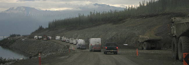
Back to the campground and hitch up the trailer — we were headed to the ferry and Vancouver Island. We decided to leave an hour sooner than we needed to as the highway is under construction — BC is spending lots of money fixing roads, etc. getting reading for the 2010 Winter Olympics. It was a good thing that we had left early. Not only was there construction delays, the ferry we were booked on was cancelled. Luckily, we were in time to get squeezed on to the earlier ferry. Now Ed and I have been on a few ferries (Yarmouth, NS to Bar Harbor, Mn, a couple in Scotland, the ferry to/from PEI and a few other ones) but I guess not one with the volume of traffic like that going to Vancouver Island (I was told that these ferries hold over 400 passenger vehicles). There were toll booths like on a highway and 5 or 6 lanes of vehicles — all waiting to get on a ferry. At other ferries we would park and go inside to pay and then get queued just before the ferry arrived. The ferry ride was an hour and half and you were allowed to stay in your vehicle or go to the passenger areas of the ship. As Zaph was with us we headed to the front of the car deck and watched from there – Zaph was happy that he didn’t have to stay in the truck.
Arriving in Nanaimo, we headed to Walmart. Colin needed to get four new tires and we figured that was a good spot to start looking. Luckily, he found a place near by with a really good price and they could do it right away. Another night in a Walmart parking lot.
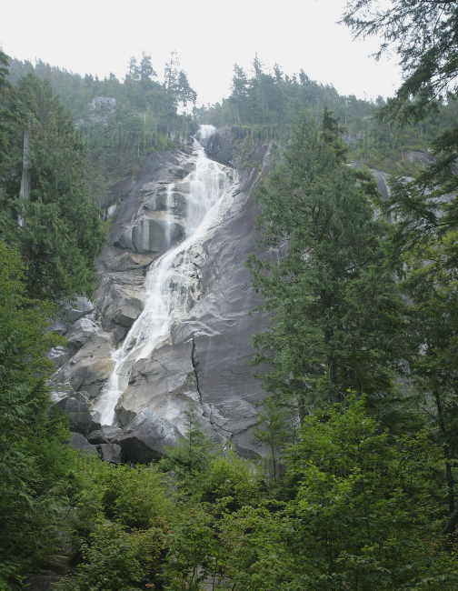
Shannon Falls.
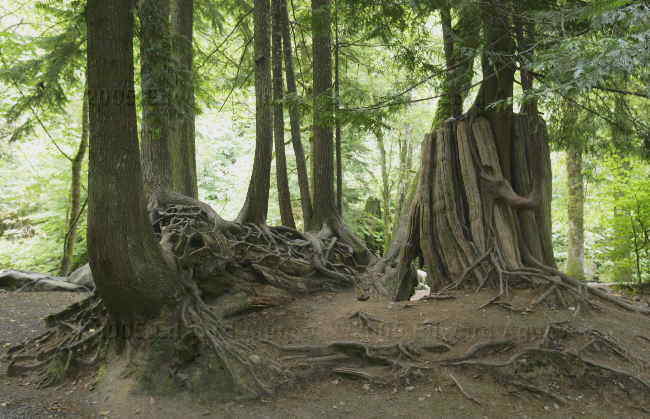
The tree with the bees nest.
One of the campsites where we stayed. Hey, who's poking his head under the rock?
Back to the campground and hitch up the trailer — we were headed to the ferry and Vancouver Island. We decided to leave an hour sooner than we needed to as the highway is under construction — BC is spending lots of money fixing roads, etc. getting reading for the 2010 Winter Olympics. It was a good thing that we had left early. Not only was there construction delays, the ferry we were booked on was cancelled. Luckily, we were in time to get squeezed on to the earlier ferry. Now Ed and I have been on a few ferries (Yarmouth, NS to Bar Harbor, Mn, a couple in Scotland, the ferry to/from PEI and a few other ones) but I guess not one with the volume of traffic like that going to Vancouver Island (I was told that these ferries hold over 400 passenger vehicles). There were toll booths like on a highway and 5 or 6 lanes of vehicles — all waiting to get on a ferry. At other ferries we would park and go inside to pay and then get queued just before the ferry arrived. The ferry ride was an hour and half and you were allowed to stay in your vehicle or go to the passenger areas of the ship. As Zaph was with us we headed to the front of the car deck and watched from there – Zaph was happy that he didn’t have to stay in the truck.
Arriving in Nanaimo, we headed to Walmart. Colin needed to get four new tires and we figured that was a good spot to start looking. Luckily, he found a place near by with a really good price and they could do it right away. Another night in a Walmart parking lot.
Shannon Falls.
The tree with the bees nest.
One of the campsites where we stayed. Hey, who's poking his head under the rock?
Sunday, August 28, 2005
Squamish..... isn’t that some type of vegetable?
Margaret and Colin had plans to visit a friend so no driving today – hooray! Unfortunately, it was raining when we woke up this morning so we opted out of driving back to Whistler or going on a long hike. After a lazy morning we headed into Squamish and the so called “beach”. The area was industrial and is currently under development so it’s not very pretty. There is a hiking trail and amongst all the driftwood there is a small beach (it was high tide so that probably made the beach even smaller). Zaph didn’t care – he had a great time splashing in the water chasing sticks. From the beach you could see Shannon Falls and Stawamus Chief. This enormous mountain of solid granite is a magnet for climbers who flock to “the Chief” to scale its immense vertical walls, long cool slabs and beautiful cracks (in case you can’t tell I stole this sentence). This area has a lot of trails so it would be worth a longer visit ... maybe next time.
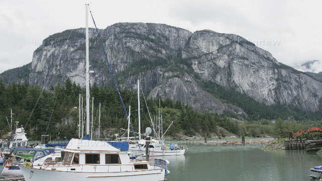
The small boat harbour of Squamish, with the "Chief" in the background
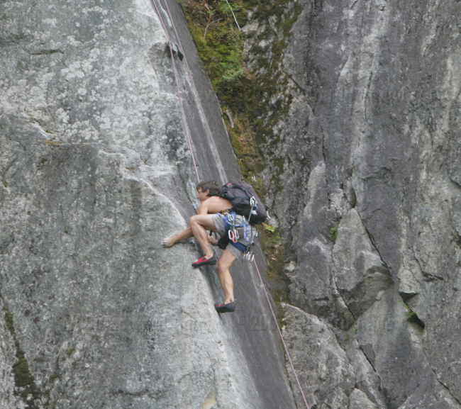
A climber playing on the rocks
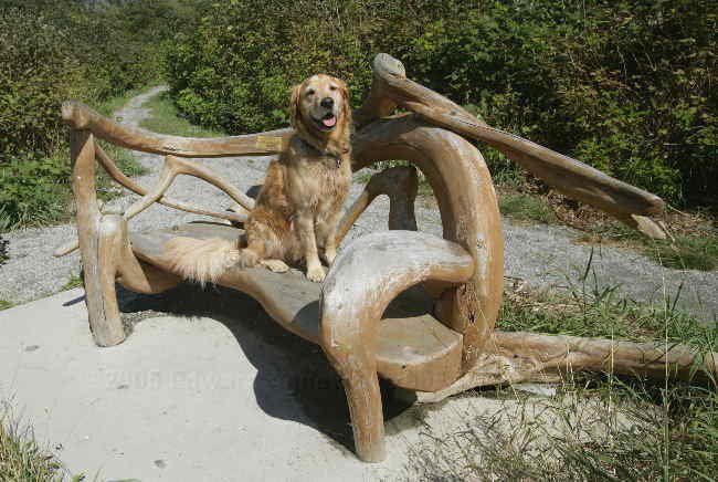
Not another dog on a bench photo!... yep.. this bench was dedicated to Albert Carlson, not a lot of other details about the person were available, but Zaph liked the location next to water.
The small boat harbour of Squamish, with the "Chief" in the background
A climber playing on the rocks
Not another dog on a bench photo!... yep.. this bench was dedicated to Albert Carlson, not a lot of other details about the person were available, but Zaph liked the location next to water.
Saturday, August 27, 2005
Contingency Man to the Rescue
Another day of driving. Colin decided to check his tires before we left this morning and sure enough the one back tire was very low again .... must have a leak. Luckily, Ed had a container of tire sealant with him so that was added to the tire. We decided to drive highway 99 and the Sea to Sky Highway. This took us through some magnificent scenery and some amazing roads that climbed at 15% percent grades with a few hairpin turns thrown in for fun. At one place we stop at, a local who was there explained what we were looking down at. We could see the Fraser River where it joined with a smaller river. The entire area was filled with tarps and tents and there was a guy dip netting (we saw him catching some fish). This was an Indian fish camp. For lunch we stopped at a picnic area provided by BC Hydro and were entertained by goats high on the mountain side. Later in the day while driving, Colin radioed us to say that he thought he might have miscalculated his fuel consumption and did we have a syphon hose so he could borrow some diesel (good thing we had the extra fuel tank, he had the syphon hose). We pulled over and he borrowed 20 liters of diesel. Ed the “Contingency Man” had come to the rescue twice in one day .... a record! The highway took us through Pemberton (way more built up then I expected) and the Whistler (even more built up) and finally Squamish where we stopped for the night.
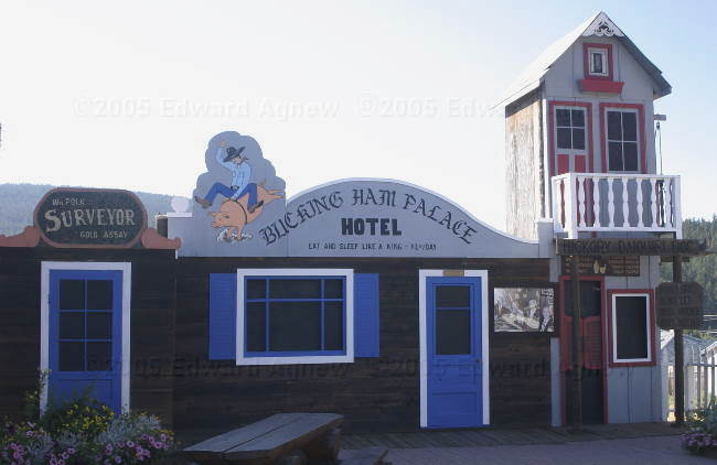
"Bucking Ham Palace", Clinton BC
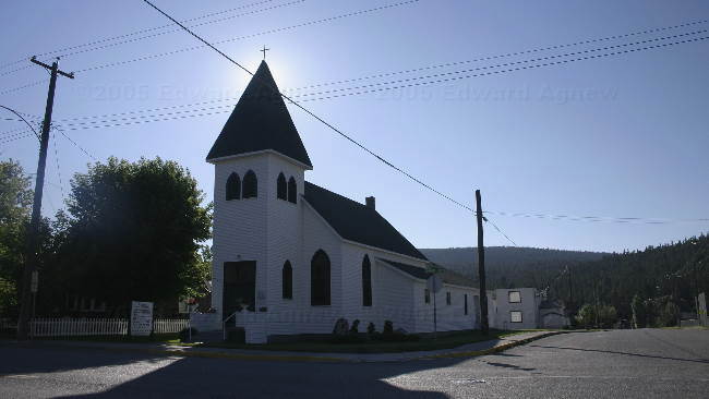
The church in Clinton
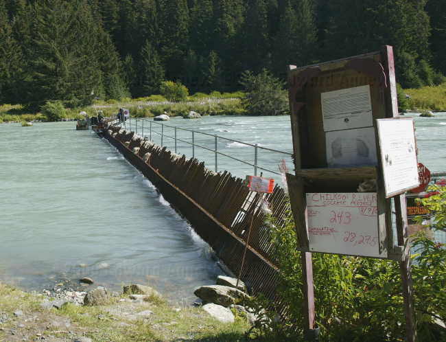
The Milepost guidebook indicated that this was the oldest general store in operation (in BC), and it had a post office as well as a good stopping/rest station. The sign at the road said "buses are welcome", so what happened?
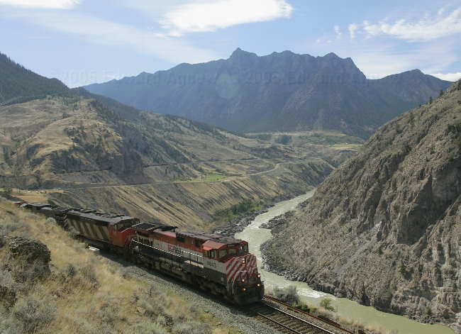
A little further down the road from the "general store", while taking a photo of this valley, I wondered, where was a train when you needed one for the photo, as I was getting back into the truck, guess what I saw coming down the track? I will point out that if you look closely, you can see the far end of train, as well as part of it, inside a tunnel
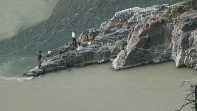
Fishing using a dip net at the indian village
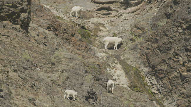
While having lunch at the BC Hydro park, we saw these mountain goat high up on the near vertical walls of the rock face above us.
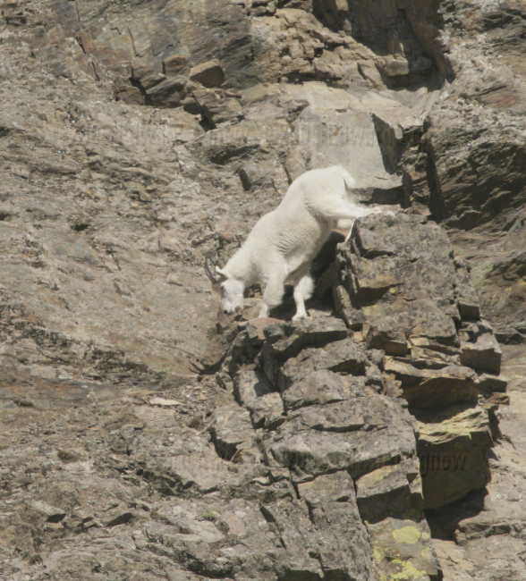
A lone goat demonstrating how is done. They make it look too easy.
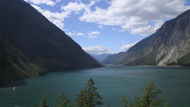
Just after lunch, we came on another of many mountain lakes
There was this sign, back near the begining of the road that asked the question, "no fuel for xxx KM, check your levels". Perhaps Colin should have followed that sign's advice. Then, he would not have had to be sucking fuel from our aux. fuel tank.
"Bucking Ham Palace", Clinton BC
The church in Clinton
The Milepost guidebook indicated that this was the oldest general store in operation (in BC), and it had a post office as well as a good stopping/rest station. The sign at the road said "buses are welcome", so what happened?
A little further down the road from the "general store", while taking a photo of this valley, I wondered, where was a train when you needed one for the photo, as I was getting back into the truck, guess what I saw coming down the track? I will point out that if you look closely, you can see the far end of train, as well as part of it, inside a tunnel
Fishing using a dip net at the indian village
While having lunch at the BC Hydro park, we saw these mountain goat high up on the near vertical walls of the rock face above us.
A lone goat demonstrating how is done. They make it look too easy.
Just after lunch, we came on another of many mountain lakes
There was this sign, back near the begining of the road that asked the question, "no fuel for xxx KM, check your levels". Perhaps Colin should have followed that sign's advice. Then, he would not have had to be sucking fuel from our aux. fuel tank.
Friday, August 26, 2005
If You Ever Stop in Clinton...
Today is a driving day and we plan on driving 350 to 400 km. We left Prince George just after 10:30am and stopped around 12:30pm for lunch as a cute wood shop / gift store. Margaret stopped in amazement just before she went into the trailer .... The rear trailer tire was a rim with black fluff around it. Colin couldn’t believe that he didn’t feel the flat tire as he was driving. Given the condition of the tire, he figured it blew just after we left the campground. Luckily, the place we stopped had lots of room for changing the tire, and Colin got a free lesson on how to remove and replace the tire. Colin then decided to check the rest of his tires and discovered that the rear tire on the other side of the trailer was way down in pressure and required some pumping up. Ed checked our tires and everything was fine. We bought some yummy fudge at the gift shop and were on our way after a 2 hour stop.
Colin was enticed by the RV park in Clinton that advertised a rate of 9.99 / day and an “all you can eat BBQ buffet” for $9.99. The gentleman running the RV park and barbeque (it appeared to me to be a one man show) gets into our “List of Characters”. When we checked in, he left whatever was on the grill, jumped into his pickup truck and led the way to our sites and directed us in. I presume he raced back to rescue the food he was barbequing. We wandered over for dinner .... who could resist the price and chatted with him. He seems to have lived everywhere (born in Mexico), including Fergus (where Colin and Margaret are from) and done a lot of different things in his life.
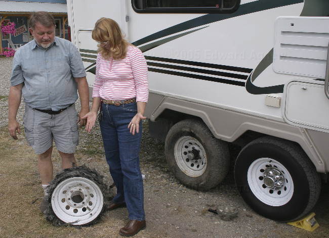
Not much left of this tire, is there?
Colin was enticed by the RV park in Clinton that advertised a rate of 9.99 / day and an “all you can eat BBQ buffet” for $9.99. The gentleman running the RV park and barbeque (it appeared to me to be a one man show) gets into our “List of Characters”. When we checked in, he left whatever was on the grill, jumped into his pickup truck and led the way to our sites and directed us in. I presume he raced back to rescue the food he was barbequing. We wandered over for dinner .... who could resist the price and chatted with him. He seems to have lived everywhere (born in Mexico), including Fergus (where Colin and Margaret are from) and done a lot of different things in his life.
Not much left of this tire, is there?
Thursday, August 25, 2005
Lumber, Lumber, Everywhere
Today was our chance to tour Prince George. We headed downtown to see what was there — not much except for roads that make no sense. I could not believe that a downtown area is laid out as badly as Prince George is. The person who designed it must has had a sick sense of humor or two people designed it and they didn’t speak to each other. Since Zaph was in the truck with us and Prince George is very proud of the 120 + parks they have, we headed to the river front where there is a network of trails. Zaph got to join the other dogs and people who were enjoying the river. At one point it appeared that Zaph was in a swim spa — he was swimming (and he’s a pretty strong swimmer) but not going any where. We didn’t realize the current was that strong. After that we encouraged him to swim much closer to shore out of the current.
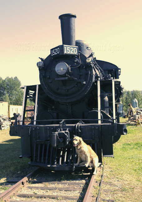
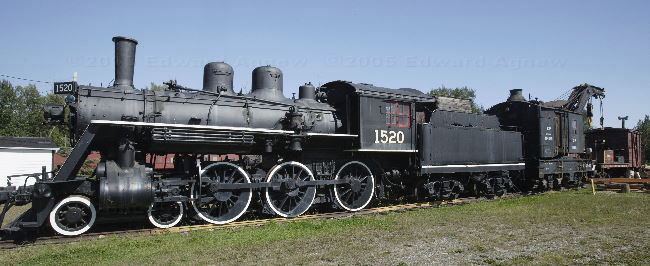
The Prince George Railway and Forestry Museum was our next stop. A notice on the door of the museum stated they were “Dog Friendly” — it’s not often that you are invited to bring your dog along, so in we went. When we were paying admission, Zaph was offered a cookie .....mmmmm good, there were water dishes in several locations around the park and they even had “doggie bags” just in case. The museum was a collection of train cars, forestry machinery (i.e. huge bands saws etc.) with the odd fire truck, car and tractor thrown in.
The young woman at the information center had told me that there was a great view of the city from the university. As it was a beautiful day we headed there next. The university is the newest university in BC and is still under construction. It’s going to be a really nice campus when it’s completed. Well the view may have been great but you couldn’t see too much because of the trees. There are a lot of trees in and around Prince George. That was evident by the huge lumber facilities around the city. One area we drove around had stacks of trees at one end of the yard and skids of lumber ready to ship at the other end. The BC Lumber industry is currently experiencing a problem with a pine beetle that is kill a very high percentage of the prime lumber trees. While the beetle is native to the area, the normally cold winters keep them in check, however it has been warm for the last few winters, and the beetles are very hungry.
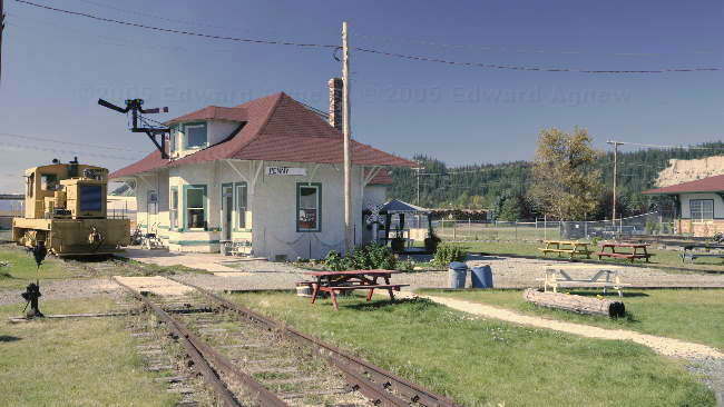
Penny Station at the Prince George Railway and Forestry Museum.
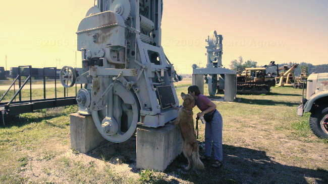
Zaph was really into this museum --- even he was reading the plaques!
Can I ride inside next time?
They don't make trains like this anymore.
The Prince George Railway and Forestry Museum was our next stop. A notice on the door of the museum stated they were “Dog Friendly” — it’s not often that you are invited to bring your dog along, so in we went. When we were paying admission, Zaph was offered a cookie .....mmmmm good, there were water dishes in several locations around the park and they even had “doggie bags” just in case. The museum was a collection of train cars, forestry machinery (i.e. huge bands saws etc.) with the odd fire truck, car and tractor thrown in.
The young woman at the information center had told me that there was a great view of the city from the university. As it was a beautiful day we headed there next. The university is the newest university in BC and is still under construction. It’s going to be a really nice campus when it’s completed. Well the view may have been great but you couldn’t see too much because of the trees. There are a lot of trees in and around Prince George. That was evident by the huge lumber facilities around the city. One area we drove around had stacks of trees at one end of the yard and skids of lumber ready to ship at the other end. The BC Lumber industry is currently experiencing a problem with a pine beetle that is kill a very high percentage of the prime lumber trees. While the beetle is native to the area, the normally cold winters keep them in check, however it has been warm for the last few winters, and the beetles are very hungry.
Penny Station at the Prince George Railway and Forestry Museum.
Zaph was really into this museum --- even he was reading the plaques!
Can I ride inside next time?
They don't make trains like this anymore.
Wednesday, August 24, 2005
Shopping....
It seems that every time we arrive at a town of any size we end of spending a day doing errands. Well today was no exception. The Prince George economy benefitted from our stay.
So who is Zaph's friend?
So who is Zaph's friend?
Tuesday, August 23, 2005
Going Down the Highway
Prince George was our destination today, about 3 hours of driving. We were about a ½ hour outside of Prince George when Ed cursed loudly. A vehicle driving the other direction had kicked up a stone and we had a chip in the center of the windshield about the size of a nickle. About 5 minutes later, Colin radioed to asked if our green carpet (a piece of fake grass that we put by the steps into the trailer) had blown out of the back of the truck. We pulled over and yes it was gone. We decided it wasn’t worth the effort of going back for it. We stopped at the Information Centre on the way into town and received a lot of help from 2 lovely young ladies. One of them made a couple of calls on our behalf including to a Speedy Auto Glass. The guy at Speedy said that he thought he could fix the chip without having to replace the windshield (hooray!!!). When Ed took it in later in the afternoon it turned out that the guy was correct — wow that saved us some money.
On the way back to the campground, Ed took Wendy’s advise and stopped at a barber shop.
On the way back to the campground, Ed took Wendy’s advise and stopped at a barber shop.
Monday, August 22, 2005
A Day of Rest
We decided to stay a second day at Burns Lake Village. The guys were suppose to fish but managed to find other projects to keep themselves busy. One of the projects was to take the rock guards off the trucks. Margaret did laundry and I read a book. Oh Zaph did manage to get a couple of walks but no swimming. Oh did I mention that it rained a good part of the day.
Sunday, August 21, 2005
Driving, driving, driving ...
Today we continued down the Yellowhead highway to Burns Lake Village. Along the way we stopped to see the World’s Largest Fly Fishing Rod – 60 feet long. What some towns will do to get tourists to stop ..... and it works with some of us!
Burns Lake has a small community campground a couple of blocks off the main highway on a lake. Quite a pretty place and it was free. Guess where we stayed!
Burns Lake has a small community campground a couple of blocks off the main highway on a lake. Quite a pretty place and it was free. Guess where we stayed!
Saturday, August 20, 2005
On the Road Yet Again
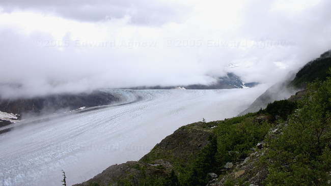
Margaret, Ed and I headed down town to check out the Toaster Museum but they wouldn’t let us in — closed for renovations they say. After a tour of the tourist shops (all three of them) we headed out of Stewart. Our eventual destination is Vancouver Island. The weather was better than on the way in so we were able to see some of the great views. There was an abundance of waterfalls due to all of the rain and many of the glaciers were visible. Bear Glacier is the largest of the glaciers along the road.
The milepost guidebook mentioned an Indian village with many totem poles so we decided to take the short detour off the main road to see them. We also stopped in Hazelton to see the Hagwilet Canyon where we saw some rock climbers scaling the sheer walls below the bridge.
We stayed in the Zellers parking lot in Smithers with about a dozen other rigs. Zellers had a large sign indicating that Rvs could park overnight.
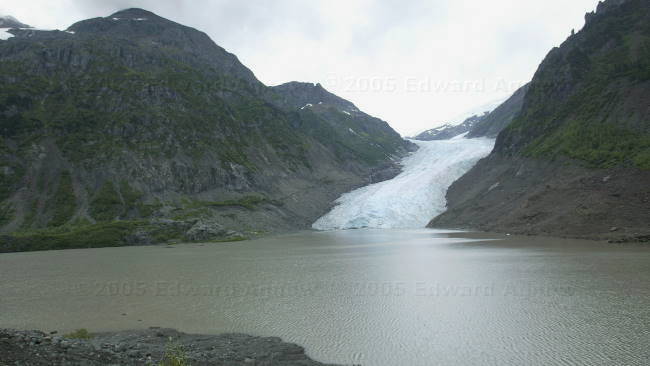
Bear Glacier, at its exit

a close up view of the water draining from the base of the Bear glacier

Totem poles at the Indian village of Gitanyow
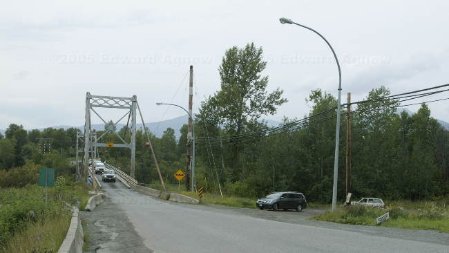
This single lane bridge spans the Bulkley River at Hazelton
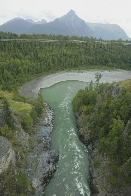
A view of the canyon below the bridge and the river

Climbers make use of the near vertical walls of the canyon below the bridge
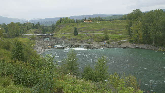
Another smaller canyon of the Bulkley river
The milepost guidebook mentioned an Indian village with many totem poles so we decided to take the short detour off the main road to see them. We also stopped in Hazelton to see the Hagwilet Canyon where we saw some rock climbers scaling the sheer walls below the bridge.
We stayed in the Zellers parking lot in Smithers with about a dozen other rigs. Zellers had a large sign indicating that Rvs could park overnight.
Bear Glacier, at its exit
a close up view of the water draining from the base of the Bear glacier
Totem poles at the Indian village of Gitanyow
This single lane bridge spans the Bulkley River at Hazelton
A view of the canyon below the bridge and the river
Climbers make use of the near vertical walls of the canyon below the bridge
Another smaller canyon of the Bulkley river
Friday, August 19, 2005
The Three Bears
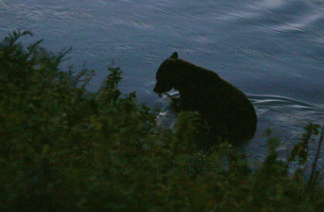
It continued to rain today although it did let up at some very opportune times. The Stewart - Hyder area is known for four things — a great Canada Day / 4th of July celebration that lasts for 4 days, bear viewing, the Salmon Glacier and the Toaster Museum. We missed the Canada Day celebration but we did see bears and the glacier. We tried to get into the Toaster Museum but the sign said under renovations and we couldn’t talk the woman into letting us in. The narrow and winding road the was built to get to mines follows one of the glacier valleys. Unfortunately, we had low cloud cover but did manage to see this very large glacier as the clouds shifted about. The bear viewing was more successful. Us, plus at least 60 other people stood on the viewing boardwalk in the rain waiting for a bear. All of a sudden a small male grizzly appeared — man did it get quiet. He sauntered through the creek picking up fish and eating them. Luckily, the rain stopped. About 5 minutes later a second larger male grizzly appeared at the other end of the viewing area. This guy munched on some berries and a fish. After about a half hour the two bears wandered off. Then the rain came back with a vengeance so we left — we had seen a couple of bears. Driving away from the viewing area there was a traffic jam. It turned out that the traffic was stopped watching a young bear cub thinking about and finally crossing the road — I hope his mom was waiting for him.
The Salmon Glacier (about 1100 Metres ASL), partly hidden by cloud layers
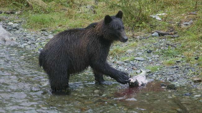
The first bear we saw was this smaller one
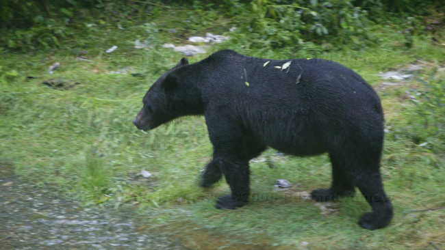
Then alone came this much larger male
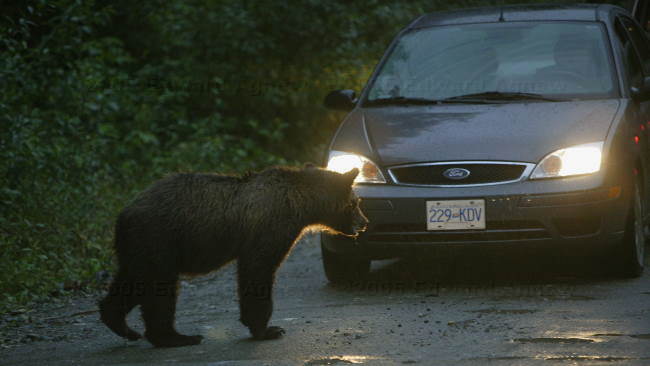
This young bear was trying to cross the road when we left
The Salmon Glacier (about 1100 Metres ASL), partly hidden by cloud layers
The first bear we saw was this smaller one
Then alone came this much larger male
This young bear was trying to cross the road when we left
Thursday, August 18, 2005
Stewart and Hyder
I didn’t drive today and boy was I glad. It rained all day plus we went through some pretty nasty construction areas. We ended up at a small town called Stewart about 60 km off the main highway. Due to low cloud cover we didn’t get to enjoy what should have been spectacular scenery on the road in. Stewart and Hyder are borders towns — Stewart is in Canada and Hyder is in the US. There is Canadian Customs but no US Customs — so much for US security. I guess the US figures there really isn’t anywhere to go once you cross the border and there isn’t unless you leave in a boat.
Wednesday, August 17, 2005
Telegraph Creek
This morning after settling into the passenger side of the truck I remember that I was going to “practice” driving some more. So I drove the 122 km to Dease Lake. It was a scenic drive and I got to drive on a 16 km section of gravel — a little scarey in places. The trip took a little longer than expected but we made it, and I even parked the trailer. Ok... so it was a pull through site and the guy from the campground guided me into it ... but still I did it.
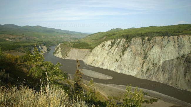
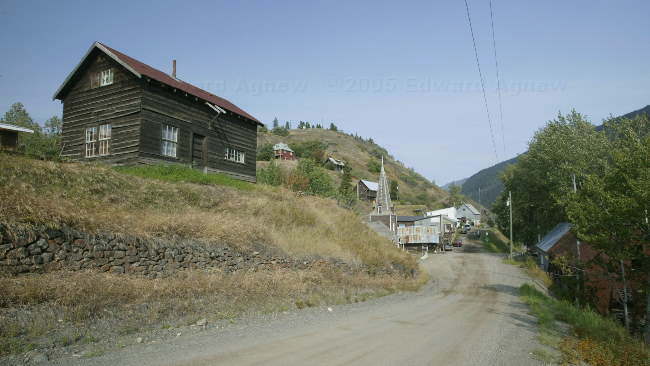
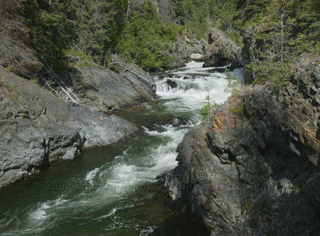
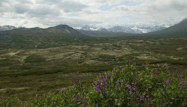
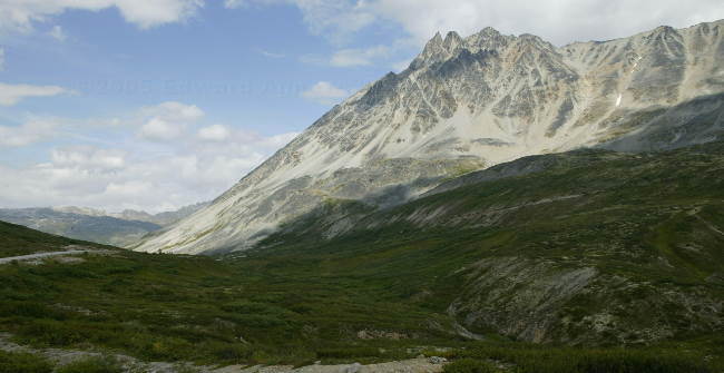
We stopped at Dease Lake as we wanted to drive to Telegraph Creek and did not want to pull the trailers (the guide book indicated that the road was not suitable for large trailers). The road from Dease Lake to Telegraph Creek is 112 km and gravel. Ed drove. The first 80 km is a windy, hilly road through trees, not a lot of great scenery. The remainder of the road was a bit more challenging and a lot more scenic – the road was narrow on the edge of a canyon climbing and descending the canyon. One of the canyons we passed is known as the Canadian Grand Canyon (Stikine Canyon). We could only see a bit of the canyon but it did look spectacular. One of the videos the previous night was on the Stikine Canyon. Telegraph Creek has a population of about 350. People apparently live there “to get away from it all”. Now the town does have electricity and telephone, but you certainly won’t get unexpected company for supper.
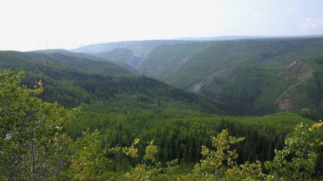
The valley formed by the Stikine river before it reaches the Canyon
Ravens glide in the air currents
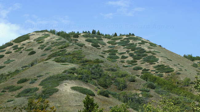
An interesting hill top
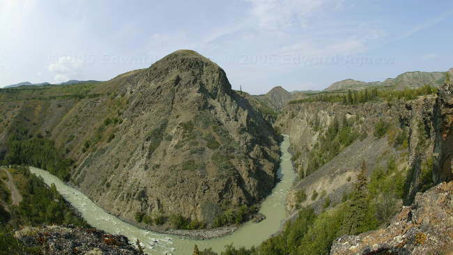
The one end of the "Canadian Grand Canyon" to the right (slightly distorted as I used a fisheye lens to get it all
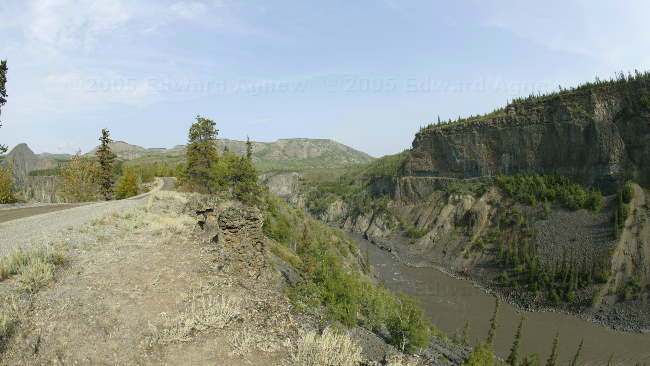
A view to the other side of the road, both sides drop off about 400 feet, ... some ditches.
Same river, after the Canyon
Getting away from it all.... the village of Telegraph Creek
We stopped at Dease Lake as we wanted to drive to Telegraph Creek and did not want to pull the trailers (the guide book indicated that the road was not suitable for large trailers). The road from Dease Lake to Telegraph Creek is 112 km and gravel. Ed drove. The first 80 km is a windy, hilly road through trees, not a lot of great scenery. The remainder of the road was a bit more challenging and a lot more scenic – the road was narrow on the edge of a canyon climbing and descending the canyon. One of the canyons we passed is known as the Canadian Grand Canyon (Stikine Canyon). We could only see a bit of the canyon but it did look spectacular. One of the videos the previous night was on the Stikine Canyon. Telegraph Creek has a population of about 350. People apparently live there “to get away from it all”. Now the town does have electricity and telephone, but you certainly won’t get unexpected company for supper.
The valley formed by the Stikine river before it reaches the Canyon
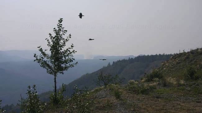
Ravens glide in the air currents
An interesting hill top
The one end of the "Canadian Grand Canyon" to the right (slightly distorted as I used a fisheye lens to get it all
A view to the other side of the road, both sides drop off about 400 feet, ... some ditches.
Same river, after the Canyon
Getting away from it all.... the village of Telegraph Creek
Tuesday, August 16, 2005
Driving Practice
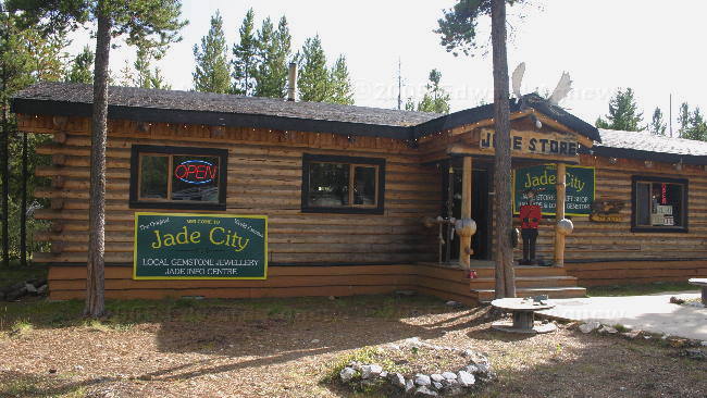
After a great breakfast we left Mukluk Annie’s and headed for the Cassiar Highway and Jade City (population 12). The section of the Alaska Highway we were driving was fairly flat with wide shoulders and was in good repair. I’m not sure what possessed me, but I asked Ed if I could drive and he actually said yes and pulled over. When we radioed Colin and Margaret to let them know we were stopping and why, Margaret asked if I had read her mind as they were planning on stopping and she was going to drive. I guess great minds think alike. Now you do need to remember that Margaret is use to driving the truck while I’m not. Ed is very possessive over what he still calls his truck. I passed a vehicle, was passed by a number of vehicles, went up hills, down hills, around sharp bends and through 2 one lane bridge construction areas. When we got to the Cassiar Highway I decided to continue driving even though the road was narrower, more windy and did not have shoulders. I did pretty good even if I say so myself. I know that Ed has told me this but you barely notice that you are pulling a trailer — you just have to push a little harder when you brake. About 20 km from Jade City I decided that I was tired and didn’t want to take any chances so I let Ed drive. Margaret drove to Jade City and parked the trailer. Way to go Margaret!
The drive along the Cassiar Highway led us into a mountainous area — some great views. Jade city consists of 2 stores one on either side of the road and yes they both sell jade. The jade is mined locally but made into jewelry and carvings else where. Both stores offered free camping and of course we stayed at one of the campgrounds — nice sites in a treed area. The “store” we stayed at also showed 3 video tapes about the area.
One of the video tapes was about a “ghost town” called Cassiar. It was located in the mountains about 15 km from Jade City. Cassiar was a company owned mining town with a population of about 3,000 – they mined asbestos. In the spring of 1992 the company went bankrupted, closed the town and sold everything they could including the houses. What little remains is behind locked gates. It’s a really weird feeling to be in an area that is pretty isolated and know that only 13 years ago 3,000 people lived there.
look out world, here I come
Blue Lake BC
The waterfalls of the 2nd North Fork Creek
Jade City
Monday, August 15, 2005
Yukon Discovery Day
What we discovered was that most of the stores were closed for the Yukon holiday of Discovery Day. Ed and I had planned on hair cuts (desperately needed) but that didn’t happen. There didn’t appear to be any events planned in Whitehorse for the day and with most everything closed we decided to move on. Mukluk Annie’s was our next planned stop. All four of us had all already decided what we were ordering for supper (even me!). Major disappointment when we arrived — they were closed for Discovery Day too. Our assumption that a business dependent on tourists would remain open every day they could was incorrect. We decided to camp at Mukluk Annie’s anyway (it was free and mostly empty) and they did open in time for breakfast the next morning. When we went into the restaurant we understood why they didn’t need to be open for Discovery Day — at least 3/4 of the merchandise that had been packed in the restaurant when we were there in June was gone. It looked like their summer had been profitable. Mukluk Annie’s is on Teslin Lake and yes Zaph did manage to convince us that he could have a swim.
Sunday, August 14, 2005
On the Road Again.
Another nice day if you ignore the smoke haze. Unfortunately, it was time to move on and head for Whitehorse. Yes, Zaph managed to sneak in one last swim with a new friend before we left. The Milepost book described some great scenery which we were unable to see, again due to the smoke haze, so there are no pictures for today. We’re spending the night in the Walmart parking lot as we have errands to run and it’s free. There are not as many rigs here as there was two months ago but the atmosphere is much more party like. People are sitting outside, playing cards and chatting enjoying the warm summer evening.
it's my toy... so let go!
it's my toy... so let go!
Saturday, August 13, 2005
Summer Vacation!
August 11 to August 13, 2005
Three more beautiful sunny days. We left Haines on the 11th and decided to stop at a Yukon government campground about 50 km south of Haines Junction. We like the campground and especially the weather that we decided to stay for three nights .... there was some pressure from Zaph as we were camped about 30 feet from a lake suitable for swimming. There were loons and swans on the lake and mountains in the background – what else could we ask for. Even I went for a swim... ok it only lasted 2 minutes but at least I went in unlike someone with a beard who will remain nameless. Zaph on the other hand spent a lot of time swimming. Ed and Colin decided to try fishing again. This time they decided to get the boats out to see if fishing in the middle of the lake would have better results. Well, finally on the 3rd day Ed caught 5 1/4 pound 28 inch long pike. Colin caught a small pike and released it.
Game 2
Fishing Results: Fish 2, Colin and Ed 1 (watch out Fish they might be getting better)
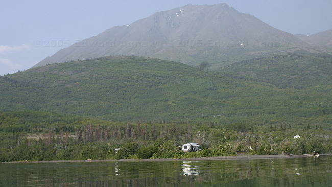
a view of our campsite from the boat
got one!!!
Three more beautiful sunny days. We left Haines on the 11th and decided to stop at a Yukon government campground about 50 km south of Haines Junction. We like the campground and especially the weather that we decided to stay for three nights .... there was some pressure from Zaph as we were camped about 30 feet from a lake suitable for swimming. There were loons and swans on the lake and mountains in the background – what else could we ask for. Even I went for a swim... ok it only lasted 2 minutes but at least I went in unlike someone with a beard who will remain nameless. Zaph on the other hand spent a lot of time swimming. Ed and Colin decided to try fishing again. This time they decided to get the boats out to see if fishing in the middle of the lake would have better results. Well, finally on the 3rd day Ed caught 5 1/4 pound 28 inch long pike. Colin caught a small pike and released it.
Game 2
Fishing Results: Fish 2, Colin and Ed 1 (watch out Fish they might be getting better)
a view of our campsite from the boat
got one!!!
Wednesday, August 10, 2005
What a Cute Bear
Wow, another beautiful day and 27C to boot. The day started with breakfast at the picnic table overlooking the harbour. Herons, an eagle and crows were our entertainment. Zaph, Ed and I decided that it would be a great day for a hike and headed out to the Mt. Riley trail head..The trail to the summit (1760 feet) is 2.8 miles from the parking lot — shouldn’t be too hard of a hike. And it wasn’t. After an hour and forty-five minutes of hiking we arrived at the summit (there was actually a survey marker that marked the spot). If was a great lookout spot — you could see a full 360 degrees. Zaph was not as impressed with the view and found a shady spot under a bush. The hike down is always easier and was done in an hour and fifteen minutes. Zaph talked us into stopping along the Chilkat inlet so he could have a quick swim to cool down – some dogs want it all. After a crab feast the four of us had at our campsite ($5 for a Dungeness crab seems like a reasonable deal), Ed and I headed out to Chilkoot River to look for bears. When we got to the river there were a lot of people but no bears. Just as Ed and I were about to give up and head home we heard that there was a bear at the lake. Sure enough there was a brown (grizzly) bear in the lake by the shore fishing, and was only 30-40 ft away.
An eagle landing on the shoreline just off from our campsite
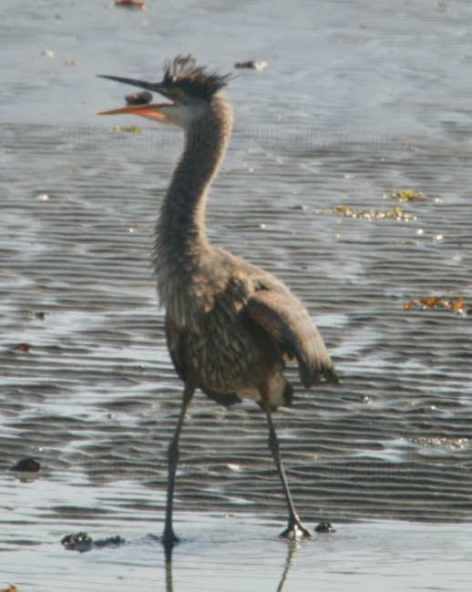
an a hundred feet down the shore was this heron (according to our bird book, this is about their northern limit)
The summit of Mt. Riley
From the summit you can see the mixing point of the blue ocean water (on left) and the grey/brown silty water from the mountain rivers that feed into the channel
A late night dinner, this brown bear was busy catching and eating fish, with little concern about the people watching from the parking lot only 30-40 feet away
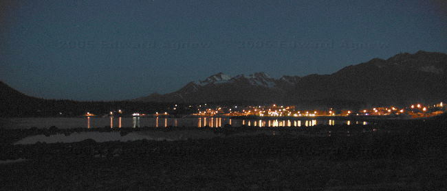
Haines at night from across the bay
An eagle landing on the shoreline just off from our campsite
an a hundred feet down the shore was this heron (according to our bird book, this is about their northern limit)
The summit of Mt. Riley
From the summit you can see the mixing point of the blue ocean water (on left) and the grey/brown silty water from the mountain rivers that feed into the channel
A late night dinner, this brown bear was busy catching and eating fish, with little concern about the people watching from the parking lot only 30-40 feet away
Haines at night from across the bay
Tuesday, August 09, 2005
Now We Know Where Mosquitos Came From
This morning held the promise of a warm and sunny day so we planned on spending as much of it as possible outside. Ed and I started with a walk around the harbour and historic Fort Seward.
Fort William H. Seward was established in 1904 with the buildings being built after 1910. A lot of the buildings are still standing and being used for such things as stores, B&B’s, condos and restaurants. Next we drove 10 miles north east along the bay to Chilkoot Lake where we saw people fishing (what else!!) As well as a fish weir where they count the salmon returning to Chilkoot Lake. They started counting in June and the count is now over 28,000 — now that’s a lot of sockeye salmon! Returning to town we then drove 10 miles west along Mud Bay Road to Chilkat State Park. We could see several glaciers as we drove along this road – very pretty. Finally we went to see the Chilkat Dancers perform some Indian tales. One of the tales explained where mosquitos came from. Once upon a time there was a monster that kept stealing food and women from an Indian Village. The villagers decided to capture the monster and destroy him. As he was being set on fire the monster vowed to return and haunt the villagers. After 3 days the villagers went to check the hole where the monster was burning and stirred the ash to make sure he was gone — mosquitos flew out of the ashes.
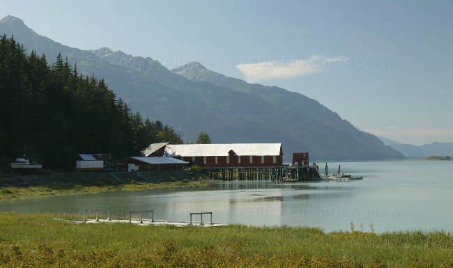
The harbour at Haines.
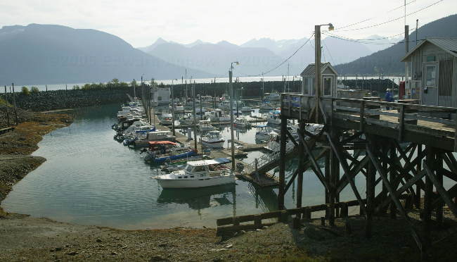
The small boat harbour at low tide.
Some of the old buildings in Fort Seward.
A totem pole.
Chilkoot Lake
Kayaking on the lake.
Fish weir. Over 28,000 sockeye salmon have returned to the lake this year.
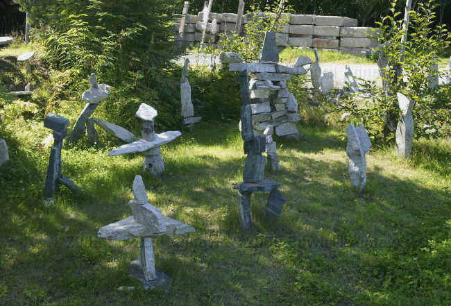
Stone art.
Chilkat inlet.
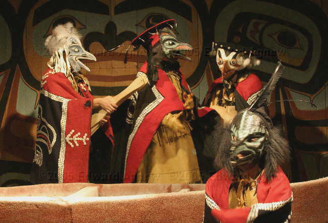
Raven, Puffin, Gull and Cormorant in one of the Indian tales.
A cruise ship from Skagway going across the harbour.
Fort William H. Seward was established in 1904 with the buildings being built after 1910. A lot of the buildings are still standing and being used for such things as stores, B&B’s, condos and restaurants. Next we drove 10 miles north east along the bay to Chilkoot Lake where we saw people fishing (what else!!) As well as a fish weir where they count the salmon returning to Chilkoot Lake. They started counting in June and the count is now over 28,000 — now that’s a lot of sockeye salmon! Returning to town we then drove 10 miles west along Mud Bay Road to Chilkat State Park. We could see several glaciers as we drove along this road – very pretty. Finally we went to see the Chilkat Dancers perform some Indian tales. One of the tales explained where mosquitos came from. Once upon a time there was a monster that kept stealing food and women from an Indian Village. The villagers decided to capture the monster and destroy him. As he was being set on fire the monster vowed to return and haunt the villagers. After 3 days the villagers went to check the hole where the monster was burning and stirred the ash to make sure he was gone — mosquitos flew out of the ashes.
The harbour at Haines.
The small boat harbour at low tide.
Some of the old buildings in Fort Seward.
A totem pole.
Chilkoot Lake
Kayaking on the lake.
Fish weir. Over 28,000 sockeye salmon have returned to the lake this year.
Stone art.
Chilkat inlet.
Raven, Puffin, Gull and Cormorant in one of the Indian tales.
A cruise ship from Skagway going across the harbour.
Monday, August 08, 2005
We Finally Found Summer
We left our campground and immediately ended up in a construction zone. The road around the bottom of Kluane is described in the Milepost book as a narrow and winding road. Well, I guess they are trying to make it wider and less winding but it’s going to be a lot of work. About 7 kms are currently under construction and there’s at least that much more to go. Once we got out of the construction area the highway was in pretty good shape. We did a quick tour around Haines Junction and then headed south to Haines and the US boarder. The drive down was very pretty. The road meandered through a large valley with mountains on either side. Margaret and I felt that the drive to Skagway was more spectacular while Colin and Ed felt the drive to Valdez was. We came to the conclusion that due to the fact that the road to Skagway was on the edge of the mountain the guys missed a lot of the spectacular scenery (something about having to watch the road). About 40 miles outside of Haines we crossed the border into the US — the road to Haines starts in the Yukon, goes through BC and finally ends up in the Alaska. The border guard was thorough but very pleasant. It turned out that he is from Buffalo and has just recently been posted to Haines. Colin noted that the temperature was climbing as we were getting closer to Haines. It was 27C and sunny when we arrived in Haines — summer at last. We landed at a small campground on the water — very nice.
Kluane Lake in the morning.
Traffic going through construction area.
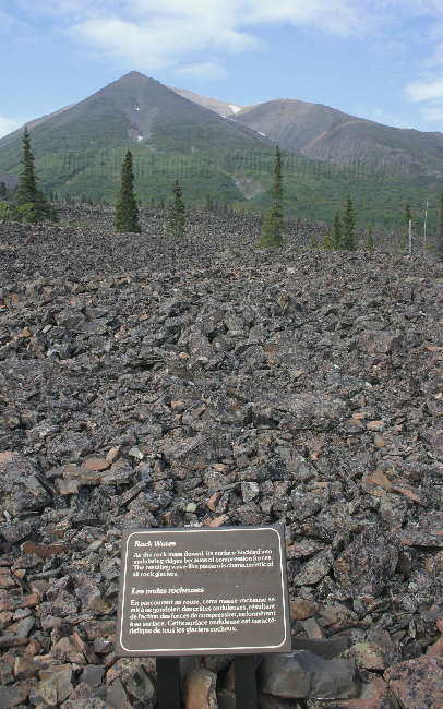
A rock glacier --- what's left after the glacier is gone.
An Indian Fish Camp.
Takhanne falls
The summit at Chilkat Pass on the Hanes Highway.
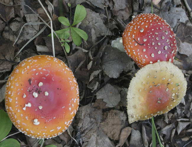
Another view of the Chilkat Pass.
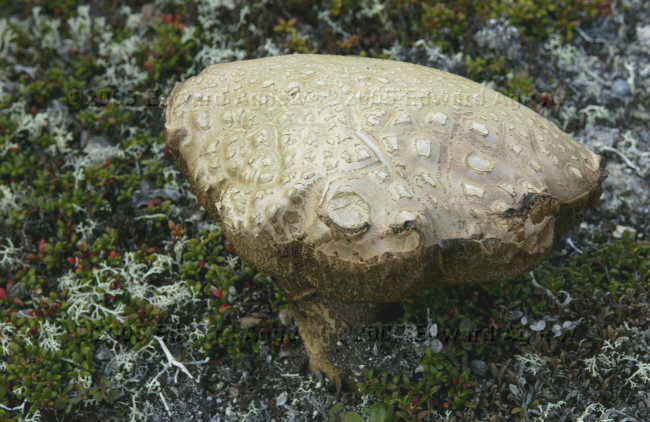
A mushroom along the side of the Haines Highway.
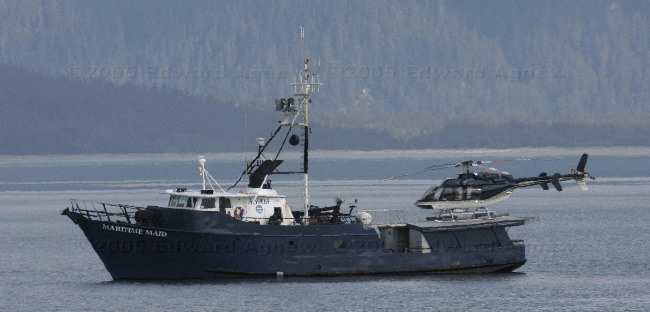
A boat in the harbour at Haines.
Kluane Lake in the morning.
Traffic going through construction area.
A rock glacier --- what's left after the glacier is gone.
An Indian Fish Camp.
Takhanne falls
The summit at Chilkat Pass on the Hanes Highway.
Another view of the Chilkat Pass.
A mushroom along the side of the Haines Highway.
A boat in the harbour at Haines.
Sunday, August 07, 2005
O Canada Our Home and Native Land.....
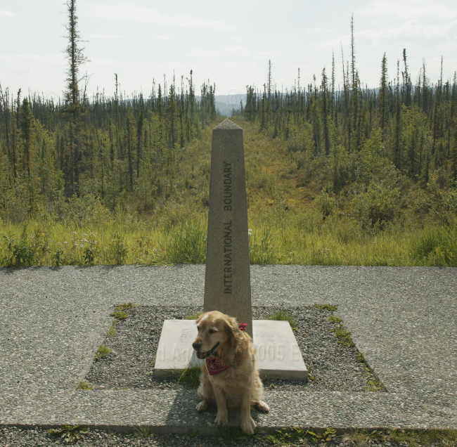
We crossed back into Canada today. It was great feeling to see the Welcome to Canada sign. A narrow clearing marks the border. This is part of the 20 foot swath cut by surveyors from 1904 to 1920 along the 141 meridian to mark the Alaska – Canada border.
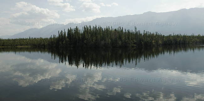
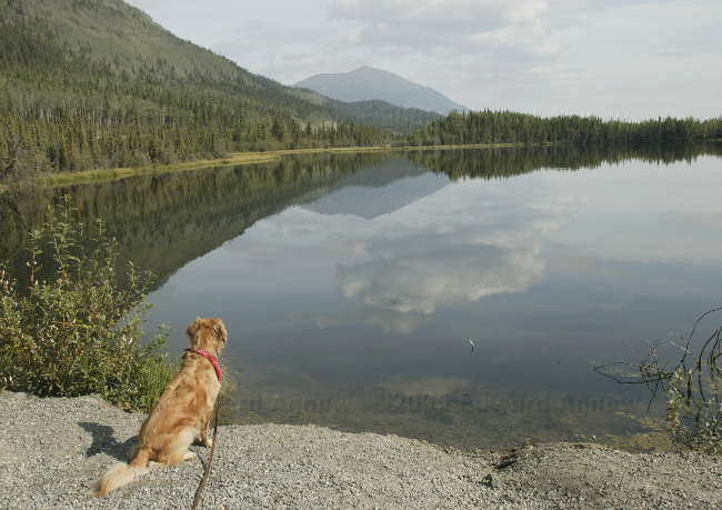
There was also a large group of bicyclists from Texas at the border. After about 2 months of riding they had finally made it to Alaska and were about 4 days from the end of their trip at Anchorage. When we arrived they were in the midst of taking pictures of their group at the boarder markers, and when we left there fifteen minutes later they were still taking pictures! The rest of our day was spent bouncing down the highway — we all agreed that this was probably the worst piece of the road we drove on so far. The Top of the World Highway was dustier but I don’t think it was as rough. We stopped at a Yukon government campground just outside of Destruction Bay (I just love that name) called Congdon Creek. It was actually on Kluane Lake the largest lake in Yukon. The Yukon government campgrounds are best — they tend to have large sites, free firewood and are very clean.
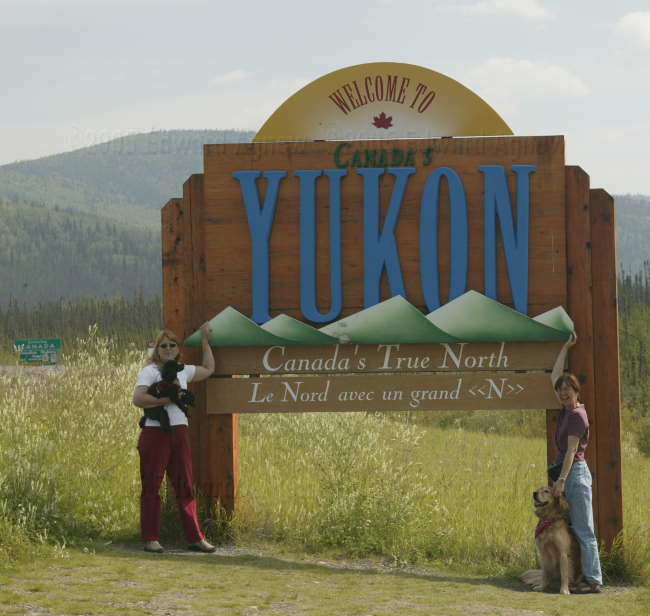
Yeah!!! We're back in Canada.
Zaph can't decide which country he wants to be in.
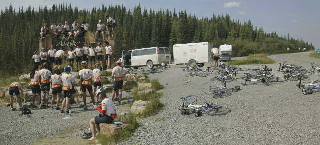
Happy Texas bikers.
Reflection Lake.
Man, do I ever want to go swimming!
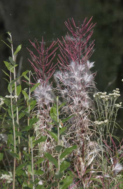
Fireweed as it goes to seed.
There was also a large group of bicyclists from Texas at the border. After about 2 months of riding they had finally made it to Alaska and were about 4 days from the end of their trip at Anchorage. When we arrived they were in the midst of taking pictures of their group at the boarder markers, and when we left there fifteen minutes later they were still taking pictures! The rest of our day was spent bouncing down the highway — we all agreed that this was probably the worst piece of the road we drove on so far. The Top of the World Highway was dustier but I don’t think it was as rough. We stopped at a Yukon government campground just outside of Destruction Bay (I just love that name) called Congdon Creek. It was actually on Kluane Lake the largest lake in Yukon. The Yukon government campgrounds are best — they tend to have large sites, free firewood and are very clean.
Yeah!!! We're back in Canada.
Zaph can't decide which country he wants to be in.
Happy Texas bikers.
Reflection Lake.
Man, do I ever want to go swimming!
Fireweed as it goes to seed.
Saturday, August 06, 2005
Construction Blues
Luckily the campground in Glennallen had a check out time of 1:00pm — that gave us time to catch up on internet stuff. We had planned on driving further than Tok but the hour going through the construction area wore us out. Tonight’s stop was at the Tok River State Recreation Area – a lovely campground on a river. Zaph, of course, wanted to go swimming but this was vetoed due to the silty river’s incredibly fast current. In the campground, was a very interesting vehicle parked in an adjacent campsite -- instead of the more common map of Canada and the US showing where it had been there was a world map!! We also met a woman traveling to Alaska on her own to visit family and had a very interesting chat with her after supper.
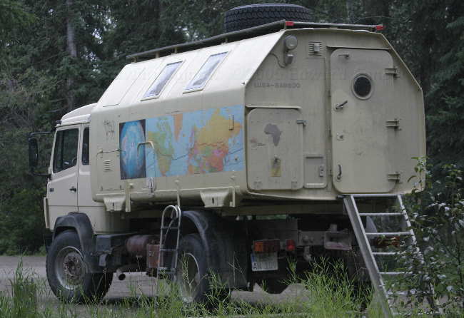
Unique camper that is travelling the world.
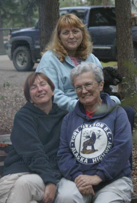
Margaret, Joanne (the woman we met at the campground) and myself.
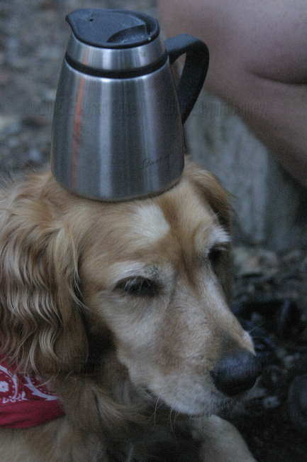
Another use for a dog ... coffee cup holder.
Unique camper that is travelling the world.
Margaret, Joanne (the woman we met at the campground) and myself.
Another use for a dog ... coffee cup holder.
Friday, August 05, 2005
Here a Waterfall, There a Waterfall, Everywhere a Waterfall
Valdez wasn’t what we expected however the weather was fairly good (we would be able to take photos of the scenery that we didn’t take on the way in due to rain) so we decided to leave after one night. The pink salmon were spawning and dying in the harbour near our campground so it was very smelly. It was actually mind boggling to see all those dead fish. We did have a nice site overlooking the water. It took us 4 ½ hours to drive 115 miles (should have taken about 2 hours) as we stopped often to take pictures of waterfalls, glaciers, lakes, mountains and the pipeline. For the first half of the drive there were waterfalls and glaciers everywhere you looked. If you ever find yourself in Glennallen and you’re hungry go to the Caribou Restaurant. Good food at very reasonable prices. The clam chowder, blue cheese dressing and apple pie were delicious and definitely not out of cans or packages.
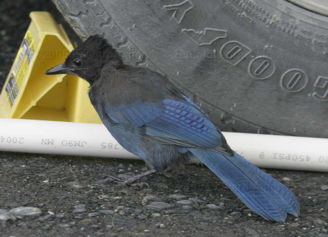
A Steller's Jay looking for food under our trailer
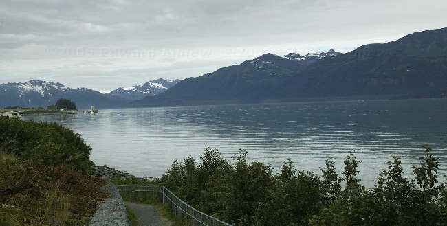
"Port Valdez", the bay on which Valdez is located
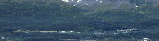
The end of the Alaskian Pipe line, the hugh oil holding and transfer station on Port Valdez where the crude oil is loaded on to tanker ships, this was just down the road from our campsite
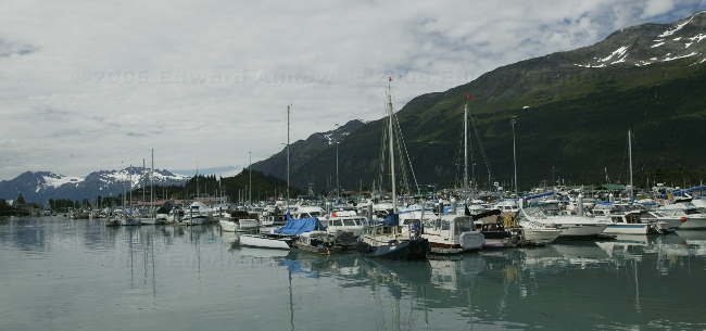
Across the bay is the small craft harbour of Valdez
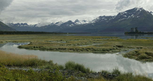
Looking towards the area that once was Valdez, up till 1964 when a massive Tsunomi removed it from the panet. The town was moved about 4 miles to more secure ground
The Horsetail waterfalls, in the Keystone Canyon
Another view of the Horsetail, note how small our rigs look
Twins? The larger one on the left is the Bridal Veil Falls, the smaller one is unknown, again in the Keystone Canyon
People on a rafting adventure stop at the Bridal Veil falls for a photo op, and since they have a good test of their waterproof clothing
A view of the Keystone Canyon from the Bridal Veil falls
Leaving Valdez we assend the Thompson pass, a 7.5 mile long steep hill climb, with lots of turnouts (some only 0.2 miles apart) for photo ops, nice touch given it was not raining today
Another view from the Thompson pass hill climb. The waterfall where way down on the river in the upper right
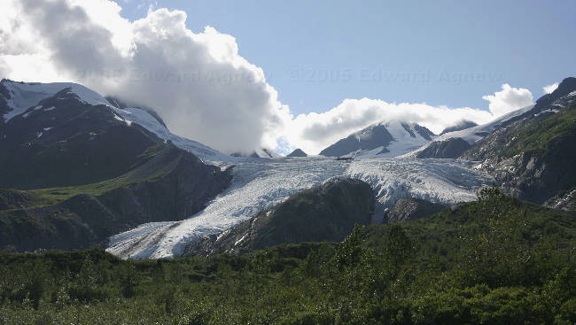
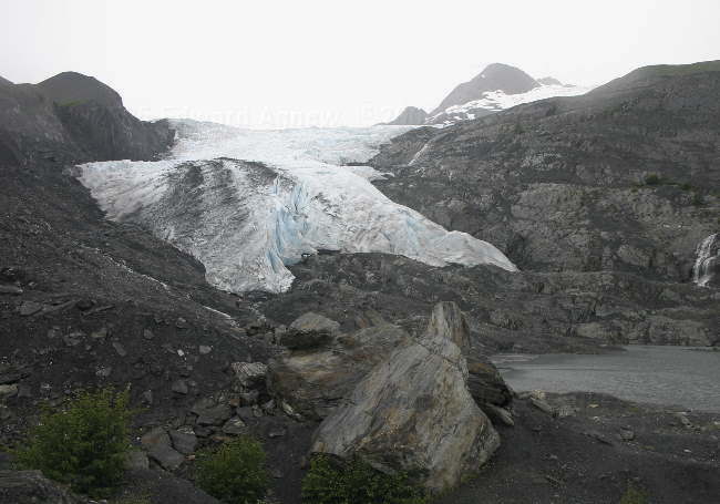
The Worthington Glacier from the road, (and in sunlight), the mile post book does indicate that you should should not approach the glacier on foot unless you are experienced in and equipped for cravasse recuses!!!, Now let me see, how many kids did we see yesterday
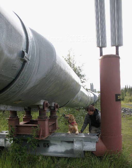
Zaph inspects the mounts of the Alaskian pipe line, noting that we are back in a perma-frost area, where the pipeline is kept above ground, and the cooling fins on the top of the piers to prevent melting of the frost layers underground
A Steller's Jay looking for food under our trailer
"Port Valdez", the bay on which Valdez is located
The end of the Alaskian Pipe line, the hugh oil holding and transfer station on Port Valdez where the crude oil is loaded on to tanker ships, this was just down the road from our campsite
Across the bay is the small craft harbour of Valdez
Looking towards the area that once was Valdez, up till 1964 when a massive Tsunomi removed it from the panet. The town was moved about 4 miles to more secure ground
The Horsetail waterfalls, in the Keystone Canyon
Another view of the Horsetail, note how small our rigs look
Twins? The larger one on the left is the Bridal Veil Falls, the smaller one is unknown, again in the Keystone Canyon
People on a rafting adventure stop at the Bridal Veil falls for a photo op, and since they have a good test of their waterproof clothing
A view of the Keystone Canyon from the Bridal Veil falls
Leaving Valdez we assend the Thompson pass, a 7.5 mile long steep hill climb, with lots of turnouts (some only 0.2 miles apart) for photo ops, nice touch given it was not raining today
Another view from the Thompson pass hill climb. The waterfall where way down on the river in the upper right
The Worthington Glacier from the road, (and in sunlight), the mile post book does indicate that you should should not approach the glacier on foot unless you are experienced in and equipped for cravasse recuses!!!, Now let me see, how many kids did we see yesterday
Zaph inspects the mounts of the Alaskian pipe line, noting that we are back in a perma-frost area, where the pipeline is kept above ground, and the cooling fins on the top of the piers to prevent melting of the frost layers underground
Thursday, August 04, 2005
GM Service Manager a Hero
Ed said the GM service manager couldn’t have been nicer. He asked Ed if he was the fellow with the transmission problem then they took the truck into the shop and said it would be 2 hours. Ed and Colin went to run a couple of errands and called back in 2 hours. The truck was ready for pickup. The best part was everything was covered under warranty. By 1 pm we were on the road heading for Valdez again. Glaciers were the item of the day today. In the approximately 250 miles we drove I think we passed 5 or 6 glaciers. We stopped to view the Matanuska Glacier (we were about 1 mile away from it) and the Worthington Glacier (this one we walked up to). The Worthington Glacier is a small glacier but is neat as you can get close to it — in fact touch it. Zaph thought it was great scrambling up the rocks and crossing the little streams. Around 7:30pm we made it to a campground across the bay from Valdez. We had finally made.
BTW. if you need service on a GMC/Chev while traveling in the Plamer/Wasilla talk to Mike at Alaska Sales and Service, 907-376-4173 they are great, and certainly saved our trip!
The Worthington Glacier from the viewing platform
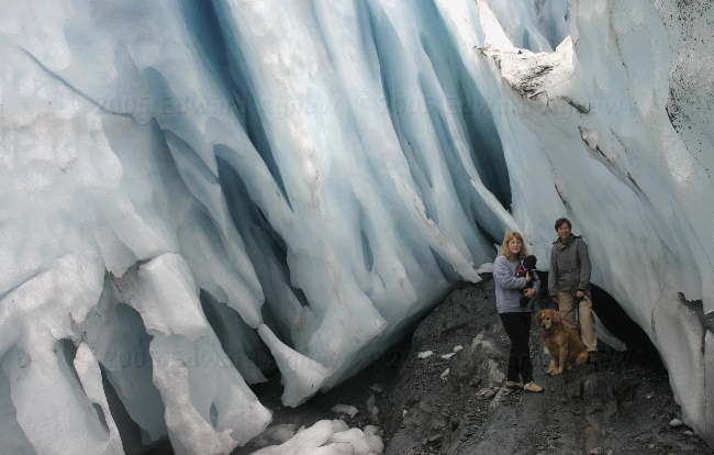
These are what you might call "cool" people and dogs, of course a minute or so later a large piece of ice fell just about where they are standing!
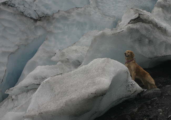
So who wants to come play in the snow?
The Worthington Glacier, another view
BTW. if you need service on a GMC/Chev while traveling in the Plamer/Wasilla talk to Mike at Alaska Sales and Service, 907-376-4173 they are great, and certainly saved our trip!
The Worthington Glacier from the viewing platform
These are what you might call "cool" people and dogs, of course a minute or so later a large piece of ice fell just about where they are standing!
So who wants to come play in the snow?
The Worthington Glacier, another view
Wednesday, August 03, 2005
What Exactly Does a Transmission Do?
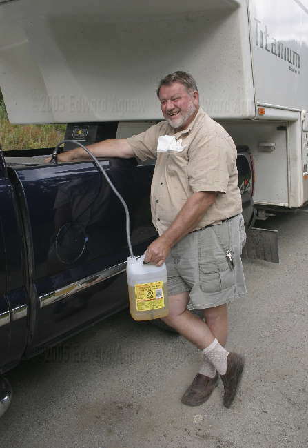
This morning when we logged onto the internet to check the status of the package and hooray...... it was in Alaska and out for delivery!!! Ed checked with the UPS store and was told that they usually got their delivery between 11:00am and 1:00pm. At noon we pulled out of the RV park (check out time) and headed to the UPS office. After waiting patiently in the parking lot for a little over an hour the package arrived. We could leave Palmer and head for Valdez. Ed did notice something funny about the truck though. Only a couple of the gear positions were lit up (3rd and 1st) but we assumed it just an issue with the display as the truck appeared to operate otherwise normally, so we would get checked out the next time we were near a GM dealer – WRONG. A little town called Sutton had a historical site regarding coal mining and we decided to stop and have a look around. Some of the buildings were from the 1960's which isn’t very historic but reminds you just how young Alaska is. Continuing on our way the scenery became more mountainous and thus the roads became more hilly with steep and winding roads. About 30 miles from Sutton as we were going down a big hill Ed told me we needed to pull over at the next pull off and to figure out what was going on with the truck. Luckily, there was a pull off at the bottom of the hill. Ed then explained to me that we no longer had a transmission ... well it turned out that we did have reverse and 1st (I figured that was better than nothing). It also turned out that the pull out was actually a wayside campground and there was room for the 2 rigs. Using reverse and 1st Ed managed to get the trailer parked ... managing to only partially park in a large mud puddle (his rubber boots came in handy!). Next it was time to figure out where to get the truck repaired and how to get it there. Cell phone service wasn’t great but if he stood on the tool box in the back of the truck he could get reception. First call was to our road side assistance plan to arrange a tow... ooops we had to figure out where it was going first. Second call was to information looking for GM dealers in Anchorage (85 miles from where we were)... they said there were no GM dealers in Anchorage (that seemed weird). A person walking through the parking lot gave us the name of the Chevrolet dealer in Wasilla (about 50 miles from where we were). A call to the Chevrolet dealer resulted in the information that their transmission expert was going on holidays next week (great) but they did reveal there was a GM dealer in Wasilla but wouldn’t tell Ed the name or phone number. Another call to information .... this time Ed got the number of GMAC (argh!!!). Another call to information resulted in a phone number for the GM dealer. The service manager at the GM dealership was fantastic. When Ed described the problem, he immediately knew what was causing it — the switch attached to the transmission had failed (this is a problem that they’ve seen a lot up here). When the switch fails the transmission’s computer doesn’t know what gear it’s it so it ceases to function. Ed and Colin fiddled with the switch and got it recognize D (drive) — Ed would be able to drive the truck to the dealer and wouldn’t need a tow. A call back to the GM dealer resulted in a 7:30am appointment. Colin was thrilled ... he would need to get up at 5:45am so he could follow Ed to the GM dealer ... I think we owe him big time!
Zaph needed some special cuddle time while we waited for the package. Splash told him you should sit on your mommy's lap when ever possible --- thanks alot Splash!
Now that's one big pooper scooper!
Now this is the pooper.
So what's this?
"The Tug Bug". It was parked at the wayside campsite.
Zaph needed some special cuddle time while we waited for the package. Splash told him you should sit on your mommy's lap when ever possible --- thanks alot Splash!
Now that's one big pooper scooper!
Now this is the pooper.
So what's this?
"The Tug Bug". It was parked at the wayside campsite.
Tuesday, August 02, 2005
Alaska is a Foreign Country According to UPS
We logged on the internet this morning to check the status of the package and found out it was delayed by a day. Ed called UPS to find out what was going on — we had paid for 2 day service. It turns out that even though the package originated in California it needed to go to Kentucky before it could be shipped to Alaska. Apparently, UPS treats Alaska as a foreign country. Margaret and I took advantage of the delay and did laundry — I know we’re sick. Zaph and Splash talked us into taking them for a swim in the lake that our campground backed onto.
Monday, August 01, 2005
Rainy Season
The sun was shining and the sky was clear this morning. After doing some chores Ed, Zaph and I headed off for some hiking and swimming (Zaph is of course the only one brave enough to swim in Alaska). The first stop was Thunderbird Falls. This was a nice 1 mile hike but the falls were somewhat disappointing. You could see the top half of the falls from the viewing platform and the bottom half from the creek trail. Next stop was Eklutna Lake. Zaph really wanted to go to this park because a picture in the Milepost book showed a golden retriever lying in the lake. Yes, Zaphie got to swim in the lake. We went for a pleasant hike in a gentle rain. We stopped at an store / fast food / rv park / cabin place for an ice cream cone. As we were the only customers we had a nice chat with the women who owned the establishment. She informed us that August is the rainy season in southern Alaska — why didn’t any of the books tell me this? She said the weather will be very mixed – a lot of clouds, a fair bit of rain and some sun.
Mushrooms on the trail to Thunderbird Falls.
More mushrooms
Eklutna Lake
Mushrooms on the trail to Thunderbird Falls.
More mushrooms
Eklutna Lake
![]()
