Monday, October 31, 2005
Happy Halloween!
Ed and I decided to go and check out the Hoover Dam today as it is only a 30 minute drive from the RV park. Apparently a lot of things have changed around the dam since 9-11: there are a lot of rules regarding the types of vehicles that can drive across the bridge (the highway goes across the bridge), there is a security check point that you have to drive through, if you decide to do the tour you have to go through a metal detector, and a lot of the tour has been removed. As this was our first visit to the dam we didn’t know what we missed on the tour till we returned to the RV park and Margaret told us what they had seen (Colin and Margaret had seen the dam on a previous trip).
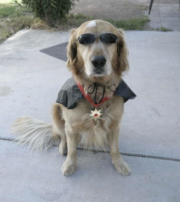
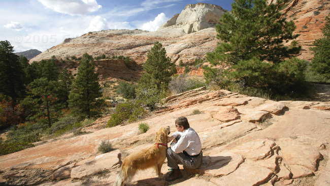
What a cool looking dracula dog

We always thought she was a princess --- now we know for sure.
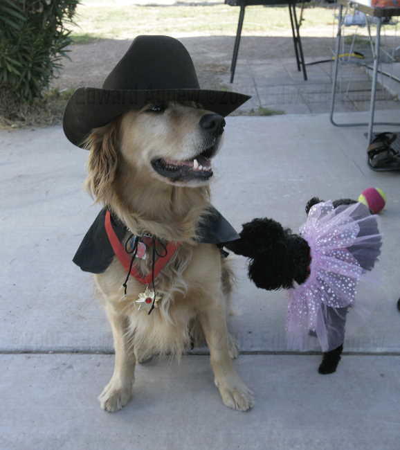
Cowboy dracula meets princess .... now that could be an interesting movie.
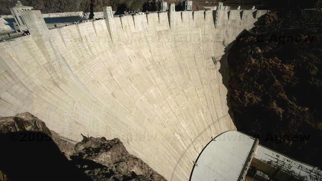
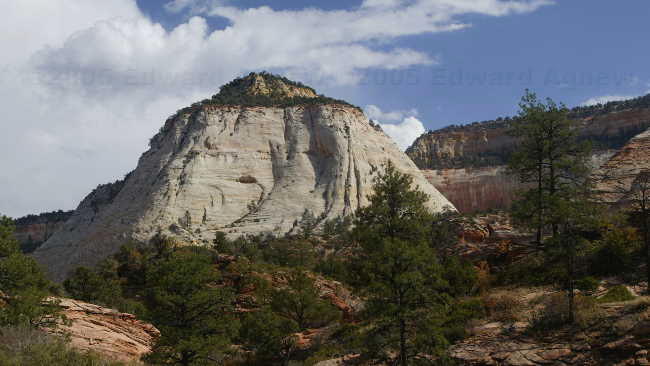
The Hoover Dam
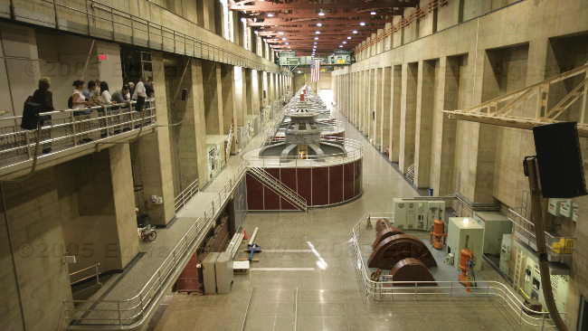
The generaters on the Nevada side of the dam.

Yes, the towers are on a angle.
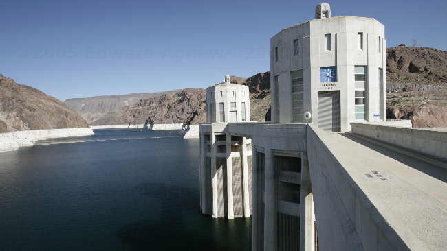
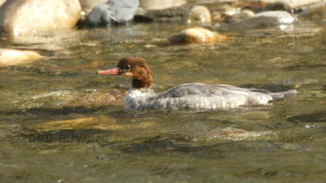
The intake towers and Mead Lake
What a cool looking dracula dog
We always thought she was a princess --- now we know for sure.
Cowboy dracula meets princess .... now that could be an interesting movie.
The Hoover Dam
The generaters on the Nevada side of the dam.
Yes, the towers are on a angle.
The intake towers and Mead Lake
Sunday, October 30, 2005
Ed Gambles
October 28 to October 30
We spent a couple of days doing regular life stuff and Ed has started sorting through the more than 9,000 photos he took for the video slide show he wants to make. We decided it was time to see the “strip”, so Colin, Margaret, Ed and I drove to Freemont Street – the “old strip”. We wandered through the casinos, played a few slot machines, bought a couple of 99 cent margaritas and watched the show on the street. As far as gambling goes Margaret is the “wild” one, she brought a bag of nickels and lost them all — must have been 3 or 4 dollars. Colin is next as he also had a stash of nickels that he lost — he got smart with his dimes and spent them on Margaritas! Ed lived on the edge — he gambled 2 dimes he had plus 2 nickels I gave him. I lost $2. The casinos aren’t going to make much off of us!!! The light show was great — there is a screen made of thousands of light bulbs over Freemont Street and they show a 10 minute video every hour during the evening. On the way back to the trailer we drove down the “new” strip — it looked just like it does on TV. — we’ll have to go back and have a good look around, maybe even gamble.
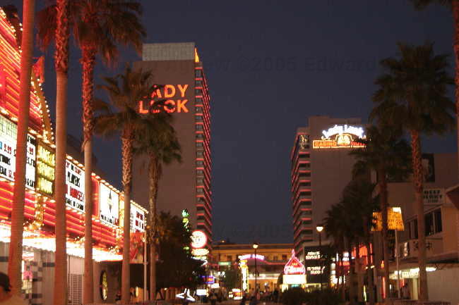
A view on the "old strip"
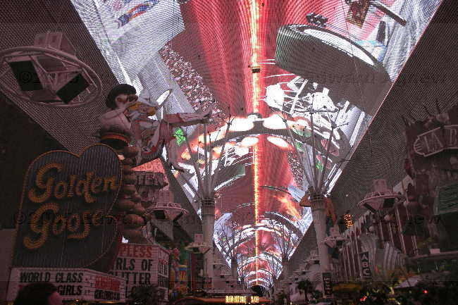
The lightshow on Freemont Street
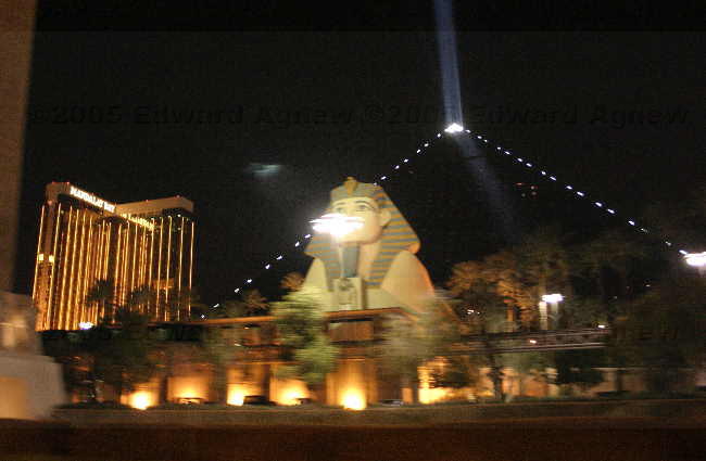
The Luxor Casino
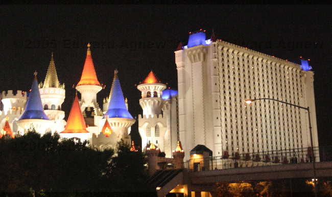
Excalibur casino
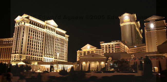
Ceasars Palice
We spent a couple of days doing regular life stuff and Ed has started sorting through the more than 9,000 photos he took for the video slide show he wants to make. We decided it was time to see the “strip”, so Colin, Margaret, Ed and I drove to Freemont Street – the “old strip”. We wandered through the casinos, played a few slot machines, bought a couple of 99 cent margaritas and watched the show on the street. As far as gambling goes Margaret is the “wild” one, she brought a bag of nickels and lost them all — must have been 3 or 4 dollars. Colin is next as he also had a stash of nickels that he lost — he got smart with his dimes and spent them on Margaritas! Ed lived on the edge — he gambled 2 dimes he had plus 2 nickels I gave him. I lost $2. The casinos aren’t going to make much off of us!!! The light show was great — there is a screen made of thousands of light bulbs over Freemont Street and they show a 10 minute video every hour during the evening. On the way back to the trailer we drove down the “new” strip — it looked just like it does on TV. — we’ll have to go back and have a good look around, maybe even gamble.
A view on the "old strip"
The lightshow on Freemont Street
The Luxor Casino
Excalibur casino
Ceasars Palice
Thursday, October 27, 2005
It’s Official — We’re Retired
Ed said that until we stayed somewhere for a month we were on vacation (we had a very nice 5 month vacation). Well we’re booked in for a month so we are now considering ourselves retired. I think this means we don’t have to run around and see and do everything but can actually relax.
Today went much better than yesterday. The power was turned on at the monthly site just before noon so we moved in without any hassles. Later we went out and ran a couple of errands, came back and made dinner, then went and had a soak in the hot tub. I think I’ll be able to handle retirement.
Today went much better than yesterday. The power was turned on at the monthly site just before noon so we moved in without any hassles. Later we went out and ran a couple of errands, came back and made dinner, then went and had a soak in the hot tub. I think I’ll be able to handle retirement.
Wednesday, October 26, 2005
Viva Las Vegas
Good-bye Springdale, Utah...... Hello Las Vegas, Nevada. The drive to Vegas was uneventful but we did pass through some nice mountains and canyons and a bit of desert. As soon as you cross the border into Nevada there is a little cluster of casinos but it doesn’t take long till you are driving through desert again. Our plan was to find a Wal-Mart, drop the trailers, drive around to RV parks checking them out, then pick one and move in. As we are staying in Vegas for a month we wanted something nice and not too expensive. As there are over 12 Wal-Marts in Vegas we picked one at the south end of the city as a lot of the RV parks were in the south. As soon as we arrived we headed to a fast food restaurant to grab a bite to eat, after that Margaret, the dogs and I found a nice shady piece of curb and sat with the telephone and the campground directory while the guys unhitched the trailers. Ooooops the emergency brake wire for the trailers was pulled .... some smart ass must have decided to have a little fun — good thing we caught it before we drove off with the trailers. Margaret and I didn’t have a lot of luck finding trailer parks with vacancies for a month long stay .... out of about 20 parks we found 3 (one of them a little further away than we wanted to be) with availability. We hitched the trailers back up and headed to the RV park with the hot tub. Just as we were given the paper work to fill in, another woman in the office said “we’re not accepting dogs right now”. Now that stopped us in our tracks!!! Luckily, the manager was in the office and after giving us the lecture on how dogs and their owners are to behave and saying “I can kick you out as easily as I’m letting you stay”, he said we could stay. It’s pretty standard that electricity is extra with monthly sites so we weren’t surprised with that but we were surprised when they said we needed to make arrangements directly with Nevada Power. We also had to get a spot for one night as we weren’t allowed on the monthly site till the electricity was hooked up. Of course Nevada Power wouldn’t accept us over the telephone as we are Canadian without US social security numbers, so we had to drive down to their office — which was in downtown Vegas. Now that was a fun half hour driving through “rush hour” traffic. We watched as a car ran a stop sign in front of Colin and then the guy honked his horn at Colin. I’m certainly not looking forward to driving here. When Ed finally got to the counter it was very simple signing up for power .... didn’t even need to give a deposit.
We decided that we needed to go out for dinner and there were a couple of casinos just down the road from us ..... there’s a casino just down the road from everything in Vegas. We picked one and went in to check their buffet out — $6.99 and it looked good. The waitress informed us that if you signed up for the players club you would get a coupon that gave you one free dinner when you purchased second dinner. That peeked Colin and Ed’s interested, so guess who are members of the players club now! First night at a casino and we didn’t even gamble a quarter!
We decided that we needed to go out for dinner and there were a couple of casinos just down the road from us ..... there’s a casino just down the road from everything in Vegas. We picked one and went in to check their buffet out — $6.99 and it looked good. The waitress informed us that if you signed up for the players club you would get a coupon that gave you one free dinner when you purchased second dinner. That peeked Colin and Ed’s interested, so guess who are members of the players club now! First night at a casino and we didn’t even gamble a quarter!
Tuesday, October 25, 2005
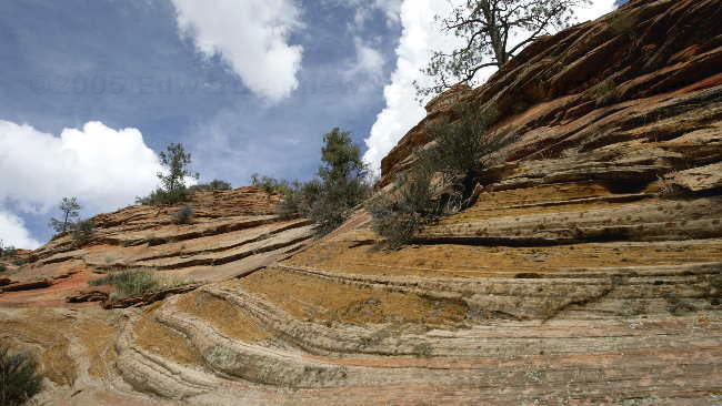
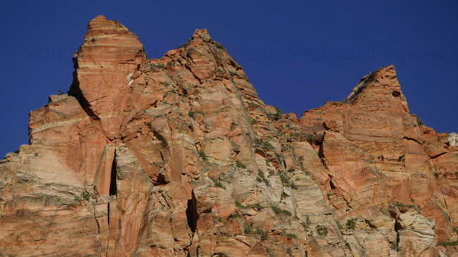
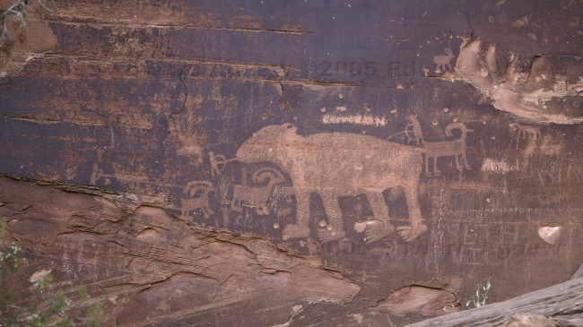
Interesting Rocks
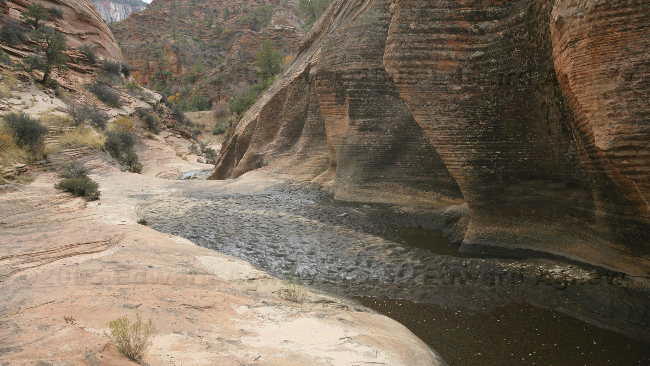
When we drove into the park with the trailer, and experienced the tunnel we passed some beautiful scenery and some different looking rock structures. Pulling the trailers, we were unable to stop (the pulls offs were too small). Today we would retrace our steps and have a good look at the rocks. We hiked one trail which gave you the view of the canyon outside of the tunnel — now I know why they went through the mountain instead of around it.
Back at the RV park, Ed took Zaph for a walk. A group of parents and kids from Indiana had arrived — Zaph happily joined the group of kids for pets and a walk down to the river. Guess who went in!
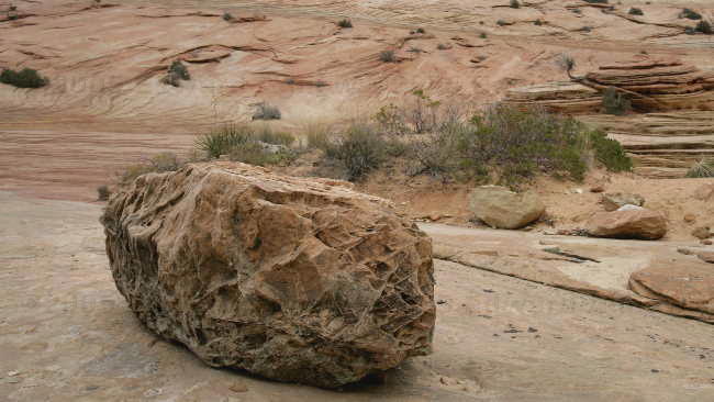
Now that's a neat rock.
Another neat rock.
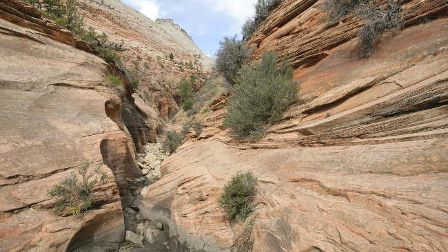
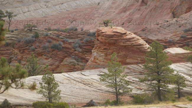
One of the many interesting canyons along the road.
The view walking into one of the canyons.
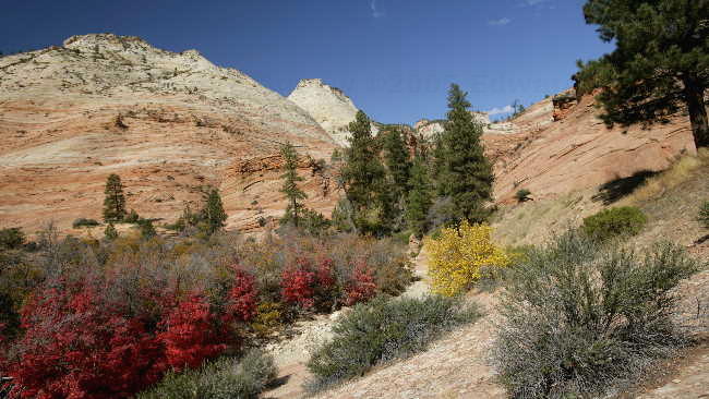
Even though it was warm the leaves were still changing colour.
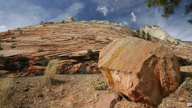
Another interesting rock --- they were all different.
Zaph and Frances enjoying the view.
One of the many intersting mountains.
The rock structures were facinating --- at least to us.
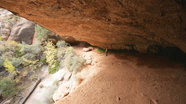
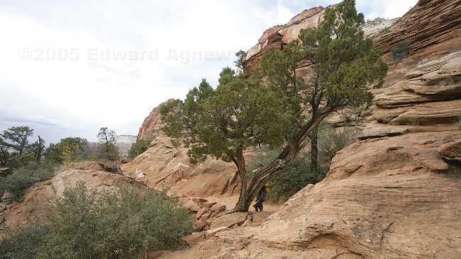
The trail went under a huge overhang --- that's Frances standing under the rock.
The trees were very gnarley.

A view of the canyon. If you look closely you can see the road windy down the mountain.
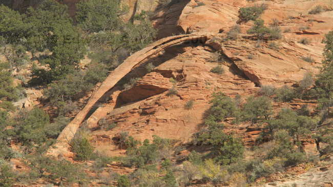
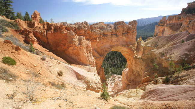
The "Crawford Arch" though it really is a natural bridge. We saw a fabulous photo from the 1930's that should a man walking on it.
Back at the RV park, Ed took Zaph for a walk. A group of parents and kids from Indiana had arrived — Zaph happily joined the group of kids for pets and a walk down to the river. Guess who went in!
Now that's a neat rock.
Another neat rock.
One of the many interesting canyons along the road.
The view walking into one of the canyons.
Even though it was warm the leaves were still changing colour.
Another interesting rock --- they were all different.
Zaph and Frances enjoying the view.
One of the many intersting mountains.
The rock structures were facinating --- at least to us.
The trail went under a huge overhang --- that's Frances standing under the rock.
The trees were very gnarley.
A view of the canyon. If you look closely you can see the road windy down the mountain.
The "Crawford Arch" though it really is a natural bridge. We saw a fabulous photo from the 1930's that should a man walking on it.
Monday, October 24, 2005
Shuttle Buses
Zion is reputed to be the busiest National Park in Utah and thus was forced to find ways to accommodate all the visitors with only 450 parking spots inside the park. Shuttle buses was their answer and I think they did a good job with it. There is a shuttle bus that runs back and forth along the main road in Springdale that drops you off just outside the park gate — a 2 minute walk through the entrance gate to the information centre. Here you pick up the shuttle bus that takes you up the canyon stopping at a number of scenic spots. You can get off at any stop, go for a hike and get back on any bus. There is a shuttle bus every 7 minutes you never have to wait long.
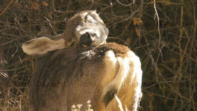
At Bryce Canyon you were on top of the plateau looking down into the canyon, at Zion you are on the canyon floor looking up. There are a lot of hiking opportunities here but as we only planned to stay 2 days we stuck to the short trails. The animals are pretty use to people — we saw a buck, a doe and 2 fawns. They were quite happy to go about their business not far from the path. A squirrel almost ran over Ed’s foot.
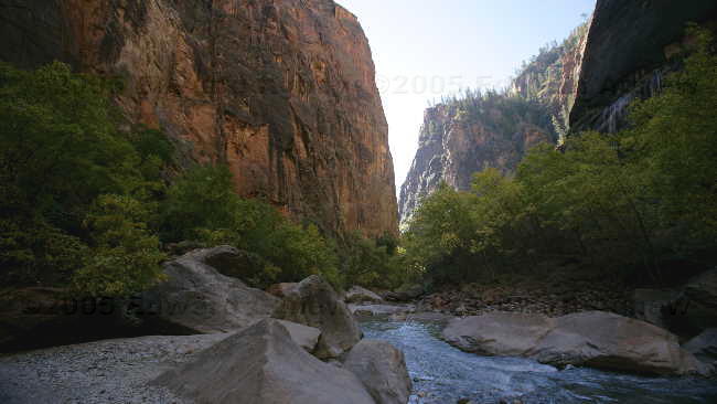
Zion does have one trail that you can walk dogs on — it’s not in the main canyon but does follow the Virgin River and the highway that goes across the park. Zaph needed a walk anyway so we decided to do this trail — a nice 4 mile walk (including the ½ mile to and from the campground). I was pretty beat by the time I finished this trail — it would have been easier on me if Zaph could have hiked with us during the day.
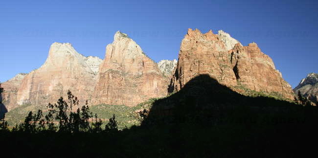
The three patriarchs --- Abraham, Issac and Jacob
Another inch and I'll reach the itch.
Hmmm, I wonder if this is a miniature dinasour.
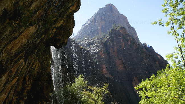
The weeping rock.
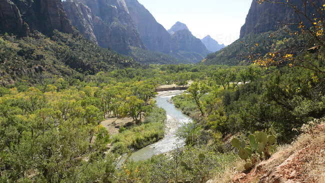
A view of the Virgin River.
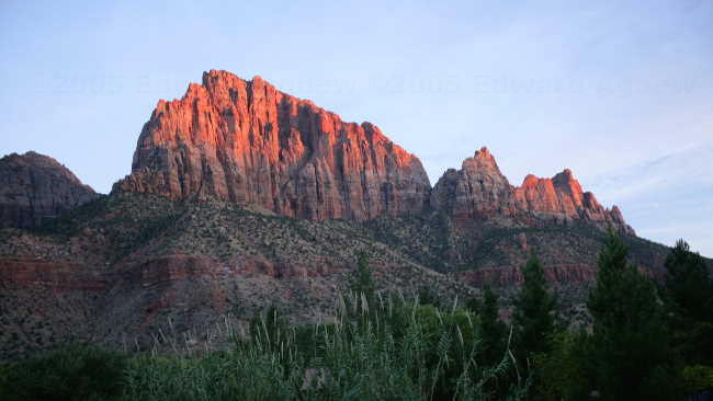
Sunset view of the cliff.
Pretty rocks.
Another view in the park.
At Bryce Canyon you were on top of the plateau looking down into the canyon, at Zion you are on the canyon floor looking up. There are a lot of hiking opportunities here but as we only planned to stay 2 days we stuck to the short trails. The animals are pretty use to people — we saw a buck, a doe and 2 fawns. They were quite happy to go about their business not far from the path. A squirrel almost ran over Ed’s foot.
Zion does have one trail that you can walk dogs on — it’s not in the main canyon but does follow the Virgin River and the highway that goes across the park. Zaph needed a walk anyway so we decided to do this trail — a nice 4 mile walk (including the ½ mile to and from the campground). I was pretty beat by the time I finished this trail — it would have been easier on me if Zaph could have hiked with us during the day.
The three patriarchs --- Abraham, Issac and Jacob
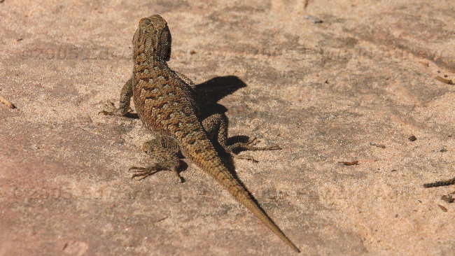
Another inch and I'll reach the itch.
Hmmm, I wonder if this is a miniature dinasour.
The weeping rock.
A view of the Virgin River.
Sunset view of the cliff.
Pretty rocks.
Another view in the park.
Sunday, October 23, 2005
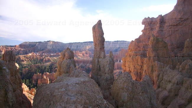
Navajo Loop
Last night we spoke with Colin and Margaret and all four of us wanted to hike down into the canyon so we decided to get up early and hike before we packed up the trailers ready to head to Zion (it’s only 85 miles). The hike was incredible even though it was fairly short — 1 ½ miles. The first third of the hike was a steep downhill, the middle third was flattish and the final third was a steep uphill. Walking among the hoodoos made you feel very small and somewhat claustrophobic. There were trees growing along side the hoodoos that were very tall and only had branches and leaves at the very top. The more open valley on the middle part of the trail had a number of trees and plants. .
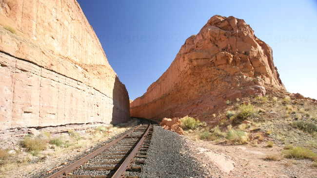
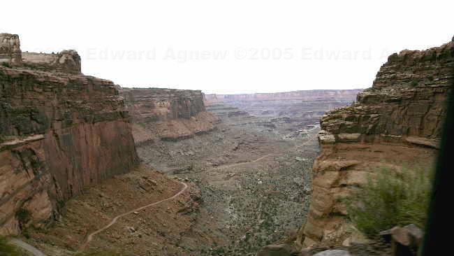
The drive to Zion was pleasant with a lot of downhill — good fuel economy. The “interesting” part of the drive was the mile long tunnel followed by several hairpin turns. The tunnel through the mountain was built in the 1930's when vehicles were smaller. Large vehicles (all RVs) needed to have an escort through the tunnel at a cost of $15 (the alternative route would cost more than $15 in fuel). We didn’t actually get an “escort” — there are two park rangers, one at each end of the tunnel and they stop traffic so large vehicles can drive down the middle of the tunnel. The tunnel itself is pretty amazing and there are several large openings that give you views of the canyon but of course you can’t stop to enjoy the view.
On the edge of the park is the town of Springdale (tiny but cute) where we found a campground.
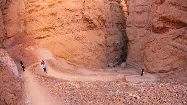
Walking down the Navajo trail -- Can you find Margaret and Frances?
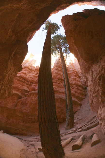
The tall trees in the canyon.
Looking up from the bottom of the canyon.
the "twin" bridges
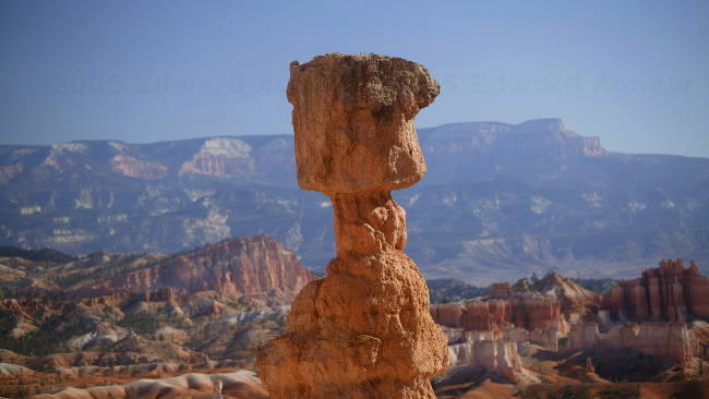
Thors Hammer.
The drive to Zion was pleasant with a lot of downhill — good fuel economy. The “interesting” part of the drive was the mile long tunnel followed by several hairpin turns. The tunnel through the mountain was built in the 1930's when vehicles were smaller. Large vehicles (all RVs) needed to have an escort through the tunnel at a cost of $15 (the alternative route would cost more than $15 in fuel). We didn’t actually get an “escort” — there are two park rangers, one at each end of the tunnel and they stop traffic so large vehicles can drive down the middle of the tunnel. The tunnel itself is pretty amazing and there are several large openings that give you views of the canyon but of course you can’t stop to enjoy the view.
On the edge of the park is the town of Springdale (tiny but cute) where we found a campground.
Walking down the Navajo trail -- Can you find Margaret and Frances?
The tall trees in the canyon.
Looking up from the bottom of the canyon.
the "twin" bridges
Thors Hammer.
Saturday, October 22, 2005
Bryce Canyon
The directions on the map they give you when you enter Bryce Canyon tell you to drive the 18 miles to the end of the road and stop at the outlooks on the way back. The suggestion was good in that you only had to make right hand turns but bad because some of the really neat stuff was closer to the front of the park. We saw a couple of mule deer on the trail as we walked to between two view points — very cute. Chipmunks, squirrels and grouse were also plentiful in the park and not afraid of people. The views from Bryce Point, Inspiration Point and Sunset Point were absolutely incredible — hopefully the pictures will be nearly as good as the real thing. There were some trails that led down into the canyon allowing you to walk around the hoodoos but due to lack of time we were unable to do that. Ed did manage to walk between a couple of the view points on the rim trail — Zaph and I drove between the lookouts.
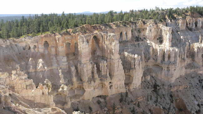
The grottos at Bryce Canyon
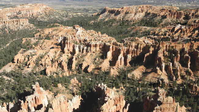
Bryce Canyon's Amphitheater
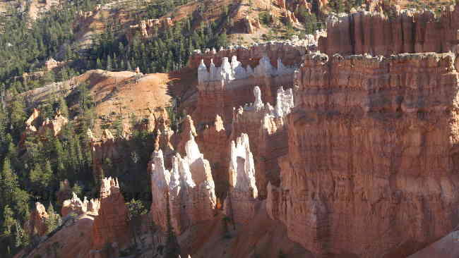
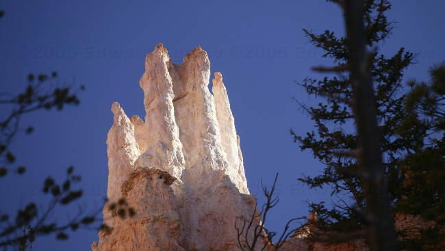
Hoodoos
More Hoodoos
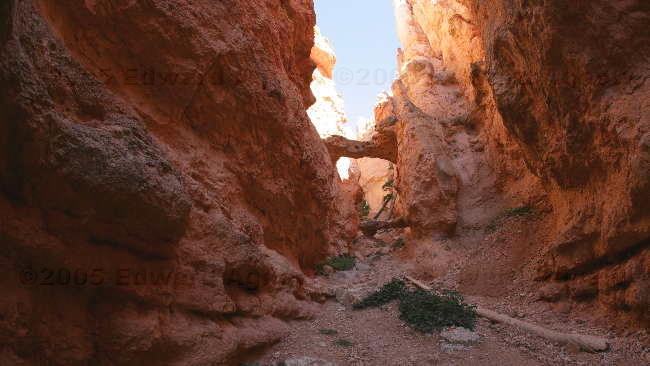
"Natural Bridge" although it is not a bridge but an arch
The grottos at Bryce Canyon
Bryce Canyon's Amphitheater
Hoodoos
More Hoodoos
"Natural Bridge" although it is not a bridge but an arch
Friday, October 21, 2005
Moving On
We probably could have stayed a month at Moab but it was time to move on to Bryce Canyon. The drive was very interesting — we drove through Capitol Reef National Park and stopped to see the petroglyphs, over “ridge back” a piece of the highway where the land is only twice as wide as the highway, up high onto a plateau that was at 9,587 feet, down into valleys where hundreds of cattle roamed and past canyons, buttes and domes. The destination for the night was Ruby’s Campground just outside of Bryce Canyon National Park — location and hot tub made it the obvious choice. There is a stretch of a hotel, motel, rodeo park, general store, gift stores, gas stations, restaurants and campground and it’s all owned by the same family — a bit of a monopoly. Everything was well maintained but of course a bit pricey. The one thing that was a bit disturbing was the sign that read “unhook your water at night due to freezing temperatures”. Luckily the lowest temperature it went to while we were there was 33F, the fellow at the counter said it was 28F the night before we came.
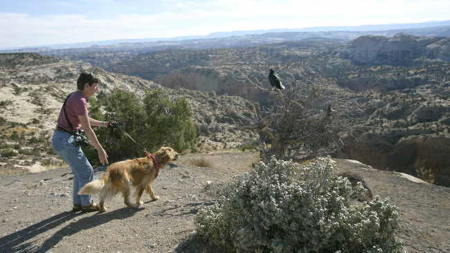
Zaph meets the Ravin
Zaph meets the Ravin
Thursday, October 20, 2005
Dinosaurs Were Here
When we checked in we were told that we could stay 4 nights but would have to move on the forth day to an water/electric site as all of the full service sites were booked. So first thing this morning Ed and I packed up the trailer for the 200 foot move. Unfortunately, the site we were moving to was still occupied (Colin and Margaret were luckier, the people who were in their new site vacated by 8am). As we didn’t want to hang around all morning waiting for the people to leave — check out wasn’t till noon, we decided to move the trailer to a large field and move into the site later in the day. Luckily our plans for the day would let us come back to the park early in the afternoon.
When Ed and Colin checked into the RV park they asked the woman what there was to see in the area. After listing the national and state parks the woman mentioned some “nice drives” and the a spot where you could see dinosaur foot prints. As we had spent the last two days in national and state parks, we decided that it was time to see some of the other sites. The drive to the dinosaur foot prints was nice — we saw a several “castles”, a number of canyons, a small town and several farms. The drive climbed up to a plateau and we stopped when the road turned to gravel. After wandering around for a few minutes we found them — large three toed prints in the rocks and as it had rained a couple of nights before there was water in them that made them easier to see. We continued the drive climbing higher up the plateau and eventually ended up back in Moab.
As it was after 1pm we headed back to the trailer park and moved the trailer into the new site (yeah it was vacant!). Next item on the clipboard of fun was Potash Road and the Indian Petroglyphs on the rocks. This road has the Colorado River on one side and sheer cliff on the other side. Along the sheer cliff there were a number of pull offs and in each pull off was at least one group of climbers — these cliffs seemed very popular with the climbing crowd. Anyway amongst the rock climbers were two areas where there was Indian Writing, pictures carved into the rocks — very neat. At another spot along the road we stopped to view some more dinosaur foot prints. These ones you viewed through a “pipe” mounted on the side of the road (the piped just made sure you looked in the correct spot on the cliff). A little further down the road was a trail to a couple of arches. As we were not in a national park Zaph was able to do the hike with us. Zaph and I didn’t make it all the way to the arches though — I’m going to have to teach him how to climb rock walls with carved foot holds and ladders! We were able to see Bow Tie Arch and Corona Arch from a distance but Ed was able to walk up to the arches (he can climb rock walls with foot holds and ladders better than Zaph).
The day had been clear and sunny and I had told Ed if we had a clear evening I would hike into Delicate Arch (in Arches National Park) with him to view it at sunset (it was a 3 mile round trip). The parking lot was full but we grabbed a spot when someone left — I guess a lot of people had the same idea. The hike was mostly up hill (at least going back would be easy) with the last part of the trail following the edge of the hill as you climbed to the top. There it was — Delicate Arch and about two hundred people sitting and milling about waiting for the sun to set. The rock turned a warm golden colour as the sun set — nice but not spectacular.
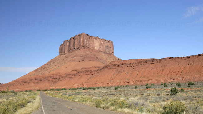
Castle Rock
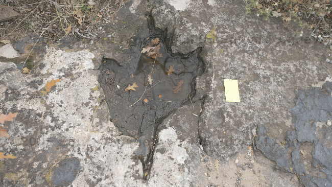
A Dinosaur foot print a standard business card is to the right for size comparison (about 22" overall length)
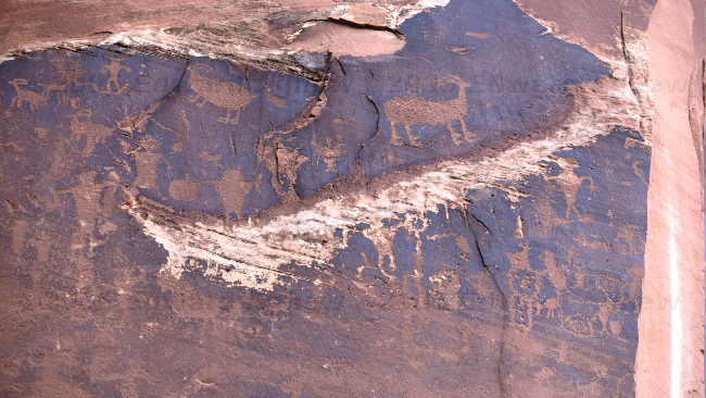
Petroglyphs along potash road
More petroglyphs
The Corona arch
The bowtie arch
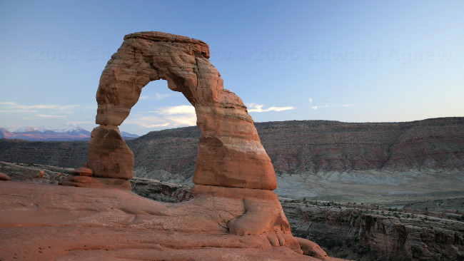
The delicate arch at sunset
On the way to the Corona arch we passed over this railroad track, would not like to meet a train in there
When Ed and Colin checked into the RV park they asked the woman what there was to see in the area. After listing the national and state parks the woman mentioned some “nice drives” and the a spot where you could see dinosaur foot prints. As we had spent the last two days in national and state parks, we decided that it was time to see some of the other sites. The drive to the dinosaur foot prints was nice — we saw a several “castles”, a number of canyons, a small town and several farms. The drive climbed up to a plateau and we stopped when the road turned to gravel. After wandering around for a few minutes we found them — large three toed prints in the rocks and as it had rained a couple of nights before there was water in them that made them easier to see. We continued the drive climbing higher up the plateau and eventually ended up back in Moab.
As it was after 1pm we headed back to the trailer park and moved the trailer into the new site (yeah it was vacant!). Next item on the clipboard of fun was Potash Road and the Indian Petroglyphs on the rocks. This road has the Colorado River on one side and sheer cliff on the other side. Along the sheer cliff there were a number of pull offs and in each pull off was at least one group of climbers — these cliffs seemed very popular with the climbing crowd. Anyway amongst the rock climbers were two areas where there was Indian Writing, pictures carved into the rocks — very neat. At another spot along the road we stopped to view some more dinosaur foot prints. These ones you viewed through a “pipe” mounted on the side of the road (the piped just made sure you looked in the correct spot on the cliff). A little further down the road was a trail to a couple of arches. As we were not in a national park Zaph was able to do the hike with us. Zaph and I didn’t make it all the way to the arches though — I’m going to have to teach him how to climb rock walls with carved foot holds and ladders! We were able to see Bow Tie Arch and Corona Arch from a distance but Ed was able to walk up to the arches (he can climb rock walls with foot holds and ladders better than Zaph).
The day had been clear and sunny and I had told Ed if we had a clear evening I would hike into Delicate Arch (in Arches National Park) with him to view it at sunset (it was a 3 mile round trip). The parking lot was full but we grabbed a spot when someone left — I guess a lot of people had the same idea. The hike was mostly up hill (at least going back would be easy) with the last part of the trail following the edge of the hill as you climbed to the top. There it was — Delicate Arch and about two hundred people sitting and milling about waiting for the sun to set. The rock turned a warm golden colour as the sun set — nice but not spectacular.
Castle Rock
A Dinosaur foot print a standard business card is to the right for size comparison (about 22" overall length)
Petroglyphs along potash road
More petroglyphs
The Corona arch
The bowtie arch
The delicate arch at sunset
On the way to the Corona arch we passed over this railroad track, would not like to meet a train in there
Wednesday, October 19, 2005
More Canyons, More Arches
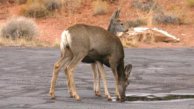
When we were at the Utah information centre the gentleman there told us to make sure that we didn’t miss Dead Horse Point State Park. According to cowboy legend Dead Horse Point received its name when some cowboys corralled wild horses on the point, took the horses they wanted and left the remaining horses to die of thirst. The point is more than a 1,000 feet above the Colorado River, there is no way down and no water. More recently the park is famous for being the location of the final scene in “Thelma and Louise”. The park is relatively small but has some great views — Zaph liked it as he was allowed to walk on the trails. We also saw a couple of mule deer on the side of the road drinking water that had collected in a pothole.
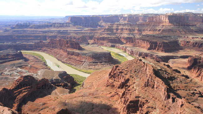
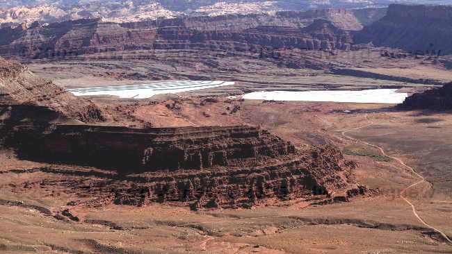
Down the road from the state park is the much larger Canyonland National Park. This park is divided into 3 sections and we visited the one called Island in the Sky. The “island” is joined to the rest of the land by a narrow “neck” of land. The views of the canyons are beautiful, you can see the Colorado River and from one point the Green River. The most interesting spot in the park was a place called Upheaval Dome — white / grey rocks were pushed up from underneath forming a dome (the top of the dome has eroded into a bit of bowl) — a real contrast to the red walls around it.
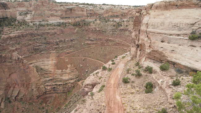
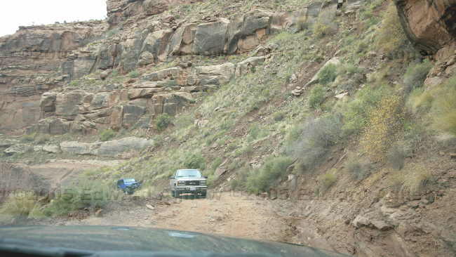
The map showed an alternate route back to Moab and after checking with a ranger and learning that they recommended a four wheel vehicle with high ground clearance (our truck is four wheel drive with reasonably high clearance) we decided to take it. The first section of “the road” involved driving down from the high plateau. The road was very narrow, had sharp hairpin turns, was extremely steep and had a surface composed of broken rocks, some bits of gravel and sand as well as some deep ruts and washouts. Of course there were 2 vehicles coming up the hill while we were going down — we saw them a couple of hairpin turns ahead so we stopped when we reached one of the few wider section of road and let them pass. Driving in the bottom of the canyon was breathtaking. It’s one thing to look down into the canyon but it’s a totally different feeling to look up at the walls and rocks. At one point we looked across the valley and saw a Hummer sitting on the plateau overlooking the Colorado River — it reminded me of a TV commercial.
the Canyon below dead horse point
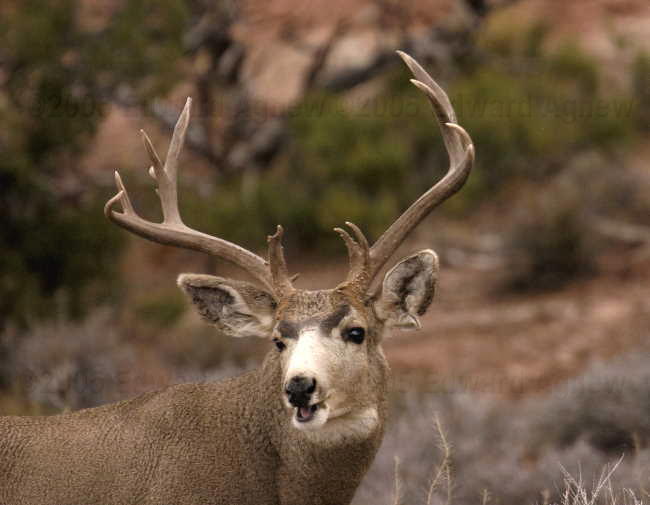
A mule deer buck alone a park road side
The famous two headed mule deer
A view down into the canyon and a very interesting road
Same road, going across bottom of canyon and to the potash salt drying lakes in the distance
That road again
No one said this was going to be an easy road to drive on, let alone meeting anyone
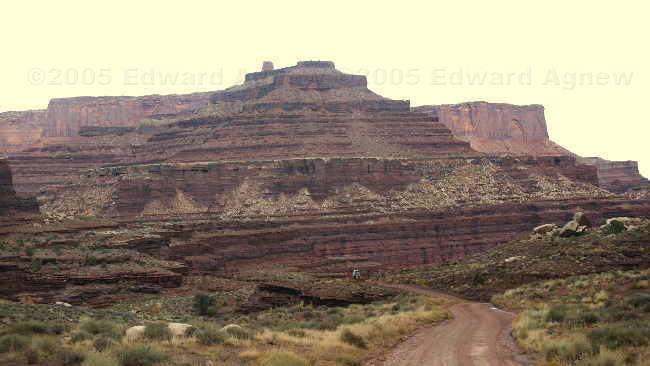
Part way down, the view is great
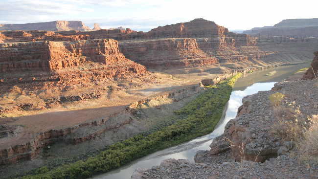
At the bottom, and the river
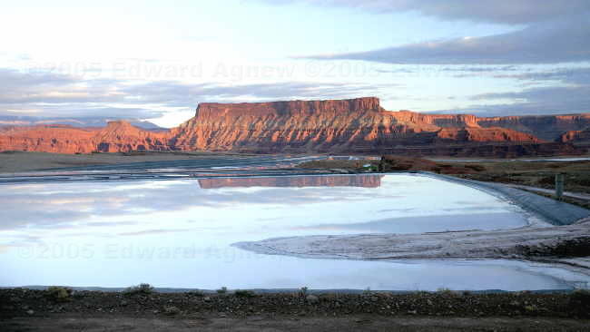
The Potash salt drying lake at the bottom of the canyon makes a nice reflecting pond
Down the road from the state park is the much larger Canyonland National Park. This park is divided into 3 sections and we visited the one called Island in the Sky. The “island” is joined to the rest of the land by a narrow “neck” of land. The views of the canyons are beautiful, you can see the Colorado River and from one point the Green River. The most interesting spot in the park was a place called Upheaval Dome — white / grey rocks were pushed up from underneath forming a dome (the top of the dome has eroded into a bit of bowl) — a real contrast to the red walls around it.
The map showed an alternate route back to Moab and after checking with a ranger and learning that they recommended a four wheel vehicle with high ground clearance (our truck is four wheel drive with reasonably high clearance) we decided to take it. The first section of “the road” involved driving down from the high plateau. The road was very narrow, had sharp hairpin turns, was extremely steep and had a surface composed of broken rocks, some bits of gravel and sand as well as some deep ruts and washouts. Of course there were 2 vehicles coming up the hill while we were going down — we saw them a couple of hairpin turns ahead so we stopped when we reached one of the few wider section of road and let them pass. Driving in the bottom of the canyon was breathtaking. It’s one thing to look down into the canyon but it’s a totally different feeling to look up at the walls and rocks. At one point we looked across the valley and saw a Hummer sitting on the plateau overlooking the Colorado River — it reminded me of a TV commercial.
the Canyon below dead horse point
A mule deer buck alone a park road side
The famous two headed mule deer
A view down into the canyon and a very interesting road
Same road, going across bottom of canyon and to the potash salt drying lakes in the distance
That road again
No one said this was going to be an easy road to drive on, let alone meeting anyone
Part way down, the view is great
At the bottom, and the river
The Potash salt drying lake at the bottom of the canyon makes a nice reflecting pond
Tuesday, October 18, 2005
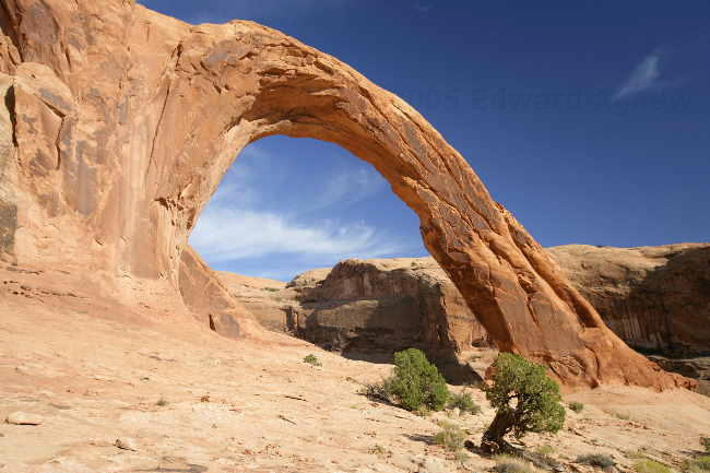
Arches, Arches Every Where
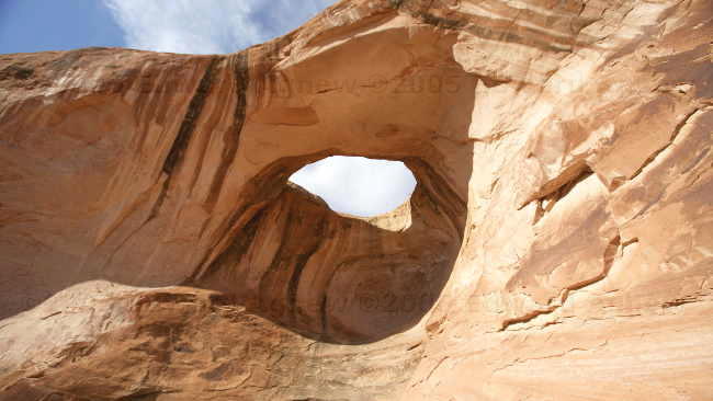
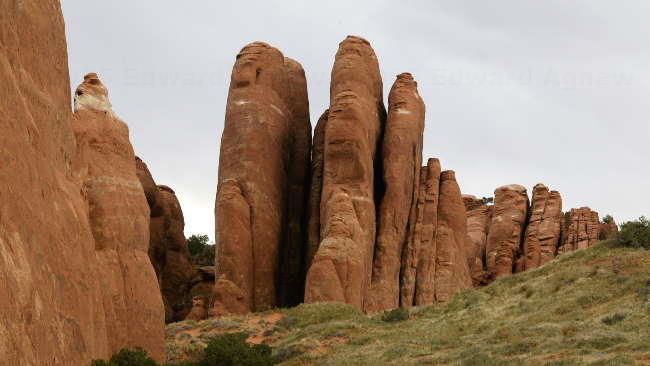
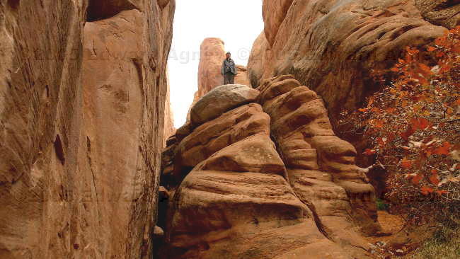
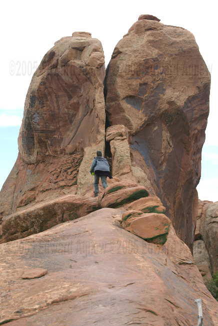
Arches National Park is one of the many parks in the area and we decided to spend the day there. Unfortunately, Zaph could only enjoy the drive as dogs are not allowed on the trails in National Parks — obviously the person who made the rule was not a dog lover. There are several roads that go through the park as well as many hiking trails (between a .3 of a mile to about 7 miles round trip). We saw Balanced Rock, the petrified dunes, many different types of towers, the Fiery Furnace, lots of interesting arches and some incredible scenery. We hiked most of Devil’s Garden, this trail winds among tall fins to “Landscape Arch” (the largest arch in the park) then continues across or on top of sandstone fins. I couldn’t believe that the views just got better and better.
note: I got a bit carried away on the photos.. sorry but there was so many
our trailer park
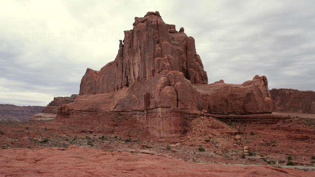
Arches NP
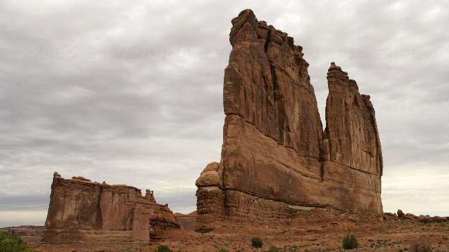
more of arches NP
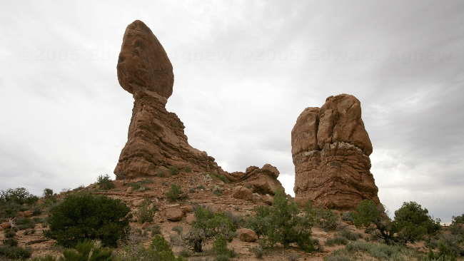
Balanced Rock at Arches NP
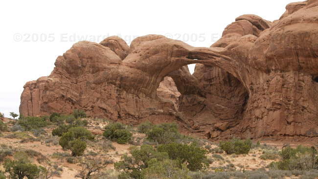
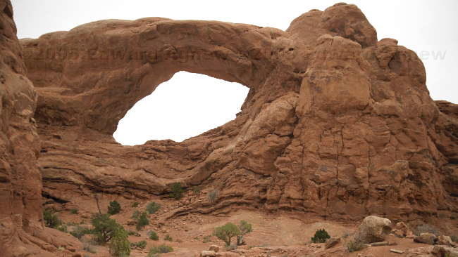
The Double Arch at Arches NP
Frances climbing the rocks in the Double Arch
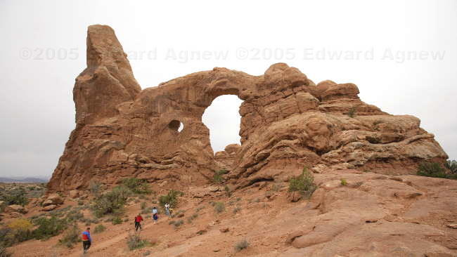
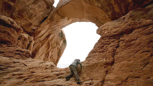
The Turret Arch at Arches NP
The Skyline Arch
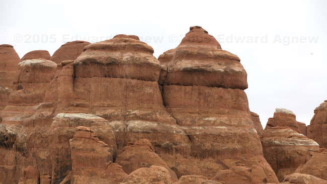
close up view of tops of the rock formations at the Fiery Furnace
Fins near Skyline arch
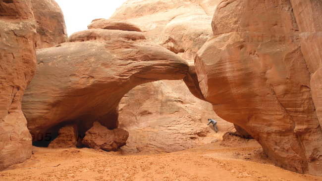
The Sand Dune Arch
Near Sand Dune Arch
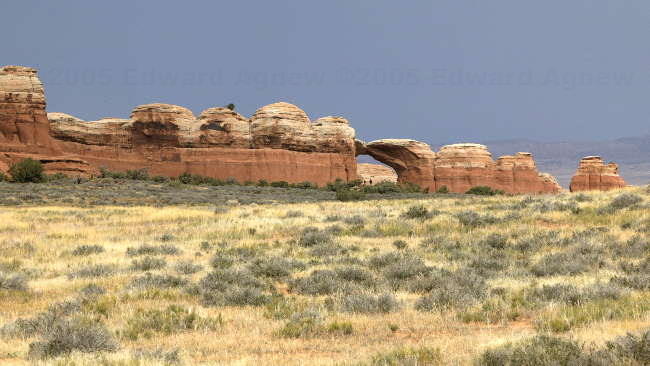
The Broken Arch from a distance
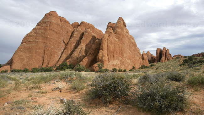
More fins
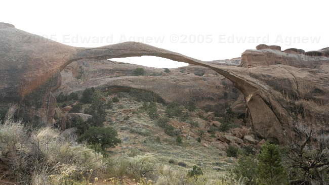
The largest of the arches, the Landscape Arch drops a large section of rock in 1991, resulting in the NPS closing the trail under the arch to hikers
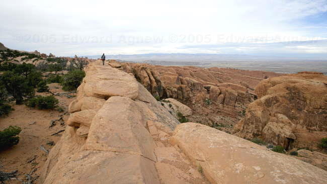
Walking along the top of fin with a very deep canyon to the right

The Double O Arch
Scaling the slick rock
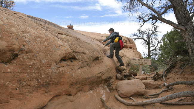
No one said this was an easy hike

a view of the valley from the Partition Arch
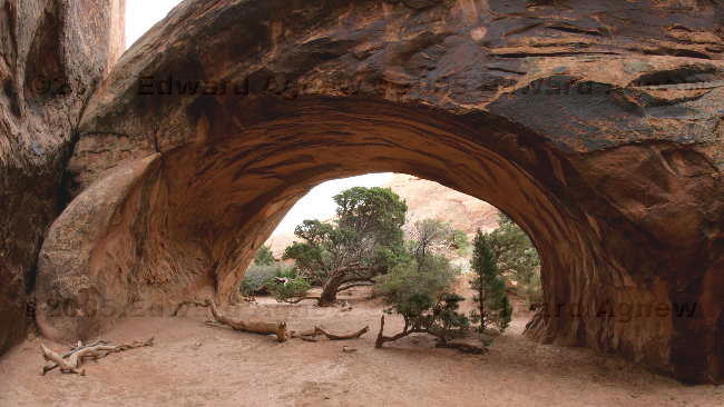
the final one of the day... The Navajo Arch
note: I got a bit carried away on the photos.. sorry but there was so many
our trailer park
Arches NP
more of arches NP
Balanced Rock at Arches NP
The Double Arch at Arches NP
Frances climbing the rocks in the Double Arch
The Turret Arch at Arches NP
The Skyline Arch
close up view of tops of the rock formations at the Fiery Furnace
Fins near Skyline arch
The Sand Dune Arch
Near Sand Dune Arch
The Broken Arch from a distance
More fins
The largest of the arches, the Landscape Arch drops a large section of rock in 1991, resulting in the NPS closing the trail under the arch to hikers
Walking along the top of fin with a very deep canyon to the right
The Double O Arch
Scaling the slick rock
No one said this was an easy hike
a view of the valley from the Partition Arch
the final one of the day... The Navajo Arch
Monday, October 17, 2005
Canyons, Canyons Every Where
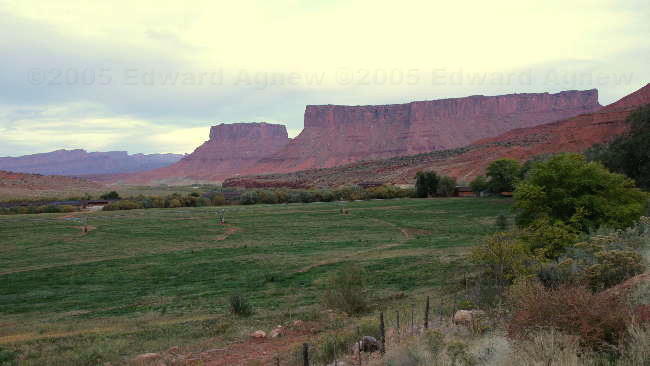
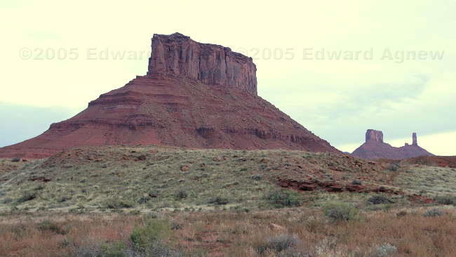
Our destination today is the town of Moab in the south eastern corner of Utah. This area is famous for it’s canyons and rock formations most of which can be found in several national and state parks or just along side the road. The drive from Springville UT, was pretty amazing as we went through a mountainous section that was right out of the old westerns — I kept looking up at the ridges waiting for the gang of “bad guys” to appear. One place we stopped was the location of a daring payroll robbery by Butch Cassidy and the Sundance Kid on April 21, 1897 – they got $8,000 in gold and silver.
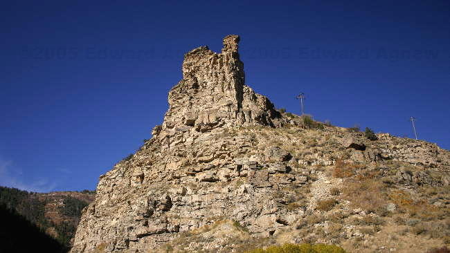
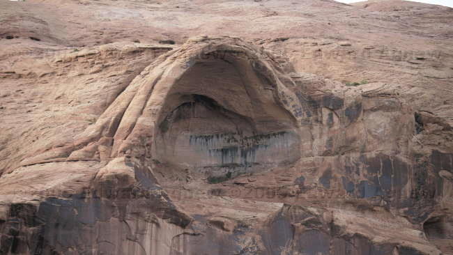
After we settled at the campground (we have full services and internet access), Ed and I drove around. I don’t know if it’s just because we haven’t seen canyons like this in our travels so far but the scenery here is spectacular. The rock is very red and the formations are amazing.
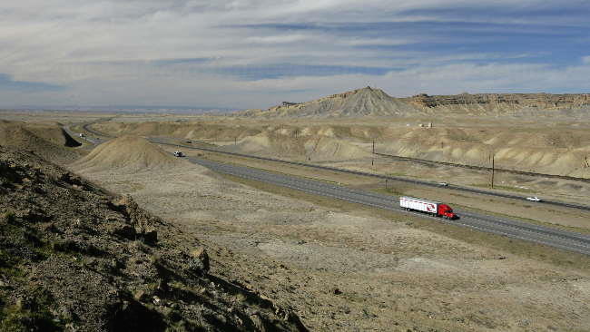
Interstate highway in Utah
a castle outcroping in Utah
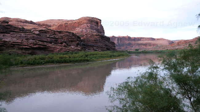
The colorado river at Moab
an arch in the Entrada sandstone along the edge of the Colorado river
about 20 miles north of Moab on the Colorado river the valley increases in size
"Castle Rock" near the Colorado river
After we settled at the campground (we have full services and internet access), Ed and I drove around. I don’t know if it’s just because we haven’t seen canyons like this in our travels so far but the scenery here is spectacular. The rock is very red and the formations are amazing.
Interstate highway in Utah
a castle outcroping in Utah
The colorado river at Moab
an arch in the Entrada sandstone along the edge of the Colorado river
about 20 miles north of Moab on the Colorado river the valley increases in size
"Castle Rock" near the Colorado river
Sunday, October 16, 2005
Where are we?
We continued to drive south through Idaho and then into Utah. The first rest area was also an information center where we picked up a lot of booklets on Utah plus got some good advise from the fellow working there — now we have a plan for our two weeks in Utah. While we were having lunch a Titanium trailer pulled into the parking space beside us — they were from BC. Tonight’s stop was going to be an RV park in Springville that had full hook up and highspeed wireless internet (the sign on there office advertised it). The office was closed but there were instructions on checking in. Ed and Colin pulled the trailers into the selected spots and Colin decided to try to connect to the internet .... hmmm wouldn’t connect. We saw another Titanium trailer (from BC) pulling in and a short while later, the lady from that rig came over to talk to us, and advised us that she had just found out the internet hadn’t been working for nine days. Well it’s not worth paying for a site if we can’t have internet — I guess it’s Wal-mart again tonight. Now my pet peeve about Utah — they changed all of the interchange numbers (at least on interstate 15) about 9 days ago and didn’t put up any signs indicating that they had been changed. Luckily we went by road names as well as interchange numbers so we didn’t have a problem finding places — the other Titanium owner had spent an hour at the incorrect exit looking for the trailer park!
After all the driving through the different states the popular question for the day was “Where are we?
After all the driving through the different states the popular question for the day was “Where are we?
Saturday, October 15, 2005
Titanium Trailers are Getting More Plentiful
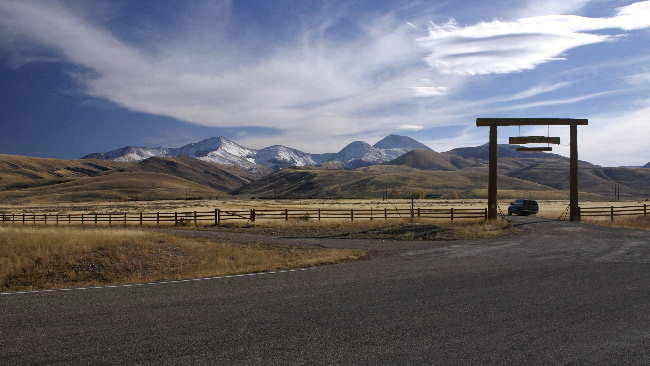
The drive continued through Montana and then back to Idaho. Personally, I think Montana is a very beautiful state. I really enjoyed the drive through the wide valley’s with the rounded mountains on either side (I even drove for a couple of hours). It reminded me a lot of the old westerns on TV that we grew up with. Now Idaho was a different matter – this section of Idaho was very flat and parts of it looked like the moon — we’re guessing it was lava rock from old volcanic eruptions. Tonight’s Wal-mart was in Blackfoot Idaho. We were about to head off for pizza when another Titanium trailer pulled in. The couple driving the Titanium was from Alberta and were heading to Mexico. When they heard we that we were going for pizza they decided to tag along. The dinner conversation included our trip to Alaska (they are hoping to go there next summer) and their trip to Mexico last year as well as Las Vegas (where they have been before and we are going in a couple of weeks).
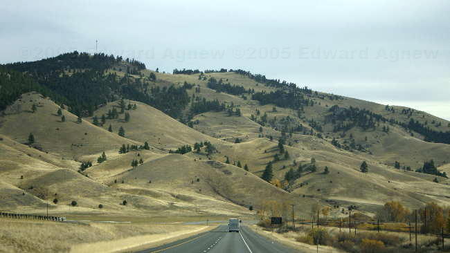
On the road in Montana
Near a fuel stop in Montana just north of the Idaho boarder
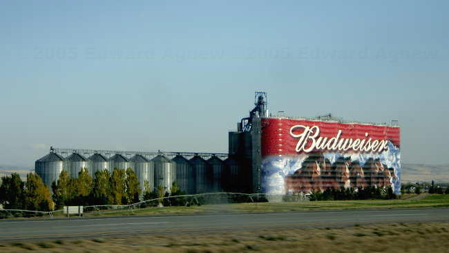
Need some beer??
On the road in Montana
Near a fuel stop in Montana just north of the Idaho boarder
Need some beer??
Friday, October 14, 2005
On the Road Again
Time to head south and hopefully find some warmer drier weather. After about 2 ½ hours of driving we crossed into the US and then drove through Washington state, Idaho and into Montana where we spent the night at a Wal-Mart in Missoula. The scenery was very nice and different from what we had been seeing in BC and it was sunny and a bit warmer. A lot of the Wal-Marts in the states have a full grocery store and are open 24 hours. This was the case in Missoula — just before midnight I was in the cereal isle discussing the pros and cons of Grits with the woman stocking the shelves. Anyway it was nice that I was able to pick up the groceries we needed.
Tuesday, October 11, 2005
Off to Lardeau
October 11 to October 13
Today we headed for Lardeau — the town (there’s about 20 homes there and not much else) where Rick and Bonnie own a lot and are planning on building a log home (the house in Boswell has been sold and closes at the end of the month). The trip included driving 30 kms to the ferry, 35 minutes on the ferry, and then driving 60 kms to Lardeau. All this and we are still on Kotenay Lake just on the other side at the other end! Rick and Bonnie currently have a travel trailer sitting on the lot and we had hoped that the 2 fifth wheel trailers would fit as well. Unfortunately, Ed didn’t think the spot set aside for us would work very well (not flat enough — most of the lot is on a slope) so we drove down the road about 5 km and parked in a very nice provincial park. As it turned out, after October 1st it was free to stay in the park — now that was a nice surprise. It wasn’t very busy so we got a lakeside site with an absolutely fantastic view.
Over the next couple of days we drove around the area checking out the sites that included a hydro dam, a fish spawning area, the town of Nelson and one of the muddiest roads I have ever seen — Ed didn’t argue when I suggested we turn around.
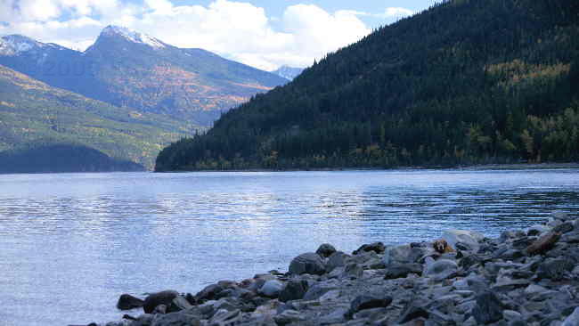
Kootenay Lake from the lost ledge Provincial park looking south
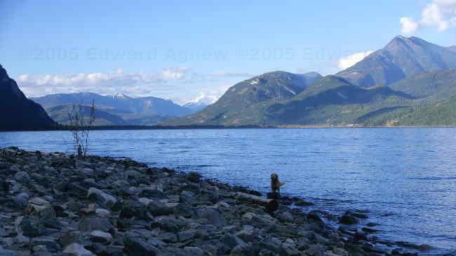
Kootenay lake from the park looking north
Kootenay lake at Kaslo
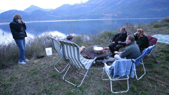
At Ricks and Bonnies trailer
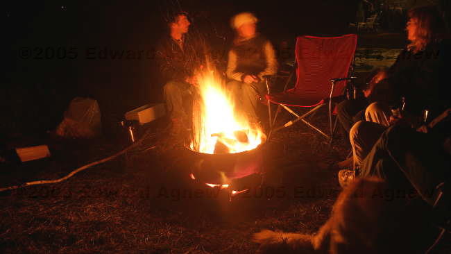
Campfire's nice
a duck on Duncan lake just north of Kootenay lake
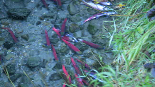
fish spawning near Duncan lake
Today we headed for Lardeau — the town (there’s about 20 homes there and not much else) where Rick and Bonnie own a lot and are planning on building a log home (the house in Boswell has been sold and closes at the end of the month). The trip included driving 30 kms to the ferry, 35 minutes on the ferry, and then driving 60 kms to Lardeau. All this and we are still on Kotenay Lake just on the other side at the other end! Rick and Bonnie currently have a travel trailer sitting on the lot and we had hoped that the 2 fifth wheel trailers would fit as well. Unfortunately, Ed didn’t think the spot set aside for us would work very well (not flat enough — most of the lot is on a slope) so we drove down the road about 5 km and parked in a very nice provincial park. As it turned out, after October 1st it was free to stay in the park — now that was a nice surprise. It wasn’t very busy so we got a lakeside site with an absolutely fantastic view.
Over the next couple of days we drove around the area checking out the sites that included a hydro dam, a fish spawning area, the town of Nelson and one of the muddiest roads I have ever seen — Ed didn’t argue when I suggested we turn around.
Kootenay Lake from the lost ledge Provincial park looking south
Kootenay lake from the park looking north
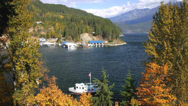
Kootenay lake at Kaslo
At Ricks and Bonnies trailer
Campfire's nice
a duck on Duncan lake just north of Kootenay lake
fish spawning near Duncan lake
Sunday, October 09, 2005
Happy Thanksgiving
October 9 and October 10
The Werners celebrated Thanksgiving on Sunday the 9th with a nice crowd — Rick and Bonnie’s three children and their other halves, one grandchild, another couple from Ontario (Rob and Cathy), Colin, Margaret, Ed and myself. Bonnie prepared a very nice dinner while Margaret and I made the yummy deserts including pumpkin tarts, butter tarts, chocolate brownies and blackberry crisp. Monday’s breakfast was also very good — left over deserts! The rest of the day was spent relaxing (and recovering from eating too much the day before).
The Werners celebrated Thanksgiving on Sunday the 9th with a nice crowd — Rick and Bonnie’s three children and their other halves, one grandchild, another couple from Ontario (Rob and Cathy), Colin, Margaret, Ed and myself. Bonnie prepared a very nice dinner while Margaret and I made the yummy deserts including pumpkin tarts, butter tarts, chocolate brownies and blackberry crisp. Monday’s breakfast was also very good — left over deserts! The rest of the day was spent relaxing (and recovering from eating too much the day before).
Saturday, October 08, 2005
Back to in the Boonies
October 6 to October 8
We’re back in Boswell and doing what you do in the boonies — not a lot. I read a book, took Zaph for a long walk, cleaned and rearranged cupboards in the trailer (well it was raining and they needed rearranging!), I drove to Creston and did laundry (Ed let me take the truck with Zaph as co-pilot). Ed read some magazines, fixed a few problems with the trailer, drove to Creston with Colin to do internet and help Colin buy some electrical stuff, as well as going with Rick and Colin to Rick’s new building lot on the other side and other end of the lake. It amazing the things you can find to do.
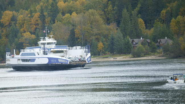
The Osprey 2000 - the ferry that cross Kotenay Lake.
We’re back in Boswell and doing what you do in the boonies — not a lot. I read a book, took Zaph for a long walk, cleaned and rearranged cupboards in the trailer (well it was raining and they needed rearranging!), I drove to Creston and did laundry (Ed let me take the truck with Zaph as co-pilot). Ed read some magazines, fixed a few problems with the trailer, drove to Creston with Colin to do internet and help Colin buy some electrical stuff, as well as going with Rick and Colin to Rick’s new building lot on the other side and other end of the lake. It amazing the things you can find to do.
The Osprey 2000 - the ferry that cross Kotenay Lake.
Wednesday, October 05, 2005
It’s Cold Out There!
This morning was very frosty and foggy — there was a layer on ice on the leaves and berries of the trees and icicles hanging from the branches. As promised, Ed’s camera was repaired by Canon in about an hour (pay’s to pre-arrange service...Thanks Canon). After checking out a few stores in Calgary we start the long drive back to Boswell. The good news is there wasn’t any more snow on the high plateau — in fact a lot of it had melted.
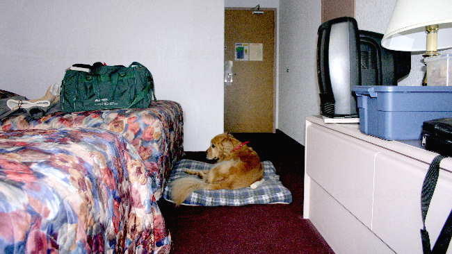
Zaph's first motel stay.
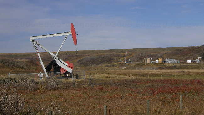
An oil well.
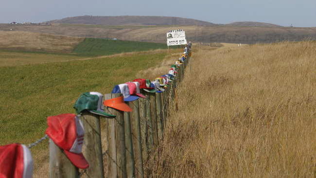
Intersting fence post toppers.
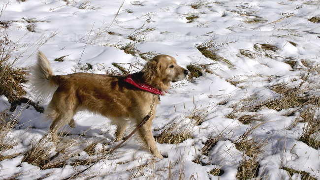
Zaph found some snow to play in.
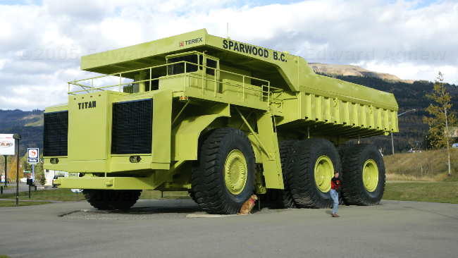
Zaph, me and the Titan 33-19
Zaph's first motel stay.
An oil well.
Intersting fence post toppers.
Zaph found some snow to play in.
Zaph, me and the Titan 33-19
Tuesday, October 04, 2005
Snow in October!
One of Ed’s cameras had a little problem since Alaska – the pin that is suppose to lock the lens into place doesn’t – so we drove to Calgary (the closest Canon service centre) to get it fixed. It was only a six hour drive each way so we decided to leave the trailer at Rick’s and stay over night in a motel — Zaph’s first motel experience and he was a good boy. It’s a very pretty drive passing through Cranbrook, Fernie, Crowsnest Pass and the high plateau outside of Calgary. There was 3 or so inches of fresh snow in the mountains and on the high plateau that give it that winter wonderland look but unfortunately I’m not ready for that in the beginning of October. We’ll have to come back to this area in the summer when it is warmer.
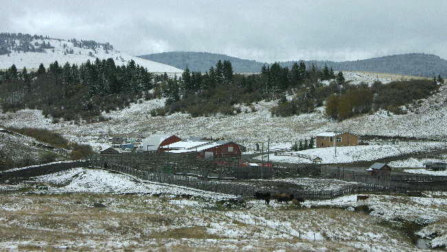
Crowsnest Pass
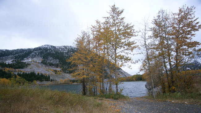
near Crowsnest Pass
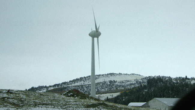
Windvane near Crowsnest Pass
Crowsnest Pass
near Crowsnest Pass
Windvane near Crowsnest Pass
![]()
