Friday, August 05, 2005
Here a Waterfall, There a Waterfall, Everywhere a Waterfall
Valdez wasn’t what we expected however the weather was fairly good (we would be able to take photos of the scenery that we didn’t take on the way in due to rain) so we decided to leave after one night. The pink salmon were spawning and dying in the harbour near our campground so it was very smelly. It was actually mind boggling to see all those dead fish. We did have a nice site overlooking the water. It took us 4 ½ hours to drive 115 miles (should have taken about 2 hours) as we stopped often to take pictures of waterfalls, glaciers, lakes, mountains and the pipeline. For the first half of the drive there were waterfalls and glaciers everywhere you looked. If you ever find yourself in Glennallen and you’re hungry go to the Caribou Restaurant. Good food at very reasonable prices. The clam chowder, blue cheese dressing and apple pie were delicious and definitely not out of cans or packages.
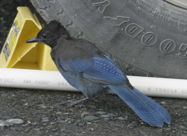
A Steller's Jay looking for food under our trailer
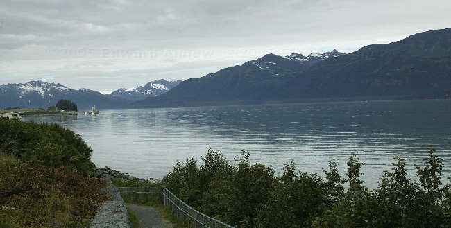
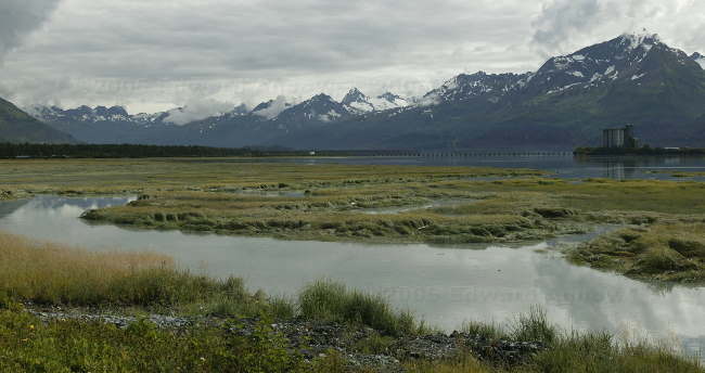
"Port Valdez", the bay on which Valdez is located
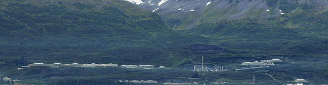
The end of the Alaskian Pipe line, the hugh oil holding and transfer station on Port Valdez where the crude oil is loaded on to tanker ships, this was just down the road from our campsite
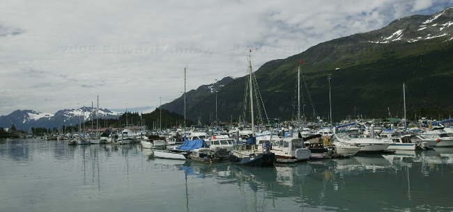
Across the bay is the small craft harbour of Valdez
Looking towards the area that once was Valdez, up till 1964 when a massive Tsunomi removed it from the panet. The town was moved about 4 miles to more secure ground
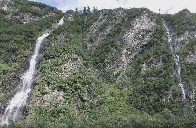
The Horsetail waterfalls, in the Keystone Canyon
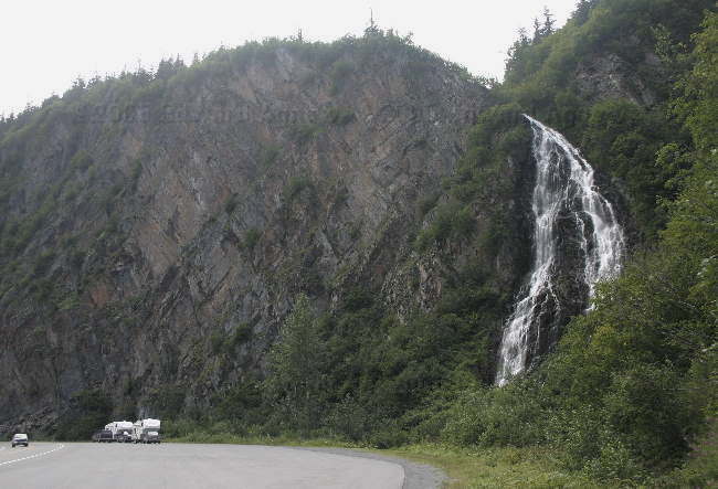
Another view of the Horsetail, note how small our rigs look
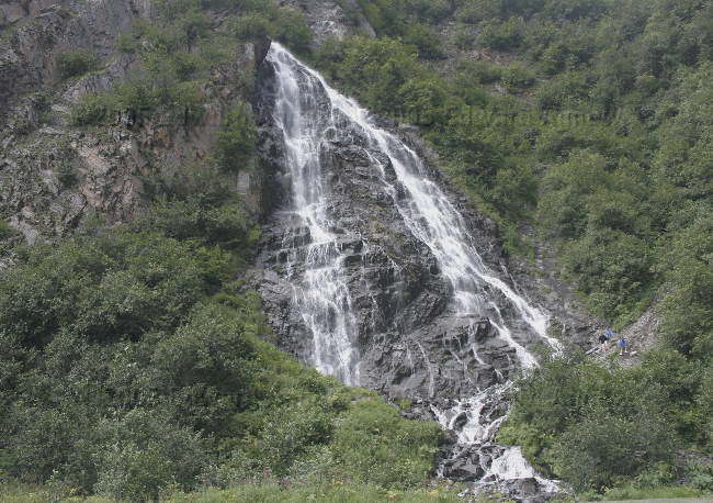
Twins? The larger one on the left is the Bridal Veil Falls, the smaller one is unknown, again in the Keystone Canyon
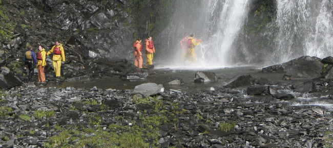
People on a rafting adventure stop at the Bridal Veil falls for a photo op, and since they have a good test of their waterproof clothing
A view of the Keystone Canyon from the Bridal Veil falls
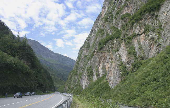
Leaving Valdez we assend the Thompson pass, a 7.5 mile long steep hill climb, with lots of turnouts (some only 0.2 miles apart) for photo ops, nice touch given it was not raining today
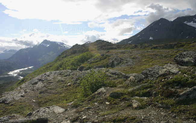
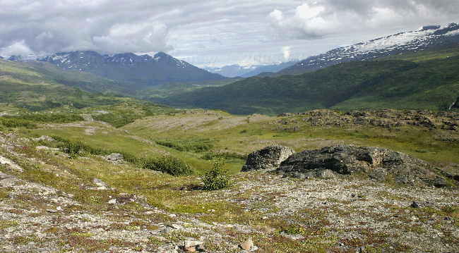
Another view from the Thompson pass hill climb. The waterfall where way down on the river in the upper right
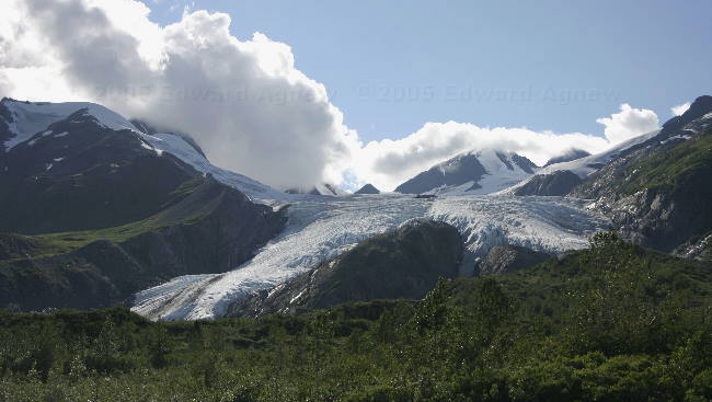
The Worthington Glacier from the road, (and in sunlight), the mile post book does indicate that you should should not approach the glacier on foot unless you are experienced in and equipped for cravasse recuses!!!, Now let me see, how many kids did we see yesterday
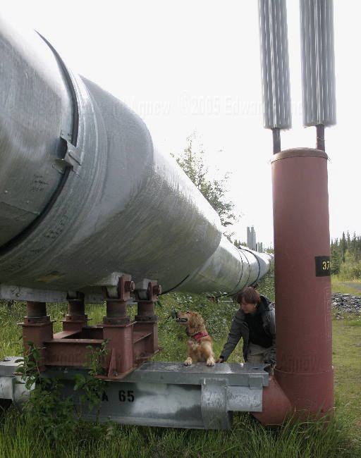
Zaph inspects the mounts of the Alaskian pipe line, noting that we are back in a perma-frost area, where the pipeline is kept above ground, and the cooling fins on the top of the piers to prevent melting of the frost layers underground
A Steller's Jay looking for food under our trailer
"Port Valdez", the bay on which Valdez is located
The end of the Alaskian Pipe line, the hugh oil holding and transfer station on Port Valdez where the crude oil is loaded on to tanker ships, this was just down the road from our campsite
Across the bay is the small craft harbour of Valdez
Looking towards the area that once was Valdez, up till 1964 when a massive Tsunomi removed it from the panet. The town was moved about 4 miles to more secure ground
The Horsetail waterfalls, in the Keystone Canyon
Another view of the Horsetail, note how small our rigs look
Twins? The larger one on the left is the Bridal Veil Falls, the smaller one is unknown, again in the Keystone Canyon
People on a rafting adventure stop at the Bridal Veil falls for a photo op, and since they have a good test of their waterproof clothing
A view of the Keystone Canyon from the Bridal Veil falls
Leaving Valdez we assend the Thompson pass, a 7.5 mile long steep hill climb, with lots of turnouts (some only 0.2 miles apart) for photo ops, nice touch given it was not raining today
Another view from the Thompson pass hill climb. The waterfall where way down on the river in the upper right
The Worthington Glacier from the road, (and in sunlight), the mile post book does indicate that you should should not approach the glacier on foot unless you are experienced in and equipped for cravasse recuses!!!, Now let me see, how many kids did we see yesterday
Zaph inspects the mounts of the Alaskian pipe line, noting that we are back in a perma-frost area, where the pipeline is kept above ground, and the cooling fins on the top of the piers to prevent melting of the frost layers underground
![]()
If you wish you can sign our guest book
