Saturday, January 21, 2006
This is One Big Park
Day three of exploring the park. Our first adventure of the day was a drive down Paint Gap Road. The first section of the road was mostly gravel, the second section was stones that kept getting larger. When parts of the road looked washed out we decided it was time to turn around. We did manage to drive far enough to see the Paint Gap Hills in the distance.
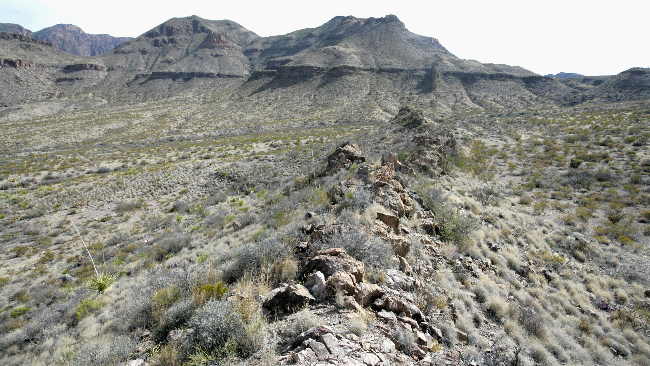
The next part of the adventure was a drive down paved Maverick Drive and paved Ross Maxwell Scenic Drive (no nail biting). The road passed through some different terrains — the Burro Messa, the Oak Creek area that once was the best grazing land in West Texas, dikes (rock outcroppings), a high scenic view point from which you can see Santa Elena Canyon 14 miles away, Tuff Canyon (a narrow canyon cut into soft gray rock called tuff, which is compressed volcanic ash), Cerro Castellan (the peak is made up of a high stack of volcanic rocks), an area of white tuff and black basaltic boulders, flood plains that were farmed in the 20's and 30's and finally Santa Elena Canyon. The Rio Grande flows through the Santa Elena Canyon with Mexico on one side and the US on the other side. You can hike about one mile into the canyon and look up at the 1,500 foot walls that tower above you.
The last part of the adventure was a the drive back on the gravel Old Maverick Drive (not bad at all). This road runs through relatively flat, barren country. The desert colors of the badlands made the drive worth while.
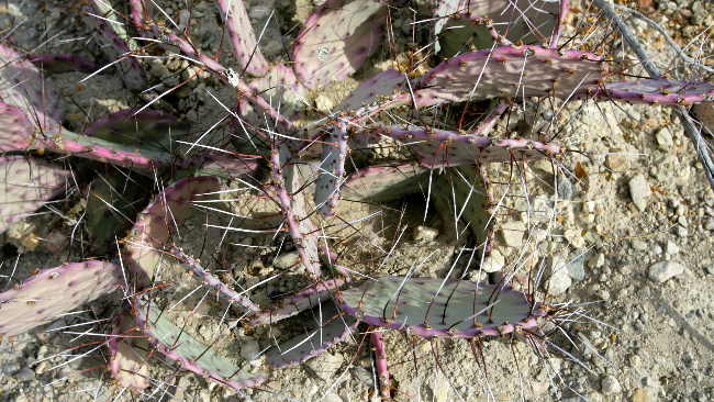
Red tinge prickly pear --- look at the size of the those spines.
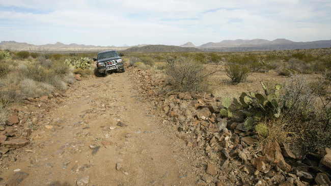
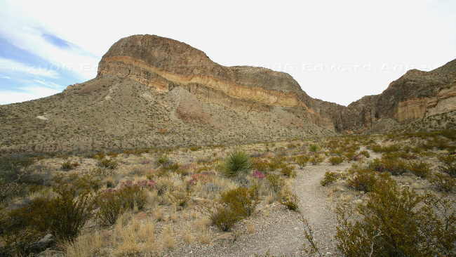
Paint Gap Road --- that's the hills in the background
A dike was formed when molten material was squeezed into cracks beneath the earth's surface. The surrounding rock layers have since been eroded away, leaving the harder dikes standing.
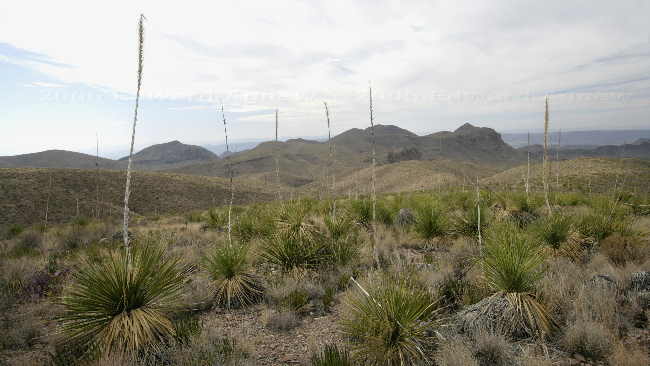
A field of sotol, large bright green plants with sharp teeth along the margins of the leaves (a member of the agave family).
Interesting layering in the rocks near Burro Mesa Pouroff
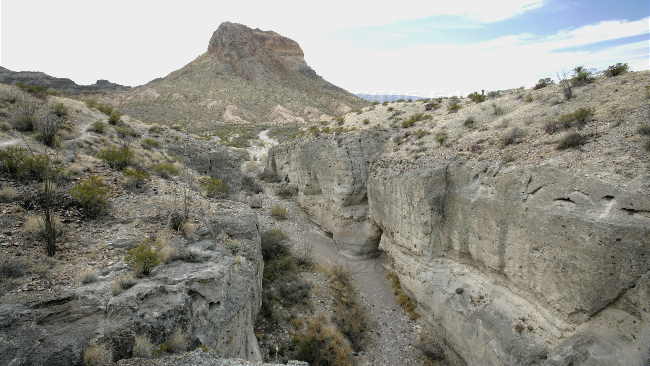
Tuff canyon
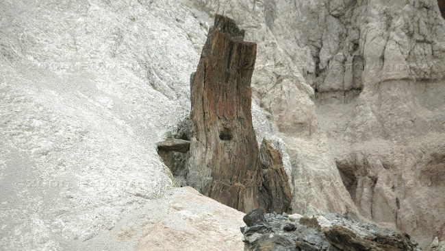
A "lava neck" that cooled and hardened in a vent from which lava probably flowed. It looks like a petrified tree.
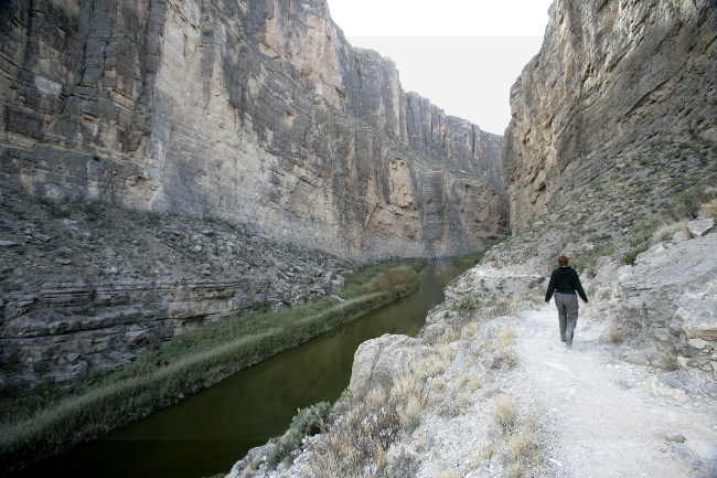
Santa Elena Canyon
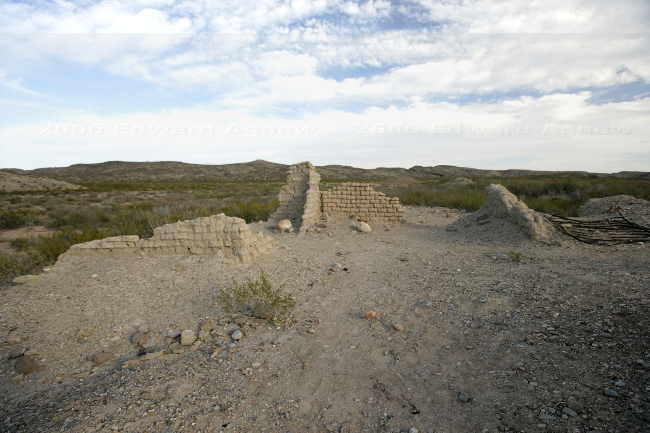
Ruins at Terlingua Abajo.
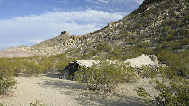
Luna's Jacal; a jacal is a primitive Mexican house-shelter typical of earliest pioneer settlements.
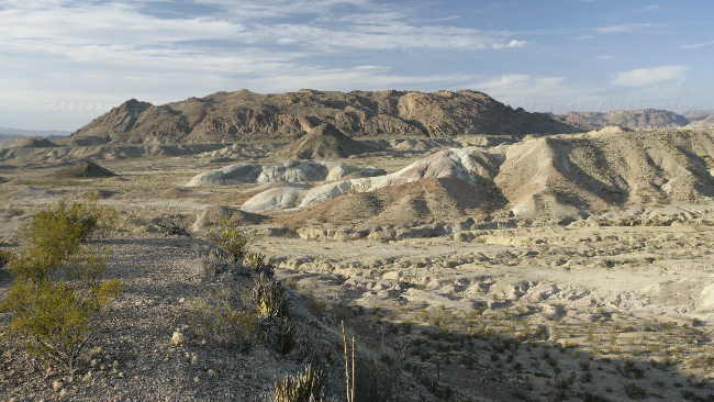
The "badlands", colour clays deposited about 70 million years ago in the Cretaceous Period.
The next part of the adventure was a drive down paved Maverick Drive and paved Ross Maxwell Scenic Drive (no nail biting). The road passed through some different terrains — the Burro Messa, the Oak Creek area that once was the best grazing land in West Texas, dikes (rock outcroppings), a high scenic view point from which you can see Santa Elena Canyon 14 miles away, Tuff Canyon (a narrow canyon cut into soft gray rock called tuff, which is compressed volcanic ash), Cerro Castellan (the peak is made up of a high stack of volcanic rocks), an area of white tuff and black basaltic boulders, flood plains that were farmed in the 20's and 30's and finally Santa Elena Canyon. The Rio Grande flows through the Santa Elena Canyon with Mexico on one side and the US on the other side. You can hike about one mile into the canyon and look up at the 1,500 foot walls that tower above you.
The last part of the adventure was a the drive back on the gravel Old Maverick Drive (not bad at all). This road runs through relatively flat, barren country. The desert colors of the badlands made the drive worth while.
Red tinge prickly pear --- look at the size of the those spines.
Paint Gap Road --- that's the hills in the background
A dike was formed when molten material was squeezed into cracks beneath the earth's surface. The surrounding rock layers have since been eroded away, leaving the harder dikes standing.
A field of sotol, large bright green plants with sharp teeth along the margins of the leaves (a member of the agave family).
Interesting layering in the rocks near Burro Mesa Pouroff
Tuff canyon
A "lava neck" that cooled and hardened in a vent from which lava probably flowed. It looks like a petrified tree.
Santa Elena Canyon
Ruins at Terlingua Abajo.
Luna's Jacal; a jacal is a primitive Mexican house-shelter typical of earliest pioneer settlements.
The "badlands", colour clays deposited about 70 million years ago in the Cretaceous Period.
![]()
If you wish you can sign our guest book
